- National Register of Historic Places listings in Seneca County, New York
-
 Location of Seneca County in New York
List of Registered Historic Places in Seneca County, New York
This is intended to be a complete list of properties and districts listed on the National Register of Historic Places in Seneca County, New York. The locations of National Register properties and districts (at least for all showing latitude and longitude coordinates below) may be seen in a Google map by clicking on "Map of all coordinates".[1] Two properties are further designated U.S. National Historic Landmarks, and one is a U.S. National Historical Park.
-
- This National Park Service list is complete through NPS recent listings posted November 18, 2011.[2]
Contents: Counties in New York Albany (Albany) – Allegany – Bronx – Broome – Cattaraugus – Cayuga – Chautauqua – Chemung – Chenango – Clinton – Columbia – Cortland – Delaware – Dutchess – Erie (Buffalo) – Essex – Franklin – Fulton – Genesee – Greene – Hamilton – Herkimer – Jefferson – Kings (Brooklyn) – Lewis – Livingston – Madison – Monroe (Rochester) – Montgomery – Nassau – New York (Manhattan – Below 14th Street, 14th to 59th Streets, 59th to 110th Streets, Above 110th Street, Islands) – Niagara – Oneida – Onondaga (Syracuse) – Ontario – Orange – Orleans – Oswego – Otsego – Putnam – Queens – Rensselaer – Richmond (Staten Island) – Rockland – Saratoga – Schenectady – Schoharie – Schuyler – Seneca – St. Lawrence – Steuben – Suffolk – Sullivan – Tioga – Tompkins – Ulster – Warren – Washington – Wayne – Westchester (New Rochelle, Peekskill, Yonkers) – Wyoming – Yates Listings county-wide
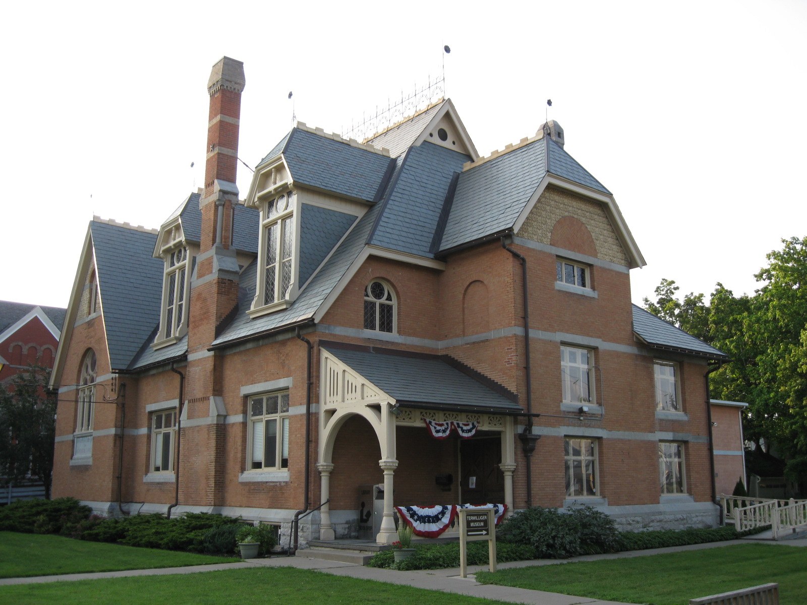
[3] Landmark name Image Date listed Location City or town Summary 1 Amelia Bloomer House August 29, 1980 53 E. Bayard St.
42°54′35″N 76°47′27″W / 42.909722°N 76.790833°WSeneca Falls 2 Julius and Harriet Bull House August 30, 2007 2534 Lower Lake Rd.
42°54′14″N 76°45′05″W / 42.903889°N 76.751389°WSeneca Falls 3 William H. Burton House 
June 14, 1996 35 E. Main St.
42°54′16″N 76°51′41″W / 42.904444°N 76.861389°WWaterloo 4 Christ Evangelical and Reformed Church December 8, 1989 Main St.
42°48′52″N 76°47′51″W / 42.814444°N 76.7975°WFayette 5 Cobblestone Farmhouse at 1027 Stone Church Rd. September 28, 2007 1027 Stone Church Rd.
42°58′34″N 76°53′05″W / 42.976111°N 76.884722°WJunius 6 Cobblestone Farmhouse at 1111 Stone Church Road September 28, 2007 1111 Stone Church Rd. Junius 7 Cobblestone Farmhouse at 1229 Birdsey Road 
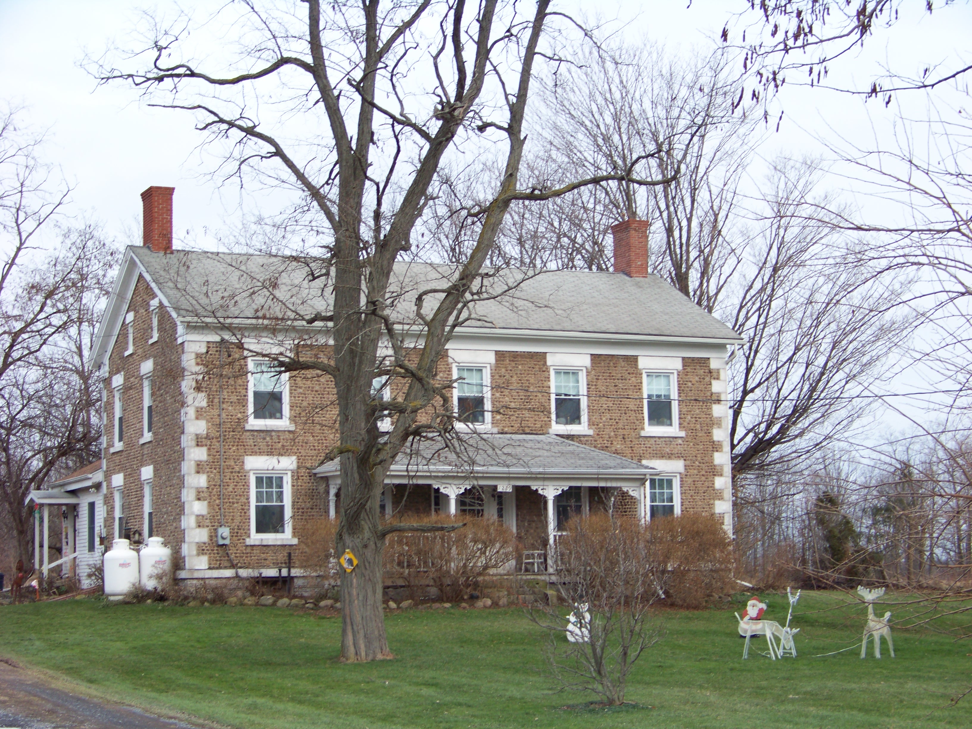
August 6, 2008 1229 Birdsey Rd.
42°58′01″N 76°51′51″W / 42.967039°N 76.864172°WJunius 8 Covert Historic District November 21, 1980 NY 96
42°34′22″N 76°41′01″W / 42.572778°N 76.683611°WCovert 9 Fall Street-Trinity Lane Historic District 
February 11, 1974 Address Restricted Seneca Falls 10 First Baptist Church of Interlaken 
December 31, 2002 8414 Main St.
42°36′59″N 76°43′32″W / 42.616389°N 76.725556°WInterlaken 11 First Presbyterian Church 
November 29, 1996 E. Main St., E of jct. with NY 96
42°54′14″N 76°51′39″W / 42.903889°N 76.860833°WWaterloo 12 Fourth Ward School March 19, 1986 8 Washington St.
42°54′38″N 76°47′21″W / 42.910556°N 76.789167°WSeneca Falls 13 John Graves Cobblestone Farmhouse February 28, 2008 1370 NY 318 Junius 14 William Hoster House December 31, 2002 3832 NY 414
42°50′17″N 76°48′41″W / 42.838056°N 76.811389°WFayette 15 Hunt House August 29, 1980 401 E. Main St.
42°54′22″N 76°50′40″W / 42.906111°N 76.844444°WWaterloo 16 David and Mary Kinne Farmstead August 30, 2007 6858 Kinne Rd. Ovid 17 Lodi Methodist Church 
May 6, 1982 S. Main and Grove Sts.
42°36′45″N 76°49′22″W / 42.6125°N 76.822778°WLodi 18 M'Clintock House August 29, 1980 14 E. Williams
42°54′19″N 76°51′42″W / 42.905278°N 76.861667°WWaterloo 19 Queen's Castle June 1, 1999 NY 414
42°33′03″N 76°52′54″W / 42.550833°N 76.881667°WLodi 20 Simon Ritter Cobblestone Farmhouse November 18, 2008 5102 NY 89
42°46′39″N 76°46′11″W / 42.7775°N 76.76972°WVarick 21 Rose Hill Mansion 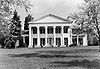
February 6, 1973 W of Fayette on NY 96A
42°51′38″N 76°56′18″W / 42.86056°N 76.93833°WFayette 22 Saint Paul's Church 
March 9, 1997 101 E. Williams St.
42°54′20″N 76°51′35″W / 42.905556°N 76.859722°WWaterloo 23 Seneca County Courthouse Complex at Ovid 
December 12, 1976 NY 414
42°40′36″N 76°49′19″W / 42.676667°N 76.821944°WOvid 24 Seneca Falls Village Historic District 
April 5, 1991 Roughly, properties along State and Cayuga Sts. from Butler and Auburn to Canal St., including Van Cleef Lake
42°54′18″N 77°13′55″W / 42.905°N 77.231944°WSeneca Falls 25 Elizabeth Cady Stanton House (Seneca Falls, New York) 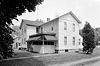
October 15, 1966 32 Washington St.
42°54′45″N 76°47′18″W / 42.9125°N 76.78833°WSeneca Falls 26 United Methodist Church 
September 24, 2004 21 E. Williams St.
42°54′28″N 76°51′40″W / 42.907778°N 76.861111°WWaterloo 27 US Post Office-Seneca Falls 
May 11, 1989 34-42 State St.
42°54′42″N 76°47′54″W / 42.911667°N 76.798333°WSeneca Falls 28 US Post Office-Waterloo May 11, 1989 2 E. Main St.
42°54′15″N 76°51′46″W / 42.904167°N 76.862778°WWaterloo 29 Waterloo Library 
June 14, 1996 31 Williams St.
42°54′20″N 76°51′40″W / 42.905556°N 76.861111°WWaterloo 30 James Russell Webster House 
December 11, 2007 115 E. Main St.
42°54′23″N 76°51′33″W / 42.906389°N 76.859167°WWaterloo 31 Wesleyan Methodist Church August 29, 1980 126 Fall St.
42°57′45″N 76°50′46″W / 42.9625°N 76.846111°WSeneca Falls 32 Willard Asylum for the Chronic Insane March 7, 1975 Willard State Psychiatric Center
42°40′45″N 76°52′46″W / 42.679167°N 76.879444°WWillard 33 Aaron Wilson House May 30, 2001 2037 Wilson Rd.
42°38′48″N 76°49′55″W / 42.646667°N 76.831944°WOvid 34 Women's Rights National Historical Park 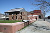
December 28, 1980 P.O. Box 70 Seneca Falls See also
References
- ^ The latitude and longitude information provided in this table was derived originally from the National Register Information System, which has been found to be fairly accurate for about 99% of listings. For about 1% of NRIS original coordinates, experience has shown that one or both coordinates are typos or otherwise extremely far off; some corrections may have been made. A more subtle problem causes many locations to be off by up to 150 yards, depending on location in the country: most NRIS coordinates were derived from tracing out latitude and longitudes off of USGS topographical quadrant maps created under the North American Datum of 1927, which differs from the current, highly accurate WGS84 GPS system used by Google maps. Chicago is about right, but NRIS longitudes in Washington are higher by about 4.5 seconds, and are lower by about 2.0 seconds in Maine. Latitudes differ by about 1.0 second in Florida. Some locations in this table may have been corrected to current GPS standards.
- ^ "National Register of Historic Places: Weekly List Actions". National Park Service, United States Department of the Interior. Retrieved on November 18, 2011.
- ^ Numbers represent an ordering by significant words. Various colorings, defined here, differentiate National Historic Landmark sites and National Register of Historic Places Districts from other NRHP buildings, structures, sites or objects.
Categories:- National Register of Historic Places in New York by county
- Buildings and structures in Seneca County, New York
-


Wikimedia Foundation. 2010.