- National Register of Historic Places listings in Greene County, New York
-
 Location of Greene County in New York
List of the National Register of Historic Places listings in Greene County, New York
This is intended to be a complete list of properties and districts listed on the National Register of Historic Places in Greene County, New York. The locations of National Register properties and districts (at least for all showing latitude and longitude coordinates below) may be seen in a Google map by clicking on "Map of all coordinates".[1] Two properties, the Pieter Bronck House and the Thomas Cole House, are further designated U.S. National Historic Landmarks, and the latter is also a National Historic Site.
-
- This National Park Service list is complete through NPS recent listings posted November 18, 2011.[2]
Contents: Counties in New York Albany (Albany) – Allegany – Bronx – Broome – Cattaraugus – Cayuga – Chautauqua – Chemung – Chenango – Clinton – Columbia – Cortland – Delaware – Dutchess – Erie (Buffalo) – Essex – Franklin – Fulton – Genesee – Greene – Hamilton – Herkimer – Jefferson – Kings (Brooklyn) – Lewis – Livingston – Madison – Monroe (Rochester) – Montgomery – Nassau – New York (Manhattan – Below 14th Street, 14th to 59th Streets, 59th to 110th Streets, Above 110th Street, Islands) – Niagara – Oneida – Onondaga (Syracuse) – Ontario – Orange – Orleans – Oswego – Otsego – Putnam – Queens – Rensselaer – Richmond (Staten Island) – Rockland – Saratoga – Schenectady – Schoharie – Schuyler – Seneca – St. Lawrence – Steuben – Suffolk – Sullivan – Tioga – Tompkins – Ulster – Warren – Washington – Wayne – Westchester (New Rochelle, Peekskill, Yonkers) – Wyoming – Yates Listings county-wide
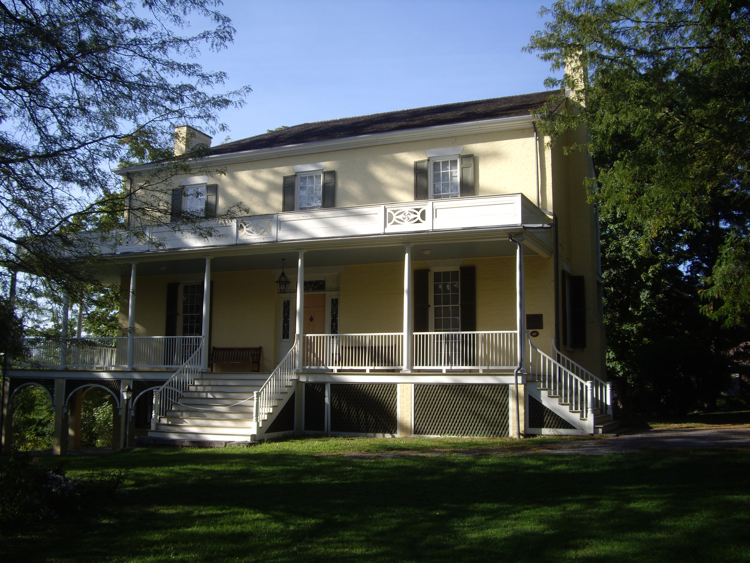
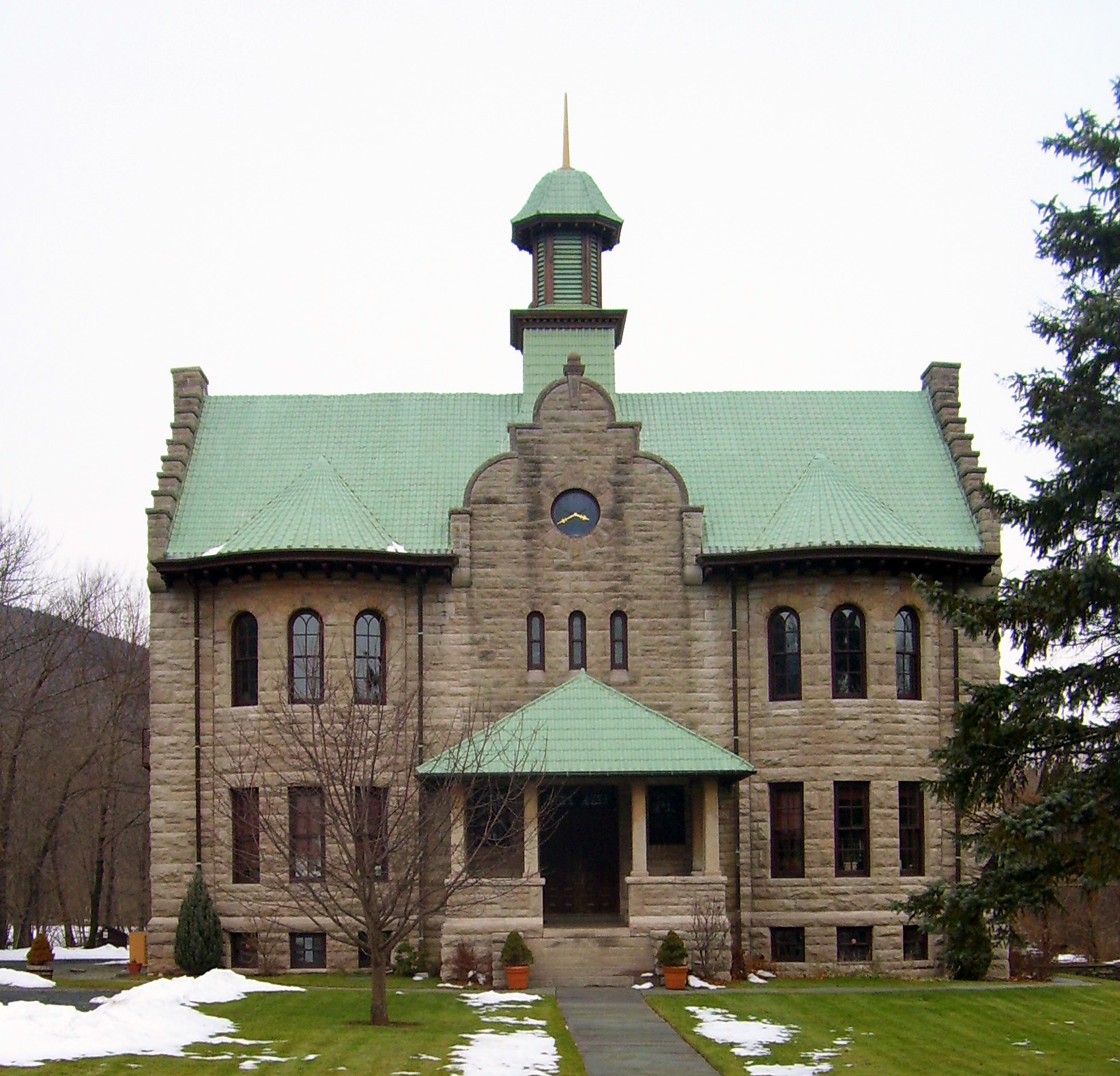
[3] Landmark name Image Date listed Location City or town Summary 1 A. T. House January 18, 2006 435 Main St.
42°24′40″N 74°09′14″W / 42.411111°N 74.153889°WOak Hill 2 All Souls Church November 24, 1993 Rt. 23-C N of Tannersville
42°13′29″N 74°08′05″W / 42.224722°N 74.134722°WTannersville 3 Allan Teator Road Stone Arch Bridge January 9, 2008 Allan Teator Rd.
42°24′27″N 74°13′12″W / 42.4075°N 74.22°WWest Durham 4 Athens Lower Village Historic District 
November 28, 1980 Roughly bounded by Hudson River, NY 385, Vernon and Market Sts.
42°15′34″N 73°48′46″W / 42.259444°N 73.812778°WAthens 5 Henry T. Botsford House November 12, 1993 NY 81 W of jct. with NY 32
42°24′24″N 74°01′28″W / 42.406667°N 74.024444°WGreenville 6 Brand Hollow Road Stone Arch Bridge April 10, 2008 Brand Hollow Road
42°24′12″N 74°14′22″W / 42.403333°N 74.239444°WWest Durham (new listing; refnum 08000271) 7 William Brandow House William Brandow HouseNovember 10, 2009 480 Rt. 385
42°15′04″N 73°50′06″W / 42.251108°N 73.83495°WAthens New listing; refnum 09000908 8 Brick Row Historic District November 28, 1980 Off NY 385
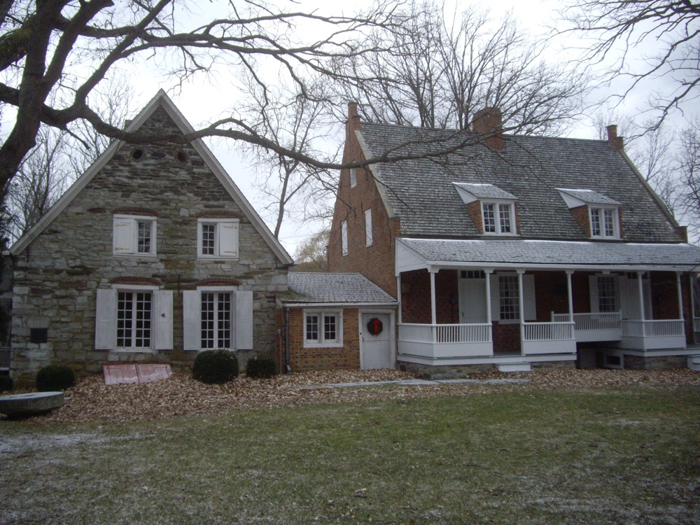
42°16′39″N 73°47′55″W / 42.2775°N 73.798611°WAthens 9 Bronck Farm 13-Sided Barn September 29, 1984 Old Kings Rd.
42°20′46″N 73°50′42″W / 42.346111°N 73.845°WCoxsackie 10 Pieter Bronck House 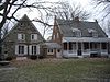
December 24, 1967 2 mi. W of Coxsackie on W side of U.S. 9W
42°20′44″N 73°50′49″W / 42.345556°N 73.846944°WCoxsackie 11 Bronk-Silvester House March 12, 2002 188 Mansion St.
42°21′33″N 73°48′51″W / 42.359167°N 73.814167°WCoxsackie 12 Centre Presbyterian Church 
September 7, 1979 Main and Church Sts
42°18′24″N 74°15′09″W / 42.306667°N 74.2525°WWindham 13 Church of St. John the Evangelist (Hunter, New York) Church of St. John the Evangelist (Hunter, New York)April 21, 2004 Philadelphia Hill Rd.
42°10′56″N 74°08′53″W / 42.182222°N 74.148056°WHunter 14 L.E. Cleveland House December 28, 2001 7818 NY 81
42°24′38″N 74°09′10″W / 42.410556°N 74.152778°WDurham 15 Thomas Cole House 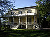
October 15, 1966 218 Spring St.
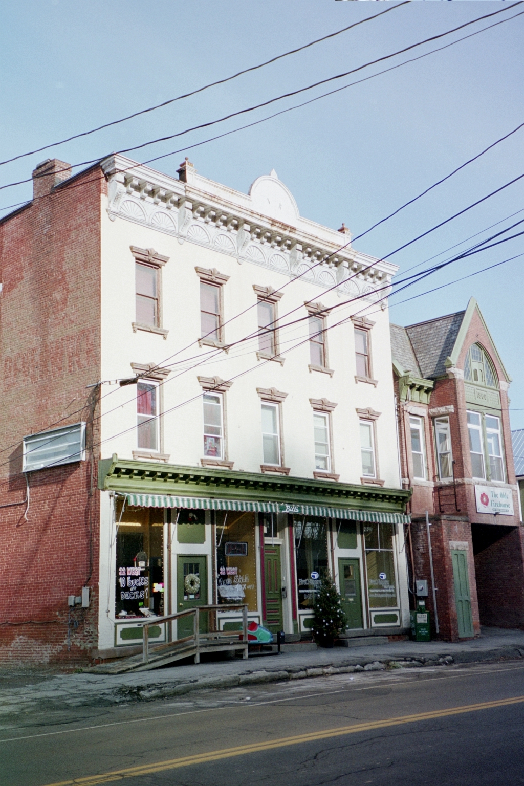
42°13′33″N 73°51′43″W / 42.22583°N 73.86194°WCatskill 16 Commercial Building at 32 West Bridge Street 
August 10, 1995 32 W. Bridge St.
42°13′01″N 73°52′12″W / 42.216944°N 73.87°WCatskill 17 Croswell-Parsons Paper Mill Ruin November 9, 2008 NY 144 New Baltimore New listing: refnum 07001366 18 W. F. DeWitt Hotel December 28, 2001 7803 NY 81
42°24′35″N 74°09′11″W / 42.409722°N 74.153056°WDurham 19 District School No. 11 
August 10, 1995 S. Jefferson Ave.
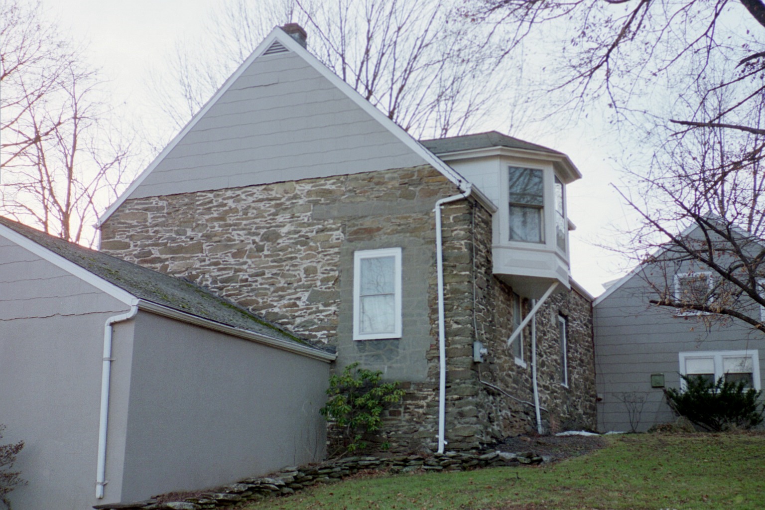
42°13′51″N 73°52′51″W / 42.230833°N 73.880833°WCatskill 20 DuBois Stone House 
November 22, 1995 347 W. Main St.
42°13′09″N 73°52′11″W / 42.219167°N 73.869722°WCatskill 21 Benjamin DuBois Stone House-Captain Martin Stone House November 22, 1995 347 W. Main St.
42°13′14″N 73°52′12″W / 42.220556°N 73.87°WCatskill (distinct from DuBois Stone House though listed at same address) 22 East Side Historic District 
August 9, 1982 Roughly bounded by Catskill Creek, the Hudson River, and River, Harrison, Day, and Gardner Sts.
42°13′07″N 73°51′44″W / 42.218611°N 73.862222°WCatskill 23 ELEANOR (Sailing Sloop) December 27, 1982 Off Lower Main St. in Catskill Creek
42°12′44″N 73°51′41″W / 42.212222°N 73.861389°WCatskill 24 Elka Park Historic District May 22, 1993 Southeast of the Hunter town center
42°09′19″N 74°10′05″W / 42.155278°N 74.168056°WHunter 25 Harry Fischel House 
April 21, 2000 6302 Main St.
42°12′40″N 74°12′56″W / 42.211111°N 74.215556°WHunter 26 Flint Mine Hill Archeological District 
November 29, 1978 Address Restricted Coxsackie 27 Ford's Store December 28, 2001 7811 NY 81
42°24′35″N 74°09′11″W / 42.409722°N 74.153056°WDurham 28 Forestville Commonwealth November 20, 1974 Address Restricted Earlton 29 Greenville Presbyterian Church Complex 
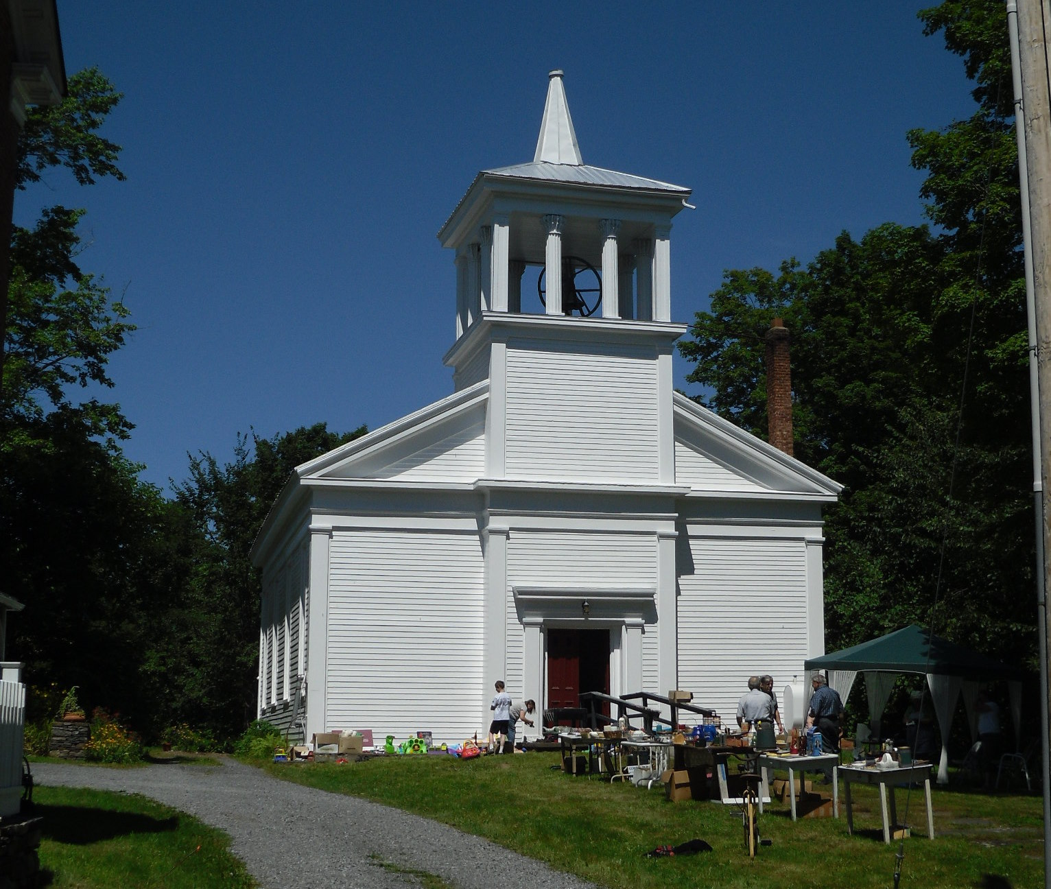
March 28, 1985 North St., NY 32
42°24′58″N 74°01′23″W / 42.416111°N 74.023056°WGreenville 1860 Greek Revival church is home to first non-Dutch congregation established in Catskill region 30 Halcott Grange No. 881 April 6, 2000 County Route 3
42°11′27″N 74°29′10″W / 42.190833°N 74.486111°WHalcott 31 Joseph Hallock House 
August 10, 1995 241 W. Main St.
42°12′59″N 73°52′08″W / 42.216389°N 73.868889°WCatskill 32 Hathaway February 12, 2008 781 County Road 25
42°13′27″N 74°07′40″W / 42.224275°N 74.127816°WTannersville 33 Hervey Street Road Stone Arch Bridge January 9, 2008 Hervey Street Rd., & Hervey Street-Sunside Rd.
42°20′42″N 74°07′37″W / 42.345°N 74.126944°WHervey Street 34 Hop-o'-Nose Knitting Mill 
August 10, 1995 130 W. Main St.
42°12′46″N 73°52′01″W / 42.212778°N 73.866944°WCatskill 35 Peter Houghtaling Farm and Lime Kiln March 20, 1986 Lime Kiln Rd.
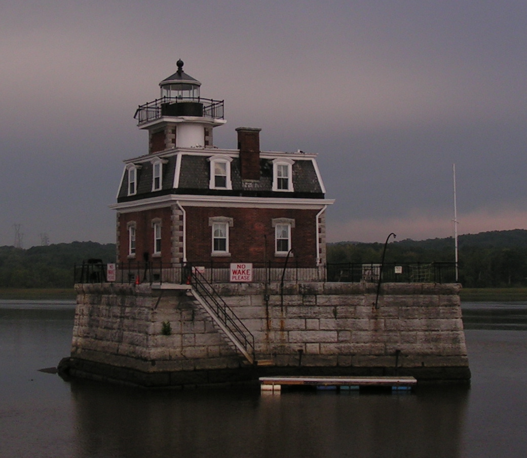
42°23′36″N 73°51′18″W / 42.393333°N 73.855°WWest Coxsackie 36 Hudson/Athens Lighthouse 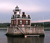
May 29, 1979 S of Middle Ground Flats in Hudson River
42°15′06″N 73°48′32″W / 42.251667°N 73.808889°WAthens 37 Hunter Mountain Fire Tower 
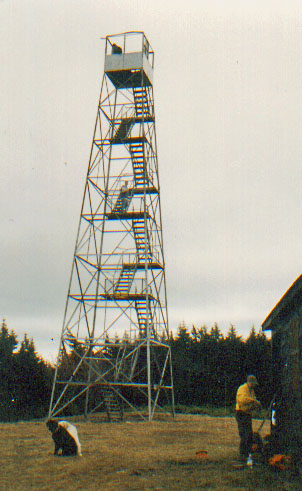
June 30, 1997 Roughly following Hunter Brook from Spruceton Rd. to Hunter Mountain
42°11′03″N 74°15′06″W / 42.184167°N 74.251667°WHunter First site in the Catskills manned by the state as fire lookout tower in 1909 38 Hunter Synagogue 
December 9, 1999 Main St.
42°12′38″N 74°12′57″W / 42.210556°N 74.215833°WHunter 39 IOOF Hall 
December 31, 2002 6325 Main St.
42°12′43″N 74°13′03″W / 42.211944°N 74.2175°WHunter 40 Jewett Presbyterian Church Complex December 28, 2001 Church St.
42°16′12″N 74°18′15″W / 42.27°N 74.304167°WJewett 41 William Lampman House 
August 10, 1995 147 Grandview Ave.
42°12′42″N 73°52′22″W / 42.211667°N 73.872778°WCatskill 42 Frank D. Layman Memorial 
June 6, 2003 Near Kaaterskill Falls
42°11′24″N 74°03′55″W / 42.19°N 74.065278°WHunter Monument on Catskill Escarpment Trail to firefighter who perished fighting forest fire there in 1901 43 Leeds Dutch Reformed Church 
February 22, 1996 Co. Rt. 23B (Susquehanna Tpk.)
42°15′17″N 73°54′04″W / 42.254722°N 73.901111°WLeeds 44 Leeds Flat Site October 1, 1998 Address Restricted Catskill 45 Lexington House September 4, 1986 NY 42
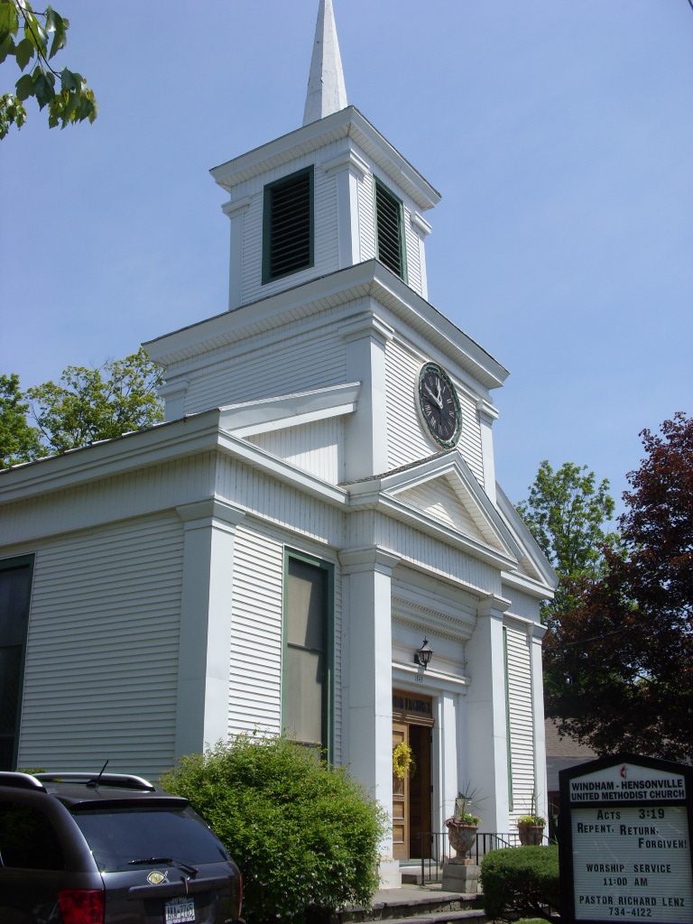
42°14′23″N 74°22′00″W / 42.239722°N 74.366667°WLexington 46 Methodist Episcopal Church of Windham Centre 
April 27, 2009 1843 NY 23
42°18′29″N 74°14′57″W / 42.308056°N 74.249167°WWindham 47 Moore-Howland Estate August 30, 2010 4 New York State Route 385
42°13′46″N 73°51′27″W / 42.229444°N 73.8575°WCatskill New listing; refnum 10000609 48 Moore Road Stone Arch Bridge April 10, 2008 Moore Rd. Cornwallville (new listing; refnum 08000272) 49 Morss Homestead/Federal City Homestead September 30, 1983 NY 23
42°18′35″N 74°23′45″W / 42.309722°N 74.395833°WRed Falls 50 New Baltimore Hamlet Historic District 
February 23, 1996 Roughly, Main St. from NY 144 to S jct. with Mill St. and along NY 144, Church and New Sts. and Washington and Madison
42°26′46″N 73°47′18″W / 42.446111°N 73.788333°WNew Baltimore 51 Newkirk Homestead July 22, 1979 NW of Leeds on Sandy Plains Rd.
42°15′59″N 73°54′26″W / 42.266389°N 73.907222°WLeeds 52 North Settlement Methodist Church May 16, 1996 Co. Rt. 10, E of jct. with Co. Rt. 32C
42°20′16″N 74°17′46″W / 42.337778°N 74.296111°WAshland 53 Oak Hill Cemetery Oak Hill CemeteryMay 11, 2011 NY 81
42°24′43″N 74°09′38″W / 42.411944°N 74.160556°WOak Hill New listing; refnum 11000274 54 Oak Hill Methodist Episcopal Church 
November 1, 2006 427 Main St.
42°24′45″N 74°09′18″W / 42.4125°N 74.155°WOak Hill 55 Old Episcopal Manse November 22, 2000 NY 23, Main St.
42°18′51″N 74°25′59″W / 42.314167°N 74.433056°WPrattsville 56 Onteora Park Historic District February 12, 2003 Onteora Club Property
42°12′36″N 74°09′06″W / 42.21°N 74.151667°WHunter 57 Mrs. Osburn House December 28, 2001 7872 NY 81
42°24′43″N 74°09′16″W / 42.411944°N 74.154444°WDurham 58 The Parsonage April 6, 2005 424 Main St.
42°24′45″N 74°09′21″W / 42.4125°N 74.155833°WOak Hill 59 Charles Pierce House December 28, 2001 7846 NY 81
42°24′41″N 74°09′12″W / 42.411389°N 74.153333°WDurham 60 Old Platte Clove Post Office June 30, 2005 2340 Platte Clove Rd.
42°08′02″N 74°05′18″W / 42.133889°N 74.088333°WElka Park 61 Pratt Rock Park 
December 10, 1992 NY 23 NW of jct. with NY 23A
42°18′43″N 74°24′39″W / 42.311944°N 74.410833°WPrattsville Rock etchings by tanner and later U.S. Congressman Zadock Pratt 62 Zadock Pratt House 
August 14, 1986 Main St.
42°18′52″N 74°25′56″W / 42.314444°N 74.432222°WPrattsville 63 Prattsville Commercial Building March 1, 1996 NY 23
42°19′01″N 74°26′06″W / 42.316944°N 74.435°WPrattsville 64 Prattsville Reformed Dutch Church 
December 6, 1996 Main St., NW of jct. with Co. Rd. 10
42°19′00″N 74°26′09″W / 42.316667°N 74.435833°WPrattsville 65 Prevost Manor House November 15, 1972 W of Greenville off NY 81
42°24′50″N 74°03′03″W / 42.413889°N 74.050833°WGreenville 66 Reed Street Historic District 
May 6, 1980 Reed, Ely, Mansion, and River Sts.
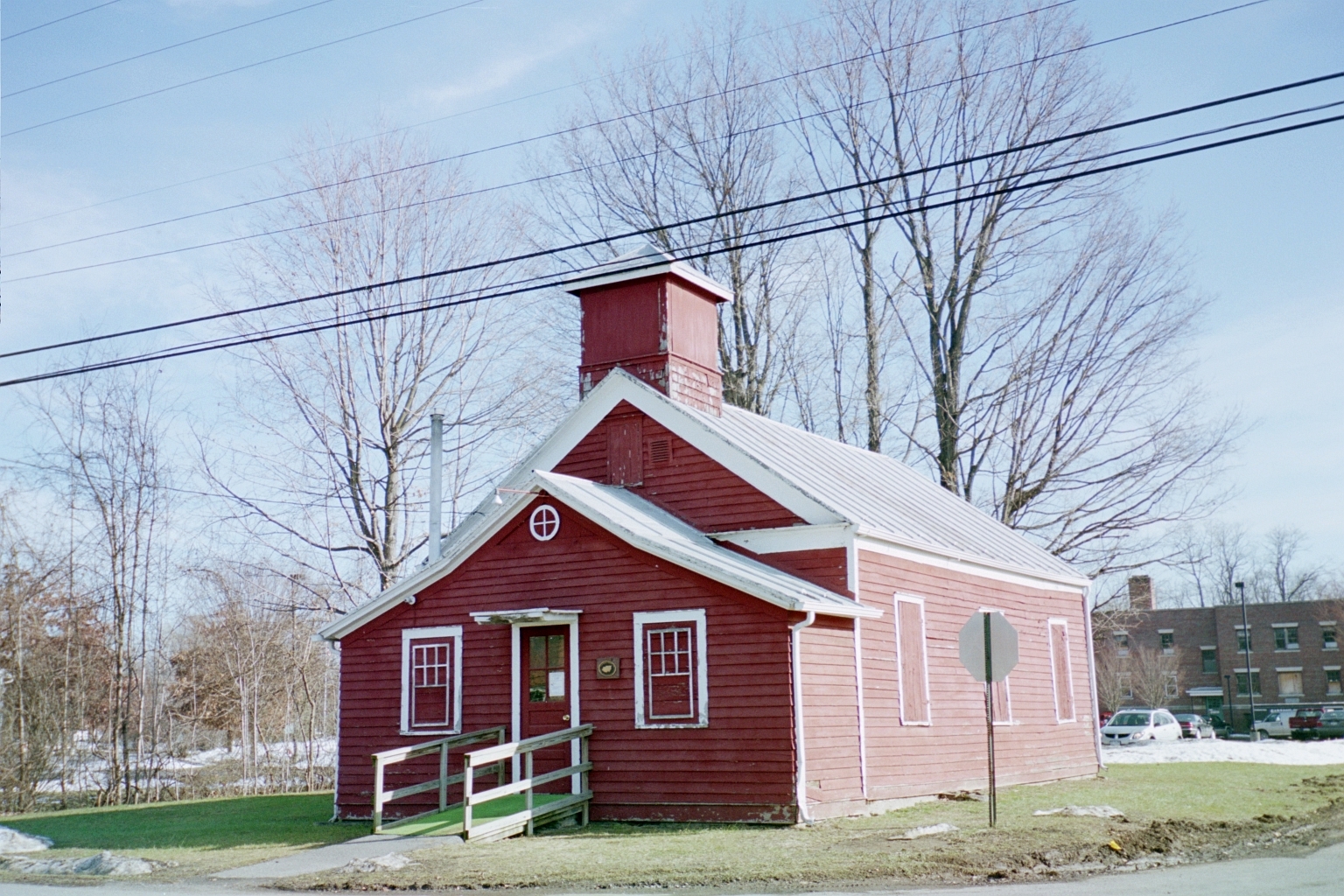
42°21′06″N 73°47′50″W / 42.351667°N 73.797222°WCoxsackie 67 Rowena Memorial School 
August 22, 2002 NY 23A
42°10′30″N 74°01′12″W / 42.175°N 74.02°WPalenville Built early 20th century by local vacationer as gift to local community in memory of his wife; used through early 1970s. 68 Rushmore Farm June 18, 2010 8748 US 9W
42°20′05″N 73°50′58″W / 42.334736°N 73.849356°WAthens vicinity 69 St. Francis DeSales Church December 9, 1999 Church St.
42°14′20″N 74°21′41″W / 42.238889°N 74.361389°WLexington 70 St. Mary's of the Mountain Church January 27, 1999 NY 23A
42°12′14″N 74°12′01″W / 42.203889°N 74.200278°WHunter 71 St. Paul's Lutheran Church 
July 6, 2005 464 Main St.
42°24′29″N 74°09′06″W / 42.408056°N 74.151667°WOak Hill 72 Salisbury Manor June 19, 1979 NW of Leeds on NY 145
42°15′47″N 73°55′10″W / 42.263056°N 73.919444°WLeeds 73 Shady Glen Road Stone Arch Bridge January 9, 2008 Shady Glen Rd. at Stone Bridge Rd.
42°22′47″N 74°08′44″W / 42.379722°N 74.145556°WCornwallville 74 Stranahan-DelVecchio House November 28, 1980 N. Washington St.
42°16′07″N 73°48′18″W / 42.268611°N 73.805°WAthens 75 Elijah Strong House January 15, 2003 12278 NY 23
42°18′14″N 74°20′30″W / 42.303889°N 74.341667°WAshland 76 Susquehannah Turnpike January 2, 1974 Beginning at Catskill, follows the Mohican Trail (NY 145) and CR 20 and 22 NW to the Schoharie County line
42°18′35″N 74°00′58″W / 42.309722°N 74.016111°WCatskill 77 Tannersville Main Street Historic District 
November 14, 2008 5898-6144 Main St., 10 Spring St.
42°11′45″N 74°07′40″W / 42.195739°N 74.127692°WTannersville New listing: refnum 08001047 78 Torry-Chittendon Farmhouse Torry-Chittendon FarmhouseAugust 30, 2010 4268 County Road 20
42°23′54″N 74°10′52″W / 42.398333°N 74.181111°WDurham New listing; refnum 10000612 79 Trinity Episcopal Church December 6, 1996 NY 23, SW of jct. with Co. Rd. 19
42°17′53″N 74°17′54″W / 42.298056°N 74.298333°WAshland 80 Tripp House and Store Complex March 12, 2001 NY 81
42°24′44″N 74°09′20″W / 42.412222°N 74.155556°WDurham 81 Twilight Park Historic District June 27, 2007 Ledge End Rd., Spray Falls Rd., Upper Level Rd. and vicinity
42°11′21″N 74°05′15″W / 42.189169°N 74.0875°WHaines Falls 82 Ulster and Delaware Railroad Station August 8, 1996 NY 23A, Hamlet of Haines Falls
42°11′45″N 74°05′29″W / 42.195833°N 74.091389°WHunter 83 Union Chapel December 28, 2001 Mill Rd.
42°21′11″N 74°14′43″W / 42.353056°N 74.245278°WWindham 84 US Post Office-Catskill 
November 17, 1988 270 Main St.
42°12′56″N 73°51′51″W / 42.215556°N 73.864167°WCatskill 85 Van Bergen House April 25, 1991 Jct. of U.S. 9W and Schiller Park Rd.
42°23′04″N 73°50′04″W / 42.384444°N 73.834444°WNew Baltimore 86 David Van Gelder Octagon House 
January 16, 1998 47 Division St.
42°13′04″N 73°52′26″W / 42.217778°N 73.873889°WCatskill 87 Albertus Van Loon House 
November 28, 1980 N. Washington St.
42°16′03″N 73°48′20″W / 42.2675°N 73.805556°WAthens 88 John Van Vechten House March 10, 1995 Susquehanna Tpk. (Co. Rd. 23B)
42°15′19″N 73°54′14″W / 42.255278°N 73.903889°WLeeds 89 Weldon House 
January 7, 2000 NY 145
42°21′55″N 74°04′53″W / 42.365278°N 74.081389°WEast Durham 90 West Athens Hill Site March 20, 1973 Address Restricted Athens 91 West Settlement Methodist Church December 6, 1996 West Settlement Rd. at its junction with Cleveland Rd.
42°19′57″N 74°22′13″W / 42.3325°N 74.370278°WAshland 92 Wiley Hose Company Building 
August 10, 1995 30 W. Bridge St.
42°13′01″N 73°52′09″W / 42.216944°N 73.869167°WCatskill 93 Woodward Road Stone Arch Bridge March 9, 2009 Woodward Road
42°22′17″N 74°05′46″W / 42.371389°N 74.096111°WEast Durham 94 Zion Lutheran Church November 28, 1980 N. Washington St.
42°16′05″N 73°48′21″W / 42.268056°N 73.805833°WAthens See also
References
- ^ The latitude and longitude information provided in this table was derived originally from the National Register Information System, which has been found to be fairly accurate for about 99% of listings. For about 1% of NRIS original coordinates, experience has shown that one or both coordinates are typos or otherwise extremely far off; some corrections may have been made. A more subtle problem causes many locations to be off by up to 150 yards, depending on location in the country: most NRIS coordinates were derived from tracing out latitude and longitudes off of USGS topographical quadrant maps created under North American Datum of 1927, which differs from the current, highly accurate GPS system used by Google maps. Chicago is about right, but NRIS longitudes in Washington are higher by about 4.5 seconds, and are lower by about 2.0 seconds in Maine. Latitudes differ by about 1.0 second in Florida. Some locations in this table may have been corrected to current GPS standards.
- ^ "National Register of Historic Places: Weekly List Actions". National Park Service, United States Department of the Interior. Retrieved on November 18, 2011.
- ^ Numbers represent an ordering by significant words. Various colorings, defined here, differentiate National Historic Landmark sites and National Register of Historic Places Districts from other NRHP buildings, structures, sites or objects.
Categories:- Greene County, New York
- National Register of Historic Places in New York by county
-


Wikimedia Foundation. 2010.