- National Register of Historic Places listings in Ulster County, New York
-
 Location of Ulster County in New York
List of the National Register of Historic Places listings in Ulster County, New York
This is intended to be a complete list of properties and districts listed on the National Register of Historic Places in Ulster County, New York. The locations of National Register properties and districts (at least for all showing latitude and longitude coordinates below) may be seen in a Google map by clicking on "Map of all coordinates".[1] Six of the properties and districts are further designated as U.S. National Historic Landmarks.
-
- This National Park Service list is complete through NPS recent listings posted November 18, 2011.[2]
Contents: Counties in New York Albany (Albany) – Allegany – Bronx – Broome – Cattaraugus – Cayuga – Chautauqua – Chemung – Chenango – Clinton – Columbia – Cortland – Delaware – Dutchess – Erie (Buffalo) – Essex – Franklin – Fulton – Genesee – Greene – Hamilton – Herkimer – Jefferson – Kings (Brooklyn) – Lewis – Livingston – Madison – Monroe (Rochester) – Montgomery – Nassau – New York (Manhattan – Below 14th Street, 14th to 59th Streets, 59th to 110th Streets, Above 110th Street, Islands) – Niagara – Oneida – Onondaga (Syracuse) – Ontario – Orange – Orleans – Oswego – Otsego – Putnam – Queens – Rensselaer – Richmond (Staten Island) – Rockland – Saratoga – Schenectady – Schoharie – Schuyler – Seneca – St. Lawrence – Steuben – Suffolk – Sullivan – Tioga – Tompkins – Ulster – Warren – Washington – Wayne – Westchester (New Rochelle, Peekskill, Yonkers) – Wyoming – Yates Listings county-wide
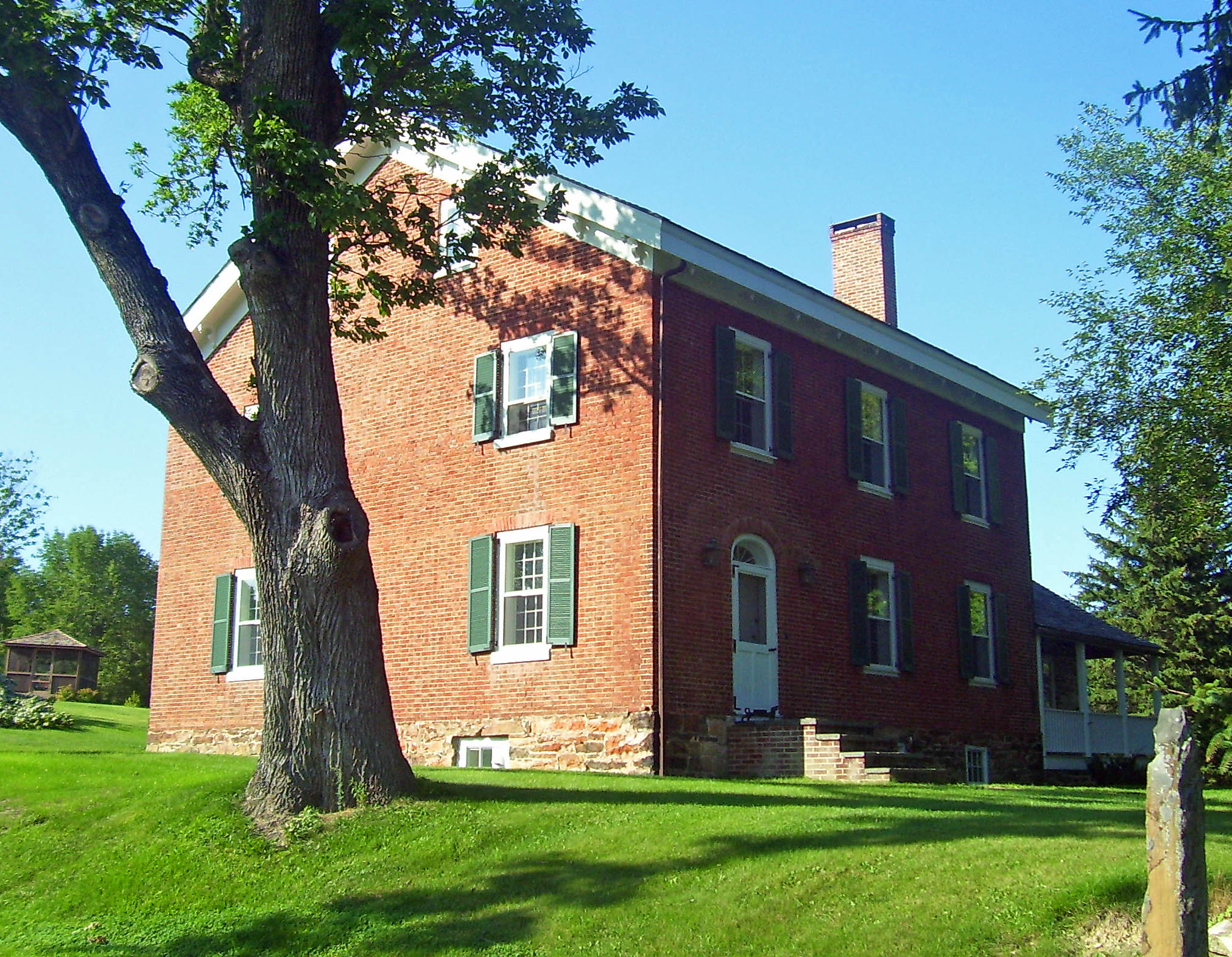
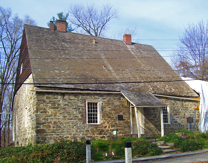
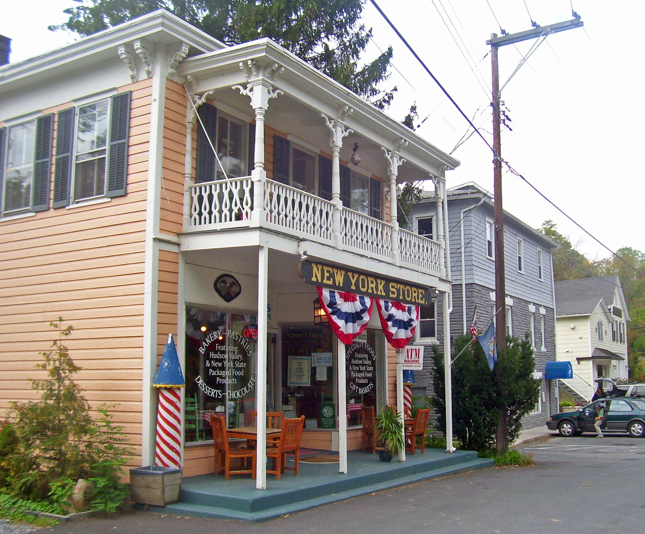
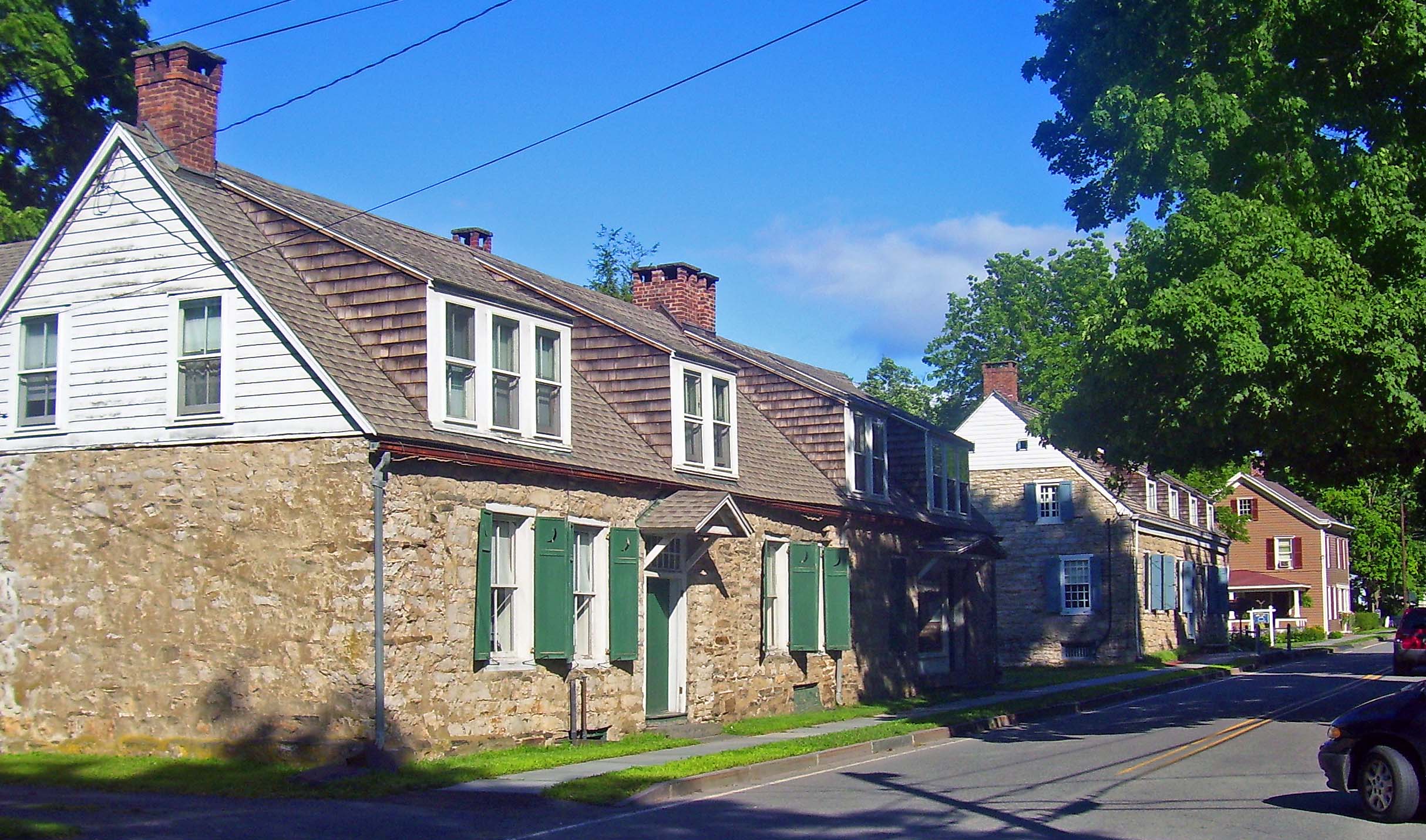
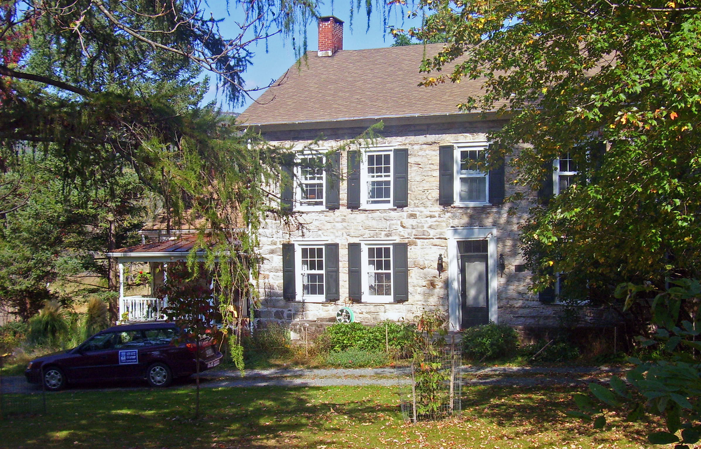
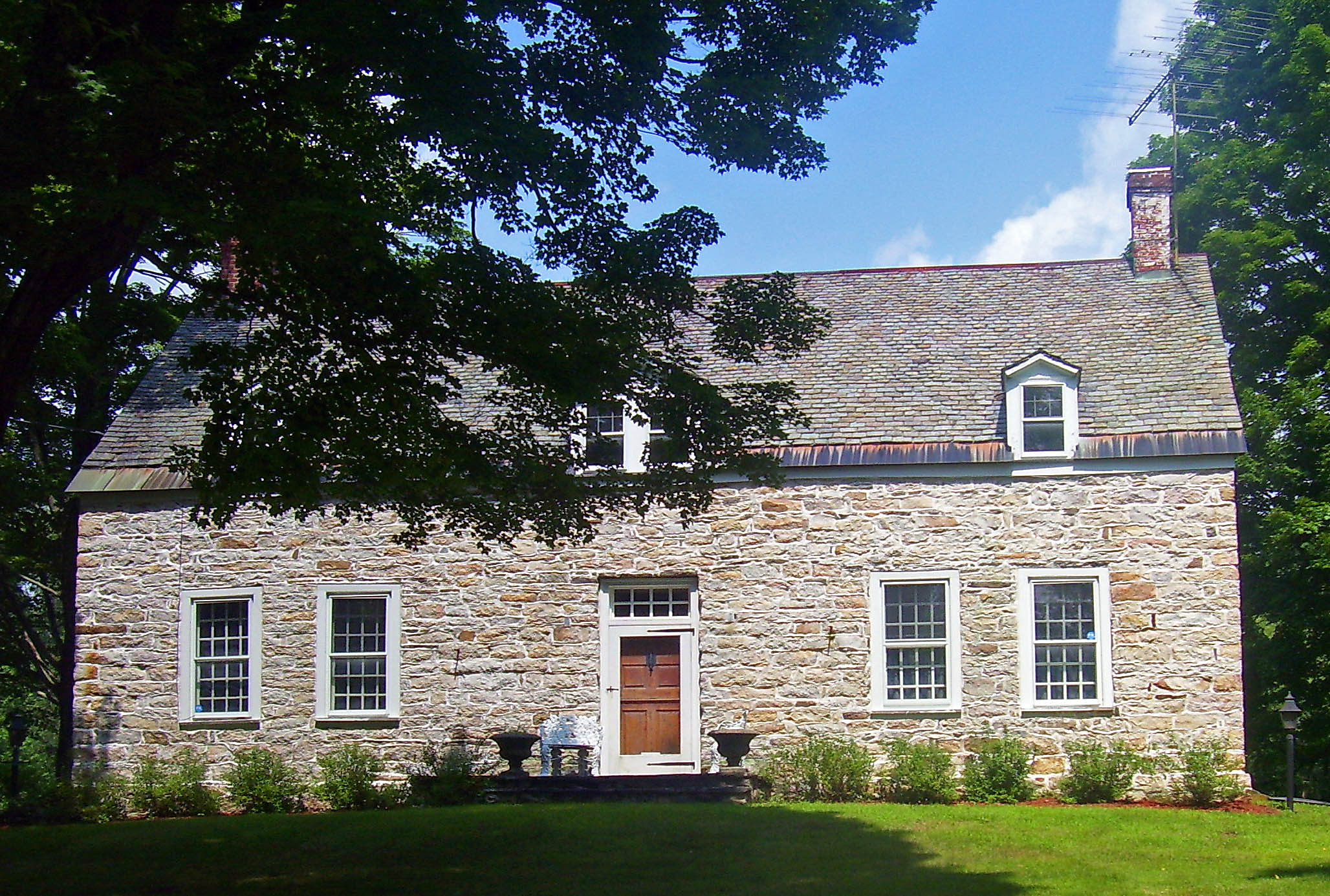
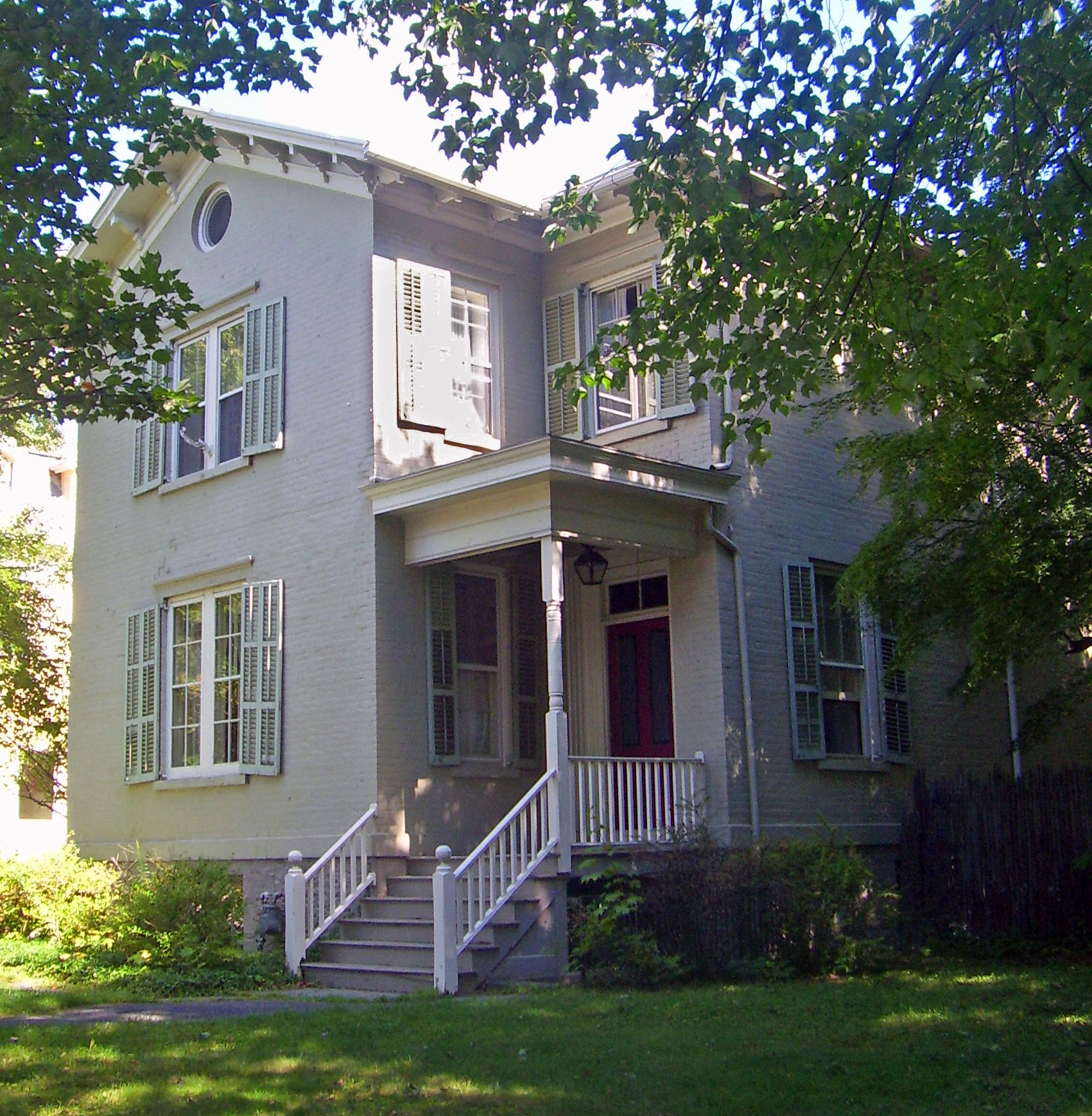
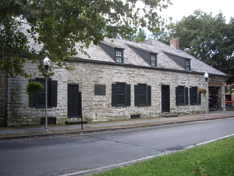
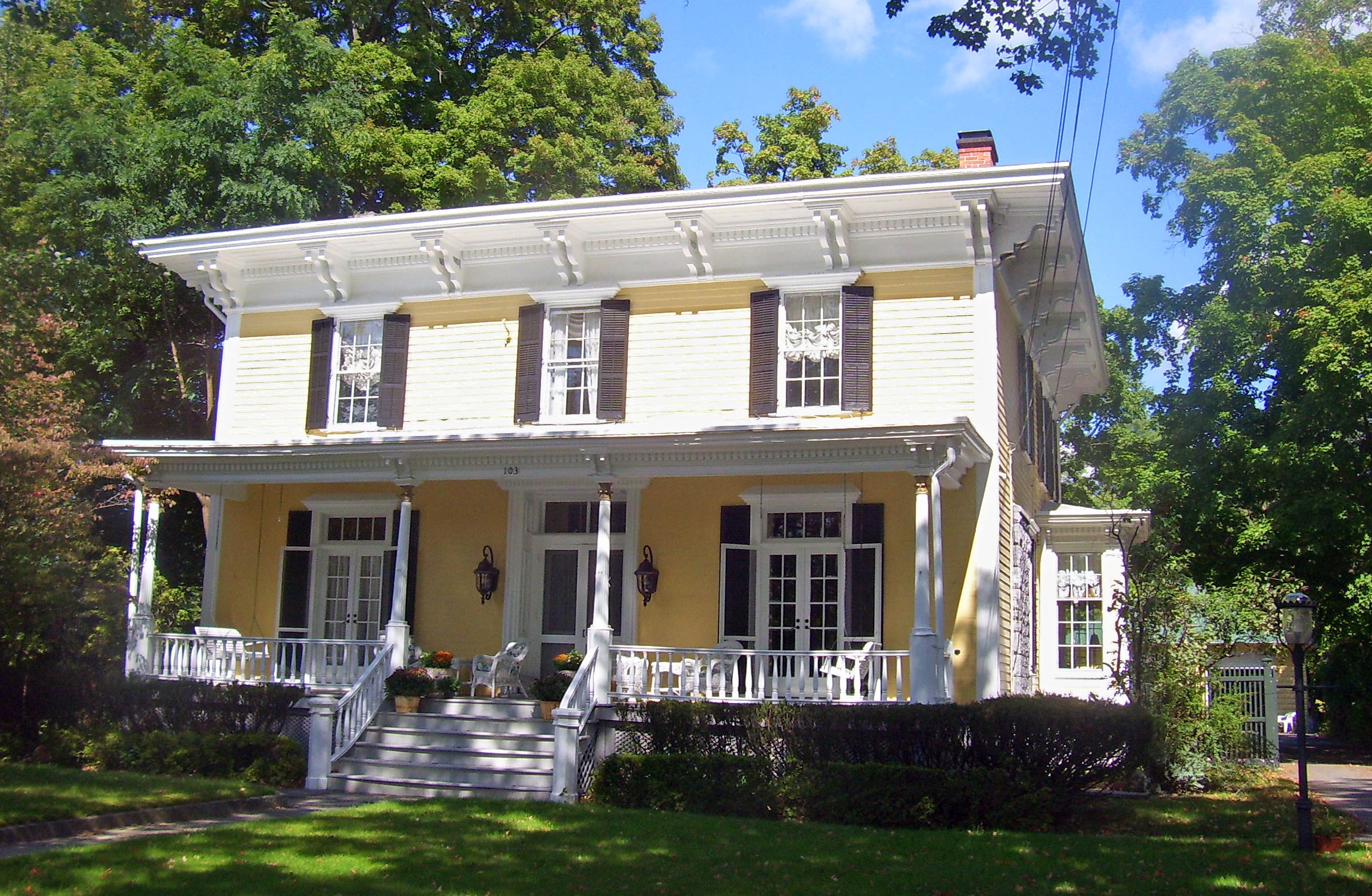
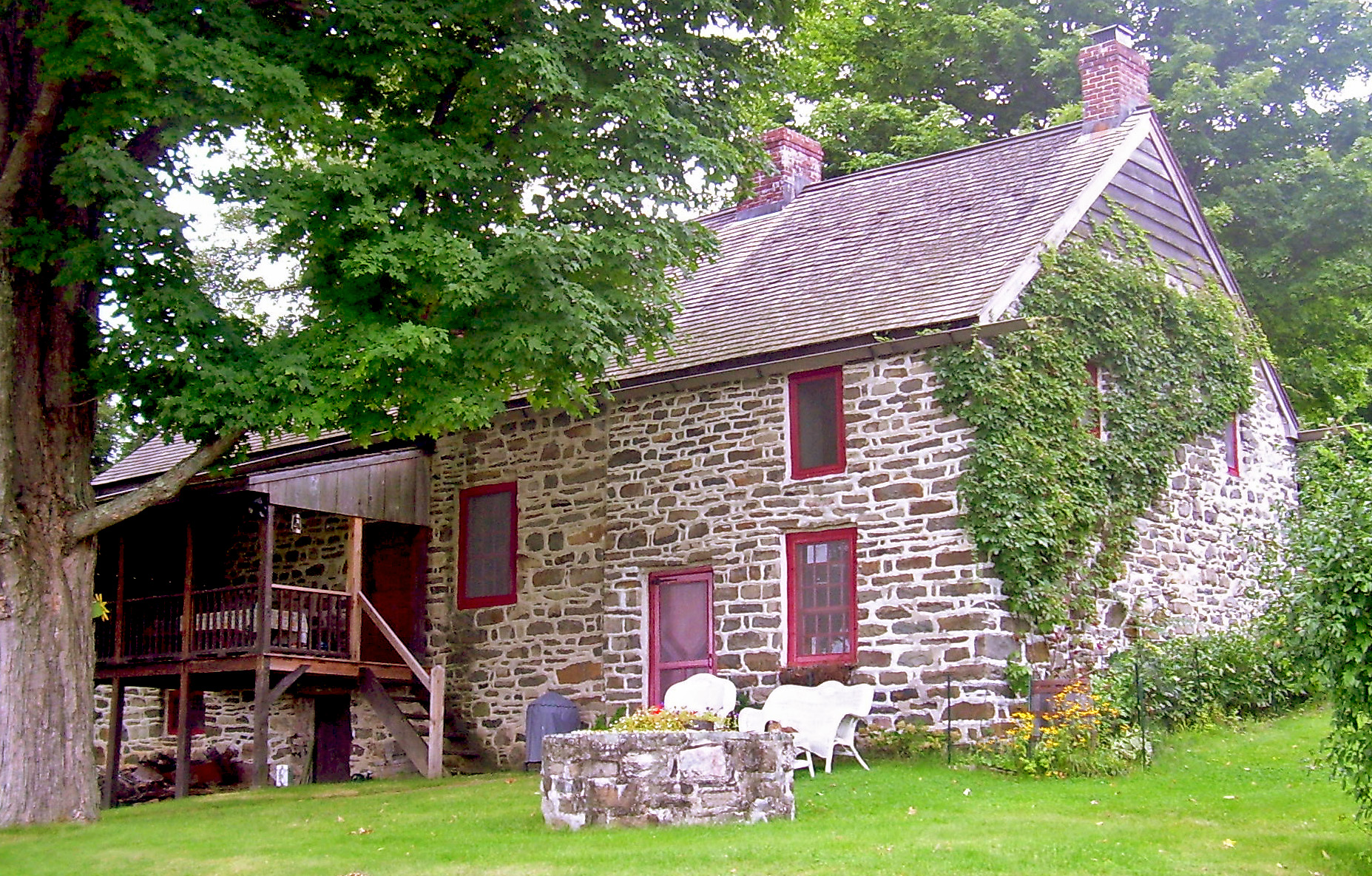
[3] Landmark name Image Date listed Location City or town Summary 1 Peter Aldrich Homestead September 26, 1983 168 Decker Rd.
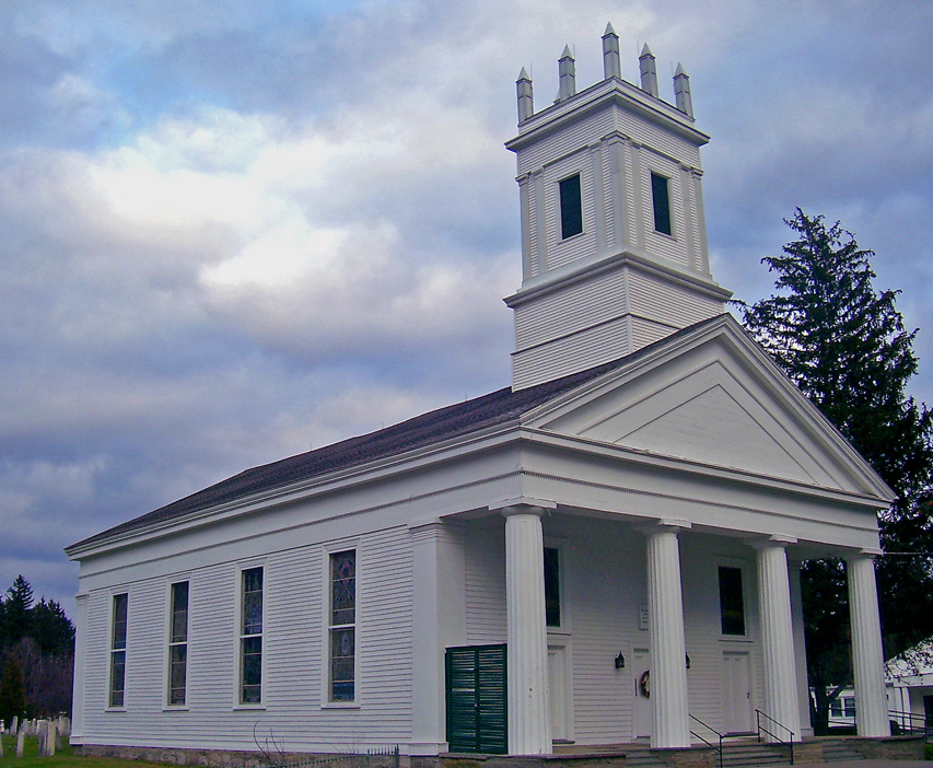
41°40′11″N 74°15′24″W / 41.669722°N 74.256667°WGardiner 1750 frame house of early settler; later expanded 2 All Saints' Chapel 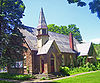
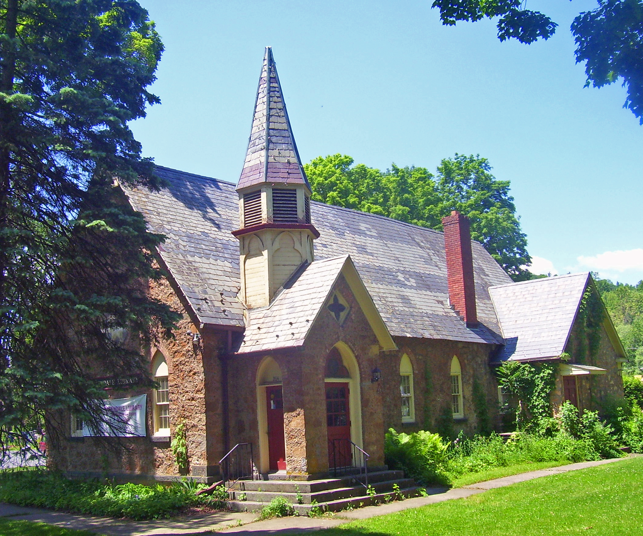
September 11, 1986 Main St.
41°50′44″N 74°04′35″W / 41.845556°N 74.076389°WRosendale Unusual 1876 Gothic Revival church building with Ruskinesque touches finished in locally mined Rosendale cement. Used as Rosendale library since 1959. 3 Ashokan-Turnwood Covered Bridge July 20, 2000 477 Beaverkill Rd.
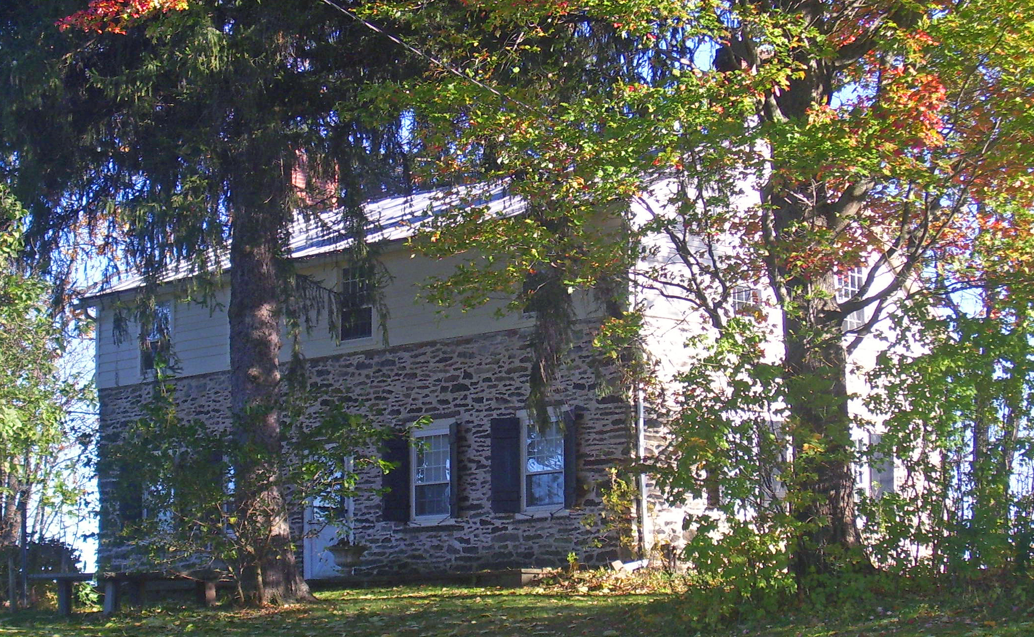
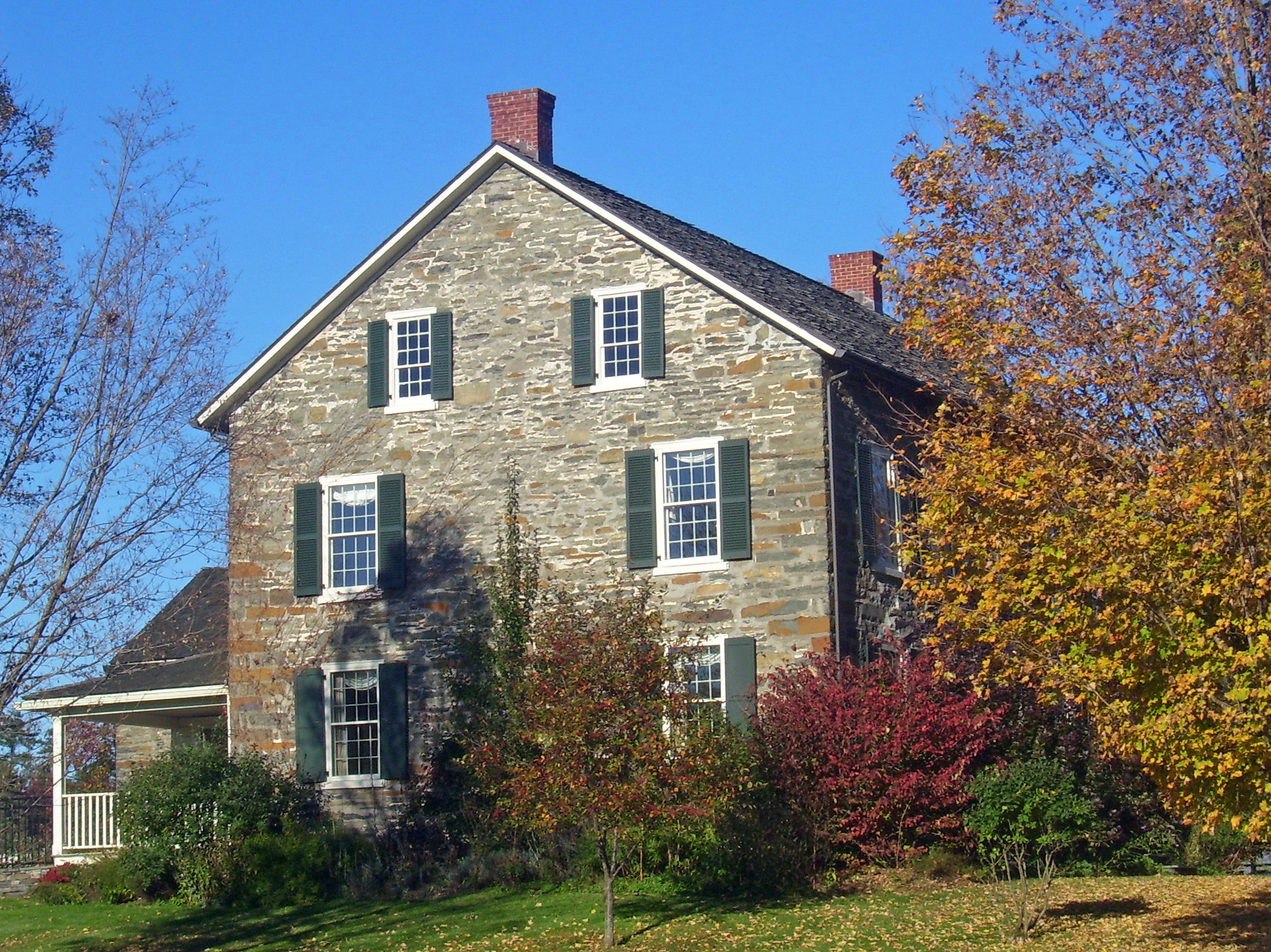
41°55′36″N 74°11′58″W / 41.926667°N 74.199444°WOliverbridge 4 Sebastian Baker Stone House February 22, 1996 10 Dug Rd.
41°49′55″N 74°14′40″W / 41.831944°N 74.244444°WRochester 5 Balsam Lake Mountain Fire Observation Station 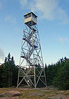
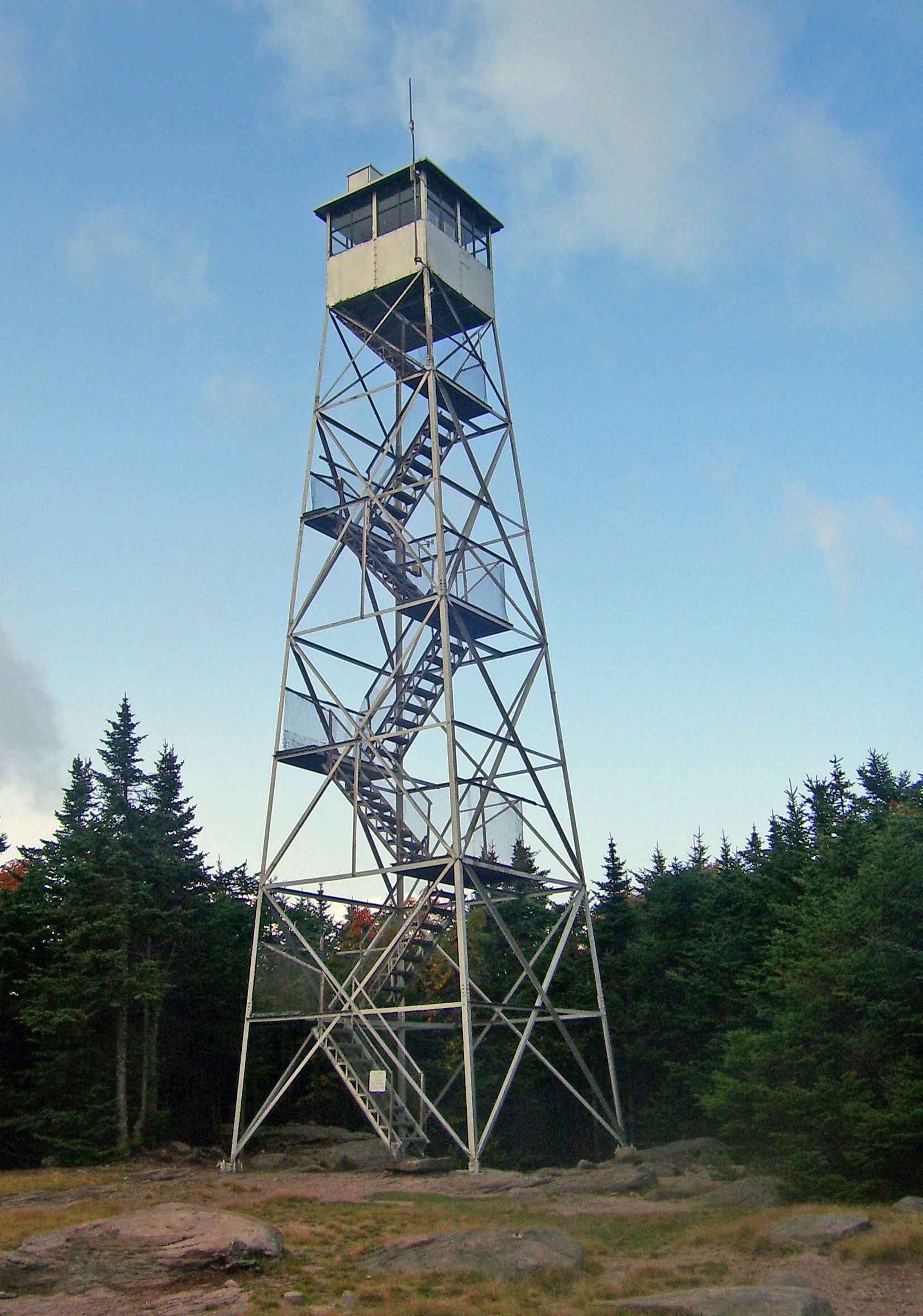
September 23, 2001 Balsam Lake Mountain
42°04′11″N 74°34′28″W / 42.069722°N 74.574444°WHardenburgh Earliest site of a fire lookout in the Catskills. Current tower built in 1930 and used till 1988. 6 Zachariah Barley Stone House August 10, 1995 193 Whitfield Rd.
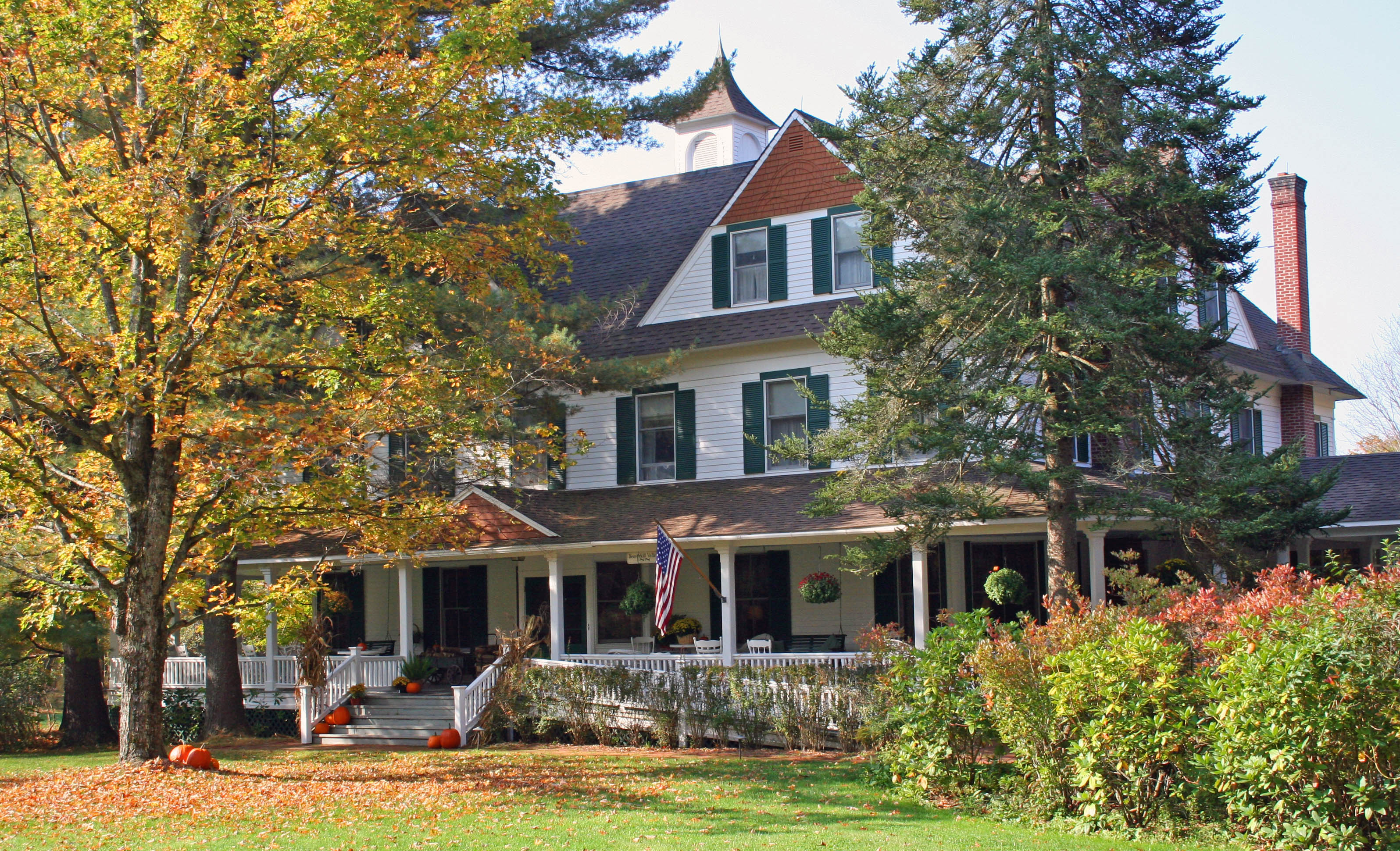
41°49′32″N 74°14′22″W / 41.825556°N 74.239444°WRochester 7 Beaverkill Valley Inn 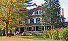
September 12, 1985 Beaverkill Rd.
42°01′24″N 74°45′06″W / 42.023333°N 74.751667°WLew Beach 1895 inn is one of few surviving fishing lodges from early years of Beaverkill angling 8 Bevier House 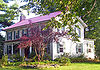
September 26, 1983 Bevier Rd.
41°40′57″N 74°10′19″W / 41.6825°N 74.171944°WGardiner Mid-19th-century farmhouse, one of few intact ones in Shawangunk Valley that predate Civil War 9 Bevier Stone House 
March 12, 2002 2687 NY 209
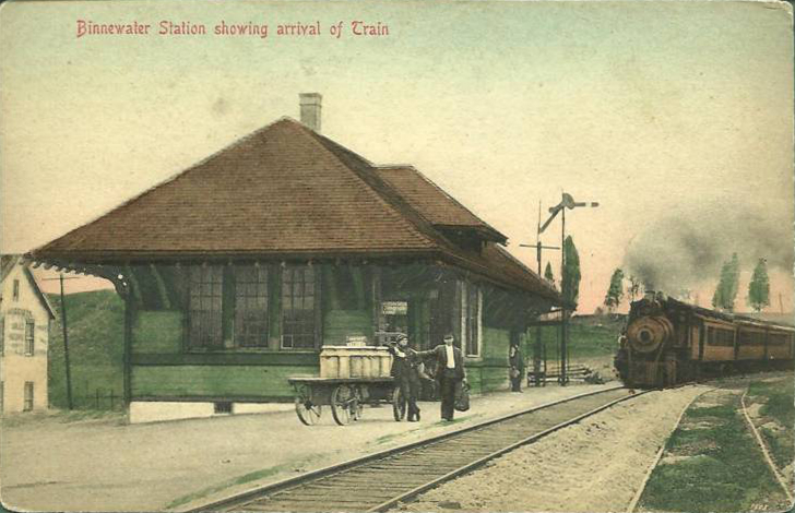
41°53′25″N 74°06′11″W / 41.890278°N 74.103056°WMarbletown 10 Binnewater Historic District 
November 4, 1982 Sawdust Ave., Breezy Hill and Binnewater Rds.
41°51′27″N 74°05′10″W / 41.8575°N 74.086111°WRosendale 11 Boice House 
December 28, 2001 110 Fair St.
41°55′40″N 74°00′58″W / 41.927778°N 74.016111°WKingston 1850s Greek Revival home remodeled in Second Empire style by local quarry owner 12 Emile Brunel Studio and Sculpture Garden 
August 10, 1999 NY 28
41°59′49″N 74°15′52″W / 41.996944°N 74.264444°WBoiceville Surviving pre–World War II Catskills roadside attraction. Studio built in imitation of European farmhouse, an unusual style in the region. 13 Bruynswick School No. 8 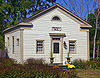
November 2, 2000 2146 Bruynswick Rd.
41°39′33″N 74°13′36″W / 41.659167°N 74.226667°WShawangunk Intact 19th-century wooden one-room schoolhouse 14 Brykill 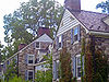
September 26, 1983 Bruynswick Rd.
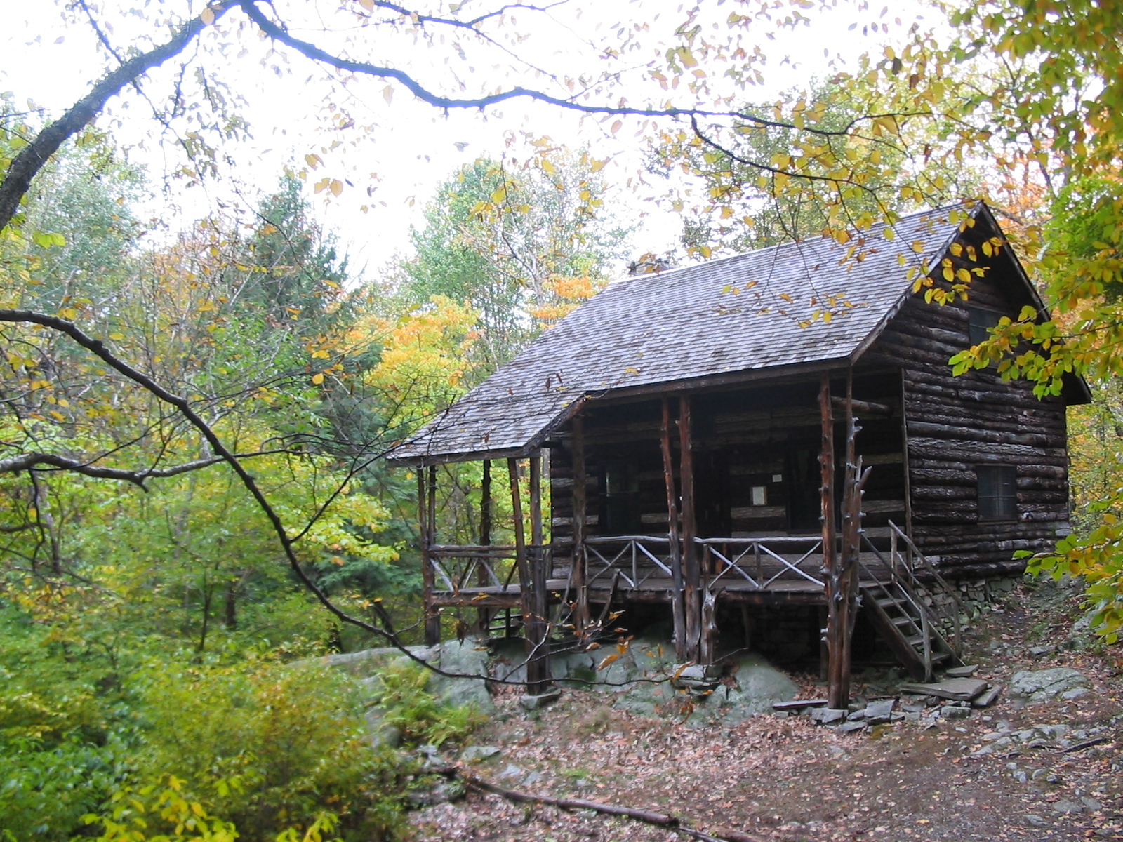
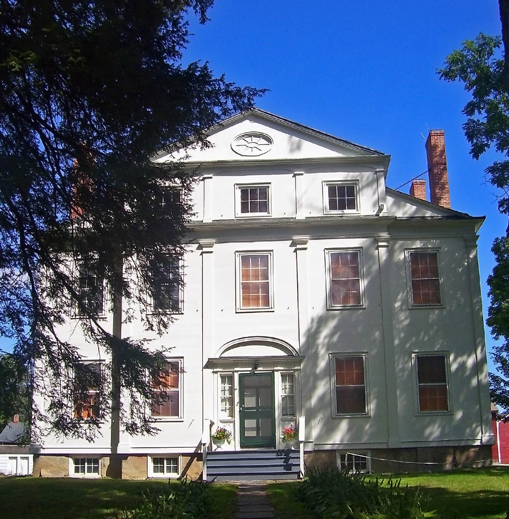
41°39′56″N 74°13′02″W / 41.665556°N 74.217222°WGardiner 1724 stone house greatly expanded into sympathetic Colonial Revival mansion by Myron Teller in 1927. Now an organic grass-fed beef ranch 15 John Burroughs Cabin 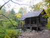
November 24, 1968 W of West Park
41°47′48″N 73°58′26″W / 41.796667°N 73.973889°WWest Park Naturalist John Burroughs' cabin known as "Slabsides" 16 John Burroughs Riverby Study November 24, 1968 Between NY 9W and the Hudson River
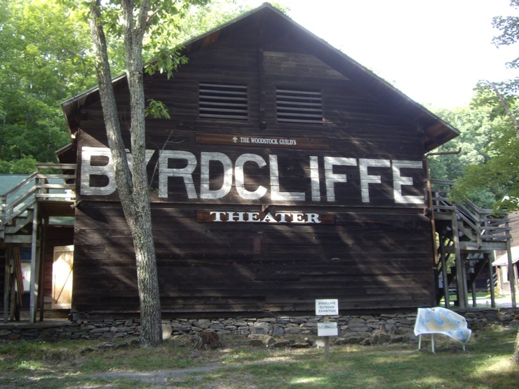
41°48′17″N 73°58′25″W / 41.804722°N 73.973611°WWest Park Burroughs' study at his West Park estate 17 Byrdcliffe Historic District 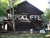
May 7, 1979 W of Woodstock at Glasco Tpke. and Larks Nest Rd.
42°03′14″N 74°08′17″W / 42.053889°N 74.138056°WWoodstock Utopian artists' community 18 Camp Wapanachki 
November 25, 1994 S. Plank Rd. (Old Co. Rt 28) at jct. with Miller Rd., Shandaken
42°02′56″N 74°16′21″W / 42.048889°N 74.2725°WMt. Tremper 19 Chapel Hill Bible Church 
January 7, 2005 49 Bingham Rd.
41°35′12″N 73°59′42″W / 41.586667°N 73.995°WMarlboro Gothic Revival church originally built 1860 in Manhattan moved to Marlboro in 1905. 20 Chestnut Street Historic District September 19, 1985 Roughly bounded by W. Chestnut St., Broadway, E. Chestnut, Livingston & Stuyvesant Sts.
41°55′24″N 73°59′22″W / 41.923333°N 73.989444°WKingston 21 Chetolah October 21, 1980 S of Cragsmoor on Vista Maria Rd.
41°39′39″N 74°22′39″W / 41.660833°N 74.3775°WCragsmoor 22 Chichester House 
December 28, 2001 116 Fair St.
41°55′41″N 74°00′58″W / 41.928056°N 74.016111°WKingston Intact 1870s Second Empire house 23 Walstein Childs House July 3, 2003 Sand Hill Rd., Wallkill Correctional Facility
41°38′33″N 74°10′08″W / 41.6425°N 74.168889°WWallkill 24 Christ Episcopal Church November 10, 2010 426 Old Post Road
41°36′01″N 73°58′18″W / 41.600278°N 73.971667°WMarlboro 25 Christ Lutheran Church and Parsonage 
May 28, 2010 105-107 Center Street
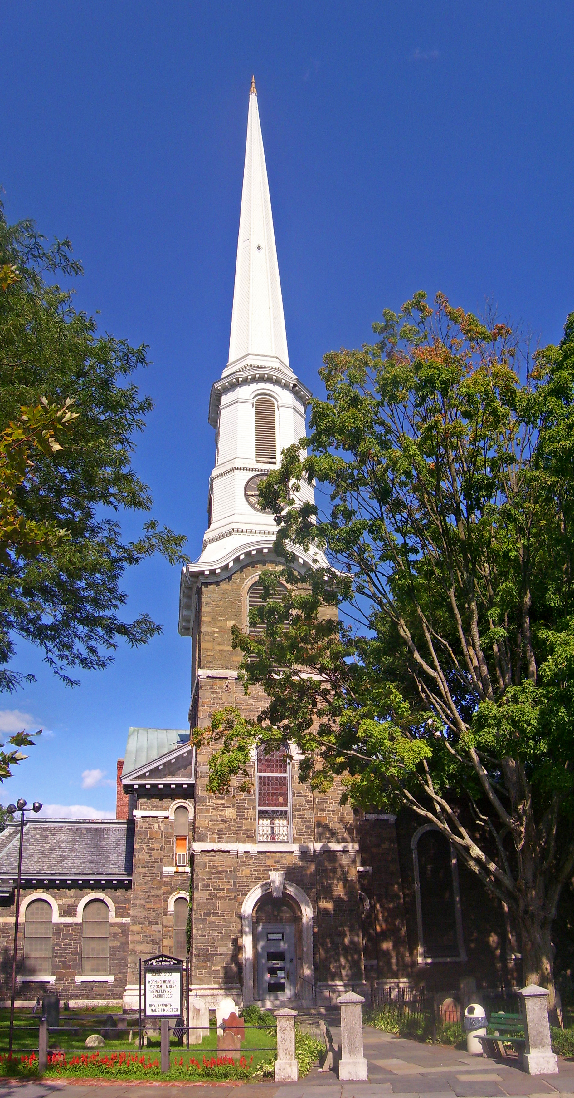
41°42′54″N 74°23′34″W / 41.714911°N 74.392794°WEllenville refnum 10000304 26 Church of the Holy Transfiguration of Christ-on-the-Mount 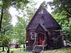
December 9, 2005 Mead's Mountain Rd.
42°03′42″N 74°07′18″W / 42.061667°N 74.121667°WWoodstock 27 Clinton Avenue Historic District 
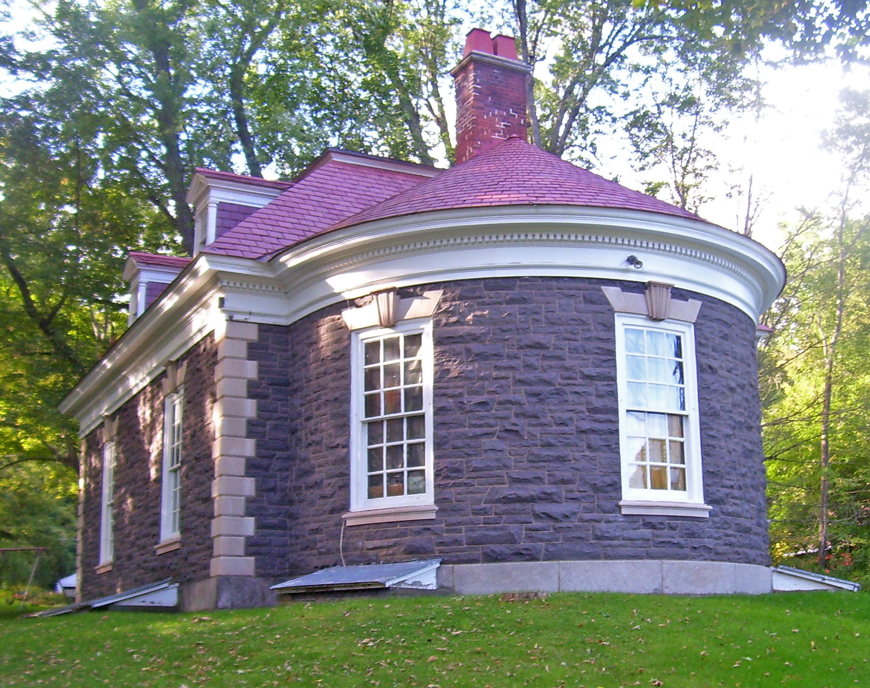
February 5, 1970 Clinton Ave. and Fair St.
41°56′05″N 74°01′29″W / 41.934722°N 74.024722°WKingston Neighborhood around Senate House was first historic district in city; now part of larger Stockade District 28 Cole-Hasbrouck Farm Historic District 
November 10, 1994 NY 32, N of the jct. with US 44 and NY 55
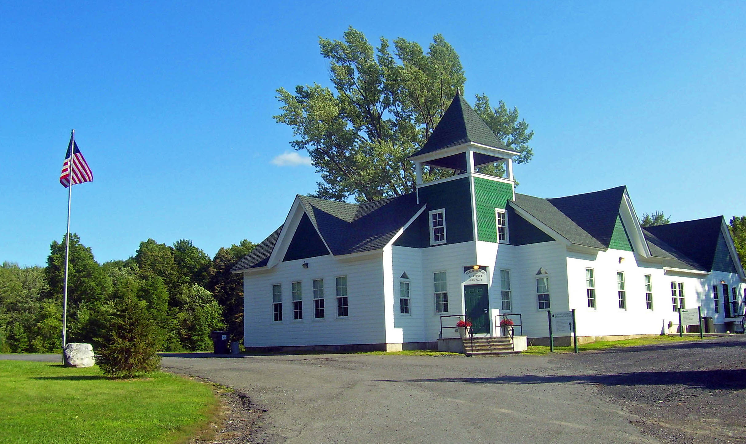
41°40′08″N 74°06′24″W / 41.668889°N 74.106667°WModena 29 Common School No. 10 September 15, 1988 Northside of Upper Cherrytown Rd.
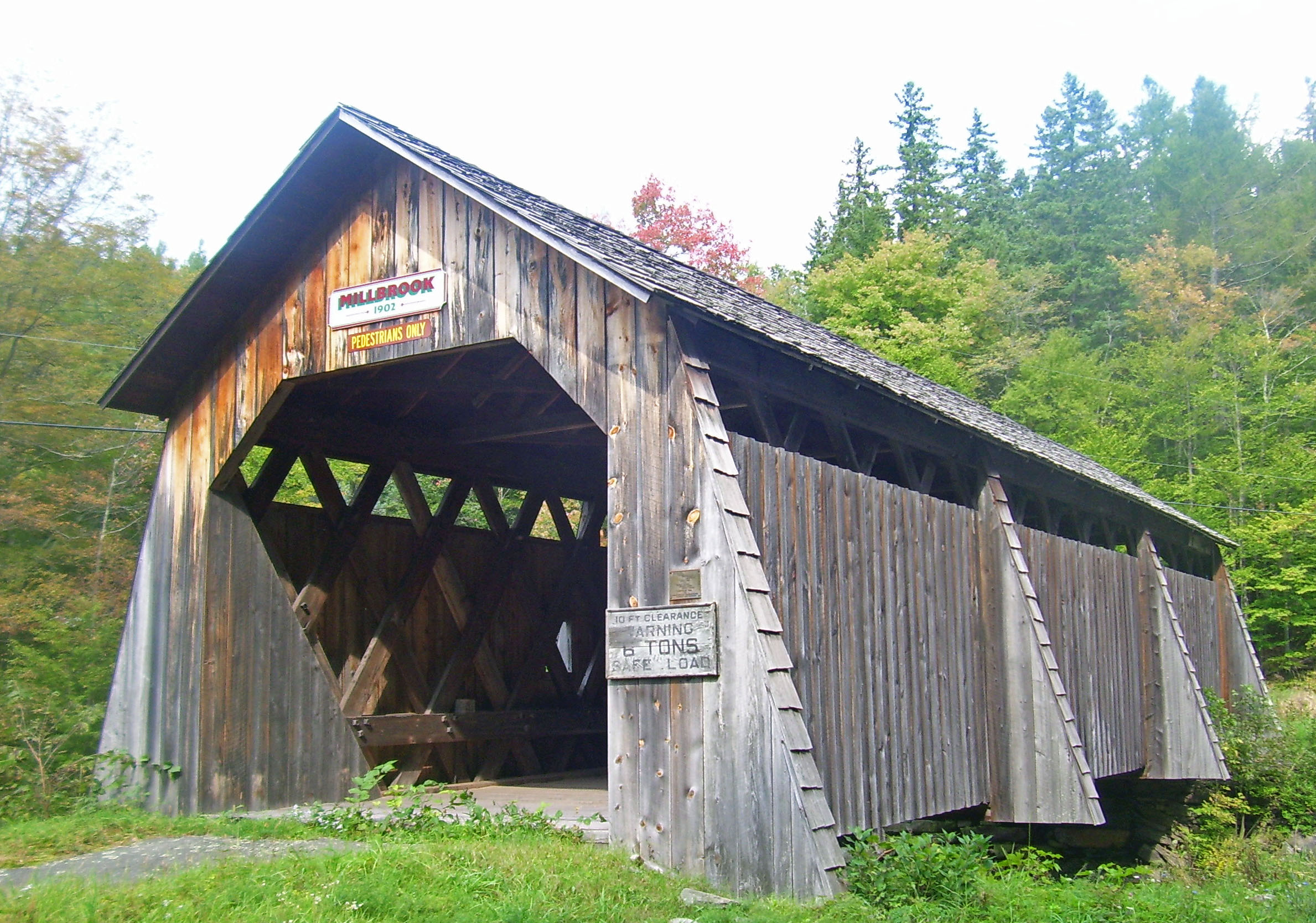
41°52′47″N 74°19′18″W / 41.879722°N 74.321667°WAccord 30 Community Theatre 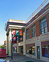
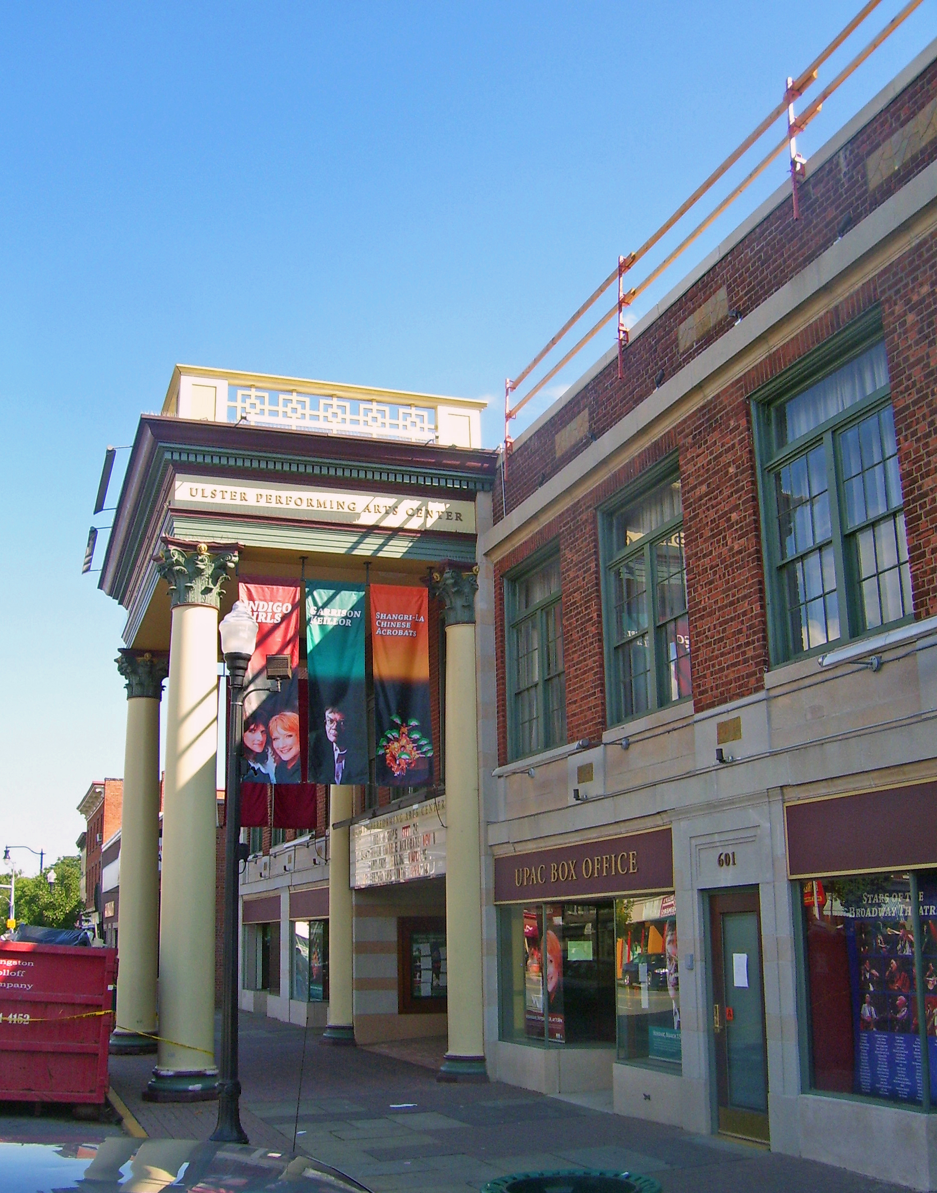
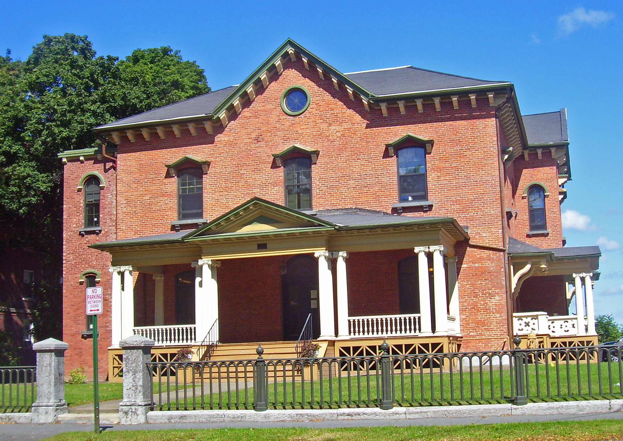
July 22, 1979 601 Broadway
41°55′46″N 74°00′17″W / 41.929444°N 74.004722°WKingston 1926 Classical Revival theater is only pre–World War II theater left in city and one of only three in the Hudson Valley. Now Ulster Performing Arts Center and home to the Hudson Valley Philharmonic 31 Cordts Mansion October 3, 2007 82-152 Lindsley Ave.
41°55′46″N 73°58′22″W / 41.929444°N 73.972778°WKingston 32 Coykendall Lodge January 11, 2002 Off Alder Lake Rd.
42°03′15″N 74°40′27″W / 42.054167°N 74.674167°WHardenburgh Lodge of rail magnate Samuel Coykendall, now one of the few non-fire tower structures allowed to remain on Forest Preserve land 33 Cragsmoor Historic District 
August 8, 1996 Roughly bounded by Henry, Cragsmoor, and Sam's Pt. Rds., Hamlet of Cragsmoor
41°40′13″N 74°22′36″W / 41.670278°N 74.376667°WCragsmoor Artists' community with many ornate 19th-century houses 34 J. B. Crowell and Son Brick Mould Mill Complex 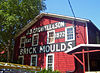
June 30, 1983 Lippencott Rd.
41°37′25″N 74°11′49″W / 41.623611°N 74.196944°WWallkill Intact late-19th-century commercial complex still in use 35 Cumming-Parker House Cumming-Parker HouseFebruary 12, 2010 50 Appletree Road
41°49′59″N 73°57′31″W / 41.832947°N 73.958681°WEsopus refnum 10000014 36 Davis Stone House August 12, 1999 4652 NY 209
41°49′09″N 74°12′01″W / 41.819167°N 74.200278°WRochester 37 Johannes Decker Farm March 5, 1974 SW of Gardiner on Red Mill Rd. and Shawangunk Kill
41°38′33″N 74°14′03″W / 41.6425°N 74.234167°WGardiner 38 William Decker House 
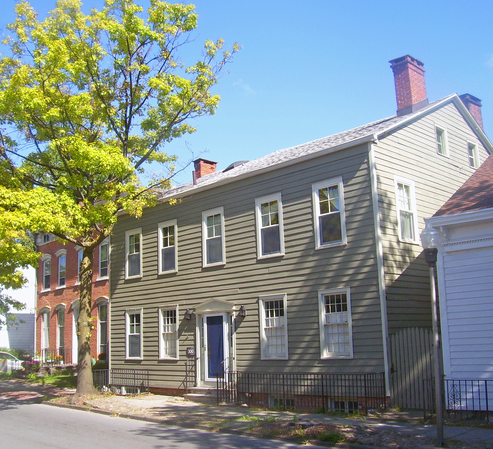
September 26, 1983 New Prospect Rd.
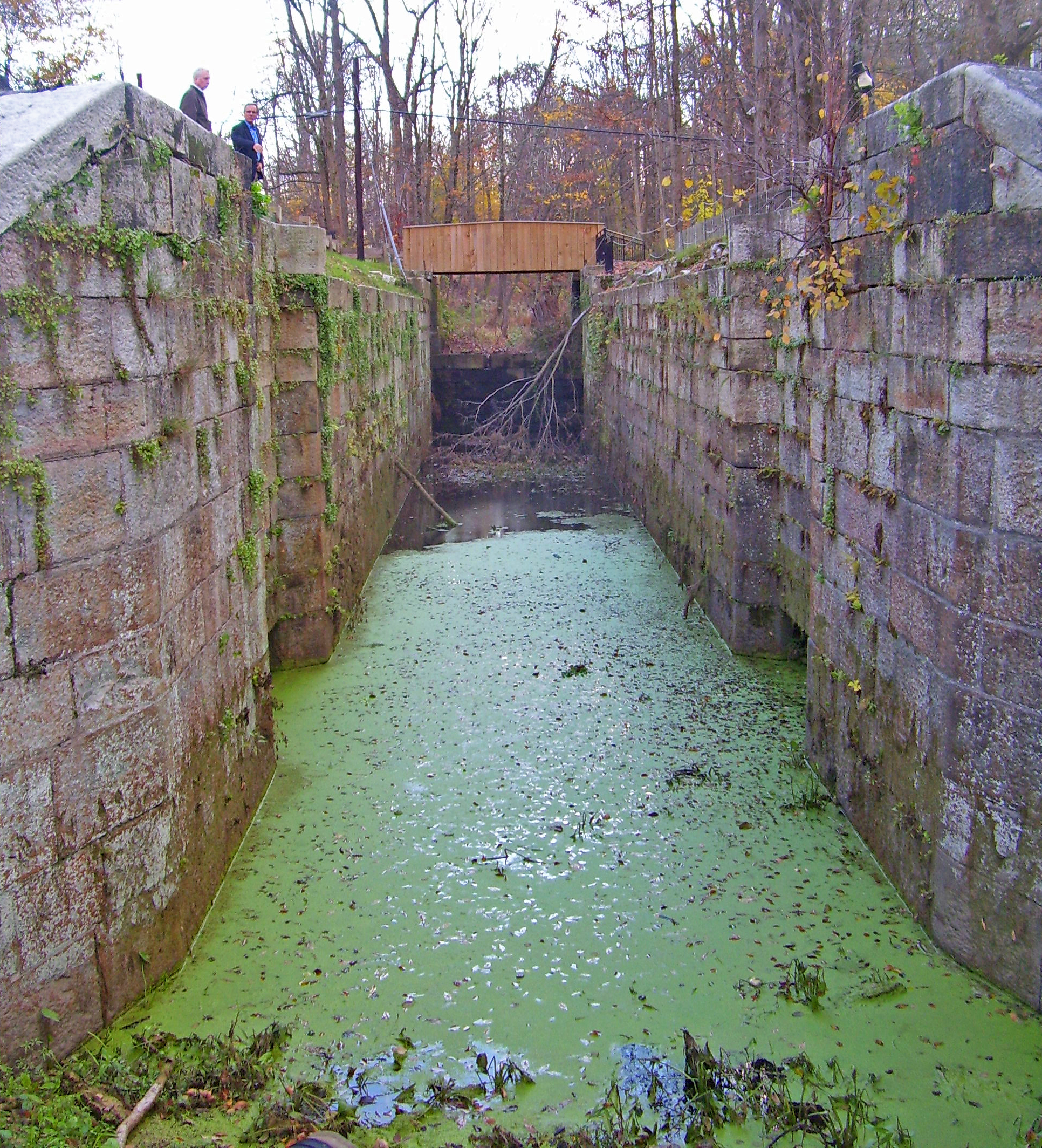
41°38′51″N 74°15′49″W / 41.6475°N 74.263611°WShawangunk Stone house of early settler of Town of Shawangunk 39 Delaware and Hudson Canal 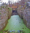
November 24, 1968 Delaware and Hudson Canal Linear through county from Spring Glen to Creeklocks Remains of canal and locks that provided anthracite coal from Northeastern Pennsylvania to New York City in 19th century, spurring city's growth 40 Dill Farm 
September 26, 1983 Off Goebel Rd.
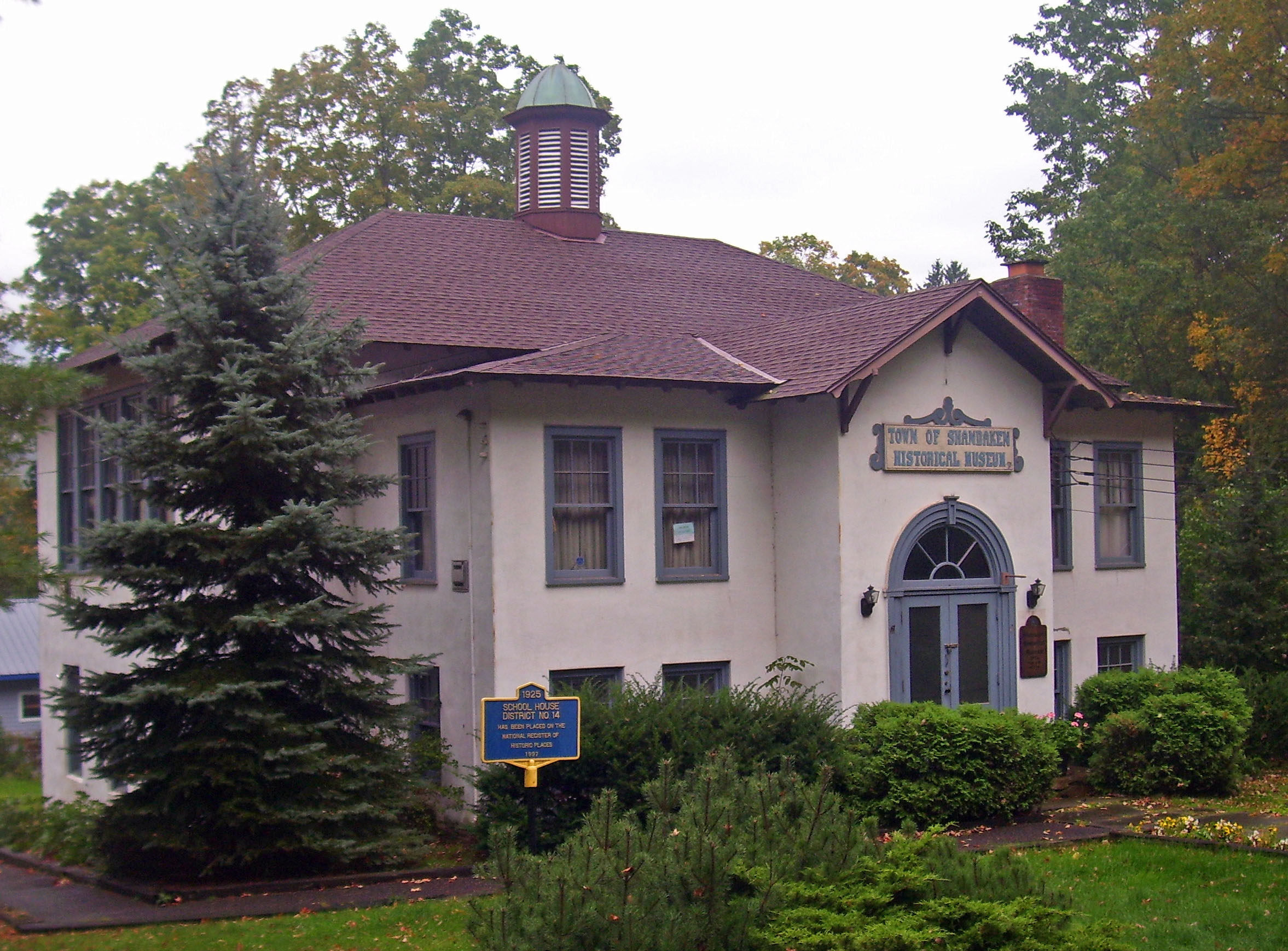
41°38′35″N 74°15′45″W / 41.643056°N 74.2625°WShawangunk Ca. 1760 family farm with original buildings from early 19th century. 41 District School No. 14 
February 21, 1997 Academy St., S of jct. with Birch Cr. Rd.
42°08′06″N 74°28′47″W / 42.135°N 74.479722°WPine Hill 1925 building reflects changes in state standards for rural schools and combines Colonial Revival and Craftsman styles. 42 Andries DuBois House 
August 6, 1998 75 Wallkill Ave.
41°36′36″N 74°11′13″W / 41.61°N 74.186944°WWallkill Oldest house in Wallkill; recently restored to original appearance 43 DuBois-Deyo House November 25, 1994 437 Springtown Rd.
41°48′16″N 74°05′12″W / 41.804444°N 74.086667°WRosendale 44 Dubois-Kierstede Stone House 
May 20, 1998 119 Main St.
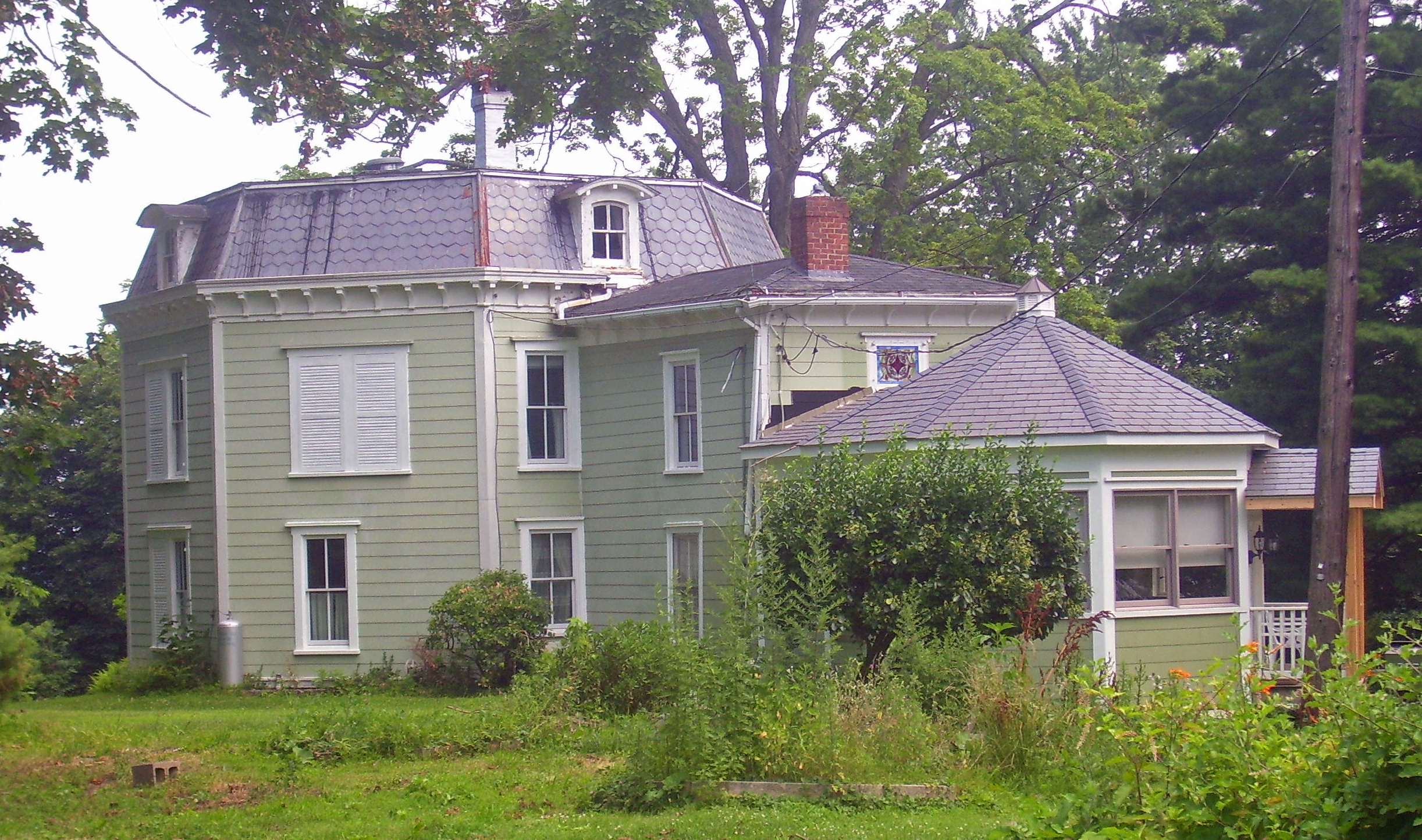
42°04′45″N 73°56′59″W / 42.079167°N 73.949722°WSaugerties 1727 stone house used as museum 45 Dubois-Sarles Octagon 
November 15, 2002 16 South St.
41°36′02″N 73°58′27″W / 41.600556°N 73.974167°WMarlboro Second Empire-style octagon house built in 1850s and modified 1872. Rare such home built on a sidehall plan. 46 Hendrikus DuBois House 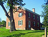
July 8, 1982 600 Albany Post Rd.
41°43′15″N 74°08′56″W / 41.720833°N 74.148889°WLibertyville House of son of "Duzine" who served in militia during Revolution 47 Ephriam DuPuy Stone House 
August 10, 1995 193 Whitfield Rd.
41°49′10″N 74°13′18″W / 41.819444°N 74.221667°WRochester Mid-18th-century stone house 48 J. Dupuy Stone House 
February 21, 1997 Krum Rd., W of jct. with Queens Hwy.
41°48′09″N 74°16′45″W / 41.8025°N 74.279167°WRochester 1840 stone house was raised only on front facade. 49 Dutch Church, Old, Parsonage August 15, 2001 109 Pearl St.
41°55′51″N 74°01′16″W / 41.930833°N 74.021111°WKingston 50 Elliott–Buckley House Elliott–Buckley HouseSeptember 29, 2011 204 Old Post Rd.
41°35′04″N 73°58′14″W / 41.584444°N 73.970556°WMarlboro vicinity refnum 11000710 51 Elm Street Stone Arch Bridge 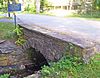
December 16, 1996 Elm St., over Alton Cr.
42°08′00″N 74°28′48″W / 42.133333°N 74.48°WPine Hill 1900 bridge is one of few stone arch bridges remaining in county 52 Elting Memorial Library 
May 12, 2004 93 Main St.
41°44′54″N 74°05′07″W / 41.748333°N 74.085278°WNew Paltz Main library of New Paltz; expanded from old stone house 53 Esopus Meadows Lighthouse 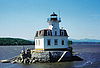
May 29, 1979 Spans Hudson River
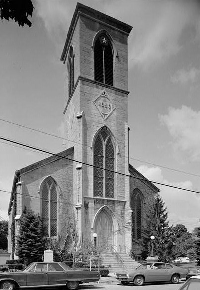
41°52′16″N 73°56′45″W / 41.871111°N 73.945833°WEsopus 54 First Reformed Protestant Dutch Church of Kingston 
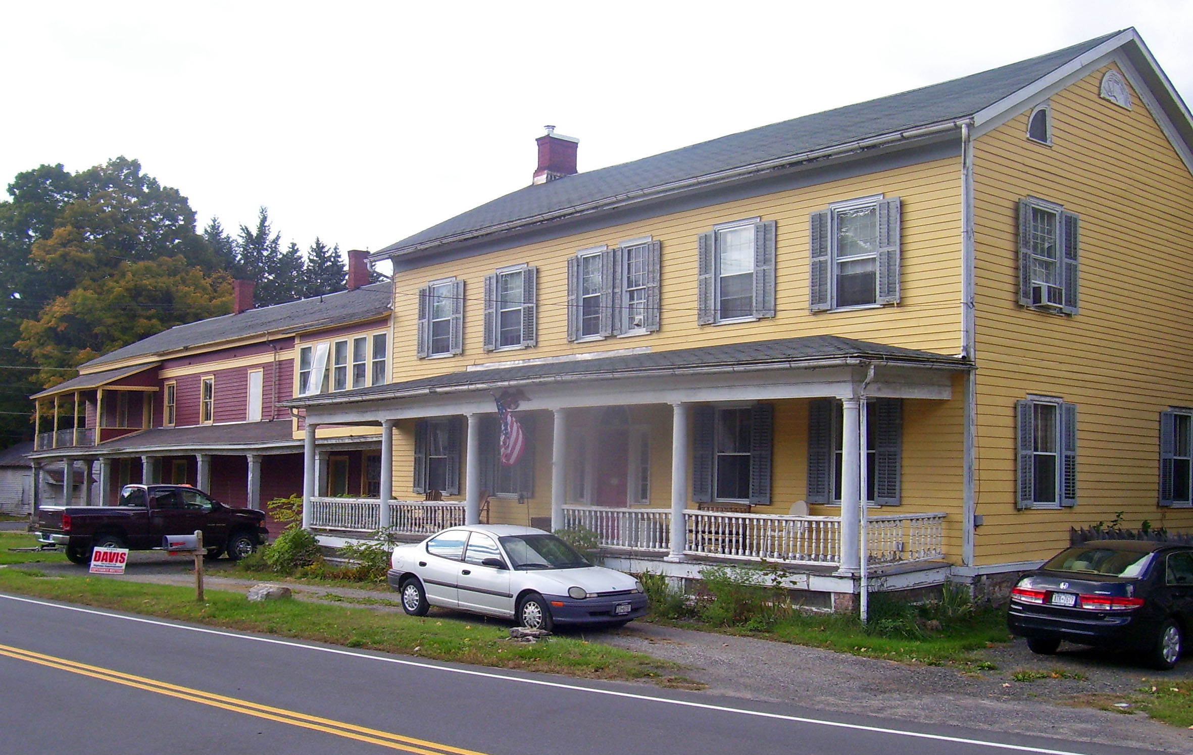
October 10, 2008 272 Wall Street
41°55′58″N 74°01′10″W / 41.932731°N 74.019353°WKingston Minard Lefever-designed 1852 church for congregation dating to 1659, one of oldest in U.S. in continuous existence. Only Lafever stone church, and his only Renaissance Revival church retaining its original integrity. 55 James and Mary Forsyth House 
July 3, 2003 31 Albany Ave.
41°55′58″N 74°00′53″W / 41.932778°N 74.014722°WKingston 1849 Richard Upjohn Italian villa is one of only two pre-Civil War buildings, and only house, by a nationally prominent architect in the city 56 Gardiner School 
November 22, 2000 2340 US 44/NY 55
41°40′43″N 74°08′59″W / 41.678611°N 74.149722°WGardiner Late-19th-century wooden school building now used as town hall following restoration 57 Grant Mills Covered Bridge 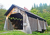
December 17, 1998 Mill Brook Rd., over Mill Brook
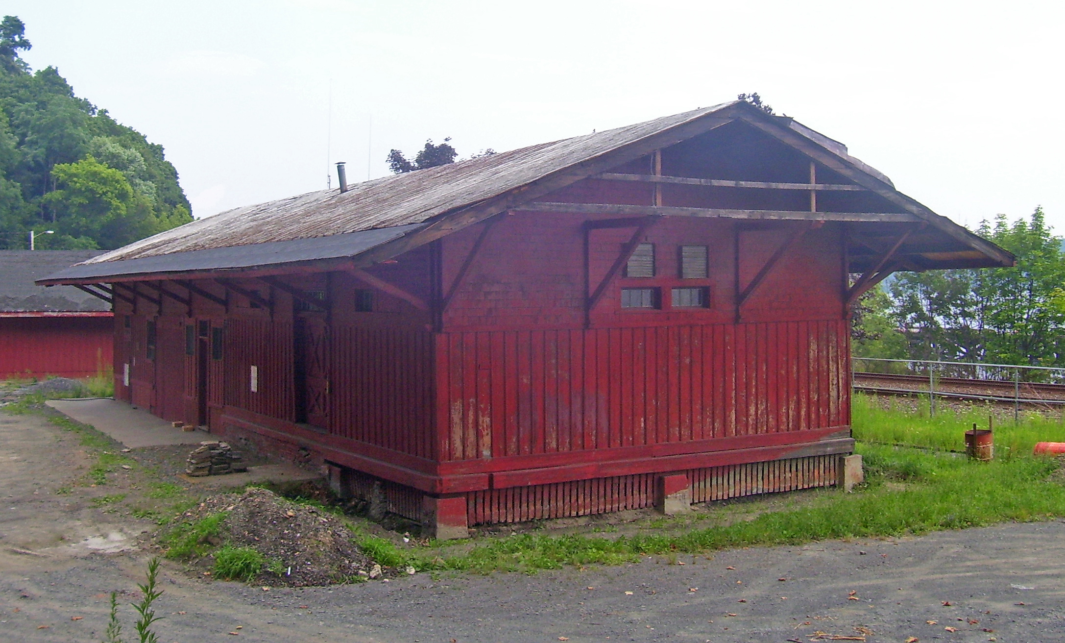
42°04′48″N 74°37′45″W / 42.08°N 74.629167°WHardenburgh Intact 1902 covered bridge, highest one in Catskills. Now carries foot traffic only 58 Guilford-Bower Farm House July 8, 1999 Albany Post Rd.
41°42′40″N 74°09′30″W / 41.711111°N 74.158333°WNew Paltz 59 Thaddeus Hait Farm 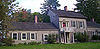
December 29, 1988 75 Allhusen Rd.
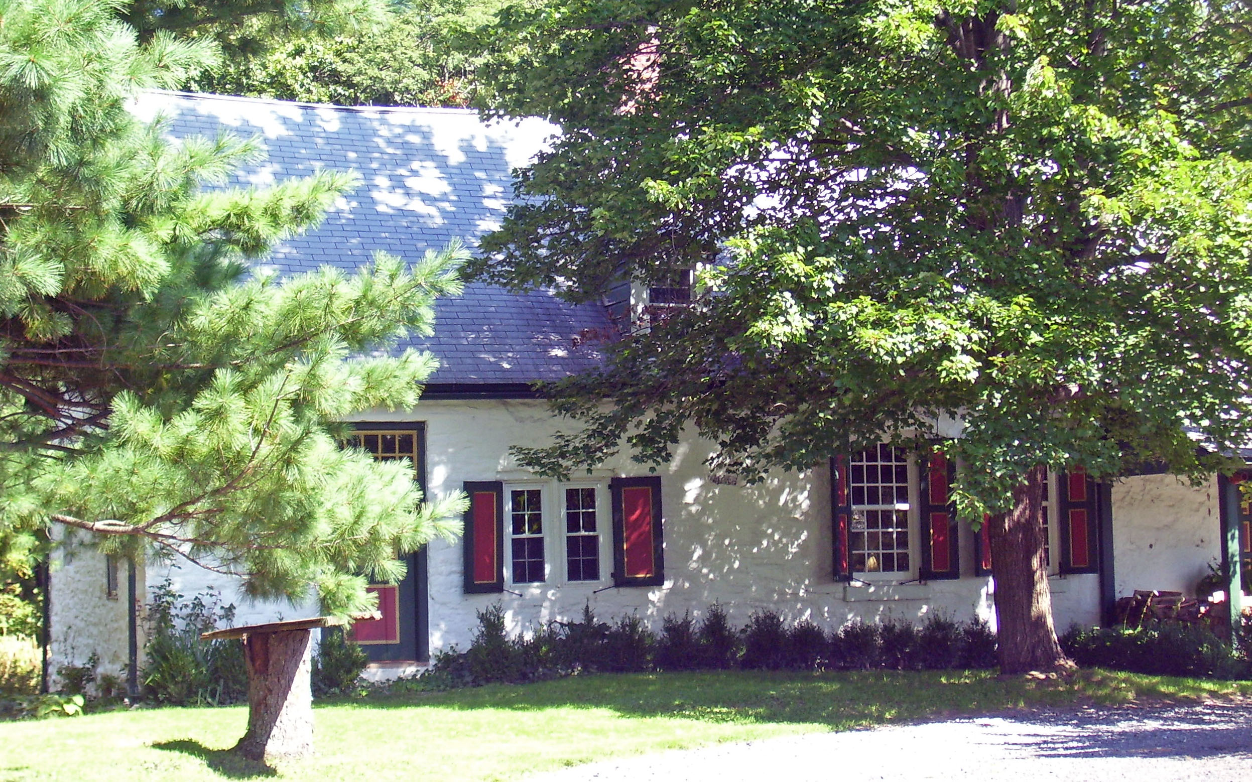
41°40′43″N 74°05′23″W / 41.678575°N 74.089844°WModena Mostly intact early-19th-century farm now returned to original use as winery 60 Jean Hasbrouck House 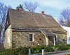
December 24, 1967 Huguenot and N. Front Sts.
41°45′06″N 74°05′20″W / 41.751667°N 74.088889°WNew Paltz Best example of Belgian stone house among the Huguenot Street homes; only one with jambless fireplace 61 Major Jacob Hasbrouck Jr. House 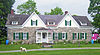
July 23, 1999 193 Huguenot St.
41°45′38″N 74°05′11″W / 41.760556°N 74.086389°WNew Paltz Home built in 1786 by Jean Hasbrouck's grandson, a veteran of the Revolution and town supervisor; modified in different ways by descendants over 19th century. Last major stone house in Ulster County and only one still owned by descendants of same family 62 High Falls Historic District 
August 6, 1998 Roughly along NY 213 and Main St.
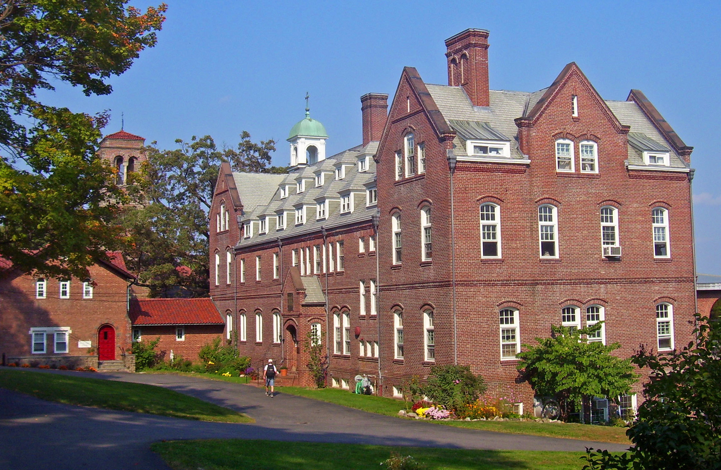
41°49′36″N 74°07′42″W / 41.826667°N 74.128333°WMarbletown Semi-planned area around major stopping point on D & H Canal 63 Holy Cross Monastery 
February 24, 1995 US 9W, E side
41°48′07″N 73°57′26″W / 41.801944°N 73.957222°WWest Park First house established in Order of the Holy Cross by founder The Rev. James Otis Sargent Huntington, in 1904. 64 Jacob Hoornbeck Stone House 
February 21, 1997 Boice Mill Rd., jct. with Krum Rd.
41°47′48″N 74°17′33″W / 41.796667°N 74.2925°WRochester 1800 stone house in Georgian style built onto smaller earlier rear wing 65 Hoornbeek Store Complex 
February 9, 1984 Main St. between Clinton & Church Sts.
41°44′28″N 74°22′27″W / 41.741111°N 74.374167°WNapanoch Early-19th-century store complex shows transition between Federal and Greek Revival styles. 66 Hornbeck Stone House 
August 10, 1995 149 Whitfield Rd.
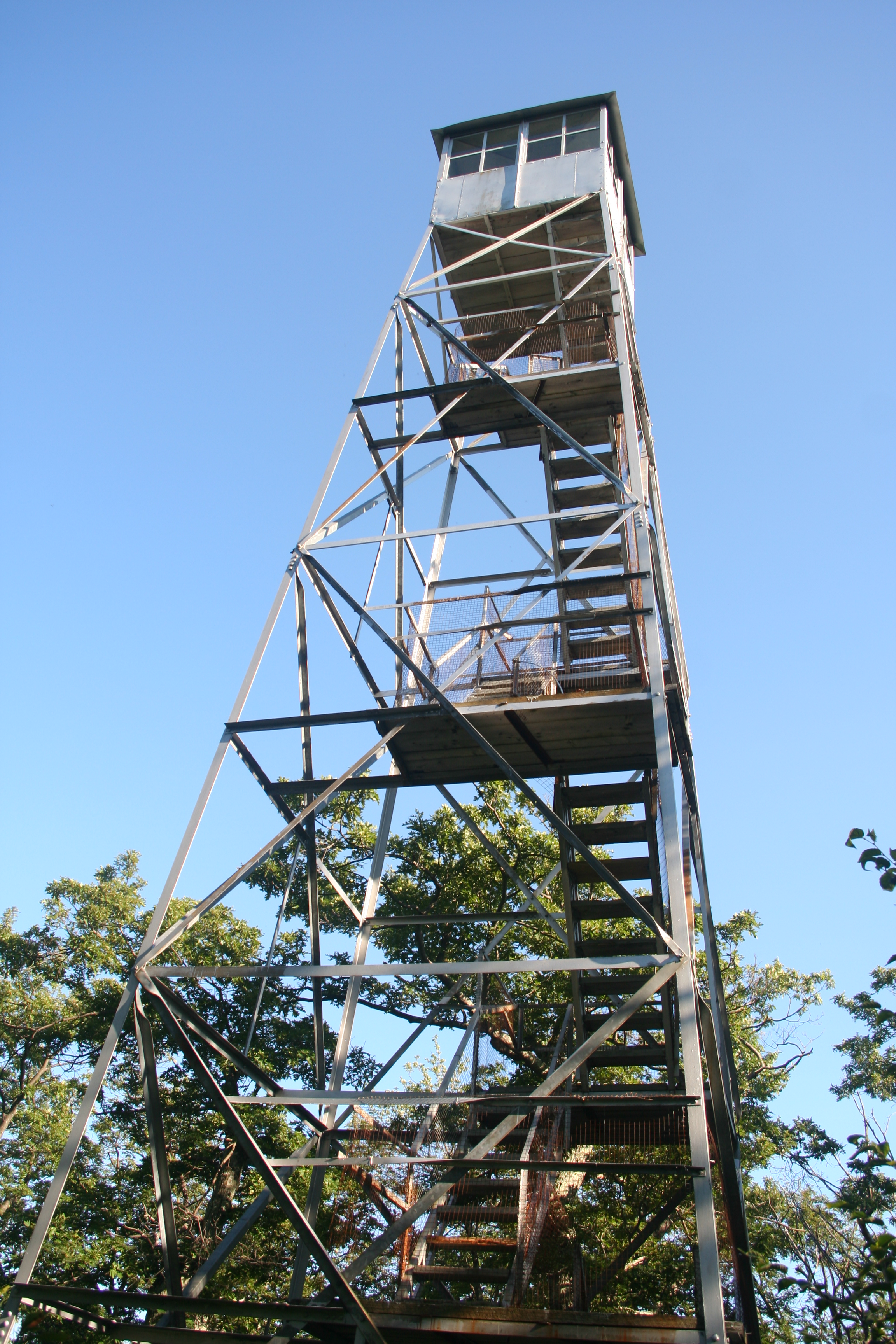
41°49′02″N 74°13′18″W / 41.817222°N 74.221667°WRochester 1750 stone house 67 House at 184 Albany Avenue 
November 15, 2002 184 Albany Ave.
41°56′01″N 74°00′29″W / 41.933611°N 74.008056°WKingston Intact ca. 1860 Picturesque house 68 House at 313 Albany Avenue 
November 15, 2002 313 Albany Ave.
41°56′16″N 74°00′17″W / 41.937778°N 74.004722°WKingston 1896 "Hutton House" in "Free Classical" mode of Queen Anne Style, showing transition to Colonial Revival 69 House at 322 Albany Avenue 
November 15, 2002 322 Albany Ave.
41°56′15″N 74°00′15″W / 41.9375°N 74.004167°WKingston Early-19th-century stone house renovated in 1840s Greek Revival and 1930s Colonial Revival 70 House at 356 Albany Avenue 
November 15, 2002 356 Albany Ave.
41°55′57″N 74°00′32″W / 41.9325°N 74.008889°WKingston 1897 house in Queen Anne "Free Classical" phase 71 Huguenot Street Historic District October 15, 1966 Huguenot St.
41°45′06″N 74°05′19″W / 41.751667°N 74.088611°WNew Paltz Late-17th-century stone houses built by founders of New Paltz; one of the oldest continuously inhabited neighborhoods in Anglo-America 72 George and John R. Hunt Memorial Building 
January 14, 2005 2 Liberty St., corner of Liberty and Canal Sts.
41°43′02″N 74°23′38″W / 41.717222°N 74.393889°WEllenville Neoclassical building from early 20th century has seen a variety of uses, mainly as village library. 73 Hurley Historic District 
October 15, 1966 Hurley St., Hurley Mountain Rd., and Schoonmaker Lane
41°55′39″N 74°03′58″W / 41.9275°N 74.066111°WHurley Well-preserved early-18th-century Dutch stone houses; temporary capitol of New York for two months after burning of nearby Kingston 74 Johannes Jansen House and Dutch Barn 
September 26, 1983 Decker Rd.
41°40′01″N 74°16′11″W / 41.666944°N 74.269722°WShawangunk Stone house and farm of early settler 75 Thomas Jansen House 
September 26, 1983 Jansen Rd.
41°39′07″N 74°17′32″W / 41.651944°N 74.292222°WShawangunk Jansen's original 1727 stone house still stands as kitchen wing of Federal-style stone house his grandson built in 1820s. 76 Jenkins-DuBois Farm and Mill Site 
May 30, 2001 Jenkinstown Rd.
41°41′46″N 74°06′38″W / 41.696111°N 74.110556°WGardiner 1793 farm on land still owned by original family. 77 K. WHITTELSEY (Tugboat) November 21, 2002 3 North St. at Rondout Creek
41°55′20″N 73°58′13″W / 41.922222°N 73.970278°WKingston 78 William Kenyon House 
December 28, 2001 104 Fair St.
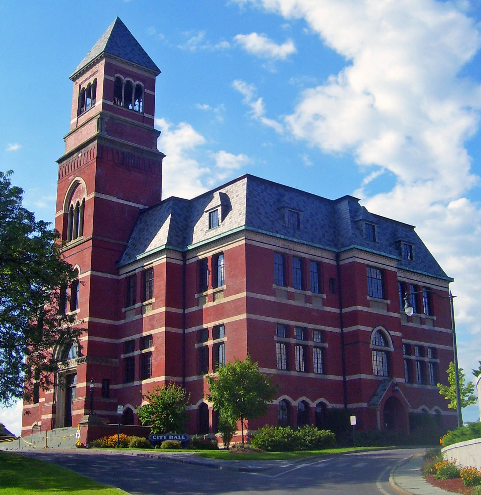
41°55′39″N 74°00′57″W / 41.9275°N 74.015833°WKingston Intact 1850 Italian villa-style house of local congressman 79 Kingston City Hall (New York) 
December 9, 1971 408 Broadway
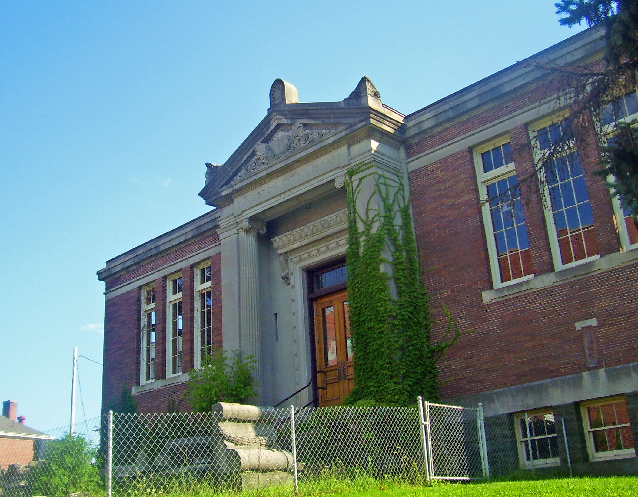
41°55′37″N 73°59′48″W / 41.926944°N 73.996667°WKingston 1873 building, recently restored, sat on former Kingston-Rondout boundary to symbolize merged city. 80 Kingston City Library 
December 7, 1995 399 Broadway
41°55′34″N 73°59′47″W / 41.926111°N 73.996389°WKingston 1903 neoclassical Carnegie library 81 Kingston Stockade District 
June 19, 1975 Area bounded by both sides of Clinton Ave., Main, Green, and Front Sts.
41°56′02″N 74°01′13″W / 41.933889°N 74.020278°WKingston Area inside 1654 stockade, commonly known as Uptown Kingston 82 Kingston-Port Ewen Suspension Bridge 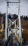
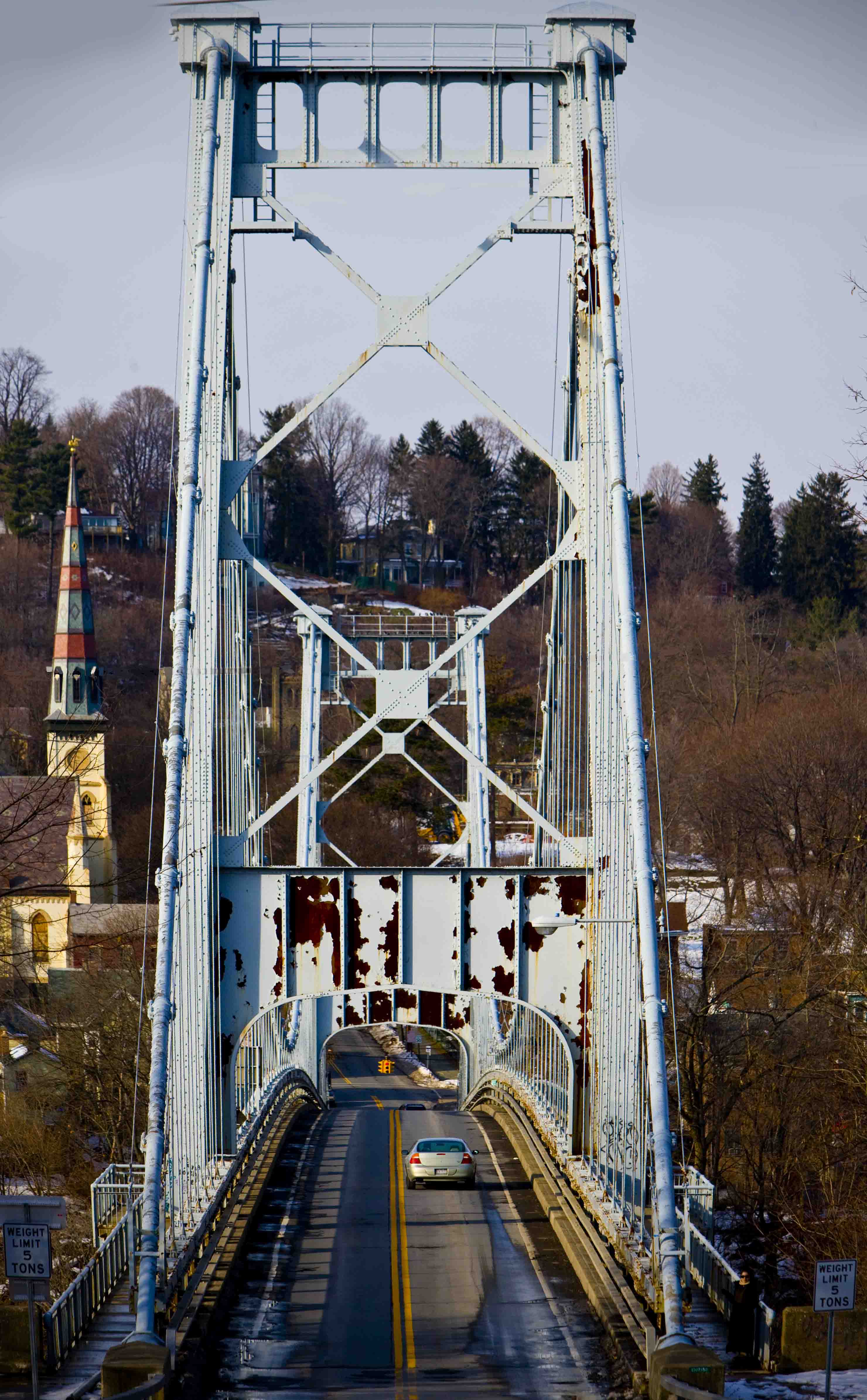
April 30, 1980 U.S. 9W
41°55′02″N 73°59′08″W / 41.917222°N 73.985556°WKingston and Port Ewen Built in 1921, was final link in first road up west side of Hudson 83 Kingston/Rondout 2 Lighthouse 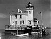
May 29, 1979 Hudson River and Rondout Creek
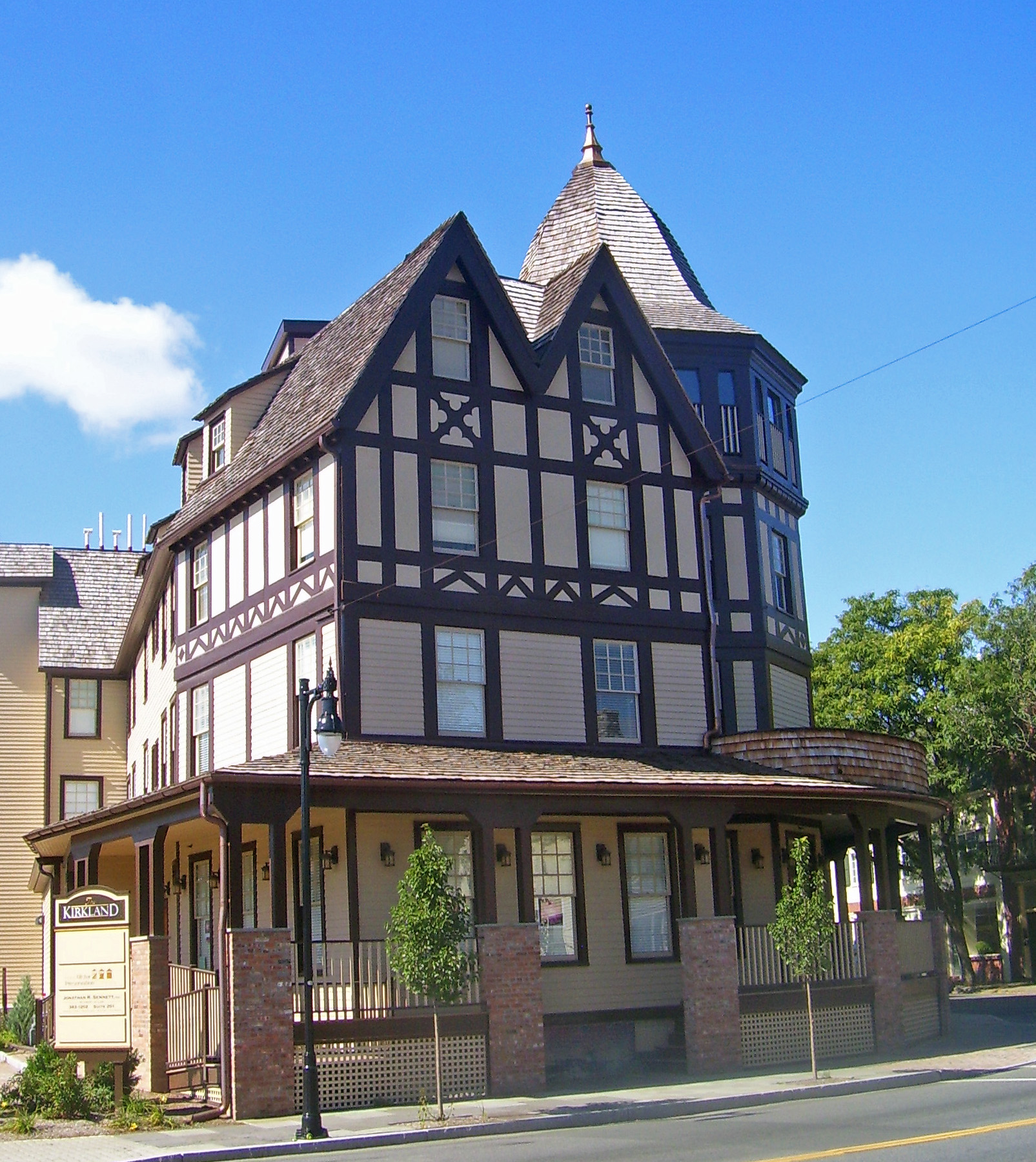
41°55′38″N 73°58′19″W / 41.927222°N 73.971944°WKingston 84 Kirkland Hotel 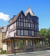
November 15, 2002 2 Main St.
41°55′59″N 74°01′01″W / 41.933056°N 74.016944°WKingston Rare surviving wood-frame urban hotel built in 1899 85 Kripplebush Historic District October 4, 1994 Roughly, area surrounding Kripplebush and Pine Bush Rds.
41°50′18″N 74°11′17″W / 41.838333°N 74.188056°WMarbletown 86 Krom Stone House and Dutch Barn August 10, 1995 Airport Rd.
41°49′01″N 74°12′35″W / 41.816944°N 74.209722°WRochester 87 Krom Stone House at 31 Upper Whitfield Road August 10, 1995 31 Upper Whitfield Rd.
41°49′43″N 74°13′39″W / 41.828611°N 74.2275°WRochester 88 Krom Stone House at 45 Upper Whitfield Road 
August 10, 1995 45 Upper Whitfield Rd.
41°49′43″N 74°13′52″W / 41.828611°N 74.231111°WRochester 1780 stone house with frame rear wing added in late 19th century 89 Lucas Krom Stone House August 10, 1995 286 Whitfield Rd.
41°49′37″N 74°13′23″W / 41.826944°N 74.223056°WRochester 90 John A. Lafevre House and School 
November 16, 1989 NY 208, S of New Paltz
41°41′50″N 74°07′09″W / 41.697222°N 74.119167°WGardiner Stone house built 1772 by New Paltz Huguenot descendant; one-room schoolhouse on property built 1838. 91 Lattingtown Baptist Church Lattingtown Baptist ChurchOctober 20, 2010 425 Old Indian Road
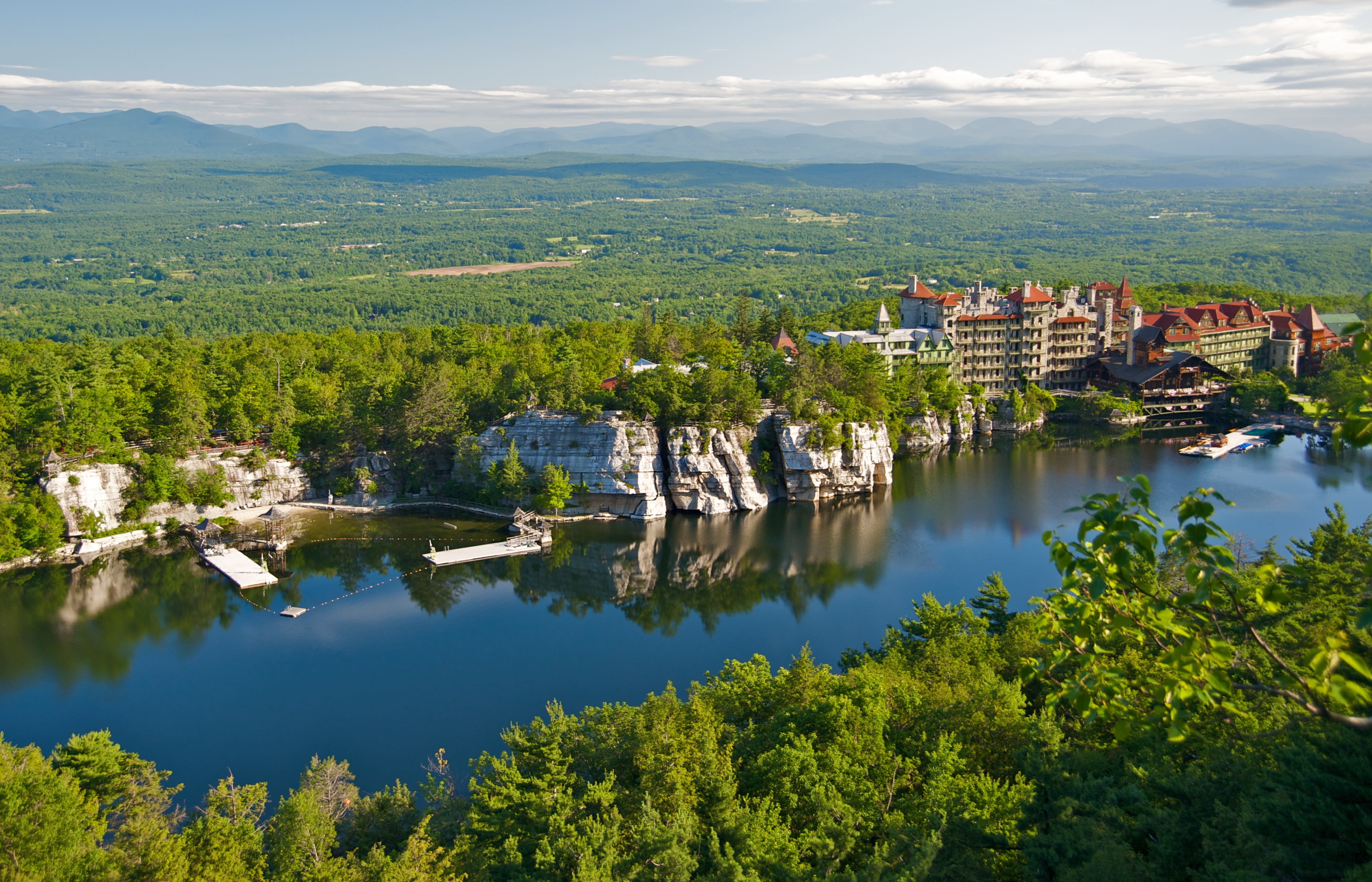
41°38′39″N 74°00′24″W / 41.644167°N 74.006667°WLattingtown refnum 10000855 92 Lake Mohonk Mountain House Complex 
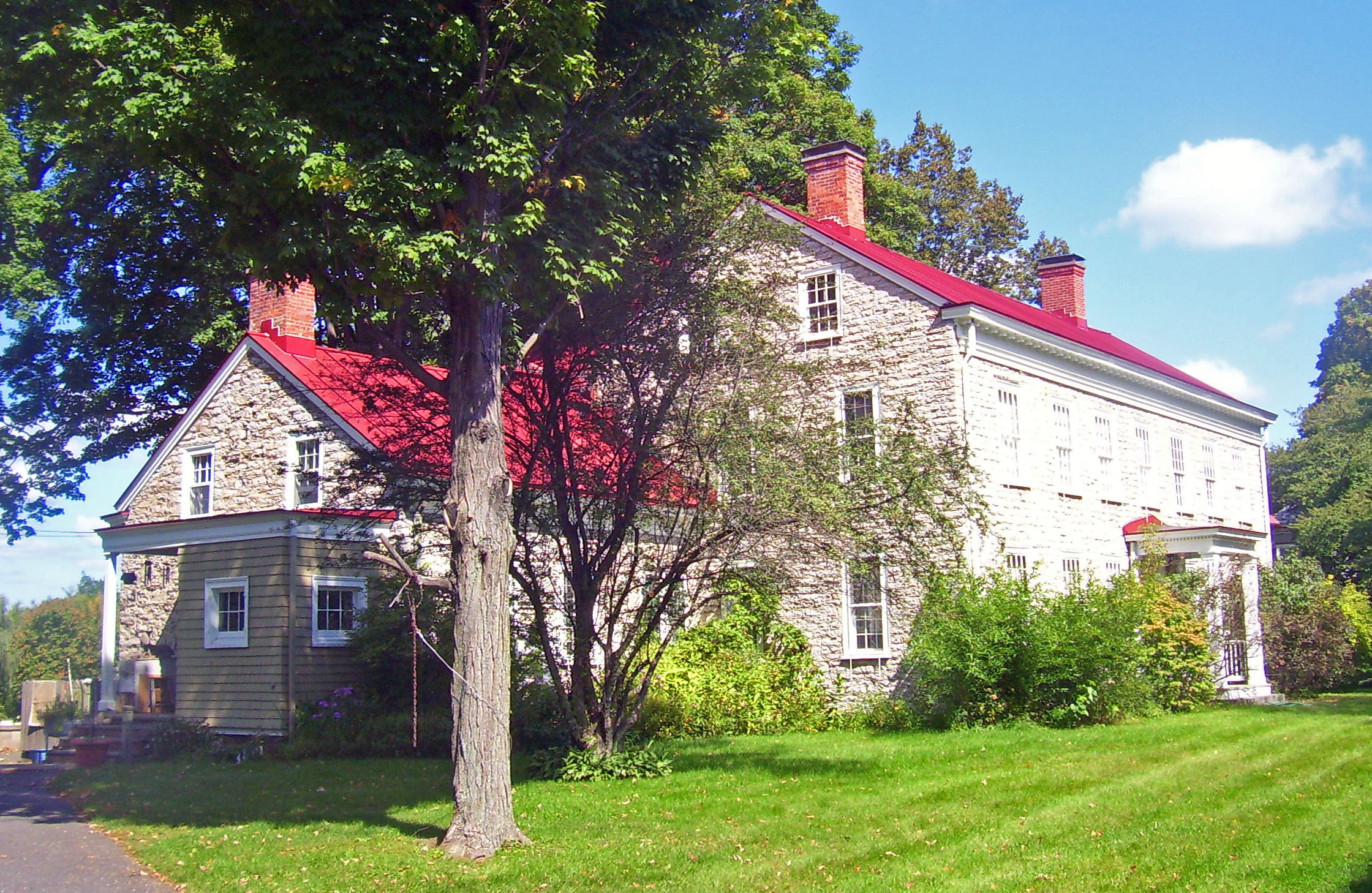
July 16, 1973 NW of New Paltz, between Wallkill Valley on E and Roundout Valley on W
41°46′48″N 74°09′41″W / 41.78°N 74.161389°WNew Paltz Architecturally eclectic ridgetop resort has been site of several important international conferences. 93 Abraham and Maria LeFevre House July 28, 2006 56 Forest Glen Rd.
41°41′56″N 74°07′48″W / 41.698889°N 74.13°WGardiner 94 Lock Tender's House and Canal Store Ruin 
August 6, 1998 40 Canal Rd.
41°49′25″N 74°07′51″W / 41.823611°N 74.130833°WHigh Falls 1848 house for keeper of D&H Canal Lock 20 and contemporary foundation for canal store 95 Locust Lawn Estate 
May 17, 1974 NY 32, SE of Gardiner
41°41′51″N 74°06′08″W / 41.6975°N 74.102222°WGardiner 1814 Federal-style estate of Josiah Hasbrouck, descendant of the Huguenot Hasbroucks and U.S. Congressman 96 Loerzel Beer Hall 
September 7, 1984 213 Partition St.
42°04′29″N 73°57′04″W / 42.074722°N 73.951111°WSaugerties 1873 brewery now used as apartments 97 Main Street Historic District 
June 7, 1988 US 209
41°50′49″N 74°08′41″W / 41.846944°N 74.144722°WStone Ridge Late-18th- and early-19th-century houses and church. 98 Main-Partition Streets Historic District 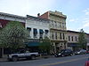
July 8, 1982 Roughly bounded by Main, Partition, Market and Jane Sts.
42°04′37″N 73°57′10″W / 42.076944°N 73.952778°WSaugerties 99 Jacob F. Markle Stone House August 10, 1995 335 Whitfield Rd.
41°49′59″N 74°13′03″W / 41.833056°N 74.2175°WRochester 100 Maverick Concert Hall December 9, 1999 Off Maverick Rd.
42°00′51″N 74°07′06″W / 42.014167°N 74.118333°WHurley 101 Middaugh-Stone House and Dutch Barn December 29, 1994 476 Mill Rd.
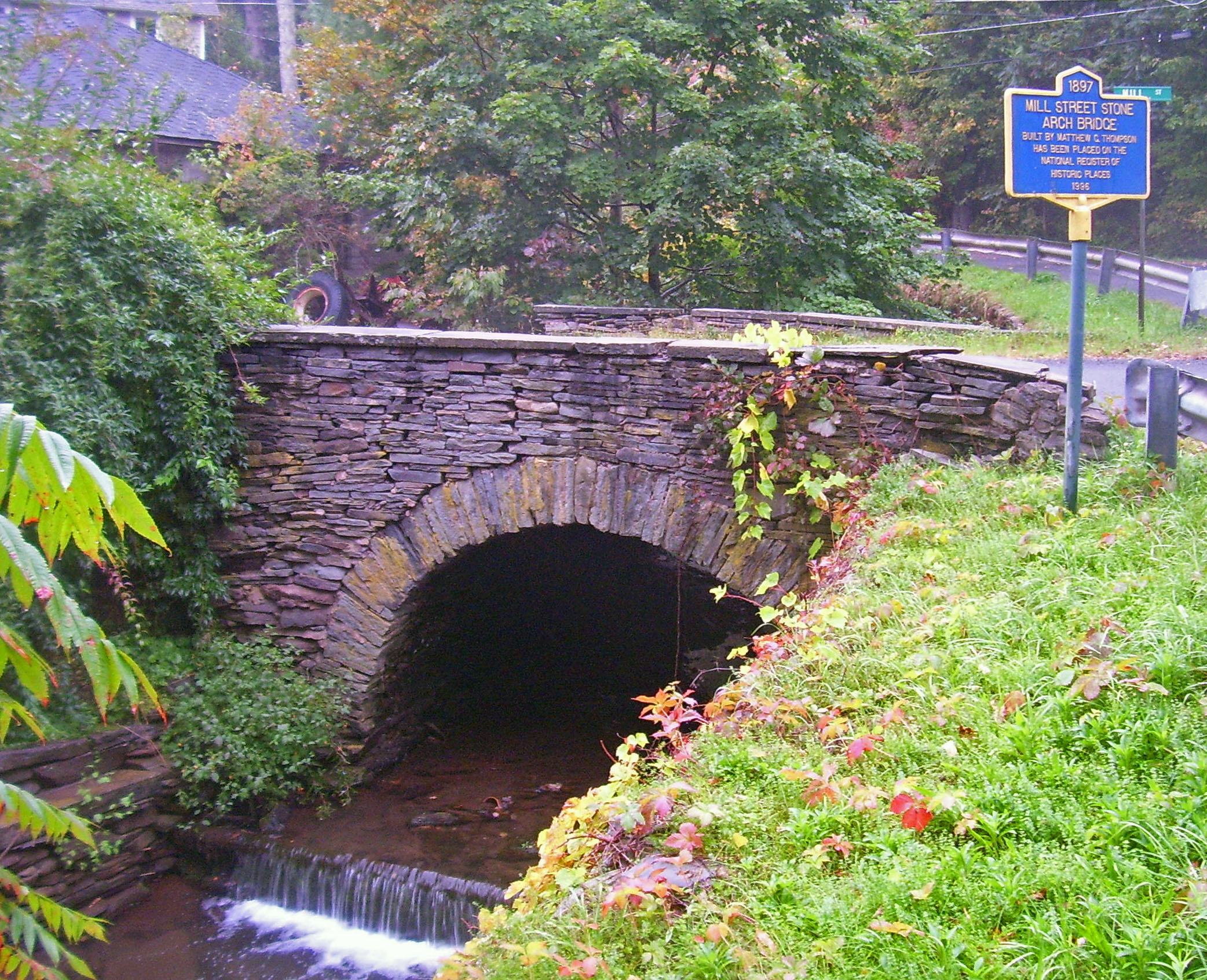
41°49′09″N 74°13′49″W / 41.819167°N 74.230278°WRochester 102 Mill Street Stone Arch Bridge 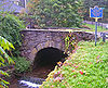
December 16, 1996 Mill St., over Birch Cr.
42°08′01″N 74°29′00″W / 42.133611°N 74.483333°WPine Hill 1897 bridge built by same builder as Elm Street bridge 103 Miller's House at Red Mills September 26, 1983 Red Mills Rd. and Wallkill Ave.
41°37′42″N 74°16′29″W / 41.628333°N 74.274722°WShawangunk 104 Milton Railroad Station 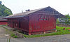
August 28, 2007 41 Dock Rd.
41°39′10″N 73°57′17″W / 41.652778°N 73.954722°WMilton One of the few remaining passenger stations from the West Shore Railroad. Built in 1883; remains relatively intact today. 105 Morton Memorial Library 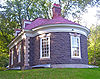
February 21, 1997 Elm St., SW of NY 28
42°08′03″N 74°28′47″W / 42.134167°N 74.479722°WPine Hill 1902 Georgian Revival library built by summer resident and local philanthropist 106 Mount Tremper Fire Observation Station 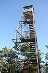
September 23, 2001 Mount Tremper
42°04′27″N 74°16′40″W / 42.074186°N 74.277669°WShandaken 107 National Youth Administration Woodstock Resident Work Center April 30, 1992 NY 212 N side, E of Woodstock
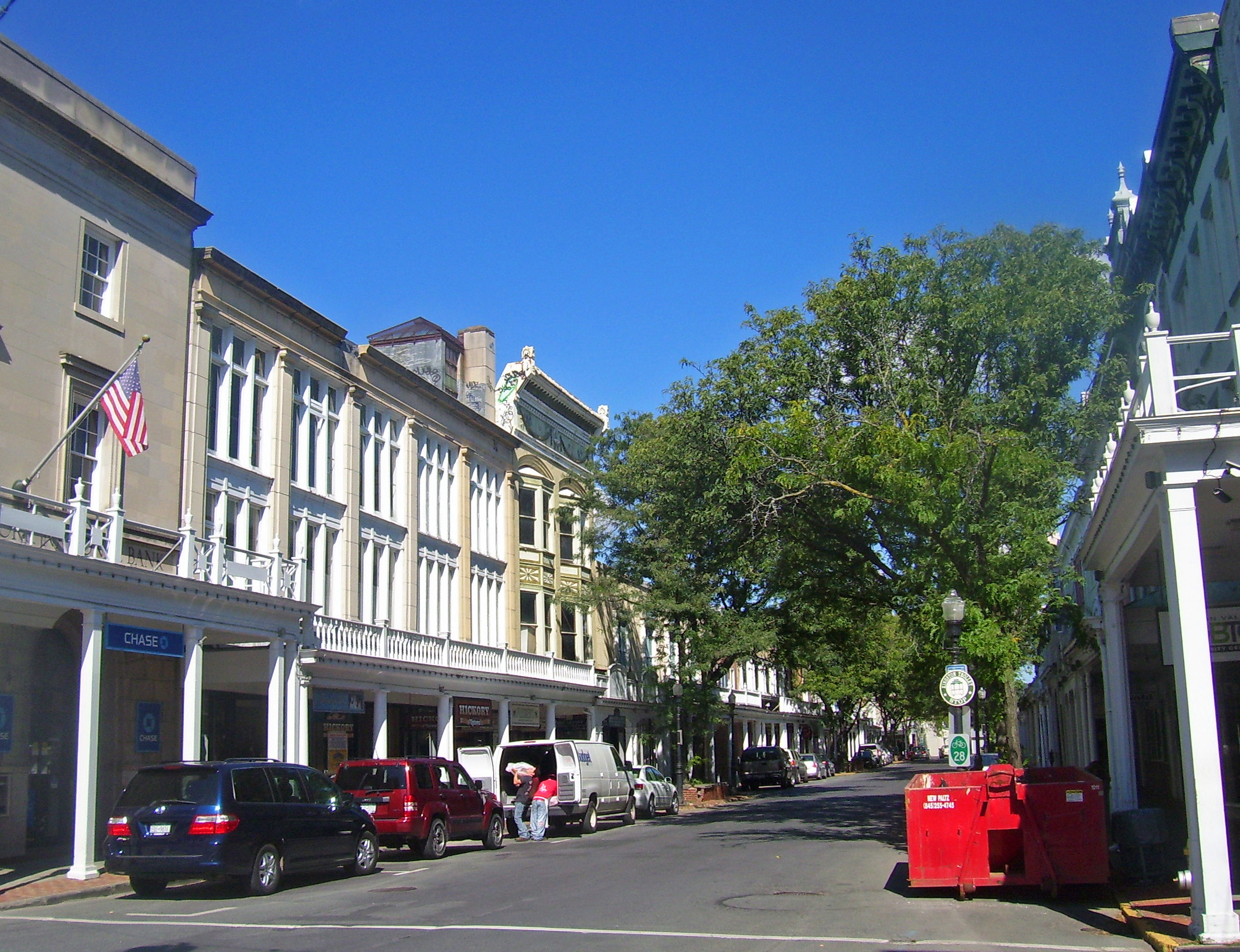
42°02′25″N 74°05′39″W / 42.040278°N 74.094167°WWoodstock Now Woodstock School of Art 108 New Paltz Downtown Historic District 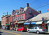
July 24, 2009 Main, N. Chestnut, S. Chestnut, Church, N. Front, Academy and W. Center Sts., Innis and Plattekill Aves.
41°44′53″N 74°05′06″W / 41.748125°N 74.085083°WNew Paltz Intact 19th-century core of funky college town 109 O & W Railroad Station at Port Ben 
January 11, 2002 Tow Path Rd.
41°45′00″N 74°20′50″W / 41.75°N 74.347222°WWawarsing Abandoned 1912 passenger station and right-of-way of former track 110 Osterhoudt Stone House July 5, 2001 1880 NY 32
42°01′03″N 73°57′32″W / 42.0175°N 73.958889°WSaugerties 111 Olive and Hurley Old School Baptist Church 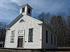
November 19, 1998 NY 28, jct. with NY 30
41°58′24″N 74°12′45″W / 41.973333°N 74.2125°WShokan 112 Ontario and Western Railroad Passenger Station 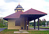
February 22, 1999 Institution Rd.
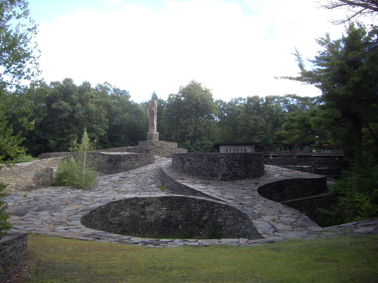
41°44′24″N 74°21′57″W / 41.74°N 74.365833°WNapanoch Intact 1903 train station next to D&H canal bed 113 Opus 40 
March 12, 2001 Fite Rd.
42°03′03″N 74°02′02″W / 42.050833°N 74.033889°WSaugerties Environmental sculpture garden created by Bard College professor Harry Fite in 1930s 114 Frank A. Palen House 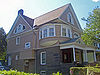
February 9, 2005 74-76 St. James St.
41°55′50″N 74°00′53″W / 41.930556°N 74.014722°WKingston Intact 1892 Queen Anne Style house of local businessman 115 Col. Oliver Hazard Payne Estate November 15, 2002 US 9W
41°48′35″N 73°57′34″W / 41.809722°N 73.959444°WEsopus 116 Pearl Street Schoolhouse 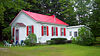
September 26, 1983 Awosting and Decker Rds.
41°39′22″N 74°16′37″W / 41.656111°N 74.276944°WShawangunk Intact 1850 one-room schoolhouse, now used as house 117 Perrine's Bridge 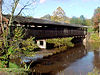
April 13, 1973 Off I-87 over Wallkill River
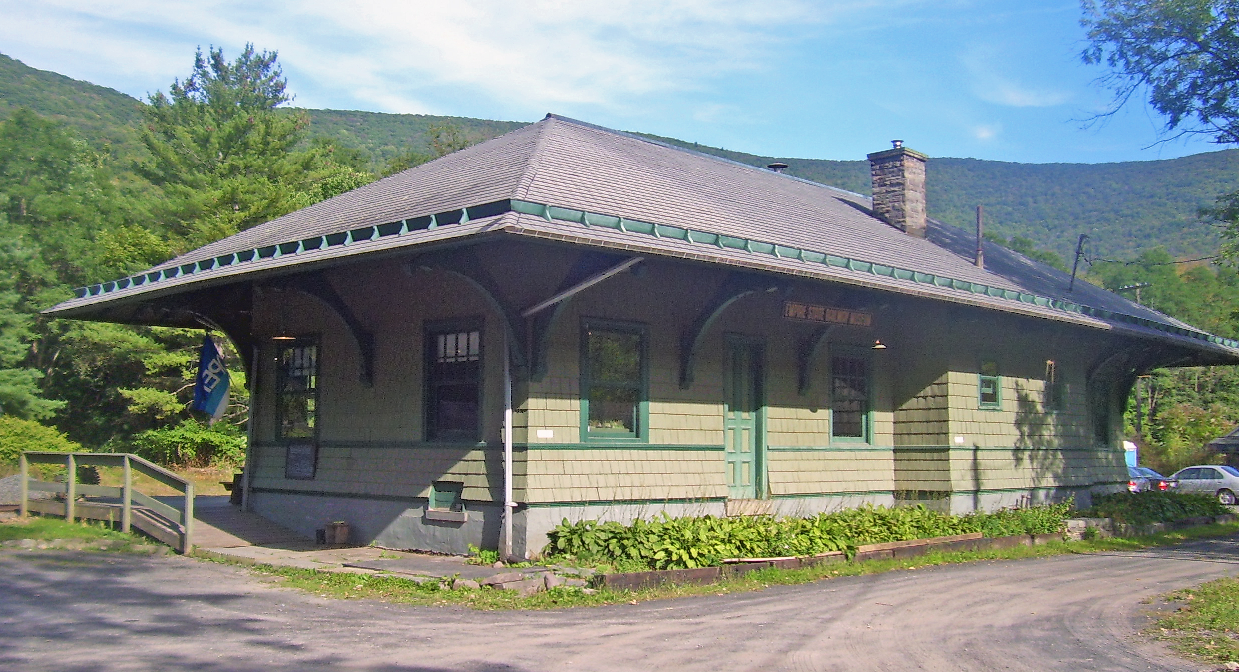
41°48′53″N 74°03′13″W / 41.814722°N 74.053611°WRosendale Second-oldest covered bridge in New York and only one along the entire length of the Wallkill 118 Phoenicia Railroad Station 
April 20, 1995 High St.
42°04′49″N 74°18′31″W / 42.080278°N 74.308611°WPhoenicia Surviving Ulster and Delaware Railroad station from 1899 now home to Empire State Rail Museum 119 Ponckhockie Union Chapel April 23, 1980 91 Abruyn St.
41°55′34″N 73°58′28″W / 41.926111°N 73.974444°WKingston 120 Poppletown Farmhouse November 7, 1991 Jct. of Old Post Rd. and Swarte Kill Rd.
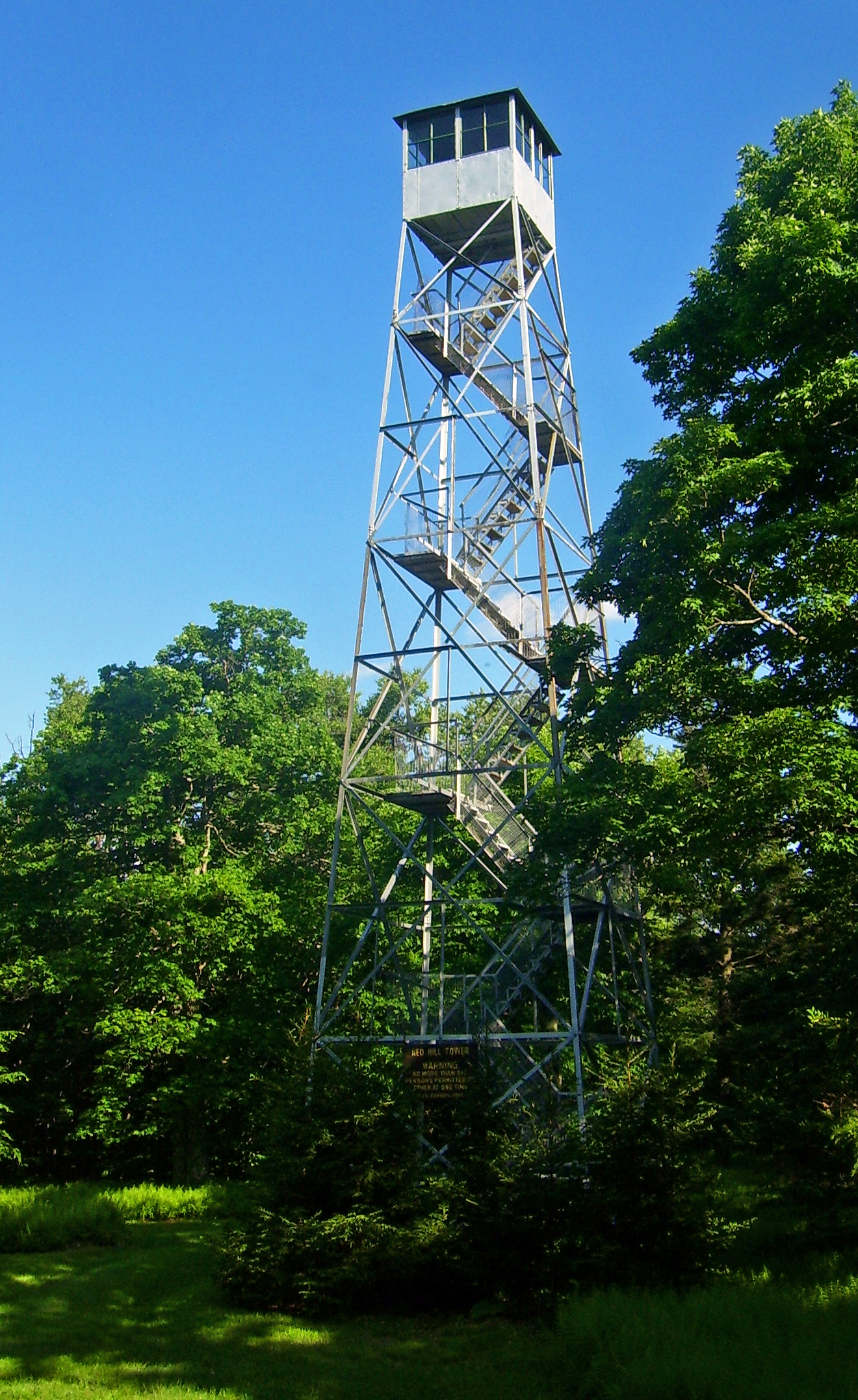
41°49′16″N 73°58′31″W / 41.821111°N 73.975278°WEsopus 121 Red Hill Fire Observation Station 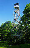
September 23, 2001 Red Hill
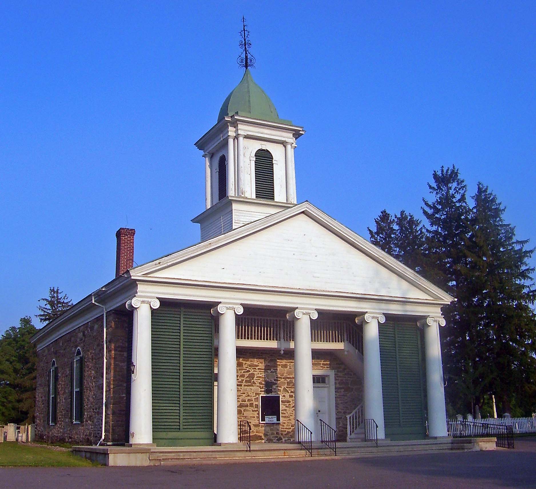
41°55′25″N 74°31′04″W / 41.923611°N 74.517778°WDenning Last Catskill fire tower still in use when it was closed in 1990 after 70 years; first one restored and reopened in late 1990s. 1931 observer's cabin is one of the oldest extant in New York. 122 Reformed Church of Shawangunk Complex 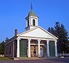
June 3, 1982 Hoagerburgh Rd.
41°39′12″N 74°12′52″W / 41.653333°N 74.214444°WShawangunk Mid-18th-century stone church is oldest building in continuous use by American Dutch Reformed Church congregation 123 Reformed Dutch Church of New Hurley 
November 10, 1982 N of Wallkill on NY 208
41°38′16″N 74°08′39″W / 41.637778°N 74.144167°WWallkill 1820s Greek Revival church replaced one of the first churches built in county 124 Reformed Protestant Dutch Church of Klyne Esopus November 15, 2002 764 US 9W
41°51′14″N 73°58′10″W / 41.853811°N 73.969328°WEsopus 125 Rest Plaus Historic District June 1, 1995 Roughly, along Old Kings Hwy., Rest Plaus Rd. and Lucas Tpk. (Co. Rt. 1)
41°49′12″N 74°09′52″W / 41.82°N 74.164444°WMarbletown 126 Johannes Rider Stone House August 10, 1995 7 Upper Whitfield Rd.
41°49′33″N 74°13′26″W / 41.825833°N 74.223889°WRochester 127 Rondout-West Strand Historic District 
August 24, 1979 Roughly bounded by Broadway, Roundout Creek, Ravine, Hone and McEntee Sts.
41°55′04″N 73°59′18″W / 41.917778°N 73.988333°WKingston Former village of Rondout and port area at northern terminus of D&H Canal preserved and restored after nearby bridge resulted in some other demolitions; now a popular nightlife and shopping area. 128 Sahler Stone House August 12, 1999 Kyserike Rd.
41°49′09″N 74°11′17″W / 41.819167°N 74.188056°WRochester 129 Sahler Stone House and Dutch Barn August 12, 1999 Winfield Rd.
41°49′33″N 74°11′52″W / 41.825833°N 74.197778°WRochester 130 J. Sahler House May 1, 2000 NY 209, SW of jct. with Co. Rd. 63
41°49′28″N 74°11′27″W / 41.824444°N 74.190833°WRochester 131 Saugerties Lighthouse 
May 29, 1979 Hudson River at Esopus Creek
42°04′19″N 73°55′49″W / 42.071944°N 73.930278°WSaugerties 1869 lighthouse on the Hudson River, no longer in use 132 Augusta Savage House and Studio March 21, 2001 189 Old Rte. 32
42°06′45″N 73°58′36″W / 42.1125°N 73.976667°WSaugerties 133 Schoonmaker Stone House and Farm February 21, 1997 Samsonville Rd., near jct. of NY 76 and Cherrytown Rd.
41°47′46″N 74°18′44″W / 41.796111°N 74.312222°WRochester 134 C. K. Schoonmaker Stone House 
February 21, 1997 294 Queens Hwy.
41°48′33″N 74°16′13″W / 41.809167°N 74.270278°WRochester Well-preserved early-19th-century stone bank house 135 Second Reformed Dutch Church of Kingston 
December 28, 2001 213-223 Fair St.
41°55′53″N 74°01′05″W / 41.931389°N 74.018056°WKingston 136 Senate House 
August 12, 1971 NW side of Clinton Ave. near jct. with N. Front St.
41°56′06″N 74°01′09″W / 41.935°N 74.019167°WKingston First meeting place of New York State Senate in 1777. First building in Kingston listed. 137 Sharp Burial Ground 
November 15, 2002 Albany Ave.
41°56′18″N 74°00′11″W / 41.938333°N 74.003056°WKingston Intact second-generation burying ground with some excellent early-19th-century funerary art 138 Shuart-Van Orden Stone House 
November 22, 1995 41 Allhusen Rd.
41°40′55″N 74°05′51″W / 41.681944°N 74.0975°WPlattekill Built in 1772 and heavily modified since, this is one of the oldest houses in Plattekill 139 George J. Smith House 
November 15, 2002 109 Albany Ave.
41°55′58″N 74°00′41″W / 41.932778°N 74.011389°WKingston 1885 Queen Anne house of area congressman 140 John Smith House 
November 15, 2002 103 Albany Ave.
41°55′58″N 74°00′42″W / 41.932778°N 74.011667°WKingston Intact 1860s Italianate house 141 Snyder Estate Natural Cement Historic District 
June 9, 1992 NY 213, 1/2 mi. W of Rosendale
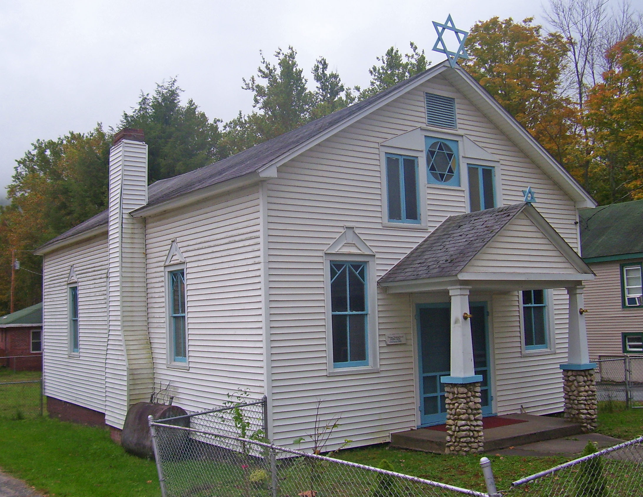
41°50′50″N 74°05′44″W / 41.847222°N 74.095556°WRosendale 275-acre (111 ha) tract with many plants, mines and other infrastructure used in the production of Rosendale cement, as well as homes of the Snyder family dating to 1809. 142 Spring Glen Synagogue 
January 15, 1999 Old NY 209
41°39′59″N 74°25′49″W / 41.666389°N 74.430278°WSpring Glen Early-20th-century synagogue built by first wave of Jews settling in the Catskills 143 Stilwell Stone House August 12, 1999 189 Old Kings Highway
41°48′40″N 74°11′19″W / 41.811111°N 74.188611°WRochester 144 Stilwill-Westbrook Stone House August 12, 1999 482 Old Kings Highway
41°48′25″N 74°11′43″W / 41.806944°N 74.195278°WRochester 145 Benjamin Ten Broeck House 
December 7, 2005 1019 Flatbush Rd.
41°58′36″N 73°58′15″W / 41.976775°N 73.970958°WKingston Tenant house built in three stages from 1750s to 1770s is only remnant of Ten Broeck estate north of Kingston 146 Jacob Ten Broeck Stone House 
November 15, 2002 169 Albany Ave.
41°56′00″N 74°00′34″W / 41.933333°N 74.009444°WKingston 1803 stone house expanded and renovated later in 19th century 147 Terwilliger House 
September 26, 1983 Hoagerburgh Rd.
41°38′59″N 74°12′19″W / 41.649722°N 74.205278°WShawangunk Early-19th-century Federal-style stone house 148 Terwilliger-Smith Farm 
December 31, 2002 160 Cherrytown Rd.
41°47′45″N 74°19′05″W / 41.795833°N 74.318056°WRochester Rare surviving complete farmstead in county from 19th and early 20th centuries 149 The Locusts 
December 16, 1996 160 Plains Rd.
41°43′46″N 74°06′10″W / 41.729444°N 74.102778°WNew Paltz 1826 brick farmhouse was first major house in New Paltz area to be built of brick rather than stone, reflecting abandonment of Dutch and Belgian-style stone houses 150 Trapps Mountain Hamlet Historic District 
November 2, 2000 Off NY 44/55
41°44′00″N 74°12′51″W / 41.733333°N 74.214167°WGardiner Remains of abandoned 1797–1940s community on Shawangunk Ridge 151 Trinity Episcopal Church Complex August 6, 1998 Jct. of Church St. and Barclay St.
42°04′04″N 73°56′55″W / 42.067778°N 73.948611°WSaugerties 152 Trumpbour Homestead Farm September 19, 1985 1789 Old Kings Hwy.
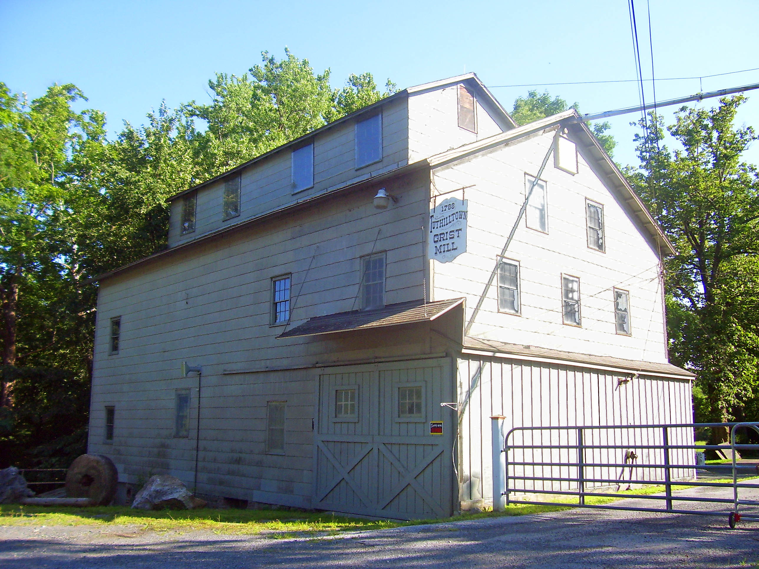
42°08′23″N 73°57′00″W / 42.139722°N 73.95°WSaugerties 153 Tuthilltown Gristmill 
June 14, 1982 Albany Post Rd.
41°41′12″N 74°10′32″W / 41.686667°N 74.175556°WGardiner Was oldest continuously operating gristmill in New York State until early 2000s 154 Ulster Heights Synagogue 
February 19, 2001 Ulster Heights Rd and Beaver Dam Rd.
41°46′48″N 74°31′04″W / 41.78°N 74.517778°WUlster Heights Knesset Israel congregation built 1924 by early Jewish settlers in Catskills; still used on High Holy Days 155 Ulster House Hotel 
November 21, 2002 Main St. at Academy Rd.
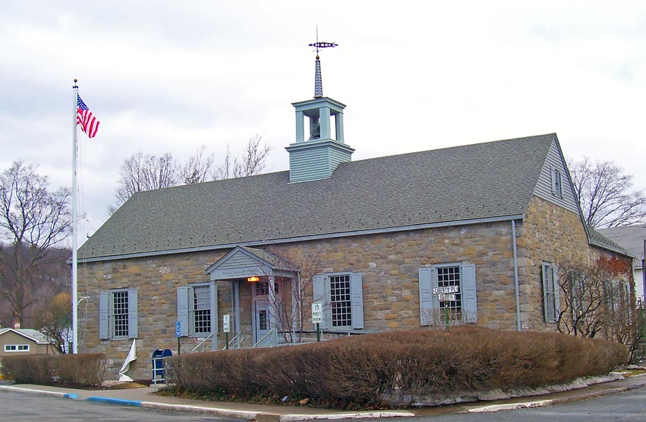
42°08′00″N 74°28′54″W / 42.133333°N 74.481667°WPine Hill 1882 Italianate building is rare surviving wood frame hotel from peak Catskill resort era 156 US Post Office-Ellenville 
November 17, 1988 Liberty Pl.
41°43′04″N 74°23′36″W / 41.717778°N 74.393333°WEllenville Franklin D. Roosevelt personally approved design after residents complained to him about proposed brick building 157 Benjamin Van Keuren House Ruin 
November 22, 2000 Off of Bruyn Turnpike
41°38′39″N 74°18′39″W / 41.644167°N 74.310833°WShawangunk Site of 1745 home of Van Keuren, early settler and Revolutionary War veteran who served four terms as supervisor 158 Tobias Van Steenburgh House 
December 9, 1999 93 Wall St.
41°55′37″N 74°00′59″W / 41.926944°N 74.016389°WKingston Stone house built ca. 1700 is one of few in city not burned by British in 1777 159 Van Wagenen Stone House and Farm Complex August 12, 1999 2732 Lucas Turnpike
41°48′20″N 74°10′56″W / 41.805556°N 74.182222°WRochester 160 Jacobus Van Wagenen Stone House August 12, 1999 2659 Lucas Turnpike
41°48′15″N 74°10′39″W / 41.804167°N 74.1775°WRochester 161 Vosburg Turning Mill Complex 
October 10, 2002 52 Hutchin Hill Rd.
42°04′13″N 74°13′55″W / 42.070278°N 74.231944°WWoodstock 162 West Strand Historic District 
June 28, 1974 West Strand and Broadway
41°55′04″N 73°59′01″W / 41.917778°N 73.983611°WKingston 163 Dirck Westbrook Stone House 
August 10, 1995 18 Old Whitfield Rd.
41°48′22″N 74°13′17″W / 41.806111°N 74.221389°WRochester 1709 stone house now rear wing on early-19th-century Greek Revival front 164 Winfield Corners Stone House August 12, 1999 Winfield Rd.
41°49′20″N 74°11′43″W / 41.822222°N 74.195278°WRochester 165 Wynkoop House 
September 7, 1984 NY 32
42°05′16″N 73°58′29″W / 42.087778°N 73.974722°WSaugerties Intact 1730s long Dutch stone house 166 Cornelius Wynkoop Stone House 
February 23, 1996 US 209
41°50′51″N 74°08′33″W / 41.8475°N 74.1425°WMarbletown George Washington was an overnight guest in this 1770s Georgian stone house that has been used as a backdrop in contemporary clothing catalogs. 167 Moses Yeomans House Moses Yeomans HouseFebruary 20, 2009 252-278 Delaware Ave.
41°55′41″N 73°58′23″W / 41.928089°N 73.973164°WKingston refnum# 09000041 168 Anthony Yelverton House September 22, 1983 39 Maple Ave.
41°43′01″N 73°57′05″W / 41.716944°N 73.951389°WHighland See also
References
- ^ The latitude and longitude information provided in this table was derived originally from the National Register Information System, which has been found to be fairly accurate for about 99% of listings. For about 1% of NRIS original coordinates, experience has shown that one or both coordinates are typos or otherwise extremely far off; some corrections may have been made. A more subtle problem causes many locations to be off by up to 150 yards, depending on location in the country: most NRIS coordinates were derived from tracing out latitude and longitudes off of USGS topographical quadrant maps created under North American Datum of 1927, which differs from the current, highly accurate GPS system used by Google maps. Chicago is about right, but NRIS longitudes in Washington are higher by about 4.5 seconds, and are lower by about 2.0 seconds in Maine. Latitudes differ by about 1.0 second in Florida. Some locations in this table may have been corrected to current GPS standards.
- ^ "National Register of Historic Places: Weekly List Actions". National Park Service, United States Department of the Interior. Retrieved on November 18, 2011.
- ^ Numbers represent an ordering by significant words. Various colorings, defined here, differentiate National Historic Landmark sites and National Register of Historic Places Districts from other NRHP buildings, structures, sites or objects.
External links
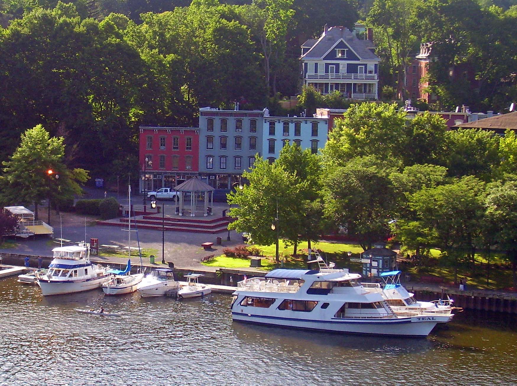
- Kingston, New York National Register of Historic Places travel itinerary
Categories:- National Register of Historic Places in Ulster County, New York
- National Register of Historic Places in New York by county
-


Wikimedia Foundation. 2010.