- National Register of Historic Places listings in Westchester County, New York
-
 Location of Westchester County in New York
This is intended to be a complete list of historic properties and districts in Westchester County, New York on the National Register of Historic Places, except those in Yonkers, New Rochelle and Peekskill which have their own articles. The locations of National Register properties and districts (at least for all showing latitude and longitude coordinates below) may be seen in a Google map by clicking on "Map of all coordinates".[1]
There are 167 listings, including one duplicate for Somers Town House and the Elephant House, which are NRHP and National Historic Landmark designation names respectively for the same place.
-
- This National Park Service list is complete through NPS recent listings posted November 18, 2011.[2]
Contents: Counties in New York Albany (Albany) – Allegany – Bronx – Broome – Cattaraugus – Cayuga – Chautauqua – Chemung – Chenango – Clinton – Columbia – Cortland – Delaware – Dutchess – Erie (Buffalo) – Essex – Franklin – Fulton – Genesee – Greene – Hamilton – Herkimer – Jefferson – Kings (Brooklyn) – Lewis – Livingston – Madison – Monroe (Rochester) – Montgomery – Nassau – New York (Manhattan – Below 14th Street, 14th to 59th Streets, 59th to 110th Streets, Above 110th Street, Islands) – Niagara – Oneida – Onondaga (Syracuse) – Ontario – Orange – Orleans – Oswego – Otsego – Putnam – Queens – Rensselaer – Richmond (Staten Island) – Rockland – Saratoga – Schenectady – Schoharie – Schuyler – Seneca – St. Lawrence – Steuben – Suffolk – Sullivan – Tioga – Tompkins – Ulster – Warren – Washington – Wayne – Westchester (New Rochelle, Peekskill, Yonkers) – Wyoming – Yates Current listings in most of the county
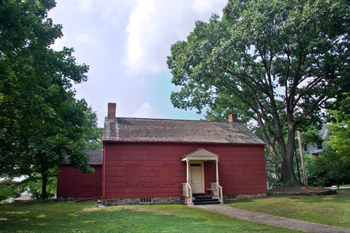
Landmark name Image Date listed Location City, Town or Village Summary 1 African Cemetery October 3, 2003 North St.
40°58′34″N 73°42′12″W / 40.97611°N 73.70333°WRye 2 All Saints Episcopal Church May 2, 2002 96 and 201 Scarborough Td.
41°8′41″N 73°50′36″W / 41.14472°N 73.84333°WBriarcliff Manor[3] 3 Amawalk Friends Meeting House November 16, 1989 Quaker Church Rd.
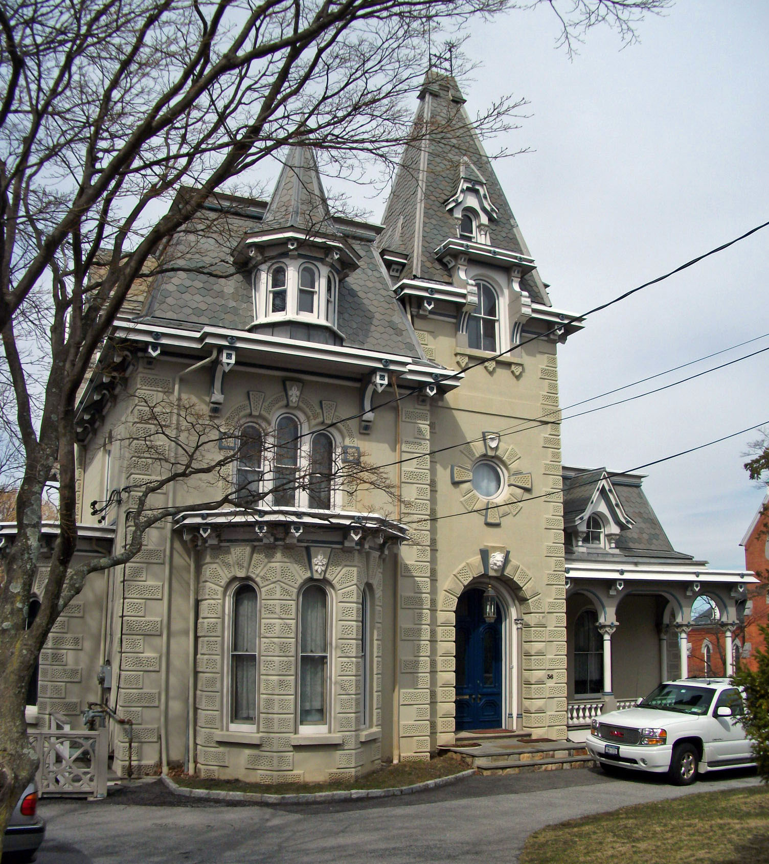
41°17′32″N 73°46′18″W / 41.29222°N 73.77167°WAmawalk 4 Armour-Stiner House 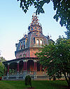
December 18, 1975 45 W. Clinton Ave.
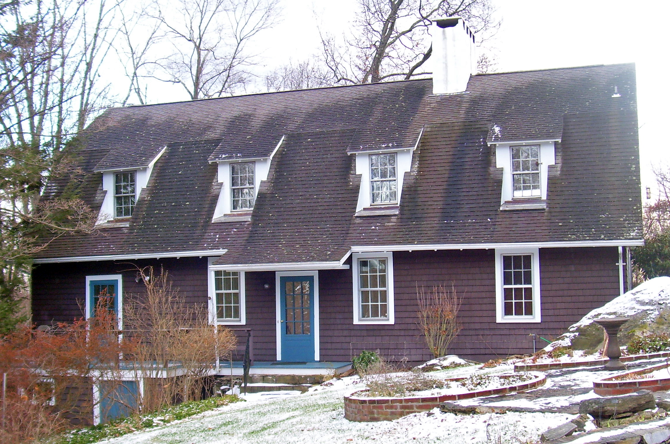
41°1′51″N 73°52′16″W / 41.03083°N 73.87111°WIrvington Possibly the only domed octagon house in the world 5 Asbury United Methodist Church and Bethel Chapel and Cemetery March 31, 2000 19 Old Post Rd. and Old Post Rd. S
41°12′26″N 73°52′50″W / 41.20722°N 73.88056°WCroton-on-Hudson 6 Richard Austin House September 20, 1988 196 Croton Ave.
41°10′0″N 73°50′46″W / 41.166667°N 73.84611°WOssining 7 Bar Building May 17, 2007 199 Main St.
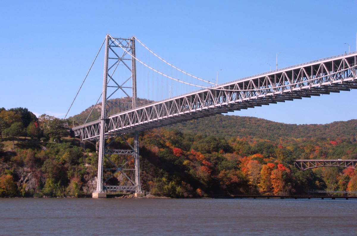
41°1′57″N 73°46′5″W / 41.0325°N 73.76806°WWhite Plains 8 Bear Mountain Bridge 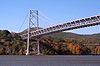
November 23, 1982 US 6/202
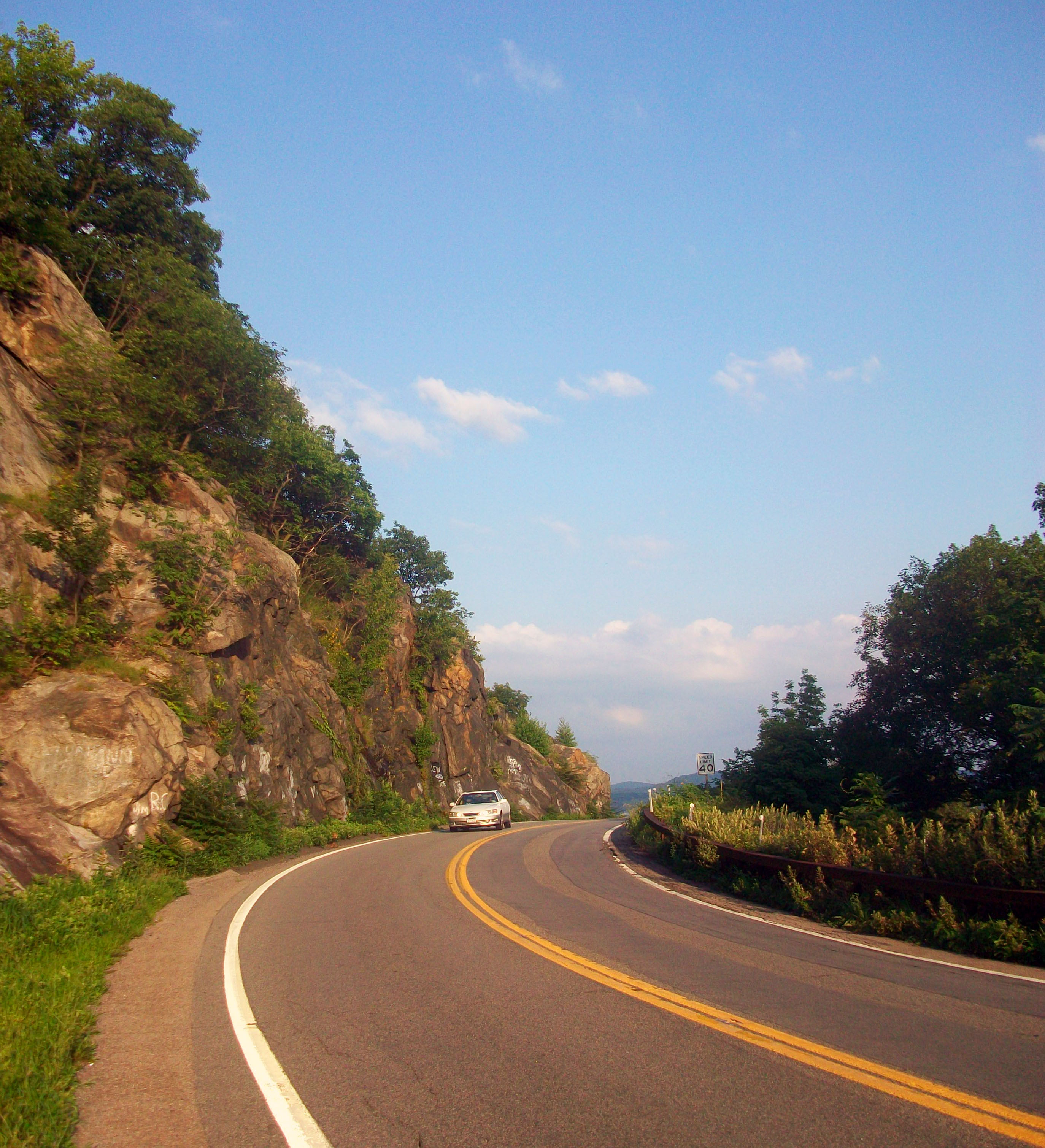
41°19′12″N 73°58′49″W / 41.32°N 73.98028°WCortlandt, shared with Rockland County First bridge across Hudson north of New York City. 9 Bear Mountain Bridge Road and Toll House 

November 23, 1982 NY 6/202, between Bear Mt. Bridge
41°19′12″N 73°58′47″W / 41.32°N 73.97972°WCortlandt Private toll road built to access bridge in 1924; later turned over to state 10 Bedford Road Historic District November 21, 1985 Bedford Rd.
41°7′31″N 73°42′45″W / 41.12528°N 73.7125°WArmonk 11 Bedford Village Historic District 
October 2, 1973 Roughly bounded by Court, Seminary, Poundridge and Greenwich Rds.
41°12′14″N 73°38′22″W / 41.20389°N 73.63944°WBedford 12 Bird Homestead February 22, 2010 600 Milton Rd.
40°57′34.5″N 73°41′21.17″W / 40.959583°N 73.6892139°WRye New listing; refnum 10000032 13 Bolton Priory June 28, 1974 7 Priory Lane
40°53′13″N 73°47′45″W / 40.88694°N 73.79583°WPelham Manor 14 Evangeline Booth House February 22, 2011 101 N. Central Ave.
41°1′12″N 73°47′50″W / 41.02°N 73.79722°WHartsdale vicinity New listing; refnum 11000040 15 Boston Post Road Historic District 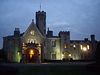
October 29, 1982 Roughly bounded by Boston Post Rd. and Milton Harbor
40°57′17″N 73°42′1″W / 40.95472°N 73.70028°WRye Houses and land use unchanged from late 18th century 16 Brandreth Pill Factory 
January 10, 1980 Water St.
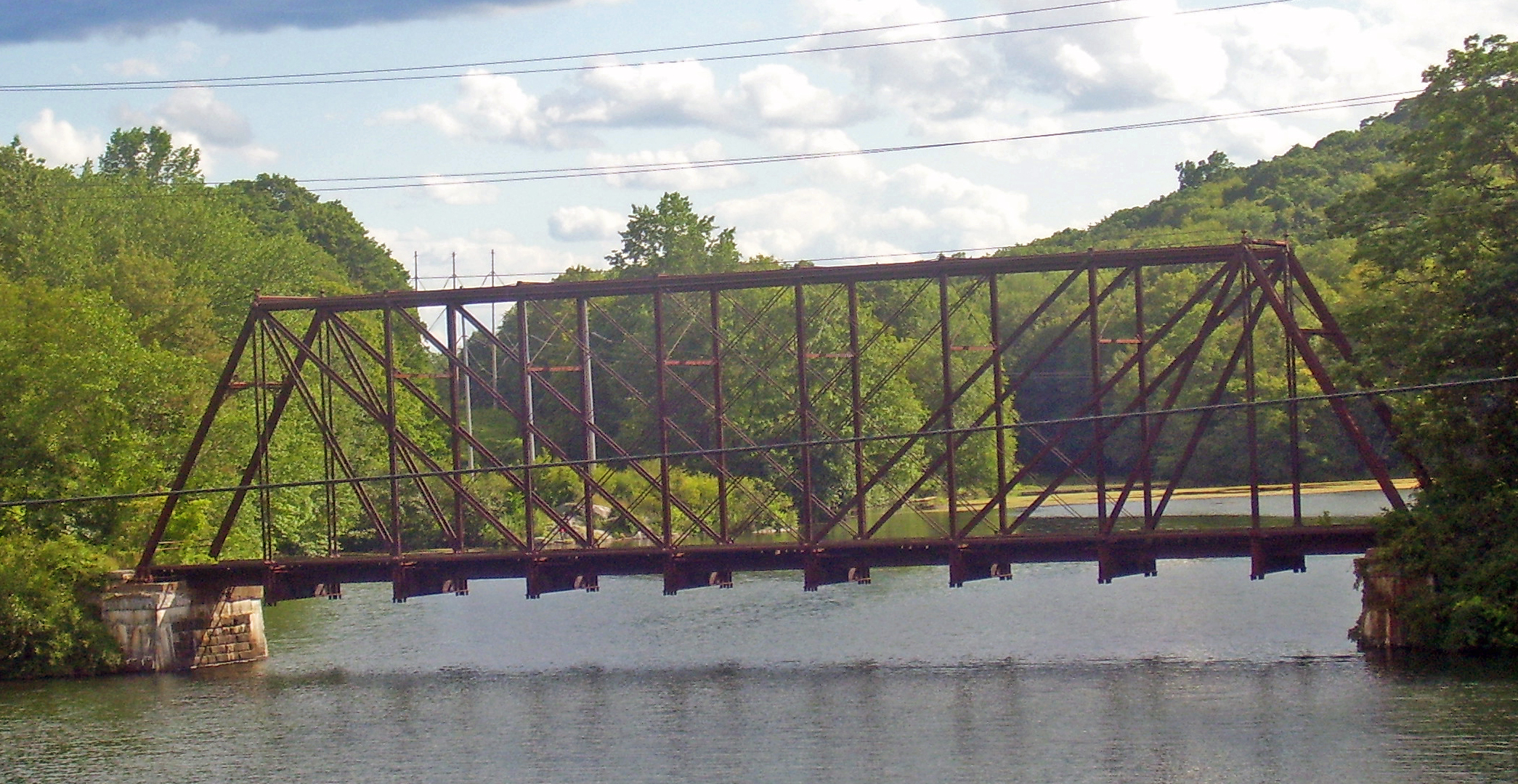
41°9′54″N 73°52′11″W / 41.165°N 73.86972°WOssining Benjamin Brandreth's facility was beginning of Ossining's industrial development when built in the 1830s. Later modified and expanded; stayed in operation until 1940s. 17 Bridge L-158 
November 29, 1978 W of Goldens Bridge at Croton River
41°17′47″N 73°40′59″W / 41.29639°N 73.68306°WGoldens Bridge Only remaining double-intersection Whipple truss rail bridge in New York. Built in 1883 near Kingston and moved to this location in 1904. Out of service since 1960. 18 Bronx River Parkway Reservation 

January 11, 1991 Bronx River Pkwy. from jct. with Sprain Brook Rd. to and including Kensico Dam Plaza
41°0′59″N 73°47′47″W / 41.01639°N 73.79639°WValhalla and Bronxville 19 Bronxville Women's Club October 3, 2007 135 Midland Ave.
40°56′36″N 73°49′35″W / 40.94333°N 73.82639°WBronxville 20 Bush-Lyon Homestead April 22, 1982 John Lyon Park, King St.
41°0′48″N 73°40′3″W / 41.01333°N 73.6675°WPort Chester 21 Capitol Theater June 7, 1984 147-151 Westchester Ave.
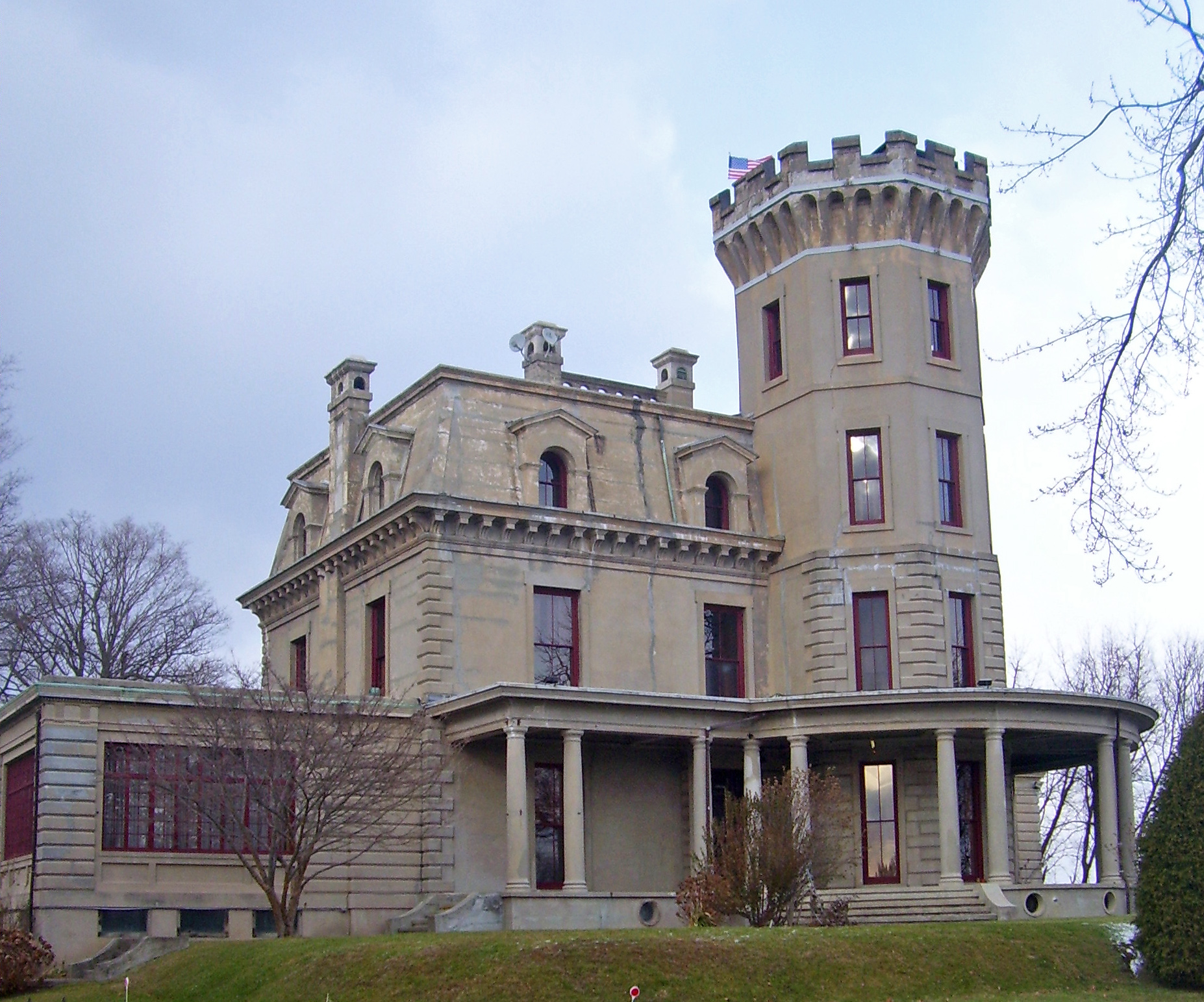
41°0′6″N 73°39′56″W / 41.00167°N 73.66556°WPort Chester 22 Caramoor 
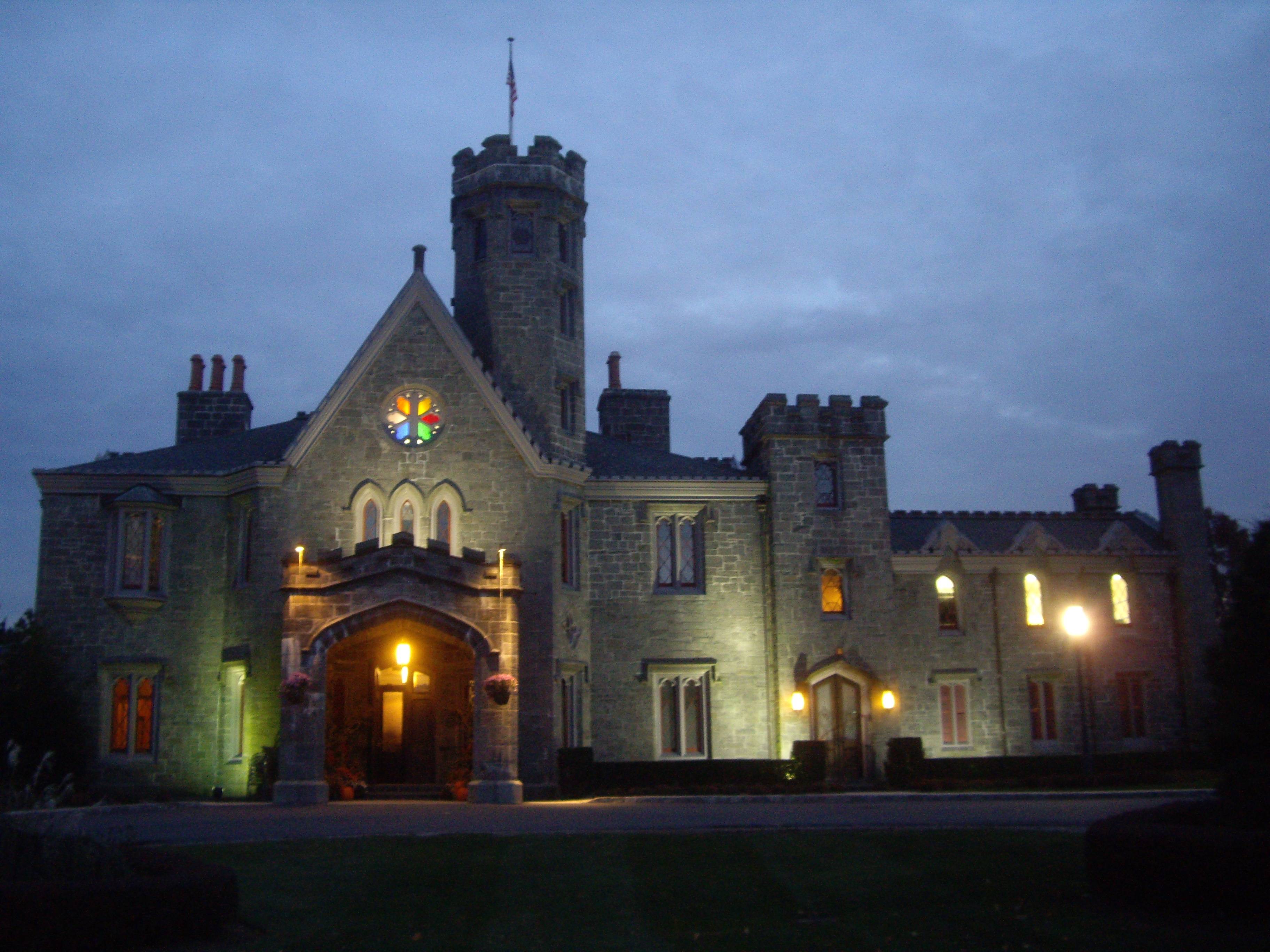
May 25, 2001 149-181 Girdle Ridge Rd.
41°14′19″N 73°38′48″W / 41.23861°N 73.64667°WBedford 1930s Renaissance Revival estate now used as classical music venue 23 Carrie Chapman Catt House May 4, 2006 20 Ryder Rd.
41°10′35″N 73°48′55″W / 41.17639°N 73.81528°WBriarcliff Manor 24 Chappaqua Railroad Depot and Depot Plaza April 19, 1979 200 South Greeley Ave
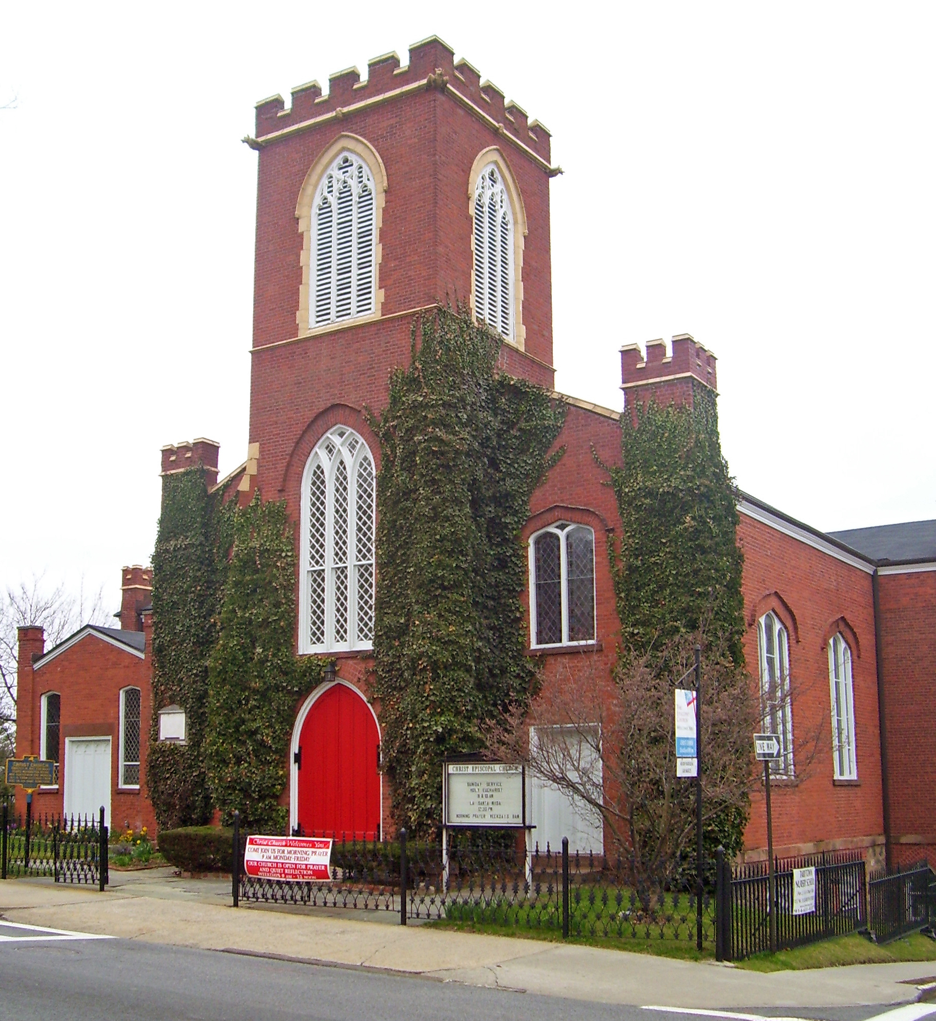
41°9′28″N 73°46′31″W / 41.15778°N 73.77528°WChappaqua 25 Christ Episcopal Church 
April 23, 1987 Broadway and Elizabeth Sts.
41°4′30″N 73°51′35″W / 41.075°N 73.85972°WTarrytown Washington Irving was member of this congregation, and his pew is still preserved. Built in 1837, this is the earliest Gothic Revival church in America 26 Church of Saint Mary the Virgin and Greeley Grove April 19, 1979 191 South Greeley Ave.
41°9′20″N 73°46′21″W / 41.15556°N 73.7725°WChappaqua 27 Church of St. Barnabas March 24, 2000 15 N Broadway
41°2′23″N 73°51′57″W / 41.03972°N 73.86583°WIrvington 28 Church of St. Joseph of Arimathea January 11, 2002 2172 Saw Mill River Rd.
41°0′53″N 73°52′22″W / 41.01472°N 73.87278°WGreenburgh 29 Aaron Copland House 
September 19, 2003 1538 Washington St.
41°14′25″N 73°54′11″W / 41.24028°N 73.90306°WCortlandt Manor Home of composer for last 30 years of his life 30 Gerard Crane House 
September 5, 1985 Old Croton Falls Rd.
41°20′27″N 73°40′30″W / 41.34083°N 73.675°WSomers Sophisticated 1849 stone Greek Revival house 31 Jasper F. Cropsey House and Studio May 17, 1973 49 Washington Ave.
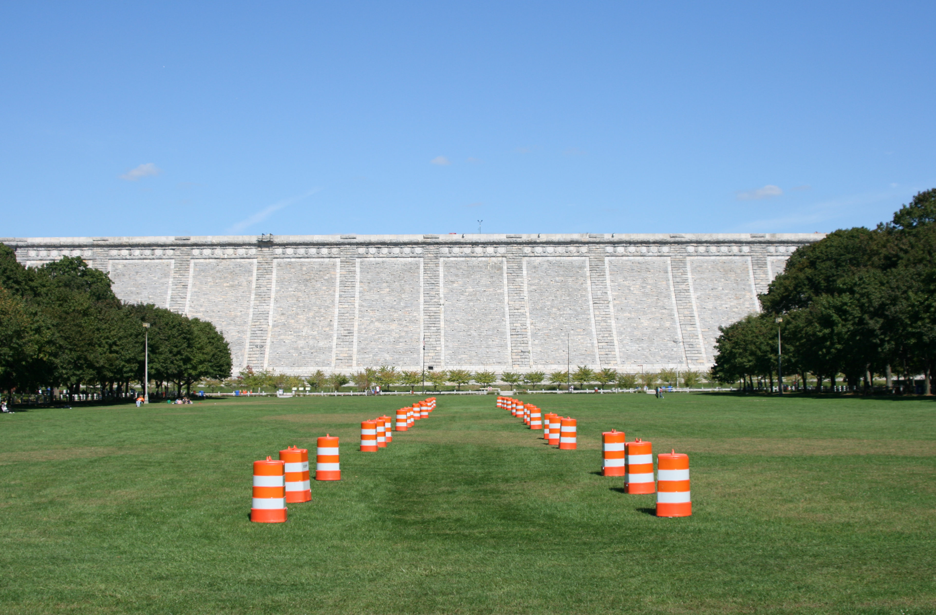
40°59′35″N 73°52′55″W / 40.99306°N 73.88194°WHastings-on-Hudson 32 Old Croton Aqueduct 
December 2, 1974 Runs N from Yonkers to New Croton Dam
41°0′52″N 73°53′14″W / 41.01444°N 73.88722°WVarious First long-distance aqueduct built to provide water from upstate to New York City. An engineering marvel in its time now used as a linear park 33 Croton North Railroad Station 
August 27, 1987 Senasqua Rd.
41°12′25″N 73°53′40″W / 41.20694°N 73.89444°WCroton-on-Hudson Intact 1890 station, now used as offices, exemplifies commuter rail stations of that era. Two former Erie Railroad cars on old siding included in listing. 34 Downtown Ossining Historic District 
August 9, 1989 Roughly along US 9, Main St., and Croton Ave.
41°9′38″N 73°51′42″W / 41.16056°N 73.86167°WOssining Core of village reflecting impact of construction of Old Croton Aqueduct and 1870s fires. 35 John William Draper House 
May 15, 1975 407 Broadway
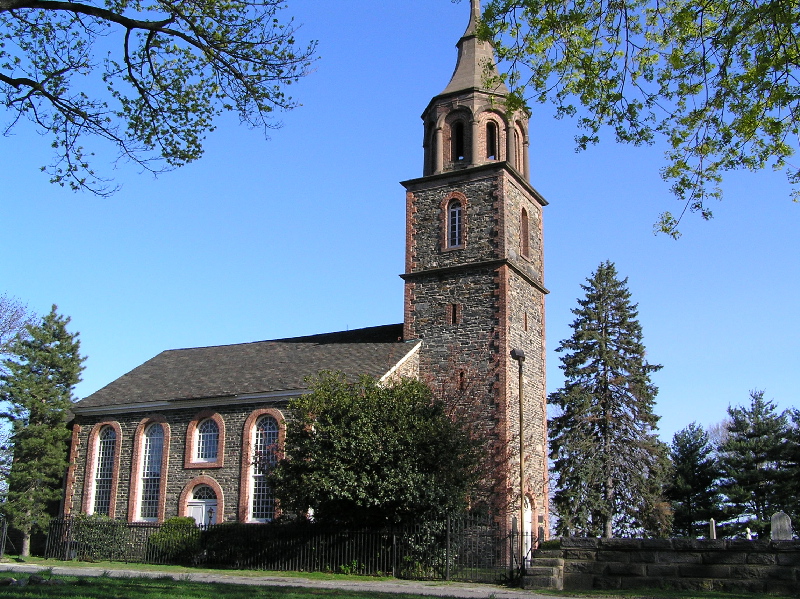
40°59′29″N 73°52′47″W / 40.99139°N 73.87972°WHastings-on-Hudson Home of astrophotography pioneer John William Draper, who in the 1840s took the first recognizable photo of the moon through a telescope at his observatory here. 36 Dutch Reformed Church 
October 15, 1966 N edge of Tarrytown on U.S. 9
41°2′10″N 73°51′47″W / 41.03611°N 73.86306°WSleepy Hollow Surviving 1685 stone church built by Dutch is state's oldest church; figures prominently in Washington Irving's "The Legend of Sleepy Hollow" 37 East Irvington School 
October 6, 1983 Taxter Rd.
41°2′46″N 73°51′21″W / 41.04611°N 73.85583°WEast Irvington Late 19th-century school built for children of growing Irish immigrant population; now apartments. 38 Edgewood House June 26, 1986 908 Edgewood Ave.
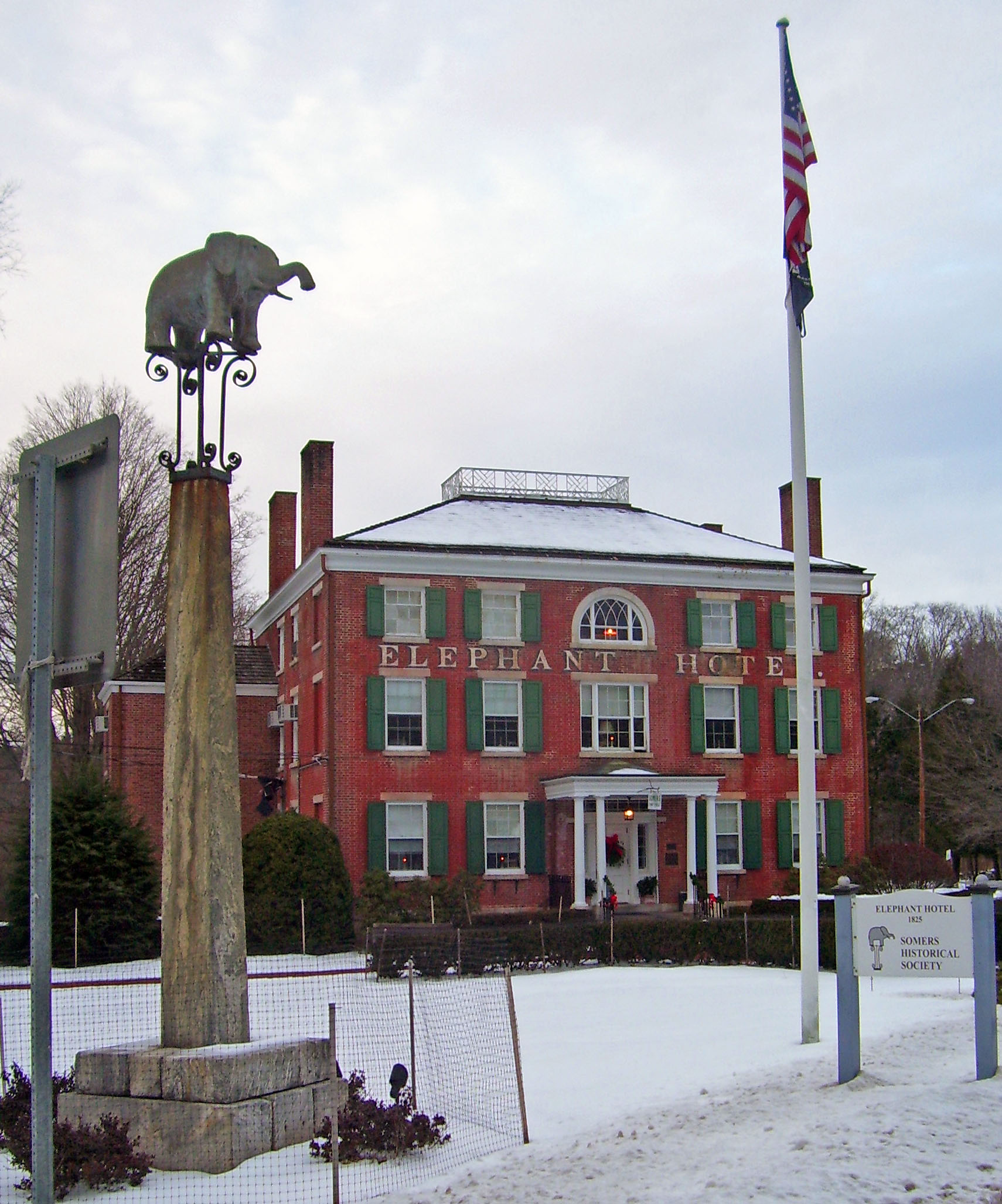
40°53′41″N 73°49′13″W / 40.89472°N 73.82028°WPelham Manor 39 Elephant Hotel 
April 5, 2005 335 Route 202
41°19′42.93″N 73°41′8.82″W / 41.3285917°N 73.6857833°WSomers Birthplace of the circus in America, when Zephaliah Bailey began charging visitors to see his elephant. Now used as a circus museum, offices of the Somers Historical Society and town hall. 40 Elmsford Reformed Church and Cemetery September 15, 1983 30 S. Central Ave.
41°3′14″N 73°49′15″W / 41.05389°N 73.82083°WElmsford 41 Estherwood and Carriage House 
November 20, 1979 Clinton Ave.
41°0′46″N 73°52′21″W / 41.01278°N 73.8725°WDobbs Ferry Late 19th-century mansion and estate of industrial tycoon James Jenning McComb; now part of The Masters School, which he helped endow. 42 First Baptist Church and Rectory July 21, 1983 56 S. Broadway
41°4′28″N 73°51′33″W / 41.07444°N 73.85917°WTarrytown 43 First Baptist Church of Ossining 
January 12, 1973 S. Highland Ave. and Main St.
41°9′41″N 73°51′43″W / 41.16139°N 73.86194°WOssining 1874 church is most advanced application of Gothic Revival style in Ossining; church was founded by town's founder 44 First United Methodist Church January 7, 2000 226 E. Lincoln Ave.
40°55′6″N 73°49′47″W / 40.91833°N 73.82972°WMount Vernon 45 Marmaduke Forster House February 22, 2011 413-415 Bedford Rd.
41°8′4″N 73°47′23″W / 41.13444°N 73.78972°WPleasantville New listing, refnum 11000139 46 Foster Memorial AME Zion Church 
June 3, 1982 90 Wildey St.
41°4′48″N 73°51′44″W / 41.08°N 73.86222°WTarrytown Founded in 1860, this is the oldest black church in Westchester County and possibly one of the oldest in the state 47 Leo Friedlander Studio July 29, 1982 825 W. Hartsdale Rd.
41°2′35″N 73°48′34″W / 41.04306°N 73.80944°WWhite Plains 48 Good Counsel Complex April 25, 1997 52 N. Broadway
41°2′21″N 73°45′52″W / 41.03917°N 73.76444°WWhite Plains 49 Percy Grainger Home and Studio April 8, 1993 7 Cromwell Pl.
41°1′38″N 73°46′2″W / 41.02722°N 73.76722°WWhite Plains 50 Greeley House April 19, 1979 100 King St.
41°9′32″N 73°46′19″W / 41.15889°N 73.77194°WChappaqua 51 Hadden-Margolis House March 7, 2008 61 Winfield Ln.
40°58′18.76″N 73°44′15.62″W / 40.9718778°N 73.7376722°WHarrison (new listing; refnum 08000146) 52 Hammond House May 6, 1980 S of Hawthorne on Grasslands Rd.
41°4′34″N 73°48′42″W / 41.07611°N 73.81167°WHawthorne 53 Edward Harden Mansion 
January 16, 2004 200 North Broadway
41°4′58″N 73°51′28″W / 41.08278°N 73.85778°WSleepy Hollow 1909 Colonial Revival house built for journalist and investor Edward Harden was later home to first U.S. Montessori school 54 John A. Hartford House 
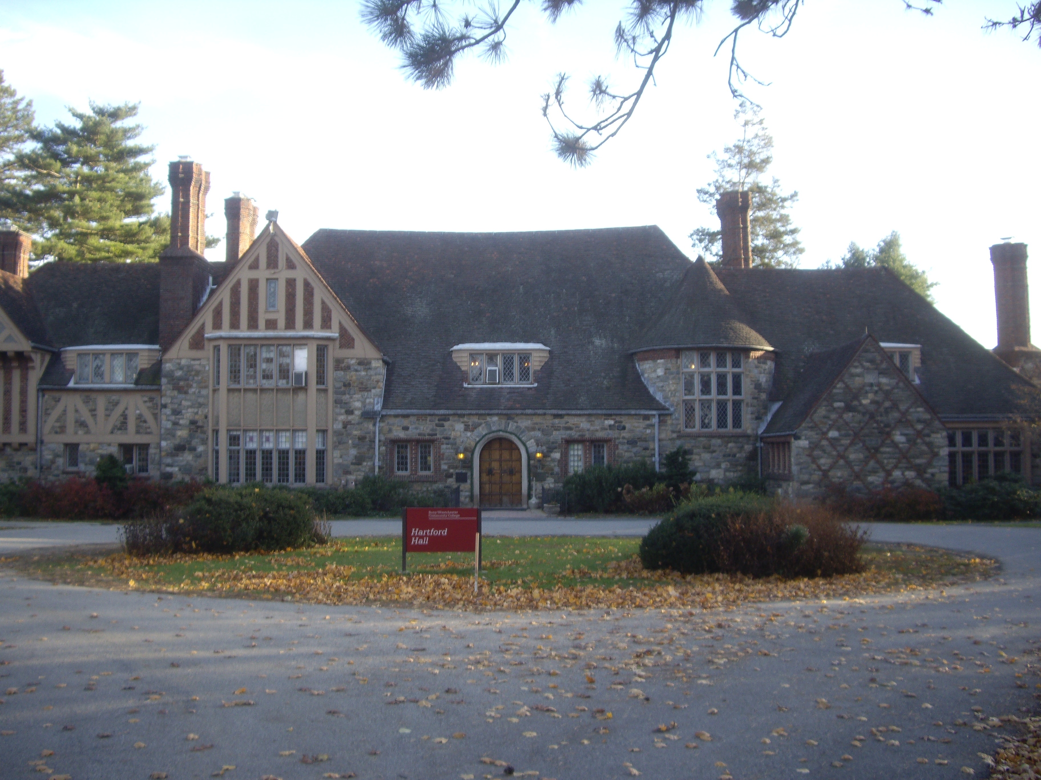
December 22, 1977 Southwest of Valhalla on New York State Route 100
41°4′8″N 73°47′25″W / 41.06889°N 73.79028°WValhalla Home of founder of A & P; now part of Westchester Community College 55 Hartsdale Railroad Station 
July 14, 2011 1 E. Hartsdale Ave.
41°0′40″N 73°47′45″W / 41.01111°N 73.79583°WHartsdale 1915 railroad station building 56 Hastings Prototype House December 19, 1991 546 Farragut Pkwy.
40°59′4″N 73°52′17″W / 40.98444°N 73.87139°WHastings-on-Hudson 57 Widow Haviland's Tavern 
April 16, 1974 Purchase St.
40°58′55″N 73°41′5″W / 40.98194°N 73.68472°WRye 58 Highland Cottage 
July 22, 1982 36 S. Highland Ave.
41°9′34.57″N 73°51′40.57″W / 41.1596028°N 73.8612694°WOssining 1872 reinforced-concrete Gothic Revival house 59 The Homestead March 29, 2001 36 Mead St.
41°16′59″N 73°35′44″W / 41.28306°N 73.59556°WWaccabuc 60 Caleb Hyatt House January 22, 1973 937 White Plains Post Rd.
40°58′54″N 73°48′1″W / 40.98167°N 73.80028°WScarsdale 61 Hyatt-Livingston House October 5, 1972 152 Broadway
41°0′32″N 73°52′45″W / 41.00889°N 73.87917°WDobbs Ferry Burned down in 1990s (should be delisted?) 62 Washington Irving High School April 26, 1984 18 N. Broadway
41°3′32″N 73°51′28″W / 41.05889°N 73.85778°WTarrytown 63 Irvington Town Hall 
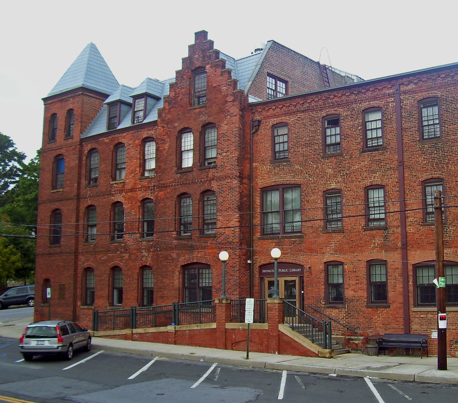
November 1, 1984 85 Main St.
41°2′25″N 73°52′6″W / 41.04028°N 73.86833°WIrvington Built in 1902, early use of Colonial Revival in a civic building. Upper floors have an auditorium for performances and community gatherings, was home to public library until 2000. 64 John Jay Homestead 
July 24, 1972 Jay St.
41°15′1″N 73°39′31″W / 41.25028°N 73.65861°WKatonah Home of John Jay, major landowner in area, first Chief Justice of the United States and early state governor 65 John Jones Homestead May 25, 1989 Oregon Rd. and Durrin Ave.
41°18′58″N 73°54′0″W / 41.31611°N 73.9°WVan Cortlandtville 66 Jug Tavern 
June 7, 1976 Revolutionary Rd. and Rockledge Ave.
41°8′41″N 73°51′52″W / 41.14472°N 73.86444°WOssining 1760s stop on on former Albany Post Road route remains intact 67 Katonah Village Historic District September 15, 1983 Parkway, Valleyedge, Edgemont and Bedford Rds.
41°15′20″N 73°41′2″W / 41.25556°N 73.68389°WKatonah 68 Timothy Knapp House and Milton Cemetery June 14, 1982 265 Rye Beach Ave. and Milton Rd.
40°57′53″N 73°41′12″W / 40.96472°N 73.68667°WRye 69 Lawrence Park Historic District January 23, 1980 Roughly bounded by Side Hill, Prescott, Kensington, Garden and Chestnut Ave.,Maidens Ln, Valley and Pondfield Rds.
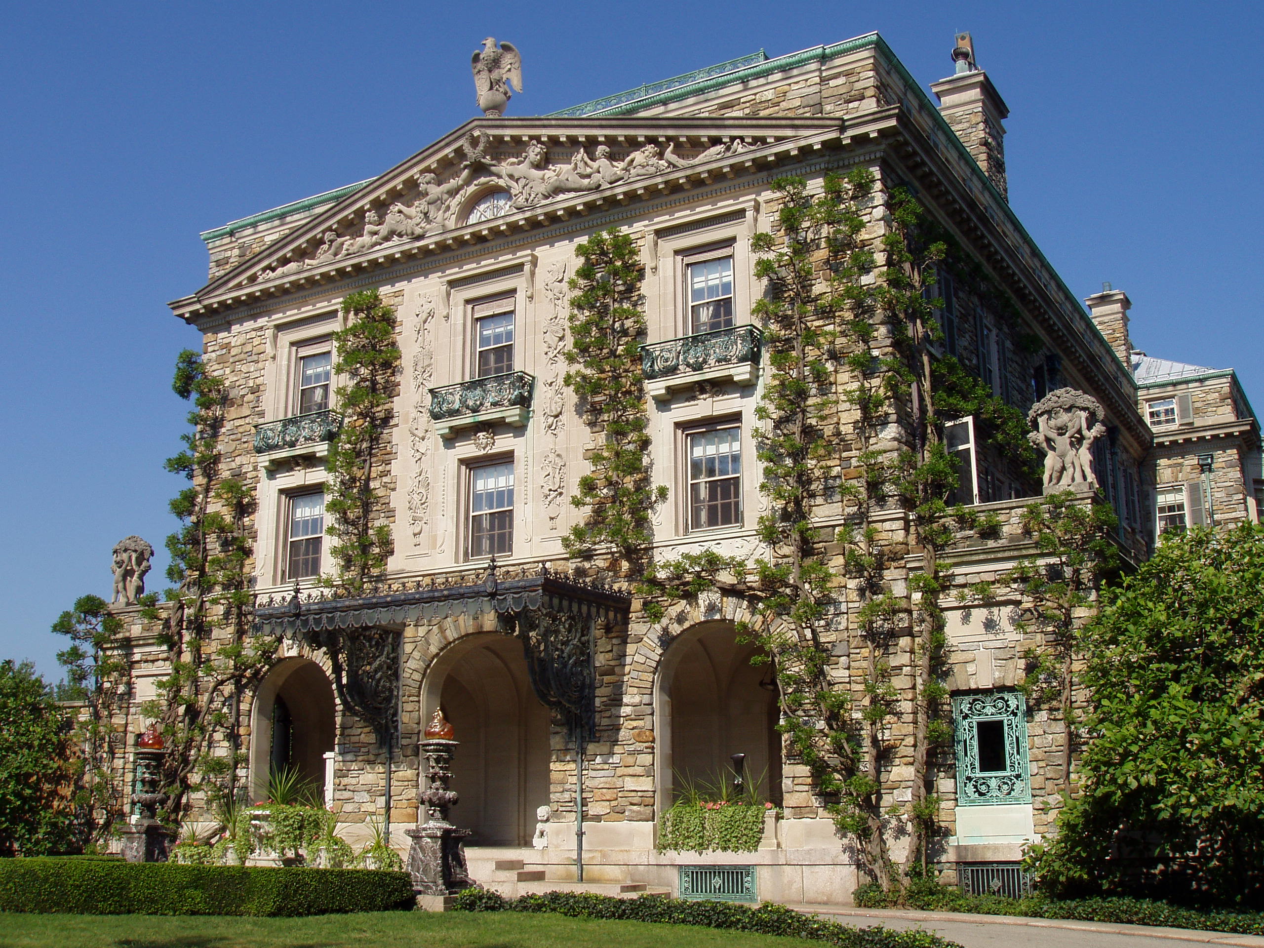
40°56′27″N 73°50′19″W / 40.94083°N 73.83861°WBronxville 70 Life Savers Building July 11, 1985 N. Main St.
41°0′20″N 73°39′52″W / 41.00556°N 73.66444°WPort Chester 71 Lord and Burnham Building 
February 12, 1999 2 Main St.
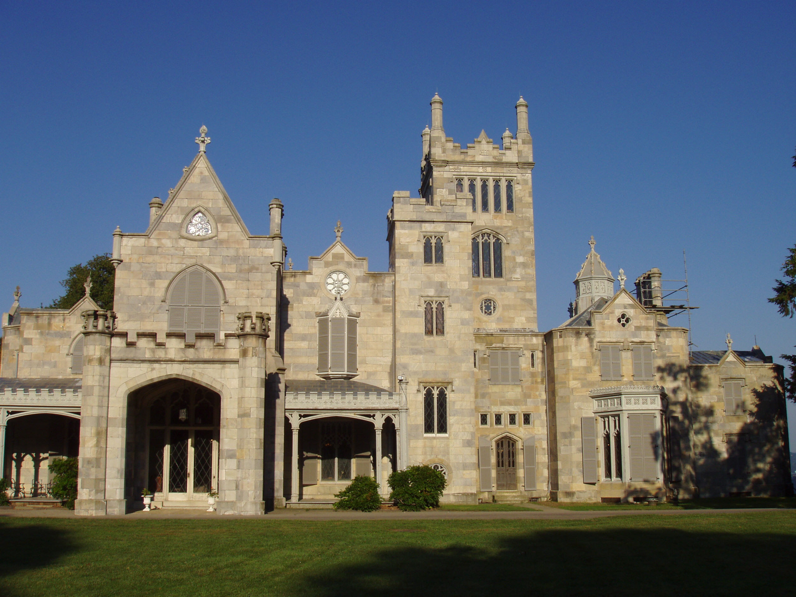
41°2′22″N 73°52′23″W / 41.03944°N 73.87306°WIrvington 1870 building, home to eponymous maker of conservatories and greenhouses that supplied local estates, is now the village's library after lengthy restoration. 72 Lyndhurst 
November 13, 1966 635 S. Broadway
41°3′15″N 73°51′58″W / 41.05417°N 73.86611°WTarrytown Stone Gothic Revival mansion purchased and expanded by rail baron Jay Gould 73 Mamaroneck Methodist Church 
October 2, 1992 514 Boston Post Rd.
40°57′5″N 73°43′48″W / 40.95139°N 73.73°WMamaroneck 74 Richard H. Mandel House March 1, 1996 323 Haines Rd.
41°14′40″N 73°43′33″W / 41.24444°N 73.72583°WBedford Hills 75 Mapleton September 28, 1976 52 N. Broadway
41°2′18″N 73°45′54″W / 41.03833°N 73.765°WWhite Plains 76 Marble Schoolhouse 
July 6, 2005 388 California Rd.
40°55′53″N 73°48′41″W / 40.93139°N 73.81139°WEastchester 77 Masterton-Dusenberry House 
April 16, 1980 90 White Plains Rd.
40°56′14″N 73°49′29″W / 40.93722°N 73.82472°WBronxville 78 McVickar House January 14, 2004 131 Main St.
41°2′20.2″N 73°51′57.05″W / 41.038944°N 73.8658472°WIrvington 79 Mead Memorial Chapel November 30, 1999 2 Chapel Rd.
41°17′47″N 73°35′59″W / 41.29639°N 73.59972°WLewisboro 80 Merestead September 27, 1984 Byram Lake Rd.
41°10′31″N 73°42′19″W / 41.17528°N 73.70528°WMount Kisco 81 Miller House 
September 29, 1976 Virginia Rd.
41°3′33″N 73°46′15″W / 41.05917°N 73.77083°WNorth White Plains 82 Mount Kisco Municipal Complex March 9, 1997 100-120 Main St.
41°12′9″N 73°43′37″W / 41.2025°N 73.72694°WMount Kisco 83 Mt. Zion Methodist Church 
May 10, 1990 Primrose St. S of Reis Park
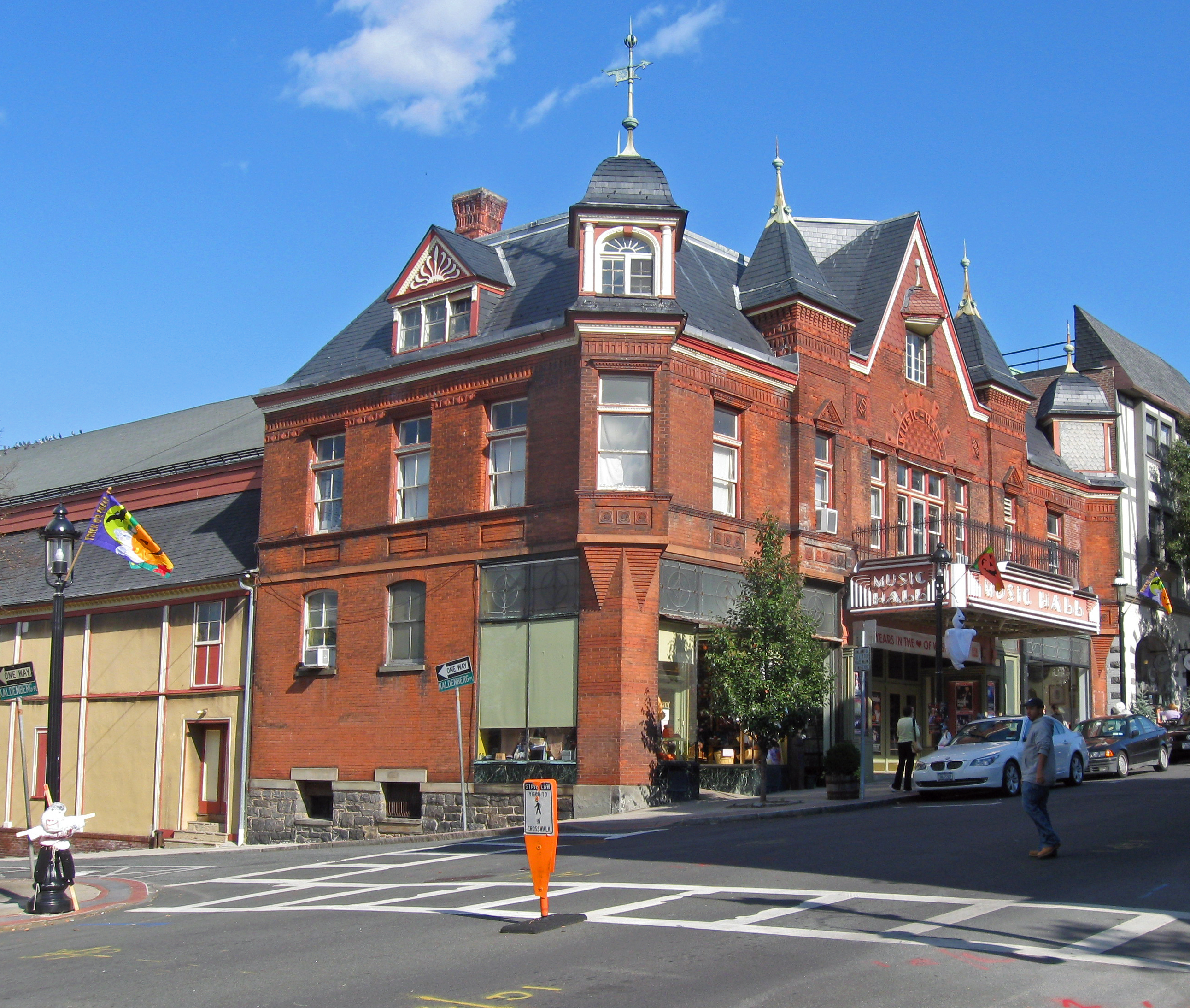
41°18′5″N 73°42′54″W / 41.30139°N 73.715°WSomers 1794 church, remodeled in 1860, is early landmark in development of Methodism in New York 84 Music Hall 
February 12, 1980 11 Main St.
41°4′35″N 73°51′33″W / 41.07639°N 73.85917°WTarrytown 1885 Queen Anne theater is one of the oldest in continuous use in the county 85 North Grove Street Historic District 
March 13, 1979 1, 2, 8, 15, and 19 Grove St.
41°4′33″N 73°51′27″W / 41.07583°N 73.8575°WTarrytown Five 1860s houses built by local well-to-do mostly intact 86 North Salem Town Hall September 4, 1980 Titicus Rd.
41°19′44″N 73°35′51″W / 41.32889°N 73.5975°WSalem Center 87 Nuits 
April 13, 1977 Hudson Rd. and Clifton Pl.
41°1′29″N 73°52′31″W / 41.02472°N 73.87528°WArdsley-on-Hudson 1852 Italian villa-style house was early work by Detlef Lienau; later home to Cyrus West Field and John Jacob Astor III 88 Odell House March 28, 1973 425 Ridge Rd.
41°1′10″N 73°49′4″W / 41.01944°N 73.81778°WGreenburgh 89 Old Chappaqua Historic District July 15, 1974 Quaker Rd.
41°10′16″N 73°46′42″W / 41.17111°N 73.77833°WChappaqua 90 Site of Old Croton Dam June 19, 1973 N of Ossining on NY 129
41°13′34″N 73°51′21″W / 41.22611°N 73.85583°WCortlandt 91 Old St. Peter's Church March 7, 1973 Oregon Rd. and Locust Ave.
41°18′49.21″N 73°54′4.23″W / 41.3136694°N 73.901175°WVan Cortlandtville 92 Osborn-Bouton-Mead House September 15, 2004 399 Poundridge Rd.
41°15′57″N 73°33′59″W / 41.26583°N 73.56639°WSouth Salem 93 Palmer-Lewis Estate August 6, 1998 Black Brook Rd.
41°13′50″N 73°37′6″W / 41.23056°N 73.61833°WBedford 94 Patriot's Park 
June 14, 1982 US 9
41°4′53″N 73°51′34″W / 41.08139°N 73.85944°WSleepy Hollow and Tarrytown 1853 monument to 1780 capture of British Major John André, exposing Benedict Arnold's betrayal of the Continental Army, was one of earliest to a Revolutionary War event. Later the park was a Carrère and Hastings residential development and two girls' schools. 95 Pelham Picture House May 28, 2010 175 Wolf's Lane
40°54′26.32″N 73°48′41″W / 40.9073111°N 73.81139°WPelham New listing; refnum 10000305 96 Pelhamdale November 4, 1982 45 Iden Ave.
40°54′3″N 73°48′55″W / 40.90083°N 73.81528°WPelham Manor 97 Peoples National Bank and Trust Company Building September 14, 2000 31 Mamaroneck Ave.
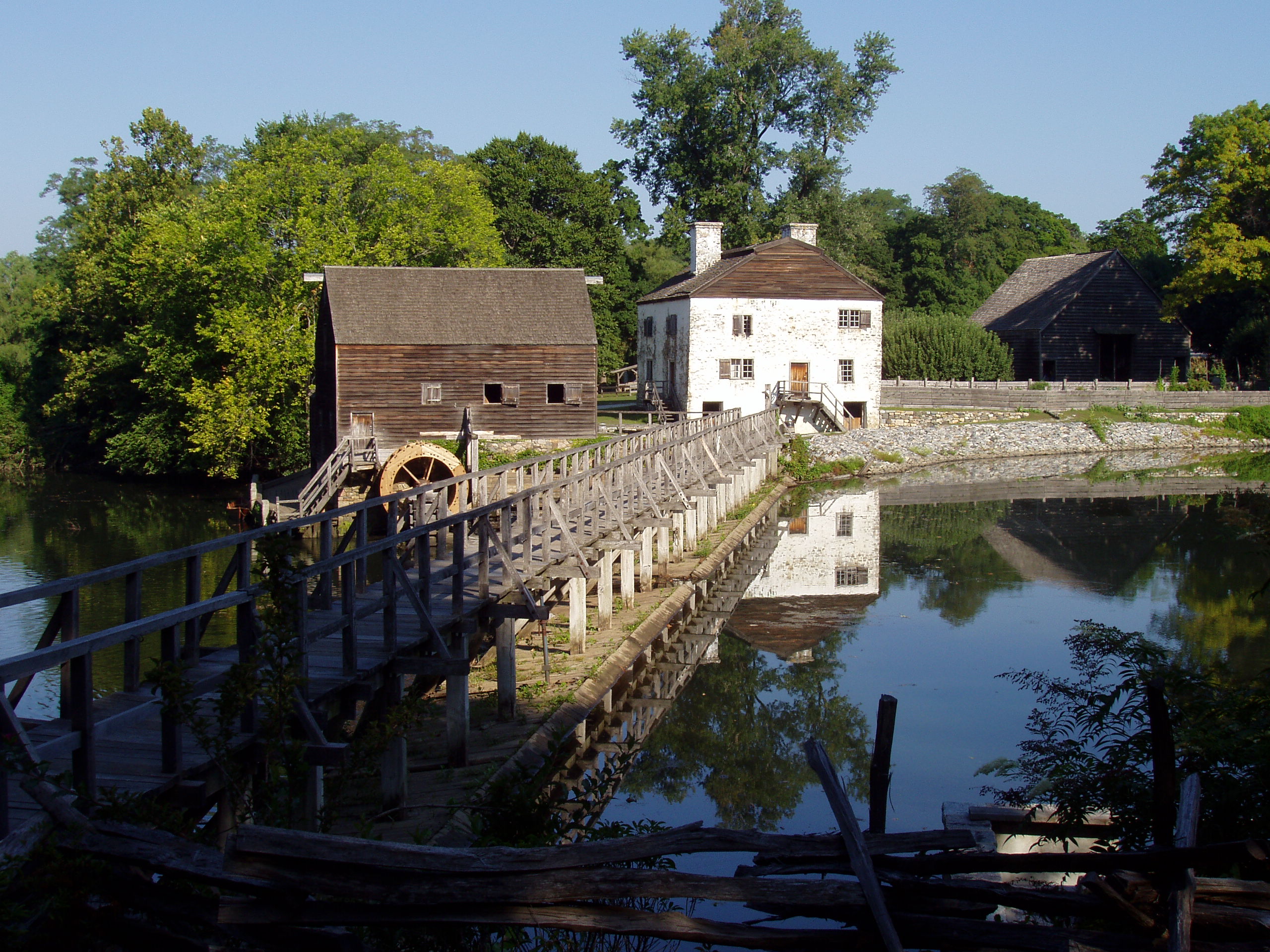
41°1′54″N 73°46′0″W / 41.03167°N 73.766667°WWhite Plains 98 Philipsburg Manor House 
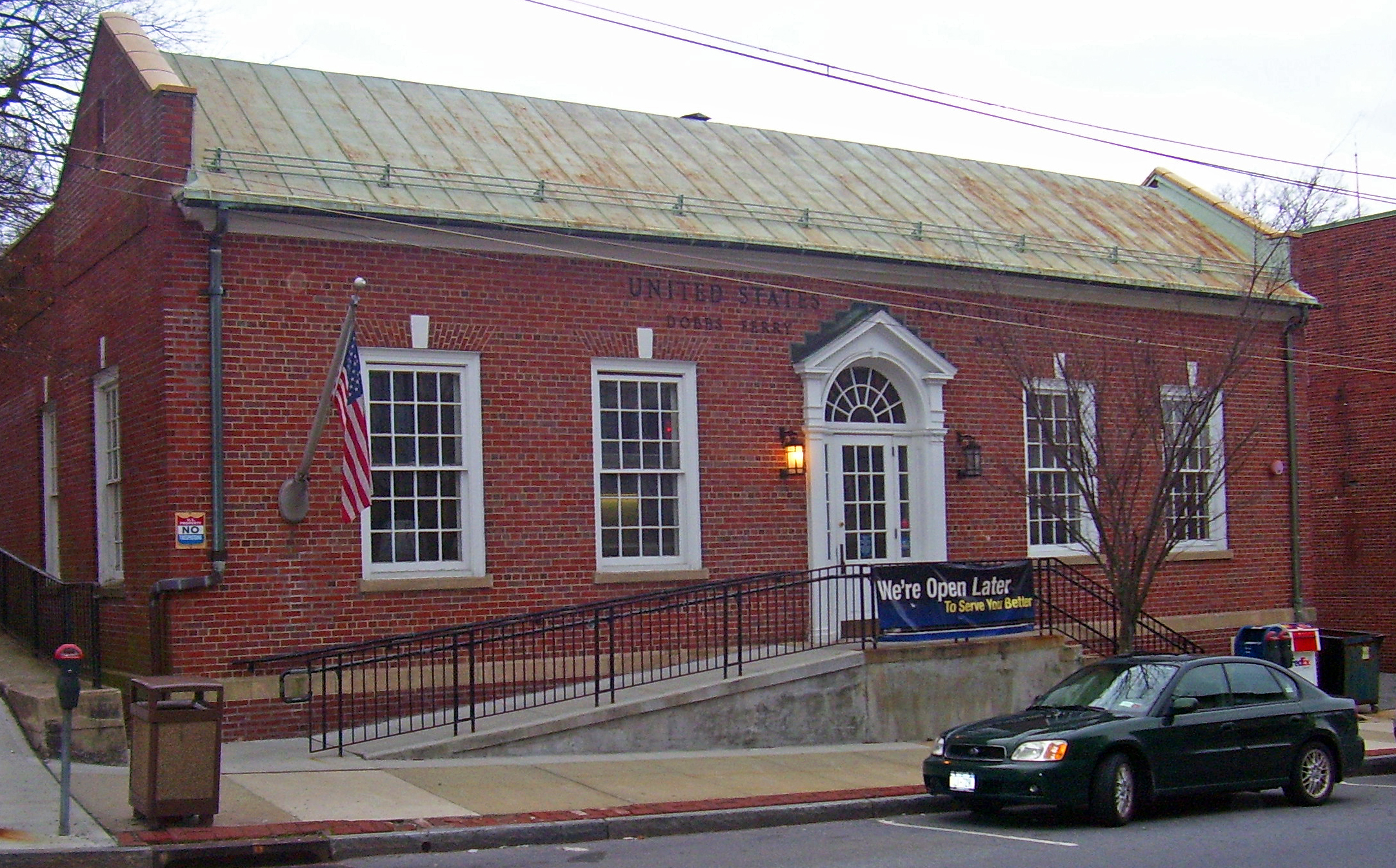
October 15, 1966 381 Bellwood Ave.
41°5′14″N 73°51′59″W / 41.08722°N 73.86639°WSleepy Hollow Intact colonial-era manor house 99 Philipse Manor Railroad Station 
March 14, 1991 Jct. of Riverside Dr. and Millard
41°5′40″N 73°52′12″W / 41.09444°N 73.87°WSleepy Hollow Restored octagonal Tudorbethan station house, home today to local writers' group, is intact surviving example of early 20th-century commuter rail station 100 Playland Amusement Park 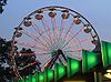
July 4, 1980 Playland Pkwy. and Forest Ave.
40°58′8″N 73°40′17″W / 40.96889°N 73.67139°WRye Only publicly-owned amusement park in U.S. and an early example of one designed for visitors by car as opposed to public transit; Art Deco stylings on attractions widely copied 101 Pound Ridge Historic District December 30, 1985 Roughly Pound Ridge, Old Stone Hill, and Salem Rds., Trinity Pass and Westchester Ave.
41°12′35″N 73°34′34″W / 41.20972°N 73.57611°WPound Ridge 102 Presbyterian Rest for Convalescents April 27, 2011 69 N. Broadway
41°2′11″N 73°46′4″W / 41.03639°N 73.76778°WWhite Plains New listing; refnum 11000230 103 Jacob Purdy House 
August 31, 1979 60 Park Ave.
41°2′12″N 73°46′26″W / 41.03667°N 73.77389°WWhite Plains 104 Joseph Purdy Homestead January 25, 1973 Jct. of NY 22 and 116
41°19′42″N 73°39′21″W / 41.32833°N 73.65583°WPurdys 105 Putnam and Mellor Engine and Hose Company Firehouse September 15, 1983 46 S. Main St.
40°59′58″N 73°39′55″W / 40.99944°N 73.66528°WPort Chester 106 Rehoboth 
April 19, 1979 33 Aldrige Rd.
41°9′22″N 73°46′10″W / 41.15611°N 73.76944°WChappaqua 107 Reid Hall, Manhattanville College March 22, 1974 Manhattanville College, Purchase St.
41°1′56″N 73°42′58″W / 41.03222°N 73.71611°WPurchase 108 John D. Rockefeller Estate 
May 11, 1976 Pocantico Hills
41°5′23″N 73°50′40″W / 41.08972°N 73.84444°WMt. Pleasant Kykuit, the estate of oil magnate and American dynasty founder John D. Rockefeller; open to public tours that also pass by his grandson Nelson's extensive modern art collection. 109 Romer-Van Tassel House November 25, 1994 2121 Saw Mill River Rd.
41°2′39″N 73°49′40″W / 41.04417°N 73.82778°WGreenburgh 110 Rye Meeting House January 14, 2011 624 Milton Rd.
40°57′31″N 73°41′20″W / 40.95861°N 73.68889°WRye New listing; refnum 10001134 111 Rye Town Park-Bathing Complex and Oakland Beach April 18, 2003 Forrest Ave., bet. Rye Beach and Dearborn Ave.
40°57′39″N 73°40′45″W / 40.96083°N 73.67917°WRye 112 St. Augustine's Episcopal Church Complex July 26, 2006 6 Old Post Rd. N
41°12′30″N 73°53′13″W / 41.20833°N 73.88694°WCroton-on-Hudson 113 St. Luke's Episcopal Church 
January 4, 2001 68 Bedford Rd.
41°15′18″N 73°41′4″W / 41.255°N 73.68444°WKatonah 114 St. Mark's Cemetery June 23, 1988 E. Main St., corner of St. Mark's Pl.
41°11′40″N 73°43′35″W / 41.19444°N 73.72639°WMount Kisco 115 St. Mark's Episcopal Church November 21, 1991 Jct. of N. Bedford Rd. and E. Main St.
41°12′26″N 73°43′35″W / 41.20722°N 73.72639°WMt. Kisco 116 St. Paul's Church National Historic Site 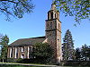
October 15, 1966 Eastchester
40°53′36.18″N 73°49′32.76″W / 40.8933833°N 73.8257667°WMount Vernon 117 St. Paul's Episcopal Church and Rectory 
December 6, 1978 St. Paul's Pl.
41°9′35″N 73°51′53″W / 41.15972°N 73.86472°WOssining 1834 Gothic Revival church of Sing Sing marble designed by Calvin Pollard is oldest church in Ossining. Now Calvary Baptist Church. 118 St. Peter's Episcopal Church (Port Chester) April 12, 2006 19 Smith St.
41°0′14″N 73°40′1″W / 41.00389°N 73.66694°WPort Chester 119 St. Thomas' Episcopal Church Complex 
August 12, 2003 158-168 W. Boston Post Rd.
40°56′53″N 73°44′7″W / 40.94806°N 73.73528°WMamaroneck 120 Sarles' Tavern December 31, 1979 NY 100
41°11′31″N 73°47′56″W / 41.19194°N 73.79889°WMillwood Demolished after 1993 fire 121 Scarborough Historic District September 7, 1984 US 9
41°7′45″N 73°51′22″W / 41.12917°N 73.85611°WOssining 122 Scarsdale Railroad Station 
July 27, 2000 Popham Rd. at Bronx River Pkwy.
40°59′22″N 73°48′32″W / 40.98944°N 73.80889°WScarsdale 123 Scarsdale Woman's Club February 29, 2008 37 Drake Rd.
40°59′13.49″N 73°47′35.61″W / 40.9870806°N 73.793225°WScarsdale (New listing; refnum 08000110) 124 Sleepy Hollow Cemetery 
June 3, 2009 540 N. Broadway
41°5′24″N 73°51′43″W / 41.09°N 73.86194°WSleepy Hollow Setting in Washington Irving's The Legend of Sleepy Hollow; his final resting place along with many other famous people. 125 Smith Tavern 
September 15, 1983 440 Bedford Rd.
41°7′35″N 73°41′40″W / 41.12639°N 73.69444°WArmonk 1770s tavern has played a variety of roles in the history of North Castle. Now used as local history museum. 126 Somers Hamlet Historic District 
April 21, 2004 US 202, New York 100, New York 116, Deans Bridge Rd. and The Lane
41°19′42″N 73°39′1″W / 41.32833°N 73.65028°WSomers Core of village that arose in late 18th and early 19th centuries from junction of two widely-used turnpikes; buildings show influence of both Hudson Valley and New England vernacular building traditions. 127 Somers Town House August 7, 1974 335 Route 202
41°19′42.9301″N 73°41′8.8201″W / 41.328591694°N 73.685783361°WSomers Same as Elephant House listed above under its National Historic Landmark name. Birthplace of the circus in America, when Zephaliah Bailey began charging visitors to see his elephant. Now used as a circus museum, offices of the Somers Historical Society and town hall. 128 Soundview Manor November 25, 2009 283 Soundview Ave.
41°0′16.72″N 73°45′54.04″W / 41.0046444°N 73.7650111°WWhite Plains New listing; refnum 09000957 129 South Presbyterian Church 
May 26, 2000 343 Broadway
41°0′53″N 73°52′22″W / 41.01472°N 73.87278°WDobbs Ferry 1869 stone Gothic Revival church is the only known building by Julius Munckowitz, later involved in developing New York City's park system 130 Spanish American War Monument to the 71st Infantry Regiment January 14, 2011 Jackson Ave. Hastings-on-Hudson vicinity 131 Stepping Stones 
July 16, 2004 62 Oak Rd.
41°14′56″N 73°42′4″W / 41.24889°N 73.70111°WKatonah Home of Alcoholics Anonymous cofounder Bill W. and his wife Lois in their later lives. AA's Big Book written here. 132 John Stevens House 
April 26, 1972 29 W. 4th St.
40°54′15″N 73°50′8″W / 40.90417°N 73.83556°WMount Vernon 133 Stonecrest January 28, 2004 703 Croton Lake Rd.
41°13′32″N 73°43′40″W / 41.22556°N 73.72778°WBedford Corners 134 Stony Hill Cemetery June 25, 1999 Buckout Rd.
41°3′18″N 73°44′59″W / 41.055°N 73.74972°WHarrison 135 Sunnyside 
October 15, 1966 Sunnyside Lane
41°2′57″N 73°52′11″W / 41.04917°N 73.86972°WTarrytown Riverside estate of Washington Irving 136 Taconic State Parkway 
December 8, 2005 Linear north from North White Plains to Putnam County line Mount Pleasant, Ossining, New Castle, Yorktown Scenic divided highway planned by Franklin D. Roosevelt for state park access. Built between 1920s and early 1960s, epitomizing peak period of parkway design. 137 Tarrytown Lighthouse 
May 29, 1979 Spans Hudson River
41°5′2″N 73°52′27″W / 41.08389°N 73.87417°WSleepy Hollow 1883 lighthouse originally stood further offshore, until shore got closer. Only one on Hudson in Westchester and only conical steel lighthouse on Hudson to have family living quarters. 138 The Woodpile February 10, 1992 Jct. of Croton Lake and Wood Rds.
41°13′42″N 73°43′46″W / 41.22833°N 73.72944°WBedford 139 Trinity Episcopal Church Complex September 1, 1998 335 Fourth Ave.
40°54′11″N 73°50′2″W / 40.90306°N 73.83389°WMount Vernon 140 Tuckahoe High School February 24, 2010 65 Siwanoy Blvd.
40°56′31.2″N 73°48′48.88″W / 40.942°N 73.8135778°WEastchester New listing; refnum 10000045 141 Union Church of Pocantico Hills May 6, 2002 555-559 Bedford Rd.
41°5′44″N 73°49′58″W / 41.09556°N 73.83278°WPocantico Hills 142 Union Hall 
August 28, 1986 NY 116 and Keeler Ln.
41°20′7″N 73°34′15″W / 41.33528°N 73.57083°WNorth Salem 143 United Methodist Church and Parsonage November 4, 1982 300 E. Main and 31 Smith Ave.
41°12′0″N 73°43′35″W / 41.2°N 73.72639°WMount Kisco A Carpenter Gothic church built in 1868, and its parsonage 144 US Post Office-Bronxville November 17, 1988 Pondfield Rd.
40°56′18″N 73°49′57″W / 40.93833°N 73.8325°WBronxville 145 US Post Office-Dobbs Ferry 
November 17, 1988 Main St.
41°0′55″N 73°52′30″W / 41.01528°N 73.875°WDobbs Ferry One of many New Deal-era Colonial Revival post offices in the state; one of only three with parapeted gables and window keystones 146 US Post Office-Harrison 
May 11, 1989 258 Halstead Ave.
40°58′7″N 73°42′51″W / 40.96861°N 73.71417°WHarrison 147 US Post Office-Larchmont 
May 11, 1989 1 Chatsworth Ave.
40°55′48″N 73°45′5″W / 40.93°N 73.75139°WLarchmont 148 US Post Office-Mount Vernon May 11, 1989 15 S. First St.
40°54′40″N 73°50′2″W / 40.91111°N 73.83389°WMount Vernon 149 US Post Office-Port Chester May 11, 1989 245 Westchester Ave.
41°0′11.35″N 73°40′7.04″W / 41.0031528°N 73.6686222°WPort Chester 150 US Post Office-Rye 
May 11, 1989 41 Purdy Ave.
40°59′4″N 73°40′59″W / 40.98444°N 73.68306°WRye 151 US Post Office-Scarsdale 
May 11, 1989 Chase Rd.
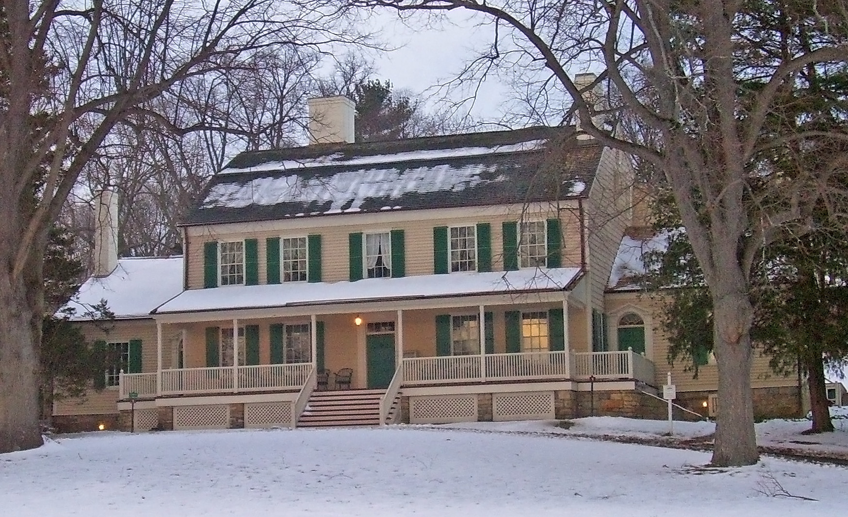
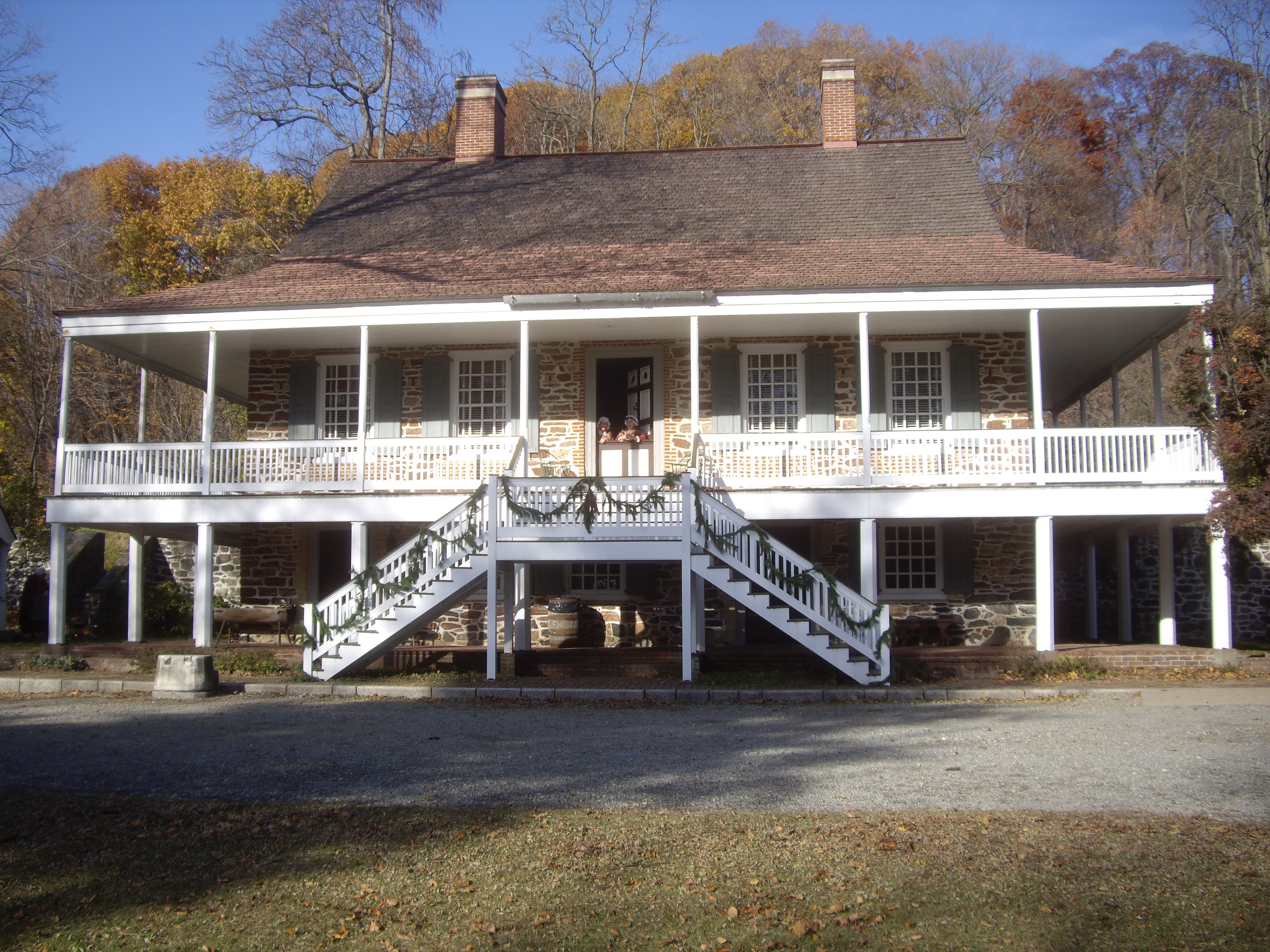
40°59′22″N 73°46′16″W / 40.98944°N 73.77111°WScarsdale 152 Van Cortlandt Manor 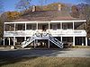
October 15, 1966 U.S. 9, N of jct. with U.S. 9A
41°11′46″N 73°52′37″W / 41.19611°N 73.87694°WCroton-on-Hudson Intact Georgian-style colonial manor house, located much further north than that style is usually found 153 Van Cortlandtville School April 7, 1989 297 Locust Ave.
41°18′45″N 73°54′1″W / 41.3125°N 73.90028°WVan Cortlandtville 154 Villa Lewaro 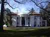
May 11, 1976 N. Broadway
41°2′0″N 73°51′56″W / 41.033333°N 73.86556°WIrvington Home of Madame C.J. Walker, hair-care products tycoon and first African-American millionaire. 155 Walter's Hot Dog Stand 
June 11, 2010 937 Palmer Ave.
40°56′35.52″N 73°44′47.29″W / 40.9432°N 73.7464694°WMamaroneck 1928 imitation pagoda 156 William E. Ward House 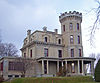
November 7, 1976 Comly Ave.
41°1′34″N 73°40′3″W / 41.02611°N 73.6675°WRye Brook (shared with Greenwich, CT) First reinforced concrete structure in U.S., built in 1870s on state line 157 Washington Irving Memorial 
September 8, 2000 Broadway and Sunnyside Ln.
41°2′53″N 73°51′43″W / 41.04806°N 73.86194°WIrvington Daniel Chester French-sculpted memorial to writer who gave Irvington its name, erected in late 1920s. 158 Washington School February 12, 1987 83 Croton Ave.
41°9′56″N 73°51′30″W / 41.16556°N 73.85833°WOssining 159 Wayside Cottage 
May 1, 1981 1039 Post Rd.
40°59′32″N 73°47′40″W / 40.99222°N 73.79444°WScarsdale 160 White Plains Armory April 16, 1980 35 S. Broadway
41°1′53″N 73°45′47″W / 41.03139°N 73.76306°WWhite Plains 161 White Plains Rural Cemetery September 19, 2003 167 N. Broadway
41°2′50″N 73°46′20″W / 41.04722°N 73.77222°WWhite Plains 162 Williams-DuBois House May 25, 1989 Grace Ln. and Pinesbridge Rd.
41°11′6″N 73°49′41″W / 41.185°N 73.82806°WNew Castle 163 Albert E. and Emily Wilson House April 18, 2007 617 Brook St.
40°57′16″N 73°43′46″W / 40.95444°N 73.72944°WMamaroneck 164 Witthoefft House February 22, 2011 11 Tallwood Rd.
41°7′48″N 73°44′13″W / 41.13°N 73.73694°WArmonk vicinity New listing; refnum 11000039 165 Woman's Club of White Plains October 20, 2010 305 Ridgeway
41°0′16″N 73°44′56″W / 41.00444°N 73.74889°WWhite Plains New listing; refnum 10000853 166 Yorktown Heights Railroad Station 
March 19, 1981 Commerce St.
41°16′16″N 73°46′49″W / 41.27111°N 73.78028°WYorktown Heights 1877 station is one of only three New York and Putnam Railroad stations remaining in county, and one of only two of this size. 167 Isaac Young House August 20, 2004 114 Pinesbridge Rd.
41°11′43″N 73°49′0″W / 41.19528°N 73.816667°WNew Castle See also
- National Register of Historic Places listings in New York
- National Register of Historic Places listings in New Rochelle, New York
- National Register of Historic Places listings in Peekskill, New York
- National Register of Historic Places listings in Yonkers, New York
References
- ^ The latitude and longitude information provided in this table was derived originally from the National Register Information System, which has been found to be fairly accurate for about 99% of listings. For about 1% of NRIS original coordinates, experience has shown that one or both coordinates are typos or otherwise extremely far off; some corrections may have been made. A more subtle problem causes many locations to be off by up to 150 yards, depending on location in the country: most NRIS coordinates were derived from tracing out latitude and longitudes off of USGS topographical quadrant maps created under the North American Datum of 1927, which differs from the current, highly accurate WGS84 GPS system used by Google maps. Chicago is about right, but NRIS longitudes in Washington are higher by about 4.5 seconds, and are lower by about 2.0 seconds in Maine. Latitudes differ by about 1.0 second in Florida. Some locations in this table may have been corrected to current GPS standards.
- ^ "National Register of Historic Places: Weekly List Actions". National Park Service, United States Department of the Interior. Retrieved on November 18, 2011.
- ^ Given as "Braircliff Manor" by the NRHP
Categories:- Westchester County, New York
- National Register of Historic Places in New York by county
- National Register of Historic Places in Westchester County, New York
-


Wikimedia Foundation. 2010.