- National Register of Historic Places listings in Yonkers, New York
-
This is a list of the National Register of Historic Places entries in Yonkers, New York. See also National Register of Historic Places listings in Westchester County, New York for all others in the county.
This is intended to be a complete list of properties and districts listed on the National Register of Historic Places in Yonkers, New York. The locations of National Register properties and districts (at least for all showing latitude and longitude coordinates below) may be seen in a Google map by clicking on "Map of all coordinates".[1]
-
- This National Park Service list is complete through NPS recent listings posted November 18, 2011.[2]
Contents: Counties in New York Albany (Albany) – Allegany – Bronx – Broome – Cattaraugus – Cayuga – Chautauqua – Chemung – Chenango – Clinton – Columbia – Cortland – Delaware – Dutchess – Erie (Buffalo) – Essex – Franklin – Fulton – Genesee – Greene – Hamilton – Herkimer – Jefferson – Kings (Brooklyn) – Lewis – Livingston – Madison – Monroe (Rochester) – Montgomery – Nassau – New York (Manhattan – Below 14th Street, 14th to 59th Streets, 59th to 110th Streets, Above 110th Street, Islands) – Niagara – Oneida – Onondaga (Syracuse) – Ontario – Orange – Orleans – Oswego – Otsego – Putnam – Queens – Rensselaer – Richmond (Staten Island) – Rockland – Saratoga – Schenectady – Schoharie – Schuyler – Seneca – St. Lawrence – Steuben – Suffolk – Sullivan – Tioga – Tompkins – Ulster – Warren – Washington – Wayne – Westchester (New Rochelle, Peekskill, Yonkers) – Wyoming – Yates Current listings
[3] Landmark name Image Date listed Location City or town Summary 1 Bell Place-Locust Avenue Historic District August 29, 1985 Roughly bounded by Cromwell Pl., Locust Hill Ave., Baldwin Pl. & N. Broadway
40°56′09″N 73°53′49″W / 40.935833°N 73.896944°WYonkers 2 John Copcutt Mansion September 12, 1985 239 Nepperhan Ave.
40°56′07″N 73°53′33″W / 40.935278°N 73.8925°WYonkers 3 Old Croton Aqueduct 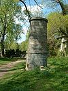
December 2, 1974 Runs N from Yonkers to New Croton Dam
41°00′52″N 73°53′14″W / 41.014444°N 73.887222°WYonkers, shared with other towns in county 4 Delavan Terrace Historic District September 15, 1983 Roughly bounded by Delavan Terr. and Palisade and Park Aves.
40°57′00″N 73°53′33″W / 40.95°N 73.8925°WYonkers 5 Ethan Flagg House-Blessed Sacrament Monastery August 12, 1998 23 Park Ave.
40°56′25″N 73°53′34″W / 40.940278°N 73.892778°WYonkers 6 Halcyon Place Historic District January 11, 1991 Halcyon Pl.
40°56′41″N 73°53′49″W / 40.944722°N 73.896944°WYonkers 7 Eleazer Hart House July 29, 1982 243 Bronxville Rd.
40°56′28″N 73°50′28″W / 40.941111°N 73.841111°WYonkers 8 Mott Mill January 28, 2004 11-23 St. Casimir Ave.
40°56′05″N 73°53′38″W / 40.934722°N 73.893889°WYonkers 9 Philipsburgh Building May 22, 2002 2-8 Hudson St.
40°55′59″N 73°54′00″W / 40.933056°N 73.9°WYonkers 10 Philipse Manor Hall 
October 15, 1966 Warburton Ave. and Dock St.
40°56′8″N 73°53′58″W / 40.93556°N 73.89944°WYonkers 11 Plashbourne Estate August 2, 2007 51 Carlton Rd.
40°56′29″N 73°50′53″W / 40.941389°N 73.848056°WYonkers 12 Proctor's Theater None 53 S. Broadway
40°55′48″N 73°53′59″W / 40.930127°N 73.899722°WYonkers New listing; refnum# 08001083 13 Public Bath House No. 2 October 21, 1985 27 Vineyard Ave.
40°56′25″N 73°53′19″W / 40.940278°N 73.888611°WYonkers 14 Public Bath House No. 3 October 21, 1985 48 Yonkers Ave.
40°56′06″N 73°53′23″W / 40.935°N 73.889722°WYonkers 15 Public Bath House No. 4 October 21, 1985 138 Linden St.
40°55′51″N 73°53′33″W / 40.930833°N 73.8925°WYonkers 16 Public School No. 13 
April 18, 2007 160 McLean Ave.
40°54′57″N 73°53′26″W / 40.915833°N 73.890556°WYonkers 17 Sherwood House May 10, 1984 340 Tuckahoe Rd.
40°57′07″N 73°51′19″W / 40.951944°N 73.855278°WYonkers 18 Alexander Smith Carpet Mills Historic District August 11, 1983 Roughly bounded by Saw Mill River Rd., Orchard St., Lake and Ashburton Aves.
40°56′33″N 73°53′01″W / 40.9425°N 73.883611°WYonkers 19 St. John's Protestant Episcopal Church 
July 29, 1982 One Hudson St.
40°56′01″N 73°53′56″W / 40.933611°N 73.898889°WYonkers 20 W. B. Thompson Mansion October 29, 1982 1061 N. Broadway
40°58′20″N 73°53′05″W / 40.972222°N 73.884722°WYonkers 21 John Bond Trevor House 
June 19, 1972 511 Warburton Ave.
40°57′12″N 73°53′54″W / 40.953333°N 73.898333°WYonkers Part of Hudson River Museum 22 Untermyer Park May 31, 1974 Warburton Ave. and N. Broadway S. of jct. with Odell Ave.
40°58′00″N 73°53′16″W / 40.966667°N 73.887778°WYonkers 23 US Post Office-Yonkers May 11, 1989 79-81 Main St.
40°56′05″N 73°54′08″W / 40.934722°N 73.902222°WYonkers 24 Yonkers Trolley Barn March 6, 2002 92 Main St.
40°56′03″N 73°54′12″W / 40.934167°N 73.903333°WYonkers 25 Yonkers Water Works July 21, 1982 Roughly bounded by Saw Mill River and Grassy Sprain Rds., and Gilmare Dr.
40°57′29″N 73°51′33″W / 40.958056°N 73.859167°WYonkers See also
- National Register of Historic Places listings in Westchester County, New York
- National Register of Historic Places listings in New York
References
- ^ The latitude and longitude information provided in this table was derived originally from the National Register Information System, which has been found to be fairly accurate for about 99% of listings. For about 1% of NRIS original coordinates, experience has shown that one or both coordinates are typos or otherwise extremely far off; some corrections may have been made. A more subtle problem causes many locations to be off by up to 150 yards, depending on location in the country: most NRIS coordinates were derived from tracing out latitude and longitudes off of USGS topographical quadrant maps created under the North American Datum of 1927, which differs from the current, highly accurate WGS84 GPS system used by Google maps. Chicago is about right, but NRIS longitudes in Washington are higher by about 4.5 seconds, and are lower by about 2.0 seconds in Maine. Latitudes differ by about 1.0 second in Florida. Some locations in this table may have been corrected to current GPS standards.
- ^ "National Register of Historic Places: Weekly List Actions". National Park Service, United States Department of the Interior. Retrieved on November 18, 2011.
- ^ Numbers represent an ordering by significant words. Various colorings, defined here, differentiate National Historic Landmark sites and National Register of Historic Places Districts from other NRHP buildings, structures, sites or objects.
Categories:- History of Yonkers, New York
- National Register of Historic Places in New York by county
- National Register of Historic Places in Westchester County, New York
-


Wikimedia Foundation. 2010.