- National Register of Historic Places listings in York County, Maine
-
 Location of York County in Maine
This is a list of the National Register of Historic Places listings in York County, Maine.
This is intended to be a complete list of the properties and districts on the National Register of Historic Places in York County, Maine, United States. Latitude and longitude coordinates are provided for many National Register properties and districts; these locations may be seen together in a Google map.[1]
There are 170 properties and districts listed on the National Register in the county, including 5 National Historic Landmarks.
-
- This National Park Service list is complete through NPS recent listings posted November 10, 2011.[2]
Contents: Counties in Maine Androscoggin - Aroostook - Cumberland - Franklin - Hancock - Kennebec - Knox - Lincoln - Oxford - Penobscot - Piscataquis - Sagadahoc - Somerset - Waldo - Washington - York Current listings
[3] Landmark name [4] Image Date listed Location City or town Summary 1 Alfred Historic District 
April 28, 1983 Kennebunk and Saco Rds.
43°28′24″N 70°42′58″W / 43.473333°N 70.716111°WAlfred 2 Alfred Shaker Historic District 
April 11, 2001 Both sides of Shaker Hill Rd.
43°29′55″N 70°42′41″W / 43.498611°N 70.711389°WAlfred 3 Arundel Golf Club November 4, 2009 19 River Rd.
43°22′26″N 70°28′40″W / 43.374°N 70.477836°WKennebunkport 4 Austin-Hennessey Homestead December 27, 1979 Brunt Mill Rd.
43°20′44″N 70°37′09″W / 43.345556°N 70.619167°WWells 5 Caleb R. Ayer House October 31, 2002 7 Main St.
43°48′16″N 70°48′15″W / 43.804444°N 70.804167°WCornish 6 Samuel Badger Monument 
January 7, 1998 Address Restricted Kittery Foreside 7 Barrell Homestead December 12, 1976 West of York Corner on Beech Ridge Rd.
43°08′41″N 70°42′28″W / 43.144722°N 70.707778°WYork Beach 8 Berwick Academy 
March 29, 1978 Academy St.; also along the eastern side of Academy St., 0.15 miles south of its junction with State Route 236
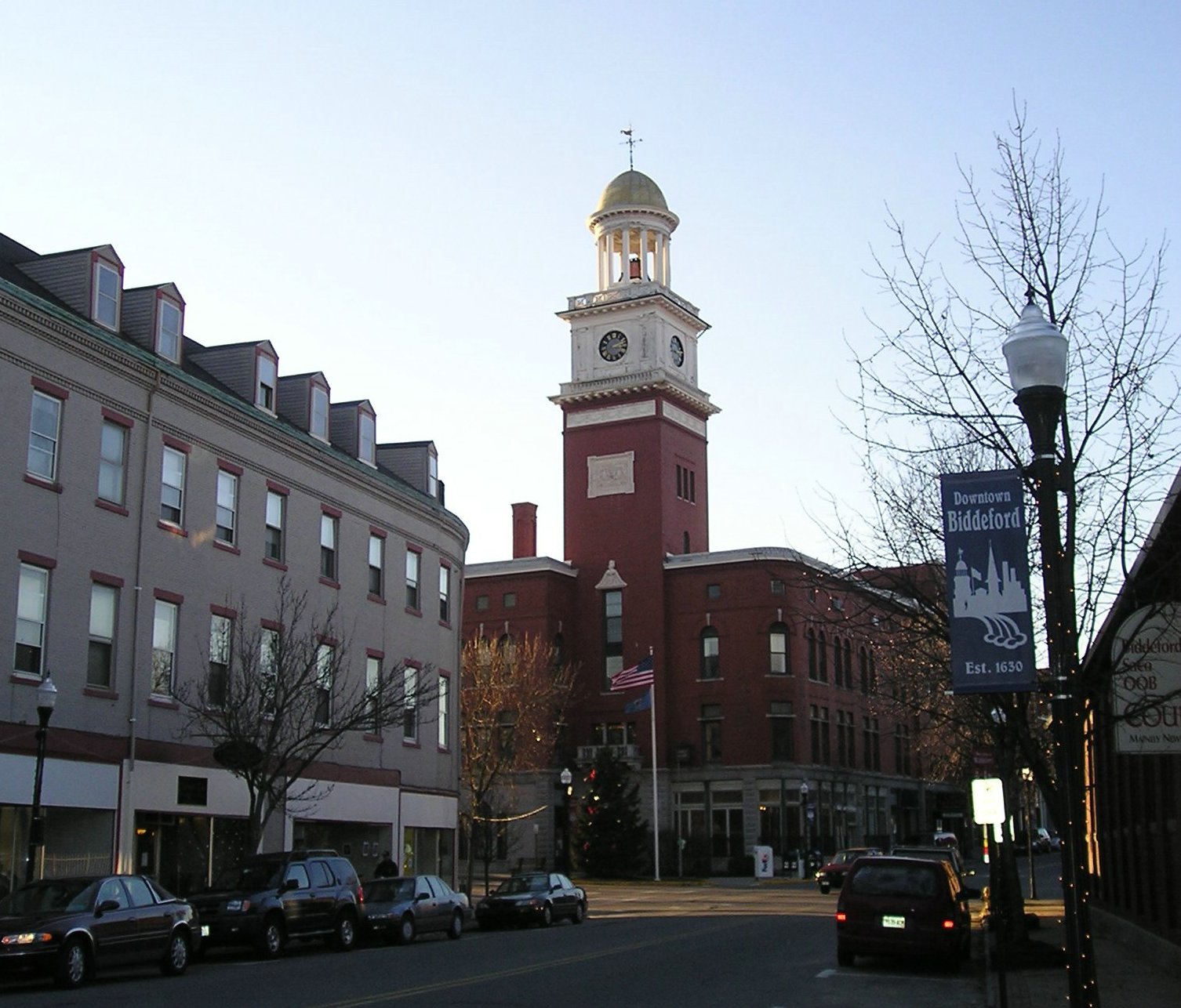
43°13′48″N 70°48′18″W / 43.23°N 70.805°WSouth Berwick Second set of addresses represents a boundary increase 9 Biddeford City Hall 
April 24, 1973 205 Main St.
43°29′36″N 70°27′26″W / 43.493333°N 70.457222°WBiddeford Rebuilt 1895-96, John Calvin Stevens, architect. 10 Biddeford Main Street Historic District 
December 24, 2009 29 to 316 Main St., and portions of Elm, Jefferson, Adams, Washington, Franklin, Alfred and Water Sts.
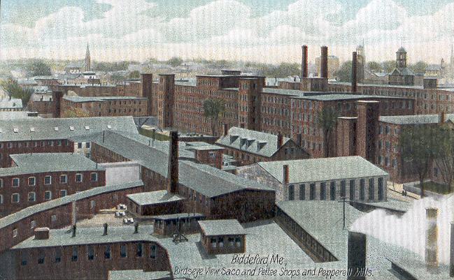
43°29′36″N 70°27′19″W / 43.493347°N 70.455233°WBiddeford 11 Biddeford-Saco Mills Historic District 
December 30, 2008 Bounded by Pearl, Lincoln, York and Main Sts., Biddeford, Gooch and Saco Sts.
43°29′38″N 70°27′18″W / 43.49387°N 70.45502°WBiddeford Detailed aerial map 12 Blazo-Leavitt House 
February 19, 1982 State Route 160
43°45′43″N 70°56′24″W / 43.761944°N 70.94°WParsonsfield 13 Boon Island Light Station 
March 14, 1988 Boon Island
43°07′03″N 70°28′06″W / 43.1175°N 70.468333°WYork 14 Bourne Mansion 
January 24, 1980 8 Bourne St.
43°23′12″N 70°32′26″W / 43.386667°N 70.540556°WKennebunk 15 Brave Boat Harbor Farm October 30, 2007 110 Raynes Neck Rd.
43°06′30″N 70°39′18″W / 43.108442°N 70.655094°WYork 16 Bray House 
October 9, 1979 Pepperell Rd.
43°04′58″N 70°42′10″W / 43.082778°N 70.702778°WKittery Point 17 Isabella Breckinridge House April 28, 1983 Off U.S. Route 1
43°08′27″N 70°41′18″W / 43.140833°N 70.688333°WYork 18 Royal Brewster House June 5, 1975 Buxton Lower Corner
43°36′22″N 70°32′09″W / 43.606111°N 70.535833°WBuxton 19 Buxton Powder House January 2, 1976 State Route 22
43°38′54″N 70°32′47″W / 43.648333°N 70.546389°WBuxton Center 20 Cape Arundel Summer Colony Historic District 
August 16, 1984 Roughly bounded by Chick's Creek, Ocean Ave., S. Main St., Endcliff Rd., and Walkers Point
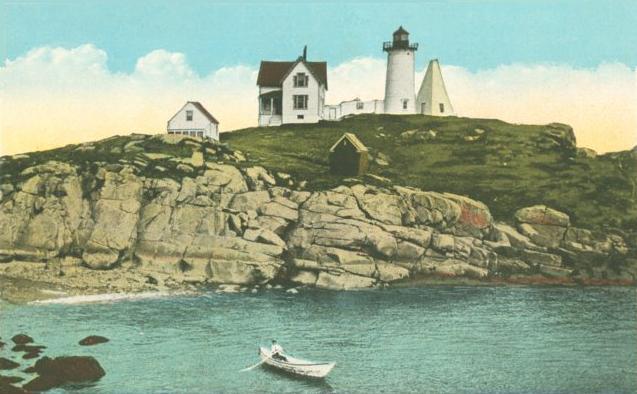
43°20′41″N 70°28′04″W / 43.344722°N 70.467778°WKennebunkport 21 Cape Neddick Light Station 
April 16, 1985 Cape Neddick
43°09′55″N 70°35′30″W / 43.165278°N 70.591667°WYork 22 Capt. Josiah E. Chase Octagon House March 25, 1987 Chase's Mill Rd.
43°43′39″N 70°39′40″W / 43.7275°N 70.661111°WEast Limington 23 George F. Clifford House April 22, 2010 17 High Rd.
43°47′09″N 70°47′42″W / 43.785742°N 70.79495°WCornish 24 Clock Farm February 19, 1982 State Route 9 and Goose Rocks Rd.
43°24′20″N 70°25′39″W / 43.405556°N 70.4275°WKennebunkport 25 Conant-Sawyer Cottage March 26, 1992 14 Kendall Rd.
43°10′22″N 70°35′59″W / 43.172778°N 70.599722°WYork Beach 26 Conway Junction Railroad Turntable Site January 5, 1989 Fife Ln. and State Route 236
43°12′33″N 70°47′22″W / 43.209167°N 70.789444°WSouth Berwick 27 Cummings' Guest House July 28, 2004 110 Portland Ave.
43°31′06″N 70°22′31″W / 43.518333°N 70.375278°WOld Orchard Beach 28 Cummings Shoe Factory 
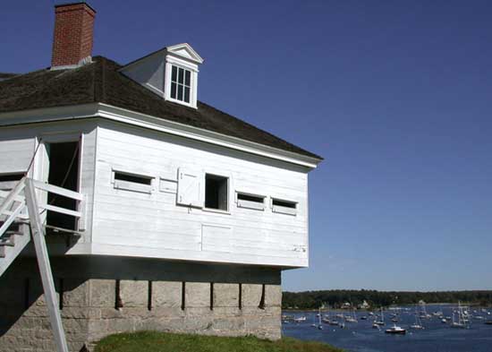
December 31, 2001 2 Railroad Ave.
43°14′14″N 70°49′18″W / 43.237222°N 70.821667°WSouth Berwick 29 Benjamin and Abigail Dalton House April 14, 1997 Address Restricted North Parsonsfield 30 J.G. Deering House February 17, 1982 371 Main St.
43°30′08″N 70°26′36″W / 43.502222°N 70.443333°WSaco 31 Dennett Garrison December 22, 1978 100 Dennett Rd.
43°06′03″N 70°45′35″W / 43.100833°N 70.759722°WKittery 32 District No. 5 School February 4, 2009 781 Gore Rd.
43°31′27″N 70°45′56″W / 43.52409°N 70.76542°WAlfred 33 Division No. 9 School 
December 14, 1995 Southern side of State Route 9, 0.15 miles east of its junction with Bragdon Rd.
43°18′23″N 70°41′27″W / 43.306389°N 70.690833°WWells 34 Dorfield Farm December 27, 1979 Harrisecket Rd.
43°21′29″N 70°34′02″W / 43.358056°N 70.567222°WWells 35 Dudley Block November 12, 1982 28-34 Water St.
43°29′32″N 70°27′01″W / 43.492222°N 70.450278°WBiddeford 36 Early Post Office December 27, 1979 Bragdon's Crossing
43°19′15″N 70°36′13″W / 43.320833°N 70.603611°WWells 37 Eaton House December 27, 1979 Sanford Rd.
43°21′33″N 70°39′49″W / 43.359167°N 70.663611°WNorth Berwick 38 Elden's Store April 28, 1983 State Route 22
43°38′55″N 70°32′31″W / 43.648611°N 70.541944°WBuxton 39 Elder Grey Meetinghouse October 9, 1979 North of North Waterboro
43°38′10″N 70°42′50″W / 43.636111°N 70.713889°WNorth Waterboro 40 Emery Homestead June 22, 1980 1 and 3 Lebanon St.
43°26′27″N 70°46′44″W / 43.440833°N 70.778889°WSanford 41 Emery House December 27, 1979 Sanford Rd.
43°21′56″N 70°40′10″W / 43.365556°N 70.669444°WHighpine 42 First Baptist Church June 28, 1988 Western side of the junction of West Rd. and Federal St.
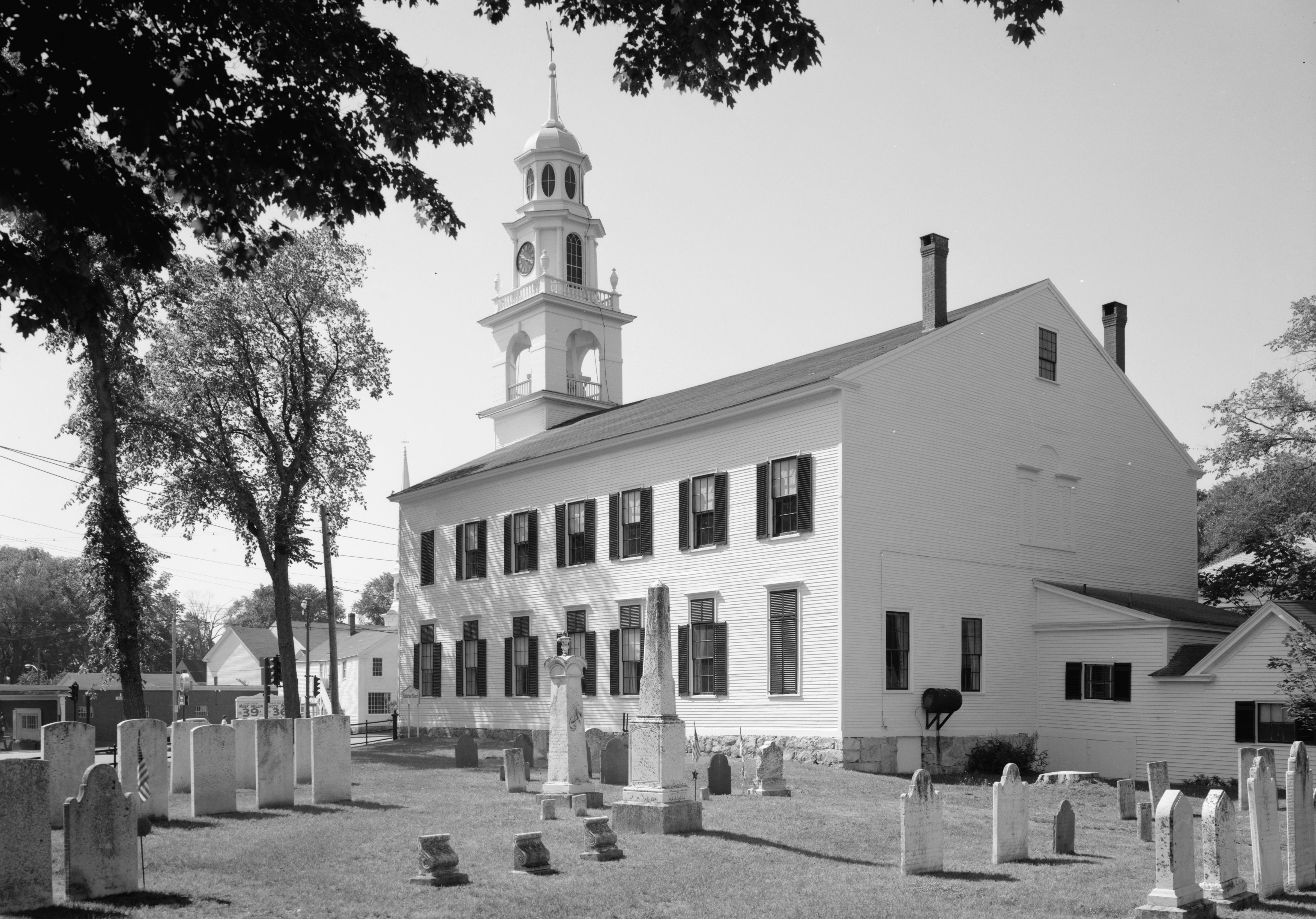
43°32′16″N 70°44′12″W / 43.537778°N 70.736667°WWaterboro 43 First Congregational Church and Parsonage 
December 18, 1978 Pepperrell Rd.; also along both sides of Whipple (Pepperell) Rd., 2.3 miles east of its junction with U.S. Route 1
43°04′54″N 70°42′56″W / 43.081667°N 70.715556°WKittery Point Second set of addresses represents a boundary increase 44 First Congregational Church of Buxton June 22, 1980 State Route 112
43°36′23″N 70°32′14″W / 43.606389°N 70.537222°WBuxton 45 First Congregational Church, Former June 21, 1991 Southwestern corner of U.S. Route 1 and Barker's Ln.
43°18′05″N 70°35′12″W / 43.301389°N 70.586667°WWells 46 First Parish Meetinghouse October 26, 1972 Old Pool Rd.
43°28′31″N 70°24′56″W / 43.475278°N 70.415556°WBiddeford 47 James Montgomery Flagg House April 23, 1980 St. Martin's Lane
43°27′00″N 70°20′38″W / 43.45°N 70.343889°WBiddeford 48 Fletcher's Neck Lifesaving Station November 1, 1974 Ocean Ave.
43°26′33″N 70°20′33″W / 43.4425°N 70.3425°WBiddeford Pool 49 William Fogg Library 
December 21, 1991 Old Rd.
43°07′42″N 70°47′53″W / 43.128333°N 70.798056°WEliot 50 Fort McClary 
October 1, 1969 Off State Route 103 near Fort McClary State Park
43°04′54″N 70°42′39″W / 43.081667°N 70.710833°WKittery Point 51 Levi Foss House March 22, 1984 State Route 35
43°30′38″N 70°34′52″W / 43.510556°N 70.581111°WGoodwins Mills 52 Frost Garrison and House June 27, 1971 Frost's Hill
43°09′47″N 70°45′04″W / 43.163056°N 70.751111°WEliot 53 Gerrish Warehouse 
May 26, 1977 Pepperrell Cove off State Route 103
43°04′52″N 70°43′06″W / 43.081111°N 70.718333°WKittery 54 Goat Island Light Station 
March 23, 1988 Goat Island in Cape Porpoise Harbor
43°21′28″N 70°25′33″W / 43.357778°N 70.425833°WCape Porpoise 55 Goodale-Bourne Farm December 27, 1979 N. Village Rd.
43°15′48″N 70°38′05″W / 43.263333°N 70.634722°WOgunquit 56 Goodale-Stevens Farm December 27, 1979 N. Village Rd.
43°15′49″N 70°37′54″W / 43.263611°N 70.631667°WOgunquit 57 Louis B. Goodall Memorial Library January 24, 2008 952 Main St.
43°26′10″N 70°46′24″W / 43.436111°N 70.773333°WSanford 58 Thomas Goodall House 
April 28, 1975 232 Main St.
43°26′10″N 70°46′21″W / 43.436111°N 70.7725°WSanford 59 Grant Family House June 21, 1990 72 Grant Rd.
43°34′47″N 70°30′15″W / 43.579722°N 70.504167°WSaco 60 Abbott Graves House April 23, 1980 Ocean Ave.
43°21′14″N 70°28′22″W / 43.353889°N 70.472778°WKennebunkport 61 Grist Mill Bridge December 27, 1990 Little River Rd. across the Little River
43°23′30″N 70°51′06″W / 43.391667°N 70.851667°WLebanon 62 Jonathan Hamilton House 
December 30, 1970 Vaughan's Lane and Old South Rd.
43°12′48″N 70°48′47″W / 43.213333°N 70.813056°WSouth Berwick 63 John Hancock Warehouse December 2, 1969 Lindsay Rd.
43°08′12″N 70°39′28″W / 43.136667°N 70.657778°WYork 64 Harper Family House October 8, 1998 State Route 5, approximately 0.95 miles south of its junction with E. Range Rd.
43°40′07″N 70°46′33″W / 43.668611°N 70.775833°WLimerick 65 Hatch House December 27, 1979 Sanford Rd.
43°21′32″N 70°39′53″W / 43.358889°N 70.664722°WNorth Berwick 66 Hawkes Pharmacy October 14, 1993 7 Main St.
43°10′33″N 70°36′40″W / 43.175833°N 70.611111°WYork Beach 67 Hedden Site October 16, 1991 Address Restricted Kennebunk 68 Thomas Hobbs, Jr., House February 11, 1982 Wells St.
43°18′19″N 70°44′17″W / 43.305278°N 70.738056°WNorth Berwick 69 Sen. John Holmes House 
April 24, 1975 U.S. Route 202
43°28′39″N 70°43′04″W / 43.4775°N 70.717778°WAlfred 70 William Dean Howells House October 25, 1979 Pepperrell Rd.
43°04′51″N 70°42′45″W / 43.080833°N 70.7125°WKittery Point 71 Mary R. Hurd House 
September 11, 1979 Elm St.
43°18′19″N 70°44′22″W / 43.305278°N 70.739444°WNorth Berwick 72 Hussey Plow Company Building December 19, 1979 Dyer St.
43°18′15″N 70°43′45″W / 43.304167°N 70.729167°WNorth Berwick 73 Isles of Shoals 
May 16, 1974 6.5 miles southeast of Kittery
42°59′43″N 70°36′23″W / 42.995278°N 70.606389°WKittery 74 Jacobs Houses and Store March 2, 1982 9-17 Elm St.
43°29′56″N 70°27′02″W / 43.498889°N 70.450556°WSaco 75 Sarah Orne Jewett House 
June 4, 1973 State Routes 4 and 236
43°14′05″N 70°48′13″W / 43.234722°N 70.803611°WSouth Berwick 76 Jewett-Eastman House December 29, 1983 37 Portland St.
43°14′06″N 70°48′33″W / 43.235°N 70.809167°WSouth Berwick 77 Dennis Johnson Lumber Company Mill May 8, 2007 Northeastern side of State Route 5, 0.3 miles north of Silas Brown Rd.
43°37′09″N 70°43′56″W / 43.619167°N 70.732222°WWaterboro 78 John Paul Jones Memorial Park January 7, 1998 Bounded by Newmarch St. and Hunter Ave.
43°05′06″N 70°45′02″W / 43.085°N 70.750556°WKittery Foreside 79 Kennebunk High School August 24, 2011 14 Park St.
43°23′07″N 70°32′06″W / 43.385278°N 70.535°WKennebunk 80 Kennebunk Historic District 
June 5, 1974 Both sides of State Route 35 from the Kennebunk River to U.S. Route 1, radiating streets at intersection
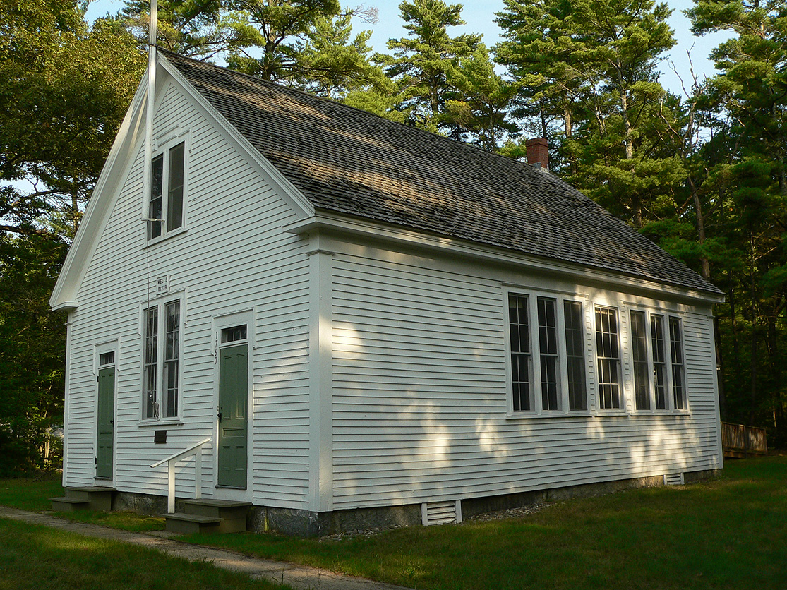
43°22′55″N 70°31′24″W / 43.381944°N 70.523333°WKennebunk 81 Kennebunk River Club 
September 9, 1975 Ocean Ave.
43°21′01″N 70°28′24″W / 43.350278°N 70.473333°WKennebunkport Frederick W. Stickney, architect. 82 Kennebunkport Historic District 
May 6, 1976 Bounded roughly by South, Maine, North, and Locke Sts., and the Kennebunk River
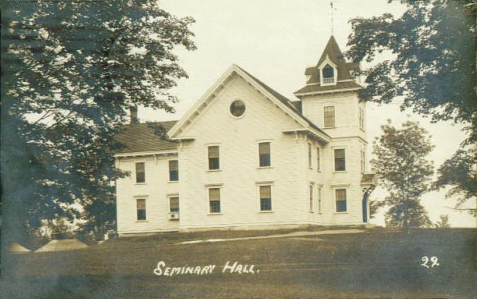
43°21′46″N 70°28′33″W / 43.362778°N 70.475833°WKennebunkport 83 Lady Pepperrell House 
October 15, 1966 State Route 103
43°04′53″N 70°43′00″W / 43.081389°N 70.716667°WKittery Point 84 Laudholm Farm October 20, 1983 Laudholm Farm Rd.
43°20′14″N 70°33′05″W / 43.337222°N 70.551389°WWells 85 James Leavitt House September 22, 2004 6 Old Alfred Rd.
43°35′20″N 70°42′34″W / 43.588889°N 70.709444°WWaterboro Center 86 Libby's Colonial Tea Room January 19, 2001 Junction of U.S. Route 1 and Harrisecket Rd.
43°21′26″N 70°33′32″W / 43.357222°N 70.558889°WWells 87 Libby-MacArthur House April 20, 1988 State Route 11
43°43′54″N 70°42′39″W / 43.731667°N 70.710833°WLimington 88 Limerick Upper Village Historic District 
April 5, 1984 State Route 5
43°41′17″N 70°47′43″W / 43.688056°N 70.795278°WLimerick 89 Limington Academy 
June 23, 1980 State Route 117
43°44′N 70°43′W / 43.73°N 70.71°WLimington 90 Limington Historic District January 15, 1999 Junction of State Routes 11 and 117
43°43′57″N 70°42′33″W / 43.7325°N 70.709167°WLimington 91 Littlefield Homestead December 27, 1979 Chick's Crossing Rd.
43°22′30″N 70°35′52″W / 43.375°N 70.597778°WWells 92 Littlefield Tavern December 27, 1979 State Route 9B Charles Chase L. Rd.
43°18′N 70°38′W / 43.3°N 70.64°WNorth Berwick 93 Littlefield-Chase Farmstead December 27, 1979 State Route 9 N. Berwick Rd.
43°18′26″N 70°40′30″W / 43.307222°N 70.675°WNorth Berwick 94 Littlefield-Dustin Farm December 27, 1979 Dodge Rd.
43°18′30″N 70°41′08″W / 43.308333°N 70.685556°WNorth Berwick 95 Littlefield-Keeping House December 27, 1979 State Route 9B Charles Chase L. Rd.
43°18′27″N 70°39′52″W / 43.3075°N 70.664444°WNorth Berwick 96 Lord Farm December 27, 1979 Laudholm Rd.
43°20′11″N 70°33′06″W / 43.336389°N 70.551667°WWells 97 Lord Mansion April 2, 1973 20 Summer St.
43°23′15″N 70°32′05″W / 43.3875°N 70.534722°WKennebunk 98 Capt. Nathaniel Lord Mansion September 20, 1973 Pleasant and Green Sts.
43°21′32″N 70°28′27″W / 43.358889°N 70.474167°WKennebunkport 99 Lord-Dane House December 17, 1992 Western side of Federal St., 2 miles north of its junction with U.S. Route 202
43°29′57″N 70°43′47″W / 43.499167°N 70.729722°WAlfred 100 Lower Alewive Historic District March 24, 1994 Northern side of Emmons Rd., east of its junction with State Route 35
43°26′06″N 70°33′32″W / 43.435°N 70.558889°WKennebunk 101 Maine Trolley Cars November 14, 1980 Seashore Trolley Museum
43°24′28″N 70°29′22″W / 43.407778°N 70.489444°WKennebunkport 102 McIntire Garrison House 
November 24, 1968 On State Route 91 about 5 miles west of York
43°10′05″N 70°42′49″W / 43.168056°N 70.713611°WYork 103 Mill House December 27, 1979 Post Rd.
43°17′16″N 70°35′39″W / 43.287778°N 70.594167°WOgunquit 104 Moody Homestead April 28, 1975 Ridge Rd.
43°09′23″N 70°38′02″W / 43.156389°N 70.633889°WYork 105 Capt. James Morison House July 12, 1978 Southeast of Parsonsfield on South Rd.
43°41′26″N 70°52′32″W / 43.690556°N 70.875556°WParsonsfield 106 Morrell House September 29, 1976 North of N. Berwick on Bauneg Beg Pond Rd.
43°21′21″N 70°44′20″W / 43.355833°N 70.738889°WNorth Berwick 107 Newfield (Willowbrook) Historic District February 14, 1985 Elm St.
43°39′18″N 70°51′07″W / 43.655°N 70.851944°WNewfield 108 North Berwick Woolen Mill July 21, 1983 Canal St.
43°18′16″N 70°44′15″W / 43.304444°N 70.7375°WNorth Berwick 109 Ocean Park Historic Buildings 
March 2, 1982 Temple Ave.
43°30′20″N 70°23′22″W / 43.505556°N 70.389444°WOcean Park 110 Odd Fellows-Rebekah Hall December 29, 1983 High St.
43°48′14″N 70°48′12″W / 43.803889°N 70.803333°WCornish 111 Ogunquit Memorial Library December 29, 1983 Shore Rd.
43°14′42″N 70°35′52″W / 43.245°N 70.597778°WOgunquit 112 Ogunquit Playhouse December 14, 1995 Eastern side of U.S. Route 1, 0.2 miles south of its junction with Bourne Rd.
43°14′20″N 70°36′02″W / 43.238889°N 70.600556°WOgunquit 113 Old Grist Mill June 5, 1975 Little River Rd.
43°23′43″N 70°51′09″W / 43.395278°N 70.8525°WEast Lebanon 114 Old Schoolhouse April 2, 1973 York St. (on the Village Green)
43°08′38″N 70°39′13″W / 43.143889°N 70.653611°WYork 115 Old Town House July 15, 2002 Merrill Hill Rd., north of its junction with Middle Rd.
43°43′42″N 70°55′47″W / 43.728333°N 70.929722°WParsonsfield 116 Old York Gaol 
November 24, 1968 4 Lindsey Rd.
43°08′38″N 70°39′10″W / 43.143889°N 70.652778°WYork 117 Parsons-Piper-Lord-Roy Farm February 15, 2005 309 Cramm Rd.
43°42′34″N 70°50′47″W / 43.709444°N 70.846389°WParsonsfield 118 Parsonsfield Seminary 
June 20, 1986 State Route 160
43°45′46″N 70°56′20″W / 43.762778°N 70.938889°WParsonsfield 119 Paul Family Farm October 20, 1998 106 Depot Rd.
43°09′22″N 70°47′25″W / 43.156111°N 70.790278°WEliot 120 Pebbledene October 14, 1993 99 Freeman St.
43°10′51″N 70°36′19″W / 43.180833°N 70.605278°WYork Beach 121 William Pepperrell House 
August 14, 1973 On State Route 103
43°04′59″N 70°42′13″W / 43.083056°N 70.703611°WKittery Point 122 Perkins Tide Mill 
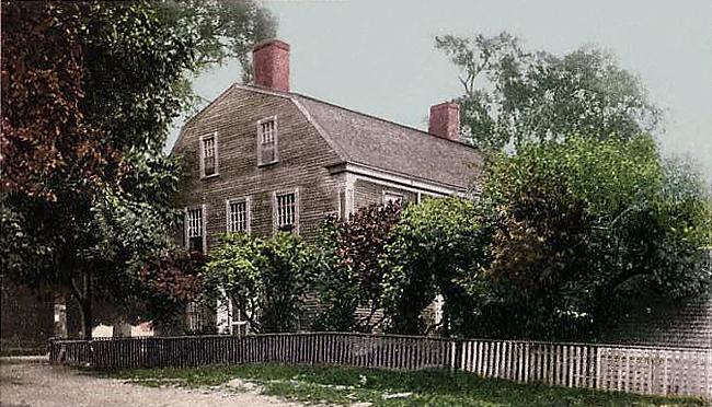
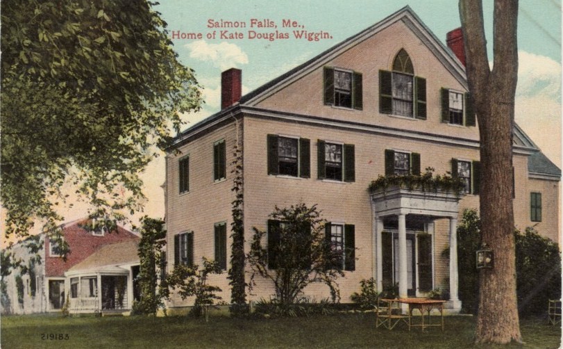
September 7, 1973 Mill Lane
43°22′01″N 70°28′28″W / 43.366944°N 70.474444°WKennebunkport 123 Charles Perkins House December 27, 1979 Scotch Hill
43°15′13″N 70°36′08″W / 43.253611°N 70.602222°WOgunquit 124 LeRoy F. Pike Memorial Building February 7, 2007 17 Maple St.
43°48′21″N 70°48′22″W / 43.805833°N 70.806111°WCornish 125 Porter-Parsonfield Bridge 
February 16, 1970 0.5 miles south of Porter over the Ossipee River
43°47′30″N 70°56′18″W / 43.791667°N 70.938333°WParsonsfield Extends into Oxford County 126 Portsmouth Company Cotton Mills: Counting House October 10, 1975 State Route 4 at the Salmon Falls River
43°13′37″N 70°48′41″W / 43.226944°N 70.811389°WSouth Berwick 127 Portsmouth Naval Shipyard 
November 17, 1977 Seavey's Island
43°04′59″N 70°44′18″W / 43.083056°N 70.738333°WKittery 128 J.L. Prescott House June 20, 1985 High St.
43°18′39″N 70°44′19″W / 43.310833°N 70.738611°WNorth Berwick 129 Proprietors Meeting House and Parish House August 2, 2001 Junction of State Route 22 and Old County Rd.
43°37′14″N 70°28′45″W / 43.620556°N 70.479167°WSouth Buxton 130 Rice Public Library October 1, 1979 8 Wentworth St.
43°05′12″N 70°44′34″W / 43.086667°N 70.742778°WKittery 131 Rock Rest January 24, 2008 167 Brave Boat Harbor Rd.
43°06′20″N 70°40′34″W / 43.105556°N 70.676111°WKittery 132 Robert Rose Tavern October 10, 1975 Off Long Sands Rd.
43°09′14″N 70°37′40″W / 43.153889°N 70.627778°WYork 133 Saco City Hall 
October 9, 1979 300 Main St.
43°29′57″N 70°26′44″W / 43.499167°N 70.445556°WSaco 134 Saco High School (old) July 14, 1983 Spring St.
43°30′09″N 70°26′21″W / 43.5025°N 70.439167°WSaco 135 Saco Historic District 
June 12, 1998 Roughly bounded by Elm, North, Beach, and Main Sts.
43°30′10″N 70°26′51″W / 43.502778°N 70.4475°WSaco 136 St. Joseph's School December 29, 1983 Birch St.
43°29′25″N 70°27′31″W / 43.490278°N 70.458611°WBiddeford 137 St. Peter's By-The-Sea Protestant Episcopal Church 
July 1, 1999 529 Shore Rd.
43°13′04″N 70°35′03″W / 43.217778°N 70.584167°WCape Neddick 138 Salmon Falls (East) Historic District October 15, 1987 Portions of State Route 117 and Simpson Rd.
43°35′34″N 70°33′04″W / 43.592778°N 70.551111°WBuxton 139 Salmon Falls (West) Historic District October 30, 1987 Salmon Falls Rd. and portion of U.S. Route 202
43°35′53″N 70°33′24″W / 43.598056°N 70.556667°WHollis 140 Sanford Mills Historic District 
November 4, 2009 Bounded by Washington St., Pioneer Ave., Emery St., and Weaver Dr.
43°26′24″N 70°46′17″W / 43.440044°N 70.771375°WSanford 141 Sanford Naval Air Station Administration Building-Control Tower, Former June 20, 1997 Southwestern corner of Sanford Municipal Airport, southwest of the junction of State Routes 99 and 109
43°23′25″N 70°43′00″W / 43.390278°N 70.716667°WSouth Sanford 142 Sanford Town Hall (Former) January 9, 2007 505 Main St.
43°27′48″N 70°47′44″W / 43.4632°N 70.79555°WSpringvale 143 A. B. Seavey House March 31, 1978 90 Temple St.
43°30′03″N 70°27′00″W / 43.500833°N 70.45°WSaco 144 John Sedgley Homestead 
January 2, 1976 North of York Corner on Chases Pond Rd.
43°09′53″N 70°40′02″W / 43.164722°N 70.667222°WYork Beach 145 James Smith Homestead February 4, 1982 State Route 35
43°25′56″N 70°33′54″W / 43.432222°N 70.565°WKennebunk 146 Smith-Emery House October 8, 1998 253 Main St.
43°28′07″N 70°48′07″W / 43.468611°N 70.801944°WSpringvale 147 South Berwick Village Historic District 
March 2, 2010 Portions of Main, Portland, Highland and Academy
43°13′57″N 70°48′31″W / 43.232608°N 70.808556°WSouth Berwick 148 Spiller Farm Paleoindian Site September 12, 2003 Address Restricted Wells 149 Staples Inn June 26, 1987 8 Portland Ave.
43°31′03″N 70°22′42″W / 43.5175°N 70.378333°WOld Orchard Beach 150 Sunnycroft November 8, 1984 Locust Hill
43°41′22″N 70°47′40″W / 43.689444°N 70.794444°WLimerick 151 John Tarr House April 23, 1980 29 Ferry Lane
43°28′09″N 70°23′54″W / 43.469167°N 70.398333°WBiddeford 152 The Temple 
April 28, 1975 Temple Ave. in Ocean Park
43°30′08″N 70°23′22″W / 43.502222°N 70.389444°WOld Orchard Beach 153 Thacher-Goodale House November 21, 1976 121 North St.
43°30′11″N 70°26′44″W / 43.503056°N 70.445556°WSaco 154 Robert and Louisa Traip House January 7, 1998 2 Wentworth St.
43°05′11″N 70°44′35″W / 43.086389°N 70.743056°WKittery Foreside 155 U.S. Customhouse January 18, 1974 Main St.
43°21′42″N 70°28′32″W / 43.361667°N 70.475556°WKennebunkport 156 U.S. Post Office May 7, 1973 35 Washington St.
43°29′32″N 70°27′21″W / 43.492222°N 70.455833°WBiddeford 157 US Post Office-Sanford Maine May 2, 1986 28 School St.
43°26′16″N 70°46′22″W / 43.43785°N 70.77282°WSanford 158 Wallingford Hall April 28, 2004 21 York St.
43°22′57″N 70°32′48″W / 43.3825°N 70.546667°WKennebunk 159 Way Way General Store December 14, 1995 93 Buxton Rd.
43°31′57″N 70°28′21″W / 43.5325°N 70.4725°WSaco 160 Andrew Welch Homestead April 11, 2002 1286 Middle Rd.
43°42′47″N 70°53′22″W / 43.713056°N 70.889444°WParsonsfield 161 Wells Baptist Church Parsonage December 27, 1979 State Route 9A
43°22′27″N 70°35′58″W / 43.374167°N 70.599444°WWells 162 Wells Homestead December 27, 1979 Sanford Rd.
43°19′21″N 70°35′10″W / 43.3225°N 70.586111°WWells 163 Mark F. and Eliza J. Wentworth House January 7, 1998 9 Wentworth St.
43°05′12″N 70°44′36″W / 43.086667°N 70.743333°WKittery Foreside 164 West Lebanon Historic District 
June 5, 1975 Irregular pattern along W. Lebanon, Rochester, Milton, Shapleigh, and Meeting House Rds.
43°23′03″N 70°57′04″W / 43.384167°N 70.951111°WWest Lebanon 165 Whaleback Light Station 
March 23, 1988 Portsmouth Harbor
43°03′31″N 70°41′48″W / 43.058611°N 70.696667°WKittery Point 166 Kate Douglas Wiggin House 
September 16, 1977 East of Hollis Center on Salmon Falls Rd.
43°35′50″N 70°33′20″W / 43.597222°N 70.555556°WHollis Center 167 Winn House December 27, 1979 King's Highway
43°15′06″N 70°36′04″W / 43.251667°N 70.601111°WOgunquit 168 Wood Island Light Station 
January 21, 1988 Eastern side of Wood Island
43°27′24″N 70°19′47″W / 43.456667°N 70.329722°WBiddeford Pool 169 York Cliffs Historic District 
July 26, 1984 Agamenticus Ave.
43°11′31″N 70°35′56″W / 43.191944°N 70.598889°WYork 170 York Historic District 
July 16, 1973 Roughly U.S. Route 1, U.S. Route 1A, State Route 103, and Woodbridge Rd.
43°08′18″N 70°39′03″W / 43.138333°N 70.650833°WYork See also
References
- ^ The latitude and longitude information provided in this table was derived originally from the National Register Information System, which has been found to be fairly accurate for about 99% of listings. For about 1% of NRIS original coordinates, experience has shown that one or both coordinates are typos or otherwise extremely far off; some corrections may have been made. A more subtle problem causes many locations to be off by up to 150 yards, depending on location in the country: most NRIS coordinates were derived from tracing out latitude and longitudes off of USGS topographical quadrant maps created under North American Datum of 1927, which differs from the current, highly accurate GPS system used by Google maps. Chicago is about right, but NRIS longitudes in Washington are higher by about 4.5 seconds, and are lower by about 2.0 seconds in Maine. Latitudes differ by about 1.0 second in Florida. Some locations in this table may have been corrected to current GPS standards.
- ^ "National Register of Historic Places: Weekly List Actions". National Park Service, United States Department of the Interior. Retrieved on November 10, 2011.
- ^ Numbers represent an ordering by significant words. Various colorings, defined here, differentiate National Historic Landmark sites and National Register of Historic Places Districts from other NRHP buildings, structures, sites or objects.
- ^ "National Register Information System". National Register of Historic Places. National Park Service. . http://nrhp.focus.nps.gov/natreg/docs/All_Data.html.
U.S. National Register of Historic Places Topics Lists by states Alabama • Alaska • Arizona • Arkansas • California • Colorado • Connecticut • Delaware • Florida • Georgia • Hawaii • Idaho • Illinois • Indiana • Iowa • Kansas • Kentucky • Louisiana • Maine • Maryland • Massachusetts • Michigan • Minnesota • Mississippi • Missouri • Montana • Nebraska • Nevada • New Hampshire • New Jersey • New Mexico • New York • North Carolina • North Dakota • Ohio • Oklahoma • Oregon • Pennsylvania • Rhode Island • South Carolina • South Dakota • Tennessee • Texas • Utah • Vermont • Virginia • Washington • West Virginia • Wisconsin • WyomingLists by territories Lists by associated states Other  Category:National Register of Historic Places •
  Portal:National Register of Historic Places
Municipalities and communities of York County, Maine County seat: Alfred Cities 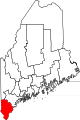
Towns CDPs Berwick | Cape Neddick | Kennebunk | Kennebunkport | Kittery | Kittery Point | Lake Arrowhead | North Berwick | Sanford | South Eliot | South Sanford | Springvale | West Kennebunk | York Harbor
Other
villagesCategories:- National Register of Historic Places in Maine by county
- York County, Maine
-


Wikimedia Foundation. 2010.