- National Register of Historic Places listings in Piscataquis County, Maine
-
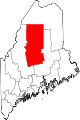
 Location of Piscataquis County in Maine
This is a list of the National Register of Historic Places listings in Piscataquis County, Maine.
This is intended to be a complete list of the properties and districts on the National Register of Historic Places in Piscataquis County, Maine, United States. Latitude and longitude coordinates are provided for many National Register properties and districts; these locations may be seen together in a Google map.[1]
There are 52 properties and districts listed on the National Register in the county.
-
- This National Park Service list is complete through NPS recent listings posted November 10, 2011.[2]
Contents: Counties in Maine Androscoggin - Aroostook - Cumberland - Franklin - Hancock - Kennebec - Knox - Lincoln - Oxford - Penobscot - Piscataquis - Sagadahoc - Somerset - Waldo - Washington - York Current listings
[3] Landmark name [4] Image Date listed Location City or town Summary 1 Ambajejus Boom House April 2, 1973 About 11 miles northwest of Millinocket and Ambajejus Lake
45°43′57″N 68°53′42″W / 45.7325°N 68.895°WNortheast Piscataquis 2 Archeological Site No. 142-6 October 31, 1995 Address Restricted Ripogenus 3 Archeological Site No. 121-52a October 31, 1995 Address Restricted Ambajejus Camps 4 Archeological Site No. 121-52B October 31, 1995 Address Restricted Ambajejus Camps 5 Archeological Site No. 121-59 October 31, 1995 Address Restricted Stephensons Landing 6 Archeological Site No. 121-71 October 31, 1995 Address Restricted Amgajejus Camps 7 Archeological Site No. 122-4a October 31, 1995 Address Restricted Northeast Piscataquis 8 Archeological Site No. 133.7 April 25, 1986 Address Restricted Chesuncook 9 Archeological Site No. 133.8 April 25, 1986 Address Restricted Chesuncook 10 Archeological Site No. 142-12 October 31, 1995 Address Restricted Ripogenus 11 Archeological Site No. 142-14 October 31, 1995 Address Restricted Ripogenus 12 Archeological Site No. 142-5 October 31, 1995 Address Restricted Ripogenus 13 Archeological Site No. 142-8 October 31, 1995 Address Restricted Ripogenus 14 Archeological Site No. 142-13 October 31, 1995 Address Restricted Ripogenus 15 Archeological Site No. 143-12 October 31, 1995 Address Restricted Ripogenus 16 Archeological Site No. 143-15 October 31, 1995 Address Restricted Ripogenus 17 Archeological Site No. 143-16 October 31, 1995 Address Restricted Ripogenus 18 Archeological Site No. 143-23 October 31, 1995 Address Restricted Chesuncook 19 Archeological Site No. 143-5 October 31, 1995 Address Restricted Ripogenus 20 Archeological Site No. 143-52 October 31, 1995 Address Restricted Chesuncook 21 Archeological Site No. 143-53 October 31, 1995 Address Restricted Chesuncook 22 Archeological Site No. 143-57 October 31, 1995 Address Restricted Chesuncook 23 Archeological Site No. 143-79 October 31, 1995 Address Restricted Chesuncook 24 The Breakwater April 11, 2002 Southern tip of Kineo Island on the western side of Kineo Cove
45°41′16″N 69°43′43″W / 45.687778°N 69.728611°WRockwood 25 Brockway Site (ME 90.3) July 27, 1987 Address Restricted Milo 26 Brown House February 14, 1985 High St.
45°18′20″N 69°02′30″W / 45.305556°N 69.041667°WBrownville 27 Burgess House May 3, 1978 Off State Route 11
45°16′10″N 69°06′53″W / 45.269444°N 69.114722°WSebec 28 Walter and Eva Burgess Farm April 14, 1997 79 Shaw Rd.
45°06′38″N 69°13′40″W / 45.110556°N 69.227778°WMacomber Corner 29 Robert Carleton House December 6, 1975 N. Main St.
45°09′56″N 69°21′26″W / 45.165556°N 69.357222°WSangerville 30 Chandler-Parsons Blacksmith Shop October 16, 1989 Dawes Rd.
45°12′13″N 69°15′27″W / 45.203611°N 69.2575°WDover-Foxcroft 31 Chesuncook Village April 11, 1973 Northwestern shore of Chesuncook Lake
46°04′N 69°25′W / 46.06°N 69.41°WChesuncook 32 Free Will Baptist Church (Former) October 12, 2000 Junction of High St. and Highland Ave.
45°15′11″N 68°59′04″W / 45.253056°N 68.984444°WMilo 33 Guilford Memorial Library July 31, 1986 Library and Water Sts.
45°10′11″N 69°23′01″W / 45.169722°N 69.383611°WGuilford 34 Harriman School June 24, 1996 Northern side of North Rd., 1.7 miles northeast of its junction with Parson Landing Rd.
45°14′05″N 69°08′49″W / 45.234722°N 69.146944°WDover-Foxcroft 35 Hathaway Barn April 22, 2003 135 Nortons Corner Rd.
45°17′37″N 69°25′24″W / 45.293611°N 69.423333°WWillimantic 36 H. Hudson Law Office October 9, 1979 Hudson Ave.
45°10′01″N 69°23′06″W / 45.166944°N 69.385°WGuilford 37 Moosehead Lake
45°28′09″N 69°37′17″W / 45.469167°N 69.621389°WGreenville 38 Katahdin Ironworks December 23, 1969 Northwest of Brownville Junction at Silver Lake
45°26′44″N 69°10′26″W / 45.445556°N 69.173889°WBrownville Junction 39 Kineo Cottage Row Historic District January 14, 2004 Western side of the Kineo Peninsula in Moosehead Lake
45°41′25″N 69°44′02″W / 45.690278°N 69.733889°WKineo Township 40 Little Schoodic Stream Archeological Site (107-4) April 20, 1989 Address Restricted Medford 41 Milo Public Library January 5, 1989 4 Pleasant St.
45°15′45″N 68°59′12″W / 45.2625°N 68.986667°WMilo 42 Monson Engine House (Former) August 5, 2005 6 Tenney Hill Rd.
45°17′10″N 69°30′00″W / 45.286111°N 69.5°WMonson 43 Munsungan-Chase Lake Thoroughfare Archeological District September 6, 1979 Address unknown Millinocket Lake 44 Observer Building June 26, 1998 126 Union Sq.
45°11′07″N 69°13′39″W / 45.185278°N 69.2275°WDover-Foxcroft 45 Sangerville Town Hall March 22, 1991 Main St.
45°09′56″N 69°21′30″W / 45.165556°N 69.358333°WSangerville 46 Sebec-Piscataquis River Confluence Prehistoric Archeological District December 24, 1986 Address Restricted Milo 47 Slate House March 10, 1995 123 Church St.
45°18′52″N 69°01′46″W / 45.314444°N 69.029444°WBrownville 48 Straw House February 19, 1982 Golda Ct.
45°10′13″N 69°23′07″W / 45.170278°N 69.385278°WGuilford 49 Swedish Lutheran Church July 19, 1984 Wilkins and Hebron Sts.
45°17′09″N 69°30′10″W / 45.285833°N 69.502778°WMonson 50 Tramway Historic District May 7, 1979 Northeast of Greenville
46°19′10″N 69°22′39″W / 46.319444°N 69.3775°WGreenville 51 James Sullivan Wiley House November 21, 1976 Main St.
45°11′01″N 69°13′31″W / 45.183611°N 69.225278°WDover-Foxcroft 52 Willard Brook Quarry September 26, 1986 Address Restricted Chesuncook See also
References
- ^ The latitude and longitude information provided in this table was derived originally from the National Register Information System, which has been found to be fairly accurate for about 99% of listings. For about 1% of NRIS original coordinates, experience has shown that one or both coordinates are typos or otherwise extremely far off; some corrections may have been made. A more subtle problem causes many locations to be off by up to 150 yards, depending on location in the country: most NRIS coordinates were derived from tracing out latitude and longitudes off of USGS topographical quadrant maps created under North American Datum of 1927, which differs from the current, highly accurate GPS system used by Google maps. Chicago is about right, but NRIS longitudes in Washington are higher by about 4.5 seconds, and are lower by about 2.0 seconds in Maine. Latitudes differ by about 1.0 second in Florida. Some locations in this table may have been corrected to current GPS standards.
- ^ "National Register of Historic Places: Weekly List Actions". National Park Service, United States Department of the Interior. Retrieved on November 10, 2011.
- ^ Numbers represent an ordering by significant words. Various colorings, defined here, differentiate National Historic Landmark sites and National Register of Historic Places Districts from other NRHP buildings, structures, sites or objects.
- ^ "National Register Information System". National Register of Historic Places. National Park Service. . http://nrhp.focus.nps.gov/natreg/docs/All_Data.html.
U.S. National Register of Historic Places Topics Lists by states Alabama • Alaska • Arizona • Arkansas • California • Colorado • Connecticut • Delaware • Florida • Georgia • Hawaii • Idaho • Illinois • Indiana • Iowa • Kansas • Kentucky • Louisiana • Maine • Maryland • Massachusetts • Michigan • Minnesota • Mississippi • Missouri • Montana • Nebraska • Nevada • New Hampshire • New Jersey • New Mexico • New York • North Carolina • North Dakota • Ohio • Oklahoma • Oregon • Pennsylvania • Rhode Island • South Carolina • South Dakota • Tennessee • Texas • Utah • Vermont • Virginia • Washington • West Virginia • Wisconsin • WyomingLists by territories Lists by associated states Other  Category:National Register of Historic Places •
  Portal:National Register of Historic Places
Municipalities and communities of Piscataquis County, Maine County seat: Dover-Foxcroft Towns Abbot | Atkinson | Beaver Cove | Bowerbank | Brownville | Dover-Foxcroft | Greenville | Guilford | Medford | Milo | Monson | Parkman | Sangerville | Sebec | Shirley | Wellington | Willimantic
Plantations Unorganized
territoriesCDPs Dover-Foxcroft | Greenville | Guilford | Milo
Categories:- National Register of Historic Places in Maine by county
- Piscataquis County, Maine
-

Wikimedia Foundation. 2010.