- National Register of Historic Places listings in Hancock County, Maine
-
 Location of Hancock County in Maine
This is a list of the National Register of Historic Places listings in Hancock County, Maine.
This is intended to be a complete list of the properties and districts on the National Register of Historic Places in Hancock County, Maine, United States. Latitude and longitude coordinates are provided for many National Register properties and districts; these locations may be seen together in a Google map.[1]
There are 121 properties and districts listed on the National Register in the county, including 2 National Historic Landmarks (at least one property has been removed from the Register).
-
- This National Park Service list is complete through NPS recent listings posted November 10, 2011.[2]
Contents: Counties in Maine Androscoggin - Aroostook - Cumberland - Franklin - Hancock - Kennebec - Knox - Lincoln - Oxford - Penobscot - Piscataquis - Sagadahoc - Somerset - Waldo - Washington - York Contents
Current listings
[3] Landmark name [4] Image Date listed Location City or town Summary 1 Robert Abbe Museum of Stone Antiquities January 19, 1983 South of Bar Harbor off State Route 3
44°21′40″N 68°12′30″W / 44.361111°N 68.208333°WBar Harbor 2 Agassiz Bedrock Outcrop February 13, 2003 406 State St.
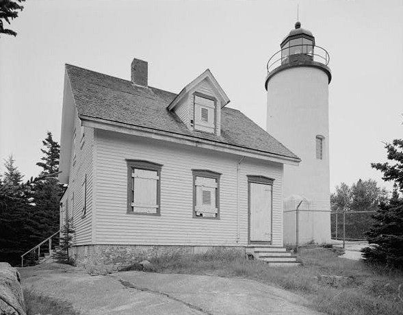
44°33′40″N 68°26′19″W / 44.561111°N 68.438611°WEllsworth 3 Baker Island Light Station 
March 14, 1988 Baker Island in Acadia National Park
44°14′28″N 68°11′56″W / 44.241111°N 68.198889°WIslesford 4 Barncastle November 10, 1980 South St.
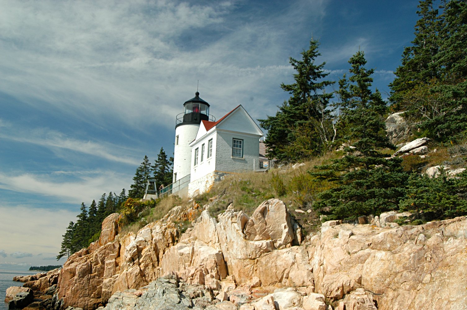
44°23′51″N 68°35′18″W / 44.3975°N 68.588333°WBlue Hill 5 Bass Harbor Head Light Station 
January 21, 1988 Bass Harbor Head
44°13′19″N 68°20′16″W / 44.221944°N 68.337778°WBass Harbor 6 Bass Harbor Memorial Library August 5, 2009 89 Bernard Rd.
44°14′28″N 68°21′20″W / 44.241244°N 68.355606°WTremont 7 Bear Island Light Station 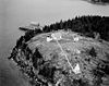
March 14, 1988 Bear Island, Acadia National Park
44°17′00″N 68°16′14″W / 44.283333°N 68.270556°WNortheast Harbor 8 Beth Eden Chapel August 2, 2001 Naskeag Point Rd., 0.05 miles north of its junction with Naskeag Loop Rd.
44°14′05″N 68°31′56″W / 44.234803°N 68.532244°WBrooklin 9 Black Mansion 
December 23, 1969 W. Main St. (State Route 172)
44°32′12″N 68°26′21″W / 44.536667°N 68.439167°WEllsworth 10 Blackwoods Campground June 29, 2007 State Route 233, Eagle Lake Rd. Bar Harbor 11 Blue Hill Historic District December 8, 1980 State Routes 15, 172, 176, and 177
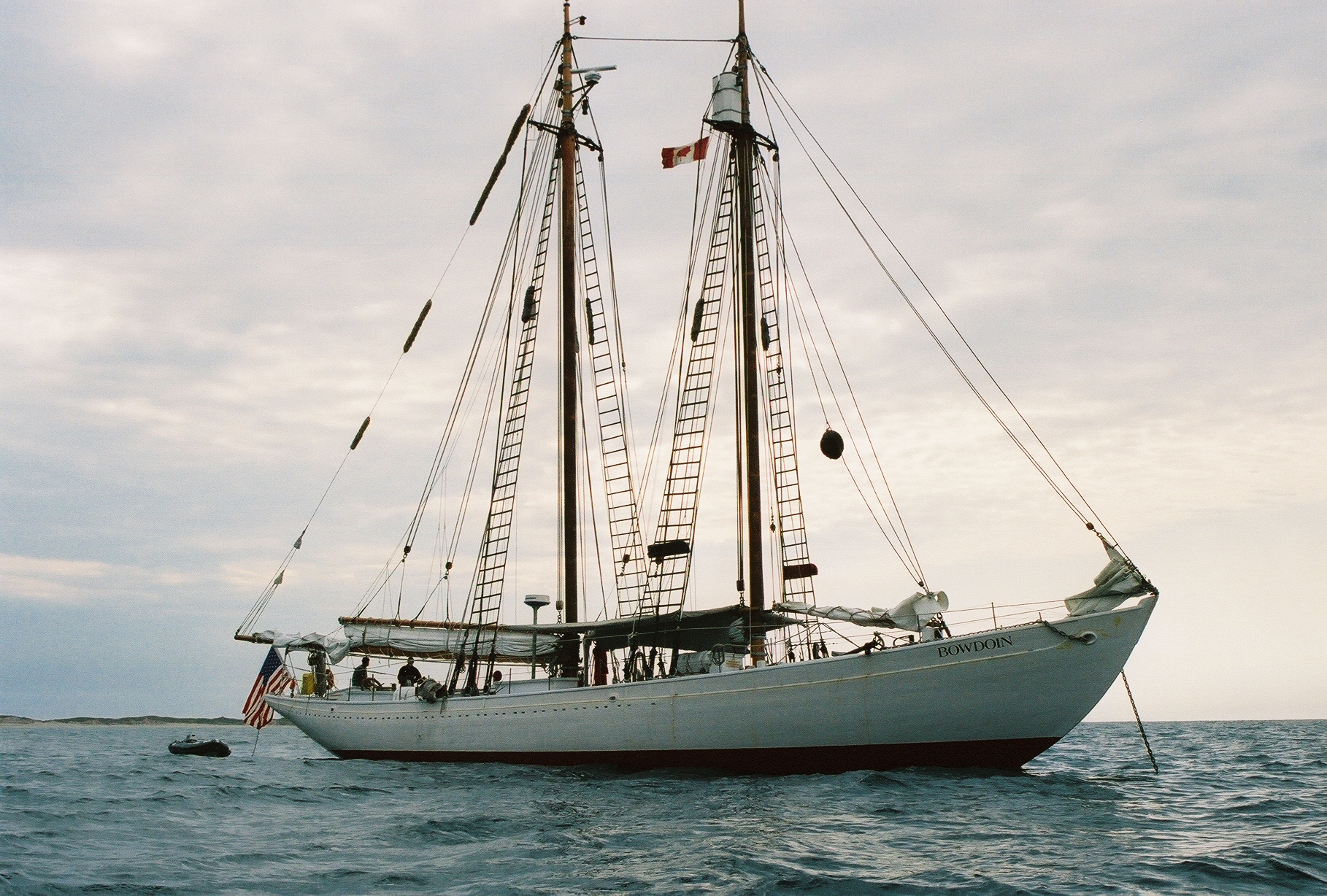
44°24′49″N 68°35′22″W / 44.413611°N 68.589444°WBlue Hill 12 BOWDOIN (schooner) 
February 12, 1980 Maine Maritime Academy
44°23′12″N 68°47′48″W / 44.386667°N 68.796667°WCastine 13 Brick School House April 23, 1980 School House Hill
44°50′51″N 68°19′43″W / 44.8475°N 68.328611°WAurora 14 Brooklin IOOF Hall January 26, 1990 State Route 175
44°15′55″N 68°34′51″W / 44.265278°N 68.580833°WBrooklin 15 Brown-Pilsbury Double House September 11, 1997 188-190 Franklin St.
44°34′26″N 68°47′49″W / 44.573889°N 68.796944°WBucksport 16 Buck Memorial Library December 30, 1987 Maine St.
44°34′17″N 68°47′32″W / 44.571389°N 68.792222°WBucksport 17 Bucksport Railroad Station April 28, 1975 Main St.
44°34′19″N 68°47′50″W / 44.571944°N 68.797222°WBucksport 18 Burnt Coat Harbor Light Station 
January 21, 1988 Hockamock Head
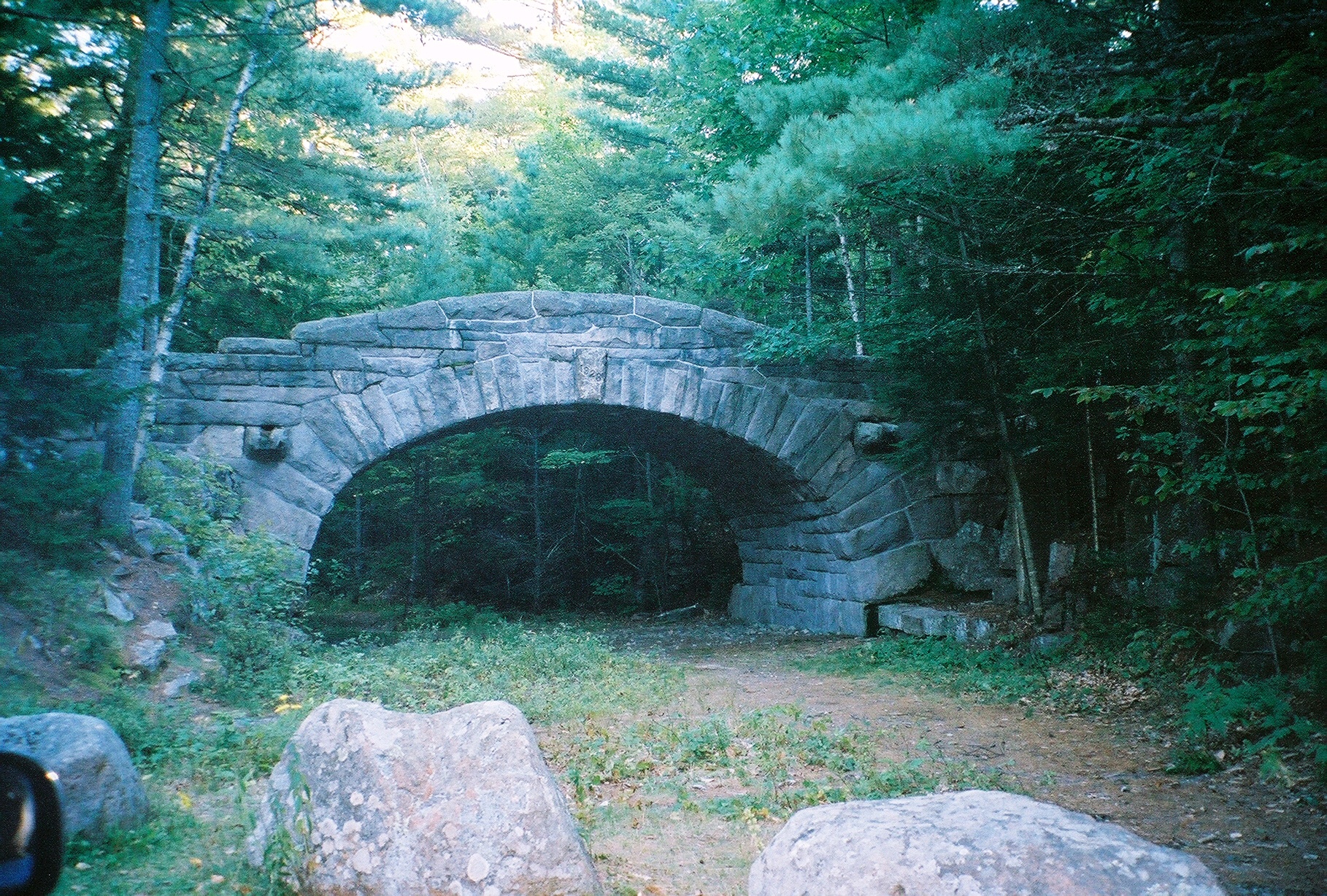
44°08′03″N 68°26′52″W / 44.134167°N 68.447778°WSwans Island 19 Carriage Paths, Bridges and Gatehouses 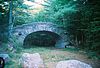
November 14, 1979 Acadia National Park and vicinity
44°20′32″N 68°15′30″W / 44.342222°N 68.258333°WAcadia National Park 20 Castine Historic District 
February 23, 1973 Roughly bounded by the Bagaduce and Penobscot rivers, and by Wadsworth Cove Rd.
44°23′27″N 68°48′19″W / 44.390833°N 68.805278°WCastine 21 Cate House January 26, 1970 Corner of Court and Pleasant Sts.
44°23′18″N 68°48′01″W / 44.388333°N 68.800278°WCastine 22 Church of Our Father July 1, 1999 State Route 3, 0.5 miles north of Crooked Rd.
44°25′15″N 68°15′02″W / 44.420833°N 68.250556°WHulls Cove 23 Claremont Hotel March 29, 1978 Claremont Rd.
44°16′44″N 68°18′46″W / 44.278889°N 68.312778°WSouthwest Harbor 24 Cleftstone September 24, 1999 92 Eden St.
44°23′36″N 68°13′19″W / 44.393333°N 68.221944°WBar Harbor 25 Cover Farm December 14, 1995 Off the western side of State Route 3, 0.3 miles northwest of its junction with Crooked Rd.
44°25′05″N 68°15′18″W / 44.418056°N 68.255°WHulls Cove 26 Criterion Theatre April 23, 1980 35 Cottage St.
44°23′24″N 68°12′23″W / 44.39°N 68.206389°WBar Harbor 27 Dix Family Stable April 5, 1990 State Route 102A
44°14′33″N 68°20′41″W / 44.2425°N 68.344722°WBass Harbor 28 Duck Cove School July 15, 1993 Eastern side of State Route 46 at its junction with Stubbs Brook Rd.
44°35′36″N 68°44′33″W / 44.593333°N 68.7425°WBucksport 29 East Blue Hill Library April 5, 1990 Miliken Rd.
44°25′01″N 68°31′21″W / 44.416944°N 68.5225°WEast Blue Hill 30 East Blue Hill Post Office February 12, 2003 13 Curtis Cove Rd.
44°25′01″N 68°31′20″W / 44.416944°N 68.522222°WEast Blue Hill 31 Eastbrook Baptist Church and Eastbrook Town House December 18, 1978 State Route 200
44°40′42″N 68°16′00″W / 44.678333°N 68.266667°WEastbrook 32 Eegonos January 15, 1980 145 Eden St.
44°24′15″N 68°13′58″W / 44.404167°N 68.232778°WBar Harbor 33 Egg Rock Light Station 
January 21, 1988 Egg Rock in Frenchman Bay
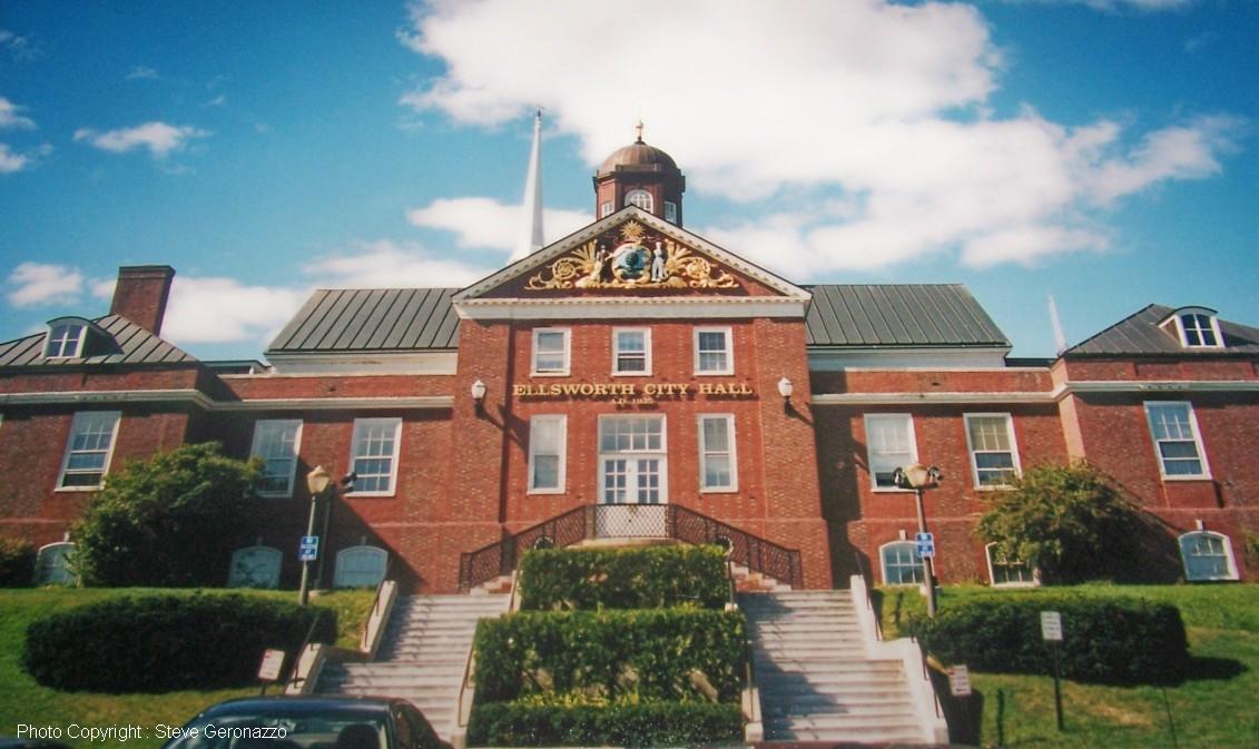
44°21′13″N 68°08′20″W / 44.353611°N 68.138889°WWinter Harbor 34 Ellsworth City Hall 
January 10, 1986 City Hall Plaza
44°32′33″N 68°25′29″W / 44.5425°N 68.424722°WEllsworth 35 Ellsworth Congregational Church 
April 23, 1973 State St.
44°32′37″N 68°25′52″W / 44.543611°N 68.431111°WEllsworth 36 Ellsworth Power House and Dam June 20, 1985 Union River
44°32′39″N 68°25′50″W / 44.544167°N 68.430556°WEllsworth 37 Elm Street Congregational Church and Parish House June 14, 1990 Junction of Elm and Franklin Sts.
44°34′24″N 68°47′41″W / 44.573333°N 68.794722°WBucksport 38 James Emery House August 13, 1974 Main St.
44°34′16″N 68°47′52″W / 44.571111°N 68.797778°WBucksport 39 The Farm House November 7, 2007 15 Highbrook Rd.
44°23′18″N 68°13′09″W / 44.388333°N 68.219167°WBar Harbor 40 Fernald Point Prehistoric Site July 21, 1978 Address Restricted Southwest Harbor 41 First Baptist Church August 2, 2001 362 Lamoine Beach Rd.
44°28′03″N 68°19′17″W / 44.4675°N 68.321389°WEast Lamoine 42 First Baptist Church April 24, 1973 Off State Route 172
44°18′16″N 68°36′52″W / 44.304444°N 68.614444°WSedgwick 43 Flye Point 2 April 15, 1985 Address Restricted Brooklin 44 Fort George December 30, 1969 Wadsworth St. off Battle Ave.
44°23′27″N 68°48′22″W / 44.390833°N 68.806111°WCastine A British fort during the American Revolution and the site of the Penobscot Expedition 45 Garland Farm October 19, 2005 1029 State Route 3
44°25′40″N 68°19′30″W / 44.427778°N 68.325°WBar Harbor 46 Gavin Watson Site March 18, 1987 Address Restricted Sullivan 47 Daniel Coit Gilman Summer Home October 15, 1966 Off Huntington Rd.
44°17′30″N 68°16′56″W / 44.291667°N 68.282222°WNortheast Harbor 48 Goddard Site May 7, 1979 Address Restricted Brooklin 49 Granite Store December 16, 1974 U.S. Route 1
44°31′12″N 68°11′57″W / 44.52°N 68.199167°WSullivan 50 Great Duck Island Light Station 
March 14, 1988 Southern tip of Great Duck Island
44°08′32″N 68°14′46″W / 44.142222°N 68.246111°WFrenchboro 51 Edward J. Hammond Hall January 14, 2004 Main St.
44°23′28″N 68°05′23″W / 44.391111°N 68.089722°WWinter Harbor 52 Hancock County Jail January 24, 2008 40 State St.
44°32′32″N 68°25′34″W / 44.542222°N 68.426111°WEllsworth 53 Harbor Lane-Eden Street Historic District July 22, 2009 Portions of Harbor Ln. and Eden St.
44°23′22″N 68°13′02″W / 44.389419°N 68.2173°WBar Harbor 54 Squire Ignatius Haskell House February 3, 1978 State Route 172A
44°13′26″N 68°40′49″W / 44.223889°N 68.680278°WDeer Isle 55 Haystack Mountain School of Crafts December 23, 2005 89 Haystack School Dr.
44°11′19″N 68°35′05″W / 44.188611°N 68.584722°WDeer Isle 56 Phineas Heywood House January 7, 1988 343 Maine St.
44°34′19″N 68°47′42″W / 44.571944°N 68.795°WBucksport 57 Higgins Barn January 28, 2004 256 Oak Hill Rd.
44°22′48″N 68°21′48″W / 44.38°N 68.363333°WIndian Point 58 Highseas November 30, 1978 South of Bar Harbor on Schooner Head Rd.
44°21′21″N 68°11′01″W / 44.355833°N 68.183611°WBar Harbor 59 Ward Hinckley House December 16, 1974 Address Restricted Blue Hill 60 Hulls Cove High School March 25, 1999 State Route 3, 0.4 miles north of its junction with Crooked Rd.
44°25′11″N 68°15′03″W / 44.419722°N 68.250833°WHulls Cove 61 Islesford Historical Museum and Blue Ducks Ships Store September 30, 1980 Little Cranberry Island
44°15′42″N 68°14′25″W / 44.261667°N 68.240278°WIslesford 62 Col. Charles and Mary Ann Jarvis Homestead January 15, 2004 10 Surry Rd.
44°32′18″N 68°25′46″W / 44.538333°N 68.429444°WEllsworth 63 Jesup Memorial Library 
April 1, 1991 34 Mt. Desert St.
44°23′12″N 68°12′25″W / 44.386667°N 68.206944°WBar Harbor 64 Jonathan Fisher Memorial December 30, 1969 Southwest of Blue Hill on State Route 15 (Outer Main St.)
44°24′18″N 68°35′51″W / 44.405°N 68.5975°WBlue Hill 65 Col. Meltiah Jordon House 
August 13, 1974 State St.
44°32′32″N 68°25′32″W / 44.542222°N 68.425556°WEllsworth 66 John Innes Kane Cottage March 26, 1992 Off the southeastern end of Hancock St.
44°23′09″N 68°11′53″W / 44.385833°N 68.198056°WBar Harbor 67 Lucerne Inn June 16, 1982 Bar Harbor Rd., U.S. Route 1A
44°42′10″N 68°35′59″W / 44.702778°N 68.599722°WDedham 68 Moore-Mayo House September 22, 2004 Lighthouse Rd. Bass Harbor 69 Mount Desert Light Station 
March 14, 1988 Mount Desert Rock
43°58′07″N 68°07′43″W / 43.968581°N 68.128603°WFrenchboro 70 Nannau November 8, 1984 Lower Main St.
44°22′31″N 68°11′45″W / 44.375278°N 68.195833°WBar Harbor 71 Nazi Spy Landing Site February 13, 2003 Western shore of Crabtree Neck at Sunset Ledge Cove
44°28′25″N 68°14′41″W / 44.473611°N 68.244722°WHancock Point Landing site of Erich Gimpel and William Colepaugh in late November 1944 72 Off-the-Neck Historic District September 25, 1986 State Route 166
44°24′16″N 68°47′38″W / 44.404444°N 68.793889°WCastine 73 Old Hancock County Buildings November 23, 1977 Cross St.
44°32′22″N 68°25′45″W / 44.539444°N 68.429167°WEllsworth 74 Frederick Law Olmsted Summer Home November 7, 1976 Southwest of Sunset on Deer Isle
44°10′43″N 68°43′05″W / 44.178611°N 68.718056°WSunset 75 Parker House September 22, 2004 185 South St.
44°23′49″N 68°35′19″W / 44.396944°N 68.588611°WBlue Hill 76 Pentagoet Archeological District 
April 12, 1993 Address Restricted Castine 77 John Perkins House December 30, 1969 Perkins St.
44°23′02″N 68°48′22″W / 44.383889°N 68.806111°WCastine 78 John Peters House October 6, 1983 Off State Route 176
44°24′41″N 68°34′28″W / 44.411389°N 68.574444°WBlue Hill 79 Pond Island Archeological District January 28, 1979 Address Restricted Deer Isle 80 Peter Powers House April 23, 1980 State Route 15 and Sunshine Rd.
44°13′00″N 68°40′27″W / 44.216667°N 68.674167°WDeer Isle 81 Prospect Harbor Light Station 
March 14, 1988 Prospect Harbor Pt.
44°24′11″N 68°00′48″W / 44.403056°N 68.013333°WProspect Harbor 82 Jed Prouty Tavern and Inn January 10, 1986 52-54 Main St.
44°34′17″N 68°47′30″W / 44.571389°N 68.791667°WBucksport 83 Pumpkin Island Light Station 
February 1, 1988 Pumpkin Island, Eggemoggin Reach
44°18′33″N 68°44′36″W / 44.309167°N 68.743333°WSargentville 84 Raventhorp January 7, 1988 Greening Island
44°16′58″N 68°18′12″W / 44.282778°N 68.303333°WSouthwest Harbor 85 Redwood April 3, 1978 Barberry Lane
44°22′58″N 68°11′48″W / 44.382778°N 68.196667°WBar Harbor 86 Reverie Cove February 19, 1982 Harbor Lane
44°23′25″N 68°12′56″W / 44.390278°N 68.215556°WBar Harbor 87 Robertson Quarry Galamander October 2, 1992 Eastern side of State Route 182, northeast of its junction with Old Rd.
44°34′45″N 68°15′51″W / 44.579167°N 68.264167°WWest Franklin 88 Rural Hall September 22, 2004 Surry Rd., 1 mile east of Contention Cove
44°29′42″N 68°26′46″W / 44.495°N 68.446111°WSurry 89 St. Edward's Convent, (Former) October 8, 1998 33 Ledgelawn Ave.
44°23′07″N 68°12′30″W / 44.385278°N 68.208333°WBar Harbor 90 Saint Jude's Episcopal Church July 24, 1986 State Route 3
44°17′38″N 68°14′48″W / 44.293889°N 68.246667°WSeal Harbor 91 St. Mary's-By-The-Sea July 5, 2000 20 S. Shore Rd.
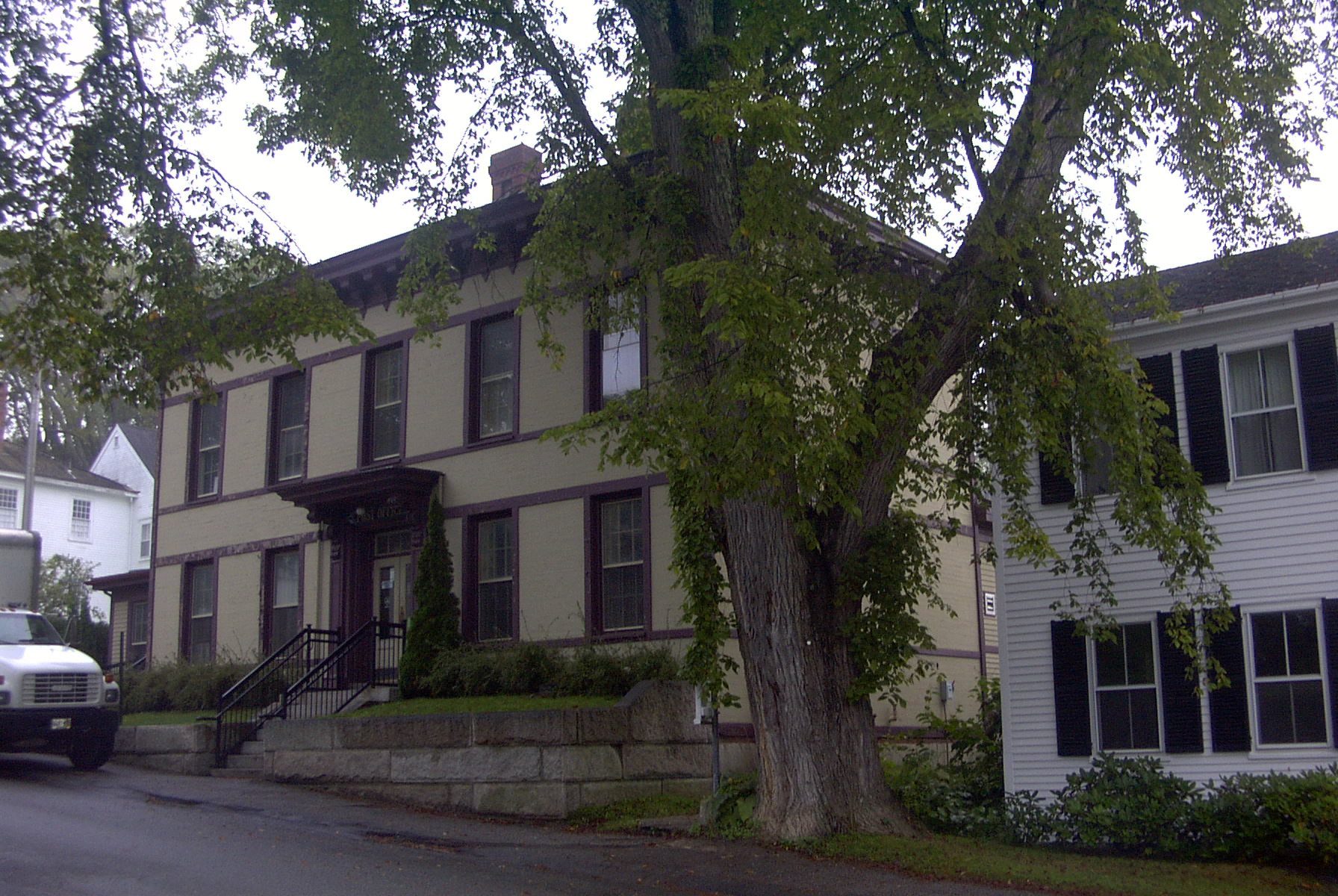
44°17′19″N 68°17′09″W / 44.288611°N 68.285833°WNortheast Harbor 92 Saint Saviour's Episcopal Church and Rectory June 20, 1995 41 Mt. Desert St.
44°23′14″N 68°12′23″W / 44.387222°N 68.206389°WBar Harbor 93 Schoodic Peninsula Historic District June 29, 2007 1.5 miles south of State Route 186 Winter Harbor 94 Sea Change August 7, 2009 27 Corning Way Northeast Harbor 95 Seal Harbor Congregational Church February 14, 1985 State Route 3
44°17′37″N 68°14′54″W / 44.293611°N 68.248333°WSeal Harbor 96 Seawall Campground June 29, 2007 State Route 233, Eagle Lake Rd. Bar Harbor 97 Sedgwick Historic District January 20, 1995 Junction of State Route 172 and Old County Rd.
44°18′58″N 68°36′35″W / 44.316111°N 68.609722°WSedgwick 98 Salome Sellers House January 27, 1983 South of Deer Isle on State Route 172
44°11′59″N 68°39′58″W / 44.199722°N 68.666111°WDeer Isle 99 Shore Acres April 14, 2000 791 Lamoine Beach Rd.
44°27′12″N 68°17′07″W / 44.453333°N 68.285278°WLamoine Beach 100 Eric E. Soderholtz Cottage June 18, 1992 Off the western side of State Route 186, 0.5 miles south of U.S Route 1
44°27′52″N 68°05′41″W / 44.464444°N 68.094722°WWest Gouldsboro 101 Somesville Historic District January 8, 1975 Somes Harbor and its environs
44°21′44″N 68°19′53″W / 44.362222°N 68.331389°WMount Desert 102 Sorrento Library June 20, 1995 Southern side of Waukeag Ave. 0.5 miles west of its junction with State Route 185
44°28′22″N 68°11′18″W / 44.472778°N 68.188333°WSorrento 103 Sproul's Cafe February 4, 1982 128 Main St.
44°23′20″N 68°12′14″W / 44.388889°N 68.203889°WBar Harbor 104 Stanwood Homestead June 19, 1973 1 mile south of Ellsworth on State Route 3
44°31′42″N 68°24′18″W / 44.528333°N 68.405°WEllsworth 105 Stone Barn Farm November 29, 2001 Junction of Crooked Rd. and Norway Dr.
44°25′03″N 68°18′06″W / 44.4175°N 68.301667°WSalsbury Cove 106 Stonington Opera House October 16, 1991 Northwestern corner of Main St. and Russ Hill Rd.
44°09′21″N 68°40′01″W / 44.155833°N 68.666944°WStonington 107 Surry Town Hall October 16, 2008 1217 Surry Rd.
44°29′50″N 68°29′29″W / 44.49719°N 68.49135°WSurry 108 Topside August 13, 1975 Northern bank of Walker Pond off State Route 176
44°20′38″N 68°41′39″W / 44.343889°N 68.694167°WBrooksville 109 The Turrets December 24, 1974 Eden St.
44°23′41″N 68°13′13″W / 44.394722°N 68.220278°WBar Harbor 110 Union Church of Northeast Harbor June 26, 1998 21 Summit Rd.
44°17′40″N 68°17′29″W / 44.294444°N 68.291389°WNortheast Harbor 111 US Post Office-Bar Harbor Main May 2, 1986 Cottage St.
44°23′16″N 68°13′14″W / 44.387778°N 68.220556°WBar Harbor 112 Von Mach Site (ME l5l/02) January 17, 1989 Address Restricted Brooksville 113 Waldo-Hancock Bridge 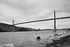
June 20, 1985 U.S. Route 1
44°33′37″N 68°48′08″W / 44.560278°N 68.802222°WVerona 114 West Brooksville Congregational Church June 20, 1995 Eastern side of State Route 176, 1 mile northwest of its junction with Varnum Rd.
44°23′42″N 68°45′28″W / 44.395°N 68.757778°WWest Brooksville 115 West Gouldsboro Union Church June 14, 1990 State Route 186 between Jones Cove and Jones Pond
44°27′55″N 68°05′41″W / 44.465278°N 68.094722°WWest Gouldsboro 116 West Gouldsboro Village Library October 23, 1991 Eastern side of State Route 186 between Jones Cove and Jones Pond
44°27′56″N 68°05′41″W / 44.465556°N 68.094722°WWest Gouldsboro 117 West Street Historic District May 6, 1980 West St. between Billings Ave. and Eden St.
44°23′28″N 68°12′41″W / 44.391111°N 68.211389°WBar Harbor 118 E. B. White House September 22, 1986 State Route 175
44°37′05″N 68°33′11″W / 44.618056°N 68.553056°WBrooklin 119 Samuel Kidder Whiting House July 14, 1983 214 Main St
44°32′37″N 68°25′18″W / 44.543611°N 68.421667°WEllsworth 120 Wilson Hall 
April 27, 1983 Franklin St.
44°34′31″N 68°47′51″W / 44.575278°N 68.7975°WBucksport 121 Winter Harbor Light Station 
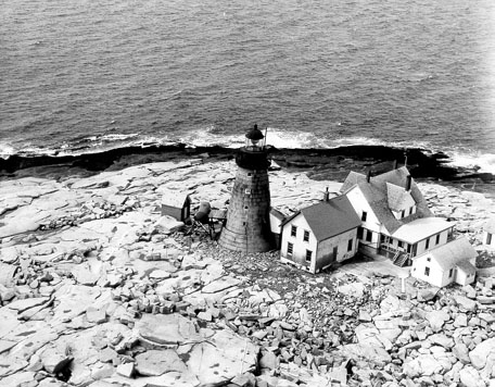
February 1, 1988 Mark Island, Winter Harbor
44°21′42″N 68°05′18″W / 44.361667°N 68.088333°WWinter Harbor Former listings
Landmark name Image Date removed Location City or Town Summary 1 Atlantic Schoolhouse April 27, 2010 Southern side of Town Rd.
44°10′16″N 68°24′45″W / 44.17111°N 68.4125°WAtlantic Listed on the NRHP January 19, 1996 See also
References
- ^ The latitude and longitude information provided in this table was derived originally from the National Register Information System, which has been found to be fairly accurate for about 99% of listings. For about 1% of NRIS original coordinates, experience has shown that one or both coordinates are typos or otherwise extremely far off; some corrections may have been made. A more subtle problem causes many locations to be off by up to 150 yards, depending on location in the country: most NRIS coordinates were derived from tracing out latitude and longitudes off of USGS topographical quadrant maps created under North American Datum of 1927, which differs from the current, highly accurate GPS system used by Google maps. Chicago is about right, but NRIS longitudes in Washington are higher by about 4.5 seconds, and are lower by about 2.0 seconds in Maine. Latitudes differ by about 1.0 second in Florida. Some locations in this table may have been corrected to current GPS standards.
- ^ "National Register of Historic Places: Weekly List Actions". National Park Service, United States Department of the Interior. Retrieved on November 10, 2011.
- ^ Numbers represent an ordering by significant words. Various colorings, defined here, differentiate National Historic Landmark sites and National Register of Historic Places Districts from other NRHP buildings, structures, sites or objects.
- ^ "National Register Information System". National Register of Historic Places. National Park Service. . http://nrhp.focus.nps.gov/natreg/docs/All_Data.html.
U.S. National Register of Historic Places Topics Lists by states Alabama • Alaska • Arizona • Arkansas • California • Colorado • Connecticut • Delaware • Florida • Georgia • Hawaii • Idaho • Illinois • Indiana • Iowa • Kansas • Kentucky • Louisiana • Maine • Maryland • Massachusetts • Michigan • Minnesota • Mississippi • Missouri • Montana • Nebraska • Nevada • New Hampshire • New Jersey • New Mexico • New York • North Carolina • North Dakota • Ohio • Oklahoma • Oregon • Pennsylvania • Rhode Island • South Carolina • South Dakota • Tennessee • Texas • Utah • Vermont • Virginia • Washington • West Virginia • Wisconsin • WyomingLists by territories Lists by associated states Other  Category:National Register of Historic Places •
  Portal:National Register of Historic Places
Municipalities and communities of Hancock County, Maine County seat: Ellsworth City 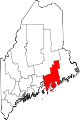
Towns Amherst | Aurora | Bar Harbor | Blue Hill | Brooklin | Brooksville | Bucksport | Castine | Cranberry Isles | Dedham | Deer Isle | Eastbrook | Franklin | Frenchboro | Gouldsboro | Great Pond | Hancock | Lamoine | Mariaville | Mount Desert | Orland | Osborn | Otis | Penobscot | Sedgwick | Sorrento | Southwest Harbor | Stonington | Sullivan | Surry | Swan's Island | Tremont | Trenton | Verona Island | Waltham | Winter Harbor
Unorganized
territoriesCDPs Other
villagesCategories:- National Register of Historic Places in Maine by county
- Hancock County, Maine
-


Wikimedia Foundation. 2010.