- National Register of Historic Places listings in Aroostook County, Maine
-
 Location of Aroostook County in Maine
This is a list of the National Register of Historic Places listings in Aroostook County, Maine.
This is intended to be a complete list of the properties and districts on the National Register of Historic Places in Aroostook County, Maine, United States. Latitude and longitude coordinates are provided for many National Register properties and districts; these locations may be seen together in a Google map.[1]
There are 59 properties and districts listed on the National Register in the county, including 1 National Historic Landmark.
-
- This National Park Service list is complete through NPS recent listings posted November 10, 2011.[2]
Contents: Counties in Maine Androscoggin - Aroostook - Cumberland - Franklin - Hancock - Kennebec - Knox - Lincoln - Oxford - Penobscot - Piscataquis - Sagadahoc - Somerset - Waldo - Washington - York Current listings
[3] Landmark name [4] Image Date listed Location City or town Summary 1 Acadian Historic Buildings December 13, 1977 North of Van Buren on U.S. Route 1
47°12′17″N 67°59′26″W / 47.204722°N 67.990556°WVan Buren 2 Acadian Landing Site September 20, 1973 East of Madawaska on the St. John River off U.S. Route 1
47°15′N 68°15′W / 47.25°N 68.25°WMadawaska 3 Amazeen House September 11, 1986 15 Weeks St.
46°07′08″N 67°50′17″W / 46.118889°N 67.838056°WHoulton 4 Anderson Bros. Store January 11, 2001 280 Main St.
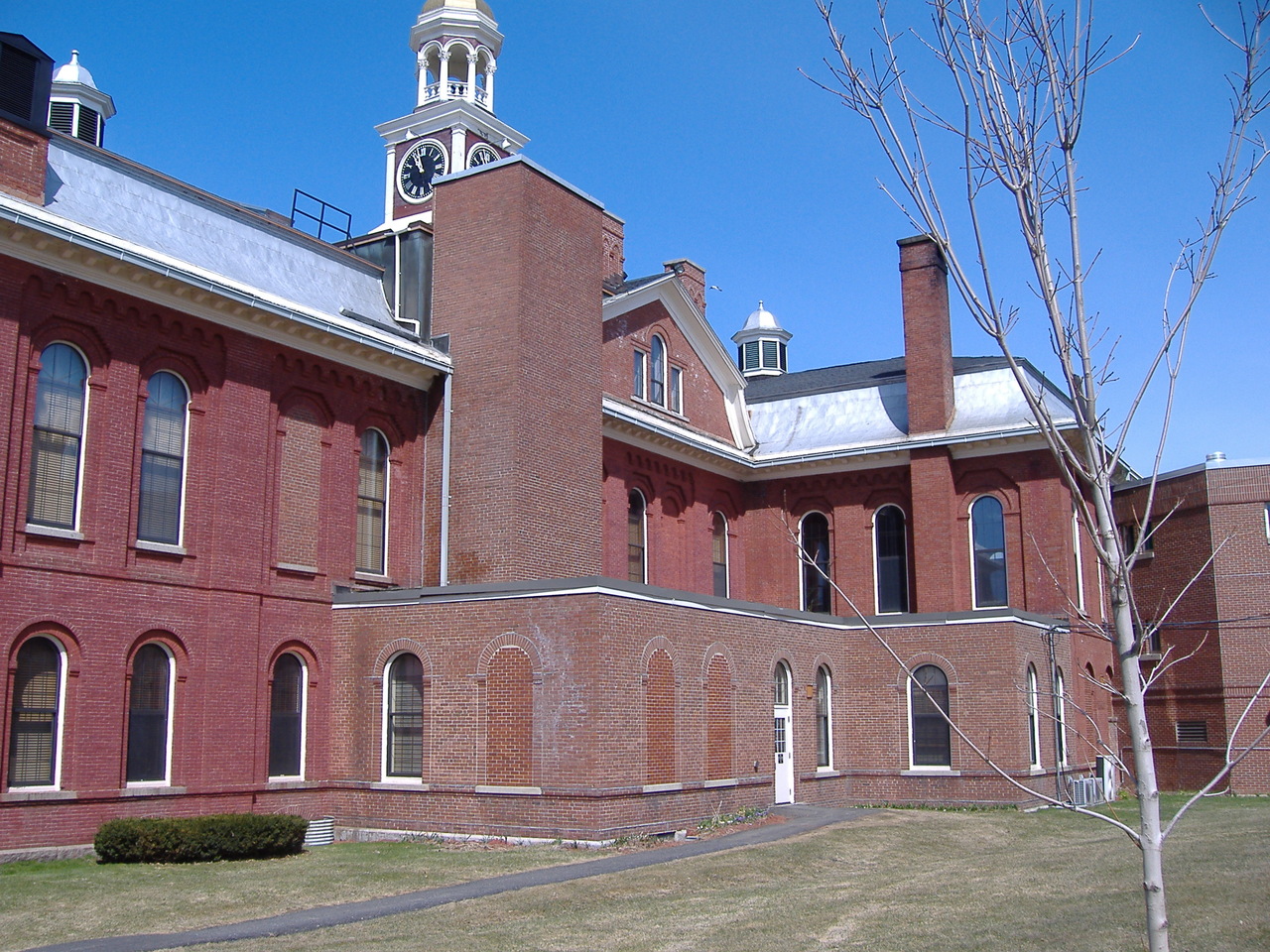
47°02′20″N 68°08′28″W / 47.038889°N 68.141111°WStockholm 5 Aroostook County Courthouse and Jail 
January 26, 1990 Court St.
46°07′29″N 67°50′23″W / 46.124722°N 67.839722°WHoulton 6 Big Black Site September 9, 1975 Address Restricted Eagle Lake 7 Bridgewater Town Hall and Jail January 26, 1990 U.S. Route 1
46°14′45″N 67°50′50″W / 46.245833°N 67.847222°WBridgewater 8 Cary Library June 25, 1987 107 Main St.
46°07′31″N 67°50′17″W / 46.125278°N 67.838056°WHoulton 9 Church of the Advent June 21, 1991 Church St., 1 block south of its junction with State Route 229
46°54′38″N 67°49′30″W / 46.910556°N 67.825°WLimestone 10 Nicholas P. Clase House October 16, 1989 Capitol Hill Rd.
46°56′30″N 68°07′22″W / 46.941667°N 68.122778°WNew Sweden 11 Edward L. Cleveland House June 12, 1987 87 Court St.
46°07′02″N 67°50′28″W / 46.117222°N 67.841111°WHoulton 12 Corriveau Mill October 28, 1994 Southern side of U.S. Route 1, 0.3 miles southwest of its junction with Paridis Rd.
47°16′53″N 68°24′47″W / 47.281389°N 68.413056°WUpper Frenchville 13 Donovan-Hussey Farms Historic District February 13, 2009 546 and 535 Ludlow Rd.
46°08′55″N 67°56′08″W / 46.148506°N 67.93551°WHoulton 14 Beecher H. Duncan Farm February 11, 2009 26 Shorey Rd.
46°34′07″N 67°56′56″W / 46.568644°N 67.948894°WWestfield 15 Elmbrook Farm Barn January 10, 1986 Parson's Rd.
46°42′26″N 68°01′23″W / 46.707222°N 68.023056°WPresque Isle 16 The Elms July 22, 2009 59 Court St.
46°07′18″N 67°50′24″W / 46.121567°N 67.839878°WHoulton 17 First National Bank of Houlton September 20, 1973 Market Sq.
46°07′25″N 67°50′42″W / 46.123611°N 67.845°WHoulton 18 Fort Fairfield Public Library January 5, 1989 Main St.
46°46′20″N 67°50′04″W / 46.772222°N 67.834444°WFort Fairfield 19 Fort Kent 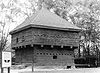
December 1, 1969 About 0.75 miles southwest of Fort Kent off State Route 11
47°15′09″N 68°35′27″W / 47.2525°N 68.590833°WFort Kent 20 Fort Kent Railroad Station April 21, 1989 Junction of Main and Market Sts.
47°15′27″N 68°35′23″W / 47.2575°N 68.589722°WFort Kent 21 Frenchville Railroad Station and Water Tank June 20, 1995 308 U.S. Route 1
47°16′47″N 68°23′20″W / 47.279722°N 68.388889°WFrenchville 22 Governor Brann School December 23, 1993 Eastern side of U.S. Route 1, 1.25 miles south of its junction with Madore Rd.
47°07′08″N 67°57′48″W / 47.118889°N 67.963333°WVan Buren 23 Gray Memorial United Methodist Church and Parsonage June 20, 1995 8 Prospect St.
46°51′37″N 68°01′02″W / 46.860278°N 68.017222°WCaribou 24 Gustaf Adolph Lutheran Church June 20, 1997 Eastern side of Capitol Hill Rd., 0.5 miles north of its junction with State Route 161
46°56′19″N 68°07′14″W / 46.938611°N 68.120556°WNew Sweden 25 Island Falls Opera House July 19, 1984 Patten Rd. and Sewall St.
46°00′31″N 68°16′13″W / 46.008611°N 68.270278°WIsland Falls 26 Pehr J. Jacobson House February 7, 2007 452 New Sweden Rd.
46°57′14″N 68°08′31″W / 46.953889°N 68.141944°WNew Sweden 27 Lagassey Farm January 21, 2009 786 Main St.
47°14′36″N 68°19′03″W / 47.24328°N 68.3175°WSt. Agatha 28 Larsson-Noak Historic District July 26, 1989 Station Rd. northeast of New Sweden
46°56′48″N 68°06′15″W / 46.946667°N 68.104167°WNew Sweden 29 A. B. Leavitt House June 20, 1986 State Route 158
45°52′22″N 68°23′21″W / 45.872778°N 68.389167°WSherman 30 Walter P. Mansur House February 9, 1990 10 Water St.
46°07′35″N 67°50′26″W / 46.126389°N 67.840556°WHoulton 31 Maple Grove Friends Church July 5, 2000 Western side of U.S. Route 1A, 0.25 miles north of its junction with Upcountry (Fairmount Rd.)
46°42′21″N 67°52′13″W / 46.705833°N 67.870278°WMaple Grove 32 Market Square Historic District June 22, 1980 Market Sq. and Main, Water, and Court Sts.
46°07′34″N 67°50′24″W / 46.126111°N 67.84°WHoulton 33 Isaie and Scholastique Martin House December 23, 2009 137 Saint Catherine St.
47°21′17″N 68°20′17″W / 47.354811°N 68.337928°WMadawaska 34 McElwain House April 12, 1982 2 Main St.
46°49′57″N 68°00′40″W / 46.8325°N 68.011111°WCaribou 35 Fortunat O. Michaud House January 26, 1990 231 Main St.
47°09′28″N 67°56′16″W / 47.157778°N 67.937778°WVan Buren 36 Monticello Grange No. 338 July 5, 2000 Main St., 0.7 miles south of its junction with Muckatee Rd.
46°18′26″N 67°50′29″W / 46.307222°N 67.841389°WMonticello 37 Oakfield Grange No. 414 October 4, 2006 89 Ridge Rd.
46°05′54″N 68°09′05″W / 46.098333°N 68.151389°WOakfield 38 Oakfield Station June 25, 1987 Station St.
46°05′52″N 68°09′21″W / 46.097778°N 68.155833°WOakfield 39 Anders and Johanna Olsson Farm March 7, 1996 114 West-Lebanon Rd.
46°58′16″N 68°10′26″W / 46.971111°N 68.173889°WNew Sweden 40 Our Lady of Mount Carmel Catholic Church October 15, 1973 U.S. Route 1
47°16′45″N 68°06′29″W / 47.279167°N 68.108056°WGrand Isle 41 Presque Isle National Bank July 31, 1986 422 Main St.
46°40′49″N 68°00′56″W / 46.680278°N 68.015556°WPresque Isle 42 Blackhawk Putnam Tavern January 30, 1976 22 North St.
46°07′43″N 67°50′37″W / 46.128611°N 67.843611°WHoulton 43 Reed School November 29, 2001 U.S. Route 1, 0.1 miles south of its junction with Lycette Rd.
45°56′26″N 67°49′49″W / 45.940556°N 67.830278°WNorth Amity 44 Philo Reed House April 4, 1986 38 Main St.
46°46′03″N 67°49′12″W / 46.7675°N 67.82°WFort Fairfield 45 Roosevelt School June 27, 2007 Eastern side of U.S. Route 1A
47°07′08″N 67°53′35″W / 47.118889°N 67.893056°WHamlin 46 Roosevelt School December 17, 1992 Southern side of State Route 161 0.1 miles east of private road 861
47°12′31″N 68°48′19″W / 47.208611°N 68.805278°WSt. John Plantation 47 St. David Catholic Church October 2, 1973 East of Madawaska on U.S. Route 1
47°20′57″N 68°16′39″W / 47.349167°N 68.2775°WMadawaska 48 St. John Catholic School February 12, 2003 St. John Rd.
47°12′19″N 68°49′08″W / 47.205278°N 68.818889°WSt. John Plantation 49 William Sewall House April 12, 1982 Main St.
46°00′30″N 68°16′11″W / 46.008333°N 68.269722°WIsland Falls 50 Smith Bridge 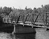
April 2, 1993 Lowery Rd. at its junction with Foxcroft Rd., across the Meduxnekeag River
46°10′52″N 67°48′16″W / 46.181111°N 67.804444°WHoulton 51 John J. and Martha Sodergren Homestead January 4, 2007 161 S. Shore Rd.
47°02′11″N 68°10′34″W / 47.036389°N 68.176111°WStockholm 52 Sunset Lodge November 10, 1994 0.5 miles south of State Route 161, on the eastern shore of Madawaska Lake
47°01′52″N 68°11′36″W / 47.031111°N 68.193333°WStockholm 53 Timmerhuset August 23, 1973 Jemtland Rd.
46°57′10″N 68°08′43″W / 46.952778°N 68.145278°WNew Sweden 54 Unitarian Church of Houlton June 25, 1987 Military St.
46°07′27″N 67°50′15″W / 46.124167°N 67.8375°WHoulton 55 US Post Office-Presque Isle Main May 9, 1986 23 2nd St.
46°40′53″N 68°01′07″W / 46.681389°N 68.018611°WPresque Isle 56 Violette House May 17, 1976 464 Main St.
47°09′58″N 67°56′35″W / 47.166111°N 67.943056°WVan Buren 57 Watson Settlement Bridge February 16, 1970 2 miles southeast of Littleton over the Meduxnekeag River
46°12′36″N 67°48′03″W / 46.21°N 67.800833°WLittleton 58 White Memorial Building January 15, 1980 109 Main St.
46°07′33″N 67°50′17″W / 46.125833°N 67.838056°WHoulton 59 Benjamin C. Wilder House June 12, 1987 Main St.
46°47′20″N 68°09′23″W / 46.788889°N 68.156389°WWashburn See also
References
- ^ The latitude and longitude information provided in this table was derived originally from the National Register Information System, which has been found to be fairly accurate for about 99% of listings. For about 1% of NRIS original coordinates, experience has shown that one or both coordinates are typos or otherwise extremely far off; some corrections may have been made. A more subtle problem causes many locations to be off by up to 150 yards, depending on location in the country: most NRIS coordinates were derived from tracing out latitude and longitudes off of USGS topographical quadrant maps created under the North American Datum of 1927, which differs from the current, highly accurate WGS84 GPS system used by Google maps. Chicago is about right, but NRIS longitudes in Washington are higher by about 4.5 seconds, and are lower by about 2.0 seconds in Maine. Latitudes differ by about 1.0 second in Florida. Some locations in this table may have been corrected to current GPS standards.
- ^ "National Register of Historic Places: Weekly List Actions". National Park Service, United States Department of the Interior. Retrieved on November 10, 2011.
- ^ Numbers represent an ordering by significant words. Various colorings, defined here, differentiate National Historic Landmark sites and National Register of Historic Places Districts from other NRHP buildings, structures, sites or objects.
- ^ "National Register Information System". National Register of Historic Places. National Park Service. . http://nrhp.focus.nps.gov/natreg/docs/All_Data.html.
U.S. National Register of Historic Places Topics Lists by states Alabama • Alaska • Arizona • Arkansas • California • Colorado • Connecticut • Delaware • Florida • Georgia • Hawaii • Idaho • Illinois • Indiana • Iowa • Kansas • Kentucky • Louisiana • Maine • Maryland • Massachusetts • Michigan • Minnesota • Mississippi • Missouri • Montana • Nebraska • Nevada • New Hampshire • New Jersey • New Mexico • New York • North Carolina • North Dakota • Ohio • Oklahoma • Oregon • Pennsylvania • Rhode Island • South Carolina • South Dakota • Tennessee • Texas • Utah • Vermont • Virginia • Washington • West Virginia • Wisconsin • WyomingLists by territories Lists by associated states Other Municipalities and communities of Aroostook County, Maine Cities 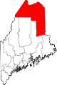
Towns Allagash | Amity | Ashland | Bancroft | Blaine | Bridgewater | Castle Hill | Caswell | Chapman | Crystal | Dyer Brook | Eagle Lake | Easton | Fort Fairfield | Fort Kent | Frenchville | Grand Isle | Hamlin | Hammond | Haynesville | Hersey | Hodgdon | Houlton | Island Falls | Limestone | Linneus | Littleton | Ludlow | Madawaska | Mapleton | Mars Hill | Masardis | Merrill | Monticello | New Canada | New Limerick | New Sweden | Oakfield | Orient | Perham | Portage Lake | St. Agatha | St. Francis | Sherman | Smyrna | Stockholm | Van Buren | Wade | Wallagrass | Washburn | Westfield | Westmanland | Weston | Woodland
Plantations Unorganized
territoriesCDPs Fort Fairfield | Fort Kent | Houlton | Limestone | Loring AFB | Madawaska | Mars Hill-Blaine | Van Buren
Other
villagesCrouseville | Estcourt Station | Wytopitlock
Categories:- National Register of Historic Places in Maine by county
- Aroostook County, Maine
-


Wikimedia Foundation. 2010.