- Ludlow, Maine
Infobox Settlement
official_name = Ludlow, Maine
settlement_type = Town
nickname =
motto =
imagesize =
image_caption =
image_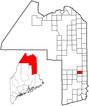
mapsize =
map_caption = Location of Ludlow, Maine
mapsize1 =
map_caption1 =subdivision_type = Country
subdivision_name =United States
subdivision_type1 = State
subdivision_name1 =Maine
subdivision_type2 = County
subdivision_name2 = Aroostook
government_footnotes =
government_type =
leader_title =
leader_name =
leader_title1 =
leader_name1 =
established_title =
established_date =unit_pref = Imperial
area_footnotes =area_magnitude =
area_total_km2 = 56.9
area_land_km2 = 56.9
area_water_km2 = 0.0
area_total_sq_mi = 22.0
area_land_sq_mi = 22.0
area_water_sq_mi = 0.0population_as_of = 2000
population_footnotes =
population_total = 402
population_density_km2 = 7.1
population_density_sq_mi = 18.3timezone = Eastern (EST)
utc_offset = -5
timezone_DST = EDT
utc_offset_DST = -4
elevation_footnotes =
elevation_m = 253
elevation_ft = 830
latd = 46 |latm = 8 |lats = 28 |latNS = N
longd = 67 |longm = 58 |longs = 19 |longEW = Wpostal_code_type =
postal_code =
area_code = 207
blank_name = FIPS code
blank_info = 23-41715
blank1_name = GNIS feature ID
blank1_info = 0582571
website =
footnotes =Ludlow is a town in Aroostook County,
Maine ,United States . The population was 402 at the 2000 census.Geography
According to the
United States Census Bureau , the town has a total area of 22.0square mile s (56.9km² ), of which, 22.0 square miles (56.9 km²) of it is land and 0.05% is water. The northernmost point on Interstate 95 is just before the southbound Exit 291 within the town (the point is roughly fourteen miles from the highway's "northern" terminus).Demographics
As of the
census GR|2 of 2000, there were 402 people, 150 households, and 118 families residing in the town. Thepopulation density was 18.3 people per square mile (7.1/km²). There were 203 housing units at an average density of 9.2/sq mi (3.6/km²). The racial makeup of the town was 98.01% White, 0.75% Native American, and 1.24% from two or more races. Hispanic or Latino of any race were 0.75% of the population.There were 150 households out of which 34.7% had children under the age of 18 living with them, 64.0% were married couples living together, 10.7% had a female householder with no husband present, and 20.7% were non-families. 14.7% of all households were made up of individuals and 8.0% had someone living alone who was 65 years of age or older. The average household size was 2.68 and the average family size was 2.94.
In the town the population was spread out with 23.9% under the age of 18, 5.0% from 18 to 24, 30.6% from 25 to 44, 27.4% from 45 to 64, and 13.2% who were 65 years of age or older. The median age was 40 years. For every 100 females there were 104.1 males. For every 100 females age 18 and over, there were 100.0 males.
The median income for a household in the town was $23,594, and the median income for a family was $25,750. Males had a median income of $21,625 versus $17,708 for females. The
per capita income for the town was $12,130. About 21.0% of families and 21.9% of the population were below thepoverty line , including 36.0% of those under age 18 and 8.9% of those age 65 or over.Ludlow, Maine in Fiction
A fictional town of Ludlow, Maine is also the setting of the novels and films
Pet Sematary , andThe Dark Half byStephen King . This fictional town is in the central area of the state, near the fictional cities ofDerry andCastle Rock and adjacent to the real life city of Bangor.References
Wikimedia Foundation. 2010.