- Mars Hill, Maine
-
Mars Hill — Town — Mars Hill Mountain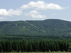 Location of Mars Hill, Maine
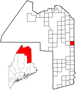
Coordinates: 46°33′35″N 67°51′07″W / 46.55972°N 67.85194°WCoordinates: 46°33′35″N 67°51′07″W / 46.55972°N 67.85194°W Country United States State Maine County Aroostook Incorporated 1867 Area – Total 35.2 sq mi (91.1 km2) – Land 35.1 sq mi (91.0 km2) – Water 0.1 sq mi (0.2 km2) Elevation 607 ft (185 m) Population (2000) – Total 1,480 – Density 109.3/sq mi (42.2/km2) Time zone Eastern (UTC-5) – Summer (DST) Eastern (UTC-4) ZIP code 04758 Area code(s) 207 FIPS code 23-43710 GNIS feature ID 0582582 Website [1] Mars Hill is a town in Aroostook County, Maine, United States. The population was 1,480 at the 2000 census.
Contents
History
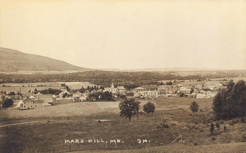
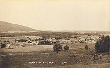 Town view c. 1915
The town is named for Hezekiah Mars, who camped for three years at the base of Mars Hill Mountain. In 1834, the first industry was cutting timber, particularly trees for masts. Following the Aroostook War, farming became important. [1] The Bangor and Aroostook Railroad arrived in 1892, allowing shipment to distant markets of local produce -- especially potatoes. [2] In the 1960s, Big Rock Ski Area was founded on Mars Hill Mountain. In 2006, Maine's first wind farm was installed along the top and northern side. [3]
Geography
According to the United States Census Bureau, the town has a total area of 35.2 square miles (91 km2), of which, 35.1 square miles (91 km2) of it is land and 0.1 square miles (0.26 km2) of it (0.20%) is water. Mars Hill is split partly in half by the Prestile Stream, which runs directly between Fort Street and Silver Street, and then crosses beneath the Fort Street Bridge. After passing the bridge, it flows between Pleasant Street and U.S. 1.
Demographics
As of the census[4] of 2000, there were 1,480 people, 614 households, and 413 families residing in the town. The population density was 42.1 people per square mile (16.3/km²). There were 708 housing units at an average density of 20.2 per square mile (7.8/km²). The racial makeup of the town was 97.50% White, 0.14% African American, 1.49% Native American, 0.20% Asian, 0.20% from other races, and 0.47% from two or more races. Hispanic or Latino of any race were 0.41% of the population.
There were 614 households out of which 26.9% had children under the age of 18 living with them, 55.0% were married couples living together, 8.1% had a female householder with no husband present, and 32.6% were non-families. 30.0% of all households were made up of individuals and 18.1% had someone living alone who was 65 years of age or older. The average household size was 2.35 and the average family size was 2.87.
In the town the population was spread out with 23.0% under the age of 18, 7.9% from 18 to 24, 25.1% from 25 to 44, 20.7% from 45 to 64, and 23.4% who were 65 years of age or older. The median age was 41 years. For every 100 females there were 89.7 males. For every 100 females age 18 and over, there were 84.2 males.
The median income for a household in the town was $24,083, and the median income for a family was $33,333. Males had a median income of $27,054 versus $19,500 for females. The per capita income for the town was $13,630. About 13.4% of families and 16.6% of the population were below the poverty line, including 19.3% of those under age 18 and 19.9% of those age 65 or over.
Downtown
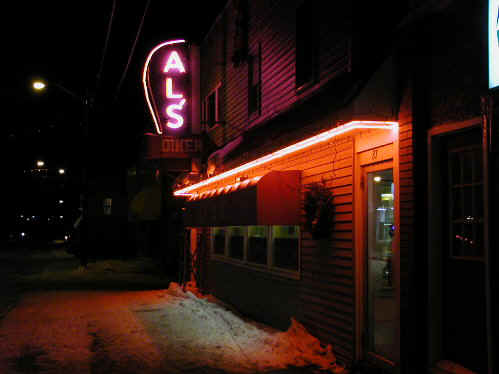
The bulk of Mars Hill's downtown area is on Main Street, also referred to as U.S. 1. On Main Street, you can find gas stations such as Mobil and Exxon, as well as a local IGA supermarket, insurance agencies, realtors, a barbershop, the Midtown Motel, Al's Diner, and the local bank, Katahdin Trust Company.
-
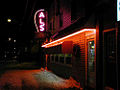
Al's Diner on Main Street.
Main street has two lanes for traffic, angle parking on either side of the street, and sidewalks for pedestrians and cyclists. As you come into Mars Hill from twin town Blaine to the south, the name changes from Military Road to Main Street, and as you continue north across the Fort Street Bridge, the street becomes Fort Street. There is a major intersection of Main Street and Benjamin Street in Mars Hill. Heading north, U.S. 1 turns left from Main to Benjamin Street and continues north. There is a park close to downtown on Park Street, with a picnic area and baseball diamond. There is a retirement community on York Street. A branch of the Aroostook Medical Center, the Aroostook Health Center Long Term Care Nursing Home, (AHC-LTC) is also close to downtown on Highland Avenue.
Uptown
Uptown is what the locals call the Silver Street/Benjamin Street/Presque Isle Road area on the west side of the Prestile Stream, and the Pleasant Street/Fort Street/Scovil Street area on the east side. The west side carries the ITS-83 snowmobile trail, which the locals call "the tracks." It is a popular path of travel year round, even among people travelling on foot because it runs parallel to Benjamin Street, crosses Silver Street, and then runs directly in between Benjamin and Silver Streets. Then, it comes out behind the Mobil OneStop gas station 1/4 mile away. It proceeds straight through the downtown and continues south until you leave town. Also on the west side is the Mountain View Apartment complex. On the east side is the Scovil's Apartment complex, the two schools for the area, Central Aroostook Jr/Sr High School and Fort Street Elementary School, and the local redemption center.
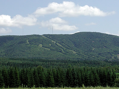
Mars Hill Mountain
Mars Hill Mountain plays an important role in the Mars Hill community. It provides not only a dramatic backdrop for photographs, but also magnificent views from atop its peak. It overlooks the Saint John Valley, in which Mars Hill is located. Mount Katahdin is visible from the top of Mars Hill Mountain over 85 miles (137 km) away.
Mars Hill Mountain underwent a wind power project in the fall of 2006. Developers installed 28 GE 1.5 MW Wind Turbines along the top and northern section of the mountain, which overlooks Canada. The windmills are assembled in multiple parts. The towers, which are composed of three support sections stacked one on top of another with a combined weight of 20,000 pounds, are 80 meters (262 feet) tall. Each of the turbine's three blades (together, a rotor) are approximately 37.5 meters (123 feet), for a total rotor diameter of approximately 75 meters (246 feet). Rotor diameters are comparable to the wingspan of a Boeing 747 jet-liner.
Mars Hill Mountain also features a ski resort called Big Rock Ski Area.
See also
References
- ^ Varney, George J. (1886), Gazetteer of the state of Maine. Mars Hill, Boston: Russell, http://history.rays-place.com/me/aroostook-4b.htm
- ^ History of Mars Hill, Maine
- ^ Mars Hill Wind Farm
- ^ "American FactFinder". United States Census Bureau. http://factfinder.census.gov. Retrieved 2008-01-31.
External links
Municipalities and communities of Aroostook County, Maine Cities 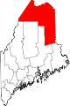
Towns Allagash | Amity | Ashland | Bancroft | Blaine | Bridgewater | Castle Hill | Caswell | Chapman | Crystal | Dyer Brook | Eagle Lake | Easton | Fort Fairfield | Fort Kent | Frenchville | Grand Isle | Hamlin | Hammond | Haynesville | Hersey | Hodgdon | Houlton | Island Falls | Limestone | Linneus | Littleton | Ludlow | Madawaska | Mapleton | Mars Hill | Masardis | Merrill | Monticello | New Canada | New Limerick | New Sweden | Oakfield | Orient | Perham | Portage Lake | St. Agatha | St. Francis | Sherman | Smyrna | Stockholm | Van Buren | Wade | Wallagrass | Washburn | Westfield | Westmanland | Weston | Woodland
Plantations Unorganized
territoriesCDPs Fort Fairfield | Fort Kent | Houlton | Limestone | Loring AFB | Madawaska | Mars Hill-Blaine | Van Buren
Other
villagesCrouseville | Estcourt Station | Wytopitlock
Categories:- Towns in Aroostook County, Maine
-


Wikimedia Foundation. 2010.