- Ashland, Maine
Infobox Settlement
official_name = Ashland, Maine
settlement_type = Town
nickname =
motto =
imagesize =
image_caption =
image_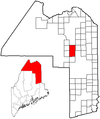
mapsize =
map_caption = Location of Ashland, Maine
mapsize1 =
map_caption1 =subdivision_type = Country
subdivision_name =United States
subdivision_type1 = State
subdivision_name1 =Maine
subdivision_type2 = County
subdivision_name2 = Aroostook
government_footnotes =
government_type =
leader_title =
leader_name =
leader_title1 =
leader_name1 =
established_title =
established_date =unit_pref = Imperial
area_footnotes =area_magnitude =
area_total_km2 = 211.7
area_land_km2 = 208.7
area_water_km2 = 2.9
area_total_sq_mi = 81.7
area_land_sq_mi = 80.6
area_water_sq_mi = 1.1population_as_of = 2000
population_footnotes =
population_total = 1474
population_density_km2 = 7.1
population_density_sq_mi = 18.3timezone = Eastern (EST)
utc_offset = -5
timezone_DST = EDT
utc_offset_DST = -4
elevation_footnotes =
elevation_m = 220
elevation_ft = 722
latd = 46 |latm = 37 |lats = 40 |latNS = N
longd = 68 |longm = 23 |longs = 23 |longEW = Wpostal_code_type =
ZIP code s
postal_code = 04732, 04737, 04759
area_code = 207
blank_name = FIPS code
blank_info = 23-01710
blank1_name = GNIS feature ID
blank1_info = 0582331
website =
footnotes =Ashland is a town in Aroostook County,
Maine ,United States . The population was 1,474 at the 2000 census.Geography
According to the
United States Census Bureau , the town has a total area of 81.7square mile s (211.7km² ), of which, 80.6 square miles (208.7 km²) of it is land and 1.1 square miles (3.0 km²) of it (1.39%) is water.Demographics
As of the
census GR|2 of 2000, there were 1,474 people, 629 households, and 398 families residing in the town. Thepopulation density was 18.3 people per square mile (7.1/km²). There were 760 housing units at an average density of 9.4/sq mi (3.6/km²). The racial makeup of the town was 98.78% White, 0.88% Native American, 0.20% Asian, and 0.14% from two or more races. Hispanic or Latino of any race were 0.07% of the population.There were 629 households out of which 27.5% had children under the age of 18 living with them, 54.2% were married couples living together, 5.4% had a female householder with no husband present, and 36.6% were non-families. 30.0% of all households were made up of individuals and 13.2% had someone living alone who was 65 years of age or older. The average household size was 2.34 and the average family size was 2.90.
In the town the population was spread out with 23.7% under the age of 18, 6.0% from 18 to 24, 29.1% from 25 to 44, 25.6% from 45 to 64, and 15.6% who were 65 years of age or older. The median age was 40 years. For every 100 females there were 104.4 males. For every 100 females age 18 and over, there were 101.3 males.
The median income for a household in the town was $33,472, and the median income for a family was $40,185. Males had a median income of $32,768 versus $21,027 for females. The
per capita income for the town was $15,328. About 6.1% of families and 9.7% of the population were below thepoverty line , including 7.4% of those under age 18 and 15.2% of those age 65 or over.Education
The town is served by
Ashland Community High School .References
External links
* [http://www.townofashland.com/ Town of Ashland]
* [http://www.sad32.org/ Official website for MSAD #32 in Ashland]
Wikimedia Foundation. 2010.