- Frenchville, Maine
Infobox Settlement
official_name = Frenchville, Maine
settlement_type = Town
nickname =
motto =
imagesize =
image_caption =
image_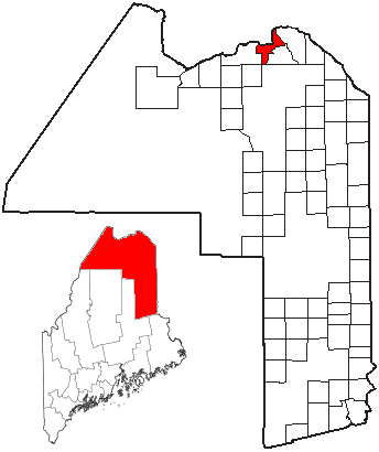
mapsize =
map_caption = Location of Frenchville, Maine
mapsize1 =
map_caption1 =subdivision_type = Country
subdivision_name =United States
subdivision_type1 = State
subdivision_name1 =Maine
subdivision_type2 = County
subdivision_name2 = Aroostook
government_footnotes =
government_type =
leader_title =
leader_name =
leader_title1 =
leader_name1 =
established_title =
established_date =unit_pref = Imperial
area_footnotes =area_magnitude =
area_total_km2 = 75.7
area_land_km2 = 74.0
area_water_km2 = 1.7
area_total_sq_mi = 29.2
area_land_sq_mi = 28.6
area_water_sq_mi = 0.6population_as_of = 2000
population_footnotes =
population_total = 1225
population_density_km2 = 16.6
population_density_sq_mi = 42.9timezone = Eastern (EST)
utc_offset = -5
timezone_DST = EDT
utc_offset_DST = -4
elevation_footnotes =
elevation_m = 193
elevation_ft = 633
latd = 47 |latm = 17 |lats = 7 |latNS = N
longd = 68 |longm = 23 |longs = 14 |longEW = Wpostal_code_type =
ZIP code
postal_code = 04745
area_code = 207
blank_name = FIPS code
blank_info = 23-26735
blank1_name = GNIS feature ID
blank1_info = 0582483
website =
footnotes =Frenchville is a
Francophone town in Aroostook County,Maine ,United States . The population was 1,225 at the 2000 census: 80 per cent are habitual speakers of French, aided by its proximity to French-speakingQuébec andNew Brunswick inCanada .The town is home to the
general aviation airportNorthern Aroostook Regional Airport .Geography
According to the
United States Census Bureau , the town has a total area of 29.2square mile s (75.7km² ), of which, 28.6 square miles (74.0 km²) of it is land and 0.6 square miles (1.7 km²) of it (2.19%) is water. The town lies on the south bank of theSaint John River , which forms theinternational boundary betweenMaine andNew Brunswick ,Canada .Demographics
As of the
census GR|2 of 2000, there were 1,225 people, 478 households, and 356 families residing in the town. Thepopulation density was 42.9 people per square mile (16.6/km²). There were 512 housing units at an average density of 17.9/sq mi (6.9/km²). The racial makeup of the town was 99.27% White, 0.08% African American, 0.24% Native American, 0.16% Asian, 0.08% from other races, and 0.16% from two or more races. Hispanic or Latino of any race were 0.41% of the population.There were 478 households out of which 32.4% had children under the age of 18 living with them, 66.7% were married couples living together, 4.8% had a female householder with no husband present, and 25.5% were non-families. 23.0% of all households were made up of individuals and 9.0% had someone living alone who was 65 years of age or older. The average household size was 2.48 and the average family size was 2.92.
In the town the population was spread out with 23.8% under the age of 18, 5.1% from 18 to 24, 28.5% from 25 to 44, 26.4% from 45 to 64, and 16.2% who were 65 years of age or older. The median age was 41 years. For every 100 females there were 95.1 males. For every 100 females age 18 and over, there were 97.3 males.
The median income for a household in the town was $33,214, and the median income for a family was $39,643. Males had a median income of $39,423 versus $20,625 for females. The
per capita income for the town was $17,127. About 7.9% of families and 9.8% of the population were below thepoverty line , including 11.3% of those under age 18 and 12.4% of those age 65 or over.References
External links
* [http://www.aroostook.me.us/frenchville/index.html Town of Frenchville]
Wikimedia Foundation. 2010.