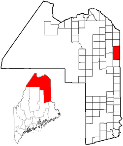
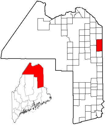
- Fort Fairfield, Maine
-
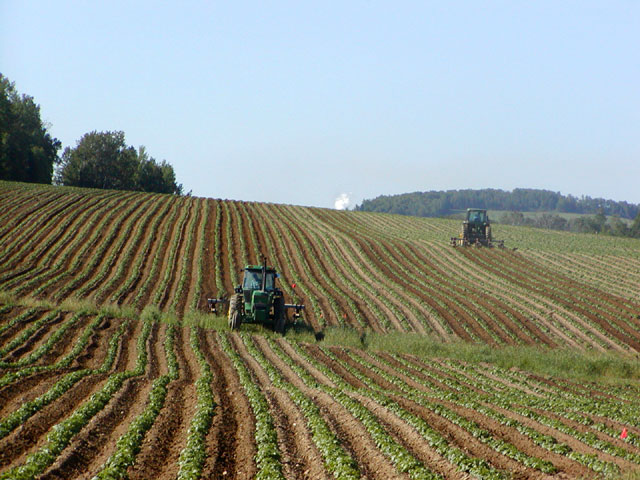
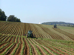 Potato field in Fort Fairfield
Fort Fairfield is a town in Aroostook County, Maine, United States. The population was 3,496 at the 2010 census.
Contents
Geography
According to the United States Census Bureau, the town has a total area of 78.4 square miles (203.0 km²), of which, 76.6 square miles (198.5 km²) of it is land and 1.7 square miles (4.5 km²) of it (2.21%) is water.
Demographics
See also: Fort Fairfield (CDP), MaineAs of the census[1] of 2000, there were 3,579 people, 1,523 households, and 1,015 families residing in the town. The population density was 46.7 people per square mile (18.0/km²). There were 1,654 housing units at an average density of 21.6 per square mile (8.3/km²). The racial makeup of the town was 98.35% White, 0.20% Black or African American, 0.45% Native American, 0.03% Asian, 0.03% Pacific Islander, 0.20% from other races, and 0.75% from two or more races. Hispanic or Latino of any race were 0.75% of the population.
There were 1,523 households out of which 27.7% had children under the age of 18 living with them, 52.9% were married couples living together, 10.2% had a female householder with no husband present, and 33.3% were non-families. 29.0% of all households were made up of individuals and 14.8% had someone living alone who was 65 years of age or older. The average household size was 2.35 and the average family size was 2.86.
In the town, the population was spread out with 23.4% under the age of 18, 6.8% from 18 to 24, 25.5% from 25 to 44, 27.2% from 45 to 64, and 17.0% who were 65 years of age or older. The median age was 41 years. For every 100 females there were 88.3 males. For every 100 females age 18 and over, there were 86.9 males.
The median income for a household in the town was $28,563, and the median income for a family was $33,446. Males had a median income of $28,448 versus $25,000 for females. The per capita income for the town was $14,757. About 9.8% of families and 16.7% of the population were below the poverty line, including 22.0% of those under age 18 and 25.0% of those age 65 or over. Agriculture, particularly potato and broccoli farming, is important to the local economy.
Places and events of interest
The town contains The Blockhouse Museum, displaying artifacts from the Aroostook War. The annual State of Maine Potato Blossom Festival is held in the third week of July. The town has a venerable public library. A large Levee (dike) holds back the spring surge of waters in the Aroostook River. The nearest significant shopping center is in Presque Isle, about 11 miles away.[citation needed] The nearby Aroostook Valley Country Club straddles the Maine-New Brunswick border.[2]
Notable people
- Dick Curless, country music singer.
- John H. Reed, 66th Governor of Maine, chairman of the National Governors Association.
- Tim Sample, New England humorist
- Carmen Towle, Miss Maine USA (1962).[citation needed]
- Ben Kilcollins, acoustic musician.
References
- ^ "American FactFinder". United States Census Bureau. http://factfinder.census.gov. Retrieved 2008-01-31.
- ^ Aroostook Valley Country Club, Club History
External links
- Town of Fort Fairfield
- Varney, George J. (1886), Gazetteer of the state of Maine. Fort Fairfield, Boston: Russell, http://history.rays-place.com/me/aroostook-7.htm#4
- Map of Fort Fairfield, ca. 1870, from the Maine Memory Network
- Chamber of Commerce
Municipalities and communities of Aroostook County, Maine Cities 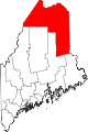
Towns Allagash | Amity | Ashland | Bancroft | Blaine | Bridgewater | Castle Hill | Caswell | Chapman | Crystal | Dyer Brook | Eagle Lake | Easton | Fort Fairfield | Fort Kent | Frenchville | Grand Isle | Hamlin | Hammond | Haynesville | Hersey | Hodgdon | Houlton | Island Falls | Limestone | Linneus | Littleton | Ludlow | Madawaska | Mapleton | Mars Hill | Masardis | Merrill | Monticello | New Canada | New Limerick | New Sweden | Oakfield | Orient | Perham | Portage Lake | St. Agatha | St. Francis | Sherman | Smyrna | Stockholm | Van Buren | Wade | Wallagrass | Washburn | Westfield | Westmanland | Weston | Woodland
Plantations Unorganized
territoriesCDPs Fort Fairfield | Fort Kent | Houlton | Limestone | Loring AFB | Madawaska | Mars Hill-Blaine | Van Buren
Other
villagesCrouseville | Estcourt Station | Wytopitlock
Coordinates: 46°46′8.6″N 67°50′9.1″W / 46.769056°N 67.835861°W
Categories:- Towns in Aroostook County, Maine
- Canada–United States border crossings

Wikimedia Foundation. 2010.