- National Register of Historic Places listings in Washington County, Maine
-
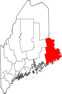 Location of Washington County in Maine
This is a list of the National Register of Historic Places listings in Washington County, Maine.
This is intended to be a complete list of the properties and districts on the National Register of Historic Places in Washington County, Maine, United States. Latitude and longitude coordinates are provided for many National Register properties and districts; these locations may be seen together in a Google map.[1]
There are 96 properties and districts listed on the National Register in the county. The old chases mill school house in east machias.
-
- This National Park Service list is complete through NPS recent listings posted November 10, 2011.[2]
Contents: Counties in Maine Androscoggin - Aroostook - Cumberland - Franklin - Hancock - Kennebec - Knox - Lincoln - Oxford - Penobscot - Piscataquis - Sagadahoc - Somerset - Waldo - Washington - York Current listings
[3] Landmark name [4] Image Date listed Location City or town Summary 1 "The Rim" and Site of Fort Foster July 23, 1973 South of East Machias off U.S. Route 1
44°43′01″N 67°23′45″W / 44.716944°N 67.395833°WEast Machias 2 Archibald-Adams House March 13, 1987 State Route 193
44°36′21″N 67°55′38″W / 44.605833°N 67.927222°WCherryfield 3 Atkinson-Koskinen Site 45.13 November 23, 1984 Address Restricted Steuben 4 Charles Best House March 2, 1982 County Rd.
44°56′51″N 67°10′30″W / 44.9475°N 67.175°WWest Pembroke 5 Birch Point December 9, 1997 Address Restricted Machiasport 6 Boynton High School, Former April 11, 2002 78 High St.
44°54′19″N 66°59′26″W / 44.905278°N 66.990556°WEastport 7 Boynton Street Historic District July 19, 1984 13-26 Boynton St.
44°54′18″N 66°59′13″W / 44.905°N 66.986944°WEastport 8 Henrietta Brewer House October 6, 1983 U.S. Route 1
45°05′04″N 67°06′41″W / 45.084444°N 67.111389°WRobbinston 9 John N.M. Brewer House October 6, 1983 U.S. Route 1
45°04′55″N 67°06′40″W / 45.081944°N 67.111111°WRobbinston 10 Bucknam House April 28, 1975 Maine St.
44°39′15″N 67°43′33″W / 44.654167°N 67.725833°WColumbia Falls 11 Samuel Bucknam House October 19, 1978 U.S. Route 1
44°39′09″N 67°43′46″W / 44.6525°N 67.729444°WColumbia Falls 12 Burnham Tavern 
April 11, 1973 Main St.
44°42′50″N 67°27′36″W / 44.713889°N 67.46°WMachias 13 Calais Free Library April 12, 2001 Union St., 0.05 miles northwest of its junction with U.S. Route 1
45°11′21″N 67°16′38″W / 45.189167°N 67.277222°WCalais 14 Calais Historic District December 20, 1978 Church, Main, and North Sts.
45°11′19″N 67°16′40″W / 45.188611°N 67.277778°WCalais 15 Calais Residential Historic District October 28, 1994 Roughly the area along Main St. and Calais Ave., and from Calais Ave. to Swan St.
45°11′11″N 67°16′25″W / 45.186389°N 67.273611°WCalais 16 Gen. Alexander Campbell House April 13, 1977 Campbell Hill
44°35′53″N 67°55′18″W / 44.598056°N 67.921667°WCherryfield 17 David W. Campbell House July 19, 1984 Main St.
44°36′02″N 67°55′19″W / 44.600556°N 67.921944°WCherryfield 18 Frank Campbell House October 29, 1982 U.S. Route 1
44°35′52″N 67°55′23″W / 44.597778°N 67.923056°WCherryfield 19 Col. Samuel Campbell House February 4, 1982 U.S. Route 1
44°35′54″N 67°55′18″W / 44.598333°N 67.921667°WCherryfield 20 Central Congregational Church June 23, 1976 Middle St.
44°54′14″N 66°59′16″W / 44.903889°N 66.987778°WEastport 21 Centre Street Congregational Church May 12, 1975 Centre St.
44°42′54″N 67°27′37″W / 44.715°N 67.460278°WMachias 22 Chaloner House February 7, 2007 3 Pleasant St.
44°51′42″N 66°59′06″W / 44.861667°N 66.985°WLubec 23 Charlotte Pound December 21, 2005 Charlotte Rd., 0.25 miles east of its junction with 214
45°00′25″N 67°16′16″W / 45.006944°N 67.271111°WCharlotte 24 Cherryfield Academy February 19, 1982 Main St.
44°36′06″N 67°55′29″W / 44.601667°N 67.924722°WCherryfield 25 Cherryfield Historic District 
October 1, 1990 Roughly bounded by Church, Main, Park, New and High Sts., as well as River Rd. properties from U.S. Route 1 to Driscoll Island
44°35′54″N 67°55′32″W / 44.598333°N 67.925556°WCherryfield 26 Columbia House October 12, 2000 Main St. at its junction with Church Hill Circle
44°39′15″N 67°43′43″W / 44.654167°N 67.728611°WColumbia Falls 27 Columbia Union Church June 20, 1997 Northern side of State Route 29-608, 0.05 miles east of its junction with State Route 29-610
44°40′59″N 67°46′48″W / 44.683056°N 67.78°WEpping 28 Dennysville Historic District October 29, 1982 The Lane, Main, and King Sts.
44°54′01″N 67°13′45″W / 44.900278°N 67.229167°WDennysville 29 Devils Head Site May 17, 2006 Address Restricted Calais 30 East Machias Historic District 
April 11, 1973 High, Water, and Bridge Sts.
44°44′11″N 67°23′21″W / 44.736389°N 67.389167°WEast Machias 31 Eastport Historic District June 1, 1982 Water St.
44°54′18″N 66°59′07″W / 44.905°N 66.985278°WEastport 32 Fort O'Brien October 1, 1969 South of Machiasport on a secondary road
44°41′22″N 67°23′48″W / 44.689444°N 67.396667°WMachiasport 33 Fort Sullivan January 26, 1970 Moose Island; barracks, 74 Washington St.
44°54′27″N 66°59′19″W / 44.9075°N 66.988611°WEastport 34 Jeremiah Fowler House December 29, 1983 35 School St.
44°51′37″N 66°59′14″W / 44.860278°N 66.987222°WLubec 35 Gallison Memorial Library January 11, 2001 U.S. Route 1, 0.5 miles west of its junction with U.S. Route 1A
44°37′09″N 67°48′45″W / 44.619167°N 67.8125°WHarrington 36 Gates House April 28, 1975 State Route 92
44°41′49″N 67°23′38″W / 44.696944°N 67.393889°WMachiasport 37 Gilmore House June 14, 1979 316 Main St.
45°11′01″N 67°15′51″W / 45.183611°N 67.264167°WCalais 38 Governors Point August 8, 2001 Address Restricted Grand Lake Stream 39 Grace Episcopal Church August 7, 2001 U.S. Route 1 0.5 miles northwest of its junction with 3rd Rd.
45°05′14″N 67°06′53″W / 45.087222°N 67.114722°WRobbinston 40 Grand Lake Stream Site December 9, 1997 Address restricted Grand Lake Stream 41 Thomas Hamilton House February 4, 1982 78 South St.
45°10′43″N 67°16′20″W / 45.178611°N 67.272222°WCalais 42 Hinckley Hill Historic District October 28, 1994 Roughly 305-326 Main St.
45°10′59″N 67°15′53″W / 45.183056°N 67.264722°WCalais 43 Hog Island-62.23 December 9, 1997 Address restricted Machiasport 44 Hog Island-62.24 September 5, 1997 Address restricted Machiasport 45 Hog Island-62.25 December 9, 1997 Address restricted Machiasport 46 Hog Island-62.29 September 5, 1997 Address restricted Machiasport 47 Holmes Cottage April 4, 1988 241 Main St.
45°11′15″N 67°16′28″W / 45.1875°N 67.274444°WCalais 48 Holmes Point December 9, 1997 Address restricted Machiasport 49 Dr. Job Holmes House April 5, 1990 247 Main St.
45°11′15″N 67°16′26″W / 45.1875°N 67.273889°WCalais 50 Indian River Baptist Church June 23, 1988 State Route 187 at Indian River
44°34′22″N 67°38′36″W / 44.572778°N 67.643333°WAddison 51 Theodore Jellison House November 23, 1984 River Rd.
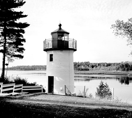
45°09′53″N 67°12′02″W / 45.164722°N 67.200556°WCalais 52 Jonesboro Grange No. 357 December 15, 2010 Harrington Road Jonesboro 53 Jonesboro Union Church July 18, 2002 Looks Point Rd. at its junction with U.S. Route 1
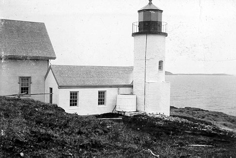
44°39′35″N 67°34′32″W / 44.659722°N 67.575556°WJonesboro 54 Libby Island Light Station 
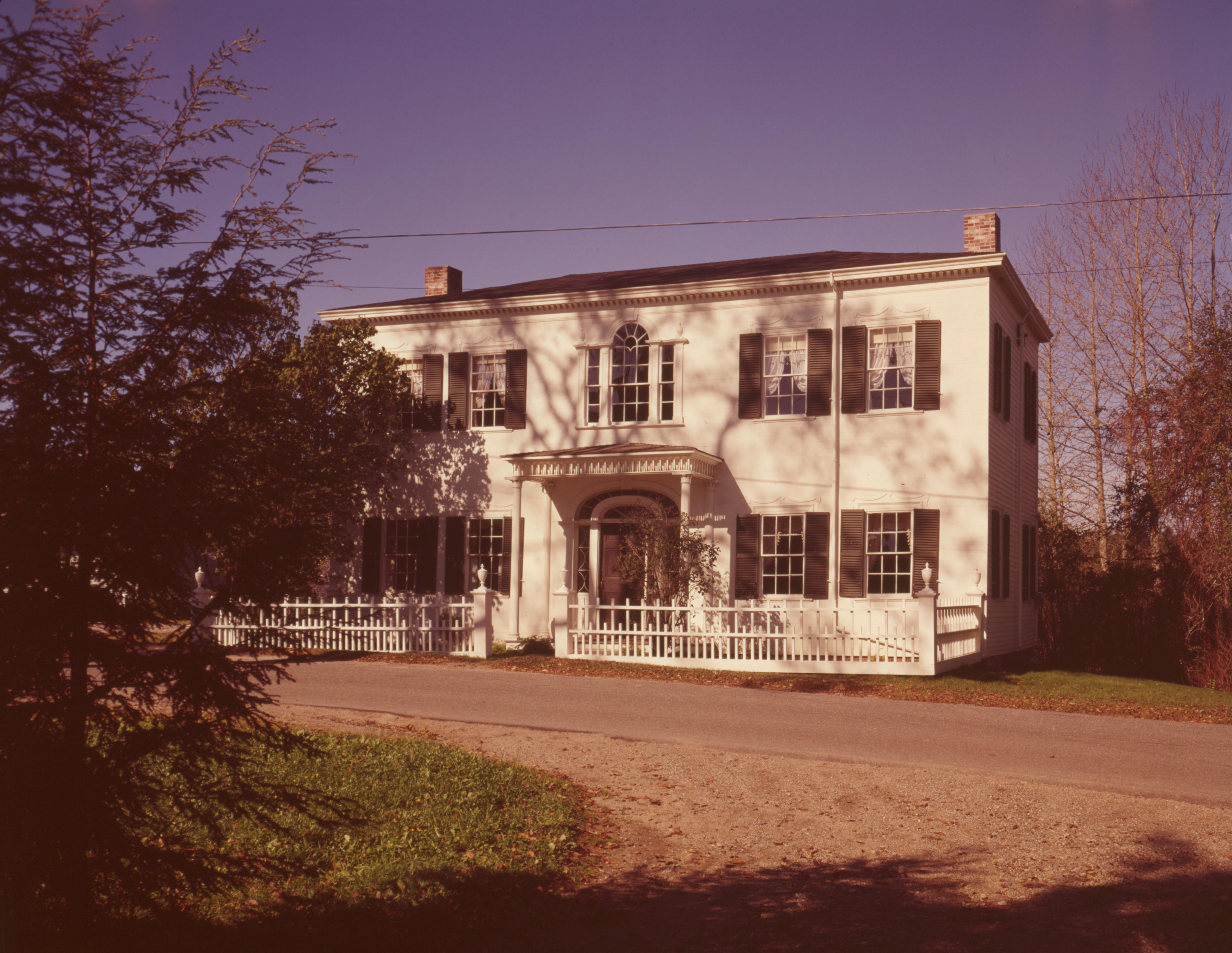
June 18, 1976 South of Machiasport on Libby Island
44°34′16″N 67°21′54″W / 44.571111°N 67.365°WMachiasport 55 Liberty Hall November 23, 1977 State Route 92
44°41′51″N 67°23′40″W / 44.6975°N 67.394444°WMachiasport 56 Lincoln House March 29, 1978 U.S. Route 1
44°54′23″N 67°13′44″W / 44.906389°N 67.228889°WDennysville 57 The Lion (locomotive) December 15, 1976 University of Maine at Machias
44°42′30″N 67°27′21″W / 44.708333°N 67.455833°WMachias 58 Little River Light Station 
March 14, 1988 Little River Island
44°39′02″N 67°11′39″W / 44.650556°N 67.194167°WCutler 59 Lubec Channel Light Station 
March 14, 1988 Lubec Channel
44°50′31″N 66°58′38″W / 44.841944°N 66.977222°WLubec 60 Machias Post Office and Customhouse November 23, 1977 Main and Center Sts.
44°42′55″N 67°27′30″W / 44.715278°N 67.458333°WMachias 61 Machias Railroad Station October 2, 1992 27 E. Main St.
44°43′10″N 67°27′08″W / 44.719444°N 67.452222°WMachias 62 Machias Valley Grange, No. 360 (Former) May 8, 2007 3 Elm St.
44°42′47″N 67°27′27″W / 44.713056°N 67.4575°WMachias 63 Maine Archeological Survey site 62.46 August 8, 2001 Address Restricted Machiasport 64 The Mansion House May 22, 1973 North of Kobbinston on U.S. Route 1
45°05′10″N 67°06′56″W / 45.086111°N 67.115556°WRobbinston 65 McCurdy Smokehouse July 15, 1993 Eastern side of Water St. at its junction with School St.
44°51′39″N 66°59′01″W / 44.860833°N 66.983611°WLubec 66 McGlashan-Nickerson House June 14, 1990 St. Croix Dr. near Pettegrove Pt.
45°07′30″N 67°08′54″W / 45.125°N 67.148333°WRed Beach 67 Henry D. Moore Parish House and Library November 29, 2001 3 Rogers Point Rd.
44°30′39″N 67°57′43″W / 44.510833°N 67.961944°WSteuben 68 Narraguagus Light Station 
November 20, 1987 Eastern side of Pond Island
44°27′15″N 67°49′44″W / 44.454167°N 67.828889°WMilbridge 69 William M. Nash House January 4, 1983 River Rd.
44°36′02″N 67°55′42″W / 44.600556°N 67.928333°WCherryfield 70 Ntolonapemk, Eastern Surplus Superfund Site August 8, 2001 Roughly bounded by State Route 191, Stone Road, Meddybemps Lake, and the Dennys River
45°2′17.988″N 67°21′30.78″W / 45.03833°N 67.35855°W[5]Meddybemps 71 Patten Building December 22, 1978 Main St.
44°35′54″N 67°55′30″W / 44.598333°N 67.925°WCherryfield 72 Clark Perry House October 9, 1979 Court St.
44°42′55″N 67°27′40″W / 44.715278°N 67.461111°WMachias 73 Petit Manan Light Station 
October 30, 1987 Petit Manan Island
44°22′03″N 67°51′53″W / 44.3675°N 67.864722°WMilbridge 74 Joshua Pettegrove House March 17, 1994 Eastern side of U.S. Route 1, 0.25 miles north of its junction with Shattuck Rd.
45°07′32″N 67°08′47″W / 45.125556°N 67.146389°WRed Beach 75 Pike's Mile Markers January 20, 1995 Twelve locations spaced 1 miles apart along the eastern side of U.S. Route 1 between Robbinston and Calais
45°10′04″N 67°14′01″W / 45.167778°N 67.233611°WCalais 76 Capt. John Plummer House January 21, 2009 23 Pleasant St.
44°37′08″N 67°44′36″W / 44.61881°N 67.74331°WAddison 77 Porter Memorial Library January 20, 1978 Court St.
44°42′55″N 67°27′36″W / 44.715278°N 67.46°WMachias 78 Reversing Falls Site June 27, 1990 Address Restricted Pembroke 79 Ruggles House 
January 26, 1970 Main Street
44°39′08″N 67°43′49″W / 44.652222°N 67.730278°WColumbia Falls 80 St. Anne's Episcopal Church July 8, 1982 Church St.
45°11′16″N 67°16′31″W / 45.187778°N 67.275278°WCalais 81 St. Croix Island International Historic Site October 15, 1966 On the international boundary in the St. Croix River
45°07′42″N 67°08′02″W / 45.128333°N 67.133889°WSt. Croix Junction 82 James R. Talbot House January 4, 1983 U.S. Route 1
44°44′18″N 67°23′28″W / 44.738333°N 67.391111°WEast Machias 83 Todd House April 23, 1980 11 Capens Ave.
44°54′41″N 66°59′09″W / 44.911389°N 66.985833°WEastport 84 Union Church, (former) July 5, 2000 Main St., 0.1 miles northeast of its junction with Addison Rd.
44°39′12″N 67°43′46″W / 44.653333°N 67.729444°WColumbia Falls 85 Union Evangelical Church June 7, 1996 Northern side of Addison Ridge Rd., 2 miles south of U.S. Route 1
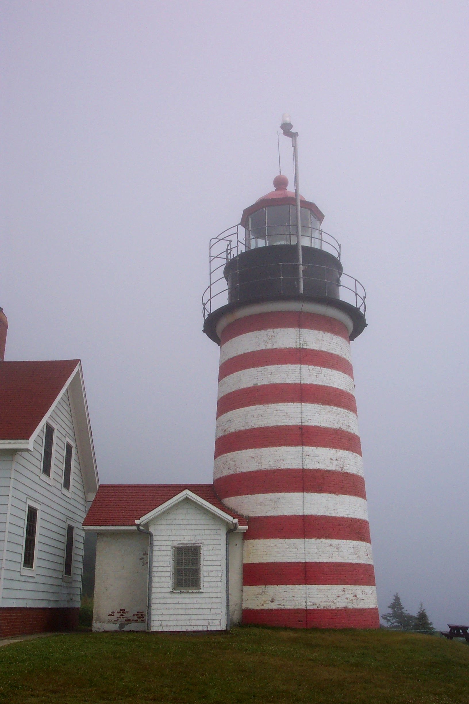
44°36′59″N 67°45′20″W / 44.616389°N 67.755556°WAddison 86 Union Hall June 25, 1987 Near the junction of U.S. Route 1 and State Route 169
45°39′29″N 67°52′02″W / 45.658056°N 67.867222°WDanforth 87 Everett Wallace House March 7, 1996 Western side of U.S. Route 1, 0.05 miles north of its junction with Wyman Rd.
44°31′57″N 67°52′59″W / 44.5325°N 67.883056°WMilbridge 88 George Washburn House February 11, 1982 318 Main St.
45°10′59″N 67°15′50″W / 45.183056°N 67.263889°WCalais 89 Washington County Courthouse November 7, 1976 Court St.
44°42′58″N 67°27′36″W / 44.716111°N 67.46°WMachias 90 Washington County Jail April 7, 1988 Court St.
44°42′58″N 67°27′35″W / 44.716111°N 67.459722°WMachias 91 West Quoddy Head Light Station 
July 4, 1980 Southeast of Lubec on West Quoddy Head
44°48′54″N 66°57′00″W / 44.815°N 66.95°WLubec 92 West Quoddy Lifesaving Station April 20, 1990 Northern side of W. Quoddy Head
44°49′04″N 66°57′59″W / 44.817778°N 66.966389°WLubec 93 Whitlocks Mill Light Station 
January 21, 1988 Southern bank of the St. Croix River
45°09′46″N 67°13′41″W / 45.162778°N 67.228056°WCalais 94 Whitneyville Congregational Church June 26, 1979 Main St.
44°43′20″N 67°29′58″W / 44.722222°N 67.499444°WWhitneyville 95 Windswept May 8, 2007 421 Petit Manan Point Rd.
44°25′05″N 67°54′45″W / 44.418056°N 67.9125°WSteuben 96 Daniel Young House March 22, 1984 34 Main St.
44°51′39″N 66°59′15″W / 44.860833°N 66.9875°WLubec See also
References
- ^ The latitude and longitude information provided in this table was derived originally from the National Register Information System, which has been found to be fairly accurate for about 99% of listings. For about 1% of NRIS original coordinates, experience has shown that one or both coordinates are typos or otherwise extremely far off; some corrections may have been made. A more subtle problem causes many locations to be off by up to 150 yards, depending on location in the country: most NRIS coordinates were derived from tracing out latitude and longitudes off of USGS topographical quadrant maps created under North American Datum of 1927, which differs from the current, highly accurate GPS system used by Google maps. Chicago is about right, but NRIS longitudes in Washington are higher by about 4.5 seconds, and are lower by about 2.0 seconds in Maine. Latitudes differ by about 1.0 second in Florida. Some locations in this table may have been corrected to current GPS standards.
- ^ "National Register of Historic Places: Weekly List Actions". National Park Service, United States Department of the Interior. Retrieved on November 10, 2011.
- ^ Numbers represent an ordering by significant words. Various colorings, defined here, differentiate National Historic Landmark sites and National Register of Historic Places Districts from other NRHP buildings, structures, sites or objects.
- ^ "National Register Information System". National Register of Historic Places. National Park Service. . http://nrhp.focus.nps.gov/natreg/docs/All_Data.html.
- ^ Address derived from this Passamaquoddy tribal website; the NRIS lists it as "Address Restricted"
U.S. National Register of Historic Places Topics Lists by states Alabama • Alaska • Arizona • Arkansas • California • Colorado • Connecticut • Delaware • Florida • Georgia • Hawaii • Idaho • Illinois • Indiana • Iowa • Kansas • Kentucky • Louisiana • Maine • Maryland • Massachusetts • Michigan • Minnesota • Mississippi • Missouri • Montana • Nebraska • Nevada • New Hampshire • New Jersey • New Mexico • New York • North Carolina • North Dakota • Ohio • Oklahoma • Oregon • Pennsylvania • Rhode Island • South Carolina • South Dakota • Tennessee • Texas • Utah • Vermont • Virginia • Washington • West Virginia • Wisconsin • WyomingLists by territories Lists by associated states Other  Category:National Register of Historic Places •
  Portal:National Register of Historic Places
Municipalities and communities of Washington County, Maine County seat: Machias Cities 
Towns Addison | Alexander | Baileyville | Beals | Beddington | Centerville‡ | Charlotte | Cherryfield | Columbia Falls | Columbia | Cooper | Crawford | Cutler | Danforth | Deblois | Dennysville | East Machias | Harrington | Jonesboro | Jonesport | Lubec | Machias | Machiasport | Marshfield | Meddybemps | Milbridge | Northfield | Pembroke | Perry | Princeton | Robbinston | Roque Bluffs | Steuben | Talmadge | Topsfield | Vanceboro | Waite | Wesley | Whiting | Whitneyville
‡ Disincorporated
Plantations Unorganized
territoriesCDPs Other
villageIndian
reservationsCategories:- National Register of Historic Places in Maine by county
- Washington County, Maine
-


Wikimedia Foundation. 2010.