- Charlotte, Maine
-
Charlotte, Maine — Town — Location within the state of Maine
 Charlotte, Maine
Coordinates: 45°0′46″N 67°15′18″W / 45.01278°N 67.255°W Country United States State Maine County Washington Area - Total 34.1 sq mi (88.2 km2) - Land 31.3 sq mi (81.1 km2) - Water 2.8 sq mi (7.1 km2) Elevation 98 ft (30 m) Population (2000) - Total 324 - Density 10.4/sq mi (4.0/km2) Time zone Eastern (EST) (UTC-5) - Summer (DST) EDT (UTC-4) ZIP code 04666 Area code(s) 207 FIPS code 23-12175 GNIS feature ID 0582405 Charlotte is a town in Washington County, Maine, United States. The town was named for the wife of legislator William Vance.[1] The population was 324 at the 2000 census.
Geography
According to the United States Census Bureau, the town has a total area of 34.0 square miles (88 km2), of which, 31.3 square miles (81 km2) of it is land and 2.8 square miles (7.3 km2) of it (8.08%) is water.
Demographics
As of the census[2] of 2000, there were 324 people, 134 households, and 97 families residing in the town. The population density was 10.4 people per square mile (4.0/km²). There were 249 housing units at an average density of 8.0 per square mile (3.1/km²). The racial makeup of the town was 99.69% White, and 0.31% from two or more races. Hispanic or Latino of any race were 0.31% of the population.
There were 134 households out of which 24.6% had children under the age of 18 living with them, 61.9% were married couples living together, 4.5% had a female householder with no husband present, and 27.6% were non-families. 24.6% of all households were made up of individuals and 11.9% had someone living alone who was 65 years of age or older. The average household size was 2.42 and the average family size was 2.80.
In the town the population was spread out with 22.2% under the age of 18, 7.1% from 18 to 24, 25.9% from 25 to 44, 28.7% from 45 to 64, and 16.0% who were 65 years of age or older. The median age was 43 years. For every 100 females there were 95.2 males. For every 100 females age 18 and over, there were 98.4 males.
The median income for a household in the town was $30,391, and the median income for a family was $32,411. Males had a median income of $26,250 versus $20,750 for females. The per capita income for the town was $13,283. About 9.3% of families and 12.8% of the population were below the poverty line, including 14.5% of those under age 18 and 3.5% of those age 65 or over.
References
- ^ "Profile for Charlotte, Maine". ePodunk. http://www.epodunk.com/cgi-bin/genInfo.php?locIndex=2076. Retrieved 2010-05-08.
- ^ "American FactFinder". United States Census Bureau. http://factfinder.census.gov. Retrieved 2008-01-31.
Municipalities and communities of Washington County, Maine Cities 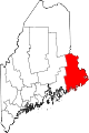
Towns Addison | Alexander | Baileyville | Beals | Beddington | Centerville‡ | Charlotte | Cherryfield | Columbia Falls | Columbia | Cooper | Crawford | Cutler | Danforth | Deblois | Dennysville | East Machias | Harrington | Jonesboro | Jonesport | Lubec | Machias | Machiasport | Marshfield | Meddybemps | Milbridge | Northfield | Pembroke | Perry | Princeton | Robbinston | Roque Bluffs | Steuben | Talmadge | Topsfield | Vanceboro | Waite | Wesley | Whiting | Whitneyville
‡ Disincorporated
Plantations Unorganized
territoriesCDPs Other
villageIndian
reservationsCoordinates: 45°01′16″N 67°14′43″W / 45.02111°N 67.24528°W
Categories:- Towns in Washington County, Maine


Wikimedia Foundation. 2010.