- Calais, Maine
-
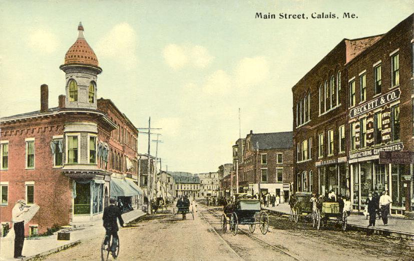
Calais — City — Main Street in 1913 Location within the state of Maine
 Calais
Coordinates: 45°9′58″N 67°14′33″W / 45.16611°N 67.2425°WCoordinates: 45°9′58″N 67°14′33″W / 45.16611°N 67.2425°W Country United States State Maine County Washington Settled 1779 Incorporated June 16, 1809 Government – Mayor Vinton Cassidy Area – Total 40.0 sq mi (103.7 km2) – Land 34.0 sq mi (88.2 km2) – Water 6.0 sq mi (15.5 km2) Elevation 43 ft (13 m) Population (2010)[1] – Total 3,123 – Density 91.8/sq mi (35.4/km2) Time zone Eastern (EST) (UTC-5) – Summer (DST) EDT (UTC-4) ZIP code 04619 Area code(s) 207 FIPS code 23-09585 GNIS feature ID 0563341 Website www.calaismaine.govoffice.com Calais (pronounced /ˈkælɨs/ (
 listen), rhyming with palace) is a city in Washington County, Maine, United States. The city has three United States border crossings or also known as a Port of entry (POE) with the busiest being on the St. Croix River bordering St. Stephen, New Brunswick, Canada. Calais has historically been a city of commerce and is recognized as the primary shopping center of eastern Washington County and Charlotte County, New Brunswick, Canada. Currently retail, service, and construction businesses are the primary components of the Calais economy. The population was 3,123 at the 2010 census.
Contents
History
The river and its area were first explored by Samuel de Champlain when he and his men spent a winter on St. Croix Island in 1604. The first permanent settler was Daniel Hill of Jonesboro, who arrived in 1779, and with others built the first sawmill in 1782. On June 27, 1789, the Massachusetts General Court sold the township to Waterman Thomas for 19¢ an acre (Approx $2.30 an acre in 2006 dollars). Early occupations included farming, hunting and ship building.[2]
On June 16, 1809, Plantation Number 5 PS was incorporated as Calais after Calais, France, in honor of French assistance during the American Revolution. The river provided the mill town with water power for industry, which included sawmills, clapboard and shingle mills, 2 planing mills, a saw factory, 2 axe factories and 4 grain mills. There were foundries, machine shops, granite works, shoe factories and a tannery. Other businesses produced bricks, bedsteads, brooms, carriages and plaster.[3]
Calais is the home of the first railroad built in the state of Maine, the Calais Railroad incorporated by the state legislature on February 17, 1832.[4] It was built to transport lumber from a mill on the Saint Croix River opposite Milltown, New Brunswick two miles (3 km) to the tidewater at Calais in 1835. In 1849, the name was changed to the Calais & Baring Railroad and the line was extended four more miles to Baring.[5] In 1870, it became part of the St. Croix & Penobscot Railroad.[6]
Calais was incorporated as a city on August 24, 1850. On July 18, 1864, Confederate agents crossed the border from New Brunswick, and robbed a bank in Calais.[7]
The Calais Free Library was designed by noted Boston architect Arthur H. Vinal and opened on July 4, 1893. The Romanesque Revival building was listed on the National Register of Historic Places in 2001.
Other places in Calais listed on the National Register of Historic Places are the Calais Historic District, Calais Residential Historic District, Devils Head Site, Gilmore House, Thomas Hamilton House, Hinckley Hill Historic District, Holmes Cottage, Dr. Job Holmes House, Theodore Jellison House, Pike's Mile Markers, St. Anne's Episcopal Church, George Washburn House and Whitlocks Mill Light.
-

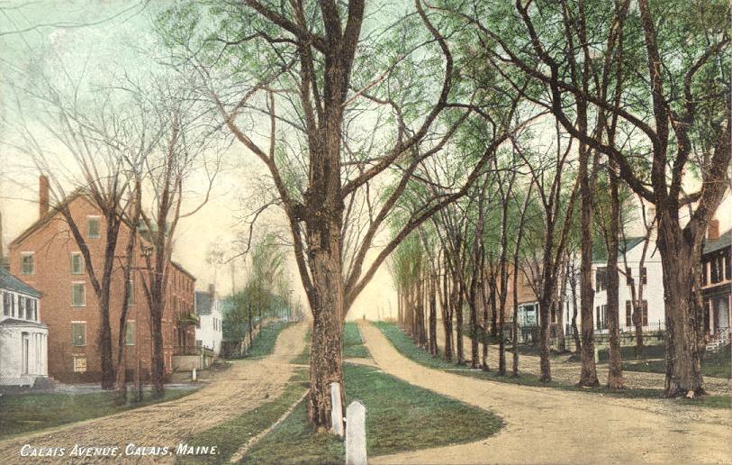
Calais Avenue c. 1905
-

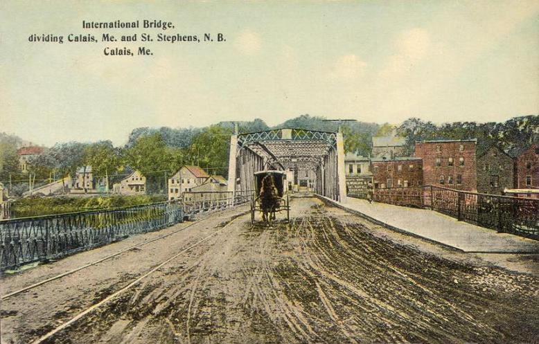
International Bridge in 1913
-

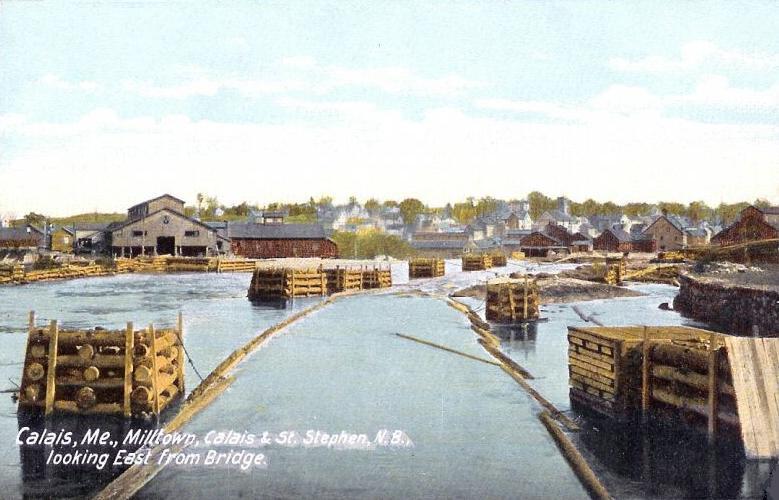
Looking east from bridge in 1908
Geography
Calais is located at 45°9′58″N 67°14′33″W / 45.16611°N 67.2425°W (45.166045, -67.242434)[8].
 Calais viewed from St. Stephen across the St. Croix River
According to the United States Census Bureau, the city has a total area of 40.0 square miles (104 km2), of which, 34.0 square miles (88 km2) of it is land and 6.0 square miles (16 km2) of it (14.94%) is water. Calais is located at the head of tide on the St. Croix River. Recently, the City of Calais acquired Devil's Head. This remarkable site comprises 318 acres (1.29 km2) of land; one mile (1.6 km) of frontage on the St Croix estuary; 6/10 of a mile of frontage on Coastal U.S. Route One; and having a variety of significant features, including: a 340-foot (100 m) high granite headland towering over the estuary; low tide sand and boulder beach; upland forest and abundant wildlife. Trail construction was completed in 2003. In addition, Calais is the northern terminus of the East Coast Greenway which has its southern terminus in Key West, Florida.
Demographics
Historical populations Census Pop. %± 1810 372 — 1820 418 12.4% 1830 1,686 303.3% 1840 2,934 74.0% 1850 4,749 61.9% 1860 5,621 18.4% 1870 5,944 5.7% 1880 6,173 3.9% 1890 7,290 18.1% 1900 7,655 5.0% 1910 6,116 −20.1% 1920 6,084 −0.5% 1930 5,470 −10.1% 1940 5,161 −5.6% 1950 4,589 −11.1% 1960 4,223 −8.0% 1970 4,044 −4.2% 1980 4,262 5.4% 1990 3,963 −7.0% 2000 3,447 −13.0% 2010 3,123 −9.4% sources:[1][9] As of the census[10] of 2000, there were 3,447 people, 1,486 households, and 904 families residing in the city. The population density was 101.3 people per square mile (39.1/km²). There were 1,921 housing units at an average density of 56.4 per square mile (21.8/km²). The racial makeup of the city was 96.81% White, 0.35% Black or African American, 0.61% Native American, 0.70% Asian, 0.49% from other races, and 1.04% from two or more races. 0.73% of the population were Hispanic or Latino of any race.
There were 1,486 households out of which 25.5% had children under the age of 18 living with them, 48.3% were married couples living together, 10.0% had a female householder with no husband present, and 39.1% were non-families. 33.7% of all households were made up of individuals and 16.4% had someone living alone who was 65 years of age or older. The average household size was 2.24 and the average family size was 2.88.
In the city the population was spread out with 21.9% under the age of 18, 8.1% from 18 to 24, 25.4% from 25 to 44, 24.4% from 45 to 64, and 20.1% who were 65 years of age or older. The median age was 42 years. For every 100 females there were 89.7 males. For every 100 females age 18 and over, there were 85.6 males.
The median income for a household in the city was $24,623, and the median income for a family was $39,118. Males had a median income of $37,684 versus $20,058 for females. The per capita income for the city was $16,135. About 11.1% of families and 16.8% of the population were below the poverty line, including 18.5% of those under age 18 and 19.6% of those age 65 or over.
Transportation
Calais is located along U.S. 1 and Maine State Route 9.
Government
The City of Calais operates under the council-manager form of government. The current city manager is Diane Barnes. Some past city managers include: William Bridgeo, Nancy Orr, and Mark Ryckman. The current city mayor is Joseph Cassidy.[citation needed]
Public safety
Calais has a full time Police, Fire, and EMS department.
Education
Public schools
Calais has an elementary school, a middle school, a high school, and a technical school.
Higher education
Calais is home to a community college and a school for extended learning and continuing education. The University of Maine at Machias and a Boat School in Eastport, ME are located nearby as well.
- Washington County Community College
- Husson University's Unobskey College
- Husson University's Boat School
- University of Maine at Machias
Healthcare
Calais Regional Hospital (CRH) currently has 15 acute care beds and 10 swing beds, in addition to a 24-hour physician staffed emergency department. It continues to serve Northeastern Washington County with an approximate population of 14,000 from Topsfield to the North, Wesley to the West and Eastport to the south. CRH is the largest employer in Calais, employing more than 200 people. The hospital is licensed by the State of Maine.
International Border Crossings
 U.S. Port of Entry
The Ferry Point International Bridge and the Milltown International Bridge connect Calais to St. Stephen, New Brunswick, Canada. Construction began in 2008 on a third bridge and Port of entry (POE) to connect the two communities as well. Referred to as the International Avenue Bridge, this bridge and POE opened on November 16, 2009 and serves commercial, cargo, trucking, passenger vehicles, campers, RVs, and buses. However, both Ferry Point and Milltown crossings remain in use for passenger vehicles.[11]
The new inspection facility alleviates traffic congestion from downtown Calais and the neighboring towns in Canada. It is equipped with state-of-the-art security equipment that allows for efficient processing of both commercial and passenger vehicles. The new facility is occupied by U.S. Customs and Border Protection (CBP), the U.S. Food and Drug Administration (FDA) and U.S. General Services Administration (GSA). This facility was built as part of GSA's high performance green building program and has received the Leadership in Energy and Environmental Design (LEED) Gold certification for comprehensive use of sustainable design and technology. Recycled, reused, and local materials were used during the construction. The facility conserves energy by bringing natural light into every occupied space, and conserves water by using low-flow fixtures that consumes 40 percent less water than traditional plumbing. The Calais Port of entry, designed by Robert Siegel Architects, provides six lanes of non-commercial inspection and three lanes of commercial inspection.
Calais LNG
Calais LNG is proposing to construct and operate a Liquefied Natural Gas (LNG) receiving terminal and storage facility on the outskirts of Calais, Maine. The 330-acre (1.3 km2) site is located approximately seven miles south of downtown Calais and features 2,800 feet (850 m) of shoreline along the deepwater banks of the St. Croix River and Passamaquoddy Bay. The Calais LNG facility would feature: 1) A pier with berthing for one LNG vessel, 2) Two 5,650,000-cubic-foot (160,000 m3), full-containment LNG storage tanks, with potential expansion for a third tank, 3) LNG receiving facility, 4) Send-out plant & ancillary features, and 5) A 20-mile (32 km) pipeline connecting the facility to the Maritimes & Northeast Pipeline. The project is claimed to support approximately 250 construction jobs and between 40 and 60 permanent operations and maintenance jobs. Calais LNG had previously secured the financial support of Goldman Sachs as a key investor and put together a group of highly experienced industry and regional experts.[citation needed] However, on 2010 July 21, Goldman Sachs backed out of financing the project. Being able to demonstrate financial capacity to carry out the project is a Maine permitting requirement; thus, Calais LNG does not meet that requirement.
On 2010 September 1, Calais LNG did not renew its purchase option for the land required to build its terminal, essentially losing state-required Title, Right, or Interest (TRI) in the necessary property. Although this deadline passed, Calais LNG did not inform the Maine Board of Environmental Protection (BEP) of the lapse at the 2010 September 15 BEP meeting on the project.
On 2010 September 23, the owners of the property required for Calais LNG's terminal wrote to the BEP, informing the Board that Calais LNG no longer held TRI in the property, and that the property owners are under no obligation to sell the property to Calais LNG.
A major hurdle is the opposition of the Canadian federal government, which has said it will not permit LNG tankers to pass through Head Harbor Passage, which they would have to do to reach the Calais LNG terminal.[12][13] In its database on proposed energy projects, the U.S. Chamber of Commerce lists the Calais LNG project’s completion as “unlikely.” [14]"Calais LNG". http://www.calaislng.com.
Sites of interest
- St. Croix Valley Chamber of Commerce
- Wabanaki Cultural Center (formerly known as the Downeast Heritage Museum)
- St. Croix Historical Society & Museum
- Calais Waterfront Walkway
- Moosehorn National Wildlife Refuge
- East Coast Greenway
- St. Croix Island
- Down East Sunrise Trail
- Bicycle Coalition of Maine - Down East Trails
- Quoddy Loop Tour Guide
- Cobscook Bay State Park
- Quoddy Head State Park
- Shackford Head State Park
- Cutler Coast Public Reserved Land
- St. Croix Country Club
- Whitlocks Mill Lighthouse
- Greystone Bed & Breakfast
- Keenes Lake Family Campground
- Hilltop Camp Ground
- Sunrise Canoe and Kayak
- Maine Birding
- St. Stephen, New Brunswick, Canada
- Campobello Island, New Brunswick, Canada
Notable people
- Nehemiah Abbott, congressman
- Ron Corning, television anchor man
- Thomas Fuller, congressman
- Andrea Gibson, spoken word artist, poet, activist
- Roger Lyndon, mathematician
- Frederick A. Pike, congressman
- James Shepherd Pike, journalist
- Henry Milner Rideout, author
- Harriet Prescott Spofford, author
- Horatio Nelson Young, naval hero
Media
10.1 WMED-TV HD PBS
10.2 WMED-TV SD PBS
10.3 WMED-TV PBS World
Stations available on Cable:
- ^ a b http://factfinder.census.gov/servlet/GCTTable?_bm=y&-geo_id=04000US23&-_box_head_nbr=GCT-T1&-ds_name=PEP_2009_EST&-_lang=en&-format=ST-9&-_sse=on
- ^ Coolidge, Austin J.; John B. Mansfield (1859). A History and Description of New England. Boston, Massachusetts. pp. 81–82. http://books.google.com/books?id=OcoMAAAAYAAJ&lpg=PA9&dq=coolidge%20mansfield%20history%20description%20new%20england%201859&pg=PA81#v=onepage&q&f=false.
- ^ Varney, George J. (1886), Gazetteer of the state of Maine. Calais, Boston: Russell, http://history.rays-place.com/me/calais-me.htm
- ^ Henry V. Poor (1860). Railroads and Canals of the United States of America. New York: John H. Schultz & Co. p. 35. http://books.google.com/books?id=M0YKAAAAIAAJ.
- ^ Henry V. Poor (1860). Railroads and Canals of the United States of America. New York: John H. Schultz & Co. pp. 21–2. http://books.google.com/books?id=M0YKAAAAIAAJ.
- ^ "Report on the Agencies of Transportation in the United States 1880". Washington DC: United States Census Bureau. 1883. http://www2.census.gov/prod2/decennial/documents/1880a_v4.zip.
- ^ Mason Philip Smith. "Confederates Downeast". The Provincial Press. http://www.musarts.net/provincial/confed.htm. Retrieved September 1, 2010.
- ^ "US Gazetteer files: 2010, 2000, and 1990". United States Census Bureau. 2011-02-12. http://www.census.gov/geo/www/gazetteer/gazette.html. Retrieved 2011-04-23.
- ^ "Minor Civil Division Population Search Results". http://www.library.umaine.edu/census/townsearch.asp. Retrieved September 1, 2010.
- ^ "American FactFinder". United States Census Bureau. http://factfinder.census.gov. Retrieved 2008-01-31.
- ^ "U.S. gives go ahead to third bridge", St. Croix Courier, September 26, 2006.
- ^ Province makes its case: Energy: Government files motion with U.S. energy regulator outlining reasons why Calais LNG proposal should be rejected. Telegraph-Journal. February 1, 2010. http://telegraphjournal.canadaeast.com/front/article/939218/.
- ^ US Coast Guard Waterway Suitability Report and Letter of Recommendation, Federal Energy Regulatory Commission
- ^ Calais LNG, Calais Project, US Chamber of Commerce
External links
- City of Calais, Maine
- Calais Free Library
- The Calais Advertiser - Calais News
- Calais History and Photos
Municipalities and communities of Washington County, Maine Cities Calais | Eastport
Towns Addison | Alexander | Baileyville | Beals | Beddington | Centerville‡ | Charlotte | Cherryfield | Columbia Falls | Columbia | Cooper | Crawford | Cutler | Danforth | Deblois | Dennysville | East Machias | Harrington | Jonesboro | Jonesport | Lubec | Machias | Machiasport | Marshfield | Meddybemps | Milbridge | Northfield | Pembroke | Perry | Princeton | Robbinston | Roque Bluffs | Steuben | Talmadge | Topsfield | Vanceboro | Waite | Wesley | Whiting | Whitneyville
‡ Disincorporated
Plantations Unorganized
territoriesCDPs Other
villageIndian
reservations State of Maine
Topics - Index
- Culture
- Geography
- Government
- Governors
- History
- Images
- People
- Visitor Attractions
- Congressional districts
Regions Counties Cities Largest towns Categories:- Calais, Maine
- Cities in Washington County, Maine
- Populated places established in 1779
- Canada–United States border crossings
-


Wikimedia Foundation. 2010.