- Oxford County, Maine
-
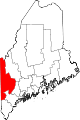
Oxford County, Maine 
Location in the state of Maine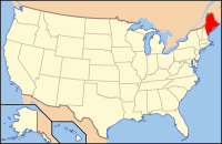
Maine's location in the U.S.Founded 1805 Seat Paris Area
- Total
- Land
- Water
2,175.26 sq mi (5,634 km²)
2,078.00 sq mi (5,382 km²)
97.26 sq mi (252 km²), 4.47%Population
- (2010)
- Density
57,833
28/sq mi (10.74/km²)Website www.oxfordcounty.org Oxford County is a county located in the U.S. state of Maine with a population of 57,833 as of the 2010 U.S. census. Its county seat is Paris[1].
Part of Oxford County is included in the Lewiston-Auburn, Maine, metropolitan New England City and Town Area while a different part of Oxford County is included in the Portland-South Portland-Biddeford, Maine, metropolitan New England City and Town Area.
Oxford County was formed on 4 March 1805 from northerly portions of York and Cumberland counties.
Contents
Geography
According to the 2000 census, the county has a total area of 2,175.26 square miles (5,633.9 km2), of which 2,078.00 square miles (5,382.0 km2) (or 95.53%) is land and 97.26 square miles (251.9 km2) (or 4.47%) is water.[2]
Adjacent counties
- Franklin County, Maine - northeast
- Androscoggin County, Maine - east
- Cumberland County, Maine - southeast
- York County, Maine - south
- Carroll County, New Hampshire - southwest
- Coos County, New Hampshire - west
Adjacent regional county municipality
National protected areas
- Umbagog National Wildlife Refuge (part)
- White Mountain National Forest (part)
Demographics
Historical populations Census Pop. %± 1810 17,630 — 1820 27,104 53.7% 1830 35,219 29.9% 1840 38,351 8.9% 1850 39,763 3.7% 1860 36,698 −7.7% 1870 33,488 −8.7% 1880 32,627 −2.6% 1890 30,586 −6.3% 1900 32,238 5.4% 1910 36,256 12.5% 1920 37,700 4.0% 1930 41,483 10.0% 1940 42,662 2.8% 1950 44,221 3.7% 1960 44,345 0.3% 1970 43,457 −2.0% 1980 48,968 12.7% 1990 52,602 7.4% 2000 54,755 4.1% 2010 57,833 5.6% [3][4][5] As of the census[6] of 2000, there were 54,755 people, 22,314 households, and 15,173 families residing in the county. The population density was 26 people per square mile (10/km²). There were 32,295 housing units at an average density of 16 per square mile (6/km²). The racial makeup of the county was 98.25% White, 0.17% Black or African American, 0.28% Native American, 0.37% Asian, 0.02% Pacific Islander, 0.11% from other races, and 0.80% from two or more races. 0.53% of the population were Hispanic or Latino of any race. 23.6% were of English, 13.9% French, 13.7% United States or American, 10.1% Irish and 8.4% French Canadian ancestry according to Census 2000. 95.9% spoke English and 2.6% French as their first language.
There were 22,314 households out of which 30.40% had children under the age of 18 living with them, 54.10% were married couples living together, 9.50% had a female householder with no husband present, and 32.00% were non-families. 25.60% of all households were made up of individuals and 11.00% had someone living alone who was 65 years of age or older. The average household size was 2.42 and the average family size was 2.87.
In the county the population was spread out with 24.20% under the age of 18, 6.50% from 18 to 24, 27.80% from 25 to 44, 25.50% from 45 to 64, and 16.10% who were 65 years of age or older. The median age was 40 years. For every 100 females there were 95.40 males. For every 100 females age 18 and over, there were 93.70 males.
The median income for a household in the county was $33,435, and the median income for a family was $39,794. Males had a median income of $30,641 versus $21,233 for females. The per capita income for the county was $16,945. About 8.30% of families and 11.80% of the population were below the poverty line, including 14.80% of those under age 18 and 10.10% of those age 65 or over.
Politics
Presidential election results[7] Year Democrat Republican 2008 56.7% 17,940 40.6% 12,863 2004 52.7% 16,618 45.0% 14,196 2000 49.7% 13,649 43.1% 11,835 Voter registration
Voter registration
Voter Registration and Party Enrollment as of August 2011[8] Party Total Voters Percentage Unaffiliated 17,250 40.68% Democratic 12,107 28.55% Republican 11,476 27.06% Green Party 1,573 3.71% Total 42,406 100% Municipalities
- Andover
- Bethel
- Brownfield
- Buckfield
- Byron
- Canton
- Denmark
- Dixfield
- Fryeburg
- Gilead
- Greenwood
- Hanover
- Hartford
- Hebron
- Hiram
- Lincoln Plantation
- Lovell
- Magalloway Plantation
- Mexico
- Newry
- Norway
- Otisfield
- Oxford
- Paris
- Peru
- Porter
- Roxbury
- Rumford
- Stoneham
- Stow
- Sumner
- Sweden
- Upton
- Waterford
- West Paris
- Woodstock
Territories
Summer Camps
Oxford county is home to many summer camps where parents send their children to make friends and learn valuable life skills. Some of these camps are Camp Wekeela, Camp Wyonegonic, Forest Acres Camp for Girls and Maine Teen Camp.
See also
References
- ^ "Find a County". National Association of Counties. http://www.naco.org/Counties/Pages/FindACounty.aspx. Retrieved 2011-06-07.
- ^ "Census 2000 U.S. Gazetteer Files: Counties". United States Census. http://www.census.gov/tiger/tms/gazetteer/county2k.txt. Retrieved 2011-02-13.
- ^ http://www.census.gov/population/www/censusdata/cencounts/files/me190090.txt
- ^ http://factfinder2.census.gov/faces/tableservices/jsf/pages/productview.xhtml?pid=DEC_10_PL_QTPL&prodType=table
- ^ http://mapserver.lib.virginia.edu/
- ^ "American FactFinder". United States Census Bureau. http://factfinder.census.gov. Retrieved 2008-01-31.
- ^ "Dave Leip's Atlas of U.S. Presidential Elections". http://uselectionatlas.org/RESULTS/. Retrieved 2011-06-11.
- ^ "Registration and Party Enrollment Statistics as of August, 2011". Maine Bureau of Corporations. http://www.maine.gov/sos/cec/elec/2011/20110817r-e-active.pdf.
External links

Le Granit Regional County Municipality, Quebec, Canada Franklin County Coos County, New Hampshire 
Androscoggin County  Oxford County, Maine

Carroll County, New Hampshire York County Cumberland County Municipalities and communities of Oxford County, Maine Towns Andover | Bethel | Brownfield | Buckfield | Byron | Canton | Denmark | Dixfield | Fryeburg | Gilead | Greenwood | Hanover | Hartford | Hebron | Hiram | Lovell | Mexico | Newry | Norway | Otisfield | Oxford | Paris | Peru | Porter | Roxbury | Rumford | Stoneham | Stow | Sumner | Sweden | Upton | Waterford | West Paris | Woodstock
Plantations Unorganized
territoriesCDPs Other
villagesDickvale | Kezar Falls | North Waterford | Waterford Flat
 State of Maine
Topics - Index
- Culture
- Geography
- Government
- Governors
- History
- Images
- People
- Visitor Attractions
- Congressional districts
Regions Counties Cities Largest towns Categories:- Maine counties
- Oxford County, Maine
- 1805 establishments in the United States
- Populated places established in 1805
- Former counties in Massachusetts


Wikimedia Foundation. 2010.