- Auburn, Maine
-
Auburn, Maine — City — 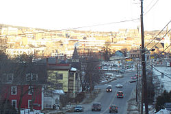

SealMotto: Vestigia Nulla Retrorsum (Latin)
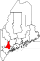
"No Steps Backward"Location of Auburn, Maine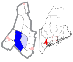
Coordinates: 44°5′21″N 70°14′29″W / 44.08917°N 70.24139°WCoordinates: 44°5′21″N 70°14′29″W / 44.08917°N 70.24139°W Country United States State Maine County Androscoggin Incorporated 1842 (town), 1868 (city) Government – Mayor Richard Gleason Area – Total 65.8 sq mi (170.4 km2) – Land 59.8 sq mi (154.8 km2) – Water 6.0 sq mi (15.6 km2) Elevation 190 ft (58 m) Population (2010) – Total 23,055 (city proper) – Density 1,046.9/sq mi (404.2/km2) Time zone Eastern (UTC-5) – Summer (DST) Eastern (UTC-4) ZIP codes 04210-04212 Area code(s) 207 FIPS code 23-02060 GNIS feature ID 0561347 Website www.auburnmaine.org Auburn is a city in and the county seat of Androscoggin County, Maine, United States.[1] The population was 23,055 at the 2010 census. It is one of two principal cities of and included in the Lewiston-Auburn, Maine metropolitan New England city and town area and the Lewiston-Auburn, Maine metropolitan statistical area (which is part of the Portland-Lewiston-South Portland, Maine combined statistical area). Auburn and Lewiston (directly across the Androscoggin River) are known as the Twin Cities.
Contents
History
The area was originally part of the Pejepscot Purchase, land bought in 1714 by a consortium from Boston and Portsmouth following the Treaty of Portsmouth, which brought peace between the Abenaki Indians and English settlements. But in 1736, the Massachusetts General Court granted a large section of the land to veterans of the 1690 Battle of Quebec. Conflicting claims led to prolonged litigation. Consequently, settlement was delayed until after the French and Indian Wars.[2]
It was first settled in 1786 as part of Bakerstown, renamed Poland when it was incorporated by the Massachusetts General Court in 1795. It was then part of Minot, set off from Poland and incorporated in 1802. Auburn would itself be set off and incorporated on February 24, 1842. The name was apparently inspired by Auburn, a village (real or fictitious) featured in the 1770 poem The Deserted Village by Oliver Goldsmith. Originally part of Cumberland County, the town became county seat of Androscoggin County at its creation in 1854. By annexing land from towns around it, including part of Poland in 1852, Minot in 1873, and all of Danville (first called Pejepscot) in 1867, Auburn grew geographically into one of Maine's largest municipalities. Incorporated a city in 1868, Auburn in 1917 would be the first city in the state to adopt a council-manager form of government.[2]
Farms supplied grain and produce. But with construction of the bridge to Lewiston in 1823, and especially after arrival of the Atlantic and St. Lawrence Railroad from Portland in January 1848, the community developed into a mill town. Mills were built to operate by water power from falls on the Androscoggin River and Little Androscoggin River. In 1835, the factory system of shoe manufacture originated at Auburn. Other firms manufactured cotton and woolen textiles, carriages, iron goods, bricks and furniture. The population in 1860 was only about 4,000 but by 1890 it was about 12,000, when its shoe factories attracted many French Canadian immigrants, many of whom arrived by train from Quebec.[3] Steady population growth continued to about 1960 when the population was about 24,500.[4]
In Auburn, shoe manufacturing became the dominant industry by the late 19th century. The CIty Seal, depicting a spindle with different types of shoes at each outside point was designed when Auburn was positioning itself as the shoe manufacturing center of Maine in the mid-19th century. In 1917 one factory in Auburn was producing 75 percent of the world's supply of white canvas shoes. However, after World War II the shoe industry began to decline, and between 1957 and 1961 the largest manufacturers closed their factories.[4]
-
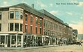
Main Street c. 1912
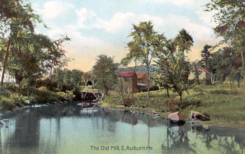
-
Old mill c. 1910
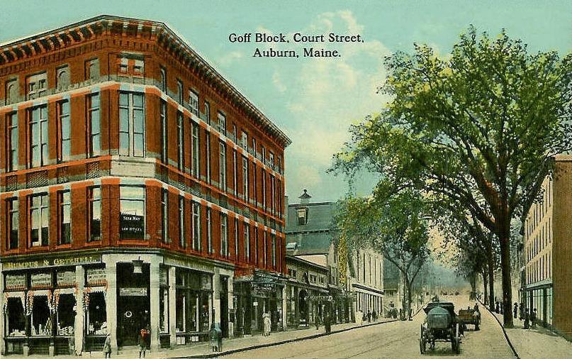
-
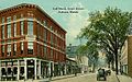
Court Street c. 1912
-

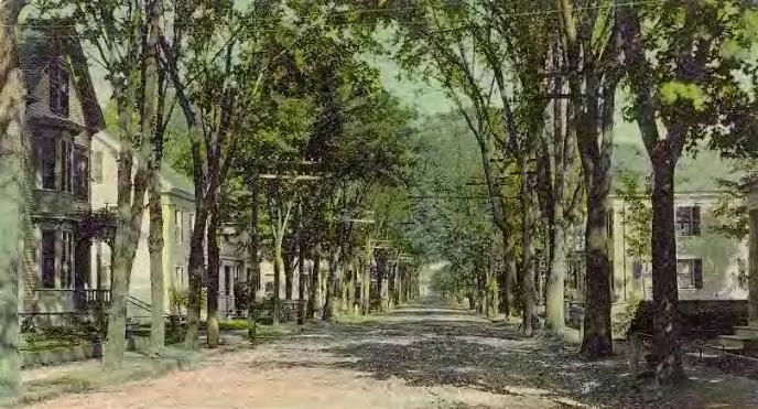
High Street in 1907
Geography
Auburn is located at 44°5′21″N 70°14′29″W / 44.08917°N 70.24139°W (44.089173, -70.241437)[5]. According to the United States Census Bureau, the city has a total area of 65.8 square miles (170.4 km2), of which 59.8 square miles (154.9 km2) is land and 6.0 square miles (15.5 km2) (9.13%) is water. Auburn is drained by the Little Androscoggin River and Androscoggin River.
Demographics
Historical populations Census Pop. %± 1850 2,840 — 1860 4,022 41.6% 1870 6,169 53.4% 1880 9,555 54.9% 1890 11,250 17.7% 1900 12,951 15.1% 1910 15,064 16.3% 1920 16,985 12.8% 1930 18,571 9.3% 1940 19,817 6.7% 1950 23,134 16.7% 1960 24,449 5.7% 1970 24,151 −1.2% 1980 23,128 −4.2% 1990 24,039 3.9% 2000 23,203 −3.5% 2010 23,055 −0.6% sources:[6][7] As of the census[8] of 2000, there were 23,203 people, 9,764 households, and 5,907 families residing in the city. The population density was 388.1 people per square mile (149.9/km²). There were 10,608 housing units at an average density of 177.4 per square mile (68.5/km²). The racial makeup of the city was 97.04% White, 0.59% African American, 0.30% Native American, 0.59% Asian, 0.05% Pacific Islander, 0.10% from other races, and 1.32% from two or more races. Hispanic or Latino of any race were 0.73% of the population.
There were 9,764 households out of which 29.4% had children under the age of 18 living with them, 44.9% were married couples living together, 11.6% had a female householder with no husband present, and 39.5% were non-families. 32.0% of all households were made up of individuals and 13.2% had someone living alone who was 65 years of age or older. The average household size was 2.28 and the average family size was 2.88.
In the city the population was spread out with 23.2% under the age of 18, 8.1% from 18 to 24, 29.3% from 25 to 44, 22.2% from 45 to 64, and 17.1% who were 65 years of age or older. The median age was 38 years. For every 100 females there were 90.5 males. For every 100 females age 18 and over, there were 86.9 males.
The median income for a six households in the city was $35,652, and the median income for a family was $44,012. Males had a median income of $32,088 versus $22,349 for females. The per capita income for the city was $19,942. About 9.0% of families and 12.0% of the population were below the poverty line, including 16.6% of those under age 18 and 11.8% of those age 65 or over.
Media
Newspapers
- Lewiston Sun Journal prints a daily newspaper in four different editions statewide. The Sun Journal was the recipient of the 2008 New England Daily Newspaper of the Year and the 2009 Maine Press Association Newspaper of the Year.
Magazines
- Lewiston Auburn Magazine, launched in April 2010, features current events and history of Lewiston/Auburn, with an emphasis on the people who are helping to rebuild the area.
Education
- Edward Little High School
- St. Dominic Regional High School
- Auburn Middle School
- Fairview Elementary School
- East Auburn Community School
- Park Avenue Elementary School
- Central Maine Community College
- Washburn Elementary School
- Walton Elementary School
- Sherwood Heights Elementary School
Government
Auburn is in the Maine's 2nd US Congressional District, Maine Senate District 15, and Maine House of Representatives Districts 68, 69, and 70.
Auburn is divided up into five wards. The city's governing body is a City Council, consisting of a mayor and 7 councilmembers (one from each of the five wards, and two elected at large). The mayor is elected at large.
Auburn's current Mayor is Richard Gleason.[9] John Jenkins is a former mayor and state senator from Auburn.[10]
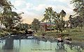
Sites of interest
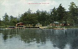 Lake Auburn in 1911
- Androscoggin Historical Society & Museum -- artifacts of local history, Civil War memorabilia, farming tools and a bird collection
- Auburn Fire Department Museum—a collection of antique fire equipment from the city
- Festival Plaza, completed in 2002—public park and performance space along the Androscoggin River. Two public water sculptures designed by artist Ross Miller operate seasonally - the Falls Fountain, that references the Androscoggin River and Native American legends of being able to hide behind the falls; and the Shoe Fountain, a series of cast bronze shoes recalling the early shoe manufacturing history of the area. A map of the Androscoggin River is cast into the plaza with colored concrete.
- Good Shepherd Food Bank distributes food to agencies across the state from its main warehouse in Auburn
- Hamster Point—Majestic river side gardens
- Knight House Museum (1796) -- the oldest frame house downtown, with a pre-1835 handwork shoe shop
National historic places in Auburn

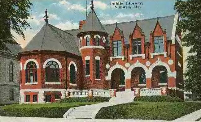
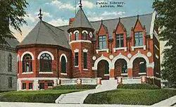 Auburn Public Library c. 1910
- A. A. Garcelon House (1890)
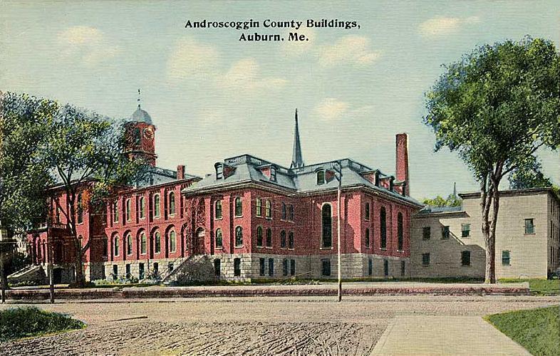
- Androscoggin County Courthouse and Jail (1857)
- Auburn Public Library (1903)
- Barker Mill (1873)
- Charles A. Jordan House (1880)
- Charles L. Cushman House (1889)
- Edward Little House (1827)
- Engine House (1879)
- First Universalist Church (1876)
- Frank L. Dingley House (1867)
- Free Baptist Church
- Gay-Munroe House (1878)
- Gilead Railroad Station, Former (1851)
- Holman Day House (1895)
- Horace Munroe House (1899)
- Horatio G. Foss House (1914)
- Lamoreau Site
- Main Street Historic District
- Roak Block (1871)
- William A. Robinson House (1874)
- William Briggs Homestead (1797)
Notable people
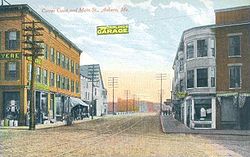 Corner of Court and Main streets c. 1908
- Tony Atlas, professional wrestler
- John Bower, skier
- Lenny Breau, jazz guitarist
- Aaron S. Daggett, last surviving Civil War general
- T. A. D. Fessenden, congressman
- John Jenkins, mayor
- Edward Little, philanthropist, educator
- Robert Luce, congressman
- Elmer Drew Merrill, botanist
- George Perkins Merrill, geologist
- Julie M. J. Parisien, skier[citation needed]
- Billy Silverman, referee
- Charles Small, baseball player
- Olympia Snowe, senator and congresswoman
- Cynthia McFadden, correspondent for ABC News
- Arlo West, musician and photographer
References
- ^ "Find a County". National Association of Counties. http://www.naco.org/Counties/Pages/FindACounty.aspx. Retrieved 2011-06-07.
- ^ a b Coolidge, Austin J.; John B. Mansfield (1859). A History and Description of New England. Boston, Massachusetts. pp. 36–38. http://books.google.com/books?id=OcoMAAAAYAAJ&lpg=PA9&dq=coolidge%20mansfield%20history%20description%20new%20england%201859&pg=PA36#v=onepage&q&f=false.
- ^ Historical Sketch of Auburn, Maine
- ^ a b Auburn Historical Highlights
- ^ "US Gazetteer files: 2010, 2000, and 1990". United States Census Bureau. 2011-02-12. http://www.census.gov/geo/www/gazetteer/gazette.html. Retrieved 2011-04-23.
- ^ [1], accessed December, 2007.
- ^ Auburn city, Maine - Population Finder - American FactFinder
- ^ "American FactFinder". United States Census Bureau. http://factfinder.census.gov. Retrieved 2008-01-31.
- ^ http://www.auburnmaine.org/index.asp?Type=B_LIST&SEC={8150265A-3ED5-4DFA-A0B9-117C641EF6A6}
- ^ Jenkins explains Blaine House bid Lewiston Sun Journal, September 8, 2010
External links
- City of Auburn, Maine
- Auburn Public Library
- Androscoggin County Chamber of Commerce
- Androscoggin Historical Society (and links)
- Museum L-A - The Story of Work and Community in Lewiston-Auburn
- Auburn School Department
- Auburn Sno-Groomers Snowmobile Club
Municipalities and communities of Androscoggin County, Maine Cities Auburn | Lewiston
Towns CDPs  State of Maine
Topics - Index
- Culture
- Geography
- Government
- Governors
- History
- Images
- People
- Visitor Attractions
- Congressional districts
Regions Counties Cities Largest towns Categories:- Cities in Maine
- County seats in Maine
- Populated places established in 1786
- Early American industrial centers
- Auburn, Maine
- Populated places in Androscoggin County, Maine
-


Wikimedia Foundation. 2010.