- Kittery, Maine
-
Kittery, Maine — Town — Old Block House at Fort McClary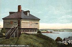

SealMotto: Gateway to Maine Location within the state of Maine
 Kittery, Maine
Coordinates: 43°5′35″N 70°43′41″W / 43.09306°N 70.72806°W Country  United States
State  Maine
MaineCounty York Incorporated 1647 Government – Assessor Bruce Kerns Area – Total 21.0 sq mi (54.4 km2) – Land 17.8 sq mi (46.2 km2) – Water 3.2 sq mi (8.2 km2) Elevation 23 ft (7 m) Population (2000) – Total 9,543 – Density 535.5/sq mi (206.8/km2) Time zone Eastern (EST) (UTC-5) – Summer (DST) EDT (UTC-4) ZIP code 03904 Area code(s) 207 FIPS code 23-37270 GNIS feature ID 0582544 Website http://www.kittery.org/ Kittery is a town in York County, Maine, United States. The population was 9,543 at the 2000 census. Home to the Portsmouth Naval Shipyard on Seavey's Island, Kittery includes Badger's Island, the seaside district of Kittery Point, and part of the Isles of Shoals. The town is a tourist destination known for its many outlet stores.
Kittery is part of the Portland–South Portland–Biddeford, Maine metropolitan statistical area.
Contents
History
Settled about 1623, Kittery was incorporated in 1647, and today bills itself as "the oldest incorporated town in Maine." It was named after the birthplace of a founder, Alexander Shapleigh, from his manor of Kittery Court at Kingswear in Devon, England. Shapleigh arrived in 1635 aboard the ship Benediction, which he co-owned with another prominent settler, Captain Francis Champernowne,[1] a cousin of Sir Ferdinando Gorges, lord proprietor of Maine.[2] Together with the Pepperrell family, they established fisheries offshore at the Isles of Shoals, where fish were caught, salted, and exported back to Europe. Other pioneers were hunters, trappers, and workers of the region's abundant timber. The settlement at the mouth of the Piscataqua River was protected by Fort McClary.[3]
Kittery originally extended from the Atlantic Ocean inland up the Salmon Falls River, including the present-day towns of Eliot, South Berwick, Berwick and North Berwick. Located opposite Portsmouth, New Hampshire, the town developed into a center for trade and shipbuilding. After the death of Gorges, Maine in 1652 became part of the Massachusetts Bay Colony. Francis Small was a pioneer resident of Kittery, and operated a trading post near the confluence of the Ossipee River and Saco River. Here major Indian trails converged—the Sokokis Trail (now Route 5), the Ossipee Trail (now Route 25), and the Pequawket Trail (now Route 113) -- a location conducive towards lucrative fur trade with Indians, but also with risks of living isolated in the wilderness.[4] Small became the largest property owner in the history of Maine, and became known as "the great landowner."[5][6]
In 1663, John Josselyn would write: "Towns there are, are not many in this province. Kittery, situated not far from Passacataway (Portsmouth), is the most populous." [7]
During the Revolution, the first vessels of the U.S. Navy were constructed on Badger's Island, including the 1777 USS Ranger commanded by John Paul Jones. The Portsmouth Naval Shipyard, the nation's first federal navy yard, was established in 1800 on Fernald's Island. It connects to the mainland by two bridges. The facility rebuilt the USS Constitution, and built the Civil War USS Kearsarge. Seavey's Island was annexed and became site of the now defunct Portsmouth Naval Prison.[8]
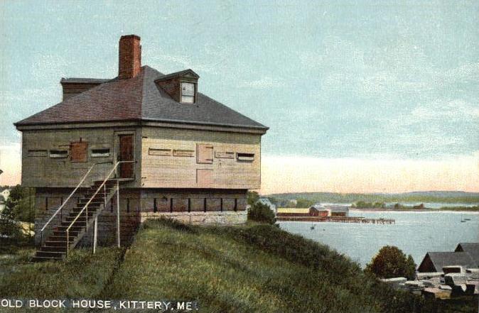
Kittery has some fine early architecture, including the Sir William Pepperrell House, built in 1733, and the Lady Pepperrell House, built in 1760. The John Bray House, built in 1662, is believed to be the oldest surviving house in Maine. Located at the John Paul Jones State Historic Site on U.S. 1 is the Maine Sailors' and Soldiers' Memorial by Bashka Paeff. Further northeast up the road, the town has developed factory outlet shopping, very popular with tourists. Kittery Point is home to Seapoint Beach and Fort Foster Park, originally a harbor defense. In 1996, the movie Thinner, based on the 1984 Richard Bachman novel Thinner, was filmed in Kittery. The Saturday morning cartoon DinoSquad is based in Kittery/Kittery Point.
-

Pepperrell House c. 1905
-

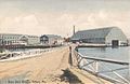
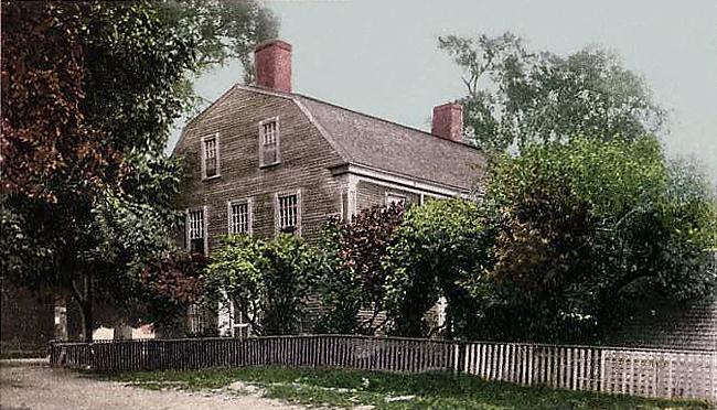
Government St. c. 1910
-
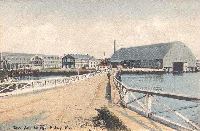
Navy Yard Bridge c. 1908
-
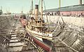
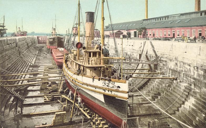
Shipyard dry dock c. 1908
Education
Kittery is home to Robert William Traip Academy, a formerly private, preparatory school which became public and town-run in 1967.
Geography
According to the United States Census Bureau, the town has a total area of 21.0 square miles (54.4 km²), of which, 17.8 square miles (46.2 km²) of it is land and 3.2 square miles (8.2 km²) of it (15.14%) is water. Situated beside the Gulf of Maine and Atlantic Ocean, Kittery is drained by Spruce Creek, Chauncey Creek and the Piscataqua River.
The town is crossed by Interstate 95, U.S. Route 1, Maine State Route 101, Maine State Route 103, and Maine State Route 236.
Demographics
- See also Kittery (CDP), Maine and Kittery Point, Maine for village demographics
As of the census[9] of 2000, there were 9,543 people, 4,078 households, and 2,528 families residing in the town. The population density was 535.5 people per square mile (206.8/km²). There were 4,375 housing units at an average density of 245.5 per square mile (94.8/km²). The racial makeup of the town was 95.98% White, 1.78% Black or African American, 0.18% Native American, 0.65% Asian, 0.02% Pacific Islander, 0.45% from other races, and 0.94% from two or more races. Hispanic or Latino of any race were 1.50% of the population.
There were 4,078 households out of which 27.7% had children under the age of 18 living with them, 50.1% were married couples living together, 8.6% had a female householder with no husband present, and 38.0% were non-families. 29.4% of all households were made up of individuals and 10.6% had someone living alone who was 65 years of age or older. The average household size was 2.29 and the average family size was 2.86.
In the town the population was spread out with 21.9% under the age of 18, 7.4% from 18 to 24, 30.7% from 25 to 44, 24.8% from 45 to 64, and 15.2% who were 65 years of age or older. The median age was 39 years. For every 100 females there were 94.8 males. For every 100 females age 18 and over, there were 92.1 males.
The median income for a household in the town was $52,200, and the median income for a family was $53,343. Males had a median income of $37,096 versus $29,850 for females. The per capita income for the town was $24,153. About 5.7% of families and 7.6% of the population were below the poverty line, including 11.9% of those under age 18 and 6.6% of those age 65 or over.
Sites of interest
- Fort Foster Historic Site
- Fort McClary State Historic Site
- The Kittery Outlets
Notable people
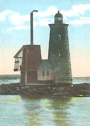
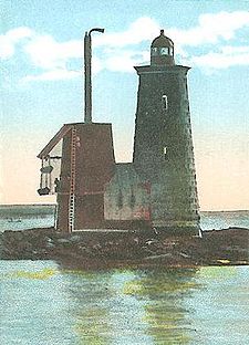 Whaleback Light c. 1920
 See also: :Category:People from Kittery, Maine
- William Badger, master shipbuilder
- John Haley Bellamy, woodcarver, folk artist
- George Berry, captain, shipbuilder
- Dennis C. Blair, admiral
- Scott Brown, senator from Massachusetts (2010–present)
- Tunis Craven, naval officer
- Shem Drowne, metalworker, creator of Boston's Grasshopper Weathervane
- Monique Edwards, actress
- William Dean Howells, writer, magazine editor
- Sandi Jackson, Chicago city alderman
- Jeremiah O'Brien, naval officer
- John O'Hurley, television actor
- Sir William Pepperrell, merchant, soldier
- Randy Price, newscaster
- Arthur Shawcross, serial killer
- Hunt Slonem, artist
- Francis Small, trader and landowner
- Celia Thaxter, poet
- John Treworgie, last proprietary governor of Newfoundland
- William Whipple, signer of the Declaration of Independence
- Jess Abbott, guitarist of the Minneapolis-based band Now, Now
References
- ^ The Champernownes were a prominent shipping family from Devon in England's West Country, having been a fixture on the West Country mercantile and social scene for generations. Kat Ashley, nee Champernowne, was a close friend and governess to Queen Elizabeth I. Her niece Catherine Champernowne was the mother of Sir Walter Raleigh and Sir Humphrey Gilbert. At the heart of the family dynastic influence lay Sir Arthur Champernowne, who served as Vice-Admiral of the West, while residing at Dartington Hall in Devon.
- ^ Sir Ferdinando Gorges and his Province of Maine, James Phinney Baxter, The Prince Society, Boston, 1890
- ^ Coolidge, Austin J.; John B. Mansfield (1859). A History and Description of New England. Boston, Massachusetts. pp. 182–185. http://books.google.com/books?id=OcoMAAAAYAAJ&lpg=PA9&dq=coolidge%20mansfield%20history%20description%20new%20england%201859&pg=PA182#v=onepage&q&f=false.
- ^ History of Cornish, Maine
- ^ Descendants of Edward Small
- ^ Sullivan, Gov. James, The History of the District of Maine, I. Thomas and E. T. Andrews, Publishers, Boston, MA, 1795.
- ^ Varney, George J. (1886), Gazetteer of the state of Maine. Kittery, Boston: Russell, http://history.rays-place.com/me/kittery-me.htm
- ^ History of the Portsmouth Naval Shipyard
- ^ "American FactFinder". United States Census Bureau. http://factfinder.census.gov. Retrieved 2008-01-31.
Further reading
- Stackpole, Everett S. Old Kittery and its Families. Published 1903. Full image at books.google
- History of Whaleback Light
- Seacoast Forts of Portsmouth Harbor from American Forts Network
External links
- Town of Kittery, Maine
- John Paul Jones State Historic Site
- Rice Public Library
- City Data Profile
- Epodunk Town Profile
- History of Kittery
- Old Kittery and Her Families, Everett Schermerhorn Stackpole, 1903
- Maine Genealogy: Kittery, York County, Maine
Municipalities and communities of York County, Maine Cities 
Towns CDPs Berwick | Cape Neddick | Kennebunk | Kennebunkport | Kittery | Kittery Point | Lake Arrowhead | North Berwick | Sanford | South Eliot | South Sanford | Springvale | West Kennebunk | York Harbor
Other
villagesCoordinates: 43°05′17″N 70°44′10″W / 43.08806°N 70.73611°W
Categories:- Populated places established in 1623
- Towns in York County, Maine
- Portland – South Portland – Biddeford metropolitan area
- Kittery, Maine
-


Wikimedia Foundation. 2010.