- Topsham, Maine
Infobox Settlement
official_name = Topsham, Maine
settlement_type = Town
nickname =
motto =
imagesize =
image_caption =
image_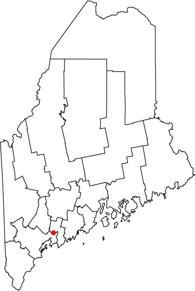
map_caption = Location of Topsham, Maine
mapsize = 150pxsubdivision_type = Country
subdivision_name =United States
subdivision_type1 = State
subdivision_name1 =Maine
subdivision_type2 = County
subdivision_name2 = Sagadahoc
government_footnotes =
government_type =
leader_title =
leader_name =
leader_title1 =
leader_name1 =
established_title = Incorporated
established_date = 1764unit_pref = Imperial
area_footnotes =area_magnitude =
area_total_km2 = 91.8
area_land_km2 = 8.8
area_water_km2 = 82.9
area_total_sq_mi = 35.4
area_land_sq_mi = 32.0
area_water_sq_mi = 3.4population_as_of = 2000
population_footnotes =
population_total = 9,100
population_density_km2 = 109.7
population_density_sq_mi = 284.2timezone = Eastern (EST)
utc_offset =
timezone_DST = EDT
utc_offset_DST =
elevation_footnotes =
elevation_m =
elevation_ft =
latd = 43 |latm = 52 |lats = 18 |latNS = N
longd = 69 |longm = 51 |longs = 32 |longEW = Wpostal_code_type =
ZIP code
postal_code =
area_code = 207
blank_name = FIPS code
blank_info =
blank1_name = GNIS feature ID
blank1_info =
website =
footnotes = :"For other locations of this name, seeTopsham "Topsham is a town in Sagadahoc County,
Maine ,United States . The population was 9,100 at the 2000 census. It is part of the Portland–South Portland–Biddeford, Maine Metropolitan Statistical Area. The town is home to the Topsham Fair.History
Called Sawacook, the area was territory of the Pejepscot
Abenaki Indians, asubtribe of the Anasagunticooks (now Androscoggins), who controlled theAndroscoggin River . They lived and fished at Pejepscot Falls. But aplague , probablysmallpox brought byEurope ans, decimated the tribe's population in 1615-1616. OnJune 16 ,1632 , the area was granted by the Plymouth Council to Thomas Purchase and George Way, later acquired by Richard Wharton, and then in 1714 by the Pejepscot Company.The first
sawmill was built in 1716 on the Cathance River, and in 1717 the plantation received the name Topsham, named for Topsham inDevon ,England . OnJanuary 31 ,1764 , it was incorporated as a town by theMassachusetts General Court .Shipbuilding andlumber mills were important early businesses, the latter especially active between 1750-1770. There was agristmill and brickyard. Pejepscot Falls providedwater power to operate mills, and industries would include adoor , sash andstairway factory, shingle mill,watch factory,pottery maker, nail factory,pitchfork factory, 2 tanneries,tobacco manufacturer, 2feldspar quarries and amarble works. In 1856, the Sagadahoc Agricultural & Horticultural Society erected its building and fairgrounds, and the town remains host to the annual Topsham Fair.Notable residents
*
Holman S. Melcher , officer & politician
* Benjamin Orr, congressman
* Benjamin Randall, congressmanGeography
According to the
United States Census Bureau , the town has a total area of 35.4square mile s (91.8km² ), of which, 32.0 square miles (82.9 km²) of it is land and 3.4 square miles (8.8 km²) of it (9.62%) is water. Located besideMerrymeeting Bay at the mouth of theAndroscoggin River , Topsham is drained by the Cathance River and Muddy River.The town is crossed by Interstate 295,
U.S. Route 201 , and state routes 24 and 196. It borders the towns of Bowdoin and Bowdoinham to the north, Brunswick to the south, and Durham and Lisbon to the northwest.Demographics
As of the
census GR|2 of 2000, there were 9,100 people, 3,424 households, and 2,461 families residing in the town. Thepopulation density was 284.2 people per square mile (109.7/km²). There were 3,573 housing units at an average density of 111.6/sq mi (43.1/km²). The racial makeup of the town was 95.19% White, 1.33% Black or African American, 0.23% Native American, 1.33% Asian, 0.05% Pacific Islander, 0.44% from other races, and 1.43% from two or more races. Hispanic or Latino of any race were 1.24% of the population.There were 3,424 households out of which 37.4% had children under the age of 18 living with them, 60.0% were married couples living together, 8.5% had a female householder with no husband present, and 28.1% were non-families. 22.4% of all households were made up of individuals and 9.3% had someone living alone who was 65 years of age or older. The average household size was 2.62 and the average family size was 3.08.
In the town the population was spread out with 27.8% under the age of 18, 6.0% from 18 to 24, 32.4% from 25 to 44, 21.3% from 45 to 64, and 12.6% who were 65 years of age or older. The median age was 36 years. For every 100 females there were 94.1 males. For every 100 females age 18 and over, there were 88.9 males.
The median income for a household in the town was $47,682, and the median income for a family was $52,134. Males had a median income of $35,943 versus $25,581 for females. The
per capita income for the town was $21,135. About 3.0% of families and 4.1% of the population were below thepoverty line , including 5.8% of those under age 18 and none of those age 65 or over.Education
Public schools in the area are operated by
Maine School Administrative District 75 .There are two elementary schools, [http://www.link75.org/wcs/ Williams-Cone School] and Woodside Elementary. The middle school is Mt. Ararat Middle School, and the high school is Mt. Ararat High School.ites of interest
* [http://www.btlt.org/preserves/bradley.shtml Bradley Pond Farm Preserve]
* [http://www.btlt.org/preserves/cathance.shtml Cathance River Nature Preserve]
* [http://www.topshamfair.net/ Topsham Fair]
* [http://www.together-responsibly.com/ Paul Bennett's 2008 Board of Selectman Campaign Site]References
Further reading
* [http://history.rays-place.com/me/topsham-me.htm History of Topsham, Maine (1886)]
* [http://www.rootsweb.ancestry.com/~mesagada/topsham.htm Brief Description & History of Topsham, Maine]
* [http://books.google.com/books?id=AmSFIvLGjLoC&dq=History+of+Maine&lr=&num=50&as_brr=0&source=gbs_summary_s&cad=0 History of Brunswick, Topsham, and Harpswell, Maine] Including Ancient Pejebscot. By George Augustus Wheeler and Henry Warren Wheeler. Published 1878. Full image at books.google.External links
* [http://www.topshammaine.com/ Town of Topsham, Maine]
* [http://www.topshamlibrary.org/ Topsham Public Library]
* [http://www.curtislibrary.com/pejepscot.htm Pejepscot Historical Society]
* [http://www.maine.gov/local/sagadahoc/topsham Maine.gov -- Topsham, Maine]
* [http://city-data.com/city/Topsham-Maine.html City-Data.com profile]
* [http://www.epodunk.com/cgi-bin/genInfo.php?locIndex=2380 Epodunk Profile]
Wikimedia Foundation. 2010.