- Otisfield, Maine
-
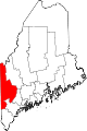
Otisfield, Maine — Town — Location within the state of Maine
 Otisfield, Maine
Coordinates: 44°4′45″N 70°32′23″W / 44.07917°N 70.53972°WCoordinates: 44°4′45″N 70°32′23″W / 44.07917°N 70.53972°W Country United States State Maine County Oxford Incorporated 1798 Area – Total 44.3 sq mi (114.7 km2) – Land 40.0 sq mi (103.5 km2) – Water 4.3 sq mi (11.2 km2) Elevation 666 ft (203 m) Population (2000) – Total 1,560 – Density 39.0/sq mi (15.1/km2) Time zone Eastern (EST) (UTC-5) – Summer (DST) EDT (UTC-4) Area code(s) 207 FIPS code 23-55960 GNIS feature ID 0582655 Otisfield is a town in Oxford County, Maine, United States. The population was 1,560 at the 2000 census. Otisfield is a summer recreation area and home to Seeds of Peace Camp and Camp Arcadia.
Contents
History
It was granted by the Massachusetts General Court on June 15, 1771 to James Otis, Nathaniel Gorham and other descendants of Captain John Gorham and certain members of his company who had fought in the 1690 Battle of Quebec. It replaced a 1736 grant which was ruled invalid when the line between New Hampshire and Massachusetts was redrawn to satisfy claims by the heirs of John Mason. Many early settlers were veterans of the Revolutionary War, with the greater number coming from Groton, Massachusetts.[1] First called Otis Field Plantation, it was incorporated on February 19, 1798 as Otisfield. It then included nearly all of Harrison, set off in 1805, and a large part of Naples, set off in 1834. The town was part of Cumberland County until 1978, when it joined Oxford County.[2]
The surface of the town is uneven with gravelly but productive soil. Farming became the principal occupation, with corn, potatoes and hay the chief crops. Mills were erected at various water power sites, with the first sawmill built 1812. Other industries included gristmills, blacksmith shops, a tannery, a pants factory and shoe shop, a cider mill and cannery for apples, a barrel factory, a shingle mill and a woolen carding mill.[3] Today, Otisfield is largely a recreational area, with camps and summer cottages lining the shores of Pleasant Lake, Thompson Lake, Saturday Pond and Moose Pond.
Geography
According to the United States Census Bureau, the town has a total area of 44.3 square miles (115 km2), of which 40.0 square miles (104 km2) is land and 4.3 square miles (11 km2), or 9.78%, is water. Otisfield is drained by the Crooked River.
The town is crossed by state routes 117 and 121. It borders the towns of Norway to the north, Oxford to the northeast, Poland to the east, Casco and Naples to the south, and Harrison to the west.
Demographics
As of the census[4] of 2000, there were 1,560 people, 595 households, and 452 families residing in the town. The population density was 39.0 people per square mile (15.1/km²). There were 1,011 housing units at an average density of 25.3 per square mile (9.8/km²). The racial makeup of the town was 98.21% White, 0.26% African American, 0.45% Native American, 0.13% Asian, 0.06% Pacific Islander, and 0.90% from two or more races.
There were 595 households out of which 35.0% had children under the age of 18 living with them, 66.1% were married couples living together, 5.5% had a female householder with no husband present, and 24.0% were non-families. 17.8% of all households were made up of individuals and 5.9% had someone living alone who was 65 years of age or older. The average household size was 2.61 and the average family size was 2.95.
In the town the population was spread out with 25.7% under the age of 18, 4.7% from 18 to 24, 29.9% from 25 to 44, 27.5% from 45 to 64, and 12.2% who were 65 years of age or older. The median age was 39 years. For every 100 females there were 101.0 males. For every 100 females age 18 and over, there were 99.5 males.
The median income for a household in the town was $43,304, and the median income for a family was $46,652. Males had a median income of $32,167 versus $26,250 for females. The per capita income for the town was $19,142. About 6.7% of families and 9.1% of the population were below the poverty line, including 13.7% of those under age 18 and 2.7% of those age 65 or over.
Seeds of Peace
Otisfield is known throughout the state of Maine for being the home of Seeds of Peace International Camp. Seeds of Peace has been located in Otisfield since its founding in 1993. It is placed on Pleasant Lake and located on the former Camp Powhatan. Over 4,000 teenagers from all over the world have come to Seeds of Peace to discuss conflict resolution issues.[5]
Site of interest
References
- ^ Coolidge, Austin J.; John B. Mansfield (1859). A History and Description of New England. Boston, Massachusetts. pp. 243–244. http://books.google.com/books?id=OcoMAAAAYAAJ&lpg=PA9&dq=coolidge%20mansfield%20history%20description%20new%20england%201859&pg=PA243#v=onepage&q&f=false.
- ^ History of Otisfield, Maine
- ^ Varney, George J. (1886), Gazetteer of the state of Maine. Otisfield, Boston: Russell, http://history.rays-place.com/me/otisfield-me.htm
- ^ "American FactFinder". United States Census Bureau. http://factfinder.census.gov. Retrieved 2008-01-31.
- ^ "About Seeds of Peace". http://www.seedsofpeace.org/about. Retrieved 2010-06-16.
External links
- Town of Otisfield, Maine
- Otisfield Trail Blazers Snowmobile Club
- Genealogy in Otisfield, Maine
- Maine.gov -- Otisfield, Maine
- Maine Genealogy: Otisfield, Oxford County, Maine
Municipalities and communities of Oxford County, Maine Towns Andover | Bethel | Brownfield | Buckfield | Byron | Canton | Denmark | Dixfield | Fryeburg | Gilead | Greenwood | Hanover | Hartford | Hebron | Hiram | Lovell | Mexico | Newry | Norway | Otisfield | Oxford | Paris | Peru | Porter | Roxbury | Rumford | Stoneham | Stow | Sumner | Sweden | Upton | Waterford | West Paris | Woodstock
Plantations Unorganized
territoriesCDPs Other
villagesDickvale | Kezar Falls | North Waterford | Waterford Flat
Categories:- Seeds of Peace
- Towns in Oxford County, Maine


Wikimedia Foundation. 2010.