- Groton, Massachusetts
Infobox Settlement
official_name = Groton, Massachusetts
nickname =
motto =
imagesize = 250px
image_caption = "Dixhouse" in c. 1910
image_
mapsize = 250px
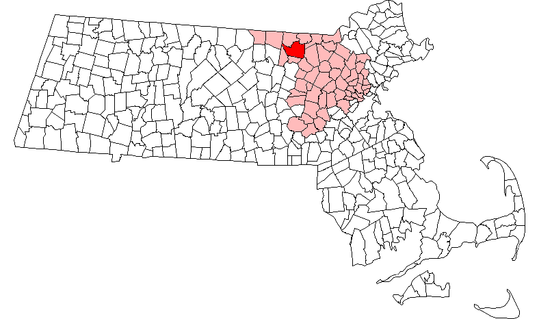
map_caption = Location in Middlesex County in Massachusetts
mapsize1 =
map_caption1 =
subdivision_type = Country
subdivision_name =United States
subdivision_type1 = State
subdivision_name1 =Massachusetts
subdivision_type2 = County
subdivision_name2 = Middlesex
established_title = Settled
established_date = 1655
established_title2 = Incorporated
established_date2 = 1655
established_title3 =
established_date3 =
government_type =Open town meeting
leader_title =
leader_name = Jean E. Kitchen [http://www.townofgroton.org/main?cmd=get-dept&id=22]
leader_title1 =
leader_name1 = George F. Dillon, Jr. [http://www.townofgroton.org/main?cmd=get-dept&id=14]
Peter S. Cunningham
John L. Saball
Mihran Keoseian, Jr.
1 Vacancy
area_magnitude =
area_total_km2 = 87.3
area_total_sq_mi = 33.7
area_land_km2 = 84.9
area_land_sq_mi = 32.8
area_water_km2 = 2.4
area_water_sq_mi = 0.9
population_as_of = 2007
settlement_type = Town
population_total = 10,641
population_density_km2 = 125.3
population_density_sq_mi = 324.4
elevation_m = 98
elevation_ft = 320
timezone = Eastern
utc_offset = -5
timezone_DST = Eastern
utc_offset_DST = -4
latd = 42 |latm = 36 |lats = 40 |latNS = N
longd = 71 |longm = 34 |longs = 30 |longEW = W
website = [http://www.townofgroton.org/ www.townofgroton.org]
postal_code_type = ZIP code
postal_code = 01450
area_code = 351 / 978
blank_name = FIPS code
blank_info = 25-27480
blank1_name = GNIS feature ID
blank1_info = 0619399
footnotes =Groton is a town located in northwestern Middlesex County,
Massachusetts . The population of Groton was 9,547 at the 2000 census. It is home to two prep schools:Groton School , founded in 1884, andLawrence Academy at Groton , founded in 1793. The town hosts the "National Shepley Hill Horse Trials".History
Groton began with the
trading post of John Tinker, who conducted business there with the NipmucAlgonquin Indians at the confluence of Nod Brook and theNashua River . Indians called the area "Petapawag," meaning "swampy land." Pioneers would follow Indian trails fromMassachusetts Bay , as Tinker had, and found the region productive forfishing andfarming .The town was officially settled and incorporated in 1655, named for Groton in Suffolk County,
England , the hometown of an early selectman, Dean Winthrop. Called "The Plantation of Groton," it included all of present-day Groton and Ayer, almost all of Pepperell and Shirley, large parts of Dunstable and Littleton, plus smaller parts of Harvard, Westford,Nashua, NH , andHollis, NH .During
King Philip's War , in 1676 Indians burned all but four Grotongarrisons . Survivors fled to Concord and other safe havens, but returned two years later to rebuild the town. Groton would again be beset by Indians duringQueen Anne's War , when several citizens of the town were abducted toCanada . In 1775, the common in front of the First Parish Church was an assembly area for Groton Minutemen, who fought in theBattle of Lexington and Concord .Geography
According to the
United States Census Bureau , Groton has a total area of 33.7square mile s (87.3km² ), of which 32.8 square miles (84.9 km²) is land and 0.9 square miles (2.4 km²) (2.79%) is water. Groton is the largest town in Middlesex County in terms of square mileage. The town is drained by the Nashua and Squannacook rivers.Groton borders the following towns: Pepperell, Dunstable, Tyngsborough, Westford, Littleton, Ayer, Shirley, and Townsend.
Demographics
"This article describes the town of Groton as a whole. Additional demographic details are available which describe only the central settlement within the town, although those details are included in the aggregate values reported here. See: Groton (CDP),
Massachusetts ".As of the
census GR|2 of 2000, there were 9,547 people, 3,268 households, and 2,568 families residing in the town. Thepopulation density was 291.3 people per square mile (112.5/km²). There were 3,393 housing units at an average density of 103.5/sq mi (40.0/km²). The racial makeup of the town was 97.22% White, 0.35% Black or African American, 0.13% Native American, 0.97% Asian, 0.02% Pacific Islander, 0.27% from other races, and 1.04% from two or more races. Hispanic or Latino of any race were 1.14% of the population.There were 3,268 households out of which 46.8% had children under the age of 18 living with them, 70.0% were married couples living together, 6.3% had a female householder with no husband present, and 21.4% were non-families. 17.1% of all households were made up of individuals and 5.4% had someone living alone who was 65 years of age or older. The average household size was 2.90 and the average family size was 3.31.
The age distribution of the town's population was 32.6% under the age of 18, 4.2% from 18 to 24, 32.7% from 25 to 44, 23.5% from 45 to 64, and 7.0% who were 65 years of age or older. The median age was 36 years. For every 100 females there were 98.2 males. For every 100 females age 18 and over, there were 94.5 males.
The median income for a household in the town was $82,869, and the median income for a family was $92,014. Males had a median income of $63,889 versus $41,581 for females. The
per capita income for the town was $33,877. About 2.5% of families and 4.0% of the population were below thepoverty line , including 3.8% of those under age 18 and none of those age 65 or over.Education
*Boutwell School
*Florence Roche Elementary School
*Groton-Dunstable Regional Middle School
*Groton-Dunstable Regional High School
*Nashoba Valley Technical High School - Public Regional Vocational Technical High School located in Westford
*Prescott Elementary School (Closed after the 2007-2008 school year due to budget cuts)
*Country Day School of the Holy Union
*Lawrence Academy
*Groton School Points of interest
* Groton Historical Society Museum
Notable residents
*
George Sewall Boutwell , governor and statesman
* Caleb Butler, historianFact|date=January 2008
*Peter Gammons , ESPN Baseball Analyst / Former Boston Globe Sports Writer
* John W. (Jay) Geils, Jr., founder of theJ. Geils Band Fact|date=January 2008
* Peter, Sue, and Christine Hanson, passengers of 9/11 flightUnited Airlines Flight 175
* Kevin Kastning, composer and recording artistFact|date=January 2008
*Abbott Lawrence , businessman, founder of Lawrence,Massachusetts
*Amos Lawrence , merchant and philanthropist
*Amos Adams Lawrence , abolitionist, founder of theUniversity of Kansas andLawrence University
* Samuel Lawrence, American revolutionary andGroton Academy founder
*Page McConnell , rock pianist/keyboardist
* Katie McNiff,Miss Massachusetts Teen USA 2007
*Otto Piene , German artist
*William Prescott , colonel in theAmerican Revolution , commanded colonial defense at theBattle of Bunker Hill
*Job Shattuck revolutionary soldier and one of the most prominent figures inShays' Rebellion
*Dan Shaughnessy ,Boston Globe sports columnist
*Edmund Charles Tarbell , artist
*Frank Bigelow Tarbell , scholar
*Paul Matisse , artist and grandson of French impressionistHenri Matisse
*Samuel Willard , colonial ministerReferences
Further reading
*cite web | title=Town of Groton, Massachusetts "Official Website" | url=http://www.townofgroton.org/ | accessmonthday=May 30 | accessyear=2006
* [http://books.google.com/books?id=xPWbzZD25hsC&dq=Groton,+Massachusetts&source=gbs_summary_s&cad=0 "Historical Sketch of Groton, Massachusetts. 1655-1890".] By Samuel Abbott Green, published 1894, 263 pages.
* [http://www.salemdeeds.com/atlases_results.asp?ImageType=index&atlastype=MassWorld&atlastown=&atlas=MASSACHUSETTS+1871&atlas_desc=MASSACHUSETTS+1871 "1871 Atlas of Massachusetts".] by Wall & Gray. [http://www.salemdeeds.com/atlases_pages.asp?ImageName=PAGE_0010_0011.jpg&atlastype=MassWorld&atlastown=&atlas=MASSACHUSETTS+1871&atlas_desc=MASSACHUSETTS+1871&pageprefix= Map of Massachusetts.] [http://www.salemdeeds.com/atlases_pages.asp?ImageName=PAGE_0044_0045.jpg&atlastype=MassWorld&atlastown=&atlas=MASSACHUSETTS+1871&atlas_desc=MASSACHUSETTS+1871&pageprefix= Map of Middlesex County.]
* "History of Middlesex County, Massachusetts", [http://books.google.com/books?id=QGolOAyd9RMC&dq=intitle:History+intitle:of+intitle:Middlesex+intitle:County+intitle:Massachusetts&lr=&num=50&as_brr=0&source=gbs_other_versions_sidebar_s&cad=5 Volume 1 (A-H)] , [http://books.google.com/books?id=hNaAnwRMedUC&pg=PA506&dq=intitle:History+intitle:of+intitle:Middlesex+intitle:County+intitle:Massachusetts&lr=&num=50&as_brr=0#PPA3,M1 Volume 2 (L-W)] compiled by Samuel Adams Drake, published 1879-1880. 572 and 505 pages. [http://books.google.com/books?id=QGolOAyd9RMC&printsec=titlepage&dq=intitle:History+intitle:of+intitle:Middlesex+intitle:County+intitle:Massachusetts&lr=&num=50&as_brr=0&source=gbs_summary_r#PPA454,M1 Groton article] by Samuel A Green in volume 1 pages 454-469.External links
* [http://www.gpl.org/ Groton Public Library]
* [http://www.groton.org/ Groton School]
* [http://www.lacademy.edu/ Lawrence Academy]
* [http://www.nashobachorale.org/ Nashoba Valley Chorale: An SATB chorus that rehearses in Littleton and performs in neighboring communities, from Acton to Pepperell]
Wikimedia Foundation. 2010.