- Magalloway Plantation, Maine
-
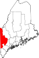
Magalloway Plantation, Maine — Plantation — Location within the state of Maine
 Magalloway Plantation, Maine
Coordinates: 44°51′42″N 70°58′10″W / 44.86167°N 70.96944°WCoordinates: 44°51′42″N 70°58′10″W / 44.86167°N 70.96944°W Country United States State Maine County Oxford Area – Total 54.2 sq mi (140.3 km2) – Land 48.4 sq mi (125.3 km2) – Water 5.8 sq mi (15.0 km2) Elevation 1,407 ft (429 m) Population (2000) – Total 37 – Density 0.8/sq mi (0.3/km2) Time zone Eastern (EST) (UTC-5) – Summer (DST) EDT (UTC-4) Area code(s) 207 FIPS code 23-42835 GNIS feature ID 0579017 Magalloway Plantation is a plantation in Oxford County, Maine, United States. The population was 37 at the 2000 census. Part of the Umbagog National Wildlife Refuge is located at its southwest corner.
Contents
Geography
According to the United States Census Bureau, the plantation has a total area of 54.2 square miles (140 km2), of which, 48.4 square miles (125 km2) of it is land and 5.8 square miles (15 km2) of it (10.67%) is water.
Demographics
As of the census[1] of 2000, there were 37 people, 15 households, and 12 families residing in the plantation. The population density was 0.8 people per square mile (0.3/km²). There were 105 housing units at an average density of 2.2 per square mile (0.8/km²). The racial makeup of the plantation was 100.00% White.
There were 15 households out of which 26.7% had children under the age of 18 living with them, 80.0% were married couples living together, and 20.0% were non-families. 20.0% of all households were made up of individuals and 6.7% had someone living alone who was 65 years of age or older. The average household size was 2.47 and the average family size was 2.83.
In the plantation the population was spread out with 18.9% under the age of 18, 5.4% from 18 to 24, 5.4% from 25 to 44, 40.5% from 45 to 64, and 29.7% who were 65 years of age or older. The median age was 52 years. For every 100 females there were 117.6 males. For every 100 females age 18 and over, there were 100.0 males.
The median income for a household in the plantation was $33,750, and the median income for a family was $39,167. Males had a median income of $0 versus $25,833 for females. The per capita income for the plantation was $16,546. None of the population and none of the families were below the poverty line.
References
- ^ "American FactFinder". United States Census Bureau. http://factfinder.census.gov. Retrieved 2008-01-31.
External links
Municipalities and communities of Oxford County, Maine Towns Andover | Bethel | Brownfield | Buckfield | Byron | Canton | Denmark | Dixfield | Fryeburg | Gilead | Greenwood | Hanover | Hartford | Hebron | Hiram | Lovell | Mexico | Newry | Norway | Otisfield | Oxford | Paris | Peru | Porter | Roxbury | Rumford | Stoneham | Stow | Sumner | Sweden | Upton | Waterford | West Paris | Woodstock
Plantations Lincoln Plantation | Magalloway Plantation
Unorganized
territoriesCDPs Other
villagesDickvale | Kezar Falls | North Waterford | Waterford Flat
Categories:- Plantations in Oxford County, Maine


Wikimedia Foundation. 2010.