- Jonesport, Maine
Infobox Settlement
official_name = Jonesport, Maine
settlement_type = Town
nickname =
motto =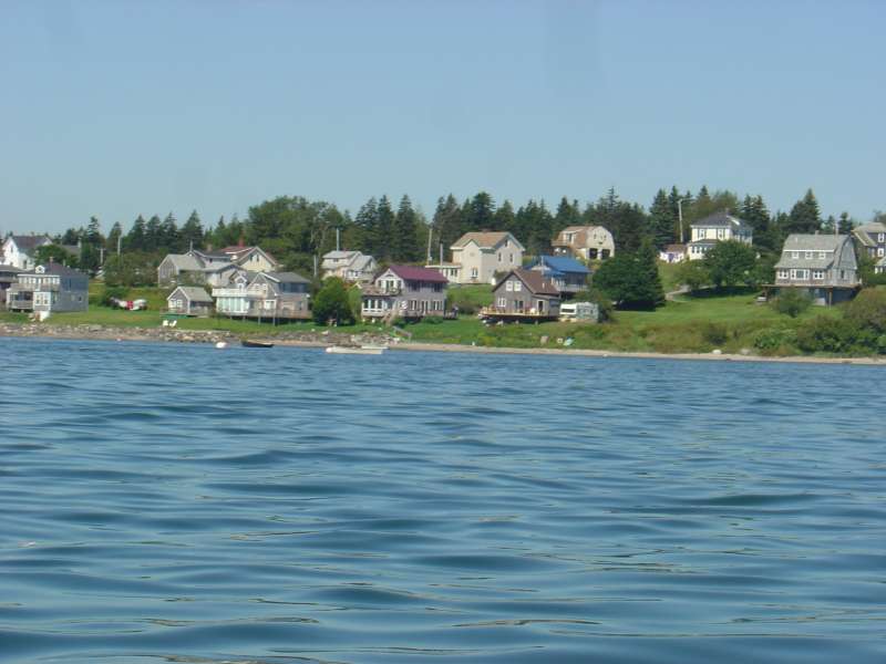
imagesize =
image_caption =
image_|pushpin_
pushpin_label_position =left
pushpin_map_caption =Location within the state of Maine
pushpin_mapsize =
|mapsize =
map_caption =
mapsize1 =
map_caption1 =subdivision_type = Country
subdivision_name =United States
subdivision_type1 = State
subdivision_name1 =Maine
subdivision_type2 = County
subdivision_name2 = Washington
government_footnotes =
government_type =
leader_title =
leader_name =
leader_title1 =
leader_name1 =
established_title = Incorporated
established_date = 1832unit_pref = Imperial
area_footnotes =
area_magnitude =
area_total_km2 = 260.7
area_land_km2 = 73.8
area_water_km2 = 186.9
area_total_sq_mi = 100.7
area_land_sq_mi = 28.5
area_water_sq_mi = 72.2population_as_of = 2000
population_footnotes =
population_total = 1408
population_density_km2 = 19.1
population_density_sq_mi = 49.4timezone = Eastern (EST)
utc_offset = -5
timezone_DST = EDT
utc_offset_DST = -4
elevation_footnotes =
elevation_m = 7
elevation_ft = 23
latd = 44 |latm = 33 |lats = 17 |latNS = N
longd = 67 |longm = 34 |longs = 41 |longEW = Wpostal_code_type =
ZIP code
postal_code = 04649
area_code = 207
blank_name = FIPS code
blank_info = 23-36010
blank1_name = GNIS feature ID
blank1_info = 0582537
website =
footnotes =Jonesport is a town in Washington County,
Maine ,United States . The population was 1,408 at the 2000 census. Jonesport is afishing , lobstering and summerresort area .History
This was part of a grant of 48,160 acres made by the
Massachusetts General Court in 1789 to John C. Jones and others. It was incorporated onMarch 4 ,1809 as Jonesborough. OnFebruary 3 ,1832 , a portion of Jonesborough was set off and incorporated as Jones' Port. Then onApril 7 ,1925 , a portion of Jonesport was set off and incorporated as the island town of Beals, which is accessible by bridge across the Moosabec Reach.Located on a
peninsula 6 miles out in theGulf of Maine , the town's principal industries arefishing ,boat building , harvesting blueberries and tourist services. Jonesport includes many uninhabited islands which provide nesting areas foreider ,cormorant s,seagull s,razorbill s,guillemot s,loon s,black scoter s,grebe s andeagle s. There are 2nature preserve s: Western Brothers Island and the Great Wass Archipelago (which includesGreat Wass Island ), the latter shared with the town of Beals.Notable residents
*
Marv Peasley , baseball playerGeography
According to the
United States Census Bureau , the town has a total area of 100.7square mile s (260.7km² ), of which, 28.5 square miles (73.8 km²) of it is land and 72.2 square miles (186.9 km²) of it (71.68%) is water. Drained by the Indian River, Jonesport is situated on a peninsula atChandler Bay and besideEnglishman Bay , part of theGulf of Maine andAtlantic Ocean .The town is crossed by state route 187. It is bordered by the towns of Addison to the west, Jonesboro to the north, and Beals to the south.
Demographics
As of the
census GR|2 of 2000, there were 1,408 people, 597 households, and 397 families residing in the town. Thepopulation density was 49.4 people per square mile (19.1/km²). There were 877 housing units at an average density of 30.8/sq mi (11.9/km²). The racial makeup of the town was 97.80% White, 0.28% African American, 0.71% Native American, 0.07% Asian, 0.14% from other races, and 0.99% from two or more races. Hispanic or Latino of any race were 0.43% of the population.There were 597 households out of which 27.0% had children under the age of 18 living with them, 54.3% were married couples living together, 8.4% had a female householder with no husband present, and 33.5% were non-families. 29.0% of all households were made up of individuals and 17.4% had someone living alone who was 65 years of age or older. The average household size was 2.30 and the average family size was 2.79.
In the town the population was spread out with 21.0% under the age of 18, 8.8% from 18 to 24, 23.7% from 25 to 44, 23.9% from 45 to 64, and 22.7% who were 65 years of age or older. The median age was 43 years. For every 100 females there were 91.0 males. For every 100 females age 18 and over, there were 89.3 males.
The median income for a household in the town was $23,224, and the median income for a family was $30,474. Males had a median income of $22,917 versus $15,917 for females. The
per capita income for the town was $14,135. About 14.7% of families and 19.8% of the population were below thepoverty line , including 22.4% of those under age 18 and 22.6% of those age 65 or over.ites of interest
* [http://peabodymemorial.com/jonesport_historical_society Jonesport Historical Society]
* [http://lighthouse.cc/moosepeak/ Moose Peak Light]References
External links
* [http://www.washingtoncountymaine.com/towns/jonesport.html Town of Jonesport, Maine]
* [http://peabodymemorial.com/ Peabody Memorial Library]
* [http://www.jonesport.com/ Jonesport Online]
* [http://maine.gov/local/washington/jonesport/ Maine.gov -- Jonesport, Maine]
* [http://history.rays-place.com/me/jonesborough-me.htm History of Jonesborough, Maine (1886)]

Wikimedia Foundation. 2010.