- National Register of Historic Places listings in Washington County, Kentucky
-
 Location of Washington County in Kentucky
This is a list of the National Register of Historic Places listings in Washington County, Kentucky. It is intended to be a complete list of the properties and districts on the National Register of Historic Places in Washington County, Kentucky, United States. The locations of National Register properties and districts for which the latitude and longitude coordinates are included below, may be seen in a Google map.[1]
There are approximately 66 properties and districts listed on the National Register in the county.
-
- This National Park Service list is complete through NPS recent listings posted November 10, 2011.[2]
Listings county-wide
[3] Landmark name Image Date listed Location City or town Summary 1 John R. Barber House February 10, 1989 West of Springfield on U.S. Route 150
37°42′49″N 85°15′50″W / 37.713611°N 85.263889°WSpringfield 2 Beech Fork Bridge, Mackville Road February 10, 1989 East of Springfield on KY 152
37°42′15″N 85°08′46″W / 37.704167°N 85.146111°WSpringfield 3 Beechfork Presbyterian Church February 10, 1989 North of Springfield off KY 55
37°45′14″N 85°10′30″W / 37.753889°N 85.175°WSpringfield 4 Richard Berry, Jr., House February 10, 1989 North of Springfield on KY 438
37°46′10″N 85°11′33″W / 37.769444°N 85.1925°WSpringfield 5 William Blackwell House February 10, 1989 138 Lebanon Hill
37°41′08″N 85°13′20″W / 37.685556°N 85.222222°WSpringfield 6 Stephen Cooke Brown House November 21, 1994 KY 438
37°45′40″N 85°10′20″W / 37.761111°N 85.172222°WSpringfield 7 William Caldwell Kitchen October 6, 1987 Off KY 55 on Spaulding Lane
37°43′03″N 85°10′50″W / 37.7175°N 85.180556°WSpringfield 8 Cartwright Creek Bridge February 10, 1989 West of Springfield on Booker Rd.
37°39′34″N 85°16′23″W / 37.659444°N 85.273056°WSpringfield 9 Clements House February 10, 1989 West of Springfield on U.S. Route 150
37°42′15″N 85°15′11″W / 37.704167°N 85.253056°WSpringfield 10 Cocanougher House February 10, 1989 Off U.S. Route 150
37°39′27″N 85°06′07″W / 37.6575°N 85.101944°WMackville 11 George Conner House February 10, 1989 Off U.S. Route 150
37°45′35″N 85°20′38″W / 37.759722°N 85.343889°WFredericktown 12 Covington Institute Teachers' Residence January 27, 1983 333 E. Main St.
37°40′58″N 85°12′56″W / 37.682778°N 85.215556°WSpringfield 13 Ed Cusick House February 10, 1989 West of Springfield on Bearwallow Rd.
37°42′59″N 85°21′59″W / 37.716389°N 85.366389°WSpringfield 14 Doe Run Trestle February 10, 1989 West of Springfield off U.S. Route 150
37°46′40″N 85°17′40″W / 37.777778°N 85.294444°WSpringfield 15 Duncan House February 10, 1989 206 Lincoln Park Rd.
37°41′10″N 85°13′18″W / 37.686111°N 85.221667°WSpringfield 16 Edelen House February 10, 1989 Highway 1183
37°42′52″N 85°23′15″W / 37.714444°N 85.3875°WSpringfield 17 Elmwood December 20, 1977 KY 55
37°40′41″N 85°13′35″W / 37.678056°N 85.226389°WSpringfield 18 Farmer's Bank of Mackville February 10, 1989 KY 152
37°43′41″N 85°04′00″W / 37.728056°N 85.066667°WMackville 19 Fields' House February 10, 1989 Highway 1183
37°42′13″N 85°19′06″W / 37.703611°N 85.318333°WSpringfield 20 Glenn Cottage Tract February 10, 1989 KY 55
37°49′07″N 85°17′38″W / 37.818611°N 85.293889°WMaud 21 Gregory-Barlow Place February 10, 1989 South of Mooresville off KY 55
37°46′54″N 85°15′42″W / 37.781667°N 85.261667°WMooresville 22 Grundy Houses January 17, 1978 North of Springfield off KY 55
37°44′53″N 85°16′39″W / 37.748056°N 85.2775°WSpringfield 23 Hamilton Farm July 22, 1993 U.S. Route 150 0.7 miles west of Parker's Branch crossing
37°45′56″N 85°19′23″W / 37.765556°N 85.323056°WSpringfield 24 Thomas H. Hamilton House February 10, 1989 West of Springfield on U.S. Route 150
37°42′56″N 85°16′11″W / 37.715556°N 85.269722°WSpringfield 25 Hatchett Tobacco Barn February 7, 2008 3067 Beechland Rd.
37°45′58″N 85°12′32″W / 37.766111°N 85.208889°WSpringfield 26 Holy Rosary Church 
February 10, 1989 KY 1183
37°42′47″N 85°23′15″W / 37.713056°N 85.3875°WManton 27 Johnson's Chapel AME Church February 10, 1989 E. High St.
37°41′03″N 85°13′00″W / 37.684167°N 85.216667°WSpringfield 28 Kalarama Saddlebred Horse Farm August 5, 2010 101 Kalarama Dr. Springfield vicinity 29 Kendrick-Croake House February 10, 1989 Hog Run, Booker Station
37°46′49″N 85°18′09″W / 37.780278°N 85.3025°WMaud 30 Kendrick-Tucker-Barber House February 10, 1989 Off U.S. Route 150
37°45′56″N 85°18′36″W / 37.765556°N 85.31°WMooresville 31 Mordecai Lincoln House August 21, 1972 5.9 miles north of Springfield on KY 528
37°44′54″N 85°12′35″W / 37.748333°N 85.209722°WSpringfield 32 John Litsey House February 10, 1989 North of Springfield off KY 438
37°46′24″N 85°12′45″W / 37.773333°N 85.2125°WSpringfield 33 Long Lick Creek Bridge February 10, 1989 Hardesty-Polin Rd. over Long Lick Creek
37°48′38″N 85°12′45″W / 37.810556°N 85.2125°WWillisburg 34 Pat Lyddan House February 10, 1989 South of Mooresville on KY 55
37°47′26″N 85°15′27″W / 37.790556°N 85.2575°WMooresville 35 Maple Grove August 5, 2010 3216 Perryville Rd.
37°39′57″N 85°10′57″W / 37.665833°N 85.1825°WSpringfield vicinity 36 Archibald Scott Mayes House February 10, 1989 East of Springfield off U.S. Route 150
37°39′40″N 85°09′58″W / 37.661111°N 85.166111°WSpringfield 37 William C. McChord House December 11, 1978 202 Lincoln Park Rd.
37°41′10″N 85°13′18″W / 37.686111°N 85.221667°WSpringfield 38 T. I. McElroy House February 10, 1989 East of Springfield on U.S. Route 150
37°39′42″N 85°11′02″W / 37.661667°N 85.183889°WSpringfield 39 Wilson McElroy House February 10, 1989 321 E. High St.
37°41′04″N 85°12′59″W / 37.684444°N 85.216389°WSpringfield 40 Mount Zion Covered Bridge March 26, 1976 North of Mooresville on KY 458]]
37°49′40″N 85°15′23″W / 37.827778°N 85.256389°WMooresville 41 Parrot House February 10, 1989 East of Springfield on KY 152
37°41′39″N 85°10′51″W / 37.694167°N 85.180833°WSpringfield 42 Benjamin Pile House February 10, 1989 Off KY 55
37°48′59″N 85°16′54″W / 37.816389°N 85.281667°WSpringfield 43 John Pope House May 13, 1976 207 Walnut St.
37°41′08″N 85°13′11″W / 37.685556°N 85.219722°WSpringfield 44 Ray-Wakefield House February 10, 1989 Off KY 55
37°49′12″N 85°17′28″W / 37.82°N 85.291111°WMaud 45 Road Run School February 10, 1989 West of Springfield off KY 152
37°40′42″N 85°21′02″W / 37.678333°N 85.350556°WSpringfield 46 Round Stone Smokehouse January 8, 1987 U.S. Route 150
37°45′32″N 85°18′55″W / 37.758889°N 85.315278°WFredericktown 47 Simms-Edelen House February 10, 1989 Southeast of Springfield
37°38′05″N 85°10′39″W / 37.634722°N 85.1775°WSpringfield 48 Simms-Mattingly House February 10, 1989 East of Springfield off KY 152
37°42′11″N 85°09′52″W / 37.703056°N 85.164444°WSpringfield 49 Simmstown February 10, 1989 South of Springfield on Rineltown-Simmstown Rd.
37°38′05″N 85°11′08″W / 37.634722°N 85.185556°WSpringfield 50 Levi J. Smith House February 10, 1989 West of Springfield on U.S. Route 150
37°41′58″N 85°15′02″W / 37.699444°N 85.250556°WSpringfield 51 Springfield Armory March 24, 2000 126 Armory Hill Rd.
37°41′11″N 85°13′13″W / 37.686389°N 85.220278°WSpringfield 52 Springfield Baptist Church February 10, 1989 Lincoln Park Rd.
37°41′11″N 85°13′15″W / 37.686389°N 85.220833°WSpringfield 53 Springfield Graded School February 10, 1989 Mackville and Perry Rds.
37°40′54″N 85°12′52″W / 37.681667°N 85.214444°WSpringfield 54 Springfield Historic Commercial District February 10, 1989 Roughly bounded by McCord, Walnut, Ballard and Doctor Sts.
37°41′07″N 85°13′19″W / 37.685278°N 85.221944°WSpringfield 55 St. Catherine of Sienna Convent February 10, 1989 West of Springfield on U.S. Route 150
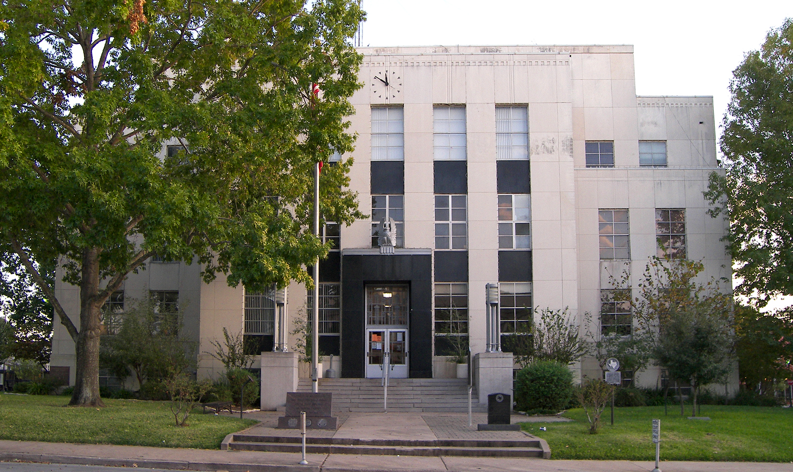
37°42′29″N 85°15′38″W / 37.708056°N 85.260556°WSpringfield 56 St. Dominic's Catholic Church February 10, 1989 Main St.
37°41′14″N 85°13′30″W / 37.687222°N 85.225°WSpringfield 57 St. Rose Roman Catholic Church Complex February 14, 1978 West of Springfield off U.S. Route 150
37°41′36″N 85°15′49″W / 37.693333°N 85.263611°WSpringfield 58 Tatham Springs February 10, 1989 North of Willisburg on Hwy. 1796
37°51′50″N 85°07′28″W / 37.863889°N 85.124444°WWillisburg 59 John Thomas House February 10, 1989 South of Mooresville on KY 55
37°47′09″N 85°15′17″W / 37.785833°N 85.254722°WMooresville 60 Dr. Thompson House February 10, 1989 East of Springfield on Mackville Rd.
37°43′19″N 85°05′59″W / 37.721944°N 85.099722°WSpringfield 61 S. F. Turner and Company Steam Flouring and Grist Mill February 10, 1989 400 W. Main St.
37°41′17″N 85°13′47″W / 37.688056°N 85.229722°WSpringfield 62 Walnut Street Historic District February 10, 1989 200-600 blocks of Walnut St.
37°41′12″N 85°13′10″W / 37.686667°N 85.219444°WSpringfield 63 Walton Manor Cottage August 24, 1977 2 miles west of Springfield on KY 150
37°42′13″N 85°15′14″W / 37.703611°N 85.253889°WSpringfield 64 Washington County Courthouse 
July 25, 1977 Public Sq., Main at Lincoln Park Rd.
37°41′06″N 85°13′16″W / 37.685°N 85.221111°WSpringfield 65 Thomas H. Williams House February 10, 1989 Hardesty Rd.
37°48′00″N 85°12′41″W / 37.8°N 85.211389°WSpringfield 66 Willisburg Central Bank and Post Office February 10, 1989 KY 53
37°48′30″N 85°07′29″W / 37.808333°N 85.124722°WWillisburg See also
- List of National Historic Landmarks in Kentucky
- National Register of Historic Places listings in Kentucky
References
- ^ The latitude and longitude information provided in this table was derived originally from the National Register Information System, which has been found to be fairly accurate for about 99% of listings. For about 1% of NRIS original coordinates, experience has shown that one or both coordinates are typos or otherwise extremely far off; some corrections may have been made. A more subtle problem causes many locations to be off by up to 150 yards, depending on location in the country: most NRIS coordinates were derived from tracing out latitude and longitudes off of USGS topographical quadrant maps created under North American Datum of 1927, which differs from the current, highly accurate GPS system used by Google maps. Chicago is about right, but NRIS longitudes in Washington are higher by about 4.5 seconds, and are lower by about 2.0 seconds in Maine. Latitudes differ by about 1.0 second in Florida. Some locations in this table may have been corrected to current GPS standards.
- ^ "National Register of Historic Places: Weekly List Actions". National Park Service, United States Department of the Interior. Retrieved on November 10, 2011.
- ^ Numbers represent an ordering by significant words. Various colorings, defined here, differentiate National Historic Landmark sites and National Register of Historic Places Districts from other NRHP buildings, structures, sites or objects.
U.S. National Register of Historic Places Topics Lists by states Alabama • Alaska • Arizona • Arkansas • California • Colorado • Connecticut • Delaware • Florida • Georgia • Hawaii • Idaho • Illinois • Indiana • Iowa • Kansas • Kentucky • Louisiana • Maine • Maryland • Massachusetts • Michigan • Minnesota • Mississippi • Missouri • Montana • Nebraska • Nevada • New Hampshire • New Jersey • New Mexico • New York • North Carolina • North Dakota • Ohio • Oklahoma • Oregon • Pennsylvania • Rhode Island • South Carolina • South Dakota • Tennessee • Texas • Utah • Vermont • Virginia • Washington • West Virginia • Wisconsin • WyomingLists by territories Lists by associated states Other  Category:National Register of Historic Places •
  Portal:National Register of Historic Places
Municipalities and communities of Washington County, Kentucky County seat: Springfield Cities 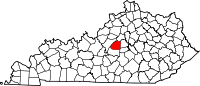
Unincorporated
communitiesBear Wallow | Fredericktown | Manton
Categories:- National Register of Historic Places in Kentucky by county
- Washington County, Kentucky
-


Wikimedia Foundation. 2010.