- U.S. Route 150
Infobox U.S. Route
article_route=150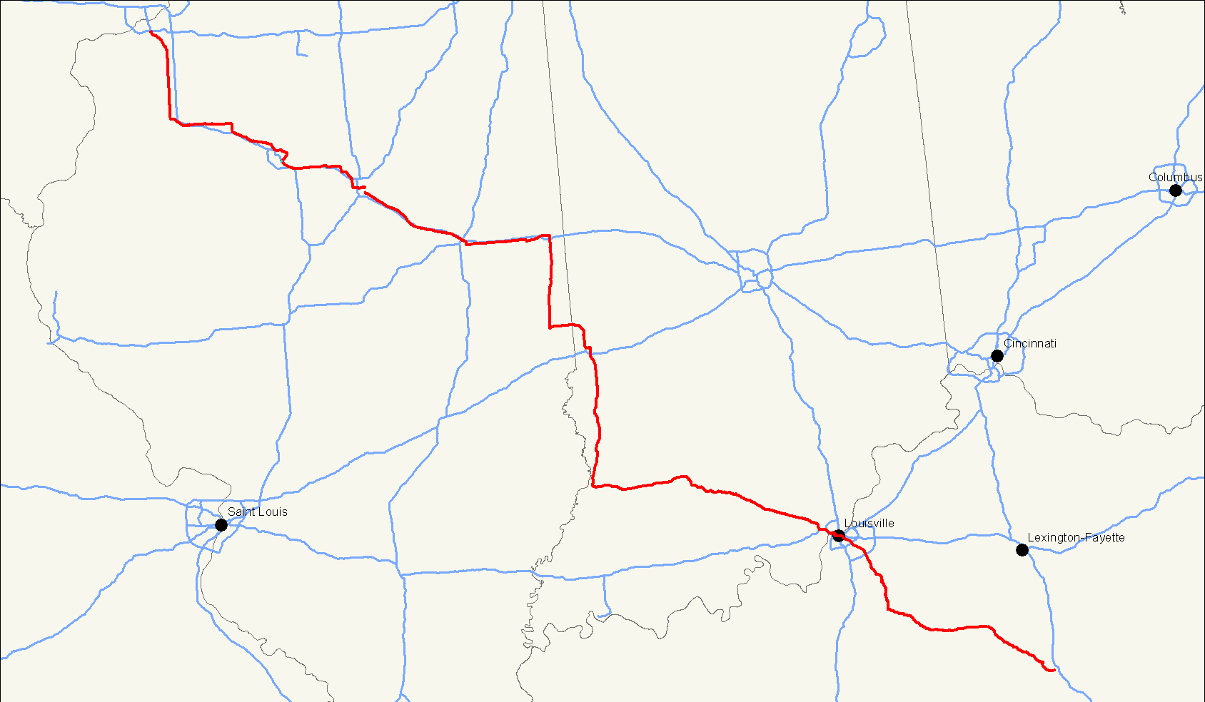
length_mi=571
length_ref= [http://www.us-highways.com/us1830.htm US Highways from US 1 to US 830] Robert V. Droz]
length_km=919
yrcom=1926
direction_a=West
direction_b=East
from=Jct|state=IL|US|6 in Moline, IL
junction=
to=Jct|state=KY|US|25 in Mount Vernon, KY
spur_of=50U.S. Route 150 (abbreviated Route 150 or U.S. 150) is a 571 mile (919 km) long northwest-southeast
United States highway , signed as east-west. It runs fromU.S. Route 6 outside ofMoline, Illinois toU.S. Route 25 inMount Vernon, Kentucky .Route description
Illinois
In the state of
Illinois , U.S. 150 runs from theQuad City International Airport atU.S. Route 6 southeast to near Vermilion.Between Moline and Danville, Route 150 closely parallels
Interstate 74 .Indiana
In the state of
Indiana , U.S. 150 runs south withU.S. Route 41 from Terre Haute. It is then concurrent with its parent,U.S. Route 50 from Vincennes to Shoals. It then runs east to New Albany before overlappingInterstate 64 into Kentucky. Between Vincennes and New Albany the road follows the original route of the Buffalo Trace.Kentucky
U.S. 150 runs with I-64 entering
Kentucky from Indiana, crossing theOhio River on theSherman Minton Bridge . It then forms a major southeastern radial artery from downtown Louisville, called Bardstown Road and intersecting with Interstates 65, 264 and 265.For its length in Louisville, U.S. 150 is also concurrent with
U.S. Route 31E . They separate at Bardstown near theMartha Layne Collins Blue Grass Parkway . U.S. 150 then continues southeast, around the city of Danville before terminating at Mount Vernon.History
U.S. Route 168 was created in 1926 from Louisville to
Mount Vernon, Kentucky , overlapping US 68 between Bardstown and Perryville. In 1934, US 150 absorbed US 168.See also
*
U.S. Route 50
*U.S. Route 250
*U.S. Route 350
*U.S. Route 450
*U.S. Route 550
*U.S. Route 650 External links
* [http://www.geocities.com/usend5059/End350/end350.htm Endpoints of US highways]
References
###@@@KEYEND@@@###
Wikimedia Foundation. 2010.