- National Register of Historic Places listings in Edmonson County, Kentucky
-
 Location of Edmonson County in Kentucky
This is a list of the National Register of Historic Places listings in Edmonson County, Kentucky. It is intended to be a complete list of the properties and districts on the National Register of Historic Places in Edmonson County, Kentucky, United States. The locations of National Register properties and districts for which the latitude and longitude coordinates are included below, may be seen in a Google map.[1]
There are 23 properties and districts listed on the National Register in the county.
-
- This National Park Service list is complete through NPS recent listings posted November 10, 2011.[2]
Listings county-wide
[3] Landmark name Image Date listed Location City or town Summary 1 Asphalt Rock Pictographs (15ED24) September 8, 1989 Address Restricted Asphalt 2 Bransford Spring Pumphouse 
May 8, 1991 Mammoth Cave National Park
37°12′05″N 86°04′37″W / 37.201389°N 86.076944°WMammoth Cave 3 Colossal Cavern Entrance 
May 8, 1991 Mammoth Cave National Park
37°11′17″N 86°04′24″W / 37.188056°N 86.073333°WMammoth Cave 4 Crystal Cave District 
May 8, 1991 Mammoth Cave National Park
37°12′40″N 86°03′17″W / 37.211111°N 86.054722°WMammoth Cave 5 Dismal Rock Shelter Petroglyphs (15ED15) September 8, 1989 Address Restricted Sweeden 6 William Ford House November 28, 1980 South of Brownsville on U.S. Route 31W
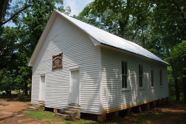
37°05′41″N 86°12′33″W / 37.094722°N 86.209167°WBrownsville 7 Good Spring Baptist Church and Cemetery May 8, 1991 Mammoth Cave National Park
37°12′32″N 86°08′53″W / 37.208889°N 86.148056°WMammoth Cave 8 Great Onyx Cave Entrance 
May 8, 1991 Mammoth Cave National Park
37°13′08″N 86°04′41″W / 37.218889°N 86.078056°WMammoth Cave 9 Hercules and Coach No. 2 
October 10, 1975 Off KY 70 in Mammoth Cave National Park
37°11′02″N 86°05′56″W / 37.183889°N 86.098889°WMammoth Cave 10 Joppa Baptist Church and Cemetery May 8, 1991 Mammoth Cave National Park
37°09′46″N 86°08′06″W / 37.162778°N 86.135°WMammoth Cave 11 Maintenance Area District 
May 8, 1991 Mammoth Cave National Park
37°10′49″N 86°05′09″W / 37.180278°N 86.085833°WMammoth Cave 12 Mammoth Cave Baptist Church and Cemetery 
May 8, 1991 Mammoth Cave National Park
37°11′52″N 86°04′23″W / 37.197778°N 86.073056°WMammoth Cave 13 Mammoth Cave Historic District 
May 8, 1991 Mammoth Cave National Park
37°10′10″N 86°05′00″W / 37.169444°N 86.083333°WMammoth Cave 14 Maple Springs Ranger Station May 8, 1991 Mammoth Cave National Park
37°12′26″N 86°07′56″W / 37.207222°N 86.132222°WMammoth Cave 15 Mill Hole Farm May 22, 1978 West of Park City off U.S. Route 31W
37°06′38″N 86°06′50″W / 37.110556°N 86.113889°WPark City 16 Mitchell-Estes Farmstead January 11, 1996 1706 Upper Smiths Grove Rd.
37°04′36″N 86°11′25″W / 37.076667°N 86.190278°WSmiths Grove 17 Old Guide Cemetery 
May 8, 1991 Mammoth Cave National Park
37°11′12″N 86°06′20″W / 37.186667°N 86.105556°WMammoth Cave 18 Reed-Dorsey House October 16, 1986 Upper Main Cross and Jefferson Sts.
37°11′35″N 86°16′12″W / 37.193056°N 86.27°WBrownsville 19 Residential Area District 
May 8, 1991 Mammoth Cave National Park
37°11′01″N 86°05′21″W / 37.183611°N 86.089167°WMammoth Cave 20 Salts Cave Archeological Site May 15, 1979 Address Restricted Munfordville 21 Superintendent's House May 8, 1991 Mammoth Cave National Park
37°11′03″N 86°05′11″W / 37.184167°N 86.086389°WMammoth Cave 22 Three Springs Pumphouse 
May 8, 1991 Mammoth Cave National Park
37°11′45″N 86°04′59″W / 37.195833°N 86.083056°WMammoth Cave 23 Mathias Willis Store House January 8, 1987 Cummins Rd.
37°10′44″N 86°21′34″W / 37.178889°N 86.359444°WWindyville See also
- List of National Historic Landmarks in Kentucky
- National Register of Historic Places listings in Kentucky
References
- ^ The latitude and longitude information provided in this table was derived originally from the National Register Information System, which has been found to be fairly accurate for about 99% of listings. For about 1% of NRIS original coordinates, experience has shown that one or both coordinates are typos or otherwise extremely far off; some corrections may have been made. A more subtle problem causes many locations to be off by up to 150 yards, depending on location in the country: most NRIS coordinates were derived from tracing out latitude and longitudes off of USGS topographical quadrant maps created under the North American Datum of 1927, which differs from the current, highly accurate WGS84 GPS system used by Google maps. Chicago is about right, but NRIS longitudes in Washington are higher by about 4.5 seconds, and are lower by about 2.0 seconds in Maine. Latitudes differ by about 1.0 second in Florida. Some locations in this table may have been corrected to current GPS standards.
- ^ "National Register of Historic Places: Weekly List Actions". National Park Service, United States Department of the Interior. Retrieved on November 10, 2011.
- ^ Numbers represent an ordering by significant words. Various colorings, defined here, differentiate National Historic Landmark sites and National Register of Historic Places Districts from other NRHP buildings, structures, sites or objects.
U.S. National Register of Historic Places Topics Lists by states Alabama • Alaska • Arizona • Arkansas • California • Colorado • Connecticut • Delaware • Florida • Georgia • Hawaii • Idaho • Illinois • Indiana • Iowa • Kansas • Kentucky • Louisiana • Maine • Maryland • Massachusetts • Michigan • Minnesota • Mississippi • Missouri • Montana • Nebraska • Nevada • New Hampshire • New Jersey • New Mexico • New York • North Carolina • North Dakota • Ohio • Oklahoma • Oregon • Pennsylvania • Rhode Island • South Carolina • South Dakota • Tennessee • Texas • Utah • Vermont • Virginia • Washington • West Virginia • Wisconsin • WyomingLists by territories Lists by associated states Other Municipalities and communities of Edmonson County, Kentucky City 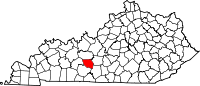
Communities Bee Spring | Big Reedy | Cedar Spring | Chalybeate Springs | Huff | Lindseyville | Pig | Rhoda | Rocky Hill | Sunfish | Sweeden | Windyville
Categories:- National Register of Historic Places in Kentucky by county
- Edmonson County, Kentucky
-


Wikimedia Foundation. 2010.