- National Register of Historic Places listings in Taylor County, Kentucky
-
 Location of Taylor County in Kentucky
This is a list of the National Register of Historic Places listings in Taylor County, Kentucky.
This is intended to be a complete list of the properties and districts on the National Register of Historic Places in Taylor County, Kentucky, United States. The locations of National Register properties and districts for which the latitude and longitude coordinates are included below, may be seen in a Google map.[1]
There are 14 properties and districts listed on the National Register in the county.
-
- This National Park Service list is complete through NPS recent listings posted November 10, 2011.[2]
Current listings
[3] Landmark name Image Date listed Location City or town Summary 1 Battle of Tebb's Bend Monument 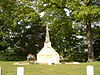
July 17, 1997 Romine Loop Rd., 0.5 miles north of its junction with Kentucky Route 55
37°13′49″N 85°20′50″W / 37.230278°N 85.347222°WCampbellsville 2 Battle of Tebbs Bend 
July 28, 1999 Off Kentucky Route 55, Tebbs Bend Rd.
37°14′19″N 85°21′29″W / 37.238611°N 85.358056°WCampbellsville 3 James Caldwell House October 3, 2011 105 Colonial Dr.
37°15′49″N 85°22′07″W / 37.263611°N 85.368611°WCampbellsville vicinity 4 Campbellsville Historic Commercial District 
February 10, 1983 Roughly bounded by Columbia Ave., Broadway, 1st, and Hotchkiss Sts., both sides of Central Ave., and railroad tracks
37°20′28″N 85°20′37″W / 37.341111°N 85.343611°WCampbellsville 5 Campbellsville Residential Historic District 
February 7, 2008 Roughly bounded by Central Ave. and Duffy, Maple, and Jackson Sts.
37°20′50″N 85°20′43″W / 37.347222°N 85.345278°WCampbellsville 6 Campbellsville School, Stadium and Athletic Field 
January 4, 2007 230 W. Main St.
37°20′15″N 85°20′55″W / 37.3375°N 85.348611°WCampbellsville 7 John Chandler House 
January 8, 1987 Off Kentucky Route 210
37°21′51″N 85°24′05″W / 37.364167°N 85.401389°WCampbellsville 8 Clay Hill 
October 10, 1975 5 miles north of Campbellsville on Kentucky Route 55
37°25′48″N 85°21′56″W / 37.43°N 85.365556°WCampbellsville 9 Jonathan Cowherd, Jr., House 
April 11, 1977 West of Campbellsville off Kentucky Route 70
37°20′12″N 85°25′21″W / 37.336667°N 85.4225°WCampbellsville 10 Jacob Hiestand House 
February 10, 1983 West of Campbellsville off Kentucky Route 210
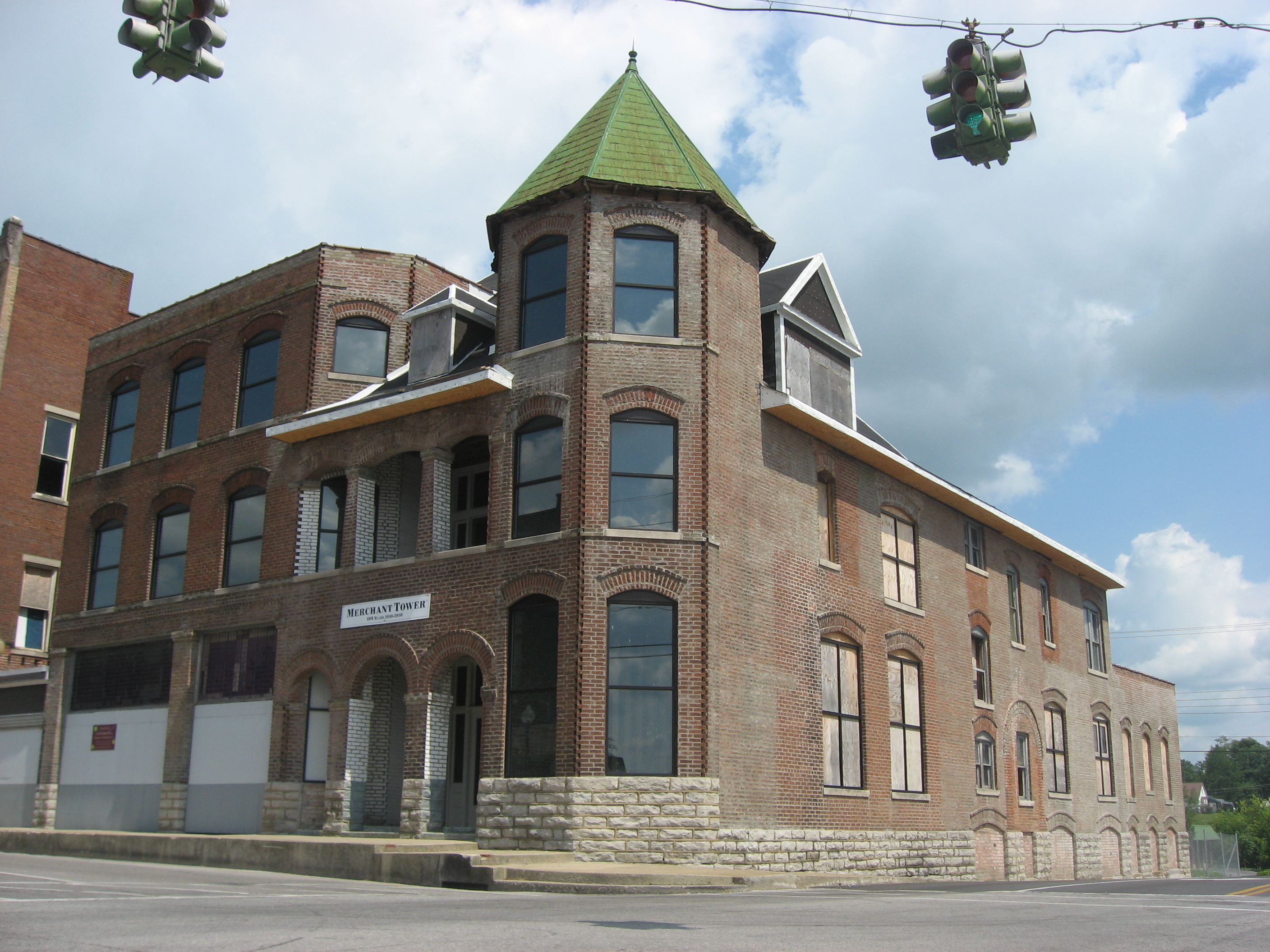
37°20′59″N 85°22′31″W / 37.349722°N 85.375278°WCampbellsville 11 Merchant's Hotel 
November 25, 1980 102 E. Main St.
37°20′27″N 85°20′43″W / 37.340833°N 85.345278°WCampbellsville 12 Durham Sanders House 
July 31, 1996 1251 Sanders Rd.
37°25′56″N 85°23′23″W / 37.432222°N 85.389722°WCampbellsville 13 Isaac Tate Farm 
August 4, 2004 5 miles south of Campbellsville on Kentucky Route 55
37°15′13″N 85°22′04″W / 37.253611°N 85.367778°WCampbellsville 14 Taylor County Clerk's Office 
December 20, 1977 Courthouse Sq.
37°20′29″N 85°20′44″W / 37.341389°N 85.345556°WCampbellsville See also
- List of National Historic Landmarks in Kentucky
- National Register of Historic Places listings in Kentucky
References
- ^ The latitude and longitude information provided in this table was derived originally from the National Register Information System, which has been found to be fairly accurate for about 99% of listings. For about 1% of NRIS original coordinates, experience has shown that one or both coordinates are typos or otherwise extremely far off; some corrections may have been made. A more subtle problem causes many locations to be off by up to 150 yards, depending on location in the country: most NRIS coordinates were derived from tracing out latitude and longitudes off of USGS topographical quadrant maps created under the North American Datum of 1927, which differs from the current, highly accurate WGS84 GPS system used by Google maps. Chicago is about right, but NRIS longitudes in Washington are higher by about 4.5 seconds, and are lower by about 2.0 seconds in Maine. Latitudes differ by about 1.0 second in Florida. Some locations in this table may have been corrected to current GPS standards.
- ^ "National Register of Historic Places: Weekly List Actions". National Park Service, United States Department of the Interior. Retrieved on November 10, 2011.
- ^ Numbers represent an ordering by significant words. Various colorings, defined here, differentiate National Historic Landmark sites and National Register of Historic Places Districts from other NRHP buildings, structures, sites or objects.
U.S. National Register of Historic Places Topics Lists by states Alabama • Alaska • Arizona • Arkansas • California • Colorado • Connecticut • Delaware • Florida • Georgia • Hawaii • Idaho • Illinois • Indiana • Iowa • Kansas • Kentucky • Louisiana • Maine • Maryland • Massachusetts • Michigan • Minnesota • Mississippi • Missouri • Montana • Nebraska • Nevada • New Hampshire • New Jersey • New Mexico • New York • North Carolina • North Dakota • Ohio • Oklahoma • Oregon • Pennsylvania • Rhode Island • South Carolina • South Dakota • Tennessee • Texas • Utah • Vermont • Virginia • Washington • West Virginia • Wisconsin • WyomingLists by territories Lists by associated states Other Municipalities and communities of Taylor County, Kentucky City 
Unincorporated
communitiesActon | Bengal | Black Gnat | Elk Horn | Finley | Hatcher | Mannsville | Merrimac | Saloma | Yuma
Categories:- National Register of Historic Places in Kentucky by county
- Taylor County, Kentucky
-


Wikimedia Foundation. 2010.