- National Register of Historic Places listings in Owen County, Kentucky
-
 Location of Owen County in Kentucky
This is a list of the National Register of Historic Places listings in Owen County, Kentucky.
This is intended to be a complete list of the properties and districts on the National Register of Historic Places in Owen County, Kentucky, United States. The locations of National Register properties and districts for which the latitude and longitude coordinates are included below, may be seen in a Google map.[1]
There are 17 properties and districts listed on the National Register in the county.
-
- This National Park Service list is complete through NPS recent listings posted November 10, 2011.[2]
Current listings
[3] Landmark name Image Date listed Location City or town Summary 1 Mason Brown House April 27, 1998 0.5 miles east of end of Brown's Bottom Rd.
38°25′52″N 84°56′28″W / 38.431111°N 84.941111°WGratz 2 Byrns Landing August 19, 1997 Old Landing Rd.
38°25′23″N 84°53′07″W / 38.423056°N 84.885278°WOwenton 3 Central Owenton Historic District 
September 4, 1984 Roughly Bryan, Madison, Seminary, and Thomas Sts.
38°32′10″N 84°50′14″W / 38.536111°N 84.837222°WOwenton 4 L.O. Cox House September 4, 1984 311 N. Main St.
38°32′22″N 84°50′12″W / 38.539444°N 84.836667°WOwenton 5 Ford House September 4, 1984 311 S. Main St.
38°31′59″N 84°50′05″W / 38.533056°N 84.834722°WOwenton 6 Enos Hardin Farm August 8, 1997 Junction of Rock Rd. and the Kentucky River
38°22′55″N 84°53′45″W / 38.381944°N 84.895833°WOwenton 7 Highfield November 17, 1977 303 N. Adams St.
38°32′12″N 84°50′29″W / 38.536667°N 84.841389°WOwenton 8 Jacob Hunter House January 8, 1987 Off Kentucky Route 325 near the Big South Fork of the Kentucky River
38°33′18″N 84°57′47″W / 38.555°N 84.963056°WNew Liberty 9 William Linsey House September 4, 1984 220 W. Seminary St.
38°32′02″N 84°42′47″W / 38.533889°N 84.713056°WOwenton 10 McKay House September 4, 1984 105 E. Adair St.
38°31′56″N 84°42′35″W / 38.532222°N 84.709722°WOwenton 11 Monterey Grade School August 19, 1997 9725 U.S. Route 127 S.
38°25′52″N 84°52′17″W / 38.431111°N 84.871389°WOwenton 12 Monterey Historic District August 19, 1997 Roughly bounded by U.S. Route 127, High, Hillcrest, and Taylor Sts.
38°25′20″N 84°52′22″W / 38.422222°N 84.872778°WMonterey 13 New Liberty Historic District January 4, 2001 Kentucky Route 227, roughly between Kentucky Routes 36 and 978
38°36′52″N 84°54′27″W / 38.614444°N 84.9075°WNew Liberty 14 North Main-North Adams Historic District September 4, 1984 N. Main, N. Adams, Bryan, and North Sts.
38°32′18″N 84°50′07″W / 38.538333°N 84.835278°WOwenton 15 Old Cedar Baptist Church September 5, 1997 1040 Claxon Ridge Rd.
38°23′49″N 84°50′55″W / 38.396944°N 84.848611°WOwenton 16 Owen County Courthouse and Jail May 6, 1976 N. Thomas and N. Madison Sts.
38°32′10″N 84°50′15″W / 38.536111°N 84.8375°WOwenton 17 E.E. Settle House September 4, 1984 403-405 N. Adams St.
38°32′27″N 84°50′09″W / 38.540833°N 84.835833°WOwenton See also
- List of National Historic Landmarks in Kentucky
- National Register of Historic Places listings in Kentucky
References
- ^ The latitude and longitude information provided in this table was derived originally from the National Register Information System, which has been found to be fairly accurate for about 99% of listings. For about 1% of NRIS original coordinates, experience has shown that one or both coordinates are typos or otherwise extremely far off; some corrections may have been made. A more subtle problem causes many locations to be off by up to 150 yards, depending on location in the country: most NRIS coordinates were derived from tracing out latitude and longitudes off of USGS topographical quadrant maps created under the North American Datum of 1927, which differs from the current, highly accurate WGS84 GPS system used by Google maps. Chicago is about right, but NRIS longitudes in Washington are higher by about 4.5 seconds, and are lower by about 2.0 seconds in Maine. Latitudes differ by about 1.0 second in Florida. Some locations in this table may have been corrected to current GPS standards.
- ^ "National Register of Historic Places: Weekly List Actions". National Park Service, United States Department of the Interior. Retrieved on November 10, 2011.
- ^ Numbers represent an ordering by significant words. Various colorings, defined here, differentiate National Historic Landmark sites and National Register of Historic Places Districts from other NRHP buildings, structures, sites or objects.
U.S. National Register of Historic Places Topics Lists by states Alabama • Alaska • Arizona • Arkansas • California • Colorado • Connecticut • Delaware • Florida • Georgia • Hawaii • Idaho • Illinois • Indiana • Iowa • Kansas • Kentucky • Louisiana • Maine • Maryland • Massachusetts • Michigan • Minnesota • Mississippi • Missouri • Montana • Nebraska • Nevada • New Hampshire • New Jersey • New Mexico • New York • North Carolina • North Dakota • Ohio • Oklahoma • Oregon • Pennsylvania • Rhode Island • South Carolina • South Dakota • Tennessee • Texas • Utah • Vermont • Virginia • Washington • West Virginia • Wisconsin • WyomingLists by territories Lists by associated states Other Municipalities and communities of Owen County, Kentucky Cities 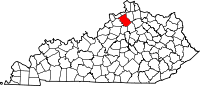
Unincorporated
communityPerry Park
Footnotes ‡This populated place also has portions in an adjacent county or counties
Categories:- National Register of Historic Places in Kentucky by county
- Owen County, Kentucky
-


Wikimedia Foundation. 2010.