- National Register of Historic Places listings in Breckinridge County, Kentucky
-
 Location of Breckinridge County in Kentucky
This is a list of the National Register of Historic Places listings in Breckinridge County, Kentucky.
This is intended to be a complete list of the properties and districts on the National Register of Historic Places in Breckinridge County, Kentucky, United States. The locations of National Register properties and districts for which the latitude and longitude coordinates are included below, may be seen in a Google map.[1]
There are 11 properties and districts listed on the National Register in the county.
-
- This National Park Service list is complete through NPS recent listings posted November 10, 2011.[2]
Current listings
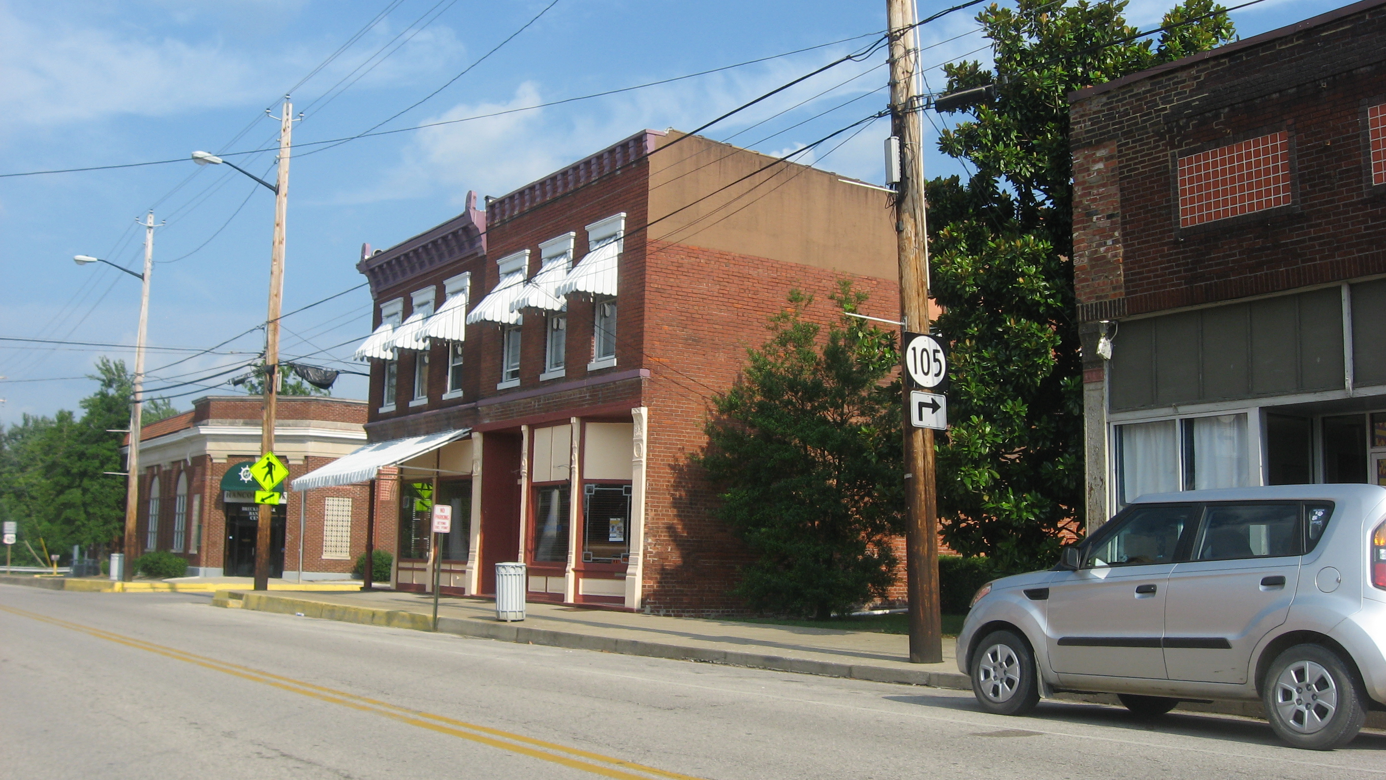
[3] Landmark name Image Date listed Location City or town Summary 1 Cloverport Historic District 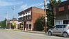
June 21, 1983 Roughly bounded by 3rd, Main, Chestnut, and Lynn Sts.
37°50′11″N 86°37′54″W / 37.836389°N 86.631667°WCloverport 2 Falls of Rough Historic District January 31, 1978 Kentucky Route 110
37°35′21″N 86°33′12″W / 37.589167°N 86.553333°WFalls of Rough 3 Fisher Homestead June 21, 1983 U.S. Route 60
37°50′04″N 86°36′48″W / 37.834444°N 86.613333°WCloverport 4 Holt Bottoms Archeological District November 16, 1978 Address Restricted Holt 5 Joseph Holt House and Chapel July 12, 1976 Southwest of Addison on Kentucky Route 144
37°54′38″N 86°34′39″W / 37.910556°N 86.5775°WAddison 6 Irvington Historic District 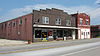
June 29, 1998 Roughly bounded by CSX tracks, Third, Caroline and Walnut Sts.
37°52′56″N 86°17′04″W / 37.882222°N 86.284444°WIrvington 7 Mattingly Petroglyphs (15BC128) September 8, 1989 Address Restricted Mattingly 8 North Fork Rough River Petroglyph (15BC130) September 8, 1989 Address Restricted Roff 9 Oglesby-Conrad June 21, 1983 Off U.S. Route 60
37°49′59″N 86°39′01″W / 37.833056°N 86.650278°WCloverport 10 Skillman House June 21, 1983 Tile Plant Rd.
37°50′30″N 86°37′24″W / 37.841667°N 86.623333°WCloverport 11 Tar Springs Petroglyphs (15BC129) September 8, 1989 Address Restricted Cloverport See also
- List of National Historic Landmarks in Kentucky
- National Register of Historic Places listings in Kentucky
References
- ^ The latitude and longitude information provided in this table was derived originally from the National Register Information System, which has been found to be fairly accurate for about 99% of listings. For about 1% of NRIS original coordinates, experience has shown that one or both coordinates are typos or otherwise extremely far off; some corrections may have been made. A more subtle problem causes many locations to be off by up to 150 yards, depending on location in the country: most NRIS coordinates were derived from tracing out latitude and longitudes off of USGS topographical quadrant maps created under the North American Datum of 1927, which differs from the current, highly accurate WGS84 GPS system used by Google maps. Chicago is about right, but NRIS longitudes in Washington are higher by about 4.5 seconds, and are lower by about 2.0 seconds in Maine. Latitudes differ by about 1.0 second in Florida. Some locations in this table may have been corrected to current GPS standards.
- ^ "National Register of Historic Places: Weekly List Actions". National Park Service, United States Department of the Interior. Retrieved on November 10, 2011.
- ^ Numbers represent an ordering by significant words. Various colorings, defined here, differentiate National Historic Landmark sites and National Register of Historic Places Districts from other NRHP buildings, structures, sites or objects.
U.S. National Register of Historic Places Topics Lists by states Alabama • Alaska • Arizona • Arkansas • California • Colorado • Connecticut • Delaware • Florida • Georgia • Hawaii • Idaho • Illinois • Indiana • Iowa • Kansas • Kentucky • Louisiana • Maine • Maryland • Massachusetts • Michigan • Minnesota • Mississippi • Missouri • Montana • Nebraska • Nevada • New Hampshire • New Jersey • New Mexico • New York • North Carolina • North Dakota • Ohio • Oklahoma • Oregon • Pennsylvania • Rhode Island • South Carolina • South Dakota • Tennessee • Texas • Utah • Vermont • Virginia • Washington • West Virginia • Wisconsin • WyomingLists by territories Lists by associated states Other Municipalities and communities of Breckinridge County, Kentucky Cities 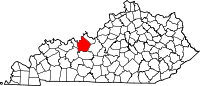
Unincorporated
communityGarfield
Categories:- National Register of Historic Places in Kentucky by county
- Breckinridge County, Kentucky
-


Wikimedia Foundation. 2010.