- National Register of Historic Places listings in Mason County, Kentucky
-
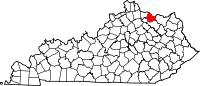
 Location of Mason County in Kentucky
This is a list of the National Register of Historic Places listings in Mason County, Kentucky. It is intended to be a complete list of the properties and districts on the National Register of Historic Places in Mason County, Kentucky, United States. The locations of National Register properties and districts for which the latitude and longitude coordinates are included below, may be seen in a Google map.[1]
There are 36 properties and districts listed on the National Register in the county.
-
- This National Park Service list is complete through NPS recent listings posted November 10, 2011.[2]
Listings county-wide
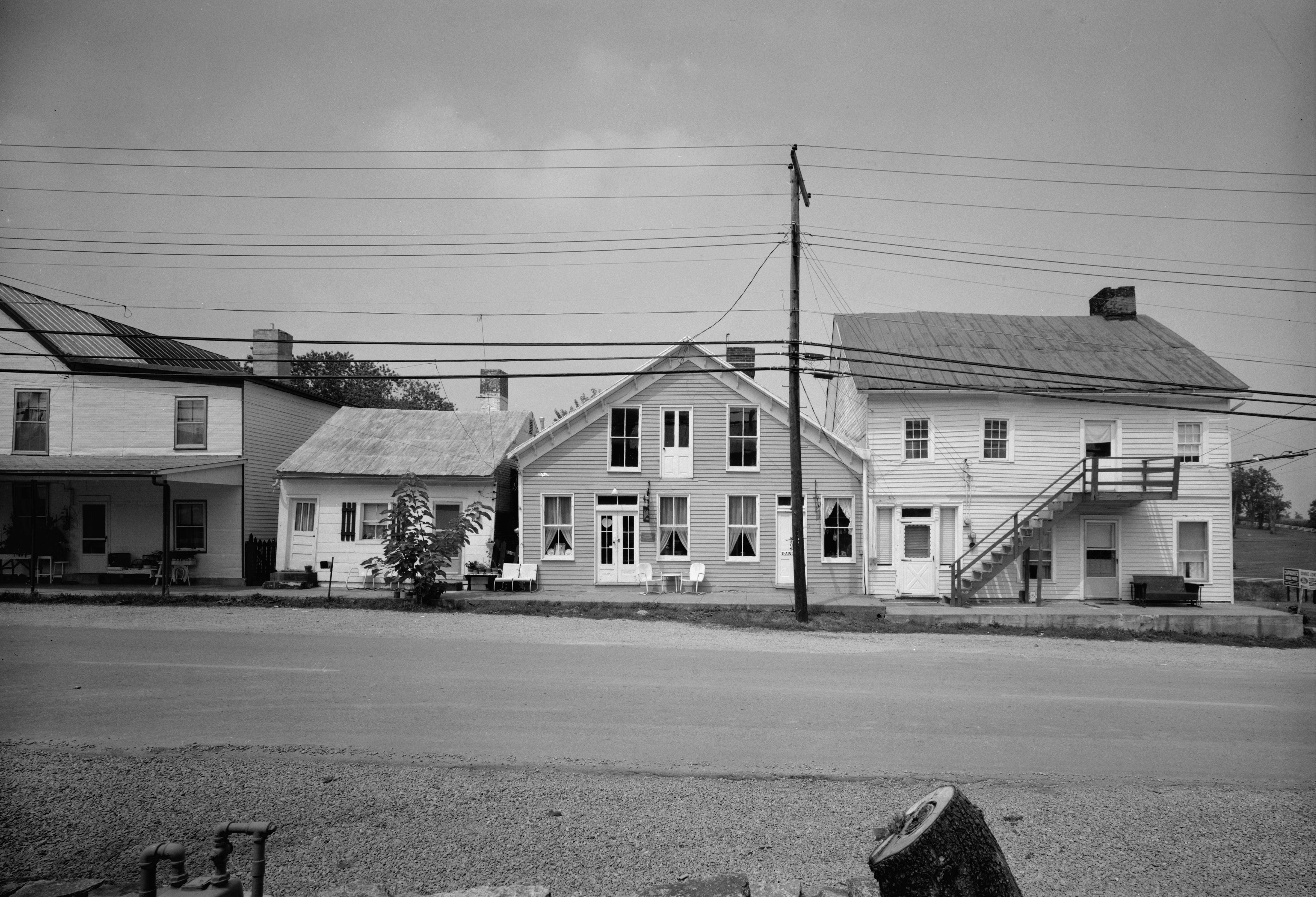
[3] Landmark name Image Date listed Location City or town Summary 1 Armstrong Row 
March 1, 1984 207-227 W. 2nd St.
38°38′59″N 83°46′08″W / 38.649722°N 83.768889°WMaysville 2 Bracken Baptist Church 
April 28, 1983 County Road 1235
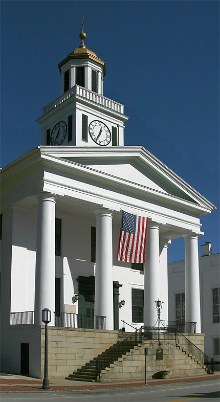
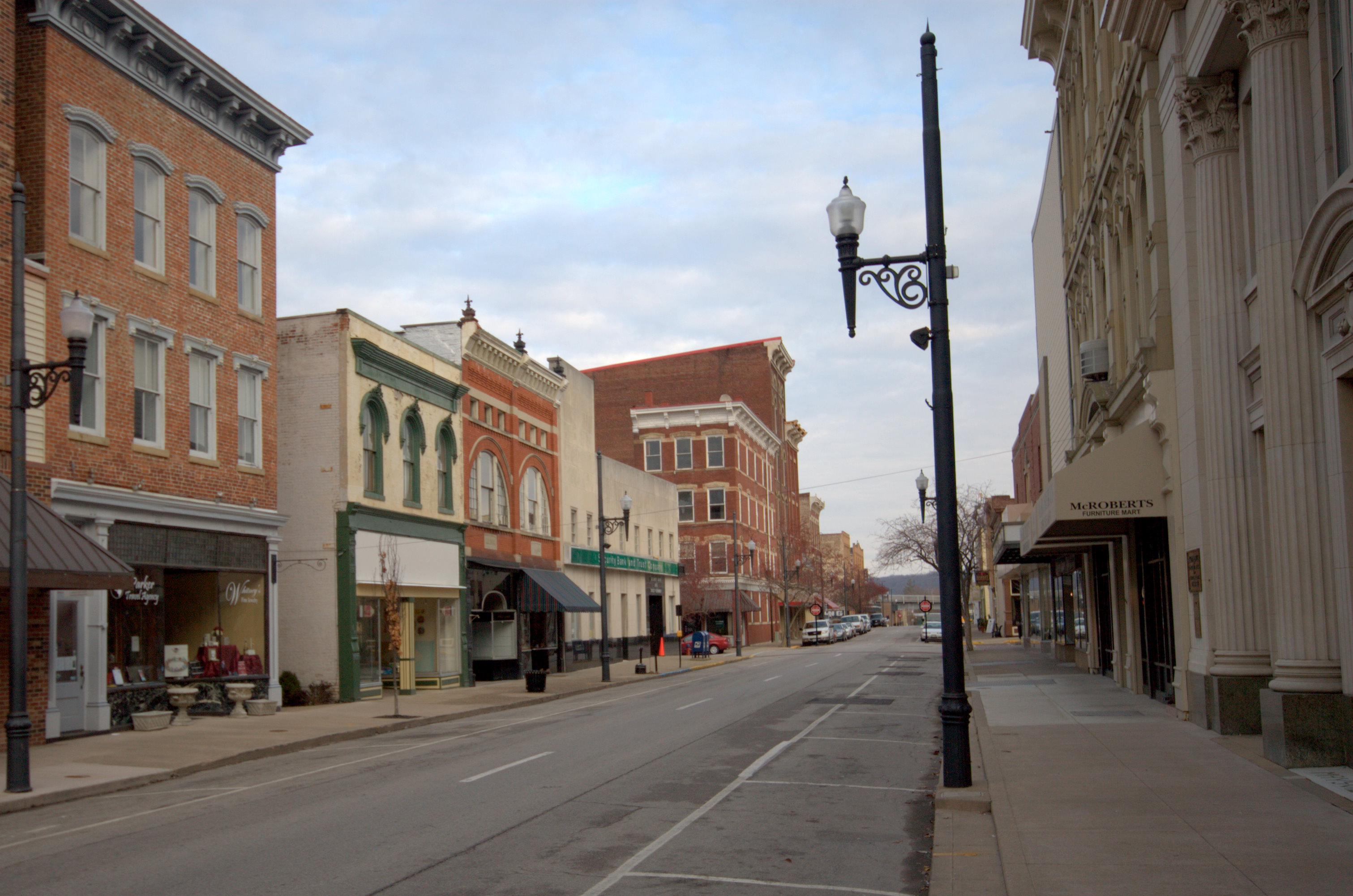
38°42′22″N 83°55′08″W / 38.706111°N 83.918889°WMinerva 3 Courthouse Square and Mechanics' Row Historic District 
May 12, 1975 W. 3rd St. between Market and Sutton Sts.
38°38′50″N 83°45′59″W / 38.647222°N 83.766389°WMaysville 4 Cox-Hord House 
July 14, 1978 128 E. 3rd St.
38°38′41″N 83°45′42″W / 38.644722°N 83.761667°WMaysville 5 The Cox Building August 18, 2011 2-8 E. 3rd St.
38°38′49″N 83°45′55″W / 38.646944°N 83.765278°WMaysville 6 Tom Forman House January 8, 1987 Off U.S. Route 62
38°36′29″N 83°48′59″W / 38.608056°N 83.816389°WWashington 7 Fox Farm Site 
May 9, 1983 Address Restricted Mays Lick 8 Gillespie Site (15MS50) December 21, 1985 Address Restricted Mays Lick 9 Helena United Methodist Church February 3, 2010 6479 Helena Rd.
38°29′50″N 83°45′51″W / 38.497275°N 83.764153°WHelena 10 Lee House 
December 20, 1977 Front and Sutton Sts.
38°38′56″N 83°45′59″W / 38.648889°N 83.766389°WMaysville 11 Lee's Creek Covered Bridge 
March 26, 1976 South of Dover on Tuckahoe Rd. off KY 8
38°44′59″N 83°52′44″W / 38.749722°N 83.878889°WDover 12 Mays Lick Consolidated School April 29, 1982 U.S. Route 68 and KY 324
38°31′21″N 83°50′13″W / 38.5225°N 83.836944°WMays Lick 13 Maysville Downtown Historic District 
March 1, 1982 Roughly bounded by McDonald Parkway, Front, Wall, Limestone and 3rd Sts.
38°38′50″N 83°45′55″W / 38.647222°N 83.765278°WMaysville 14 Maysville-Aberdeen Bridge 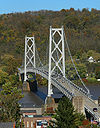
June 30, 1983 Spans the Ohio River between Maysville and Aberdeen, Ohio
38°39′19″N 83°45′27″W / 38.655278°N 83.7575°WMaysville Extends into Brown County, Ohio 15 Milton Mills January 8, 1987 7191 Taylor Mill Rd.
38°34′27″N 83°44′04″W / 38.574167°N 83.734444°WOrangeburg 16 Ben Moran House January 8, 1987 Intersection of KY 8 and KY 10
38°40′24″N 83°49′27″W / 38.673333°N 83.824167°WMoranburg 17 Newdigate-Reed House 
October 10, 1975 West of Maysville at the junction of old KY 68 and U.S. Route 62
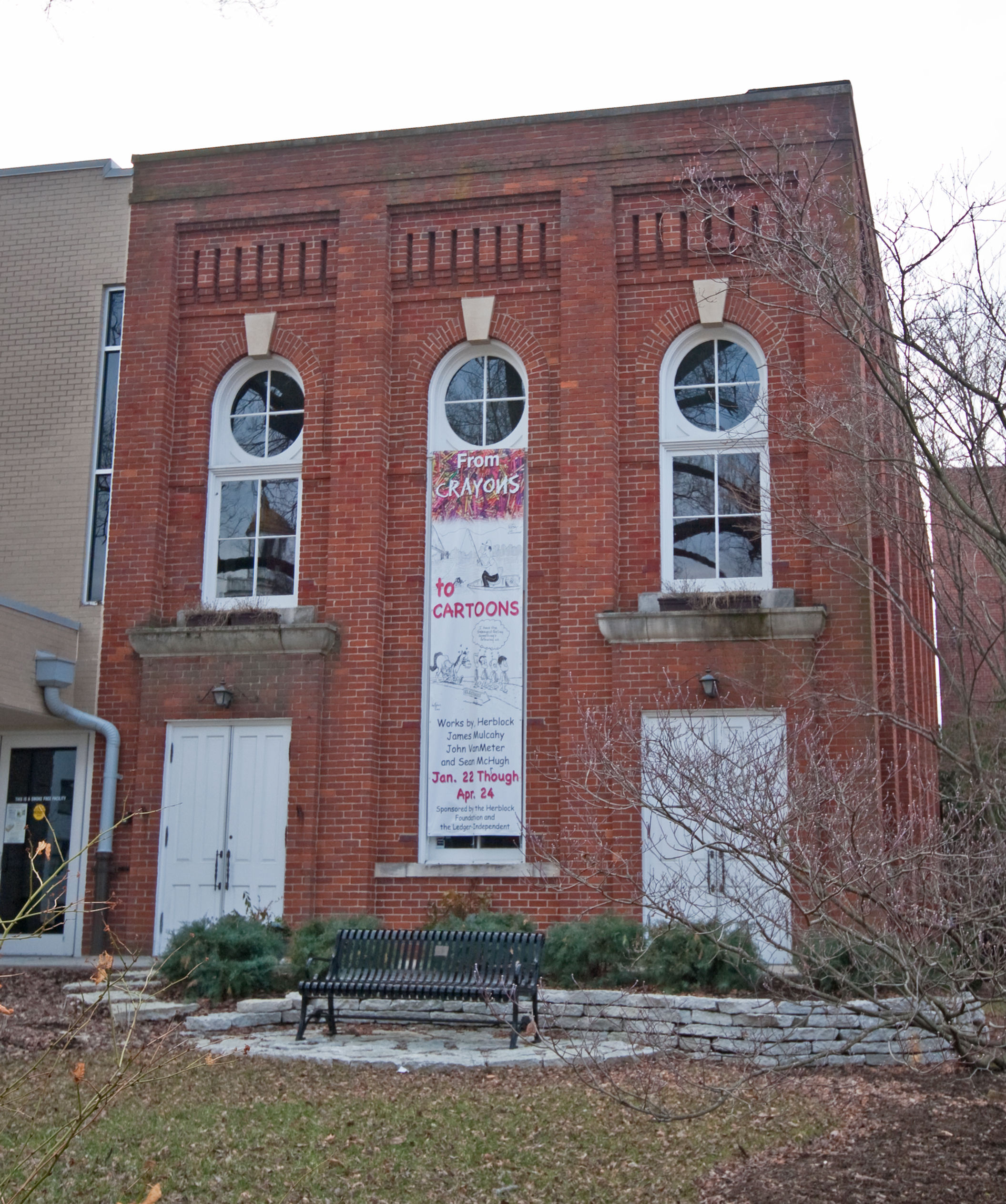
38°38′43″N 83°46′37″W / 38.645278°N 83.776944°WMaysville 18 Old Library Building 
August 30, 1974 221 Sutton St.
38°38′54″N 83°46′01″W / 38.648333°N 83.766944°WMaysville 19 Henry Perviance Peers House 
December 21, 1998 325 W. 3rd St.
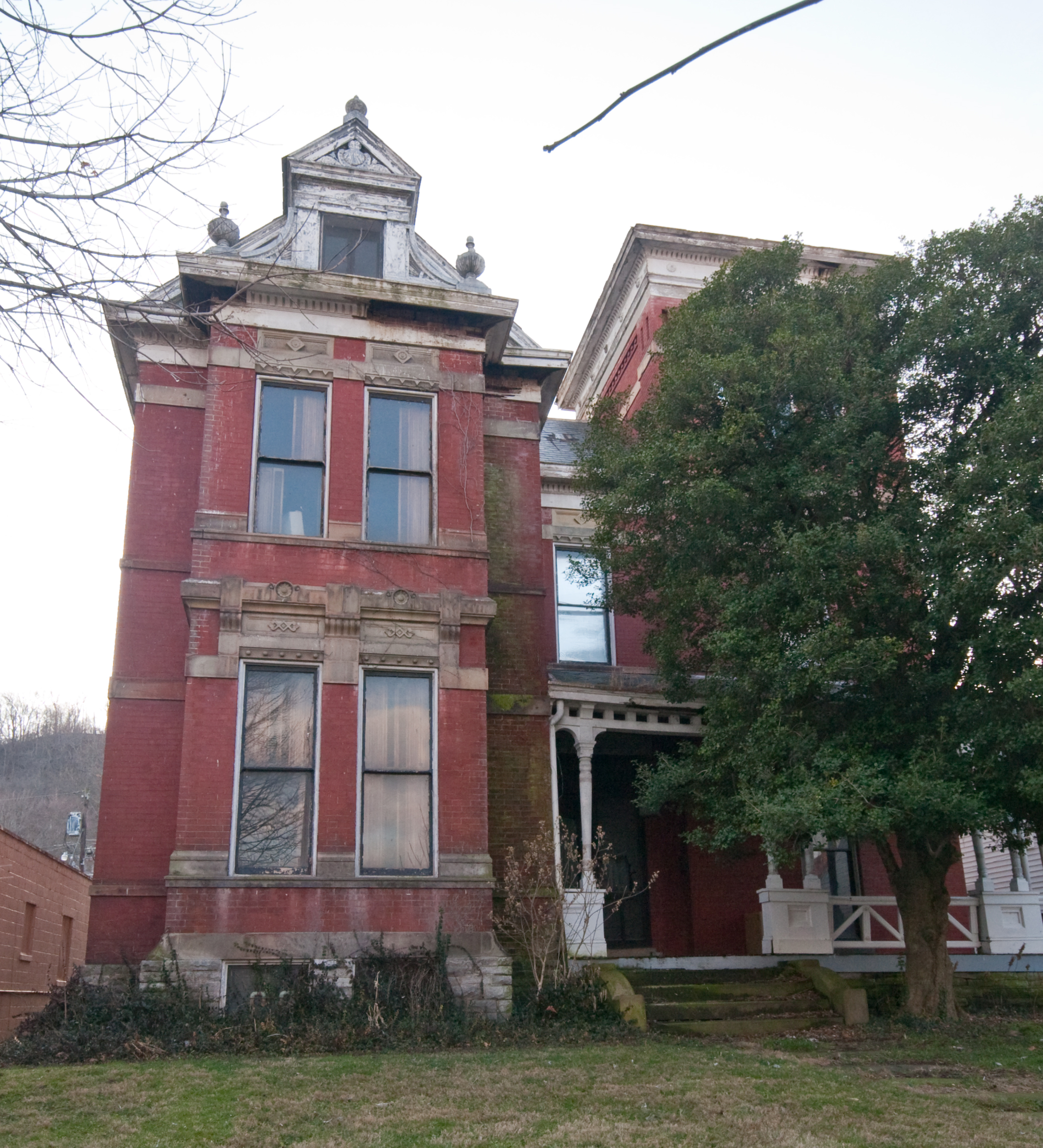
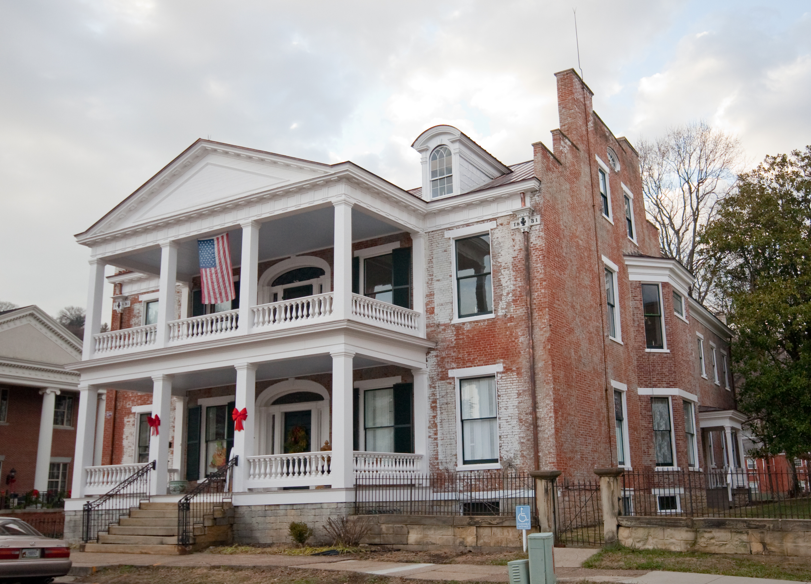
38°38′58″N 83°46′15″W / 38.649444°N 83.770833°WMaysville 20 Phillips' Folly 
August 10, 1978 227 Sutton St.
38°38′51″N 83°46′03″W / 38.6475°N 83.7675°WMaysville 21 Poague House 
January 8, 1987 Parker Ln.
38°31′24″N 83°49′08″W / 38.523333°N 83.818889°WMays Lick 22 Pogue House 
November 25, 2005 716 W. 2nd St.
38°39′42″N 83°46′47″W / 38.661667°N 83.779722°WMaysville 23 Point Au View 
January 4, 1985 721 Hillcrest Rd.
38°38′55″N 83°46′36″W / 38.648739°N 83.776792°WMaysville 24 Pyles Site (15MS28) April 5, 1984 Address Restricted Mays Lick 25 John Brett Richeson House 
July 22, 1994 331 W. 3rd St.
38°38′58″N 83°46′15″W / 38.649444°N 83.770833°WMaysville 26 Russell Theatre 
March 31, 2006 9 E. 3rd St.
38°38′48″N 83°45′53″W / 38.646667°N 83.764722°WMaysville 27 Rust House February 23, 1978 South of Maysville on KY 11
38°32′24″N 83°45′10″W / 38.54°N 83.752778°WMaysville 28 Spring House at Flat Fork October 6, 1987 KY 161
38°29′48″N 83°49′43″W / 38.496667°N 83.828611°WFlat Fork 29 Springhouse in Mays Lick October 6, 1987 Off KY 324
38°31′04″N 83°50′28″W / 38.517778°N 83.841111°WMays Lick 30 Stone Barn on Lee's Creek January 8, 1987 U.S. Route 68
38°31′55″N 83°49′48″W / 38.531944°N 83.83°WMays Lick 31 Valley Pike Covered Bridge 
March 26, 1976 West of Maysville off KY 8
38°40′27″N 83°52′20″W / 38.674167°N 83.872222°WMaysville 32 Van Meter Site December 5, 1985 Address Restricted Mays Lick 33 Washington Historic District 
January 21, 1970 Roughly bounded by Hoppe St., Bartlett Lane, and city limits on the east and the west; also extending north and south along U.S. Routes 62 and 68
38°36′50″N 83°48′28″W / 38.613889°N 83.807778°WWashington Boundaries along U.S. Routes 62 and 68 represent a boundary increase 34 Washington Opera House 
June 11, 1975 116 W. 2nd St.
38°38′54″N 83°46′02″W / 38.648333°N 83.767222°WMaysville 35 West Fourth Street District 
November 7, 1974 24, 29, 31, 32, 33 W. 4th St.
38°38′46″N 83°46′02″W / 38.646111°N 83.767222°WMaysville 36 Woodlawn November 24, 1978 South of Maysville on KY 11
38°35′23″N 83°45′58″W / 38.589722°N 83.766111°WMaysville See also
- List of National Historic Landmarks in Kentucky
- National Register of Historic Places listings in Kentucky
References
- ^ The latitude and longitude information provided in this table was derived originally from the National Register Information System, which has been found to be fairly accurate for about 99% of listings. For about 1% of NRIS original coordinates, experience has shown that one or both coordinates are typos or otherwise extremely far off; some corrections may have been made. A more subtle problem causes many locations to be off by up to 150 yards, depending on location in the country: most NRIS coordinates were derived from tracing out latitude and longitudes off of USGS topographical quadrant maps created under North American Datum of 1927, which differs from the current, highly accurate GPS system used by Google maps. Chicago is about right, but NRIS longitudes in Washington are higher by about 4.5 seconds, and are lower by about 2.0 seconds in Maine. Latitudes differ by about 1.0 second in Florida. Some locations in this table may have been corrected to current GPS standards.
- ^ "National Register of Historic Places: Weekly List Actions". National Park Service, United States Department of the Interior. Retrieved on November 10, 2011.
- ^ Numbers represent an ordering by significant words. Various colorings, defined here, differentiate National Historic Landmark sites and National Register of Historic Places Districts from other NRHP buildings, structures, sites or objects.
U.S. National Register of Historic Places Topics Lists by states Alabama • Alaska • Arizona • Arkansas • California • Colorado • Connecticut • Delaware • Florida • Georgia • Hawaii • Idaho • Illinois • Indiana • Iowa • Kansas • Kentucky • Louisiana • Maine • Maryland • Massachusetts • Michigan • Minnesota • Mississippi • Missouri • Montana • Nebraska • Nevada • New Hampshire • New Jersey • New Mexico • New York • North Carolina • North Dakota • Ohio • Oklahoma • Oregon • Pennsylvania • Rhode Island • South Carolina • South Dakota • Tennessee • Texas • Utah • Vermont • Virginia • Washington • West Virginia • Wisconsin • WyomingLists by territories Lists by associated states Other  Category:National Register of Historic Places •
  Portal:National Register of Historic Places
Municipalities and communities of Mason County, Kentucky County seat: Maysville Cities Dover | Germantown | Maysville | Sardis
Unincorporated
communitiesCategories:- National Register of Historic Places in Kentucky by county
- Mason County, Kentucky
-


Wikimedia Foundation. 2010.