- National Register of Historic Places listings in Hopkins County, Kentucky
-
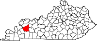
 Location of Hopkins County in Kentucky
This is a list of the National Register of Historic Places listings in Hopkins County, Kentucky. It is intended to be a complete list of the properties and districts on the National Register of Historic Places in Hopkins County, Kentucky, United States. The locations of National Register properties and districts for which the latitude and longitude coordinates are included below, may be seen in a Google map.[1]
There are 31 properties and districts listed on the National Register in the county.
-
- This National Park Service list is complete through NPS recent listings posted November 10, 2011.[2]
Listings county-wide
[3] Landmark name Image Date listed Location City or town Summary 1 Archeological Site 15 Hk 46 and 47 July 28, 1980 Address Restricted White Plains 2 Archeological Site 15 HK 79 December 4, 1980 Address Restricted Nebo 3 Archeological Site 15 Hk 8 August 1, 1980 Address Restricted Hanson 4 Beulah Lodge March 8, 1989 KY 70, 0.5 miles west of its junction with KY 109
37°16′17″N 87°41′24″W / 37.271389°N 87.69°WDawson Springs 5 John Cox House December 13, 1988 KY 502, 0.5 miles north of Nebo
37°23′37″N 87°38′20″W / 37.393611°N 87.638889°WNebo 6 Cranor School March 8, 1989 Buttermilk Rd., 0.2 miles southeast of its junction with Hamby Rd.
37°07′46″N 87°35′09″W / 37.129444°N 87.585833°WSt. Charles 7 The Darby House August 15, 1997 301 W. Arcadia Ave.
37°10′00″N 87°41′37″W / 37.166667°N 87.693611°WDawson Springs 8 Dawson Springs Historic District December 13, 1988 100 block of S. Main St.; also roughly bounded by Keigan St., Water St., Arcadia Ave., Hunter St., and Sycamore St.
37°10′04″N 87°41′33″W / 37.167778°N 87.6925°WDawson Springs Second group of streets represents a boundary increase 9 Bazle Edmiston House December 13, 1988 KY 291, 0.2 miles west of its junction with KY 109
37°19′30″N 87°43′07″W / 37.325°N 87.718611°WNebo 10 Dr. Thomas Gardiner House December 13, 1988 173 Sugg St.
37°19′43″N 87°30′06″W / 37.328611°N 87.501667°WMadisonville 11 Hanson Historic District December 13, 1988 Roughly Main St. from U.S. Route 41 to E. Railroad St.
37°24′30″N 87°28′53″W / 37.408333°N 87.481389°WHanson 12 John Harvey House December 13, 1988 175 N. Seminary St.
37°19′54″N 87°29′56″W / 37.331667°N 87.498889°WMadisonville Designed by architect George Franklin Barber 13 L.D. Hockersmith House December 13, 1988 218 S. Scott St.
37°19′29″N 87°29′43″W / 37.324722°N 87.495278°WMadisonville 14 Hotel Earlington December 13, 1988 118 E. Main St.
37°16′27″N 87°30′43″W / 37.274167°N 87.511944°WEarlington 15 Beckley Jackson House March 23, 1989 KY 1069, 0.2 miles south of its junction with Jones Rd.
37°26′40″N 87°31′50″W / 37.444444°N 87.530556°WHanson 16 Gabriel Jennings House December 13, 1988 KY 70, 1 mile east of its junction with KY 291
37°16′17″N 87°46′02″W / 37.271389°N 87.767222°WDawson Springs 17 W.W. Kington House December 13, 1988 109 Crooked St.
37°14′24″N 87°28′23″W / 37.24°N 87.473056°WMortons Gap 18 Chittenden P. Lyon, Jr. House October 18, 1976 304 Union St.
37°19′26″N 87°29′56″W / 37.323889°N 87.498889°WMadisonville 19 Madisonville Armory September 6, 2002 670 Park Ave.
37°18′59″N 87°29′18″W / 37.316389°N 87.488333°WMadisonville 20 Madisonville Commercial Historic District 
December 13, 1988 Center and Main Sts.
37°19′40″N 87°29′55″W / 37.327778°N 87.498611°WMadisonville 21 Madisonville Public Library December 13, 1988 107 S. Union St.
37°19′38″N 87°29′53″W / 37.327222°N 87.498056°WMadisonville 22 Frederick Miller House December 13, 1988 U.S. Route 62, 2.1 miles west of White Plains
37°11′32″N 87°25′14″W / 37.192222°N 87.420556°WWhite Plains 23 Munn's School August 30, 1983 Princeton Rd.
37°18′54″N 87°31′48″W / 37.315°N 87.53°WMadisonville 24 North Main Street Historic District December 13, 1988 Roughly the 200 and 300 blocks of N. Main St.
37°19′57″N 87°29′51″W / 37.3325°N 87.4975°WMadisonville 25 Oakmoor December 13, 1988 E. Main St.
37°16′37″N 87°30′31″W / 37.276944°N 87.508611°WEarlington 26 Bradford Porter House December 13, 1988 U.S. Route 41A, 1 mile west of its junction with KY 630
37°22′40″N 87°35′57″W / 37.377778°N 87.599167°WNebo 27 Turner Ruby House December 13, 1988 264 S. Union St.
37°19′27″N 87°29′54″W / 37.324167°N 87.498333°WMadisonville 28 Richard Salmon House December 13, 1988 KY 112
37°11′52″N 87°36′34″W / 37.197778°N 87.609444°WDawson Springs 29 James E. Slaton House December 13, 1988 County Highway 1221
37°17′31″N 87°25′20″W / 37.291944°N 87.422222°WMadisonville 30 US Post Office-Madisonville January 3, 1989 56 N. Main St.
37°19′46″N 87°29′53″W / 37.329444°N 87.498056°WMadisonville 31 Zion Brick Missionary Church December 13, 1988 Crossroad Chapel Rd., 0.3 miles north of its junction with KY 138
37°29′56″N 87°28′46″W / 37.498889°N 87.479444°WHanson See also
- List of National Historic Landmarks in Kentucky
- National Register of Historic Places listings in Kentucky
References
- ^ The latitude and longitude information provided in this table was derived originally from the National Register Information System, which has been found to be fairly accurate for about 99% of listings. For about 1% of NRIS original coordinates, experience has shown that one or both coordinates are typos or otherwise extremely far off; some corrections may have been made. A more subtle problem causes many locations to be off by up to 150 yards, depending on location in the country: most NRIS coordinates were derived from tracing out latitude and longitudes off of USGS topographical quadrant maps created under the North American Datum of 1927, which differs from the current, highly accurate WGS84 GPS system used by Google maps. Chicago is about right, but NRIS longitudes in Washington are higher by about 4.5 seconds, and are lower by about 2.0 seconds in Maine. Latitudes differ by about 1.0 second in Florida. Some locations in this table may have been corrected to current GPS standards.
- ^ "National Register of Historic Places: Weekly List Actions". National Park Service, United States Department of the Interior. Retrieved on November 10, 2011.
- ^ Numbers represent an ordering by significant words. Various colorings, defined here, differentiate National Historic Landmark sites and National Register of Historic Places Districts from other NRHP buildings, structures, sites or objects.
U.S. National Register of Historic Places Topics Lists by states Alabama • Alaska • Arizona • Arkansas • California • Colorado • Connecticut • Delaware • Florida • Georgia • Hawaii • Idaho • Illinois • Indiana • Iowa • Kansas • Kentucky • Louisiana • Maine • Maryland • Massachusetts • Michigan • Minnesota • Mississippi • Missouri • Montana • Nebraska • Nevada • New Hampshire • New Jersey • New Mexico • New York • North Carolina • North Dakota • Ohio • Oklahoma • Oregon • Pennsylvania • Rhode Island • South Carolina • South Dakota • Tennessee • Texas • Utah • Vermont • Virginia • Washington • West Virginia • Wisconsin • WyomingLists by territories Lists by associated states Other Municipalities and communities of Hopkins County, Kentucky Cities Dawson Springs‡ | Earlington | Hanson | Madisonville | Mortons Gap | Nebo | Nortonville | St. Charles | White Plains
Unincorporated
communitiesFootnotes ‡This populated place also has portions in an adjacent county or counties
Categories:- National Register of Historic Places in Kentucky by county
- Hopkins County, Kentucky
-


Wikimedia Foundation. 2010.