- National Register of Historic Places listings in Jessamine County, Kentucky
-
 Location of Jessamine County in Kentucky
This is a list of the National Register of Historic Places listings in Jessamine County, Kentucky.
This is intended to be a complete list of the properties and districts on the National Register of Historic Places in Jessamine County, Kentucky, United States. The locations of National Register properties and districts for which the latitude and longitude coordinates are included below, may be seen in a Google map.[1]
There are 72 properties and districts listed on the National Register in the county.
-
- This National Park Service list is complete through NPS recent listings posted November 10, 2011.[2]
Current listings
[3] Landmark name Image Date listed Location City or town Summary 1 Asbury College Administration Building 
July 6, 1985 Kentucky Route 29
37°51′49″N 84°39′43″W / 37.863611°N 84.661944°WWilmore Part of the Asbury College campus; renamed the "Hager Administration Building" in 1993.[4] 2 Craig Ashurst House July 5, 1984 Off U.S. Route 27
37°57′57″N 84°33′45″W / 37.965833°N 84.5625°WNicholasville 3 Barkley House July 5, 1984 U.S. Route 68
37°54′22″N 84°37′01″W / 37.906111°N 84.616944°WNicholasville 4 Isaac Barkley House July 5, 1984 Kentucky Route 169
37°54′52″N 84°36′32″W / 37.914444°N 84.608889°WNicholasville 5 Bethel Academy Site (15JS80) March 15, 1984 Atop bluffs above the Kentucky River at High Bridge, 4 miles from Wilmore
37°49′20″N 84°42′18″W / 37.82222°N 84.705°W[5]Wilmore Site of the first Methodist school west of the Appalachians[5] 6 Bicknell House July 5, 1984 Kentucky Route 29
37°51′13″N 84°40′21″W / 37.853611°N 84.6725°WWilmore 7 Brick House on Shun Pike 
July 5, 1984 Off Kentucky Route 1268
37°50′33″N 84°37′03″W / 37.8425°N 84.6175°WNicholasville 8 J.S. Bronaugh House 
July 5, 1984 103 N. 2nd St.
37°52′53″N 84°34′28″W / 37.881389°N 84.574444°WNicholasville 9 George I. Brown House 
December 2, 1977 206 Linden Lane
37°52′22″N 84°34′43″W / 37.872778°N 84.578611°WNicholasville 10 George and Betty Bryan House 
July 5, 1984 U.S. Route 68
37°53′23″N 84°39′17″W / 37.889722°N 84.654722°WNicholasville 11 Bryant House July 6, 1985 U.S. Route 27
37°55′32″N 84°33′43″W / 37.925556°N 84.561944°WNicholasville 12 Burrier House July 13, 1984 North of Keene
37°57′57″N 84°37′04″W / 37.965833°N 84.617778°WKeene 13 Butler's Tavern 
July 5, 1984 U.S. Route 27
37°50′41″N 84°35′16″W / 37.844722°N 84.587778°WNicholasville 14 Camp Nelson 
March 15, 2001 U.S. Route 27
37°47′16″N 84°35′53″W / 37.787778°N 84.598056°WNicholasville 15 Camp Nelson National Cemetery 
September 3, 1998 6890 Danville Rd.
37°47′07″N 84°35′59″W / 37.785278°N 84.599722°WNicholasville 16 Canewood Farm April 29, 1999 8080 Harrodsburg Rd.
37°53′43″N 84°38′15″W / 37.895278°N 84.6375°WNicholasville 17 Chaumiere des Prairies September 25, 1975 North of Nicholasville off U.S. Route 68
37°56′37″N 84°35′04″W / 37.943611°N 84.584444°WNicholasville 18 Joseph Chrisman House July 5, 1984 U.S. Route 27
37°54′49″N 84°33′12″W / 37.913611°N 84.553333°WNicholasville 19 Confederate Memorial in Nicholasville 
July 17, 1997 Courthouse lawn, junction of U.S. Route 27 and Kentucky Route 29
37°52′51″N 84°34′24″W / 37.880833°N 84.573333°WNicholasville 20 Joseph Crockett House February 11, 2011 Union Mills Pike Nicholasville Early Stone Buildings of Central Kentucky Thematic Resource 21 Curd House July 13, 1984 Kentucky Route 29
37°49′55″N 84°42′04″W / 37.831944°N 84.701111°WWilmore 22 J.W. Duncan House July 5, 1984 Kentucky Route 169
37°54′00″N 84°34′49″W / 37.9°N 84.580278°WNicholasville 23 Nathaniel Dunn House March 7, 1979 North of Nicholasville off U.S. Route 68
37°57′06″N 84°35′32″W / 37.951667°N 84.592222°WNicholasville 24 East Main Street Historic District 
August 5, 1994 Roughly E. Main St. from S. Walnut St. to Rice St.
37°51′32″N 84°39′35″W / 37.858889°N 84.659722°WWilmore 25 Ebenezer Presbyterian Church 
June 23, 1983 Off Kentucky Route 1267
37°55′49″N 84°41′04″W / 37.930278°N 84.684444°WKeene 26 Federal House on Hickman Creek July 6, 1985 West of Logana
37°52′17″N 84°29′57″W / 37.871389°N 84.499167°WLogana 27 Fort Bramlette June 13, 1975 Off Fort Bramlette Road, south of Nicholasville
37°45′56″N 84°35′28″W / 37.76556°N 84.59111°W[6]Nicholasville 28 A. Grubb House July 5, 1984 Kentucky Route 169
37°52′16″N 84°26′17″W / 37.871111°N 84.438056°WSpears 29 Hoover House 
July 5, 1984 U.S. Route 27
37°51′47″N 84°34′55″W / 37.863056°N 84.581944°WNicholasville 30 Hughes House July 5, 1984 Kentucky Route 169
37°57′26″N 84°40′22″W / 37.957222°N 84.672778°WKeene 31 John Hunter House July 6, 1985 South of Logana
37°50′32″N 84°29′23″W / 37.842222°N 84.489722°WLogana 32 Ephriam January House 
June 23, 1983 Address Restricted Keene 33 Keene Springs Hotel July 5, 1984 Kentucky Route 1267
37°56′37″N 84°37′38″W / 37.943611°N 84.627222°WKeene 34 Kenyon Avenue Historic District 
August 5, 1994 401, 403, 405, 406, 407, and 408 Kenyon Ave.
37°51′52″N 84°39′48″W / 37.864444°N 84.663333°WWilmore 35 Grant Knight House July 5, 1984 Kentucky Route 169
37°55′10″N 84°36′40″W / 37.919444°N 84.611111°WNicholasville 36 John Lancaster House June 23, 1983 Kentucky Route 169
37°57′12″N 84°39′09″W / 37.953333°N 84.6525°WKeene 37 Lexington and Main Historic District 
August 5, 1994 100, 101, 102, 103, and 105 N. Lexington Ave. and 101 E. Main St.
37°51′41″N 84°39′43″W / 37.861389°N 84.661944°WWilmore 38 Locust Grove Stock Farm July 5, 1984 North of Keene
37°57′59″N 84°37′28″W / 37.966389°N 84.624444°WKeene 39 Log House on Shun Pike 
July 5, 1984 Off Kentucky Route 1268
37°50′45″N 84°37′03″W / 37.845833°N 84.6175°WNicholasville 40 William C. Lowry House July 5, 1984 Off Kentucky Route 169
37°55′53″N 84°36′37″W / 37.931389°N 84.610278°WNicholasville 41 Marshall-Bryan House July 5, 1984 U.S. Route 27
37°56′55″N 84°32′22″W / 37.948611°N 84.539444°WNicholasville 42 James G. Martin House July 5, 1984 Tates Creek Rd.
37°54′38″N 84°27′51″W / 37.910556°N 84.464167°WNicholasville 43 Lewis Y. Martin House February 7, 2008 6975 Tates Creek Pk.
37°54′37″N 84°27′24″W / 37.910278°N 84.456667°WNicholasville 44 McClure-Shelby House November 20, 1978 5 miles (8 km) east of Nicholasville on Kentucky Route 169
37°53′15″N 84°28′49″W / 37.8875°N 84.480278°WNicholasville 45 McConnell-Woodson-Philips House 
July 5, 1984 303 S. Main St.
37°52′38″N 84°34′29″W / 37.877222°N 84.574722°WNicholasville 46 Morrison-Kenyon Library 
July 6, 1985 Kentucky Route 29
37°51′48″N 84°39′46″W / 37.863333°N 84.662778°WWilmore Part of the Asbury College campus; now a student union.[7] 47 Mt. Pleasant Baptist Church July 5, 1984 North of Keene
37°56′50″N 84°37′47″W / 37.947222°N 84.629722°WKeene 48 Nave-Brown House 
July 5, 1984 Kentucky Route 29
37°53′16″N 84°36′06″W / 37.887778°N 84.601667°WNicholasville 49 Davis Newman House July 5, 1984 West of Spears
37°52′20″N 84°26′37″W / 37.872222°N 84.443611°WSpears 50 Nicholasville Historic District 
July 19, 1984 Court Row, Maple and Main Sts.
37°52′51″N 84°34′26″W / 37.880833°N 84.573889°WNicholasville 51 North Lexington Avenue Historic District 
August 5, 1994 Roughly N. Lexington Ave. from College Ave. to Banta Ln.
37°52′00″N 84°39′29″W / 37.866667°N 84.658056°WWilmore 52 George O'Neal House July 6, 1985 Off U.S. Route 68
37°56′43″N 84°36′34″W / 37.945278°N 84.609444°WNicholasville 53 James O'Neal House July 6, 1985 Off Kentucky Route 169
37°56′02″N 84°36′28″W / 37.933889°N 84.607778°WNicholasville 54 Payne-Saunders House 
July 25, 1996 503 N. Central Ave.
37°53′02″N 84°34′08″W / 37.883889°N 84.568889°WNicholasville 55 Pleasant Grove July 5, 1984 North of Keene
37°57′19″N 84°37′44″W / 37.955278°N 84.628889°WKeene 56 Providence Church July 5, 1984 U.S. Route 27
37°57′28″N 84°32′15″W / 37.957778°N 84.5375°WNicholasville 57 Roberts Chapel 
July 5, 1984 U.S. Route 27
37°49′07″N 84°35′47″W / 37.818611°N 84.596389°WNicholasville 58 Sandy Bluff 
July 13, 1984 Off Kentucky Route 1268
37°51′05″N 84°36′26″W / 37.851389°N 84.607222°WNicholasville 59 Scott House June 23, 1983 U.S. Route 27
37°49′03″N 84°36′11″W / 37.8175°N 84.603056°WLittle Hickman 60 John Harvey Scott House 
July 13, 1984 Off U.S. Route 27
37°49′14″N 84°35′02″W / 37.820556°N 84.583889°WNicholasville 61 Shady Grove July 6, 1985 Off U.S. Route 27
37°57′07″N 84°33′23″W / 37.951944°N 84.556389°WNicholasville 62 Shanklin House July 6, 1985 Kentucky Route 169
37°54′55″N 84°35′33″W / 37.915278°N 84.5925°WNicholasville 63 Robert Steele House June 23, 1983 Troy Rd.
37°54′N 84°41′W / 37.9°N 84.69°WKeene 64 Stone House on Brooklyn Hill June 23, 1983 Off U.S. Route 68
37°52′08″N 84°42′10″W / 37.868889°N 84.702778°WWilmore 65 Stone House on West Hickman June 23, 1983 Kentucky Route 1980
37°56′23″N 84°30′33″W / 37.939722°N 84.509167°WNicholasville 66 Sunnyside Farm House July 5, 1984 U.S. Route 27
37°57′34″N 84°32′10″W / 37.959444°N 84.536111°WNicholasville 67 Ridge Taylor Farm July 6, 1985 Off Kentucky Route 595
37°48′56″N 84°28′45″W / 37.815556°N 84.479167°WNicholasville 68 Thornwood July 13, 1984 Baker Lane
37°55′16″N 84°34′39″W / 37.921111°N 84.5775°WNicholasville 69 Venable-Todhunter Houses July 5, 1984 Tates Creek Rd.
37°56′22″N 84°28′52″W / 37.939444°N 84.481111°WNicholasville 70 Woodland July 5, 1984 U.S. Route 27
37°56′57″N 84°36′07″W / 37.949167°N 84.601944°WNicholasville 71 Young House 
July 13, 1984 Kentucky Route 29
37°52′58″N 84°38′31″W / 37.882778°N 84.641944°WNicholasville 72 A.M. Young House July 6, 1985 West of Ash Grove Pike
37°56′21″N 84°29′38″W / 37.939167°N 84.493889°WNicholasville See also
- List of National Historic Landmarks in Kentucky
- National Register of Historic Places listings in Kentucky
References
- ^ The latitude and longitude information provided in this table was derived originally from the National Register Information System, which has been found to be fairly accurate for about 99% of listings. For about 1% of NRIS original coordinates, experience has shown that one or both coordinates are typos or otherwise extremely far off; some corrections may have been made. A more subtle problem causes many locations to be off by up to 150 yards, depending on location in the country: most NRIS coordinates were derived from tracing out latitude and longitudes off of USGS topographical quadrant maps created under North American Datum of 1927, which differs from the current, highly accurate GPS system used by Google maps. Chicago is about right, but NRIS longitudes in Washington are higher by about 4.5 seconds, and are lower by about 2.0 seconds in Maine. Latitudes differ by about 1.0 second in Florida. Some locations in this table may have been corrected to current GPS standards.
- ^ "National Register of Historic Places: Weekly List Actions". National Park Service, United States Department of the Interior. Retrieved on November 10, 2011.
- ^ Numbers represent an ordering by significant words. Various colorings, defined here, differentiate National Historic Landmark sites and National Register of Historic Places Districts from other NRHP buildings, structures, sites or objects.
- ^ Asbury College Facilities, Asbury College, 2009. Accessed 2009-07-24.
- ^ a b Thacker, Joseph A., Jr. Asbury College: Vision and Miracle. Nappanee: Evangel, 1900, 19.
- ^ Location derived from its GNIS feature record; the NRIS lists the site as "Address Restricted"
- ^ Asbury College Facilities, Asbury College, 2009. Accessed 2009-07-24.
U.S. National Register of Historic Places Topics Lists by states Alabama • Alaska • Arizona • Arkansas • California • Colorado • Connecticut • Delaware • Florida • Georgia • Hawaii • Idaho • Illinois • Indiana • Iowa • Kansas • Kentucky • Louisiana • Maine • Maryland • Massachusetts • Michigan • Minnesota • Mississippi • Missouri • Montana • Nebraska • Nevada • New Hampshire • New Jersey • New Mexico • New York • North Carolina • North Dakota • Ohio • Oklahoma • Oregon • Pennsylvania • Rhode Island • South Carolina • South Dakota • Tennessee • Texas • Utah • Vermont • Virginia • Washington • West Virginia • Wisconsin • WyomingLists by territories Lists by associated states Other  Category:National Register of Historic Places •
  Portal:National Register of Historic Places
Municipalities and communities of Jessamine County, Kentucky County seat: Nicholasville Cities 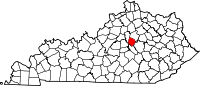
Unincorporated
communitiesBrannon Woods | High Bridge
Categories:- National Register of Historic Places in Kentucky by county
- Jessamine County, Kentucky
-


Wikimedia Foundation. 2010.