- Nappanee, Indiana
-
City of Nappanee — City — Downtown Nappanee.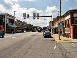 Location in the state of Indiana
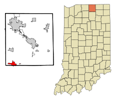
Coordinates: 41°26′39″N 85°59′58″W / 41.44417°N 85.99944°WCoordinates: 41°26′39″N 85°59′58″W / 41.44417°N 85.99944°W Country United States State Indiana Counties Elkhart, Kosciusko Government - Mayor Larry Thompson (R) Area - Total 3.7 sq mi (9.6 km2) - Land 3.7 sq mi (9.6 km2) - Water 0 sq mi (0 km2) 0% Elevation 869 ft (265 m) Population (2010) - Total 6,648 - Density 1,818.9/sq mi (702.1/km2) Time zone EST (UTC-5) - Summer (DST) EDT (UTC-4) ZIP code 46550 Area code(s) 574 FIPS code 18-52020[1] GNIS feature ID 0439936[2] Website http://www.nappanee.org/ Nappanee is a city in Elkhart and Kosciusko counties in the U.S. state of Indiana. The population was 6,648 at the 2010 census. The name Nappanee probably means "flour."[3] Nappanee holds the distinction of having the longest city name in the United States containing each letter in its name twice.[4] The town has several tourist attractions: Amish Acres, Metzler's Shoes, The Arts & Crafts Festival, and the Apple Festival. Nappanee is a small town but is increasing in size and number every year.
A tornado touched down in Nappanee around 10:30 pm on 18 October 2007, injuring at least five people and damaging 200 to 250 buildings, half of them severely. The tornado was classified as an EF3. The damage included three recreational vehicles factories that are among the community's largest employers: Fairmont Homes, Franklin Coach, and Gulf Stream Coach.[5]
Contents
Geography
Nappanee is located at 41°26′39″N 85°59′58″W / 41.444201°N 85.999390°W.[6]
According to the United States Census Bureau, the city has a total area of 3.7 square miles (9.6 km2), all of it land.
Historical populations Census Pop. %± 1900 2,208 — 1910 2,260 2.4% 1920 2,678 18.5% 1930 2,957 10.4% 1940 3,028 2.4% 1950 3,393 12.1% 1960 3,895 14.8% 1970 4,159 6.8% 1980 4,694 12.9% 1990 5,510 17.4% 2000 6,710 21.8% 2010 6,648 −0.9% Demographics
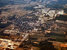 Nappanee from above.
As of the census[1] of 2000, there were 6,710 people, 2,521 households, and 1,792 families residing in the city. The population density was 1,818.9 people per square mile (702.1/km²). There were 2,647 housing units at an average density of 717.5 per square mile (277.0/km²). The racial makeup of the city was 95.48% White, 0.28% African American, 0.22% Native American, 0.34% Asian, 2.52% from other races, and 1.15% from two or more races. Hispanic or Latino of any race were 4.98% of the population.
There were 2,521 households out of which 39.2% had children under the age of 18 living with them, 57.1% were married couples living together, 9.3% had a female householder with no husband present, and 28.9% were non-families. 23.9% of all households were made up of individuals and 8.6% had someone living alone who was 65 years of age or older. The average household size was 2.65 and the average family size was 3.15.
In the city the population was spread out with 29.7% under the age of 18, 10.6% from 18 to 24, 30.9% from 25 to 44, 17.9% from 45 to 64, and 11.0% who were 65 years of age or older. The median age was 31 years. For every 100 females there were 99.8 males. For every 100 females age 18 and over, there were 97.5 males.
The median income for a household in the city was $45,988, and the median income for a family was $53,329. Males had a median income of $36,200 versus $21,733 for females. The per capita income for the city was $19,229. About 4.5% of families and 4.6% of the population were below the poverty line, including 5.9% of those under age 18 and 8.4% of those age 65 or over.
Economy
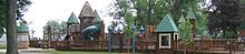 Little Paws Playground in Stauffer Park.
Nappanee is a regional center for both the RV manufacturing industry and the Amish craft and tourism industry. Many Amish and Mennonite families live in the area, often farming as well as working in the RV industry or woodworking trade. Since the storms and sluggish economy, Nappanee has experienced a high rate of job loss. Until it stopped running on March 7, 2005 Nappanee was a stop on Amtrak's Three Rivers train with service to Chicago and New York.
Notable residents
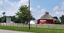 Amish Acres, a popular tourist attraction in Nappanee.
- Lt. Colonel (Ret) Todd Beer, United States Air Force, an Air Force One pilot, is from Nappanee; he graduated from the United States Air Force Academy where he was recruited to play basketball. He has flown Air Force One for President Bill Clinton and President George W. Bush.
- Vance George, conductor of the San Francisco Symphony Chorus from 1982-2006.
- Rob Rensberger (1921–2007), a professional basketball player for the Chicago Stags.
- James L. Weygand (1919–2003), a lifelong resident of Nappanee, was a writer and publisher of miniature books who also wrote a definitive town history They Called It Nappanee: A History 1874-1974 Collections of his miniature books are held at The Lilly Library, Indiana University [1] and at the University of Iowa. The University of Florida has digitized his three books on printers' devices
- Six successful cartoonists lived in Nappanee as children:
- Merrill Blosser (Freckles and His Friends)
- Max Gwin (Slim and Spud in Prairie Farmer)
- Bill Holman (Smokey Stover)
- Henry Maust, advertising artist and cartoonist
- Fred Neher (Life’s Like That)
- Francis "Mike" Parks, political cartoonist[7]
Twin city
 Napanee, Ontario
See also
References
- ^ a b "American FactFinder". United States Census Bureau. http://factfinder.census.gov. Retrieved 2008-01-31.
- ^ "US Board on Geographic Names". United States Geological Survey. 2007-10-25. http://geonames.usgs.gov. Retrieved 2008-01-31.
- ^ Nappanee - Britannica Online Encyclopedia
- ^ http://www.scs.stanford.edu/~stutsman/nappanee.html
- ^ Tom, Coyne (2007-10-19). "Tornado hits Nappanee, brings destruction". The Associated Press. Archived from the original on 2007-10-21. http://web.archive.org/web/20071021012443/http://www.indystar.com/apps/pbcs.dll/article?AID=/20071019/LOCAL/710190515. Retrieved 2007-10-19.
- ^ "US Gazetteer files: 2010, 2000, and 1990". United States Census Bureau. 2011-02-12. http://www.census.gov/geo/www/gazetteer/gazette.html. Retrieved 2011-04-23.
- ^ Cavinder, Fred D. More Amazing Tales from Indiana. Indiana University Press, 2003.
Sources
- They Called It Nappanee: A History 1874-1974 by James L Weygand. (Nappanee, Indiana, 1974)
External links
- City of Nappanee, Indiana website
- Amish Acres Historic Farm and Heritage Resort - Listed in the National Register of Historic Places
- Nappanee Missionary Church - Largest church in the area
- Nappanee Amish community
Municipalities and communities of Elkhart County, Indiana Cities 
Towns Bristol | Middlebury | Millersburg | Wakarusa
Townships CDPs Unincorporated
communitiesBainter Town | Benton | Bonneyville Mills | Foraker | Garden Village | Jamestown | Locke | Midway | Nibbyville | Southwest | Vistula | Waterford Mills
Footnotes ‡This populated place also has portions in an adjacent county or counties
Municipalities and communities of Kosciusko County, Indiana Cities Nappanee‡ | Warsaw

Towns Burket | Claypool | Etna Green | Leesburg | Mentone | Milford | North Webster | Pierceton | Sidney | Silver Lake | Syracuse | Winona Lake
Townships Unincorporated
communitiesArrowhead Park | Atwood | Barbee | Bayfield | Beaver Dam | Bell Rohr Park | Between-The-Lakes Park | Black Point | Buttermilk Point | Cedar Point | Clunette | DeFries Landing | Eagle Point | Enchanted Hills | Epworth Forest | Forest Glen | Gravelton | Hastings | Highbanks | Highlands Park | Island Park | Kalorama Park | Kanata Manayunk | Kinsey | Lakeside Park | Lakeview Spring | Marineland Gardens | Milford Junction | Mineral Springs | Monoquet | Musquabuck Park | Oakwood Park | Osborn Landing | Oswego | Palestine | Pickwick Park | Quaker Haven Park | Sevastopol | Shady Banks | Silver Point | South Park | Stoneburner Landing | Stony Ridge | Sunrise Beach | Vawter Park | Walker Park | Wawasee Village | Wa-Will-Away Park | Wooster | Yellowbanks
Footnotes ‡This populated place also has portions in an adjacent county or counties
Categories:- Amish
- Cities in Indiana
- Populated places in Elkhart County, Indiana
- Populated places in Kosciusko County, Indiana


Wikimedia Foundation. 2010.