- National Register of Historic Places listings in Elkhart County, Indiana
-
 Location of Elkhart County in Indiana
This is a list of the National Register of Historic Places listings in Elkhart County, Indiana.
This is intended to be a complete list of the properties and districts on the National Register of Historic Places in Elkhart County, Indiana, United States. Latitude and longitude coordinates are provided for many National Register properties and districts; these locations may be seen together in a Google map.[1]
There are 34 properties and districts listed on the National Register in the county.
-
- This National Park Service list is complete through NPS recent listings posted November 10, 2011.[2]
Current listings
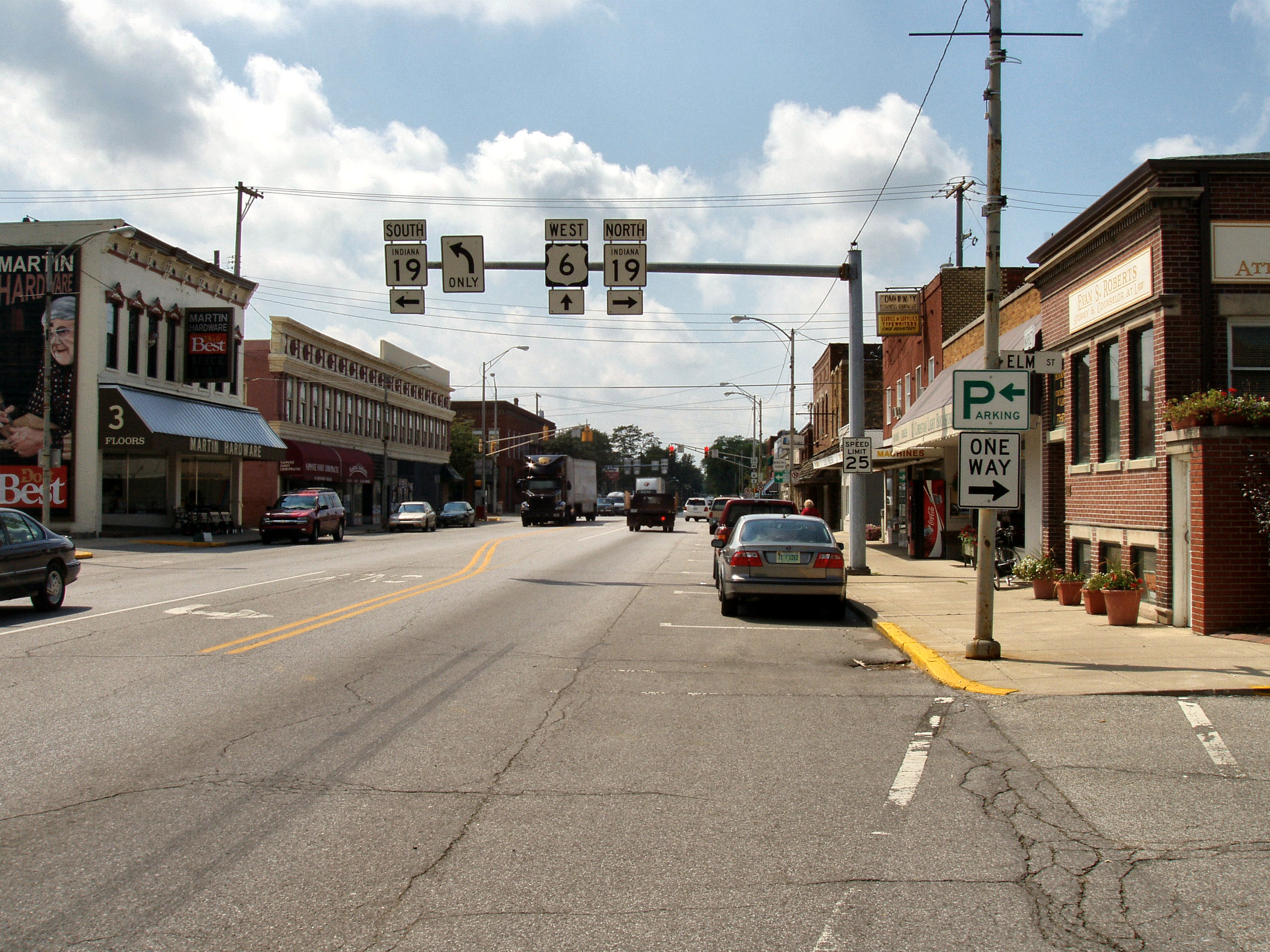
[3] Landmark name[4] Image Date listed Location City or Town Summary 1 Beardsley Avenue Historic District September 28, 2003 405 W. to 441 E. Beardsley Ave., the 700 block of N. Riverside, and Island Park
41°41′32″N 85°58′31″W / 41.69222°N 85.97528°WElkhart 2 Albert R. Beardsley House November 28, 1978 302 E. Beardsley Ave.
41°41′36″N 85°58′24″W / 41.69333°N 85.97333°WElkhart 3 Dr. Havilah Beardsley House June 22, 2000 102 W. Beardsley Ave.
41°41′37″N 85°58′40″W / 41.69361°N 85.97778°WElkhart 4 Emmanuel C. Bickel House November 14, 1979 614 Bower St.
41°41′20″N 85°59′3″W / 41.68889°N 85.98417°WElkhart 5 Bonneyville Mills 
October 22, 1976 2.5 miles east of Bristol on County Road 131
41°43′10″N 85°45′53″W / 41.71944°N 85.76472°WBristol 6 Bridge Street Bridge September 24, 2009 Bridge St. over the St. Joseph River
41°40′37.2″N 85°59′26.58″W / 41.677°N 85.9907167°WElkhart 7 Bristol-Washington Township School August 29, 1991 304 W. Vistula St.
41°43′18″N 85°49′57″W / 41.72167°N 85.8325°WBristol 8 Charles Gerard Conn Mansion December 19, 2007 723 Strong Ave.
41°41′7″N 85°59′11″W / 41.68528°N 85.98639°WElkhart 9 Frank and Katharine Coppes House November 29, 1990 302 E. Market St.
41°26′35″N 85°59′55″W / 41.44306°N 85.99861°WNappanee 10 Dierdorff Farmstead March 21, 2011 2055 Dierdorff Rd.
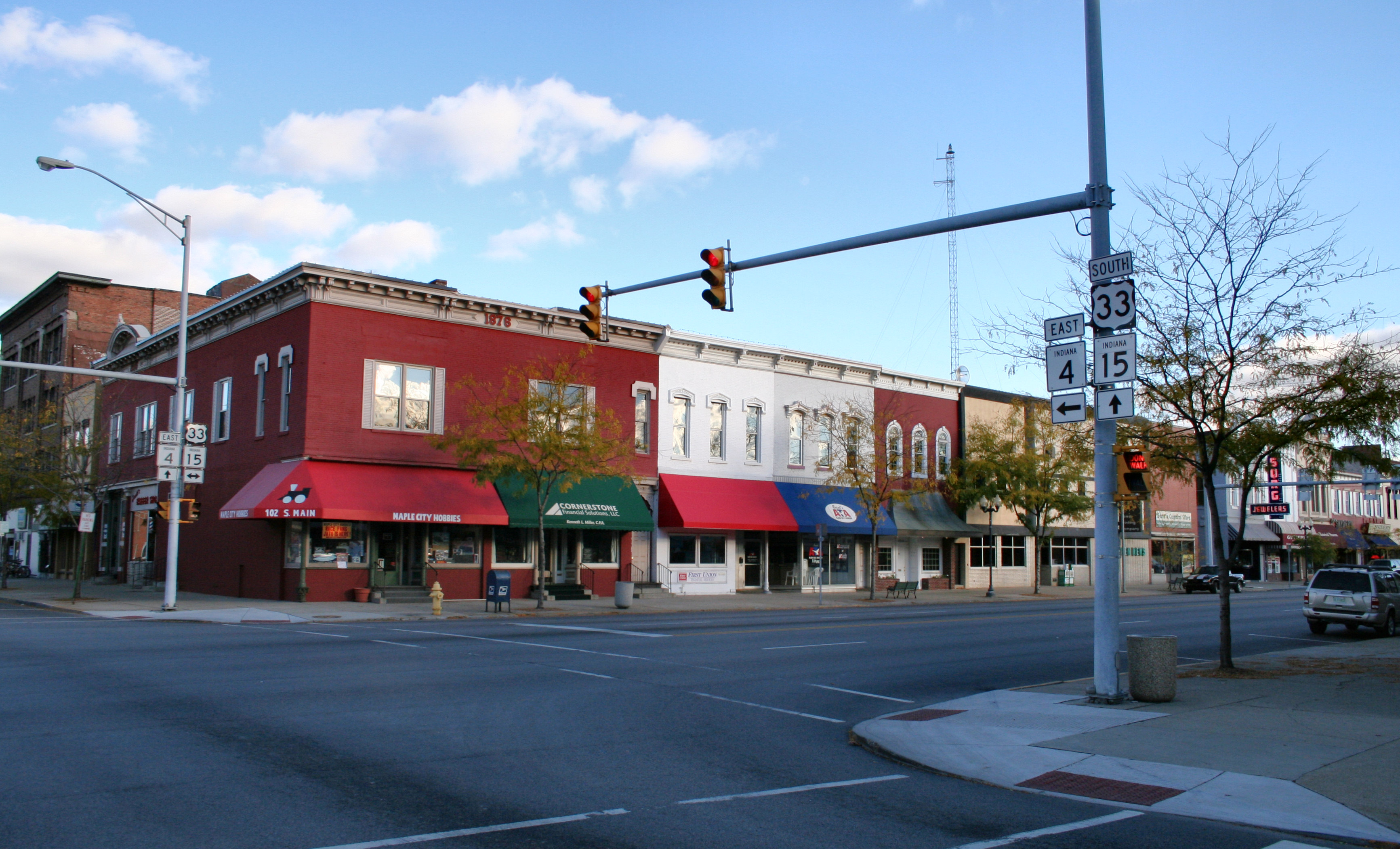
41°33′36″N 85°48′18″W / 41.56°N 85.805°WGoshen 11 Downtown Nappanee Historic District 
March 8, 1990 Main and Market Sts.
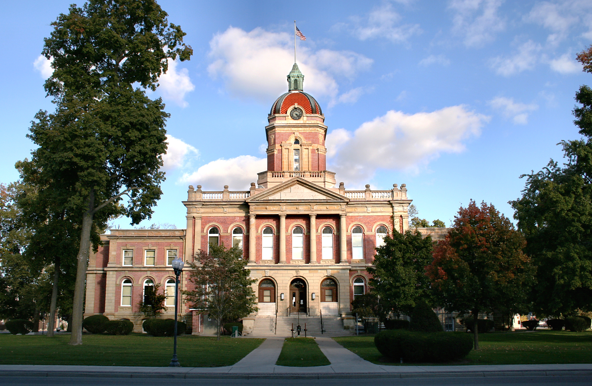
41°26′32″N 86°0′3″W / 41.44222°N 86.00083°WNappanee 12 Elkhart County Courthouse 
April 10, 1980 Courthouse Square
41°35′14″N 85°50′8″W / 41.58722°N 85.83556°WGoshen 13 Elkhart Downtown Commercial Historic District 
September 26, 1997 Roughly along Main St., roughly bounded by E. Jackson and 2nd Sts., Waterfall Dr., and Tyler Ave.
41°41′4″N 85°58′18″W / 41.68444°N 85.97167°WElkhart 14 Fort Wayne Street Bridge 
September 15, 2005 Indiana Ave. over the Elkhart River
41°35′36″N 85°50′55″W / 41.59333°N 85.84861°WGoshen 15 Solomon Fowler Mansion September 28, 2003 11505 W. Vistula St.
41°43′7″N 85°49′48″W / 41.71861°N 85.83°WBristol 16 Goshen Carnegie Public Library February 17, 1983 202 N. 5th St.
41°35′6″N 85°49′58″W / 41.585°N 85.83278°WGoshen 17 Goshen Historic Distriict 
February 17, 1983 Bounded by Pike, the railroad line, Cottage, Plymouth, Main, Purl, the Canal, and 2nd St.
41°34′57″N 85°49′57″W / 41.5825°N 85.8325°WGoshen 18 Green Block 
July 17, 1980 109-115 E. Lexington
41°41′11″N 85°58′20″W / 41.68639°N 85.97222°WElkhart 19 William and Helen Koerting House December 22, 2009 2625 Greenleaf Boulevard
41°41′51.98″N 85°56′16.06″W / 41.6977722°N 85.9377944°WElkhart 20 Lerner Theatre 
October 2, 1980 401 S. Main St.
41°41′2″N 85°58′18″W / 41.68389°N 85.97167°WElkhart 21 Arthur Miller House April 2, 1992 253 E. Market St.
41°26′33″N 85°59′57″W / 41.4425°N 85.99917°WNappanee 22 Mark L. and Harriet E. Monteith House December 26, 1985 871 E. Beardsley Ave.
41°41′41″N 85°57′48″W / 41.69472°N 85.96333°WElkhart 23 Morehouse Residential Historic District September 16, 2011 Roughly bounded by E. Indiana, Morehouse, E. Hubbard, and the western side of Frances Aves.
41°40′16″N 85°57′43″W / 41.67111°N 85.96194°WElkhart 24 Nappanee West Park and Pavilion March 28, 1994 Junction of Nappanee and Van Buren Sts.
41°26′48″N 86°0′19″W / 41.44667°N 86.00528°WNappanee 25 Nappaness Eastside Historic District December 23, 2003 Roughly bounded by Market, Main, John, and Summit Sts.
41°26′39″N 85°59′52″W / 41.44417°N 85.99778°WNappanee 26 Joseph and Sarah Puterbaugh Farm March 3, 1995 59123 County Road 9
41°38′10″N 85°57′57″W / 41.63611°N 85.96583°WElkhart 27 Joseph J. Rohrer Farm February 23, 1990 24394 County Road 40
41°32′41″N 85°55′57″W / 41.54472°N 85.9325°WGoshen 28 St. John of the Cross Episcopal Church, Rectory and Cemetery September 17, 1980 601 and 611 E. Vistula Rd.
41°43′17″N 85°48′40″W / 41.72139°N 85.81111°WBristol 29 St. John's Lutheran Church November 25, 1994 Northeastern corner of the junction of County Roads 15 and 32
41°34′50″N 85°54′20″W / 41.58056°N 85.90556°WGoshen 30 Stahly-Nissley-Kuhns Farm November 29, 1990 1600 W. Market St.
41°26′39″N 86°1′2″W / 41.44417°N 86.01722°WNappanee 31 State Street-Division Street Historic District February 26, 1999 Roughly both sides of State and Division Sts. between Main and Monroe
41°40′58″N 85°57′59″W / 41.68278°N 85.96639°WElkhart 32 William N. Violett House September 20, 1984 3004 S. Main St.
41°32′40″N 85°49′41″W / 41.54444°N 85.82806°WGoshen 33 Violett-Martin House and Gardens September 20, 2007 2612 S. Main St.
41°33′4″N 85°49′40″W / 41.55111°N 85.82778°WGoshen 34 Young Women's Christian Association 
March 21, 1991 120 W. Lexington Ave.
41°41′11″N 85°58′26″W / 41.68639°N 85.97389°WElkhart See also
- List of National Historic Landmarks in Indiana
- National Register of Historic Places listings in Indiana
References
- ^ The latitude and longitude information provided in this table was derived originally from the National Register Information System, which has been found to be fairly accurate for about 99% of listings. For about 1% of NRIS original coordinates, experience has shown that one or both coordinates are typos or otherwise extremely far off; some corrections may have been made. A more subtle problem causes many locations to be off by up to 150 yards, depending on location in the country: most NRIS coordinates were derived from tracing out latitude and longitudes off of USGS topographical quadrant maps created under North American Datum of 1927, which differs from the current, highly accurate GPS system used by Google maps. Chicago is about right, but NRIS longitudes in Washington are higher by about 4.5 seconds, and are lower by about 2.0 seconds in Maine. Latitudes differ by about 1.0 second in Florida. Some locations in this table may have been corrected to current GPS standards.
- ^ "National Register of Historic Places: Weekly List Actions". National Park Service, United States Department of the Interior. Retrieved on November 10, 2011.
- ^ Numbers represent an ordering by significant words. Various colorings, defined here, differentiate National Historic Landmark sites and National Register of Historic Places Districts from other NRHP buildings, structures, sites or objects.
- ^ "National Register Information System". National Register of Historic Places. National Park Service. 2009-03-13. http://nrhp.focus.nps.gov/natreg/docs/All_Data.html.
U.S. National Register of Historic Places Topics Lists by states Alabama • Alaska • Arizona • Arkansas • California • Colorado • Connecticut • Delaware • Florida • Georgia • Hawaii • Idaho • Illinois • Indiana • Iowa • Kansas • Kentucky • Louisiana • Maine • Maryland • Massachusetts • Michigan • Minnesota • Mississippi • Missouri • Montana • Nebraska • Nevada • New Hampshire • New Jersey • New Mexico • New York • North Carolina • North Dakota • Ohio • Oklahoma • Oregon • Pennsylvania • Rhode Island • South Carolina • South Dakota • Tennessee • Texas • Utah • Vermont • Virginia • Washington • West Virginia • Wisconsin • WyomingLists by territories Lists by associated states Other  Category:National Register of Historic Places •
  Portal:National Register of Historic Places
Municipalities and communities of Elkhart County, Indiana County seat: Goshen Cities 
Towns Bristol | Middlebury | Millersburg | Wakarusa
Townships CDPs Unincorporated
communitiesBainter Town | Benton | Bonneyville Mills | Foraker | Garden Village | Jamestown | Locke | Midway | Nibbyville | Southwest | Vistula | Waterford Mills
Footnotes ‡This populated place also has portions in an adjacent county or counties
Categories:- National Register of Historic Places in Elkhart County, Indiana
- National Register of Historic Places in Indiana by county
-


Wikimedia Foundation. 2010.