- National Register of Historic Places listings in Sangamon County, Illinois
-
Contents: List of properties on the National Register of Historic Places in Sangamon County, Illinois, USA:
-
- This National Park Service list is complete through NPS recent listings posted November 10, 2011.[1]
Landmark name Image Date listed Location City or Town Summary 1 Bolivia Road Bridge January 28, 2004 Across the North Fork of the Sangamon R.
39°46′9″N 89°20′44″W / 39.76917°N 89.34556°WBolivia 2 H. P. Boult House June 3, 1982 1123 S. 2nd St.
39°47′18″N 89°39′13″W / 39.78833°N 89.65361°WSpringfield 3 Bressmer-Baker House June 29, 1982 913 6th St.
39°47′30″N 89°38′54″W / 39.79167°N 89.64833°WSpringfield 4 John F. Bretz House and Warehouse August 10, 2000 113 N. Fifth St.
39°48′50″N 89°38′58″W / 39.81389°N 89.64944°WSpringfield 5 George M. Brinkerhoff House December 18, 1978 1500 N. 5th St.
39°49′16″N 89°38′54″W / 39.82111°N 89.64833°WSpringfield 6 Brunk Farmstead December 17, 1999 KOA Campground Rd., i mi. S. of E. Lake Dr.
39°41′51″N 89°35′12″W / 39.6975°N 89.58667°WRochester 7 Caldwell Farmstead August 16, 1984 IL 4
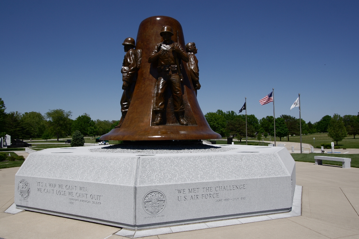
39°42′9″N 89°42′21″W / 39.7025°N 89.70583°WChatham 8 Camp Butler National Cemetery 
August 15, 1997 5063 Camp Butler Rd.
39°49′58″N 89°33′21″W / 39.83278°N 89.55583°WSpringfield 9 Camp Lincoln Commissary Building November 13, 1984 1301 N. MacArthur Blvd.
39°49′15″N 89°40′8″W / 39.82083°N 89.66889°WSpringfield 10 Central Springfield Historic District August 29, 1978 Roughly bounded by 14th, 7th, Jefferson, and Washington Sts.; also 6th St. from Capitol to Monroe St.
39°48′1″N 89°38′56″W / 39.80028°N 89.64889°WSpringfield Second set of boundaries represents a boundary increase of November 19, 1986 11 Christ Episcopal Church September 12, 1980 611 E. Jackson St.
39°47′50″N 89°38′51″W / 39.79722°N 89.6475°WSpringfield 12 Clayville Tavern May 8, 1973 0.5 mi. SE of Pleasant Plains on IL 125
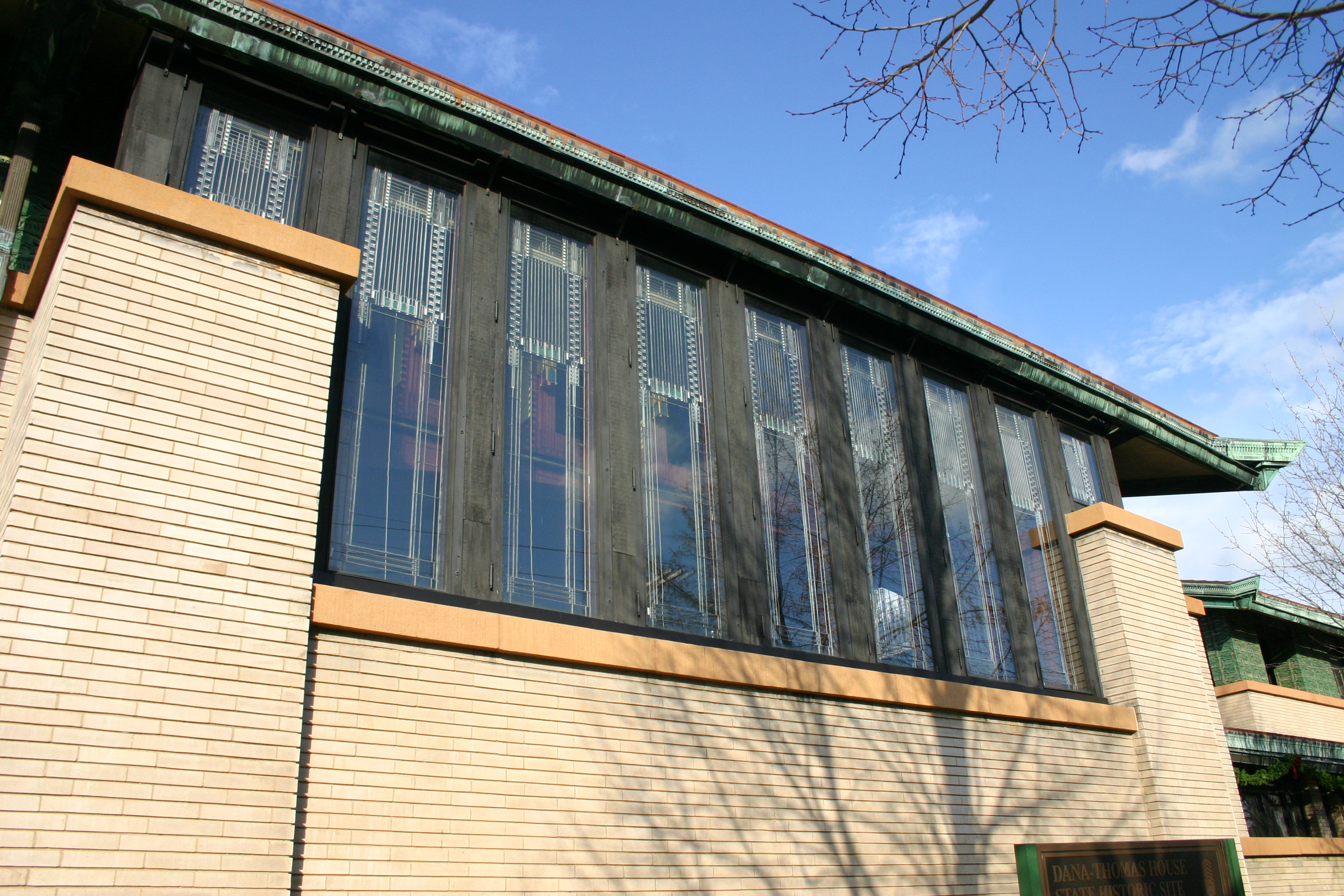
39°52′25″N 89°53′50″W / 39.87361°N 89.89722°WPleasant Plains 13 Susan Lawrence Dana House 
July 30, 1974 301 Lawrence Ave.
39°47′39″N 89°39′5″W / 39.79417°N 89.65139°WSpringfield 14 Edwards Place December 17, 1969 700 N. 4th St.
39°48′34″N 89°39′1″W / 39.80944°N 89.65028°WSpringfield 15 Executive Mansion July 19, 1976 4th and Jackson Sts.
39°47′48″N 89°39′0″W / 39.79667°N 89.65°WSpringfield 16 Fisher Building-Latham Block April 28, 2000 111, 113, and 115 N. Sixth St.
39°47′58″N 89°38′51″W / 39.79944°N 89.6475°WSpringfield 17 Cornelius Flagg Farmstead February 3, 1993 Tipton School Rd., 0.4 mi. W of I-55 Bus. and 0.4 mi. S of Andrew Rd.
39°53′23″N 89°36′58″W / 39.88972°N 89.61611°WSherman 18 Clarkson W. Freeman House September 29, 1980 704 W. Monroe St.
39°47′57″N 89°39′49″W / 39.79917°N 89.66361°WSpringfield 19 Hugh M. Garvey House November 10, 2009 8 Fair Oaks Dr.
39°46′54.25″N 89°41′13.25″W / 39.7817361°N 89.6870139°WLeland Grove 20 Fred Gottschalk Grocery Store March 18, 1985 301 W. Edwards St.
39°47′47″N 89°39′28″W / 39.79639°N 89.65778°WSpringfield 21 Cong. James M. Graham House May 1, 1989 413 S. 7th St.
39°47′52″N 89°38′48″W / 39.79778°N 89.64667°WSpringfield 22 Hickox Apartments November 13, 1984 4th and Cook Sts.
39°47′43″N 89°39′4″W / 39.79528°N 89.65111°WSpringfield 23 Virgil Hickox House March 5, 1982 518 E. Capitol Ave.
39°47′53″N 89°38′55″W / 39.79806°N 89.64861°WSpringfield 24 Elijah Iles House February 23, 1978 1825 S. 5th St.
39°46′51″N 89°39′1″W / 39.78083°N 89.65028°WSpringfield 25 Illinois Department of Mines and Minerals-Springfield Mine Rescue Station July 5, 1985 609 Princeton Ave.
39°46′29″N 89°38′53″W / 39.77472°N 89.64806°WSpringfield 26 Illinois Route 4-North of Auburn August 6, 1998 Curran and Snell Rd.
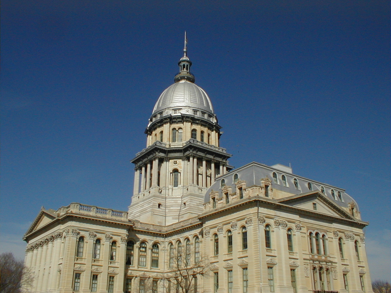
39°37′1″N 89°44′48″W / 39.61694°N 89.74667°WAuburn 27 Illinois State Capitol 
November 21, 1985 Capitol Ave. and Second St.
39°47′54″N 89°39′16″W / 39.79833°N 89.65444°WSpringfield 28 Illinois State Fairgrounds May 14, 1990 Jct. of Sangamon Ave. and Peoria Rd.
39°50′11″N 89°38′27″W / 39.83639°N 89.64083°WSpringfield 29 Jennings Ford Automobile Dealership May 31, 2006 431 S. Fourth St.
39°47′57″N 89°39′4″W / 39.79917°N 89.65111°WSpringfield 30 Alvin S. Keys House May 6, 1994 1600 Park Dr.
39°46′55″N 89°41′3″W / 39.78194°N 89.68417°WSpringfield 31 Lazy A Motel November 8, 1994 2840 Peoria Rd.
39°50′21″N 89°37′59″W / 39.83917°N 89.63306°WSpringfield 32 John L. Lewis House September 10, 1979 1132 W. Lawrence Ave.
39°47′38″N 89°40′22″W / 39.79389°N 89.67278°WSpringfield 33 Lincoln Colored Home August 6, 1998 427 S. Twelfth St.
39°47′51″N 89°38′23″W / 39.7975°N 89.63972°WSpringfield 34 Lincoln Home National Historic Site 
August 18, 1971 8th and Jackson Sts.
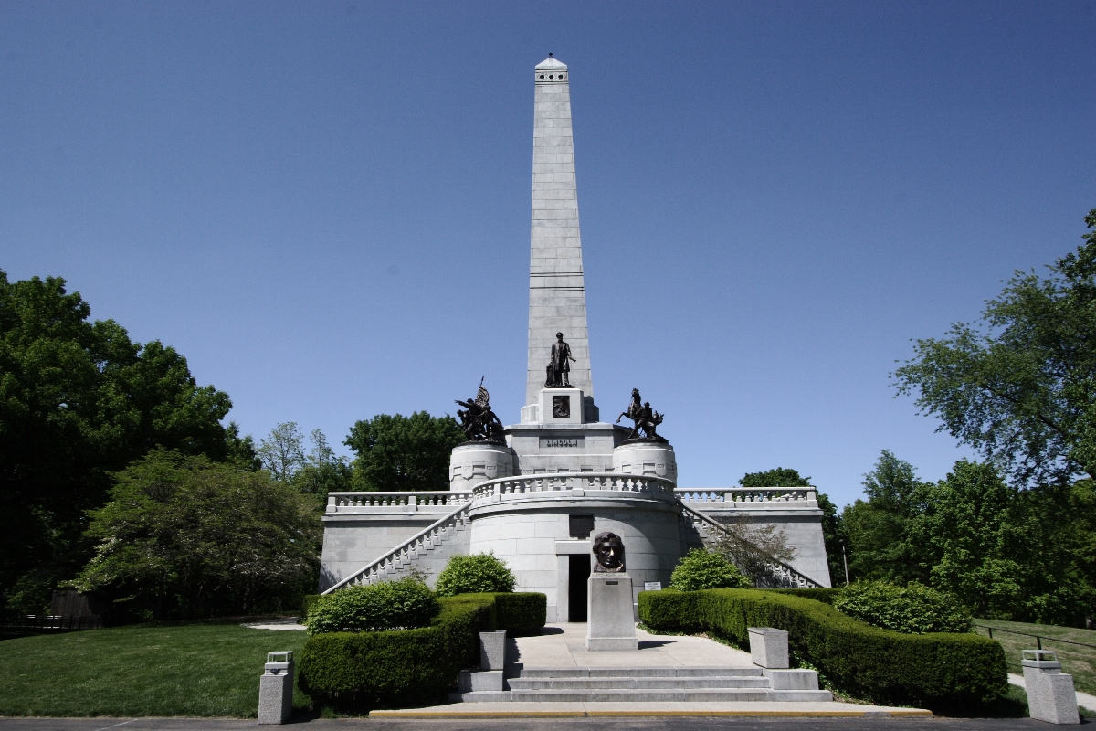
39°47′50″N 89°38′41″W / 39.79722°N 89.64472°WSpringfield 35 Lincoln Tomb 
October 15, 1966 Oak Ridge Cemetery
39°49′23″N 89°39′23″W / 39.82306°N 89.65639°WSpringfield 36 Abraham Lincoln Memorial Garden August 12, 1992 2301 E. Lake Dr.
39°42′11″N 89°36′0″W / 39.70306°N 89.6°WSpringfield 37 Vachel Lindsay House 
November 11, 1971 603 S. 5th St.
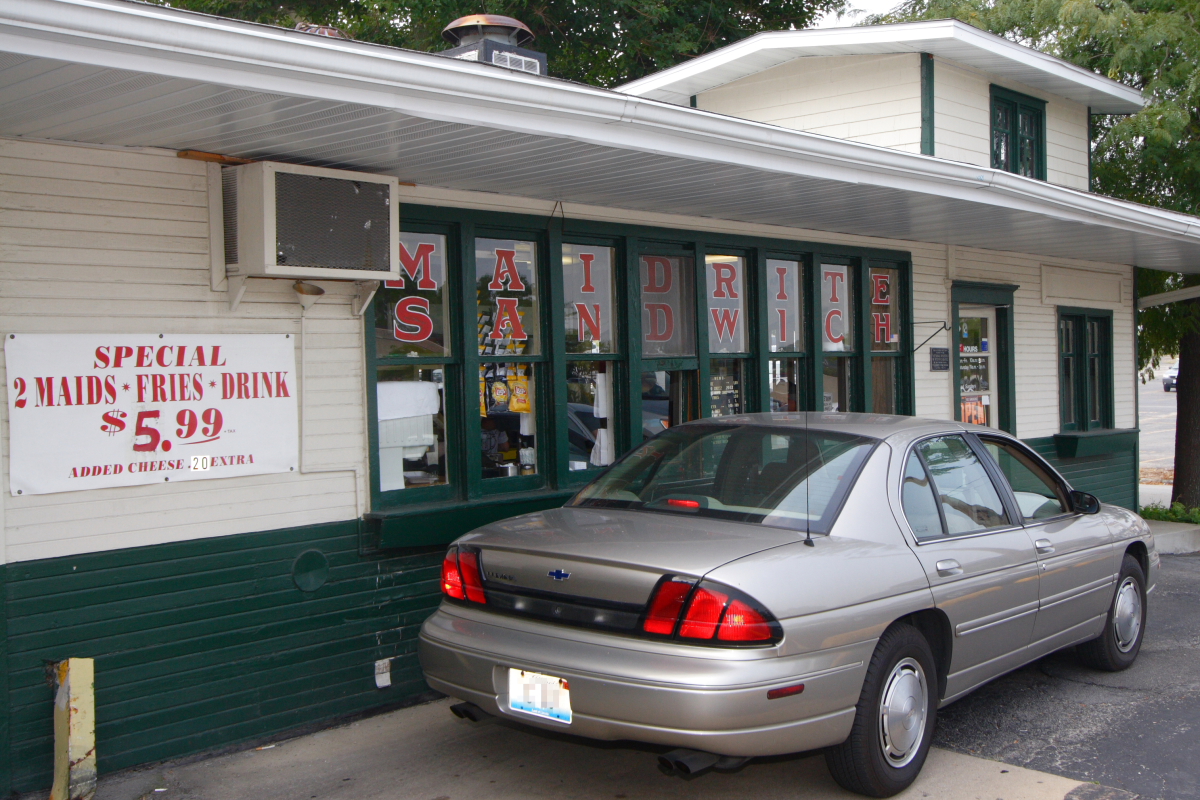
39°47′45″N 89°38′59″W / 39.79583°N 89.64972°WSpringfield 38 Maid-Rite Sandwich Shop 
August 16, 1984 118 N. Pasfield St.
39°48′9″N 89°39′30″W / 39.8025°N 89.65833°WSpringfield 39 Bell Miller Apartments November 7, 1995 835 S. Second St.
39°47′33″N 89°39′14″W / 39.7925°N 89.65389°WSpringfield 40 Joseph Miller House November 24, 1980 Buckhart Rd. Rochester 41 Oak Ridge Cemetery 
August 4, 1995 1441 Monument Ave.
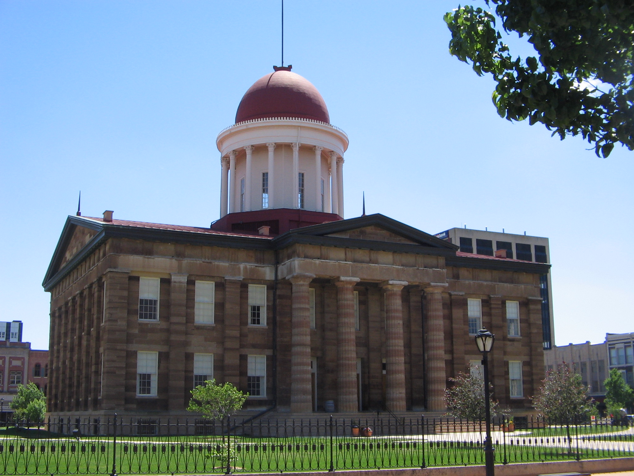
39°49′25″N 89°39′28″W / 39.82361°N 89.65778°WSpringfield 42 Old State Capitol 
October 15, 1966 Bounded by 5th, 6th, Adams, and Washington Sts.
39°48′4″N 89°38′53″W / 39.80111°N 89.64806°WSpringfield 43 Power Farmstead May 1, 1989 Co. Rd. 9.5 North, 0.5 mi. E of Cantrall
39°56′39″N 89°39′45″W / 39.94417°N 89.6625°WCantrall 44 Price-Prather House May 13, 1991 Jct. of Main and Elkhart Sts.
39°57′17″N 89°32′47″W / 39.95472°N 89.54639°WWilliamsville 45 Price/Wheeler House February 14, 1985 618 S. 7th St.
39°47′43″N 89°38′46″W / 39.79528°N 89.64611°WSpringfield 46 Rippon-Kinsella House February 27, 1992 1317 N. Third St.
39°49′1″N 89°39′6″W / 39.81694°N 89.65167°WSpringfield 47 Joseph Ross House March 2, 2006 5200 Passfield Rd.
39°43′41″N 89°26′4″W / 39.72806°N 89.43444°WRochester 48 Route 66 by Carpenter Park May 9, 2002 Old Route 66 between Cabin Smoke Trail and north bank of the Sangamon River
39°52′21″N 89°36′51″W / 39.8725°N 89.61417°WSpringfield 49 Route 66 South of Lake Springfield May 12, 2009 Olde Rt. 66/Olde Carriage Way
39°40′30.9″N 89°37′28.92″W / 39.67525°N 89.6247°WSpringfield 50 St. Nicholas Hotel February 10, 1983 400 E. Jefferson St.
39°48′9″N 89°39′1″W / 39.8025°N 89.65028°WSpringfield 51 Sugar Creek Covered Bridge January 9, 1978 SE of Chatham off I-55
39°38′25″N 89°39′43″W / 39.64028°N 89.66194°WChatham 52 Taft Farmstead November 20, 1980 SR 3
39°45′8″N 89°33′34″W / 39.75222°N 89.55944°WRochester 53 Taylor Apartments September 15, 2004 117 S. Grand Ave. W
39°47′21″N 89°39′22″W / 39.78917°N 89.65611°WSpringfield 54 Tiger-Anderson House June 11, 1986 CR 3 N
39°50′39″N 89°42′31″W / 39.84417°N 89.70861°WSpringfield 55 Town House June 3, 2005 718 7th St.
39°47′47″N 89°38′47″W / 39.79639°N 89.64639°WSpringfield 56 Union Station 
November 27, 1978 Madison St.
39°48′13″N 89°38′54″W / 39.80361°N 89.64833°WSpringfield 57 US ARMY Aircraft P-51D-25NA 44-73287 March 11, 1999 Capital Airport , 0.5 N of Jct. of IL 29 and Veterans Parkway
39°50′27″N 89°40′33″W / 39.84083°N 89.67583°WSpringfield 58 Washington Park 
May 22, 1992 Bounded by Fayette Ave., Williams Blvd., Walnut St., MacArthur Blvd., S. Grand Ave. and Chatham Rd.
39°47′20″N 89°40′37″W / 39.78889°N 89.67694°WSpringfield 59 Howard K. Weber House October 1, 1979 925 S. 7th St.
39°47′30″N 89°38′48″W / 39.79167°N 89.64667°WSpringfield 60 Gov. Richard Yates House March 1, 1984 1190 Williams Blvd.
39°47′57″N 89°40′21″W / 39.79917°N 89.6725°WSpringfield References
- ^ "National Register of Historic Places: Weekly List Actions". National Park Service, United States Department of the Interior. Retrieved on November 10, 2011.
Resources
U.S. National Register of Historic Places Topics Lists by states Alabama • Alaska • Arizona • Arkansas • California • Colorado • Connecticut • Delaware • Florida • Georgia • Hawaii • Idaho • Illinois • Indiana • Iowa • Kansas • Kentucky • Louisiana • Maine • Maryland • Massachusetts • Michigan • Minnesota • Mississippi • Missouri • Montana • Nebraska • Nevada • New Hampshire • New Jersey • New Mexico • New York • North Carolina • North Dakota • Ohio • Oklahoma • Oregon • Pennsylvania • Rhode Island • South Carolina • South Dakota • Tennessee • Texas • Utah • Vermont • Virginia • Washington • West Virginia • Wisconsin • WyomingLists by territories Lists by associated states Other Municipalities and communities of Sangamon County, Illinois Cities Auburn | Leland Grove | Springfield | Virden‡

Villages Berlin | Buffalo | Cantrall | Chatham | Clear Lake | Curran | Dawson | Divernon | Grandview | Illiopolis | Jerome | Loami | Mechanicsburg | New Berlin | Pawnee | Pleasant Plains | Riverton | Rochester | Sherman | Southern View | Spaulding | Thayer | Williamsville
Townships Auburn | Ball | Buffalo Hart | Capital | Cartwright | Chatham | Clear Lake | Cooper | Cotton Hill | Curran | Divernon | Fancy Creek | Gardner | Illiopolis | Island Grove | Lanesville | Loami | Maxwell | Mechanicsburg | New Berlin | Pawnee | Rochester | Salisbury | Springfield | Talkington | Williams | Woodside
Unincorporated
communitiesFootnotes ‡This city also has portions in adjacent county or counties
Categories:- National Register of Historic Places in Sangamon County, Illinois
- National Register of Historic Places in Illinois by county
-


Wikimedia Foundation. 2010.