- Vermilion County, Illinois
-
Vermilion County, Illinois 
Seal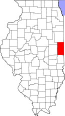
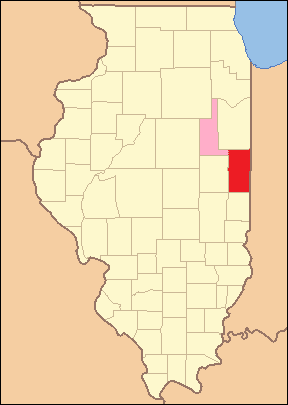
Location in the state of Illinois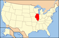
Illinois's location in the U.S.Founded 1826 Seat Danville Area
- Total
- Land
- Water
901.28 sq mi (2,334 km²)
898.37 sq mi (2,327 km²)
2.91 sq mi (8 km²), 0.32%Population
- (2010)
- Density
81,625
93/sq mi (36/km²)Website www.co.vermilion.il.us Vermilion County is a county located in the eastern part of the U.S. state of Illinois, between the Indiana border and Champaign County. It was established in 1826 and was the 45th of Illinois' 102 counties. It is part of the 'Danville, Illinois, Metropolitan Statistical Area' which encompasses all of Vermilion County.
According to the 2010 census, it has a population of 81,625, which is a decrease of 2.7% from 83,919 in 2000.[1] It contains 21 incorporated settlements; the county seat is the largest city, Danville.[2] The county is also divided into 19 townships which provide local services.[3]
Contents
History
Vermilion County is named after the Vermilion River, which passes through the county and empties into the Wabash River in Indiana near Cayuga; the river was so named because of the color of the earth along its route.[4][5]
The area which became Vermilion County was under the flag of France from 1682 to 1763, as part of New France. It was owned by Great Britain for fifteen years after the French and Indian War; it then became part of the colonies after the Revolutionary War when the area was ceded to Virginia and was known as "the Illinois County of Virginia". Later it was part of the Indiana Territory, then the Illinois Territory, and finally the state of Illinois.[6] The county was officially created on January 18, 1826 from a portion of Edgar County. There was an unorganized territory to the north and west which was attached to the county; Champaign and Iroquois counties were formed from part of this territory in 1833. The remainder was used to create Ford County in 1859; this was the last county to be formed in the state.
The existence of saline springs in the county proved to be a strong attraction to early white men, and were mentioned as early as 1801, when Joseph Barron, an interpreter fluent in a number of Native American languages, stated in an affidavit that he was present at the "Vermilion Salines" that year. The production required 100 gallons of water for one bushel of salt and proved to be profitable from the first run 1822 to 1829, when salt became less expensive and the venture was no longer economical.[7]
The saline springs were also the site of the first settlement, made by Seymour Treat in 1819, along with the Beckwith and Whitcomb families. James Butler, from Ohio, followed in 1820 and settled in the Catlin area; within a few years, the settlement grew to encompass several families and became known as "Butler's Point". About the same time, the southern area of the county also attracted an early settler named Henry Johnson, who built a cabin approximately two miles west of Georgetown; this area later became known as "Johnson's Point". The southern portion of the county soon became populated with a number of cabins and small settlements. The majority of those coming to Vermilion County originated in the American South and left because of their opposition to slavery.[8]
Some of the early settlers were of the Religious Society of Friends, or Quakers. Some of these settlers founded the settlement of Vermilion Grove in the south part of the county; it is not only one of the oldest settlements in the county but also the site of the second school in the county.
The county has strong ties to Abraham Lincoln. He practiced law in Danville from 1841 to 1859 with Ward Hill Lamon, who later served as his bodyguard. Lincoln also gave a brief speech in Danville in 1858 while campaigning for U.S. Senate against Stephen A. Douglas; Lincoln gave the speech in his stocking feet while standing on the balcony at the home of Dr. William Fithian, a prominent local physician. Today, the Fithian home is listed on the National Register of Historic Places and serves as the Vermilion County Museum;[9] visitors can see Lincoln memorabilia including a bed in which Lincoln slept.[10]
The maps below illustrate the various stages in the evolution of Vermilion County.[11]
-

Vermilion County from the time of its creation to 1831, including a large tract of unorganized territory temporarily attached to it.
-

Vermilion between 1831 and 1833
-

The county between 1833 and 1836, after Vermilion proper was reduced to its current borders through the creation of Champaign and Iroquois Counties
-

Vermilion County between 1836 and 1837
-

Vermilion County between 1837 and 1853
-

Vermilion County after 1853, when the unorganized territory was reduced to its current size.
-

In 1859 the additional territory was split off as Ford County, reducing Vermilion to its current borders.
Geography
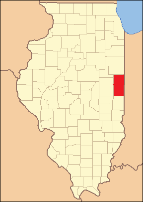
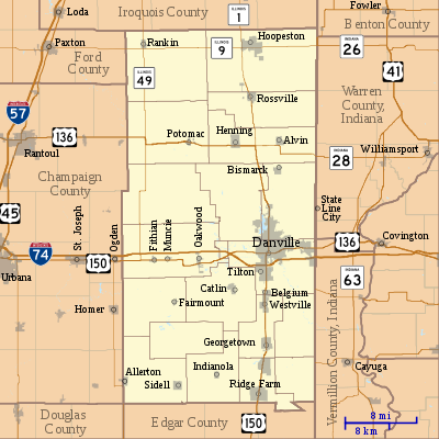 Map of Vermilion County
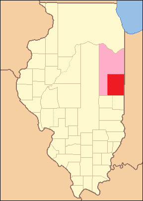
Vermilion County is located along the eastern border of Illinois; its northern border is about 95 miles (153 km) south of Chicago. The county is bordered on the north by Iroquois County. To the west are Champaign County and Ford County and to the south is Edgar County. The Indiana counties of Benton, Warren and Vermillion lie to the northeast, east and southeast, respectively. This is one of only a few cases in the United States where two counties with the same name share a border; the Indiana county is spelled the French way with two "L"s, and the Illinois county is spelled in the English manner with one "L", but the source of the name is the same; the Vermilion River flows through both counties. (Another such situation in Illinois involves Pike County, which borders Pike County, Missouri.)
Vermilion County is also one of several counties which share borders with eight other counties, although one of the counties it borders, Douglas County, is at a single point (the southwestern corner of Vermilion County and northeastern corner of Douglas County).
According to the 2010 census, the county has a total area of 901.28 square miles (2,334.3 km2), of which 898.37 square miles (2,326.8 km2) (or 99.68%) is land and 2.91 square miles (7.5 km2) (or 0.32%) is water.[12] The land in Vermilion County consists mostly of various forms of silt loam.[13] Lake Vermilion, a man-made 1,000-acre (400 ha) reservoir, is the largest body of water in the county; it lies on the northwest side of Danville and is the source of the city's water, and also provides recreation opportunities.
Illinois law allows settlements to incorporate as either cities or villages; when incorporated, cities must have a population of at least 2,500, and villages must have a population of at least 500.[14] There are three cities in the county and eighteen villages, along with several unincorporated towns. The three cities are Danville, the county seat and the county's largest settlement with a population of about 34,000; Hoopeston, located in the far north part of the county, with a population of about 6,000; and Georgetown, south of Danville, with a population of about 3,600.
The village of Allerton is in the far southwest corner of the county, with a small portion extending into Champaign County; Sidell is just east of Allerton. Alvin and Bismarck are both located to the north of Danville; further north, Rossville is on Route 1 south of Hoopeston. Going south from Danville, Route 1 passes through Tilton, Belgium, Westville, the city of Georgetown, and Ridge Farm.
West of Danville along U.S. Route 150 lie the villages of Oakwood, Muncie and Fithian; all are just to the south of Interstate 74. Potomac and Henning both lie along an east–west portion of U.S. Route 136 north of Danville. Fairmount, Catlin and Indianola all lie to the southwest of Danville. Rankin is in the far northwest corner of the county, near the intersection of Route 9 and Route 49.
There are at least a dozen communities in the county which are not incorporated.
Several towns were established in the county which no longer survive. In some cases, the coming of the railroads helped to define the best locations for settlements, and as a result some existing towns were abandoned. When Lake Vermilion was created, the old town of Denmark, to the northwest of Danville, was flooded and now lies at the bottom of the reservoir.
Townships
Township government was adopted in Vermilion County in 1851, and eight townships were created, listed below.
- Middlefork
- Newell (first called Richland)
- Pilot
- Ross
Eleven more townships, listed below, were created in the following decades. The final total was nineteen townships.
Parks
The Vermilion County Conservation District operates four parks in the county: Forest Glen Preserve, the Heron County Park, Kennekuk Cove County Park and the Lake Vermilion County Park.[16] The Kickapoo State Recreation Area, the Harry "Babe" Woodyard State Natural Area and the Middle Fork State Fish and Wildlife Area are all managed by the Illinois Department of Natural Resources.[17]
Climate and weather
Danville, Illinois Climate chart (explanation) J F M A M J J A S O N D 2.13417240223.252323.965414.575514.784604.486643.9846337855367433.552342.83923Average max. and min. temperatures in °F Precipitation totals in inches Source: The Weather Channel[18] Metric conversion J F M A M J J A S O N D 521-8514-6811109818511424111192916112301810029177726137719690111714-5Average max. and min. temperatures in °C Precipitation totals in mm Vermilion County is in the humid continental climate region of the United States along with most of Illinois. Its Köppen climate classification is Dfa,[19] meaning that it is cold, has no dry season, and has a hot summer.[20] In recent years, average temperatures in the county seat of Danville have ranged from a low of 17 °F (−8 °C) in January to a high of 86 °F (30 °C) in July, although a record low of −26 °F (−32 °C) was recorded in January 1994 and a record high of 112 °F (44 °C) was recorded in July 1936. Average monthly precipitation ranged from 1.99 inches (51 mm) inches in February to 4.70 inches (119 mm) inches in June.[18]
Transportation
Interstate 74 enters Vermilion County from the west on its way from Champaign–Urbana, and passes just to the north of the towns of Fithian, Muncie and Oakwood before passing through the south edge of the Kickapoo State Park, the north edge of Tilton and the south edge of Danville. Continuing east, it leaves the county and the state on its way to Indianapolis.[21]
U.S. Route 136, which runs across five states, passes into Vermilion County from the west on its way from Rantoul. It passes east through the towns of Armstrong, Potomac and Henning; it reaches Illinois Route 1 south of Rossville and then shares that highway's route as it passes south through Danville. At the south edge of Danville it reaches Main Street and resumes its eastward heading, leaving the east edge of Danville and passing out of the county and state on its way to Covington, Indiana.[22]
U.S. Route 150 enters the county from Champaign–Urbana to the west, running just to the south of Interstate 74 and passing through the towns of Fithian, Muncie and Oakwood. Just east of Danville it crosses to the north side of Interstate 74 as that highway veers to the southeast. In downtown Danville, it meets Illinois Route 1 and U.S. Route 136, and follows Route 1 to the south and continues through the towns of Belgium, Westville, Georgetown and Ridge Farm before entering Edgar County further to the south.[23]
Illinois Route 1 runs from the north to the south through the county, passing through Hoopeston, Rossville, Danville, Belgium, Westville, Georgetown and Ridge Farm.[24] Illinois Route 9 runs from west to east near the north edge of the county and passes through Rankin and Hoopeston; upon reaching the Indiana border, Indiana State Road 26 continues its route to the east toward Lafayette, Indiana.[25] Illinois Route 49 is a north–south highway near the western edge of the county. It passes south through Rankin where it intersects Route 1; further south it passes through Armstrong where U.S. Route 136 briefly shares its route. Crossing Interstate 74, it briefly shares the route of U.S. Route 150, running west for about 2 miles (3.2 km) and leaving the county before continuing south in Champaign County.[26] Illinois Route 119 is a short 8-mile (13 km) east–west road that connects the intersection of Illinois Route 1 and U.S. Route 136 with Indiana State Road 28 at the state line.[27]
Four railroad lines pass through or into the county, all intersecting in the Danville area; this results in many different railroad crossings throughout the city. A Norfolk Southern Railway line enters the county from Decatur to the southwest and passes through Danville on its way to Lafayette, Indiana to the northeast. CSX Transportation operates a north–south line through the county which connects with Chicago to the north and Terre Haute, Indiana further south via Paris. A Kankakee, Beaverville and Southern Railroad north–south line runs to the east of the CSX line, just a few miles from the state border, beginning in northern Iroquois County and running south through Danville, then veering east.[28] The Vermilion Valley Railroad is a 6-mile (9.7 km) line that connects the Flex-N-Gate factory west of Covington, Indiana with CSX in Danville.[29]
The Vermilion Regional Airport is located just northeast of Danville.
Economy
As of 2009, Vermilion County had a workforce of 37,293 people, 33,021 of whom were employed and 4,272 of whom (11.5%) were unemployed.[30]
Education
There are 15 school districts in the county that provide primary and secondary education.[31] There are two post-secondary educational institutions: Danville Area Community College, a public two-year community college, and Lakeview College of Nursing, a four-year private institution (both located in Danville).
Government
Based on the 2000 census, Vermilion County is part of the Illinois' 15th congressional district;[32] the Illinois Senate districts 52 and 53; and the Illinois House of Representatives districts 104 and 105.[33]
Each township has a supervisor. The township board consists of the supervisor and four members elected at large from the township.[34]
Demographics
Historical populations Census Pop. %± 1900 65,635 — 1910 77,996 18.8% 1920 86,162 10.5% 1930 89,339 3.7% 1940 86,791 −2.9% 1950 87,079 0.3% 1960 96,176 10.4% 1970 97,047 0.9% 1980 95,222 −1.9% 1990 88,257 −7.3% 2000 83,919 −4.9% Source: United States Department of Commerce,
Bureau of the Census, Population Division[35]As of the census of 2000, there were 83,919 people, 33,406 households, and 22,315 families residing in the county. The population density was 93 people per square mile (36/km²). There were 36,349 housing units at an average density of 40 per square mile (16/km²). The racial makeup of the county was 85.84% White, 10.58% Black or African American, 0.22% Native American, 0.59% Asian, 0.02% Pacific Islander, 1.44% from other races, and 1.30% from two or more races. 2.98% of the population were Hispanic or Latino of any race. 19.7% were of American, 19.2% German, 11.2% English and 8.9% Irish ancestry according to Census 2000.
There were 33,406 households out of which 30.10% had children under the age of 18 living with them, 50.60% were married couples living together, 12.20% had a female householder with no husband present, and 33.20% were non-families. 28.90% of all households were made up of individuals and 13.50% had someone living alone who was 65 years of age or older. The average household size was 2.42 and the average family size was 2.96.
In the county the population was spread out with 25.00% under the age of 18, 8.40% from 18 to 24, 27.20% from 25 to 44, 23.40% from 45 to 64, and 16.00% who were 65 years of age or older. The median age was 38 years. For every 100 females there were 96.90 males. For every 100 females age 18 and over, there were 94.80 males.
The median income for a household in the county was $34,071, and the median income for a family was $41,553. Males had a median income of $32,305 versus $22,210 for females. The per capita income for the county was $16,787. About 9.70% of families and 13.30% of the population were below the poverty line, including 18.90% of those under age 18 and 9.20% of those age 65 or over.[36]
See also
- Danville Area Community College
- Vermilion Regional Airport
- Danville High School
- National Register of Historic Places listings in Vermilion County, Illinois
References
- ^ "Vermilion County QuickFacts". United States Census Bureau. http://quickfacts.census.gov/qfd/states/17/17183.html. Retrieved 2011-11-05.
- ^ "Find a County – Vermilion County, IL". National Association of Counties. http://www.uscounties.org/cffiles_web/counties/county.cfm?id=17183. Retrieved 2011-01-06.
- ^ "Townships by County – Vermilion". Township Officials of Illinois. http://www.toi.org/townshipsbycounty.asp#vermilion. Retrieved 2011-02-16.
- ^ Callary, Edward (2009). Place Names of Illinois. Urbana: University of Illinois Press. p. 358. ISBN 978-0252033568.
- ^ Jones 1911, p. 25.
- ^ Jones 1911, pp. 32–35.
- ^ Jones 1911, pp. 40–48.
- ^ Jones 1911, pp. 57–62.
- ^ "Vermilion County Museum". Vermilion County Museum. http://www.vermilioncountymuseum.org/. Retrieved 2010-10-16.
- ^ "Vermilion County Village Profile". Community Profile Network. http://www.villageprofile.com/illinois/danville/03his/topic.html. Retrieved 2010-10-16.
- ^ "Origin and Evolution of Illinois Counties" (PDF). State of Illinois. March 2010. http://www.cyberdriveillinois.com/publications/pdf_publications/ipub15.pdf.
- ^ "Census 2010 U.S. Gazetteer Files: Counties". United States Census. http://www.census.gov/geo/www/gazetteer/files/Gaz_counties_national.txt. Retrieved 2011-11-05.
- ^ United States Department of Agriculture's Natural Resources Conservation Service. "Acreage and Proportionate Extent of Soils: Vermilion County, Illinois". http://soildatamart.nrcs.usda.gov/Report.aspx?Survey=IL183&UseState=IL. Retrieved 2010-10-17.
- ^ "Illinois Municipal Code: Municipalities". http://www.ilga.gov/legislation/ilcs/ilcs4.asp?DocName=006500050HArt.+2&ActID=802&ChapterID=14&SeqStart=9100000&SeqEnd=14800000. Retrieved 2010-10-17.
- ^ a b c d Stapp 1968, pp. 21, 38–39, 45
- ^ "The Vermilion County Conservation District". http://www.vccd.org/. Retrieved 2010-10-17.
- ^ "Illinois State Parks and other Natural Areas — East–Central Region". Illinois Department of Natural Resources. http://dnr.state.il.us/Lands/Landmgt/PARKS/R3/region3.htm. Retrieved 2010-10-17.
- ^ a b "Monthly Averages for Danville, Illinois". The Weather Channel. http://www.weather.com/weather/wxclimatology/monthly/graph/USIL0295. Retrieved 2011-01-27.
- ^ "Köppen Climate Classification for the Conterminous United States". Idaho State Climate Services. http://snow.cals.uidaho.edu/clim_map/koppen_usa_map.htm. Retrieved 2011-01-23.
- ^ Peel, M. C.; Finlayson, B. L.; McMahon, T. A. (2007). "Updated world map of the Köppen–Geiger climate classification" (PDF). Copernicus Publications. p. 1636. http://www.hydrol-earth-syst-sci.net/11/1633/2007/hess-11-1633-2007.pdf. Retrieved 2011-01-23.
- ^ "Interstate 74". Highway Explorer. http://www.highwayexplorer.com/il_EndsPage.php?id=3074§ion=1. Retrieved 2010-10-17.
- ^ "U.S. Route 136". Highway Explorer. http://www.highwayexplorer.com/il_EndsPage.php?id=2136§ion=1. Retrieved 2010-10-17.
- ^ "U.S. Route 150". Highway Explorer. http://www.highwayexplorer.com/il_EndsPage.php?id=2150§ion=1. Retrieved 2010-10-17.
- ^ "Illinois Route 1". Highway Explorer. http://highwayexplorer.com/il_EndsPage.php?id=1001§ion=1. Retrieved 2010-10-17.
- ^ "Illinois Route 9". Highway Explorer. http://highwayexplorer.com/il_EndsPage.php?id=1009§ion=1. Retrieved 2010-10-17.
- ^ "Illinois Route 49". Highway Explorer. http://highwayexplorer.com/il_EndsPage.php?id=1049§ion=1. Retrieved 2010-10-17.
- ^ "Illinois Route 119". Highway Explorer. http://highwayexplorer.com/il_EndsPage.php?id=1119§ion=1. Retrieved 2010-10-17.
- ^ "Illinois Railroad Map" (PDF). Illinois Department of Transportation. January 2006. http://www.dot.state.il.us/officialrailmap.pdf. Retrieved 2010-10-17.
- ^ Railroad Retirement Board (2003-06-30). "Employer Status Determination: Vermilion Valley Railroad Company, Inc.". http://www.rrb.gov/blaw/bcd/bcd03-61.htm. Retrieved 2010-08-28.
- ^ "Local Area Unemployment Statistics". Illinois Department of Employment Security. http://lmi.ides.state.il.us/laus/county2009.htm. Retrieved 2010-10-17.
- ^ "Vermilion County Regional Office of Education – Schools". http://www.roe54.k12.il.us/schools.html. Retrieved 2010-10-17.
- ^ "Illinois Congressional Districts". IllinoisAtlas.com. http://www.illinoisatlas.com/illinois/political/html/il_cd2002.htm. Retrieved 2011-02-11.
- ^ "Illinois Legislative Districts". IllinoisAtlas.com. http://www.illinoisatlas.com/illinois/political/html/il_legdist_state.htm. Retrieved 2011-02-11.
- ^ "2005 Illinois 60 ILCS 1/ Township Code". Justia.com. http://law.justia.com/illinois/codes/2005/chapter13/770.html. Retrieved 2011-02-16.
- ^ Forstall, Richard L. (editor) (1996). Population of states and counties of the United States: 1790 to 1990 : from the twenty-one decennial censuses. United States Department of Commerce, Bureau of the Census, Population Division. ISBN 0-934213-48-8. http://www.census.gov/population/cencounts/il190090.txt.
- ^ "Census data for Vermilion County". United States Census Bureau. http://factfinder.census.gov/servlet/ACSSAFFFacts?_event=Search&geo_id=&_geoContext=&_street=&_county=Vermilion+County&_cityTown=Vermilion+County&_state=04000US17&_zip=&_lang=en&_sse=on&pctxt=fph&pgsl=010. Retrieved 2010-09-25.
Bibliography
- Beckwith, H. W. (1879). History of Vermilion County, together with historic notes on the northwest. Chicago: H. H. Hill and Company, Publishers. http://www.archive.org/stream/historyofvermili00beck#page/n5/mode/2up.
- Jones, Lottie (1911). History of Vermilion County, Illinois, volume 1. Chicago: Pioneer Publishing Company. http://www.archive.org/details/historyofvermiliv1jone.
- Stapp, Katherine; W. I. Bowman (1968). History Under Our Feet: The Story of Vermilion County, Illinois. Danville, Illinois: Interstate Printers and Publishers, Incorporated.
External links
- Vermilion County official site
- Vermilion County Fact Sheet, Illinois State Archives
- Vermilion County and Danville Public Portal
- Vermilion County Museum
- Vermilion County War Museum
- Vermilion County Forest Preserves
- Cemeteries of Vermilion County Illinois

Ford County Iroquois County Benton County, Indiana Champaign County 
Warren County, Indiana  Vermilion County, Illinois

Douglas County Edgar County Vermillion County, Indiana Municipalities and communities of Vermilion County, Illinois Cities 
Villages Townships Unincorporated
communitiesFootnotes ‡This populated place also has portions in an adjacent county or counties
Categories:- Illinois counties
- 1826 establishments in the United States
- Populated places established in 1826
- Vermilion County, Illinois
-


Wikimedia Foundation. 2010.