- Rockford metropolitan area
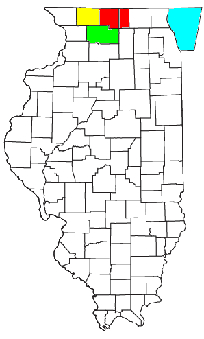
thumb|right|200px|Location of the Rockford-Freeport-Rochelle CSA and its components:The Rockford Metropolitan Statistical Area, as defined by the
United States Census Bureau , is an area consisting of two counties in north-centralIllinois , anchored by the city of Rockford. As of the 2000 census, the MSA had a population of 320,204 (though a July 1, 2007 estimate placed the population at 352,290). [cite web | url = http://www.census.gov/popest/metro/tables/2007/CBSA-EST2007-01.csv | title = Annual Estimates of the Population of Metropolitan and Micropolitan Statistical Areas: April 1, 2000 to July 1, 2007 (CBSA-EST2007-01) | format = CSV | work = 2007 Population Estimates | publisher =United States Census Bureau , Population Division | date =2008-03-27 | accessdate = 2008-03-29]Counties
Communities
*Places with more than 150,000 inhabitants
**Rockford (Principal City)*Places with 20,000 to 30,000 inhabitants
**Belvidere
**Loves Park
**Machesney Park*Places with 5,000 to 20,000 inhabitants
**Rockton
**Roscoe
**South Beloit*Places with 1,000 to 5,000 inhabitants
**Cherry Valley
**Durand
**Lake Summerset (census-designated place ; partial)
**Pecatonica
**Poplar Grove
**Winnebago*Places with less than 1,000 inhabitants
**Caledonia
**Capron
**New Milford
**Timberlane*Unincorporated places
**Argyle
**Harrison
**Seward
**ShirlandTownships
*Belvidere
*Bonus
*Boone
*Burritt
*Caledonia
*Cherry Valley
*Durand
*Flora
*Harlem
*Harrison
*Laona
*Leroy
*Manchester
*Owen
*Pecatonica
*Poplar Grove
*Rockford
*Rockton
*Roscoe
*Seward
*Shirland
*Spring
*WinnebagoDemographics
As of the
census GR|2 of 2000, there were 320,204 people, 122,577 households, and 84,896 families residing within the MSA. The racial makeup of the MSA was 83.46% White, 9.27% African American, 0.29% Native American, 1.56% Asian, 0.03% Pacific Islander, 3.57% from other races, and 1.82% from two or more races. Hispanic or Latino of any race were 7.63% of the population.The median income for a household in the MSA was $48,142, and the median income for a family was $55,881. Males had a median income of $41,141 versus $25,819 for females. The
per capita income for the MSA was $21,392.Combined Statistical Area
The Rockford–Freeport–Rochelle Combined Statistical Area is made up of four counties in north-central Illinois. The statistical area includes one metropolitan area and two micropolitan areas. As of the 2000 Census, the CSA had a population of 420,215 (though a July 1, 2007 estimate placed the population at 453,874). [cite web | url = http://www.census.gov/popest/metro/tables/2007/CBSA-EST2007-02.csv | title = Table 2. Annual Estimates of the Population of Combined Statistical Areas: April 1, 2000 to July 1, 2007 (CBSA-EST2007-02) | format = CSV | work = 2007 Population Estimates | publisher =
United States Census Bureau , Population Division | date =2008-03-27 | accessdate = 2008-03-29]*Metropolitan Statistical Areas (MSAs)
**Rockford (Winnebago and Boone counties)*Micropolitan Statistical Areas (μSAs)
**Freeport (Stephenson County)
**Rochelle (Ogle County)ee also
*
Illinois census statistical areas References
Wikimedia Foundation. 2010.