- McKendree Township, Vermilion County, Illinois
-
McKendree Township — Township — Location in Vermilion County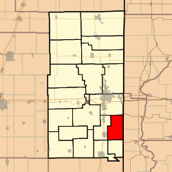
Coordinates: 40°00′12″N 87°34′37″W / 40.00333°N 87.57694°WCoordinates: 40°00′12″N 87°34′37″W / 40.00333°N 87.57694°W Country United States State Illinois County Vermilion Created 1912 Area – Total 29.33 sq mi (75.96 km2) – Land 29.2 sq mi (75.63 km2) – Water 0.13 sq mi (0.33 km2) 0.43% Elevation 673 ft (205 m) Population (2000) – Total 743 – Density 25.4/sq mi (9.8/km2) Time zone CST (UTC-6) – Summer (DST) CDT (UTC-5) GNIS feature ID 0429301 McKendree Township is a township in Vermilion County, Illinois, USA. As of the 2000 census, its population was 743[1]. Forest Glen Preserve is located in this township.
Contents
History
This area was originally part of Georgetown Township, but growing dissatisfaction with a lack of development in that portion of the township, compared with the Georgetown and Westville areas, led to a petition for creation of a new township in 1912. The name came from McKendree Methodist Church.[2]
Geography
McKendree Township covers an area of 29.33 square miles (76.0 km2); of this, 0.13 square miles (0.34 km2) or 0.43 percent is water. The stream of White Branch runs through this township.
Extinct towns
- Meeks
Adjacent townships
- Danville Township (north)
- Highland Township, Vermillion County, Indiana (northeast)
- Eugene Township, Vermillion County, Indiana (southeast)
- Love Township (south)
- Georgetown Township (west)
Cemeteries
The township contains eight cemeteries: Bock, Elwood Church, Locket, Lorance, McKendree, Michael, Niccum and North Fork.
References
- ^ United States Census Bureau American FactFinder
- ^ Stapp, Katherine; W. I. Bowman (1968). History Under Our Feet: The Story of Vermilion County, Illinois. Danville, Illinois: Interstate Printers and Publishers, Inc.. pp. p. 27.
External links
Municipalities and communities of Vermilion County, Illinois Cities 
Villages Townships Unincorporated
communitiesFootnotes ‡This populated place also has portions in an adjacent county or counties
Categories:- Townships in Vermilion County, Illinois

Wikimedia Foundation. 2010.