- Danville, Illinois
-
Danville — City — 
SealVermilion County's location in Illinois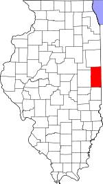 Danville's location in Vermilion County
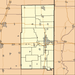
 Danville
Coordinates: 40°07′28″N 87°37′48″W / 40.12444°N 87.63°WCoordinates: 40°07′28″N 87°37′48″W / 40.12444°N 87.63°W Country  United States
State  Illinois
County Vermilion Township Blount, Danville, Newell Founded April 10, 1827[1] Government – Mayor Scott Eisenhauer Area – City 17.1 sq mi (44.28 km2) – Land 17 sq mi (44.04 km2) – Water 0.1 sq mi (0.25 km2) Elevation 597 ft (182 m) Population (2010) – City 32,467 – Density 1,994.4/sq mi (769.8/km2) – Urban 52,663 – Metro 82,226 ZIP code 61832-61834 Area code(s) 217 GNIS feature ID 0406949[2] Website www.CityOfDanville.org Danville is a city in Vermilion County, Illinois, United States. It is the principal city of the 'Danville, Illinois Metropolitan Statistical Area' which encompasses all of Danville and Vermilion County. As of the 2010 census, the city had a total population of 32,467. It is the county seat of Vermilion County[3]. Danville is the 14th-most populous city in Illinois, outside of the Chicago Metropolitan Area.
Contents
History
Danville was founded in 1827 on 60 acres (240,000 m2) of land donated by Guy W. Smith and 20 acres (81,000 m2) donated by Dan W. Beckwith.[4] The sale of lots was set for April 10, 1827 and advertised in newspapers in Indianapolis, Indiana and the state capital of Vandalia.[1] The first post office was established in May of the same year in the house of Amos Williams, organizer of Vermilion and Edgar Counties and a prominent Danville citizen. Williams and Beckwith drew up the first plat map; the city was named after Dan Beckwith at Williams' suggestion, although Beckwith suggested the names "Williamsburg" and "Williamstown". Beckwith was born in Pennsylvania in 1795 and moved to Indiana as a young man; in 1819 he accompanied the first white explorers to the area where Danville later existed because of his interest in the salt springs of the Vermilion River. He died in 1835 of pneumonia contracted on a horseback ride back from Washington; he was 40 years old.[5] Danville became a major industrial city in the late 19th and early twentieth centuries. From the 1850s to the 1940s, Danville was an important coal mining area; some of the first open pit mining techniques were practiced here.[6] The coal formation underlying eastern Illinois and western Indiana is named the "Danville Member," after the area where it was first discovered.[7] With the closure of the mines and many factories, Danville's economic base suffered in the latter half of the 20th century. The former mines were converted into lakes, creating fishing and recreation opportunities at parks such as Kickapoo State Recreation Area and Kennekuk Cove County Park.[citation needed]
-
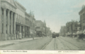
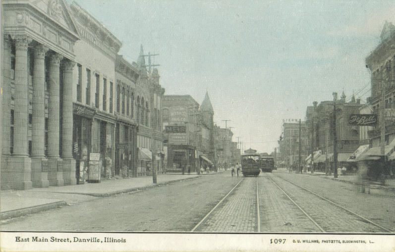
East Main Street circa 1910
-
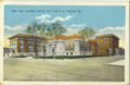
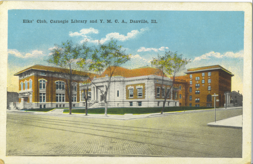
The Elks' Club, Public Library, and YMCA buildings circa 1920
-
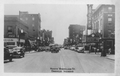
North Vermilion Street circa 1941
Geography
Danville is located approximately 120 miles (190 km) south of Chicago, 35 miles (56 km) east of Champaign-Urbana, and 90 miles (140 km) west of Indianapolis, Indiana. Illinois Route 1, U.S. Route 136, and U.S. Route 150 intersect in Danville; Interstate 74 passes through the south end of town. Lake Vermilion is located on the northwest side of town.
According to the United States Census Bureau, the city has a total area of 17.1 square miles (44.3 km²), of which, 17.0 square miles (44.0 km²) of it is land and 0.1 square miles (0.3 km²) of it (0.58%) is water.
Climate and weather
Danville, Illinois Climate chart (explanation) J F M A M J J A S O N D 2.13417240223.252323.965414.575514.784604.486643.9846337855367433.552342.83923Average max. and min. temperatures in °F Precipitation totals in inches Source: The Weather Channel[8] Metric conversion J F M A M J J A S O N D 521-8514-6811109818511424111192916112301810029177726137719690111714-5Average max. and min. temperatures in °C Precipitation totals in mm In recent years, average temperatures in Danville have ranged from a low of 17 °F (−8 °C) in January to a high of 86 °F (30 °C) in July, although a record low of −26 °F (−32 °C) was recorded in January 1994 and a record high of 112 °F (44 °C) was recorded in July 1936. Average monthly precipitation ranged from 1.99 inches (51 mm) inches in February to 4.70 inches (119 mm) inches in June.[8]
Demographics
Historical populations Census Pop. %± 1840 503 — 1850 736 46.3% 1860 1,632 121.7% 1870 4,751 191.1% 1880 7,733 62.8% 1890 11,491 48.6% 1900 16,354 42.3% 1910 27,871 70.4% 1920 33,776 21.2% 1930 36,765 8.8% 1940 36,919 0.4% 1950 37,864 2.6% 1960 41,856 10.5% 1970 42,570 1.7% 1980 38,985 −8.4% 1990 33,828 −13.2% 2000 33,904 0.2% 2010 32,467 −4.2% Decennial US Census As of the census[9] of 2000, there were 33,904 people, 13,327 households, and 8,156 families residing in the city. The population density was 1,994.0 people per square mile (770.0/km²). There were 14,886 housing units at an average density of 875.5 per square mile (338.1/km²). The racial makeup of the city was 70.19% White, 24.37% African American, 0.21% Native American, 1.20% Asian, 0.03% Pacific Islander, 2.09% from other races, and 1.92% from two or more races. Hispanic or Latino of any race were 4.57% of the population.
There were 13,327 households out of which 28% had children under the age of 18 living with them, 42.0% were married couples living together, 15.1% had a female householder with no husband present, and 38.8% were non-families. 33.9% of all households were made up of individuals and 15.5% had someone living alone who was 65 years of age or older. The average household size was 2.35 and the average family size was 3.01.
In the city the population was spread out with 24.9% under the age of 18, 9.5% from 18 to 24, 27.7% from 25 to 44, 21.3% from 45 to 64, and 16.6% who were 65 years of age or older. The median age was 37 years. For every 100 females there were 99.3 males. For every 100 females age 18 and over, there were 97.7 males.
The median income for a household in the city is $30,431, and the median income for a family is $39,308. Males have a median income of $31,027 versus $22,303 for females. The per capita income for the city is $16,476. 18.1% of the population and 13.4% of families are below the poverty line. Out of the total people living in poverty, 26.8% are under the age of 18 and 10.5% are 65 or older.
Parks and recreation
The City of Danville maintains 17 parks, including Harrison Park Golf Course and FETCH Dog Park in Espenschied Park.[10]
Retail
Danville's main shopping center is the Danville Village Mall, which includes Sears, Elder-Beerman and County Market.
Education
College
- Danville Area Community College
- Lakeview College of Nursing
Primary and secondary education
High schools:
- Danville High School
- Schlarman High School
- First Baptist Christian School
- Danville Christian Academy
Middle schools:
- Danville Lutheran School
- North Ridge Middle School
- South View Middle School
- First Baptist Christian School
Grade schools:
- Cannon
- Danville Lutheran School
- First Baptist Christian School
- East Park
- Edison
- Garfield
- Liberty
- Meade Park
- Northeast
- Southwest
- Holy Family
- Saint Paul's
Transportation
The general aviation community is served by the Vermilion Regional Airport.
Danville is known as a major railroad intersection with at least four different tracks entering town from different directions, resulting in many crossings throughout the town. CSX Transportation, Norfolk Southern Railway, and Kankakee, Beaverville and Southern Railroad all operate rail lines that pass through Danville.[11]
Notable people
- Jason Anderson, baseball player
- Irving Azoff, record producer[citation needed]
- Zeke Bratkowski, NFL player/coach
- Jack Doan, WWE referee for the RAW brand
- Joseph Cannon, Speaker of the U.S. House of Representatives (1903–1911)
- Keon Clark, former NBA player
- Joshua Ferris, novelist and author of Then We Came to the End
- Gene Hackman, Academy Award–winning actor
- Jim Marshall, MLB player/manager
- Helen Morgan, stage and screen star
- Donald O'Connor, film star and dancer
- Curtis Redden, All-Western football player and coach, died in World War I
- Bobby Short, cabaret singer, TV and film star, and recording artist
- Joseph R. Tanner, astronaut
- Dick Van Dyke, film, TV, and stage star
- Jerry Van Dyke, film, TV, and stage star
- Helen Wells, (1910–1986) author of nurse Cherry Ames volumes 1-7 and 17-27[citation needed]
- Jared Yates, 2005 American Idol top 12 guys runner-up[citation needed]
- Robin Yount, Hall of Fame center fielder and shortstop with the Milwaukee Brewers
- Molly Melching, Humanitarian and founder of Tostan
- Jeremy Jones, Athletic Director Cincinatti Christian and Asst. Coach Bryan Station High School
Recent mayors
- 1967–1971: Al Gardner[12]
- 1971–1975: Rolland E. Craig
- 1975–1985: David S. Palmer, namesake of David S. Palmer Arena
- 1985: Wilbur Scharlau, appointed acting mayor by city council following Palmer's death.
- 1985–1986 Hardin W. Hawes, appointed acting mayor following Scharlau's resignation.[13]
- 1986–1987 Wilbur Scharlau, appointed mayor following resignation of Hawes.
- 1987–2003: Robert E. Jones, namesake of Danville Municipal building.
- 2003–present: Scott Eisenhauer
The City of Danville website maintains the complete list of mayors from 1867 to present.[14]
References
- ^ a b Stapp, Katherine; W. I. Bowman (1968). History Under Our Feet: The Story of Vermilion County, Illinois. Danville, Illinois: Interstate Printers and Publishers, Inc.. pp. 54–55.
- ^ "Danville". Geographic Names Information System, U.S. Geological Survey. http://geonames.usgs.gov/pls/gnispublic/f?p=gnispq:3:::NO::P3_FID:0406949. Retrieved 2010-08-21.
- ^ "Find a County". National Association of Counties. http://www.naco.org/Counties/Pages/FindACounty.aspx. Retrieved 2011-06-07.
- ^ Jones, Lottie (1911). History of Vermilion County, Illinois. Chicago: Pioneer Publishing Company. p. 89. http://www.archive.org/details/historyofvermiliv1jone.
- ^ Wright, Bob (1987). Danville: A Pictorial History. St. Louis, Missouri: G. Bradley Publishing, Inc.. p. 8. ISBN 094396301X.
- ^ "Kickapoo - State Recreation Area". Illinois Department of Natural Resources. http://dnr.state.il.us/Lands/Landmgt/PARKS/R3/KICKAPOO.HTM. Retrieved 2007-10-20.
- ^ "Danville coal member". Indiana Geological Survey. http://igs.indiana.edu/Geology/structure/compendium/html/comp7e78.cfm. Retrieved 2007-10-20.
- ^ a b "Monthly Averages for Danville, Illinois". The Weather Channel. http://www.weather.com/weather/wxclimatology/monthly/graph/USIL0295. Retrieved 2011-01-27.
- ^ "American FactFinder". United States Census Bureau. http://factfinder.census.gov. Retrieved 2008-01-31.
- ^ "Parks and Recreation". City of Danville. http://www.cityofdanville.org/index.php/departments/public_works/parks_and_recreation/. Retrieved 2009-09-04.
- ^ "Illinois Railroad Map" (PDF). Illinois Department of Transportation. January, 2006. http://www.dot.il.gov/officialrailmap.pdf. Retrieved 2007-09-23.
- ^ Brian Huchel (2004-08-22). "Former Danville mayor dies". Commercial-News. http://www2.commercial-news.com/articles/news/article/7115.html. Retrieved 2009-10-28.
- ^ Jennifer Weakley (2002-05-14). "Mayor's secretary retires". Commercial-News. http://www2.commercial-news.com/articles/news/article/4595.html. Retrieved 2009-10-28.
- ^ "Mayoral History". City of Danville, Illinois. http://www.cityofdanville.org/index.php?cID=79. Retrieved 2009-10-28.
- US Census Bureau Population Estimates for Metropolitan Statistical Areas
- US Census Bureau Lists of Urbanized Areas
- Census 2000 information on Danville
External links
- City website
- Danville events
- Commercial News, local newspaper
- Danville School District 118
- David S. Palmer Arena
- Provena United Samaritans Medical Center
- "History of Vermilion County Illinois" book
Municipalities and communities of Vermilion County, Illinois Cities Danville | Georgetown | Hoopeston

Villages Townships Unincorporated
communitiesFootnotes ‡This populated place also has portions in an adjacent county or counties
Categories:- Populated places in Vermilion County, Illinois
- Cities in Illinois
- County seats in Illinois
- Populated places established in 1827
- Danville, Illinois
-


Wikimedia Foundation. 2010.