- Montgomery County, Illinois
-
Montgomery County, Illinois 
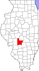
Location in the state of Illinois
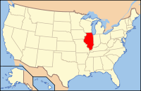
Illinois's location in the U.S.Founded 1821 Seat Hillsboro Largest city Litchfield Area
- Total
- Land
- Water
709.68 sq mi (1,838 km²)
703.69 sq mi (1,823 km²)
5.99 sq mi (16 km²), 0.84%Population
- (2010)
- Density
30,104
44/sq mi (17/km²)Time zone Central: UTC-6/-5 Website www.montgomeryco.com Montgomery County is a county located in the U.S. state of Illinois. According to the 2010 census, it has a population of 30,104, which is a decrease of 1.8% from 30,652 in 2000.[1] Its county seat is Hillsboro.[2]
Contents
History
Montgomery County was formed in 1821 out of Bond and Madison Counties. It was named in honor of Richard Montgomery, an American Revolutionary War general killed in 1775 while attempting to capture Quebec City, Canada.[3] Perrin's 1882 History of Montgomery County relates that the County was named in honor of Gen. Montgomery, but goes on to say that "others are dubious as to whence it received its name."
Geography
According to the 2010 census, the county has a total area of 709.68 square miles (1,838.1 km2), of which 703.69 square miles (1,822.5 km2) (or 99.16%) is land and 5.99 square miles (15.5 km2) (or 0.84%) is water.[4]
Adjacent Counties
- Sangamon County - north
- Christian County - northeast
- Shelby County - east
- Fayette County - southeast
- Bond County - south
- Madison County - southwest
- Macoupin County - west
Transportation
Major highways
 Interstate 55
 Illinois Route 16
 Illinois Route 48
 Illinois Route 108
 Illinois Route 127
 Illinois Route 185
Airports
Litchfield Municipal Airport is located in Montgomery County, two nautical miles (3.7 km) southwest of the central business district of Litchfield, Illinois.
Demographics
Historical populations Census Pop. %± 1900 30,836 — 1910 35,311 14.5% 1920 41,403 17.3% 1930 35,278 −14.8% 1940 34,499 −2.2% 1950 32,460 −5.9% 1960 31,244 −3.7% 1970 30,260 −3.1% 1980 31,686 4.7% 1990 30,728 −3.0% 2000 30,652 −0.2% 2010 30,104 −1.8% IL Counties 1900-1990 As of the census[5] of 2010, there were 30,104 people, 11,507 households, and 7,928 families residing in the county. The population density was 44 people per square mile (17/km²). There were 12,743 housing units at an average density of 18 per square mile (7/km²). The racial makeup of the county was 95.1% White, 3.2% Black or African American, 0.2% Native American, 0.4% Asian, 0.03% Pacific Islander, 0.47% from other races, and 0.7% from two or more races. 1.5% of the population were Hispanic or Latino of any race. 33.7% were of German, 19.3% American, 12.6% English and 9.2% Irish ancestry according to Census 2000.
There were 11,507 households out of which 31.90% had children under the age of 18 living with them, 56.10% were married couples living together, 8.90% had a female householder with no husband present, and 31.10% were non-families. 27.80% of all households were made up of individuals and 14.70% had someone living alone who was 65 years of age or older. The average household size was 2.44 and the average family size was 2.97.
In the county the population was spread out with 23.70% under the age of 18, 8.30% from 18 to 24, 29.30% from 25 to 44, 21.70% from 45 to 64, and 17.00% who were 65 years of age or older. The median age was 38 years. For every 100 females there were 106.40 males. For every 100 females age 18 and over, there were 106.40 males.
The median income for a household in the county was $33,123, and the median income for a family was $39,923. Males had a median income of $30,657 versus $20,563 for females. The per capita income for the county was $16,272. About 10.60% of families and 13.40% of the population were below the poverty line, including 18.40% of those under age 18 and 11.00% of those age 65 or over.
Townships
Audubon, Bois d'Arc, Butler Grove, East Fork, Fillmore, Grisham, Harvel, Hillsboro, Irving, Nokomis, North Litchfield, Pitman, Raymond, Rountree, South Fillmore, South Litchfield, Walshville, Witt, Zanesville
Cities and towns
- Butler
- Coalton
- Coffeen
- Donnellson
- Farmersville
- Fillmore
- Harvel
- Hillsboro
- Irving
- Litchfield
- Nokomis
- Ohlman
- Panama
- Raymond
- Schram City
- Taylor Springs
- Waggoner
- Walshville
- Wenonah
- Witt
Census designated places
- Chapman
- Kortcamp
- Van Burensburg
Notable natives
- Otto Funk (1868–1934) Violinist who achieved fame (and a Guinness Book of Records entry) by walking from New York to San Francisco in the depression-era, "playing the fiddle every step of the way." When he died in 1934 at the age of 65, he was accorded the biggest funeral in the history of Montgomery County.
Climate and weather
Hillsboro, Illinois Climate chart (explanation) J F M A M J J A S O N D 2.23721244263.656354.268454.378554.187643.591683.589663.282582.971473.8553734226Average max. and min. temperatures in °F Precipitation totals in inches Source: The Weather Channel[6] Metric conversion J F M A M J J A S O N D 553-6517-390132106207109261310331188833209032198028147422897133766-3Average max. and min. temperatures in °C Precipitation totals in mm In recent years, average temperatures in the county seat of Hillsboro have ranged from a low of 21 °F (−6 °C) in January to a high of 91 °F (33 °C) in July, although a record low of −22 °F (−30 °C) was recorded in February 1905 and a record high of 114 °F (46 °C) was recorded in July 1954. Average monthly precipitation ranged from 2.00 inches (51 mm) in February to 4.31 inches (109 mm) in May.[6]
See also
References
- History of Montgomery County, Illinois, Perrin, 1882
- ^ "Montgomery County QuickFacts". United States Census Bureau. http://quickfacts.census.gov/qfd/states/17/17135.html. Retrieved 2011-11-05.
- ^ "Error: no
|title=specified when using {{Cite web}}". http://quickfacts.census.gov/qfd/states/17/17135.html. Retrieved 2011-07-14. - ^ Allan H. Keith, Historical Stories: About Greenville and Bond County, IL. Consulted on August 15, 2007.
- ^ "Census 2010 U.S. Gazetteer Files: Counties". United States Census. http://www.census.gov/geo/www/gazetteer/files/Gaz_counties_national.txt. Retrieved 2011-11-05.
- ^ "American FactFinder". United States Census Bureau. http://factfinder.census.gov. Retrieved 2008-01-31.
- ^ a b "Monthly Averages for Hillsboro, Illinois". The Weather Channel. http://www.weather.com/weather/wxclimatology/monthly/graph/USIL0541. Retrieved 2011-01-27.
External links

Sangamon County Christian County 
Macoupin County 
Shelby County  Montgomery County, Illinois

Madison County Bond County Fayette County Municipalities and communities of Montgomery County, Illinois Cities Coffeen | Hillsboro | Litchfield | Nokomis | Witt
Villages Butler | Coalton | Donnellson‡ | Farmersville | Fillmore | Harvel‡ | Irving | Ohlman | Panama‡ | Raymond | Schram City | Taylor Springs | Waggoner | Walshville | Wenonah
Townships Audubon | Bois D'Arc | Butler Grove | East Fork | Fillmore | Grisham | Harvel | Hillsboro | Irving | Nokomis | North Litchfield | Pitman | Raymond | Rountree | South Fillmore | South Litchfield | Walshville | Witt | Zanesville
Unincorporated
communitiesChapman | Kortcamp | Van Burensburg | Zenobia‡
Footnotes ‡This populated place also has portions in an adjacent county or counties
Categories:- Illinois counties
- 1821 establishments in the United States
- Populated places established in 1821
- Montgomery County, Illinois
Wikimedia Foundation. 2010.


