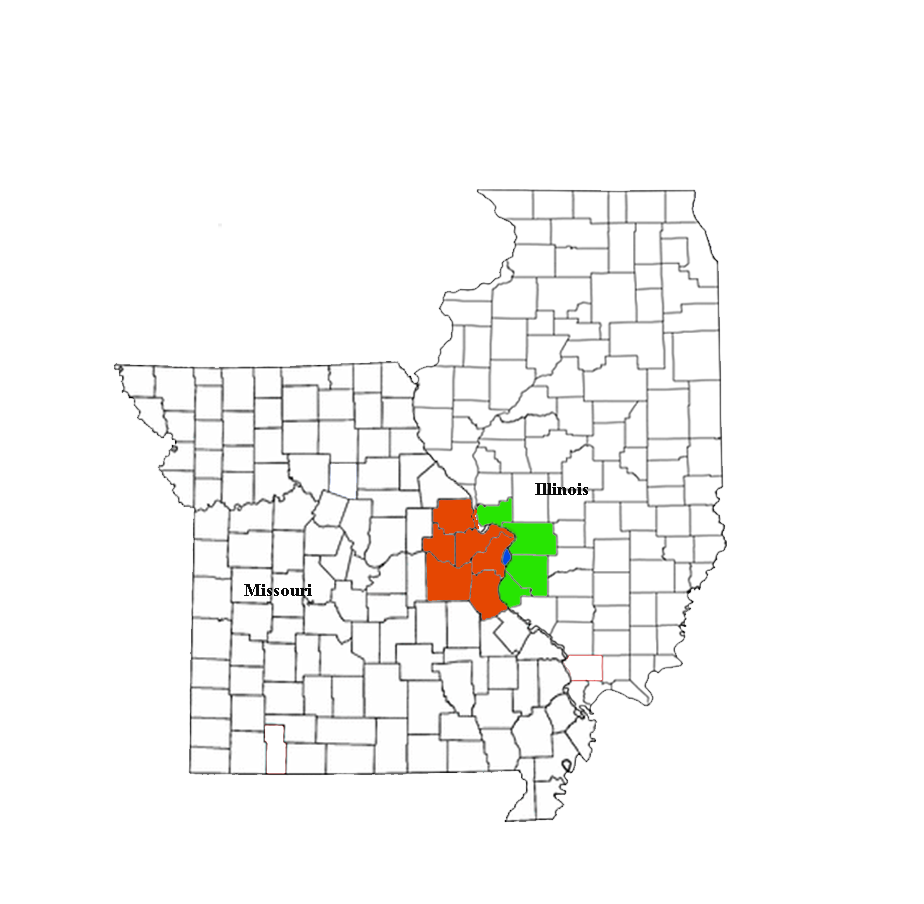
- O'Fallon, Illinois
-
O'Fallon, Illinois City 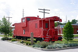
Country United States State Illinois County St. Clair Area 10.9 sq mi (28 km2) - land 10.9 sq mi (28 km2) Population 28,281 (2010) Mayor Gary L. Graham Timezone CST (UTC-6) - summer (DST) CDT (UTC-5) Postal code 62269 Area code 618 Wikimedia Commons: O'Fallon, Illinois Website: http://www.ofallon.org/ O'Fallon is a city in St. Clair County, Illinois, United States, and one of the fastest-growing communities in the Metropolitan St. Louis area.[1] As of the 2010 census, the city had a total population of 28,281. The city is the third largest city in the Metro-East and Southern Illinois. Due to its close proximity to Scott Air Force Base, the population receives a boost from military and federal civilian personnel, defense contractors, and military retirees.
The city center is located approximately two miles east of the intersection of Interstate 64 and U.S. Route 50.
O'Fallon, along with its namesake in St. Charles County, Missouri is part of the St. Louis Metropolitan Statistical Area. This makes O'Fallon (along with the two Troys in Illinois and Missouri) one of the few pairs of like-named municipalities to be part of the same MSA.
Contents
History
Founded in 1854, O'Fallon's namesake comes from Colonel John O'Fallon who was a wealthy gentleman from St. Louis. In downtown O'Fallon, a Baltimore and Ohio Railroad railroad depot was built, which helped put O'Fallon on the map. City lots were platted and sold at a public auction on May 18, 1854. A post office was established the following year and the city began attracting German settlers looking for fertile farming land. On January 27, 1874, O'Fallon was incorporated as a village. On March 14, 1905, the citizens voted for a change to the city form of government. Since its founding, O'Fallon has gained population every year except 1930, when the census showed a net loss of 23 people.
O'Fallon today
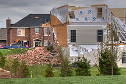 Tornado damage, 2006
Since the 1980s, growth in O'Fallon has accelerated. Following the expansion of Interstate 64, the 1990s saw a building boom with the construction of several now-established subdivisions including Thornbury Hills, Nolin Creek Estates, Fairwood Hills, Deer Creek, Forest Hills, and the completion of Fairwood East. O'Fallon Township High School's main campus at 600 South Smiley Street has undergone numerous additions over the past decades to ease overcrowding. A new city hall was completed in 1996. More than 50 percent of O'Fallon's housing is less than 15 years old.[2]
Events
April 2, 2006 Central United States tornado outbreak
Annual events
-
- August - Homecoming
- September - Arts Festival
- November - Craft Fair
Parks and recreation
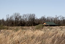 Rock Springs Nature Park
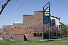 Public Library
-
- Family Sports Park
- Hesse Park
- Katy Cavin's Community Center
- O'Fallon Community Park
- O'Fallon Memorial Pool
- Rock Springs Nature Park
- Nature center
- Jogging/cycling paths
- Nature trails
- Natural prairie
- Dog Park
- St. Clair Recreation Complex
- St. Ellen Mine Park
- Thoman Park
- Veteran's Monument
- O'Fallon Public Library
Registered historic places
Schools
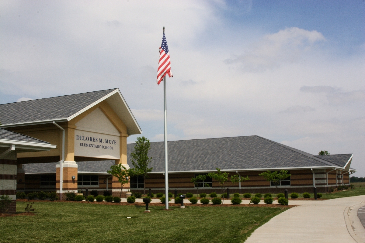
 Delores Moye School
- O'Fallon Community Consolidated School District # 90
- O'Fallon Central School District # 104
- O'Fallon District #203
- Private Schools
Geography
O'Fallon is located at 38°35′30″N 89°54′43″W / 38.59167°N 89.91194°W (38.591549, -89.912000).[3] O'Fallon is:
- 5 miles (8 km) from Scott Air Force Base
- 7 miles (11.5 km) from Lindenwood University – Belleville
- 10 miles (16 km) from McKendree University
- and 17 miles (27 km) from St. Louis, Missouri
According to the United States Census Bureau, the city has a total area of 10.9 square miles (28 km2), of which, 10.9 square miles (28 km2) of it is land and 0.09% is water.
Demographics
As of a special census of 2005, there are 25,647 people (up 3,737 from the census of 2000) and 10,468 households, with an average of 2 people per household. (down from 2.4 in 2000) The significant increase in population can be attributed to the ever-expanding suburbs of metropolitan St. Louis, Missouri and the influx of military personnel from nearby Scott Air Force Base
The population density is 2,007.6 people per square mile (775.4/km²). There are 10,468 housing units at an average density of 790.4 per square mile (305.3/km²). The racial makeup of the city is 82.67% White, 11.99% African American, 0.23% Native American, 2.47% Asian, 0.07% Pacific Islander, 0.79% from other races, and 1.77% from two or more races. 2.23% of the population are Hispanic or Latino of any race.
There are 10,468 households out of which 39.6% have children under the age of 18 living with them, 59.0% are married couples living together, 10.5% have a female householder with no husband present, and 27.6% are non-families. 23.2% of all households are made up of individuals and 7.2% have someone living alone who is 65 years of age or older. The average household size is 2.62 and the average family size is 3.13.
In the city, the population is spread out with 28.3% under the age of 18, 8.0% from ages 18 to 24, 32.2% from ages 25 to 44, 22.7% from ages 45 to 64, and 8.9% who are age 65 or older. The median age is 35 years.
The median income for a household in the city is estimated at $68,534[4] and the median income for a family is $86,052.[5] Males have a median income of $46,303 versus $30,158 for females. The per capita income for the city is $24,821. 5.0% of the population and 4.1% of families are below the poverty line. Out of the total population, 5.0% of those under the age of 18 and 7.9% of those 65 and older are living below the poverty line.
Notable people
- Bob Cryder, professional football player.
- Bernie Fuchs, illustrator.
- William Holden, actor.
- Dawn Stern, actress.
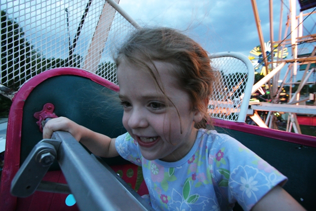
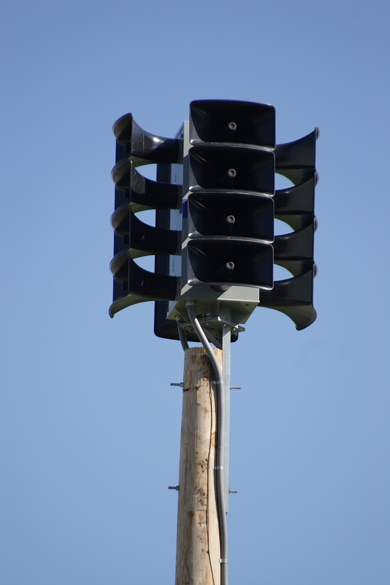
Gallery
-

Homecoming
-

Mayfest Parade
-
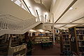
O'Fallon Public Library
-

City Civil defense siren
References
External links
- The City of O'Fallon
- O'Fallon Historical Society
- O'Fallon Chamber of Commerce
- 360 Degree Panorama of the O'Fallon Veterans' Monument
Illinois Metro-East region Counties 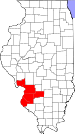
Major Cities (10,000+) Alton | Belleville | Cahokia | Centralia | Collinsville | East St. Louis | Edwardsville | Fairview Heights | Glen Carbon | Godfrey | Granite City | O'Fallon | Swansea | Wood RiverCities (5,000-10,000) Bethalto | Centreville | Columbia | East Alton | Highland | Jerseyville | Maryville | Mascoutah | Pontoon Beach | Shiloh | Staunton | Troy | Washington Park | WaterlooCities (1,000-5,000) Alorton | Aviston | Beckemeyer | Breese | Brighton | Carlyle | Caseyville | Dupo | Fairmont City | Freeburg | Germantown | Hartford | Lebanon | Madison | Marissa | Millstadt | New Athens | New Baden | Rosewood Heights | Roxana | Smithton | South Roxana | Trenton | Valmeyer | Venice | WamacInterstates in the Metro-East Airports/Military Bases List of Colleges in the Metro-East Sports teams based in the Metro East Municipalities and communities of St. Clair County, Illinois Cities Belleville | Centreville | Collinsville‡ | Columbia‡ | East St. Louis | Fairview Heights | Lebanon | Madison‡ | Mascoutah | O'Fallon

Villages Alorton | Brooklyn | Cahokia | Caseyville | Dupo | East Carondelet | Fairmont City‡ | Fayetteville | Freeburg | Hecker‡ | Lenzburg | Marissa | Millstadt | New Athens | New Baden‡ | Sauget | Shiloh | Smithton | St. Libory | Summerfield | Swansea | Washington Park
Townships Canteen | Caseyville | Centreville | Engelmann | Fayetteville | Freeburg | Lebanon | Lenzburg | Marissa | Mascoutah | Millstadt | New Athens | O’Fallon | Prairie du Long | Shiloh Valley | Smithton | St. Clair | Stites | Stookey | Sugarloaf
CDPs Unincorporated
communitiesDouglas | Imbs | Westview
Footnotes ‡This populated place also has portions in an adjacent county or counties
Greater St. Louis Topics 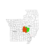
Central city Largest cities
(over 20,000 in 2000)Affton CDP · Alton · Ballwin · Belleville · Chesterfield · Collinsville · East St. Louis · Edwardsville · Ferguson · Florissant · Granite City · Hazelwood · Kirkwood · Maryland Heights · Mehlville CDP · Oakville CDP · O'Fallon, Illinois · O'Fallon, Missouri · Saint Charles · St. Peters · Spanish Lake CDP · University City · Webster Groves · WildwoodLargest towns
and villages
(over 10,000 in 2000)Arnold · Bellefontaine Neighbors · Berkeley · Bridgeton · Cahokia · Clayton · Concord CDP · Crestwood · Creve Coeur · Fairview Heights · Farmington · Festus · Glen Carbon · Godfrey · Jennings · Lake St. Louis · Lemay CDP · Manchester · Overland · St. Ann · Swansea · Town and Country · Washington · Wentzville · Wood RiverMissouri Counties Franklin · Jefferson · Lincoln · St. Charles · Saint Francois · St. Louis City · St. Louis County · Warren · WashingtonIllinois Counties Subregions  State of Illinois
Topics - Index
- Buildings and structures
- Communications
- Culture
- Delegations
- Economy
- Education
- Environment
- Geography
- Government
- Health
- History
- Music
- People
- Portal
- Society
- Sports
- Tourism
- Transportation
- Windmills
Regions - American Bottom
- Central Illinois
- Champaign–Urbana metropolitan area
- Chicago metropolitan area
- Driftless Area
- Forgottonia
- Fox Valley
- Illinois–Indiana–Kentucky Tri-State Area
- Metro East
- Mississippi Alluvial Plain
- North Shore
- Northern Illinois
- Northwestern Illinois
- Peoria metropolitan area
- Quad Cities
- River Bend
- Rockford metropolitan area
- Southern Illinois
- Streatorland
- Wabash Valley
Major cities,
towns and villages- Alton/Granite City/Edwardsville
- Arlington Heights/Palatine
- Aurora/Naperville/Oswego/Plainfield
- Bartlett/Hanover Park/Streamwood
- Belleville/East St. Louis/Collinsville/O'Fallon
- Berwyn/Cicero
- Bloomington/Normal
- Bolingbrook/Romeoville
- Buffalo Grove/Wheeling
- Calumet City
- Canton
- Carbondale
- Carol Stream/Glendale Heights
- Centralia
- Champaign/Urbana
- Charleston/Mattoon
- Chicago
- Chicago Heights
- Crystal Lake/Algonquin
- Danville
- Decatur
- DeKalb/Sycamore
- Des Plaines/Mount Prospect/Park Ridge
- Dixon
- Downers Grove/Woodridge
- Effingham
- Elgin/Carpentersville
- Elmhurst/Lombard/Addison
- Evanston/Skokie
- Freeport
- Galesburg
- Glenview/Northbrook
- Harrisburg
- Jacksonville
- Joliet
- Kankakee/Bradley/Bourbonnais
- Lincoln
- Macomb
- Marion/Herrin
- Moline/East Moline/Rock Island
- Mount Vernon
- Mundelein
- Oak Lawn
- Oak Park
- Orland Park/Tinley Park
- Ottawa/Streator/LaSalle/Peru
- Peoria/Pekin/East Peoria/Morton
- Pontiac
- Quincy
- Rochelle
- Rockford/Belvidere/Machesney Park/Loves Park
- St. Charles
- Schaumburg/Hoffman Estates/Elk Grove Village
- Springfield
- Sterling/Rock Falls
- Taylorville
- Waukegan/North Chicago/Gurnee
- Wheaton
Counties - Adams
- Alexander
- Bond
- Boone
- Brown
- Bureau
- Calhoun
- Carroll
- Cass
- Champaign
- Christian
- Clark
- Clay
- Clinton
- Coles
- Cook
- Crawford
- Cumberland
- DeKalb
- DeWitt
- Douglas
- DuPage
- Edgar
- Edwards
- Effingham
- Fayette
- Ford
- Franklin
- Fulton
- Gallatin
- Greene
- Grundy
- Hamilton
- Hancock
- Hardin
- Henderson
- Henry
- Iroquois
- Jackson
- Jasper
- Jefferson
- Jersey
- Jo Daviess
- Johnson
- Kane
- Kankakee
- Kendall
- Knox
- LaSalle
- Lake
- Lawrence
- Lee
- Livingston
- Logan
- Macon
- Macoupin
- Madison
- Marion
- Marshall
- Mason
- Massac
- McDonough
- McHenry
- McLean
- Menard
- Mercer
- Monroe
- Montgomery
- Morgan
- Moultrie
- Ogle
- Peoria
- Perry
- Piatt
- Pike
- Pope
- Pulaski
- Putnam
- Randolph
- Richland
- Rock Island
- Saline
- Sangamon
- Schuyler
- Scott
- Shelby
- St. Clair
- Stark
- Stephenson
- Tazewell
- Union
- Vermilion
- Wabash
- Warren
- Washington
- Wayne
- White
- Whiteside
- Will
- Williamson
- Winnebago
- Woodford
Categories:- Cities in Illinois
- Populated places in St. Clair County, Illinois
-


Wikimedia Foundation. 2010.