- MidAmerica St. Louis Airport
-
MidAmerica St. Louis Airport 
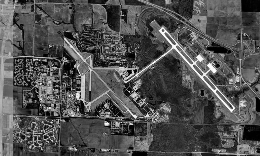
MidAmerica St. Louis Airport, 2 April 1998 
Logo for the airport IATA: BLV – ICAO: KBLV – FAA LID: BLV Summary Airport type Public Location St. Clair County, near Mascoutah, Illinois Elevation AMSL 459 ft / 140 m Coordinates 38°32′43″N 089°50′07″W / 38.54528°N 89.83528°W Website Runways Direction Length Surface ft m 14L/32R 10,000 3,048 Concrete 14R/32L 8,001 2,439 Asphalt/Concrete Source: Federal Aviation Administration[1] MidAmerica St. Louis Airport (IATA: BLV, ICAO: KBLV, FAA LID: BLV) is an airport co-located on the grounds of Scott Air Force Base. MidAmerica has operated as a Joint Use Airport since beginning operations in November 1997 and has not been served by any commercial airlines since Allegiant Air pulled out of the airport on January 3, 2009.[2][3]
Contents
History
MidAmerica St. Louis Airport was created to alleviate some crowding of Lambert-St. Louis International Airport, but has never had service from any major airline and has been criticized as a pork barrel project.[4] Featured several times as a "Fleecing of America" segment on the NBC Nightly News, it was called a "Gateway to Nowhere" by Tom Brokaw, costing taxpayers $313 million.[5] Supporters credit MidAmerica's additional runway with saving Scott AFB from closure during BRAC 2005. They also describe MidAmerica as a "Gateway to the World", citing a new cargo terminal and customs facility designed to attract international cargo.[3] As of January 2010, one air cargo company uses the airport to import flowers from Colombia, totalling one flight each week,[6] although when it was originally constructed, FedEx seriously considered using it as a central hub for the midwest, but due to delays in its construction and governmental red tape, they ultimately decided on Memphis instead. Allegiant Air also offered flights to both McCarran Airport in Las Vegas and Orlando Sanford International Airport until 2009.
MidAmerica's construction has included creation of the 10,000-foot (3,000 m) 14L/32R (east) runway, adding 1,000 feet (300 m) to the existing west runway, adding passenger and cargo terminals on the east side of the facility and a 7,000-foot (2,100 m) taxiway connecting the two runways. A new air traffic control tower staffed by Air Force personnel was also constructed midway between the two runways.[7]
In CY2008, the dual-use facility was ranked 314 in the United States with 27,002 passenger enplanements. This placed it ninth in the state of Illinois.[8] By comparison, Lambert-St. Louis International Airport was ranked 31 with over 6.74 million enplanements. Congestion at Lambert-St. Louis has not been a problem since American Airlines reduced hub operations and a new billion-dollar runway opened. The civil operations are administered by St. Clair County, Illinois, which also pays the maintenance costs for the east runway. Over half of all air operations at the facility utilize the eastern runway.[3]
Facilities
MidAmerica St. Louis Airport covers 7,003 acres (2,834 ha) and has two runways:
- Runway 14L/32R: 10,000 x 150 ft (3,048 x 46 m), Surface: Concrete, ILS equipped.
- Runway 14R/32L: 8,001 x 150 ft (2,439 x 46 m), Surface: Asphalt/Concrete, ILS equipped.
References
- ^ FAA Airport Master Record for BLV (Form 5010 PDF), effective 2007-07-05
- ^ St. Louis Post-Dispatch. MidAmerica Wings it Without Allegiant Air. 1/7/2009. Retrieved 1/30/2009.
- ^ a b c Imbs, Christine (March 2006). "Gateway to the World". St. Louis Commerce Magazine. http://www.stlcommercemagazine.com/archives/march2006/gateway.html. Retrieved 28 December 2009.
- ^ Tom Brokaw. It was featured several times on a "Fleecing of America" segment on the NBC evening news.January 5, 1998. May 27, 1999. August 16, 2000.
- ^ Marson, Barrett (1998-01-05). "NBC 'Fleecing' Telecast Snipes At MidAmerica Airport". Belleville News-Democrat. http://www.ofallon.com/rosemary/m-980106.shtml. Retrieved 28 December 2009.[dead link]
- ^ NBC Nightly News, January 12, 2009.
- ^ Grandone, Jim (February 2000). "Emerging Roles of Scott Air Force Base & MidAmerica". St. Louis Commerce Magazine. http://www.stlcommercemagazine.com/archives/february2000/scott.html. Retrieved 28 December 2009.
- ^ "Commercial Service Airports CY2008 Enplanements". FAA. 2009-12-17. http://www.faa.gov/airports/planning_capacity/passenger_allcargo_stats/passenger/media/cy08_primary_np_comm.pdf. Retrieved 28 December 2009.
External links
- Official website MidAmerica St. Louis Airport
- FAA Airport Diagram (PDF), effective 20 October 2011
Public transportation in Greater St. Louis Public Transit Agencies Missouri: Bi-State Development Agency • St. Charles Area Transit Illinois: Madison County Transit • St. Clair County Transit DistrictLocal and express bus service Bus rapid transit St. Louis Bus Rapid TransitLight rail St. Louis MetroLink: (List of stations) Red Line • Blue LineStreetcar Streetcars in St. Louis • Delmar Loop Trolley • St. Charles City StreetcarParatransit Commuter rail St. Louis Commuter RailIntercity rail Airport Lambert-St. Louis International Airport • MidAmerica St. Louis Airport • Spirit of St. Louis Airport • St. Louis Downtown Airport • St. Louis Regional Airport • Creve Coeur AirportOther Transportation in St. Louis, Missouri • Gateway Arch • Eads BridgeItalics denote lines or service which are planned, or not operating at this present time Aviation in Illinois Primary airports O'Hare International Airport · Chicago Midway International Airport · Quad City International Airport · Central Illinois Regional Airport · General Wayne A. Downing Peoria International Airport · University of Illinois Willard Airport · Chicago Rockford International Airport · Abraham Lincoln Capital Airport · MidAmerica St. Louis Airport · Decatur Airport · Williamson County Regional Airport 
Military Airlines Air Illinois (1970-1984) · Chicago Air (1985-1986) · Festival Airlines (2006) · Midway Airlines (1976-1991) · Mississippi Valley Airlines (1969-1985) · United Airlines (founded 1927) Aviation-related List of airports in Illinois Categories:- 1997 establishments in the United States
- Transportation in St. Clair County, Illinois
- Airports in Greater St. Louis
- Airports established in 1997
- Airports in Illinois
- Buildings and structures in St. Clair County, Illinois

Wikimedia Foundation. 2010.