- Mascoutah, Illinois
-
Mascoutah City Country United States State Illinois County St. Clair Coordinates 38°29′50″N 89°48′4″W / 38.49722°N 89.80111°W Area 8.7 sq mi (23 km2) - land 8.7 sq mi (23 km2) Population 7,483 (2010) Density 655.1 / sq mi (253 / km2) Timezone CST (UTC-6) - summer (DST) CDT (UTC-5) Postal code 62258 Area code 618 

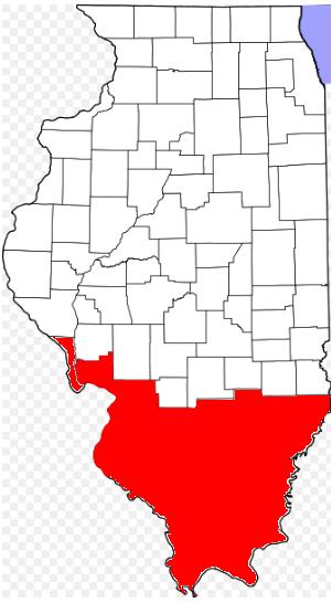
 Location of Mascoutah within Illinois
Wikimedia Commons: Mascoutah, Illinois Mascoutah is a small town in St. Clair County, Illinois, United States. The population was 7,483 at the 2010 census.
Contents
Registered historic places
- Berger-Kiel House
- George, Jr. Draser House
Geography
Mascoutah is located at 38°29′50″N 89°48′4″W / 38.49722°N 89.80111°W (38.497312, -89.801248).[1]
According to the United States Census Bureau, the city has a total area of 8.7 square miles (23 km2), of which, 8.6 square miles (22 km2) of it is land and 0.1 square miles (0.26 km2) of it (0.69%) is water.
Demographics
Mascoutah was the United States center of population point in 1970. As of the census[2] of 2000, there were 5,659 people, 2,162 households, and 1,571 families residing in the city. The population density was 655.1 people per square mile (252.9/km²). There were 2,309 housing units at an average density of 267.3 per square mile (103.2/km²). The racial makeup of the city was 91.73% White, 4.19% African American, 0.35% Native American, 0.97% Asian, 0.05% Pacific Islander, 0.85% from other races, and 1.86% from two or more races. Hispanic or Latino of any race were 1.75% of the population.
There were 2,162 households out of which 35.8% had children under the age of 18 living with them, 57.5% were married couples living together, 11.2% had a female householder with no husband present, and 27.3% were non-families. 23.7% of all households were made up of individuals and 10.5% had someone living alone who was 65 years of age or older. The average household size was 2.57 and the average family size was 3.05.
In the city the population was spread out with 26.4% under the age of 18, 8.5% from 18 to 24, 29.4% from 25 to 44, 21.5% from 45 to 64, and 14.2% who were 65 years of age or older. The median age was 38 years. For every 100 females there were 92.4 males. For every 100 females age 18 and over, there were 90.1 males.
The median income for a household in the city was $46,451, and the median income for a family was $55,018. Males had a median income of $37,182 versus $23,156 for females. The per capita income for the city was $21,569. About 6.3% of families and 7.8% of the population were below the poverty line, including 11.8% of those under age 18 and 7.9% of those age 65 or over.
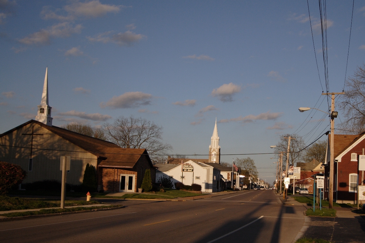
Location
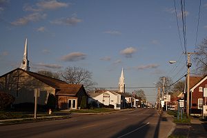 Main Street, 2006
Mascoutah is located just off Interstate 64 and is in close proximity to St. Louis, Missouri. Mascoutah accessible to St. Louis and Lambert Airport by Metrolink with stations a few miles out of town. Mascoutah is home to Mid America Airport. Nearby Scott AFB is a major employer and base residents attend school in Mascoutah.
Parks
There are three parks in town that offer a wide array of activities. Scheve Park has two swimming pools, 6 baseball diamonds (2 with lights), two lighted tennis courts, a lighted sand volleyball court, lighted horseshoe pits, two soccer fields, ten pavilions varying in size, and several playground areas. Scheve Park also has a restored train caboose that visitors can tour. Maple Park is equipped with outdoor basketball facilities, a ball playing area, playground equipment, and a family sized pavilion. Prairie Park has two fishing lakes, a fountain, and a pavilion. [3] [4] [5]
Education
Mascoutah Community Unit School District#19 serves the city. There are four schools in the district: Mascoutah Community High School, Mascoutah Middle School, Mascoutah Elementary School, and Scott Air Force Base Elementary School.
Holy Childhood School is the private catholic school in Mascoutah. It offers preschool through eighth grade.
References
- ^ "US Gazetteer files: 2010, 2000, and 1990". United States Census Bureau. 2011-02-12. http://www.census.gov/geo/www/gazetteer/gazette.html. Retrieved 2011-04-23.
- ^ "American FactFinder". United States Census Bureau. http://factfinder.census.gov. Retrieved 2008-01-31.
- ^ http://www.mascoutah.com/index.asp?Type=B_BASIC&SEC={197B90E4-2971-4370-919E-60EE6C427794}
- ^ http://www.recreationparks.net/IL/st-clair/scheve-park-mascoutah
- ^ http://www.ifishillinois.org/gofish/reg4kidshotspot.html
External links
Illinois Metro-East region Counties 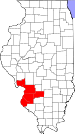
Major Cities (10,000+) Alton | Belleville | Cahokia | Centralia | Collinsville | East St. Louis | Edwardsville | Fairview Heights | Glen Carbon | Godfrey | Granite City | O'Fallon | Swansea | Wood RiverCities (5,000-10,000) Bethalto | Centreville | Columbia | East Alton | Highland | Jerseyville | Maryville | Mascoutah | Pontoon Beach | Shiloh | Staunton | Troy | Washington Park | WaterlooCities (1,000-5,000) Alorton | Aviston | Beckemeyer | Breese | Brighton | Carlyle | Caseyville | Dupo | Fairmont City | Freeburg | Germantown | Hartford | Lebanon | Madison | Marissa | Millstadt | New Athens | New Baden | Rosewood Heights | Roxana | Smithton | South Roxana | Trenton | Valmeyer | Venice | WamacInterstates in the Metro-East Airports/Military Bases List of Colleges in the Metro-East Sports teams based in the Metro East Municipalities and communities of St. Clair County, Illinois County seat: Belleville Cities Belleville | Centreville | Collinsville‡ | Columbia‡ | East St. Louis | Fairview Heights | Lebanon | Madison‡ | Mascoutah | O'Fallon

Villages Alorton | Brooklyn | Cahokia | Caseyville | Dupo | East Carondelet | Fairmont City‡ | Fayetteville | Freeburg | Hecker‡ | Lenzburg | Marissa | Millstadt | New Athens | New Baden‡ | Sauget | Shiloh | Smithton | St. Libory | Summerfield | Swansea | Washington Park
Townships Canteen | Caseyville | Centreville | Engelmann | Fayetteville | Freeburg | Lebanon | Lenzburg | Marissa | Mascoutah | Millstadt | New Athens | O’Fallon | Prairie du Long | Shiloh Valley | Smithton | St. Clair | Stites | Stookey | Sugarloaf
CDPs Unincorporated
communitiesDouglas | Imbs | Westview
Footnotes ‡This populated place also has portions in an adjacent county or counties
Categories:- Cities in Illinois
- Populated places in St. Clair County, Illinois


Wikimedia Foundation. 2010.