- Interstate 57
length_mi=386.12
length_round=2
length_ref=cite web |url=http://www.fhwa.dot.gov/reports/routefinder/table1.htm |title=Route Log- Main Routes of the Eisenhower National System Of Interstate and Defense Highways - Table 1 |author=United States Department of Transportation - Federal Highway Administration |date=2002-10-31 |accessdate=2006-07-13]
established=
direction_a=South
terminus_a=Jct|state=MO|I|55|US|60 in Miner, MO
junction=Jct|state=IL|I|24 inGoreville, IL
Jct|state=IL|I|64 inMount Vernon, IL
Jct|state=IL|I|70 inEffingham, IL
Jct|state=IL|I|72 inChampaign, IL
Jct|state=IL|I|74 inChampaign, IL
Jct|state=IL|I|80 inCountry Club Hills, IL
direction_b=North
terminus_b=Jct|state=IL|I|94 inChicago, IL
commons=categoryInterstate 57 (I-57) is an
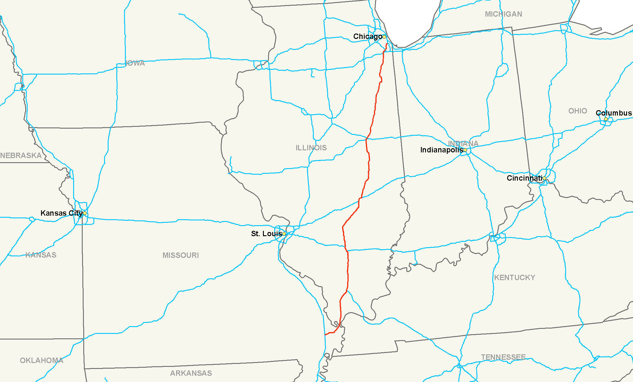
interstate highway in the midwesternUnited States . It goes fromMiner, Missouri , atInterstate 55 to Chicago, Illinois, atInterstate 94 . Interstate 57 serves as a de-facto bypass route for travelers from the south onInterstate 55 who are headed on their way to Chicago instead of going through St. Louis.As of 2007 , I-57 has no spur routes, nor are any planned in the near future.Route description
-
MO
21.96
35.34
-
IL
364.16
586.06
-
Total
386.12
621.40Missouri
In the state of
Missouri , Interstate 57 runs from Miner to theCairo I-57 Bridge over theMississippi River south ofCairo, Illinois .After ending at Interstate 55, the highway continues as U.S. Route 60, which meets U.S. Route 67 at
Poplar Bluff, Missouri and from here US 67 goes south toLittle Rock, Arkansas . The state ofMissouri has proposed extending the I-57 designation down this corridor. However, this plan conflicts withArkansas ' plans to extend theInterstate 30 designation north on US 67, a road of which a long section already meets Interstate highway standards.Fact|date=June 2008Illinois
In the state of
Illinois , Interstate 57 runs from the bridge over the Mississippi River north to Chicago. I-57 is the longest Interstate highway in Illinois. The route is an easy way to reach Shawnee National Forest in the southern tip of the state. It also serves as a major artery for college students in the state, running nearSouthern Illinois University in Carbondale,Eastern Illinois University in Charleston,Parkland College in Champaign,University of Illinois at Urbana-Champaign in Urbana-Champaign,Kankakee Community College in Kankakee,Olivet Nazarene University in Bourbonnais, andGovernors State University in University Park. Interstate 57 currently does not have an intersection withInterstate 294 (Tri-State Tollway ) in northeastern Illinois. It is one of only a few examples where Interstates cross but do not have interchanges with each other. Vehicles are directed to useInterstate 80 to access Interstate 294 instead, thoughU.S. Route 6 is another option.Although the Illinois General Assembly named all of Interstate 57 in Illinois as the "
Thurgood Marshall Memorial Freeway", this name has not entered popular usage, and I-57 remains the only Chicago expressway that does not have a commonly-used name. Its original name was the Dan Ryan Expressway-West Leg.cite web |url=http://www.ilga.gov/legislation/legisnet91/summary/910HJR0071.html |title=91st General Assembly |author=State of Illinois |date=2000-04-15 |accessdate=2006-11-26]Emergency Traffic Patrol (IDOT Minutemen)
All portions of Interstate 57 (near Chicago) between the Dan Ryan Expressway/I-94 and I-80 are patrolled by the Illinois State Police and the IDOT Emergency Traffic Patrol (IDOT ETP "Minutemen"). The ETP patrol 24/7/365 and can be recognized by their large bright yellow-green wreckers and orange jumpsuits. They can be reached at *999 via cellphone and respond to all manner of expressway incidents that you may be involved in from flat tires and no gas to major crashes. They are direct state employees and all of their services are free of charge (gasoline nominal mail-in charge). If your vehicle is disabled, attempt to pull immediately to the shoulder, place your hazard lights on and STAY IN YOUR VEHICLE until ETP arrival! If your vehicle stalls in a live lane of traffic and you are unable to coast to the shoulder, immediately place your hazard lights on, dial 911 (especially if traffic is moving at high speeds) and *999 if you have a cell phone and inform the operator that you are stalled in an interstate traffic lane; and brace for a possible high-speed rear end collision, but remain in your vehicle! An ETP vehicle wil arrive within twenty minutes (much sooner if you are in a lane). Never walk on or cross Interstate 57 on foot! Also, never accept unsolicited help from a private towing company. These companies often attempt to illegally prey on vulnerable motorists and charge exorbitant rates. If you have a motor club, call them. But DO allow the ETP driver to fix your issue or relocate your vehicle to a safe spot off the interstate. The ETP and/or state trooper can provide you with a list of reputable towing companies.
Exit list
In Popular Culture
•Champaign, Illinois band Braid recorded a song titled 'Interstate 57' on their debut album,
Frankie Welfare Boy Age Five .References
External links
* [http://illi-indi.com/il_EndsPage.php?id=3057§ion=1 Illinois Highway Ends: Interstate 57]
###@@@KEYEND@@@###
Wikimedia Foundation. 2010.

