- Miner, Missouri
-
Miner, Missouri — City — Location of Miner, Missouri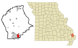
Coordinates: 36°53′31″N 89°32′9″W / 36.89194°N 89.53583°WCoordinates: 36°53′31″N 89°32′9″W / 36.89194°N 89.53583°W Country United States State Missouri Counties Scott, Mississippi Area – Total 4.1 sq mi (10.6 km2) – Land 4.1 sq mi (10.6 km2) – Water 0.0 sq mi (0.0 km2) Elevation 312 ft (95 m) Population (2000) – Total 1,056 – Density 257.5/sq mi (99.4/km2) Time zone Central (CST) (UTC-6) – Summer (DST) CDT (UTC-5) ZIP code 63801 Area code(s) 573 FIPS code 29-48656[1] GNIS feature ID 0731619[2] Miner is a city in Mississippi and Scott counties in the U.S. state of Missouri. It borders the city of Sikeston to the east. The population was 1,056 at the 2000 census.
Contents
Geography
Miner is located at 36°53′31″N 89°32′9″W / 36.89194°N 89.53583°W (36.892082, -89.535861)[3].
According to the United States Census Bureau, the city has a total area of 4.1 square miles (10.6 km²), all land.
Miner is located at the southern end of Interstate 57 (I-57).
Demographics
As of the census[1] of 2000, there were 1,056 people, 408 households, and 290 families residing in the city. The population density was 257.5 people per square mile (99.4/km²). There were 442 housing units at an average density of 107.8 per square mile (41.6/km²). The racial makeup of the city was 92.90% White, 2.18% African American, 0.57% Native American, 0.95% Asian, 0.28% Pacific Islander, 1.14% from other races, and 1.99% from two or more races. Hispanic or Latino of any race were 2.27% of the population.
There were 408 households out of which 31.9% had children under the age of 18 living with them, 57.4% were married couples living together, 9.6% had a female householder with no husband present, and 28.7% were non-families. 25.2% of all households were made up of individuals and 12.3% had someone living alone who was 65 years of age or older. The average household size was 2.48 and the average family size was 2.92.
In the city the population was spread out with 24.0% under the age of 18, 8.0% from 18 to 24, 26.7% from 25 to 44, 26.0% from 45 to 64, and 15.2% who were 65 years of age or older. The median age was 38 years. For every 100 females there were 92.0 males. For every 100 females age 18 and over, there were 89.4 males.
The median income for a household in the city was $30,750, and the median income for a family was $35,132. Males had a median income of $28,611 versus $18,487 for females. The per capita income for the city was $17,409. About 16.3% of families and 18.6% of the population were below the poverty line, including 21.7% of those under age 18 and 29.2% of those age 65 or over.
Trivia
Although popular family restaurant Lambert's Cafe is generally referred to as being located in Sikeston, the restaurant is actually located just inside the Miner city limits. Lambert's originated in Sikeston, but moved closer to I-55, which is located on the eastern side of Miner.
References
- ^ a b "American FactFinder". United States Census Bureau. http://factfinder.census.gov. Retrieved 2008-01-31.
- ^ "US Board on Geographic Names". United States Geological Survey. 2007-10-25. http://geonames.usgs.gov. Retrieved 2008-01-31.
- ^ "US Gazetteer files: 2010, 2000, and 1990". United States Census Bureau. 2011-02-12. http://www.census.gov/geo/www/gazetteer/gazette.html. Retrieved 2011-04-23.
Municipalities and communities of Mississippi County, Missouri Cities Anniston | Bertrand | Charleston | East Prairie | Miner‡ | Wyatt

Villages Unincorporated
communitiesFootnotes ‡This populated place also has portions in an adjacent county or counties
Municipalities and communities of Scott County, Missouri Cities Benton | Cape Girardeau‡ | Chaffee | Miner‡ | Morley | Oran | Scott City‡ | Sikeston‡

Villages Blodgett | Commerce | Diehlstadt | Haywood City | Kelso | Lambert | Vanduser
Townships Commerce | Kelso | Moreland | Morley | Richland | Rootwad | Sandywoods | Sylvania | Tywappity
Unincorporated
communitiesFootnotes ‡This populated place also has portions in an adjacent county or counties
Categories:- Cities in Mississippi County, Missouri
- Cities in Scott County, Missouri


Wikimedia Foundation. 2010.