- Chaffee, Missouri
-
Chaffee, Missouri — City — Location of Chaffee, Missouri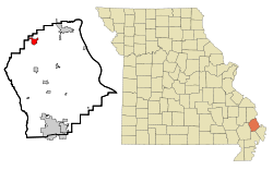
Coordinates: 37°10′47″N 89°39′34″W / 37.17972°N 89.65944°WCoordinates: 37°10′47″N 89°39′34″W / 37.17972°N 89.65944°W Country United States State Missouri County Scott Area – Total 1.8 sq mi (4.7 km2) – Land 1.8 sq mi (4.6 km2) – Water 0.0 sq mi (0.1 km2) Elevation 344 ft (105 m) Population (2000) – Total 3,045 – Density 1,715.8/sq mi (662.5/km2) Time zone Central (CST) (UTC-6) – Summer (DST) CDT (UTC-5) ZIP code 63740 Area code(s) 573 FIPS code 29-12988[1] GNIS feature ID 0739982[2] Chaffee is a city in Scott County, Missouri, United States. The population was 3,045 at the 2000 census.
Contents
Geography
Chaffee is located at 37°10′47″N 89°39′34″W / 37.17972°N 89.65944°W (37.179706, -89.659353)[3].
According to the United States Census Bureau, the city has a total area of 1.8 square miles (4.7 km2), of which, 1.8 square miles (4.7 km2) of it is land and 0.1 square miles (0.26 km2) of it (2.75%) is water.
Demographics
As of the census[1] of 2000, there were 3,044 people, 1,267 households, and 824 families residing in the city. The population density was 1,715.8 people per square mile (664.0/km²). There were 1,378 housing units at an average density of 776.7 per square mile (300.6/km²). The racial makeup of the city was 98.46% White, 0.07% African American, 0.23% Native American, 0.07% Asian, 0.39% from other races, and 0.79% from two or more races. Hispanic or Latino of any race were 1.18% of the population.
There were 1,267 households out of which 32.3% had children under the age of 18 living with them, 46.8% were married couples living together, 15.1% had a female householder with no husband present, and 34.9% were non-families. 32.7% of all households were made up of individuals and 18.4% had someone living alone who was 65 years of age or older. The average household size was 2.36 and the average family size was 2.96.
In the city the population was spread out with 25.2% under the age of 18, 9.9% from 18 to 24, 25.1% from 25 to 44, 21.4% from 45 to 64, and 18.4% who were 65 years of age or older. The median age was 38 years. For every 100 females there were 85.8 males. For every 100 females age 18 and over, there were 78.6 males.
The median income for a household in the city was $27,076, and the median income for a family was $34,671. Males had a median income of $27,576 versus $18,873 for females. The per capita income for the city was $16,554. About 12.9% of families and 16.2% of the population were below the poverty line, including 21.4% of those under age 18 and 13.7% of those age 65 or over.
History
On June 20, 1905, The Chaffee Real Estate Company of St. Louis, Missouri purchased 1,800 acres (7.3 km2) of land from a local farmer, John Witt of Sikeston, Missouri, for $140,000. The Chaffee Real Estate Company soon transferred ownership of 150 acres (0.61 km2) to the St. Louis-San Francisco Railway for the purposes of building a large switching yard and began surveying the area for a town for the railroad employees.
The Chaffee Real Estate Company gave public notice for the sale of lots within the soon to be established town to local individuals and companies, and began clearing the land for construction on August 15, 1905. The company attached an unusual clause to the deed stating that the property would not be used for "the dispensation of intoxicating liquors."
The residents of the new town petitioned the Clerk of the County Court of Scott County, Missouri to incorporate the area into the fourth-class city of Chaffee on August 6, 1906 and the petition was granted on December 8, 1909. Popular opinion states that the city was named for the Spanish-American War hero, General Adna Chaffee, but in all likelihood it was simply named for the real estate company that owned the land.
In 1911, The First National Bank of Chaffee issued $392,320 in "National Currency" with the permission of the United States Department of the Treasury, giving Chaffee the distinction of being a city with its own currency.
References
- ^ a b "American FactFinder". United States Census Bureau. http://factfinder.census.gov. Retrieved 2008-01-31.
- ^ "US Board on Geographic Names". United States Geological Survey. 2007-10-25. http://geonames.usgs.gov. Retrieved 2008-01-31.
- ^ "US Gazetteer files: 2010, 2000, and 1990". United States Census Bureau. 2011-02-12. http://www.census.gov/geo/www/gazetteer/gazette.html. Retrieved 2011-04-23.
External links
- Historic maps of Chaffee in the Sanborn Maps of Missouri Collection at the University of Missouri
Municipalities and communities of Scott County, Missouri Cities Benton | Cape Girardeau‡ | Chaffee | Miner‡ | Morley | Oran | Scott City‡ | Sikeston‡

Villages Blodgett | Commerce | Diehlstadt | Haywood City | Kelso | Lambert | Vanduser
Townships Commerce | Kelso | Moreland | Morley | Richland | Rootwad | Sandywoods | Sylvania | Tywappity
Unincorporated
communitiesFootnotes ‡This populated place also has portions in an adjacent county or counties
Categories:- Cities in Scott County, Missouri


Wikimedia Foundation. 2010.