- Missouri Triangle, California
-
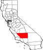
Missouri Triangle — Unincorporated community — Location in California
 Missouri Triangle
Coordinates: 35°26′20″N 119°41′24″W / 35.43889°N 119.69°WCoordinates: 35°26′20″N 119°41′24″W / 35.43889°N 119.69°W Country United States State California County Kern County Elevation[1] 561 ft (171 m)  MiniMart at the corner of Lost Hills and Highway 33, looking north; note the oil derrick next to the highway sign.
Missouri Triangle is an unincorporated community in Kern County, California.[1] It is located 10 miles (16 km) north of McKittrick,[2] at an elevation of 561 feet (171 m).[1]
Defined by the triple junction of California State Route 33, Lost Hills Road, and 7th Standard Road, it entirely within the South Belridge Oil Field. Within the triangle formed by the inexact junction of the three major roads, there is a mini-mart and a water tower, with the place name painted on the water tower.
Aera Energy LLC operates most of the oil wells in the immediate vicinity.[3]
References
- ^ a b c U.S. Geological Survey Geographic Names Information System: Missouri Triangle, California
- ^ Durham, David L. (1998). California's Geographic Names: A Gazetteer of Historic and Modern Names of the State. Quill Driver Books. p. 1073. ISBN 9781884995149.
- ^ DOGGR online mapping service. Zoom in on Latitude 35.439711 / Longitude -119.690198 to see the active well visible in the photograph.
Municipalities and communities of Kern County, California Cities Arvin | Bakersfield | California City | Delano | Maricopa | McFarland | Ridgecrest | Shafter | Taft | Tehachapi | Wasco
CDPs Bear Valley Springs | Bodfish | Boron | Buttonwillow | Cherokee Strip | China Lake Acres | Derby Acres | Dustin Acres | Edmundson Acres | Edwards Air Force Base | Fellows | Ford City | Frazier Park | Fuller Acres | Golden Hills | Greenacres | Greenfield | Inyokern | Johannesburg | Keene | Kernville | Lake Isabella | Lake of the Woods | Lamont | Lebec | Lost Hills | McKittrick | Mettler | Mexican Colony | Mojave | Mountain Mesa | North Edwards | Oildale | Onyx | Pine Mountain Club | Randsburg | Rosamond | Rosedale | Smith Corner | South Taft | Squirrel Mountain Valley | Stallion Springs | Taft Heights | Tupman | Valley Acres | Weedpatch | Weldon | Wofford Heights
Unincorporated
communitiesActis | Aerial Acres | Alameda | Algoso | Alta Sierra | Annette | Ansel | Armistead | Baker | Bannister | Bealville | Bena | Bissell | Blackwells Corner | Bowerbank | Bradys | Brown | Burton Mill | Cable | Calders Corner | Calico | Caliente | Cameron | Camp Owens | Canebrake | Cantil | Cawelo | Ceneda | Chaffee | China Lake | Cinco | Claraville | Conner | Crome | Desert Lake | Di Giorgio | Dow | East Bakersfield | Edison | Edwards | El Rita | Elmo | Famoso | Fig Orchard | Five Points | Fleta | Fruitvale | Glennville | Goler Heights | Gosford | Grapevine | Gulf | Gypsite | Halfway House | Harpertown | Harts Place | Havilah | Hazelton | Hights Corner | Hollis | Ilmon | Indian Wells | Jasmin | Jastro | Kayandee | Kecks Corner | Kern Lake | Kernell | Keyesville | Kilowatt | Lackey Place | Lakeview | Landco | Lerdo | Lokern | Lonsmith | Loraine | Magunden | Maltha | Manolith | Marcel | Mayfair | Meridian | Midoil | Millersville | Millux | Minter Village | Miracle Hot Springs | Missouri Triangle | Mitchells Corner | Monolith | Moreland Mill | Myricks Corner | Neufeld | North Belridge | North Shafter | Oil City | Oil Junction | Old Garlock | Old River | Old Town | Palmo | Panama | Patch | Pentland | Pettit Place | Pinon Pines Estates | Pond | Prospero | Pumpkin Center | Quality | Rancho Seco | Rand | Reward | Ribier | Ricardo | Rich | Rio Bravo | Riverkern | Rowen | Saco | Sageland | Saltdale | San Emidio | Sanborn | Sand Canyon | Searles | Seguro | Semitropic | Shirley Meadows | Silt | Slater | South Lake | Spellacy | Spicer City | Stevens | Summit | Thomas Lane | Twin Lakes | Twin Oaks | Una | Venola | Vinland | Walker Basin | Wallace Center | Walong | Wheeler Ridge | Wible Orchard | Willow Springs | Woodford | Woody | Zentner
Former
settlements18 Mile House | Allard | Amalie | Artwell | Asphalto | Barnes Settlement | Benita | Big Blue Mill | Borel | Burkeville | Cabernet | Cambio | Canebrake | Canfield | Chanz | Clarkson | Code | Craft | Cuttens | Desert Spring | Domino | Eaires | Eric | Fluhr | Fram | Gamba | Garlock | Girard | Glenburn | Gold Town | Greenwich | Gyle | Indian Springs | Inmans | Isabella | Joe Walker Town | Joyfull | Kern River Slough | Kernvale | Kernville | Kyan | La Rose | Langdon | Lavers' Crossing | Leliter | Leonards | Levee | Levee Spur | Little Dixie | Martendale | Midway | Miramonte | Monterio | Moseman | Muroc | Nadeau | Neil | Neuralia | Nome | North Muroc | Olig | Packwood | Page | Paloma | Parsons | Petersburg | Petro | Pine | Piute | Proctor | Progress | Pylema | Quartzburg | Redrock | Reefer City | Reservoir | Rio Bravo | Riverview | Rock Springs | Rogersville | Sage | San Miguel de los Noches | Sand Cut | Scovern Hot Springs | Sedwell | Shady Rest | Shale | Shamrock | Smyrna | Solon | Sorrell's | Strader | Strand | Sullivan | Summers | Sunset | Teagle | Tehichipa | Tejon | Terese | Terese Siding | Toolwass | Trescape | Treves | Una Siding | Unadilla | Vaccaro | Vaughn | Vernette | Warren (Fellows) | Warren (Mojave) | Water Station | West Baker | Winter Garden
Categories:- Populated places in Kern County, California
- Unincorporated communities in California
- Kern County, California geography stubs


Wikimedia Foundation. 2010.