- Taft, California
-
For the community in Plumas County formerly with this name, see Cromberg, California.
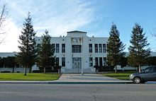
City of Taft — City — The Fort, a replica of Sutter's Fort in Sacramento, is on the National Register of Historic Places.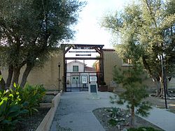

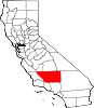
LogoLocation in Kern County and the state of California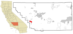
Coordinates: 35°08′33″N 119°27′23″W / 35.1425°N 119.45639°WCoordinates: 35°08′33″N 119°27′23″W / 35.1425°N 119.45639°W Country  United States
State  California
County Kern Government – Mayor – Senate Roy Ashburn (R) – Assembly Jean Fuller (R) – U. S. Congress Kevin McCarthy (R) Area[1] – Total 15.113 sq mi (39.143 km2) – Land 15.113 sq mi (39.143 km2) – Water 0 sq mi (0 km2) 0% Elevation[2] 955 ft (291 m) Population (2010) – Total 9,327 – Density 617.2/sq mi (238.3/km2) Time zone PST (UTC-8) – Summer (DST) PDT (UTC-7) ZIP code 93268 Area code(s) 661 FIPS code 06-77574 GNIS feature ID 1661543 Website www.cityoftaft.org Taft (formerly Moron, Moro, and Siding Number Two)[3] is a city in the foothills at the extreme southwestern edge of the San Joaquin Valley, in Kern County, California. Taft is located 30 miles (48 km) west-southwest of Bakersfield,[3] at an elevation of 955 feet (291 m).[2] The population was 9,327 at the 2010 census. According to the United States Census Bureau, the city has a total area of 15.1 square miles (39.1 km2).
Contents
History
The town began as Siding Number Two on the Sunset Railroad.[3] According to a display at the West Kern Oil Museum, local residents asked the Southern Pacific Railroad if the station could be named Moro when the rails arrived about 1900.[citation needed] A railroad official, the story says, declined because the name would be too easily confused with the coastal town of Morro Bay. Instead, the railroad directed the station be called Moron, a word which as yet had no association with mental retardation. Pictures of local businesses, including the Moron Pharmacy, hang in the museum.
After a fire burned much of the town, the name was changed to Taft in honor of William Howard Taft[3] during his one and only term 1908 - 1912 in order to establish a Post Office in the town. According to local folklore the town was actually named after a picture of President Taft. During a meeting at the Post Office to come up with a new name someone suggested Taft based on the picture currently on the calendar on display in the Post Office.[citation needed] The US Post Master General refused to issue a license to a town named Moron.
Taft and oil
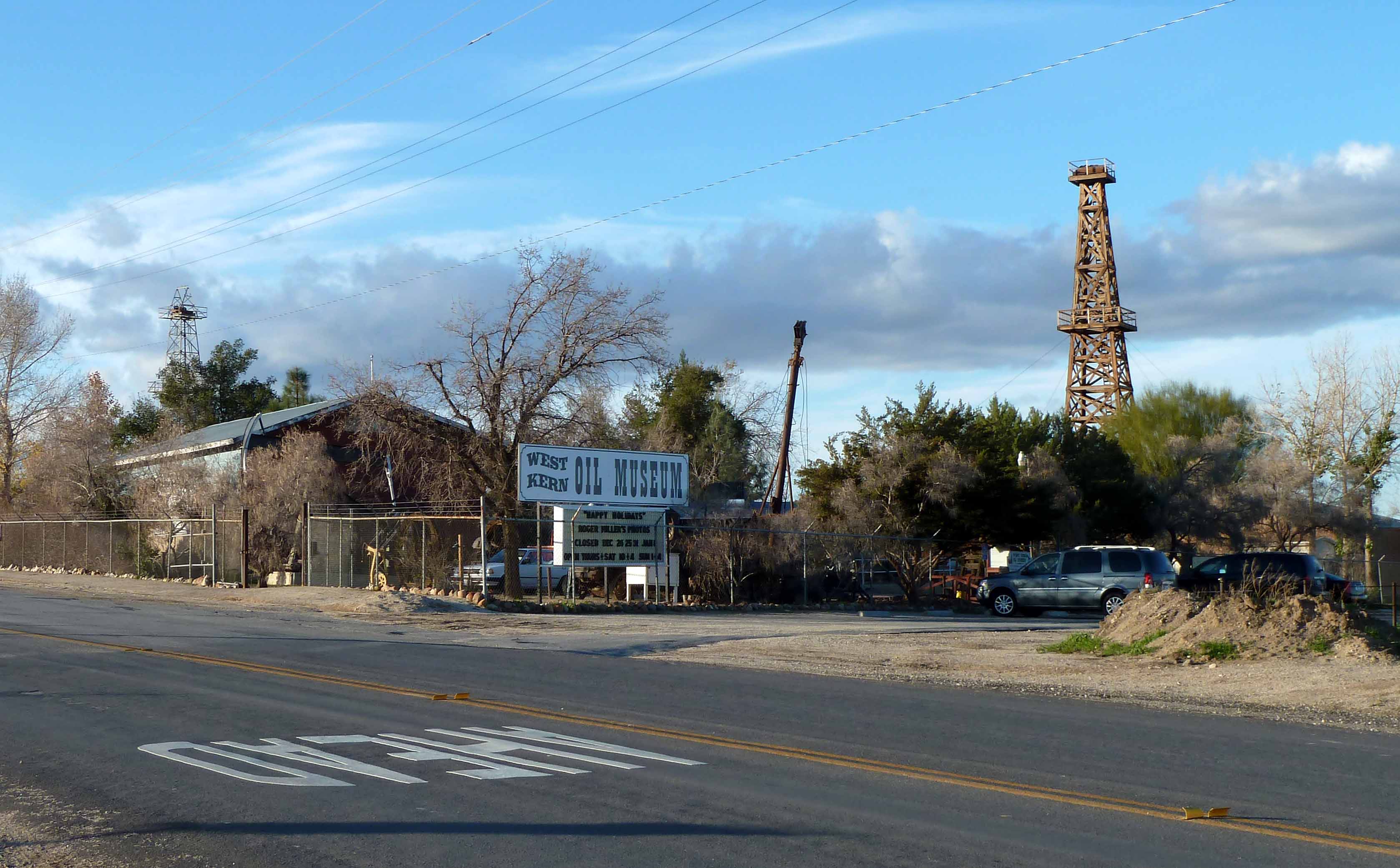
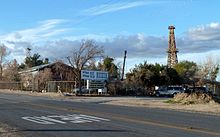 West Kern Oil Museum
Taft is situated in a major petroleum and natural gas production region in California and is one of the few remaining towns in the United States which exist exclusively because of nearby oil reserves. The discovery of oil in the region occurred in the late 19th century near Maricopa, seven miles (11 km) south of Taft. Many other oil and gas accumulations were discovered around Taft during the early-to-mid-20th century, notably the Midway field (near Fellows, California), Sunset field (later found to be part of the same trend, accounting for the modern combined name of Midway-Sunset), and the Buena Vista. The town is built directly between these two huge fields. The operational activities within these fields, as well as Occidental Petroleum's Elk Hills Oil Field north of Taft, have been the economic life blood of the town for over 100 years.
The super-giant Midway-Sunset field has produced approximately 2,800,000,000 barrels (450,000,000 m3) of crude oil, most of it heavy gravity (13-14 degrees API). Enhanced oil recovery operations in the form of steam production and injection have been used on the thick viscous crude oil of the Midway-Sunset field since the mid-to-late-1960s. The reservoirs of the Midway-Sunset field are composited layers of mostly unconsolidated sandstones of late Miocene age, shallowly buried. The shallow burial depth and ideal nature of the sandstones make them almost perfectly suited for steam injection. As a result, the amount of oil that can be recovered is greatly increased.
Standard Oil, later the Standard Oil Company of California (modern Chevron), made Taft its corporate operational headquarters. At one time it is reported that as many as 6,000 inhabitants of Taft were employed by Standard Oil. The hub of this activity was "11-C Camp", so named due to its township location in section 11 and designated "township C" by Standard's mapping department. Within the camp was everything imaginable to run a large oil and gas company: a rail spur from the line running through Taft, steel and timber for derrick construction and maintenance, pipe, valves, numerous offices, an expansive and highly specialized machine shop, a plethora of supply shops, the car and truck fleet, bunkhouses for workers, and dozens of company homes for employees. In its heyday, 11-C camp sported very nice facilities including a large playground, baseball field, tennis courts, a large swimming pool, a cook-house open to the public, beautifully landscaped grounds, a clubhouse with a television, pool and card tables, and an ice-cream stand. The huge complex gradually closed down over a period of many years. In 1968 Standard Oil of California moved its accounting and finance offices to Concord, California. In the late 1980s the machine shop was closed and auctioned, signaling the end of the 11-C Camp era.
Many other oil companies had operations in the area, including larger companies such as Shell, Texaco, Exxon, Mobil, Gulf, and Arco, as well as smaller operations (but with a large local presence) such as Santa Fe Energy, Berry Petroleum, Tannehill, M.H. Whittier, and lately Plains Exploration & Production. In the mid 1990s, according to California's Department of Oil, Gas, and Geothermal Resources (DOGGR), there were 68 operating companies working the Midway-Sunset field alone. While the names of most of these companies have changed, due to mergers, acquisitions, and liquidations, the production activities have been continuous.
In celebration of its oil heritage, Taft holds its "Oildorado" festival every five years. Oildorado was first started in 1930 (see below) and was held intermittently before then.
In the early days of oil exploration and production, long before the advent of modern blowout preventions, gushers were the norm. Although there were many, the Lakeview Gusher was the grand-daddy of them all, producing 100,000 barrels (16,000 m3) of oil per day at its peak. In all, the Lakeview No.1 produced about nine million barrels of oil (a very respectable cumulative production for a single well in this area). The well and its State historical marker can be found along the Petroleum Club road, just off SR 33 south of town. (Note: Lake Gusher was formed when Taft began its early drills, first finding water, which was very much needed in the area and one of the few reason along with prostitution and booze that Taft survived while surrounding towns vanished overnight. Finally striking oil it was clear Taft understood drilling, However, the art of capping a well was something no one in the area had any understanding, as a result the Gusher Lake was formed during the months it took for proper materials and an instructor from Texas to travel out to Taft.
Taft was also the site of a military airfield named Gardner Field which was used to train pilots during World War II. After the base was closed its abandoned airstrip served as a clandestine dragstrip for many years.
Today
Today, the railroad, originally built to export crude oil and import drinking water, is gone but the area still has a significant oil industry presence.
The U.S. Bureau of Prisons operates a prison on Cadet Road south of town. There is a large, modern high school serving area students. The West Kern Oil Museum, at 1168 Wood Street, has vast holdings including pumps, fire apparatus, trucks, a historic wooden derrick, photos, models, and extensive displays of local history back to Indian times. The town's newspaper, the Midway Driller, was reputed to be the oldest daily newspaper in California. On or about 2005, the "Daily Midway Driller" became the "Midway Driller" and is now pressed on Tuesdays and Fridays. The town's second weekly newspaper, the Taft Independent, began publication on July 4, 2006. Taft-Kern County Airport (FAA identifier: L17) is located at the east edge of town at FAA-provided coordinates 35°08′27″N 119°26′28″W / 35.14083°N 119.44111°W and is a favorite for parachutists in Kern County and the South San Joaquin Valley.Taft is also known as a hot bed for Meth, with an estimated 21% of the population habitually using the drug.
Demographics
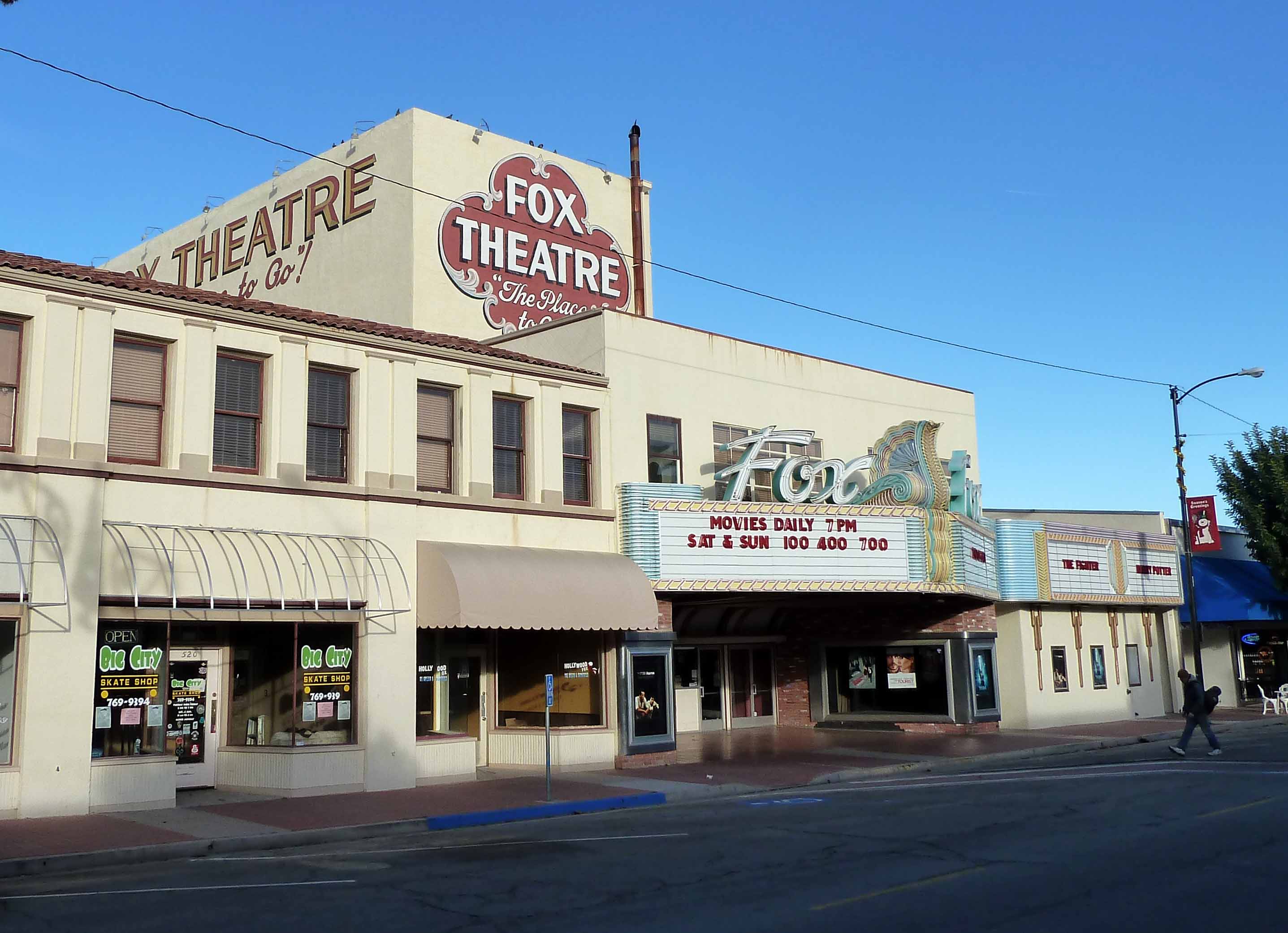
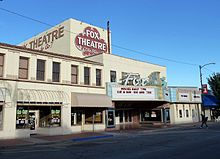 The Fox Theatre, downtown Taft.
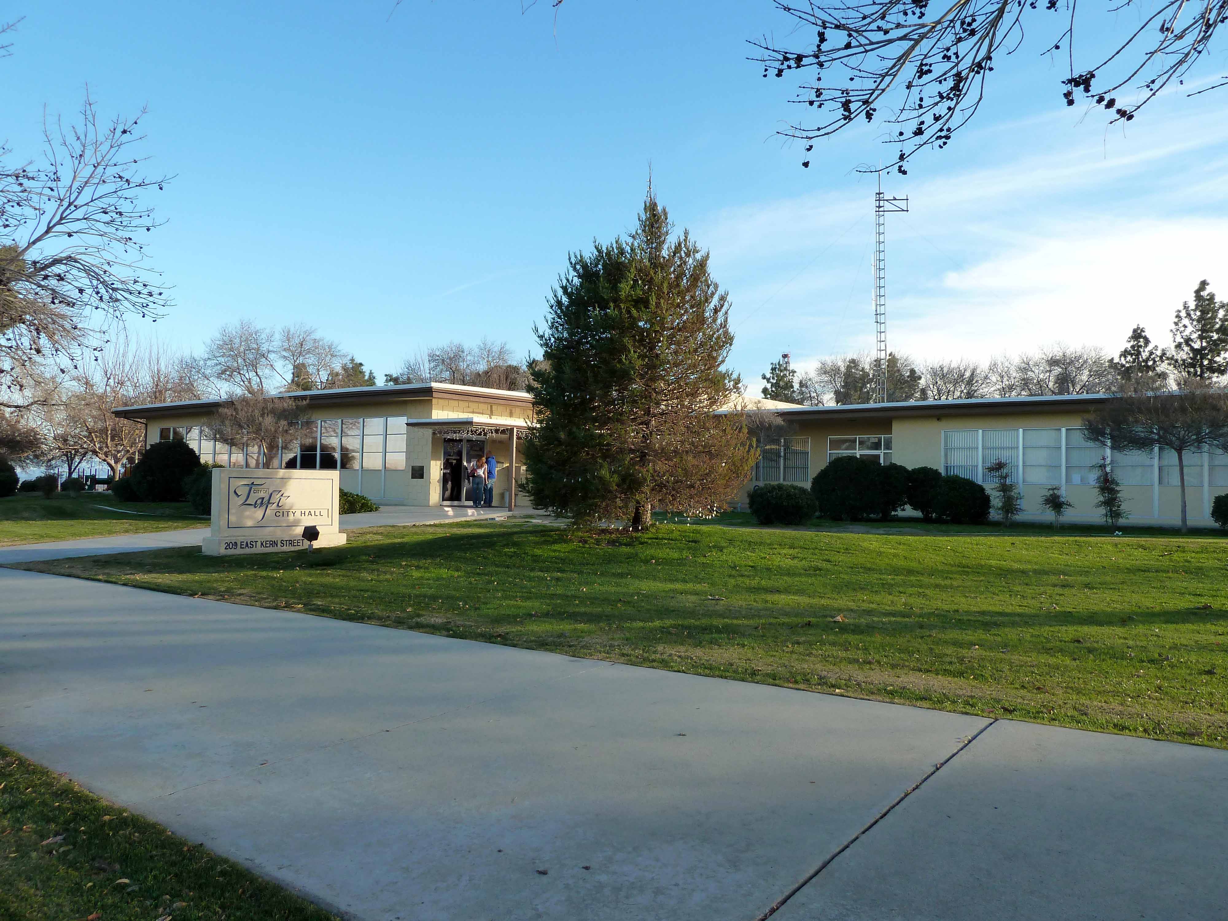
 Taft City Hall
2000
According to the census[4] of 2000, there were 6,400 people, 2,233 households, and 1,565 families residing in the city. The population density was 422.6 people per square mile (163.2/km²). There were 2,478 housing units at an average density of 163.6 per square mile (63.2/km²). The racial makeup of the city was 83.16% White, 1.97% Black or African American, 0.84% Native American, 1.27% Asian, 0.44% Pacific Islander, 10.39% from other races, and 1.94% from two or more races. 15.55% of the population were Hispanic or Latino of any race.
There were 2,233 households out of which 33.6% had children under the age of 18 living with them, 53.9% were married couples living together, 10.7% had a female householder with no husband present, and 29.9% were non-families. 24.9% of all households were made up of individuals and 11.8% had someone living alone who was 65 years of age or older. The average household size was 2.62 and the average family size was 3.09.
In the city the population was spread out with 25.6% under the age of 18, 12.1% from 18 to 24, 27.9% from 25 to 44, 21.5% from 45 to 64, and 12.8% who were 65 years of age or older. The median age was 34 years. For every 100 females there were 108.5 males. For every 100 females age 18 and over, there were 109.6 males.
The median income for a household in the city was $33,861, and the median income for a family was $42,468. Males had a median income of $47,000 versus $26,838 for females. The per capita income for the city was $17,564. About 13.1% of families and 17.5% of the population were below the poverty line, including 26.5% of those under age 18 and 5.5% of those age 65 or over.
2010
The 2010 United States Census[5] reported that Taft had a population of 9,327. The population density was 617.1 people per square mile (238.3/km²). The racial makeup of Taft was 7,388 (79.2%) White, 396 (4.2%) African American, 118 (1.3%) Native American, 93 (1.0%) Asian, 65 (0.7%) Pacific Islander, 1,023 (11.0%) from other races, and 244 (2.6%) from two or more races. Hispanic or Latino of any race were 3,353 persons (35.9%).
The Census reported that 6,372 people (68.3% of the population) lived in households, 123 (1.3%) lived in non-institutionalized group quarters, and 2,832 (30.4%) were institutionalized.
There were 2,254 households, out of which 914 (40.6%) had children under the age of 18 living in them, 1,119 (49.6%) were opposite-sex married couples living together, 289 (12.8%) had a female householder with no husband present, 178 (7.9%) had a male householder with no wife present. There were 176 (7.8%) unmarried opposite-sex partnerships, and 9 (0.4%) same-sex married couples or partnerships. 543 households (24.1%) were made up of individuals and 246 (10.9%) had someone living alone who was 65 years of age or older. The average household size was 2.83. There were 1,586 families (70.4% of all households); the average family size was 3.32.
The population was spread out with 1,844 people (19.8%) under the age of 18, 1,041 people (11.2%) aged 18 to 24, 3,521 people (37.8%) aged 25 to 44, 2,136 people (22.9%) aged 45 to 64, and 785 people (8.4%) who were 65 years of age or older. The median age was 34.9 years. For every 100 females there were 186.5 males. For every 100 females age 18 and over, there were 219.0 males.
There were 2,525 housing units at an average density of 167.1 per square mile (64.5/km²), of which 1,375 (61.0%) were owner-occupied, and 879 (39.0%) were occupied by renters. The homeowner vacancy rate was 2.6%; the rental vacancy rate was 10.8%. 3,847 people (41.2% of the population) lived in owner-occupied housing units and 2,525 people (27.1%) lived in rental housing units.
Education
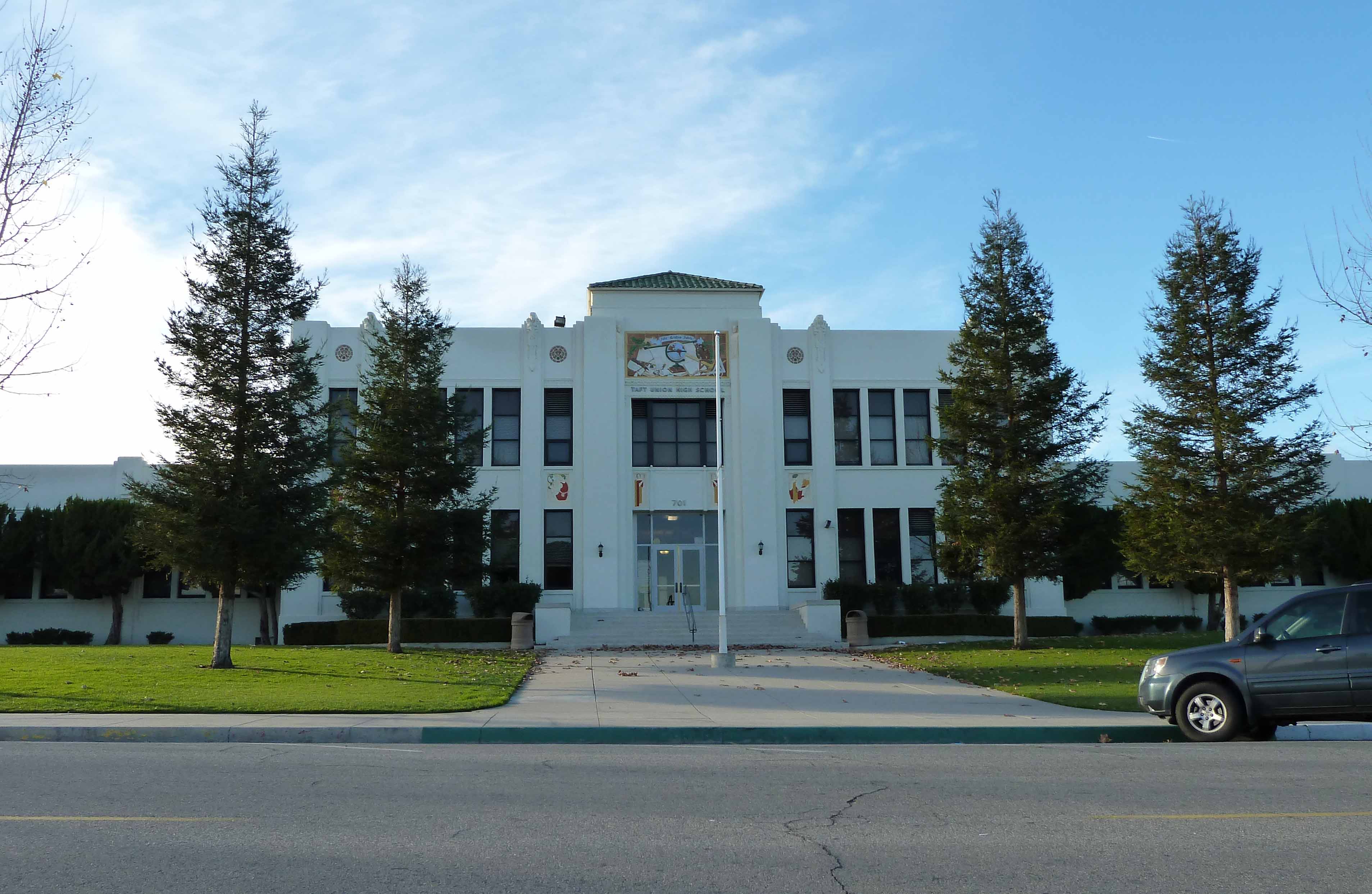
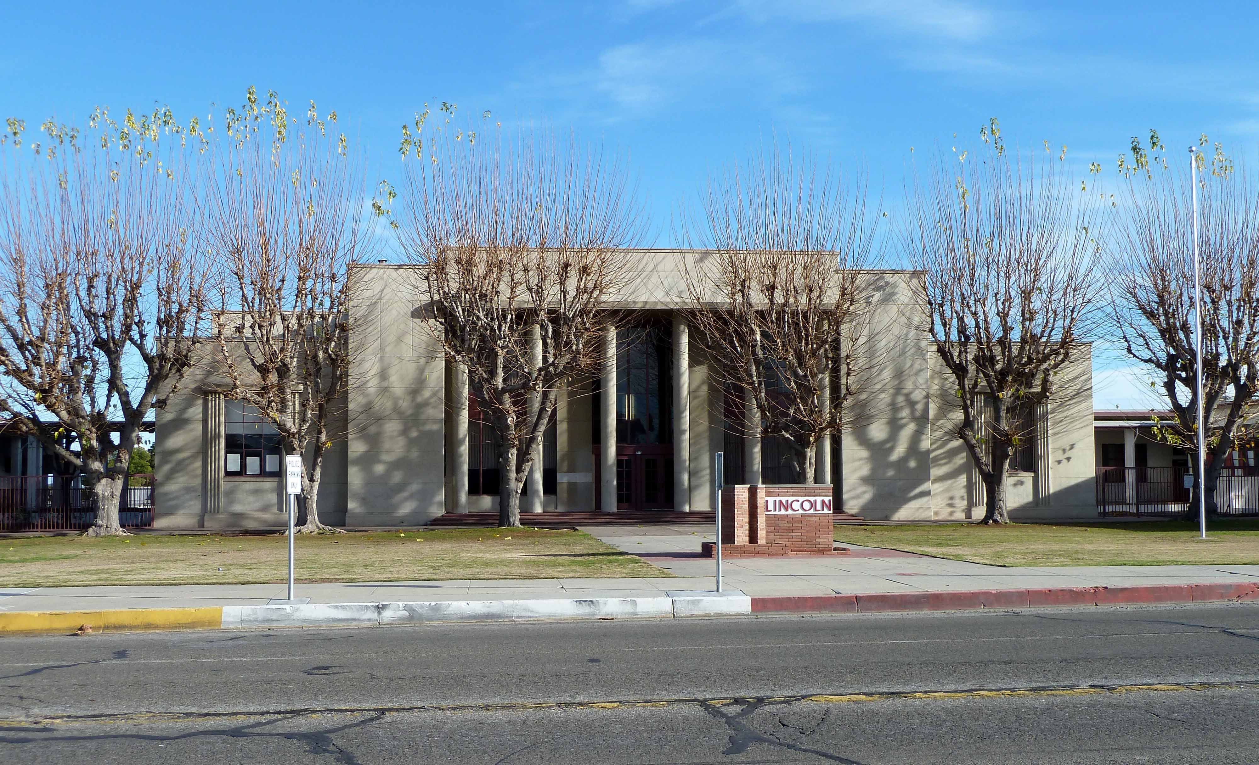
 Taft Union High School
 Lincoln Junior High School
- Jefferson Elementary School
- Parkview Elementary School
- Conley Elementary School
- Taft Primary School
- Roosevelt Elementary School
- Lincoln Junior High School
- Taft Union High School
- Taft College, Community College
Local holidays
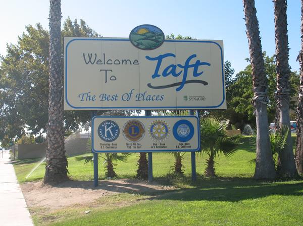
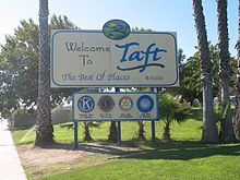 Welcome to Taft sign.
In October 2010 Taft had its 100 year birthday.
Every 5 years during October, Taft holds a quinquennial birthday celebration. This event began as a parade and civic luncheon, commemorating Taft's 20th birthday in November 1930. These celebrations were held every five years until World War II, during which time none were held.
After the war, in 1946, the celebrations began again and the Taft District Chamber of Commerce made them permanent. A contest was held to choose a name for the event and "Oildorado" was chosen, having been submitted by W.A. Poff.
Today, Oildorado is a week long celebration during which many events are held. Oildorado is an ongoing testimony for Taft as a certified "Oil Town" -its origins owing solely to oil production and exploration, a rare distinction among any town in the world. As such, there are several oilfield-type skill contests held during each Oildorado. These include or have included: welding, pipe threading and fitting, rod wrenching, various skill tests with a backhoe, and at least as late as 1965 a regular well-pulling contest with local well servicing rigs and crews. Understandably, due to safety and probably liability issues, the well-pulling contests ceased. Much more could be said of these various contests and their participants through the years, it being quite memorable for those who were there.
Additionally, there is a beauty pageant where an Oildorado Queen is selected, a facial hair growing contest, talent shows, barbecues, street fairs, parades, and in 2005, motocross races. People usually dress in cowboy boots and a cowboy hat throughout the week.
It is also customary for all men to grow facial hair during this time. If a man does not grow facial hair, he must pay for a permit and wear a bolo tie or lapel pin called a Smooth Puss Badge. If he is caught clean shaven without his badge he may be arrested by the Posse, a group of men dressed in western garb, sporting pistols and rifles filled with blanks and, of course, facial hair. The man will be placed in a jail truck called "The Hoosegow" and driven around town for an hour for all to see. Warrants may also be purchased to have somebody else arrested and placed in The Hoosegow.[6]
The Posse is overseen by the Grand Marshal. The group patrols the streets, schools, and businesses and engages in make-believe shootouts with the Bandits, (the Wooden Nickel Gang) who customarily wear bandanna masks on their faces.
Other staples of this week long celebration include wooden nickels, dinner theatres, classic car shows, and rodeos.
Notable persons from Taft
- Ryan Shuck, guitarist
- Tracy Rogers, NFL football player
- Jeanne Cooper, actress
- Loren Cunningham, co-founder of Youth With A Mission
- Dennis Fimple, actor
- William Nelson, 2008 Olympian, Athletics
- Jordan Belfort The Wolf Of Wall Street
Movies filmed in Taft
- Thelma & Louise
- Attack of the 50 Ft. Woman
- Five Easy Pieces
- The Best of Times, a movie about Taft
- Too Young to Die?
- Meteor
- Frog-g-g!
References
- ^ U.S. Census
- ^ a b U.S. Geological Survey Geographic Names Information System: Taft, California
- ^ a b c d Durham, David L. (1998). California's Geographic Names: A Gazetteer of Historic and Modern Names of the State. Quill Driver Books. p. 1114. ISBN 9781884995149.
- ^ "American FactFinder". United States Census Bureau. http://factfinder.census.gov. Retrieved 2008-01-31.
- ^ All data are derived from the United States Census Bureau reports from the 2010 United States Census, and are accessible on-line here. The data on unmarried partnerships and same-sex married couples are from the Census report DEC_10_SF1_PCT15. All other housing and population data are from Census report DEC_10_DP_DPDP1. Both reports are viewable online or downloadable in a zip file containing a comma-delimited data file. The area data, from which densities are calculated, are available on-line here. Percentage totals may not add to 100% due to rounding. The Census Bureau defines families as a household containing one or more people related to the householder by birth, opposite-sex marriage, or adoption. People living in group quarters are tabulated by the Census Bureau as neither owners nor renters. For further details, see the text files accompanying the data files containing the Census reports mentioned above.
- ^ http://www.oildoradodays.com
External links
- City of Taft
- Taft District Chamber of Commerce
- Taft College
- "Taft Union High School"
- "Lincoln Jr. High School"
- "Taft City Schools"
- West Kern Oil Museum web page
- West Kern Water District
- The Midway Driller newspaper
- The "Taft Independent" newspaper
- The "Carrizo Plain Visitors Guide" Magazine
- "Oildorado Days 2010"
- "Taft Camera Club"
- "Taft PC Services"
Municipalities and communities of Kern County, California Cities Arvin | Bakersfield | California City | Delano | Maricopa | McFarland | Ridgecrest | Shafter | Taft | Tehachapi | Wasco
CDPs Bear Valley Springs | Bodfish | Boron | Buttonwillow | Cherokee Strip | China Lake Acres | Derby Acres | Dustin Acres | Edmundson Acres | Edwards Air Force Base | Fellows | Ford City | Frazier Park | Fuller Acres | Golden Hills | Greenacres | Greenfield | Inyokern | Johannesburg | Keene | Kernville | Lake Isabella | Lake of the Woods | Lamont | Lebec | Lost Hills | McKittrick | Mettler | Mexican Colony | Mojave | Mountain Mesa | North Edwards | Oildale | Onyx | Pine Mountain Club | Randsburg | Rosamond | Rosedale | Smith Corner | South Taft | Squirrel Mountain Valley | Stallion Springs | Taft Heights | Tupman | Valley Acres | Weedpatch | Weldon | Wofford Heights
Unincorporated
communitiesActis | Aerial Acres | Alameda | Algoso | Alta Sierra | Annette | Ansel | Armistead | Baker | Bannister | Bealville | Bena | Bissell | Blackwells Corner | Bowerbank | Bradys | Brown | Burton Mill | Cable | Calders Corner | Calico | Caliente | Cameron | Camp Owens | Canebrake | Cantil | Cawelo | Ceneda | Chaffee | China Lake | Cinco | Claraville | Conner | Crome | Desert Lake | Di Giorgio | Dow | East Bakersfield | Edison | Edwards | El Rita | Elmo | Famoso | Fig Orchard | Five Points | Fleta | Fruitvale | Glennville | Goler Heights | Gosford | Grapevine | Gulf | Gypsite | Halfway House | Harpertown | Harts Place | Havilah | Hazelton | Hights Corner | Hollis | Ilmon | Indian Wells | Jasmin | Jastro | Kayandee | Kecks Corner | Kern Lake | Kernell | Keyesville | Kilowatt | Lackey Place | Lakeview | Landco | Lerdo | Lokern | Lonsmith | Loraine | Magunden | Maltha | Manolith | Marcel | Mayfair | Meridian | Midoil | Millersville | Millux | Minter Village | Miracle Hot Springs | Missouri Triangle | Mitchells Corner | Monolith | Moreland Mill | Myricks Corner | Neufeld | North Belridge | North Shafter | Oil City | Oil Junction | Old Garlock | Old River | Old Town | Palmo | Panama | Patch | Pentland | Pettit Place | Pinon Pines Estates | Pond | Prospero | Pumpkin Center | Quality | Rancho Seco | Rand | Reward | Ribier | Ricardo | Rich | Rio Bravo | Riverkern | Rowen | Saco | Sageland | Saltdale | San Emidio | Sanborn | Sand Canyon | Searles | Seguro | Semitropic | Shirley Meadows | Silt | Slater | South Lake | Spellacy | Spicer City | Stevens | Summit | Thomas Lane | Twin Lakes | Twin Oaks | Una | Venola | Vinland | Walker Basin | Wallace Center | Walong | Wheeler Ridge | Wible Orchard | Willow Springs | Woodford | Woody | Zentner
Former
settlements18 Mile House | Allard | Amalie | Artwell | Asphalto | Barnes Settlement | Benita | Big Blue Mill | Borel | Burkeville | Cabernet | Cambio | Canebrake | Canfield | Chanz | Clarkson | Code | Craft | Cuttens | Desert Spring | Domino | Eaires | Eric | Fluhr | Fram | Gamba | Garlock | Girard | Glenburn | Gold Town | Greenwich | Gyle | Indian Springs | Inmans | Isabella | Joe Walker Town | Joyfull | Kern River Slough | Kernvale | Kernville | Kyan | La Rose | Langdon | Lavers' Crossing | Leliter | Leonards | Levee | Levee Spur | Little Dixie | Martendale | Midway | Miramonte | Monterio | Moseman | Muroc | Nadeau | Neil | Neuralia | Nome | North Muroc | Olig | Packwood | Page | Paloma | Parsons | Petersburg | Petro | Pine | Piute | Proctor | Progress | Pylema | Quartzburg | Redrock | Reefer City | Reservoir | Rio Bravo | Riverview | Rock Springs | Rogersville | Sage | San Miguel de los Noches | Sand Cut | Scovern Hot Springs | Sedwell | Shady Rest | Shale | Shamrock | Smyrna | Solon | Sorrell's | Strader | Strand | Sullivan | Summers | Sunset | Teagle | Tehichipa | Tejon | Terese | Terese Siding | Toolwass | Trescape | Treves | Una Siding | Unadilla | Vaccaro | Vaughn | Vernette | Warren (Fellows) | Warren (Mojave) | Water Station | West Baker | Winter Garden
Categories:- Cities in Kern County, California
- Incorporated cities and towns in California


Wikimedia Foundation. 2010.